


W0C/SP-065
Puma Peak
3527 m / 11570 ft
Sep 10, 2016
By KX0R
Puma Peak is an interesting sub-alpine SOTA peak in the northern Puma Hills, on the east side of South Park. It’s the highest summit in the Puma Hills.
Key Points:
• Pike National Forest
• Jeep road most of the way
• Relatively short off-trail climb to peak
• Prominent summit
• Fine HF site
• ~ 7.5 miles round-trip, hiking from 9770 feet
• ~ 1800 vertical feet, hiking from 9770 feet
-
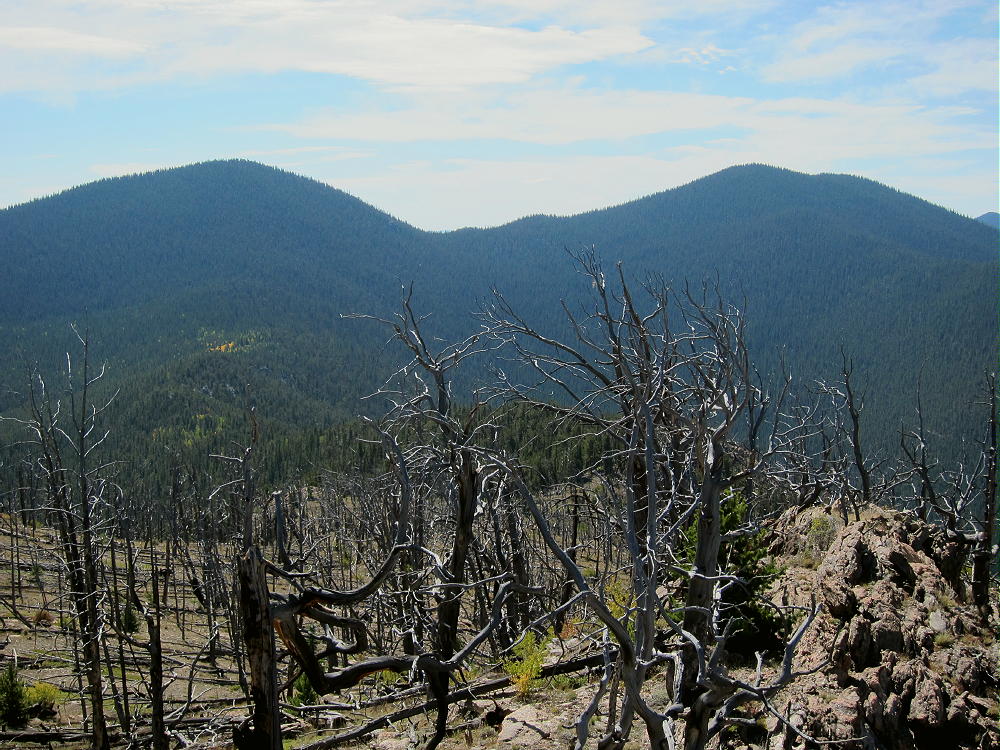
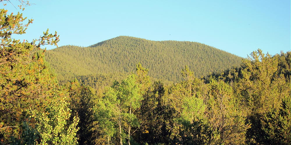
- Puma Peak – Little Puma and Puma Peaks from Burntop
Driving Directions:
• Drive down 285, across Kenosha Pass, to Jefferson
• Turn south on Highway 77 and go about 16 miles to Tarryall Reservoir
• Just south of Tarryall Reservoir, turn right, west, on CR 23
• CR 23 is a bumpy 2WD dirt road
• Drive about 1.5 miles to a split in the road
• Turn left, south, on marked Packer Gulch Road FR-144
• FR-144 is a good 2WD dirt road up the valley if dry
• Drive south on FR-144 about 4 miles
-
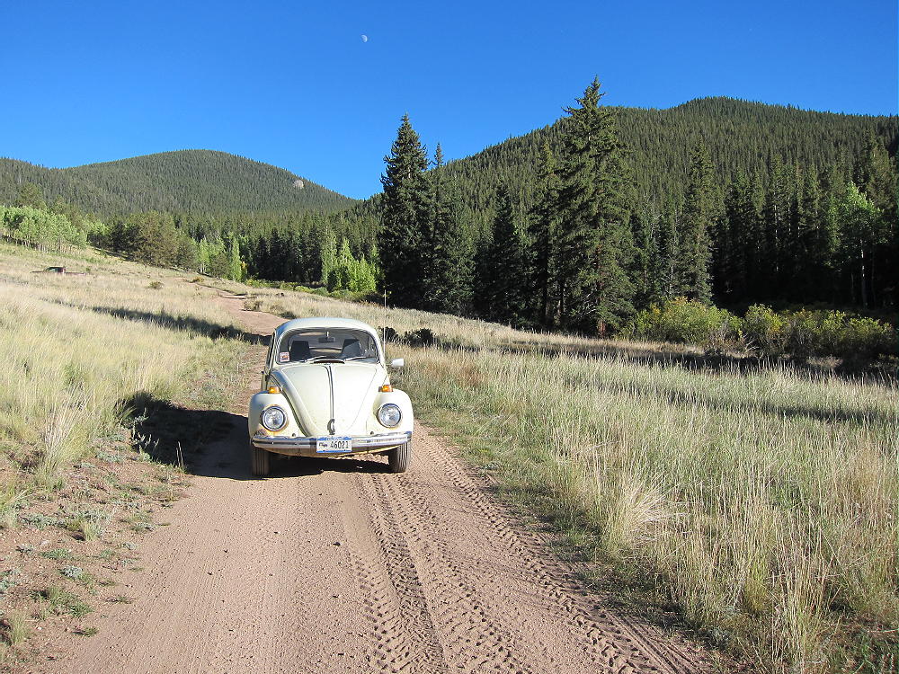
- Puma Peak – Forest Road 144, Little Puma and Puma Peaks
• The road ascends the drainage and then makes a big turn to the right as it enters thick forest
• Very soon there’s a junction with FR-237
• This is a good place to park, unless you have a high-clearance vehicle
The Climb:
• It’s possible to drive up this road to a saddle at 11,040 feet, provided conditions are good
• The road doesn’t require 4WD or high clearance for the first couple of miles, but it’s very narrow, and it gets considerable use from ATV’s, Jeeps, and trail-bikes
• The road gets rougher above about 10,000 feet, with large rocks in a few spots
-
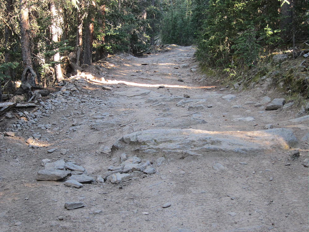
- Puma Peak – Road 144, Upper Part
• There was a tree blocking the road about a mile below the end when I was there – some 4WD drivers were able to go up and around it – steep, serious detour!
• The road isn’t steep, so it’s an easy hike – but it’s so gentle that it’s inefficient
• This would be an ideal MTB or motorbike climb – but listen for motor vehicles
• From the saddle at 11,040 feet, hike southwest, up through the forest, on a small, steep path
• The path is less distinct toward the top – just follow the ridge up through the bristlecone pines and a little deadfall
-
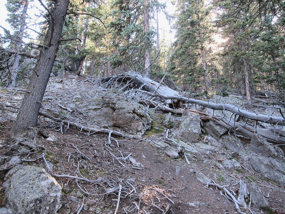
- Puma Peak – Route up the Summit
• After about 0.3 mile and over 500 vertical feet, the rocky summit appears
-
- Puma Peak – Summit and Register Jar
Additional Details:
Puma Peak is heavily forested with bristlecone pine trees. Views across South Park are spectacular but limited by the trees. You can look down at Eagle Rock W0C/SP-113 and Observatory Rock W0C/SP-102 far below, and much of South Park and other mountains far to the west.
-
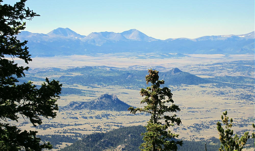
- Puma Peak – View NW across South Park
I set up my radio gear just east of the summit, because of rocks and deadfall on the peak. There’s plenty of room to set up among the trees.
-
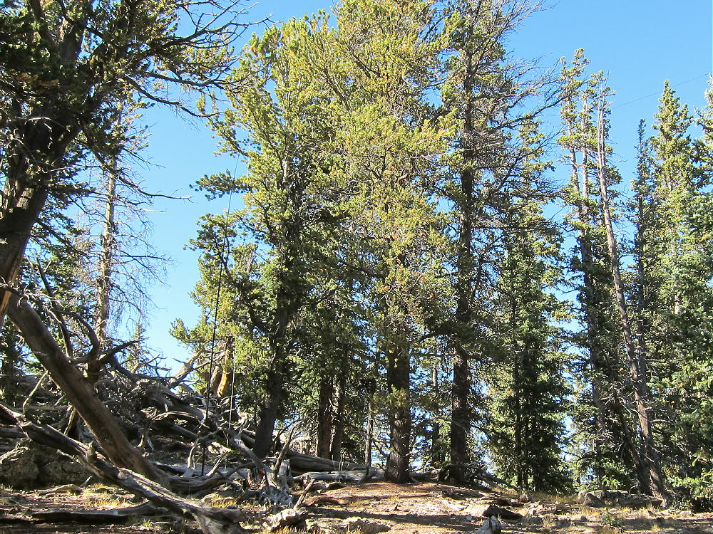
- Puma Peak – KX0R SOTA Activation near Summit
Puma Peak is a fine SOTA peak. It’s prominent in all directions, and no higher mountains block HF skip signals significantly. The site has very low noise – there’s no development near the mountain. The peak is probably an OK VHF/UHF site, with coverage limited to the northern part of South Park.
-
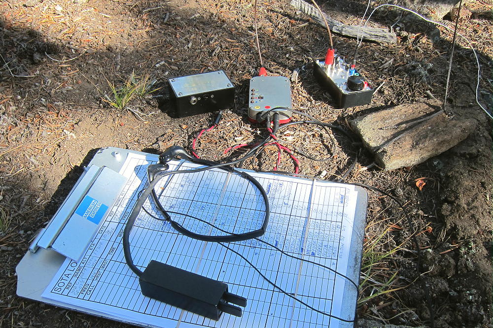
- Puma Peak – KX0R Radio Gear
This peak can be combined with nearby Burntop W0C/SP-074 for a dual activation.
Thanks to WG0AT Steve for his First Activation of Puma Peak!
Which Summit is the Peak?
Puma Peak has a sister summit about ¼ mile along the ridge to the southwest. This peak’s elevation is similar to that of the designated SOTA peak. The SOTA location of Puma Peak on Google Maps agrees with the location of the red balloon summit shown by Lists of John – both show the northeastern peak as the summit. This location is 39.1572, -105.5815. The SOTA elevation is given as 3527m, or 11570 ft.
The problem is that the USGS topography on the 7.5 minute quadrangle (Farnum Peak quad) clearly shows the southwestern peak at 11570 feet and the northeastern peak at 11550 feet; the printed numerical elevations for both peaks agree with the contour line data. I looked at the digital version of Farnum Peak quad on the USGS site, and the mapped topography indicates that the southwest summit is the peak. It isn’t clear why this discrepancy exists.
When I climbed the mountain, I first hiked out to the southwestern summit. I ran my GPS track out and back, and I recorded waypoints on both summits and the saddle. My GPS has a barometric altimeter which tends to stabilize the GPS altitude measurements. The various altitude measurements along the track strongly suggest – but don’t confirm – that the northeast peak is the real SOTA peak.
Without more accurate instruments, there’s no way to verify which summit is higher. In their book “Colorado’s Lost Creek Wilderness”, Gerry and Jennifer Roach say that they made careful checks with a hand level and determined that the northeast summit is the real peak. That’s pretty solid.
Unfortunately the saddle between the peaks appears to be too low for both peaks to share the Activation Zone – my GPS data shows the saddle almost 100 feet below the northeast peak. The USGS map has it even lower.
After I ran my GPS track out to the southwestern sub-peak and back, I did my activation on the northeastern summit.
-
- Puma Peak – Northwest Side from Campsite
Be aware of hunters in the fall – wear bright orange.
73
George
KX0R
-
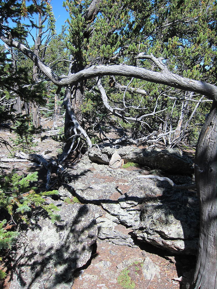
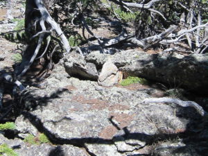
- Puma Peak Summit – Why I Didn’t Set up My SOTA Radio Gear There
![]() !! WARNING !! There are old mountaineers, and
bold mountaineers... there are no old-bold mountaineers.
Hiking and mountain climbing are potentially hazardous activities particularly in Colorado with its extreme elevations. I am not accepting responsibility for any death or injury resulting from activations based on my trip reports. Proper training, experience, and personal capability assessment is required - enjoy!
!! WARNING !! There are old mountaineers, and
bold mountaineers... there are no old-bold mountaineers.
Hiking and mountain climbing are potentially hazardous activities particularly in Colorado with its extreme elevations. I am not accepting responsibility for any death or injury resulting from activations based on my trip reports. Proper training, experience, and personal capability assessment is required - enjoy!