


W0C/PR-120
Dice Hill
3003 m / 9853 ft
First Activation: June 20, 2021
With N0TZW
By N3ALT
Dice Hill is an easily accessible summit North of Silverthorne, that you can almost drive up.
Following our activation of W0C/PR-077 (Williams Peak), Tim (N0TZW) and I headed over to Dice Hill. Taking CO-9 North from Silverthorne, past the reservoir and the turn off for W0C/PR-077, take a left on County Highway 10. This will turn into County Road 23, and then you will take a left on BLM 2750 \ County Road 1830 heading North. This starts as a paved road and turns into a very well maintained dirt road. This eventually dead-ends into a forest service parking lot, where you’ll take a right onto a narrow two track.
Assuming they’re dry, all of these roads should be doable in most crossovers if you’re careful. The main requirement is your ability \ willingness to back up on a narrow road with leaves touching both your mirrors. A full-size pick-up truck would be less than ideal for this. This became especially important when we reached the end of the road prematurely:
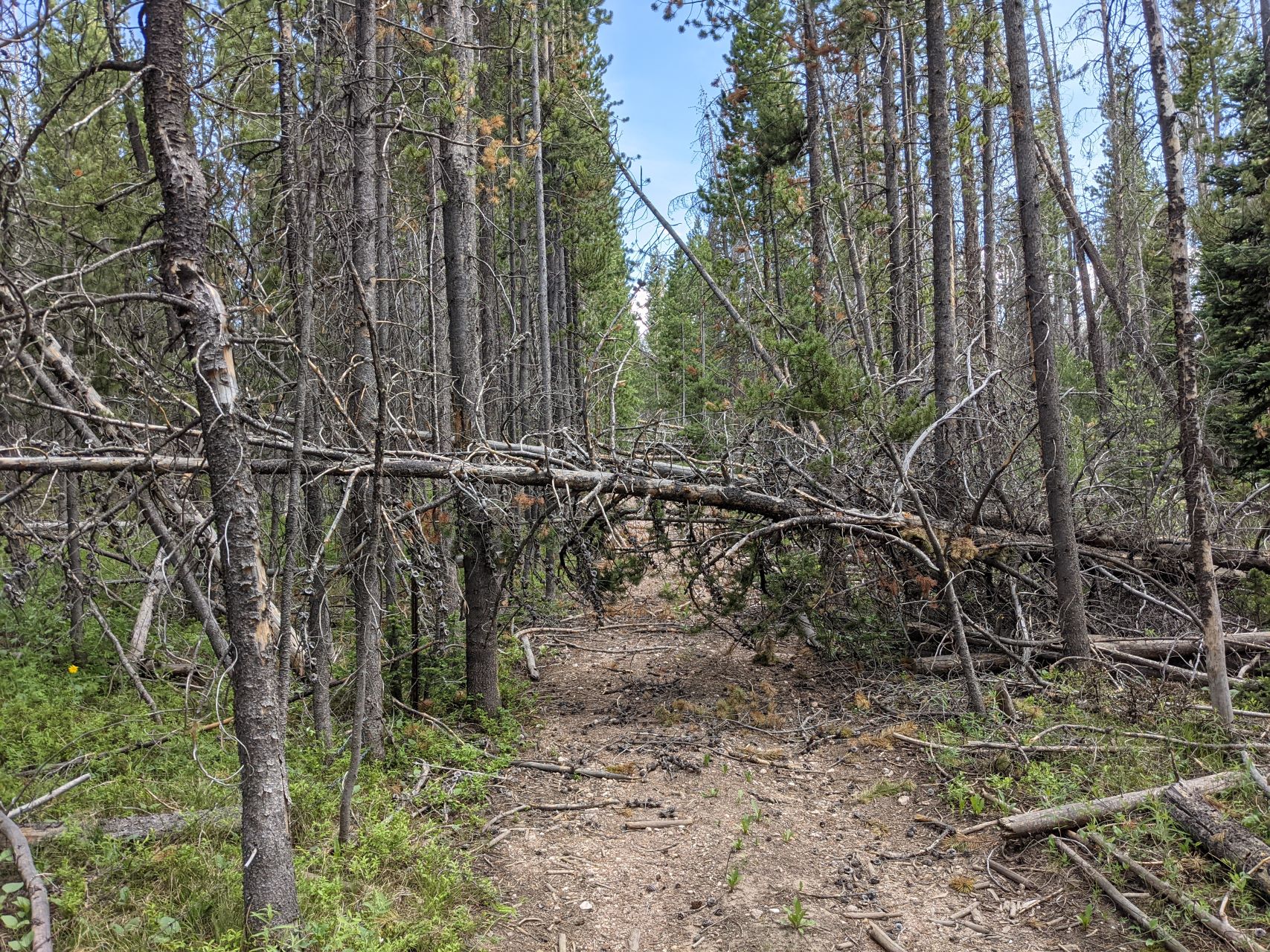
According to the map, you can normally drive almost to the top of the mountain. We were blocked by downed trees, and lacking a chainsaw, ended up backing out a ways until we found a reasonable pull off. Leaving the car there, we followed the two-track up the hill, zigging and zagging to avoid the downed trees.
To the left of the road, there’s a barbed wire fence. Sometimes, the fence is hidden under a pile of fallen logs. If you cross over the fence here without realizing it, you may be further up when you need to cut right and there’s a fence in the way. In general, I would stay to the right (Western) side of the road as you climb up it.
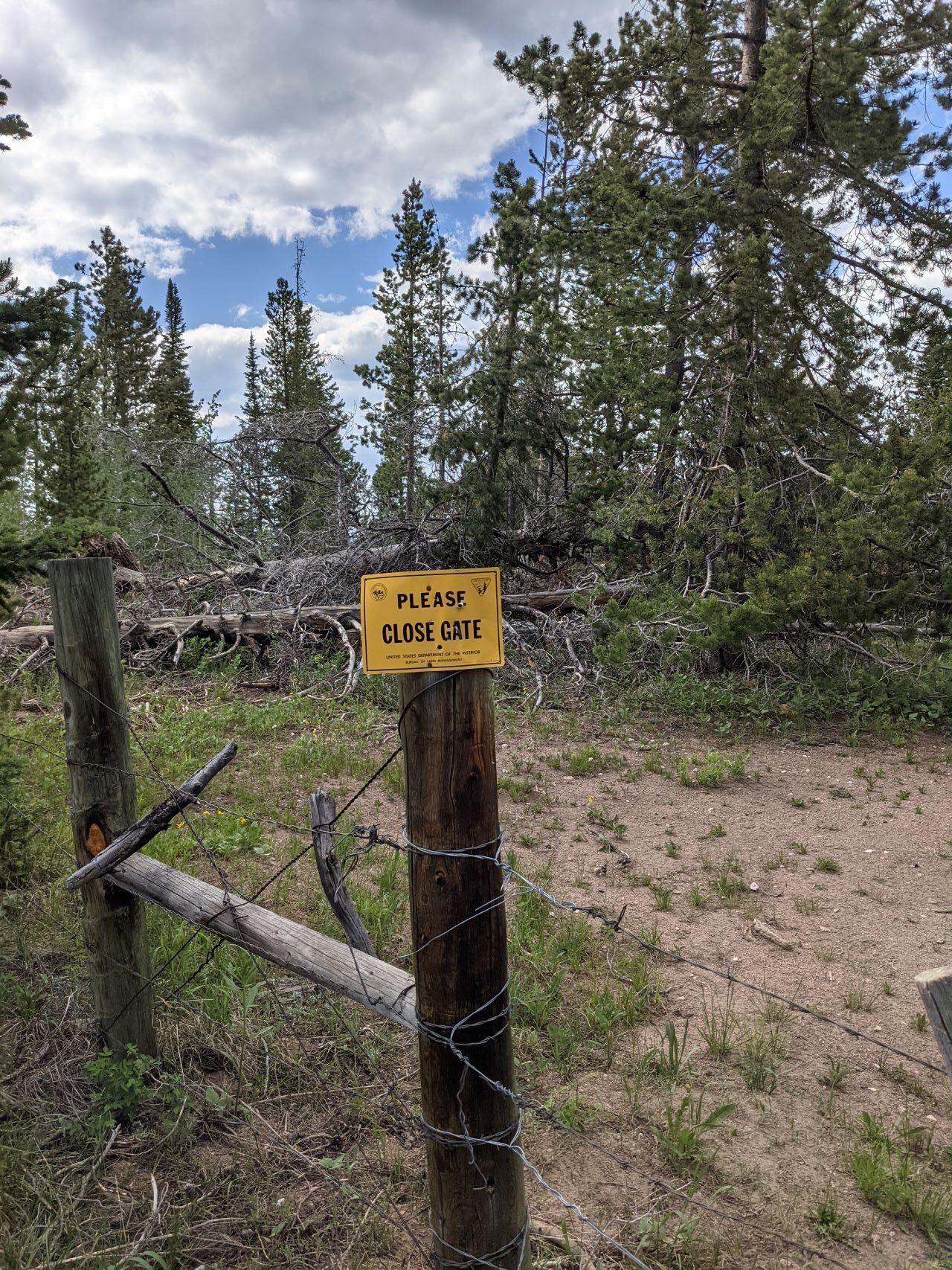
At the top, you’ll dead end into another fence. We were initially disappointed, only to stick our head over the fence to notice a bunch of signs telling us to close the gate – there’s a wire loop right next to a tree that lets you move a chunk of fence. Make sure you close it behind you. The view coming back down the trail, with the actual “gate mechanism” off to the right of the sign:
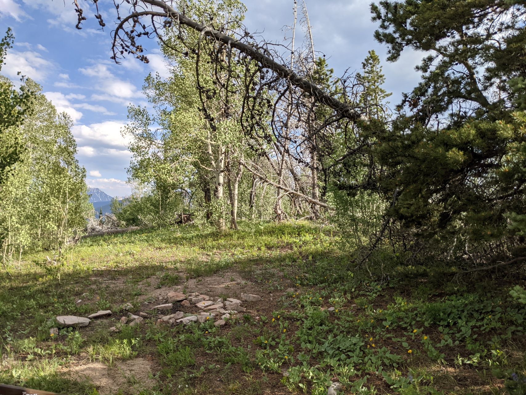
Follow the now overgrown two-track another couple hundred feet to the top. There’s a big flat open spot, with some smallish trees, and tons of wildflowers. The views are mostly obscured by trees, but it’s a fine HF site. Like Williams Peak, I hadn’t heard any traffic on the 2m/70cm simplex calling frequencies all day, and didn’t bother trying – there are significantly taller mountains between you and where most people live.
It was fairly late in the day at this point, so Tim & I quickly got our contacts and headed back down. Along the road, we passed several campsites that could make for some nice laid-back car-camping. Besides a first activation and 4 points, the main attraction to this mountain was that it was easy – the road the entire way up is reasonable, the hike is short and not especially steep (roughly a quarter mile and 150 feet vertical from where we found parking), and it’s a nice HF site. I wouldn’t make a return trip just for Dice Hill, but if I was activating anything else in the area would happily tack it on a nice way to close out my day.
![]() !! WARNING !! There are old mountaineers, and
bold mountaineers... there are no old-bold mountaineers.
Hiking and mountain climbing are potentially hazardous activities particularly in Colorado with its extreme elevations. I am not accepting responsibility for any death or injury resulting from activations based on my trip reports. Proper training, experience, and personal capability assessment is required - enjoy!
!! WARNING !! There are old mountaineers, and
bold mountaineers... there are no old-bold mountaineers.
Hiking and mountain climbing are potentially hazardous activities particularly in Colorado with its extreme elevations. I am not accepting responsibility for any death or injury resulting from activations based on my trip reports. Proper training, experience, and personal capability assessment is required - enjoy!