


Sheep Mountain is an rarely visited mountain in White River National Forest, approximately a half mile bushwhack from the nearest road.
The first thing worth noting is that both Google Maps and COTREX have the marker for this mountain very much not on top of a mountain. The latitude \ longitude from the SOTA database is the correct one – approximately 1.2 miles South and 1600 feet above the marker.
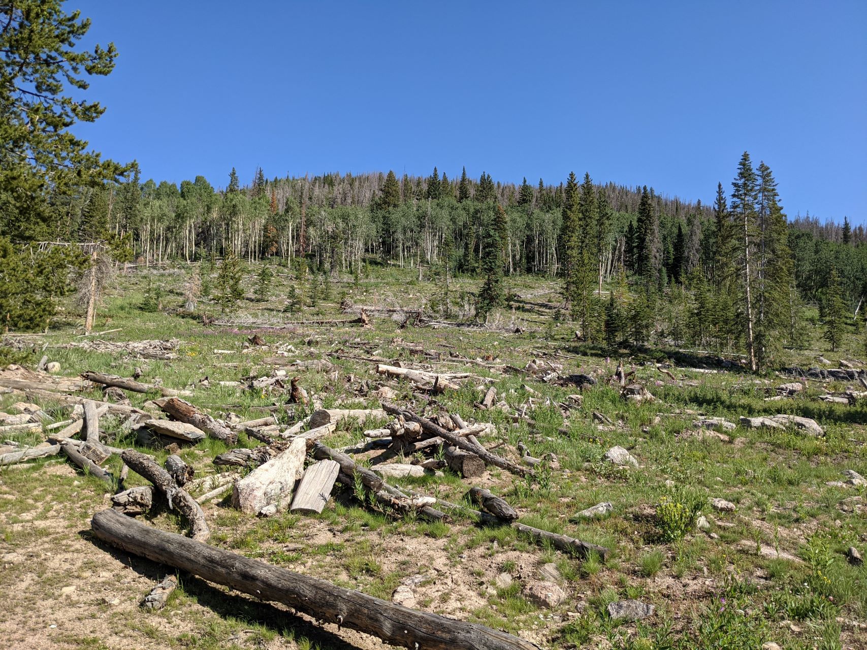
To get to Sheep Mountain, take I-70 to Silverthorne and head North on CO-9. Once you pass the reservoir, you’ll go by the turn off for Williams Peak Road on your right, and hang a left onto County Highway 10. Take this back a while, until you see a sign indicating Dice Hill to your right, and National Forest land straight ahead. Continue straight past this sign, onto BLM2773. At the border of the National Forest, there will be a bunch of information signs and various admonishments. Veer right on FS23.1, which quickly climbs uphill. Take this back almost 3 miles. I parked at 39.87308N 106.43094W – there was a convenient pull-off on the right with an open field that heads up Sheep Mountain:
If you encounter a split in the road with FS1834.1 off to the left and FS202.1 continuing straight, you’ve gone too far.
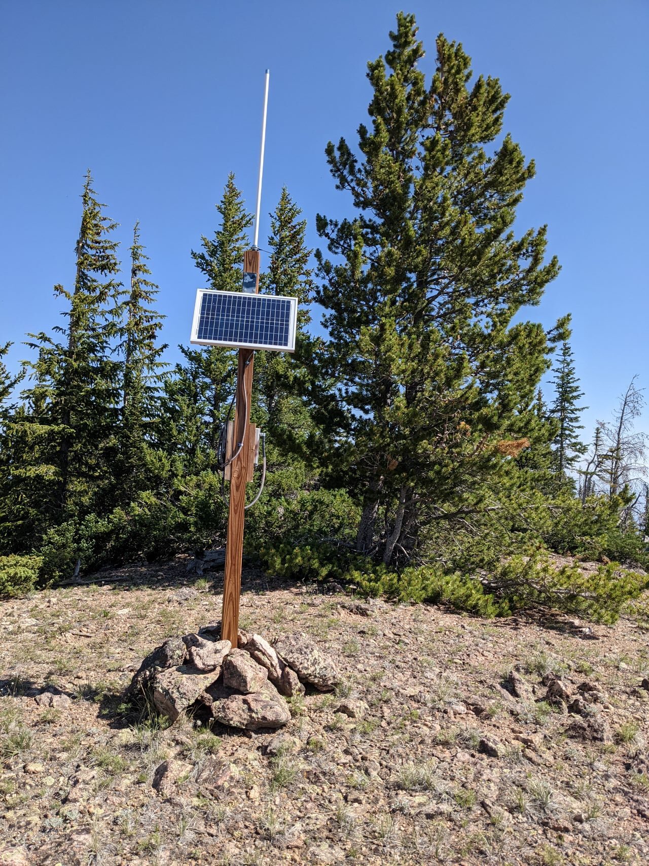
From here, it’s a pick-your-own-adventure bushwhack up to the top. I crossed the field and aimed for the what looked like a ridge on the left (West). This wasn’t a good choice – there were long rocky segments, tons of downed trees, and and waist-high grass hiding ankle deep mud. Regardless, I made it to the top. Having not seen any cars, or signs of people, since the National Forest boundary, I was somewhat surprised to see some gear with a solar panel and antenna on top of the mountain:
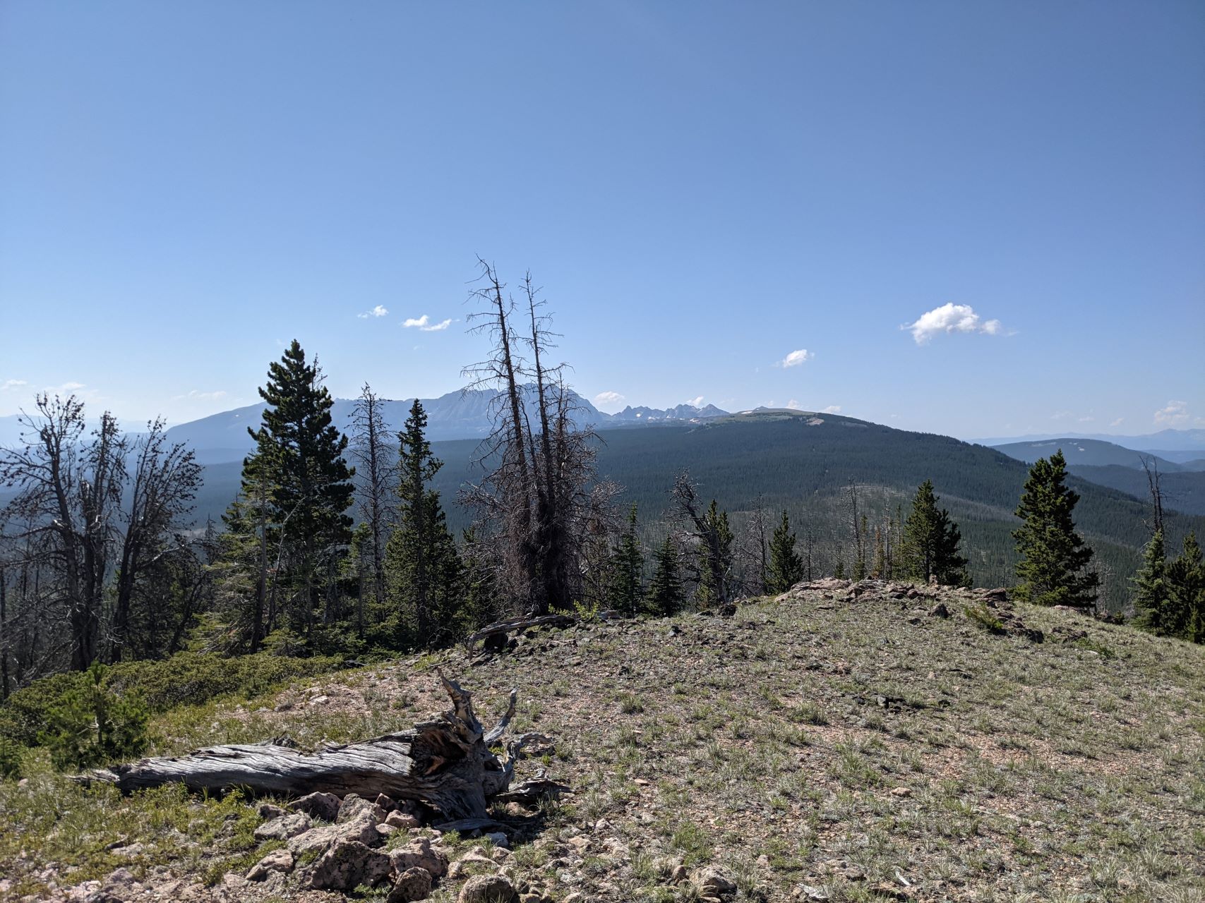
The summit has some low (5′) trees that I threw a random wire over. There were also a couple logs and rocks that a pole could be guyed to. The weather on top was lovely, and I spent an hour or so working the radio. I tested out a newly-added GPS to my portable FT8 setup, got a couple QSOs that way, then hunted for P2P and S2S. My phone showed plenty of bars, but data service was non-existent.
As far as VHF goes, I was able to intermittently hear a couple activators on the other side of continental divide on 2m, but didn’t manage to get through to them.
On the way down, I stayed more to the East, and emerged at the Eastern edge of the clearing that I parked by. This was significantly less rocky and muddy compared to the way up. Back in your car, you can retrace your steps, or continue further along the forest service road towards Cottonwood Peak and Piney Peak. The road quickly gets worse in that direction, and I would strongly recommend only attempting this with a high-clearance 4WD vehicle. I was planning on attempting to activate one of them, but time and weather ended up forcing me to leave them for another day.
This was slightly harder to get to than Dice Hill, but significantly more scenic, and could be easily combined with any of the other summits in the area.
![]() !! WARNING !! There are old mountaineers, and
bold mountaineers... there are no old-bold mountaineers.
Hiking and mountain climbing are potentially hazardous activities particularly in Colorado with its extreme elevations. I am not accepting responsibility for any death or injury resulting from activations based on my trip reports. Proper training, experience, and personal capability assessment is required - enjoy!
!! WARNING !! There are old mountaineers, and
bold mountaineers... there are no old-bold mountaineers.
Hiking and mountain climbing are potentially hazardous activities particularly in Colorado with its extreme elevations. I am not accepting responsibility for any death or injury resulting from activations based on my trip reports. Proper training, experience, and personal capability assessment is required - enjoy!