


W0C/SP-030
Boreas Mountain
3987 m / 13,082 ft
Aug 1, 2016
By KX0R
Boreas Mountain is a challenging alpine summit near Boreas Pass, south of Breckenridge.
• Pike National Forest
• High altitude hike
• No marked trail to the summit
• Route follows the Continental Divide part way
• Fine alpine scenery
• Excellent HF site
• 3.3 miles round-trip
• ~1550 vertical feet total
-
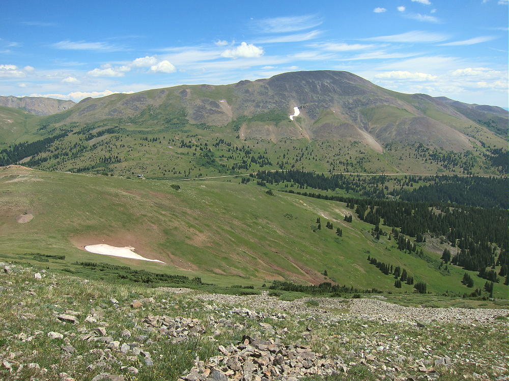
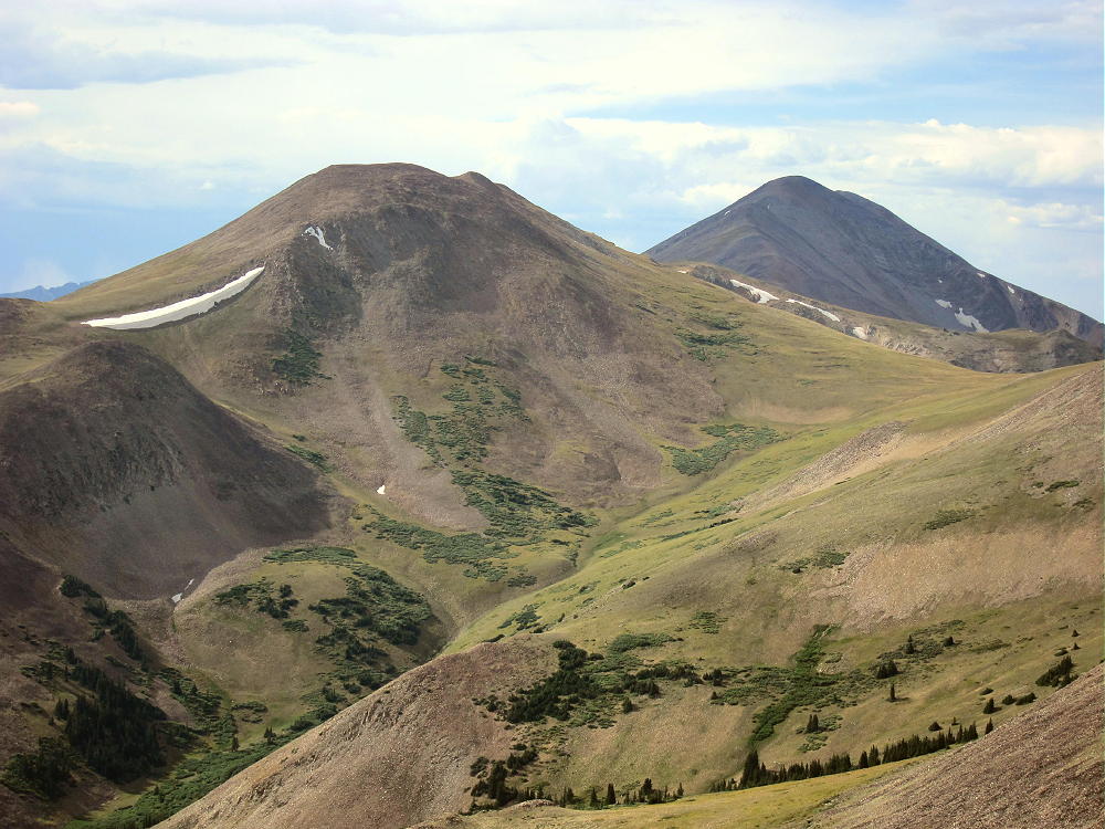
- Boreas Mountain and Pass – from Madonna Dome
Driving access:
• Drive west on Highway 285 and cross Kenosha Pass
• Continue west on Highway 285 about 10 miles
• Turn north on CR 33 and drive about ½ mile to Como
• Pass through Como and drive up CR 33 about 9 miles to Boreas Pass at 11482 feet
• The route follows a historic narrow gage rail line and continues all the way across to Breckenridge
• CR 33 is an OK unpaved road, with several rough, rocky sections, but most cars can make the trip along the railway roadbed
• Park off the road at Boreas Pass, near the old Section House
• This is the trailhead
-
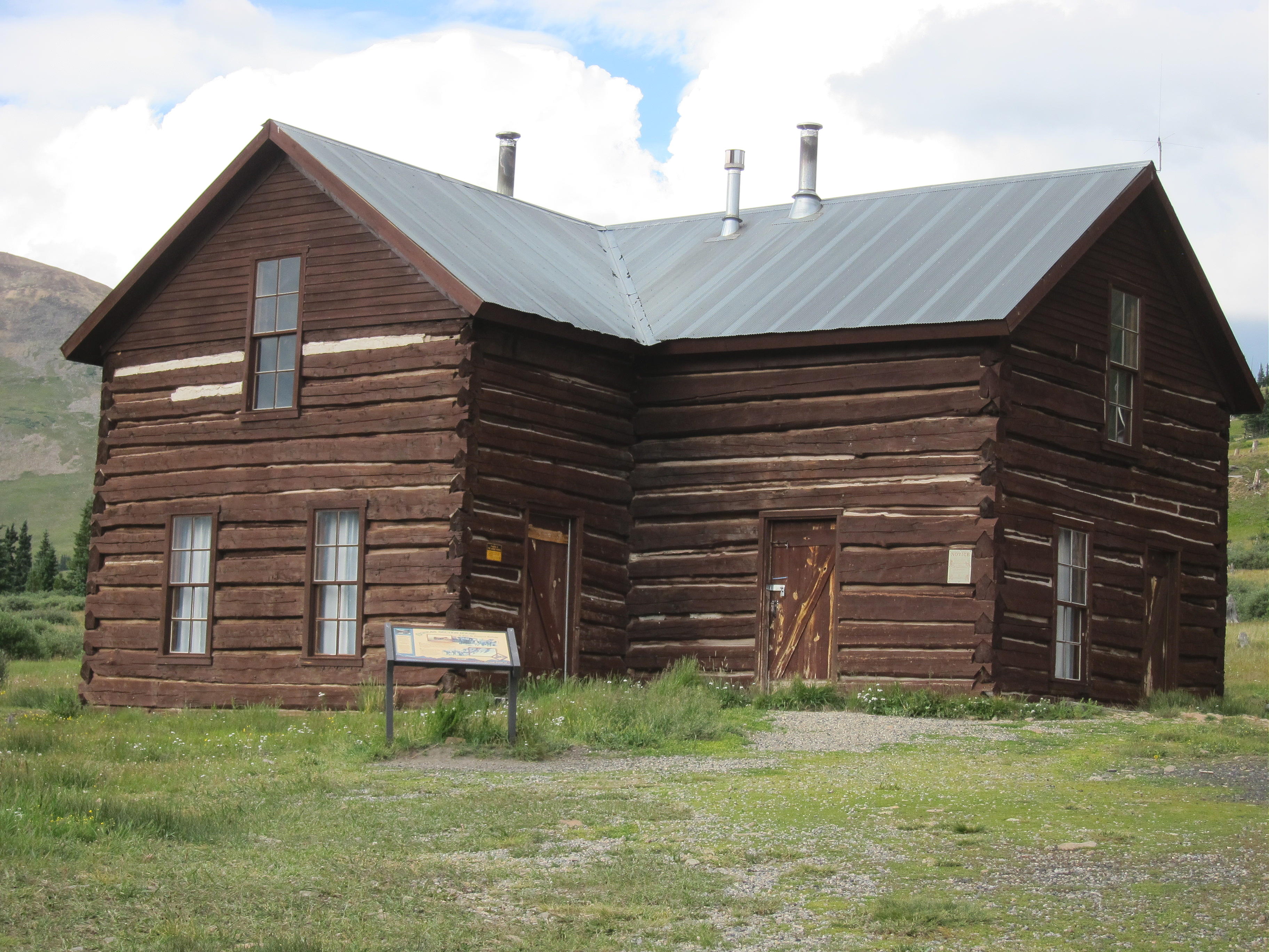
- Boreas Mountain – Section House at Trailhead
The hike and climb:
• Google Maps shows none of the hiking trails near Boreas Pass
• GPS is very useful in this area
• Hike east from the Section House up through meadows toward the north ridge of Boreas Mountain
• This route follows the Continental Divide
• At about 12,000 feet the grade becomes steep
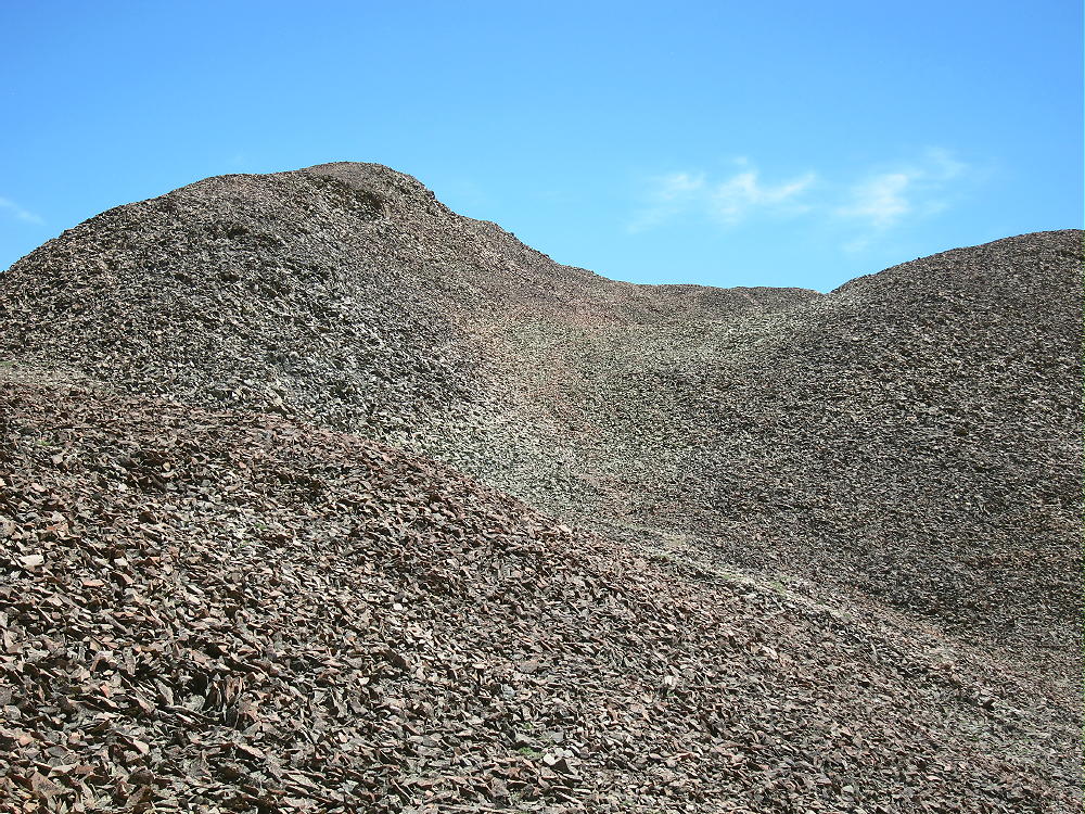
• Follow game trails up through the rocky tundra toward the north sub-peak
• Avoid the obvious talus slopes – stay in the green area
• Pass southwest below a small sub-peak
• At about 12,600 feet, traverse southeast up toward the summit ridge
• Head south up a long, shallow valley west of the summit ridge
-
- Boreas Mountain – Route up to Summit Valley
• Follow convenient old trails in the rocks
• The summit is the highest bump near the south end of the rocky summit ridge
• Climb up the rock pile to the top
• There’s a convenient wind shelter on the peak
-
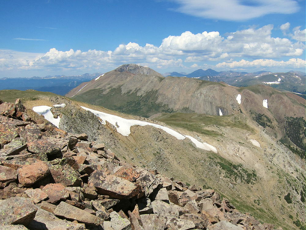
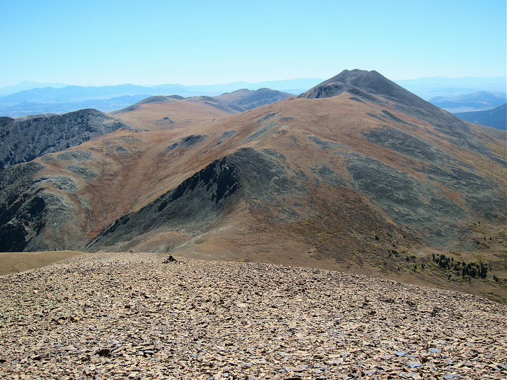
- Boreas Mountain Summit – View Northeast to Mount Guyot
Additional Details:
Not many people climb Boreas Mountain. The off-trail route up to the ridge is steep and rocky. There are a few game trails that lead up through the tundra. The hike gets easier toward the top – the hike up the shallow valley is pleasant. The old trails may date from the mining days, but I didn’t see much evidence of mines up there.
The entire summit ridge appears to be made of reddish intrusive igneous rock. It makes almost musical tones, like pieces of ceramic, as you hike over it. Most of the top part of the mountain looks like a giant rock pile. The peak is about ½ mile south of the Divide.
-
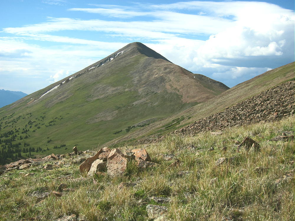
- Boreas Mountain from Volz Benchmark
The summit offers great views of the surrounding peaks and most of South Park below. Bald Mountain stands much higher to the north, and Mount Guyot looks cool with its cliffs in the northeast. The views along the Divide to the southwest are interesting – Red Peak, Hoosier Ridge, Mount Silverheels, etc.
-
- Boreas Mountain – View North of Bald Mountain
Boreas Mountain is a fine HF summit. It falls away in all directions, and the noise level is very low. My end-fed wire worked well on top – 34 CW contacts on 4 HF bands. Partly surrounded by higher mountains, this peak is likely a poor VHF/UHF summit, with coverage limited to parts of South Park and the area near Breckenridge.
-
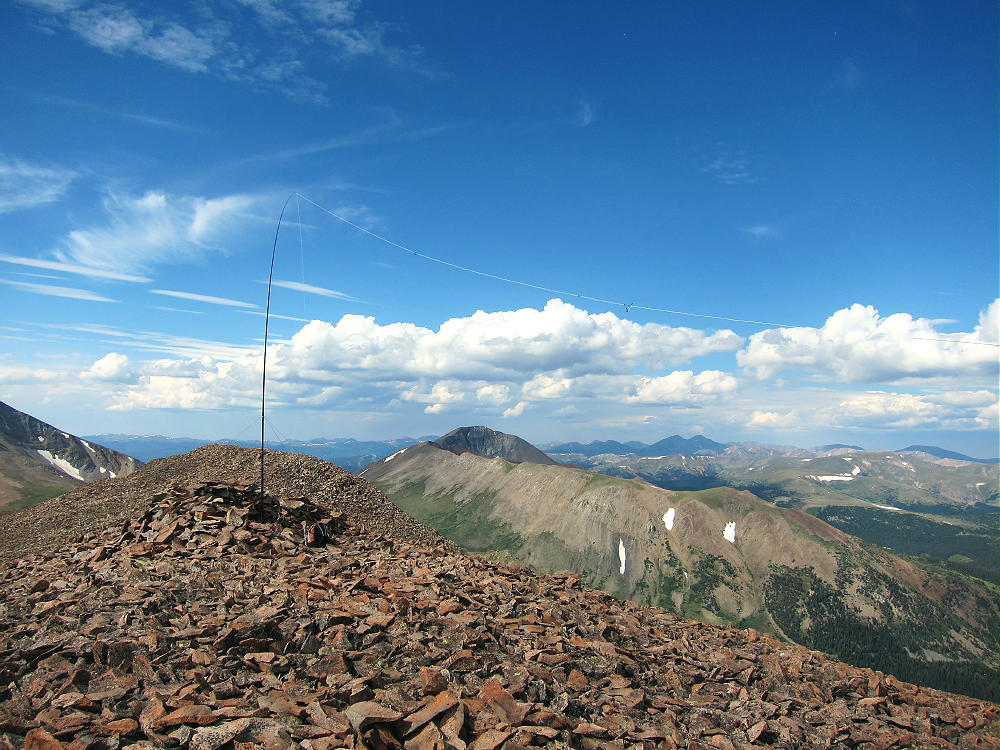
- Boreas Mountain – SOTA Activation on Summit
-
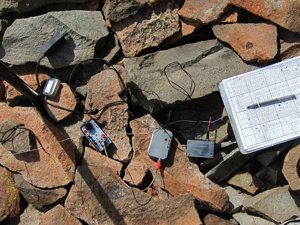
- Boreas Mountain – SOTA Radio Gear
It might be practical to climb Boreas Mountain’s north ridge via the trail from the Section House to Black Powder Pass, but I haven’t done that. The ascent up the north ridge from the Pass is partly through talus, but there might be a game trail(s) up through it.
-
- Boreas Mountain, North Ridge, from Bald Mountain – Sep 19, 2016
For a dual activation, consider these nearby summits:
Madonna Dome W0C/SP-051 Easy – access from Boreas Pass
Bald Mountain W0C/PR-019 Very challenging – access from Boreas Pass
Volz Benchmark W0C/SP-046 Challenging – access from CR 33
73
George Carey Fuller
KX0R
-
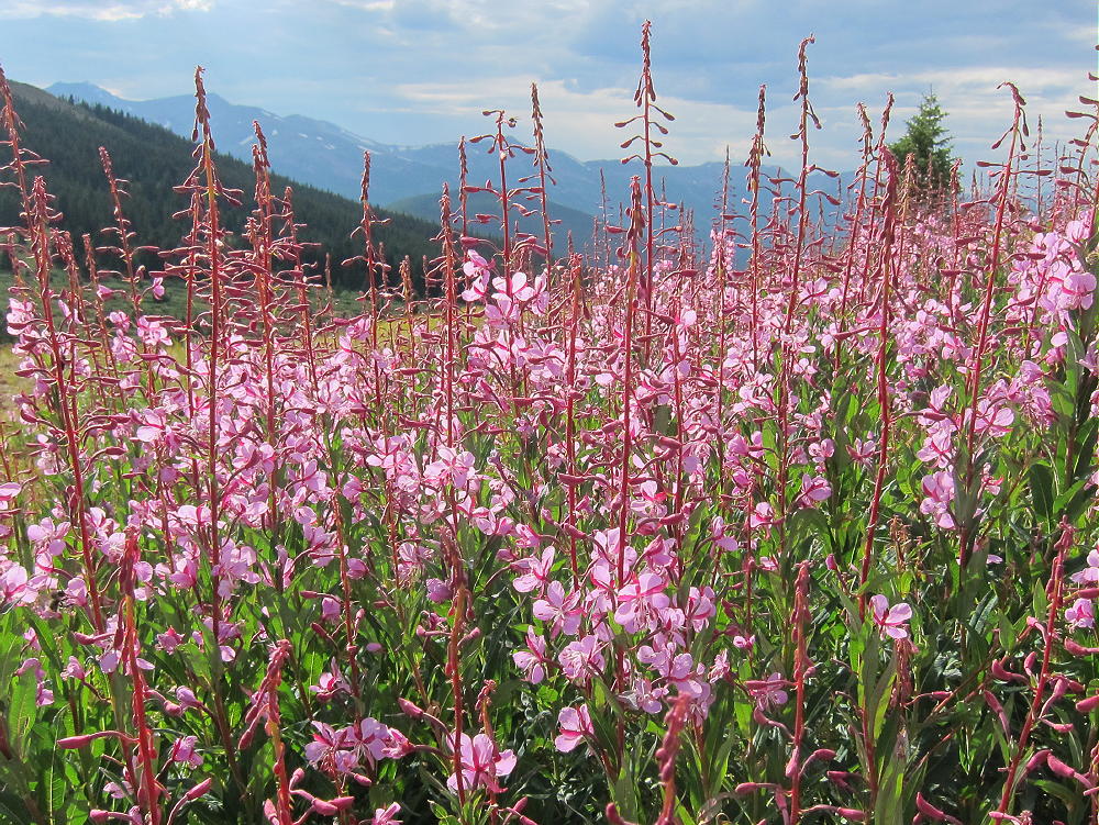
- Boreas Mountain – Fireweed
![]() !! WARNING !! There are old mountaineers, and
bold mountaineers... there are no old-bold mountaineers.
Hiking and mountain climbing are potentially hazardous activities particularly in Colorado with its extreme elevations. I am not accepting responsibility for any death or injury resulting from activations based on my trip reports. Proper training, experience, and personal capability assessment is required - enjoy!
!! WARNING !! There are old mountaineers, and
bold mountaineers... there are no old-bold mountaineers.
Hiking and mountain climbing are potentially hazardous activities particularly in Colorado with its extreme elevations. I am not accepting responsibility for any death or injury resulting from activations based on my trip reports. Proper training, experience, and personal capability assessment is required - enjoy!