


W0C/SP-054
Little Baldy Mountain
3701 m / 12142 ft
First Activation
Aug 15, 2016
By KX0R
Little Baldy Mountain is the prominent bald-topped peak standing above Como, in South Park.
Key Points:
• Pike National Forest
• Access via Gold Dust Trail
• No marked trail up the north ridge
• Route finding required
• Game trails and bushwhacking
• ~ 5.5 miles round-trip
• ~ 2000 vertical feet
• Seldom visited
• Superb HF site
-
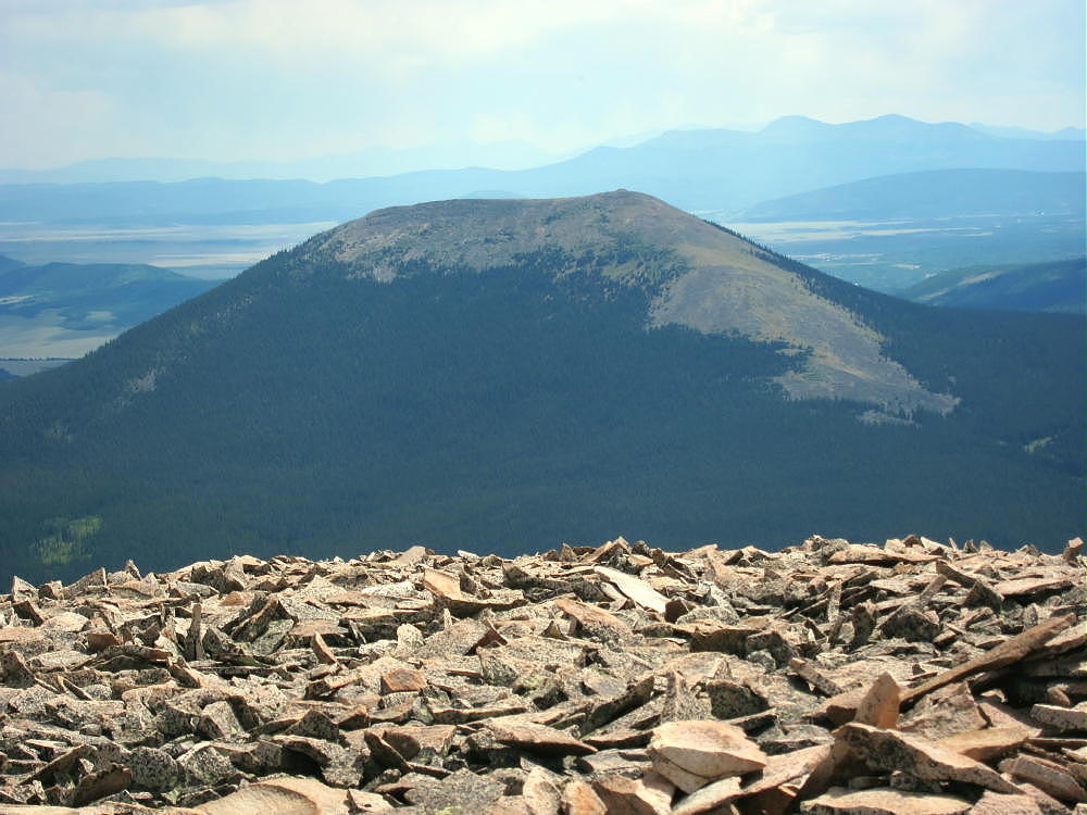
- Little Baldy from Volz Benchmark
Driving Directions:
• Drive west on Highway 285 and cross Kenosha Pass
• Continue west on Highway 285 about 11 miles
• The Pike National Forest visitor map is very helpful in this area
• Turn north on CR 33 and drive about ½ mile to Como
• Continue on CR 33 up the Tarryall Creek drainage for about 3 miles to a marked split where CR 33 heads off to the right, NW, toward Boreas Pass
• Roberts Cabin is near this split
• Don’t follow CR 33 right at this intersection, but continue straight on CR 50 northwest along Tarryall Creek for about 1.5 miles
• Look for a marker on the south side of the road for Trail 698, the Gold Dust Trail
-
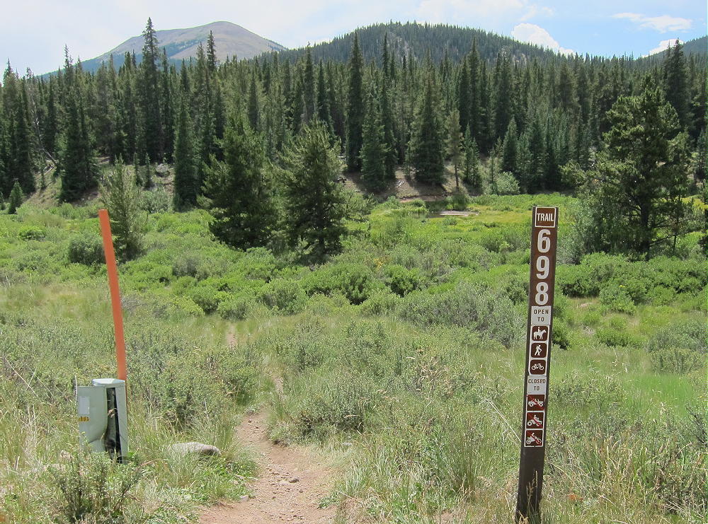
- Little Baldy – Gold Dust Trailhead
• The Gold Dust Trail crosses the road at this point – this is the trailhead – park on the north side of the road
• Most of the land along the creek and the road is private, and the Gold Gust Trail 698 provides convenient, legal access to the National Forest land south of the creek
The Hike and the Climb:
• Google Maps show none of the hiking trails in this area, and the Gold Dust Trail 698 and trailhead are not shown
• All the trails and creeks are shown on the Pike National Forest visitor map
• GPS is also very useful in this area
• Hike south from the trailhead on Trail 698
• Cross Tarryall Creek on a convenient wood bridge
-
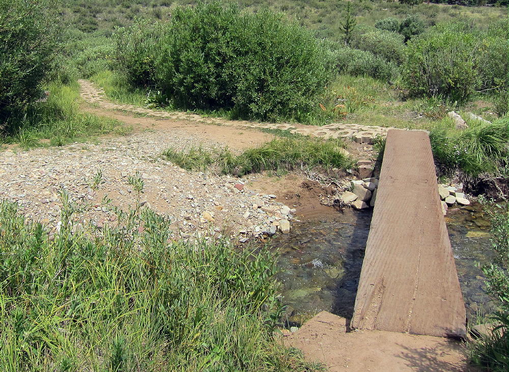
- Little Baldy – Gold Dust Trail Bridge
• This bridge is visible on Google satellite images, and is the key to the whole trip – this is how I found the Gold Dust trailhead!
• Follow the Gold Dust Trail 698 southeast for about ½ mile to a trail junction – Trail 614 splits off and heads west up Silverheels Creek.
• Cross Silverheels Creek and continue southeast on Gold Dust Trail 698 for about 0.4 mile to South Tarryall Creek
-
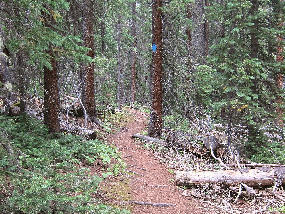
- Little Baldy – Gold Dust Trail
• Cross the creek and walk southeast along Trail 698 for about 100-200 feet.
• Leave the trail and head south, uphill, through mostly open forest
-
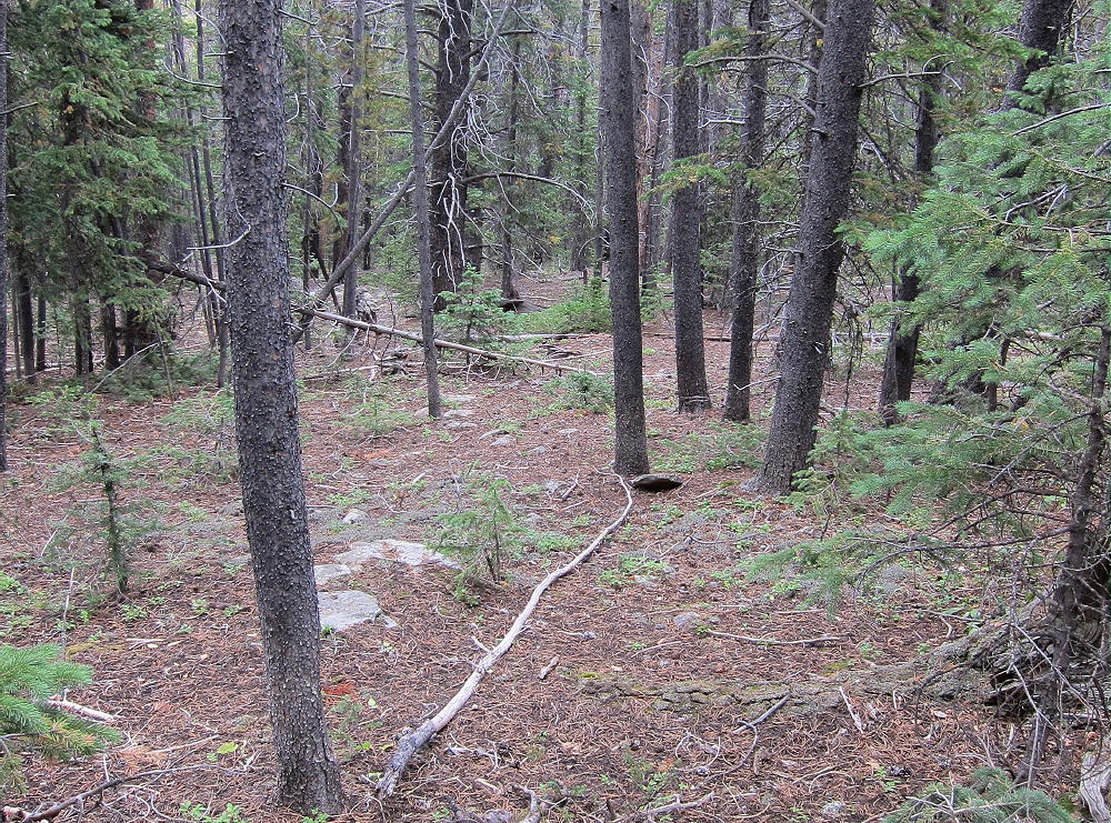
- Little Baldy – Lower Slopes Open Forest
• This route is gentle at first, but the hike becomes steeper and tougher as it ascends south up the long north ridge of Little Baldy.
• Visibility is limited; it’s important to stay on the ridge and keep climbing south.
• Some bushwhacking is inevitable in dense parts of the forest.
• At about 10,800 feet the ridge gets steeper, but the route ahead can be seen
• The hardest part of the climb is up through the forest from 10,800 to 11,500 feet – use the available game trails and stay on the ridge.
-
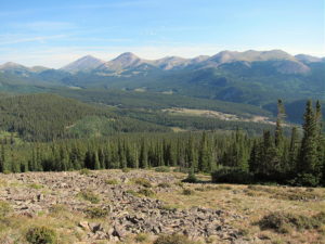
- Little Baldy – North Ridge Route, View North
-
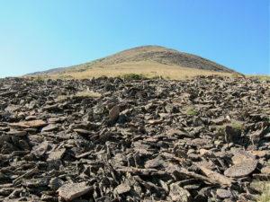
- Little Baldy – North Ridge Route
• Above 11,500 feet the grade is less steep.
• Climb south via faint game trails, up tundra and talus of the open, spectacular north ridge, to the summit area
-
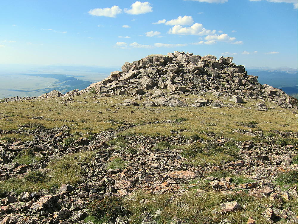
- Little Baldy – Summit Rockpile
• The actual peak is at the top of a rocky knoll on the west side of the broad mountaintop
• Climb carefully over boulders to the top of this knoll.
Additional Details:
As far as I can tell, there’s no public route up the south or east side of Little Baldy. There’s likely access on the steep west side via either FR-194 or Trail 614, but I see no advantage to either route. The north ridge route is challenging but relatively efficient. Stay on the ridge – avoid the deadfall and thickets of the steep northeast slopes.
-
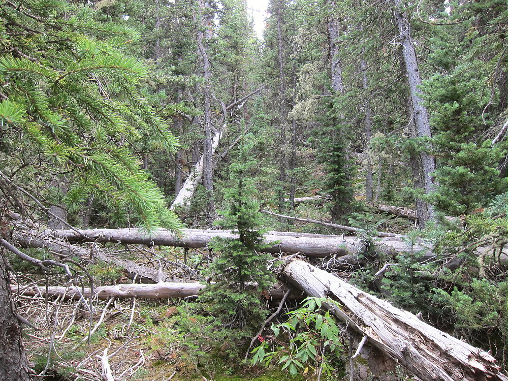
- Little Baldy – Northeast Ridge Deadfall
The forest on the north side holds snow for many months of the year, so the north-side ascent is best done during the summer or fall.
There are some good spots for setting up radio gear near the summit knoll. I set up on the south side to reduce the wind. Setting up on the knoll provides some additional height for an antenna.
-
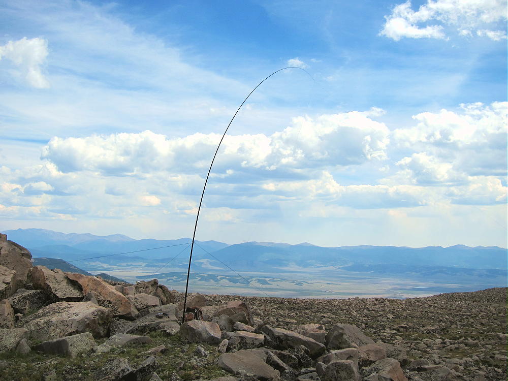
- Little Baldy – SOTA Activation
Little Baldy Mountain is a near-perfect HF radio site. It falls away in all directions, and the noise level is very low. Little development is nearby. This peak is likely a fair VHF/UHF summit, with coverage across much of South Park.
The peak offers great views of several higher peaks and South Park. Boreas Mountain stands east of the Pass to the north, and Bald Mountain stands higher behind it. Mount Silverheels is impressive to the west, with Hoosier Ridge north of it. Reinecker Ridge and Red Hill extend more miles to the south. Pikes Peak and Mount Evans are visible many miles to the east.
-
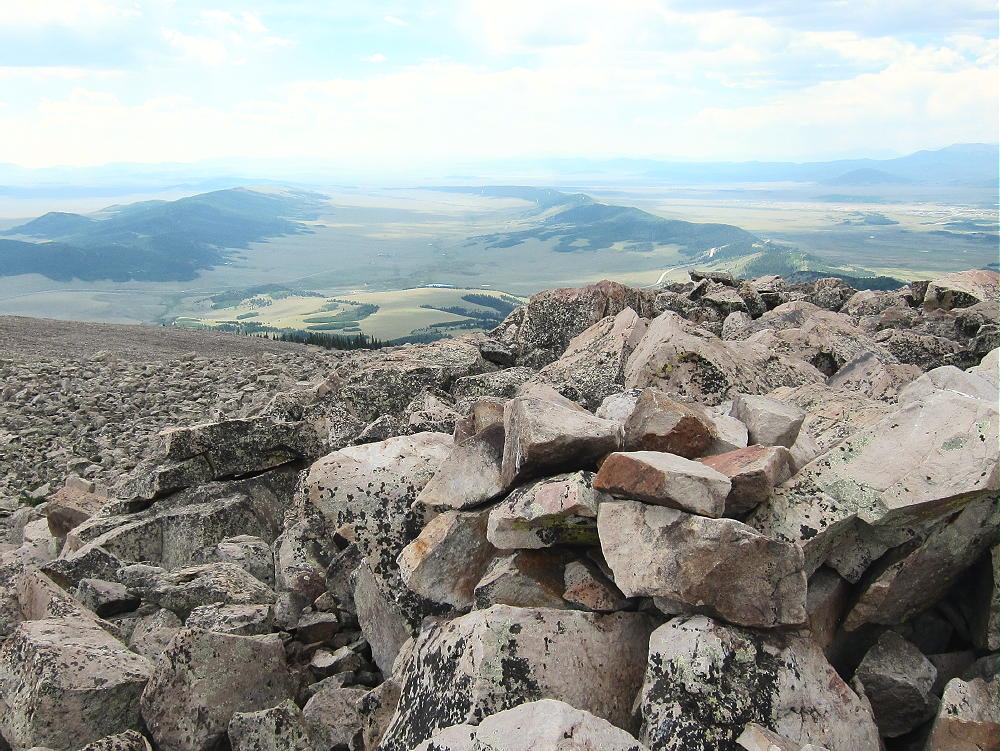
- Little Baldy – Summit, View South, Reinecker Ridge and Red Hill
For a dual activation, consider these nearby summits:
Madonna Dome W0C/SP-051 Easy – start at Boreas Pass
Boreas Mountain W0C/SP-030 Challenging – start at Boreas Pass
Volz Mountain W0C/SP-046 Challenging – start along CR 33
I activated Volz after Little Baldy, and it was a full, very fun day!
73
George
KX0R
-
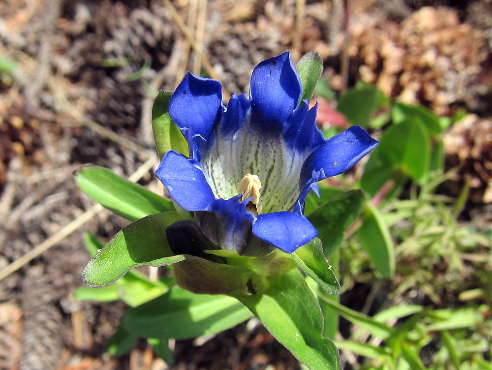
- Little Baldy – Blue Gentian
![]() !! WARNING !! There are old mountaineers, and
bold mountaineers... there are no old-bold mountaineers.
Hiking and mountain climbing are potentially hazardous activities particularly in Colorado with its extreme elevations. I am not accepting responsibility for any death or injury resulting from activations based on my trip reports. Proper training, experience, and personal capability assessment is required - enjoy!
!! WARNING !! There are old mountaineers, and
bold mountaineers... there are no old-bold mountaineers.
Hiking and mountain climbing are potentially hazardous activities particularly in Colorado with its extreme elevations. I am not accepting responsibility for any death or injury resulting from activations based on my trip reports. Proper training, experience, and personal capability assessment is required - enjoy!