


W0C/FR-020
Kataka Mountain
3792 m / 12441 ft
First Activation
July 11, 2015
By KX0R
Kataka Mountain is a lightly-visited alpine summit in the Mount Evans Wilderness about 25 miles west of the Denver area.
Key points of the trip:
• Pike National Forest
• Good trail most of the way
• No marked route or trail to the summit
• Navigation and route-finding required
• Fine HF site
• Friendly meadows with alpine flowers
• ~14.4 miles round-trip (~3 hours each way)
• ~3100 vertical feet
-
- Kataka Mountain South Side
Driving Directions:
• Drive west from Denver on Highway 285
• About ½ mile before Crow Hill, turn right on Road 43A – this becomes Road 43
• Continue on Road 43 up the Deer Creek Valley for several miles, to the end of the road
• The last section of the road is unpaved but passable in most cars
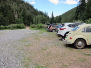
• Park at the Deer Creek Trailhead at 9300 feet
-
- Kataka Hike – Deer Creek Trailhead
-
- Kataka Mountain – Deer Creek Trailhead
Summary of the route:
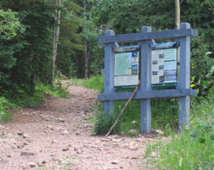
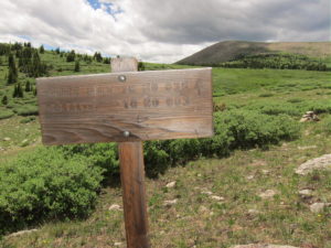
• Hike the marked Rosalie Trail 603 all the way up to the saddle at about 11600 feet
• At the sign go left on Three Mile Trail 635
• Continue south to the willows east of Kataka
• Hike through or around the willows near the south side
• Climb up the tundra on the east side of Kataka
• Continue to the summit near the south end of the mountain
Additional details:
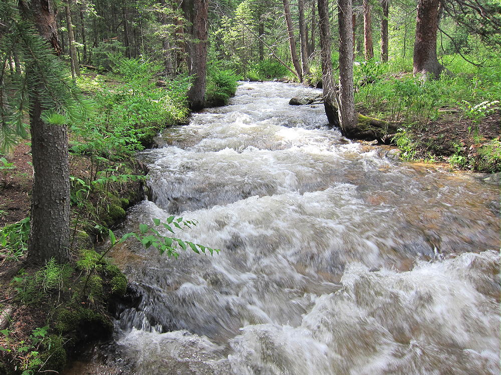
Most of the route is in the Mount Evans Wilderness. This is a protected area with special rules. There is no charge for parking or entry. The Rosalie Trail follows Deer Creek up a beautiful valley, all the way to the alpine tundra.
-
- Kataka Mountain – Deer Creek
This is a high-quality hike on its own. An early start is advised, especially if thunderstorms are in the forecast.
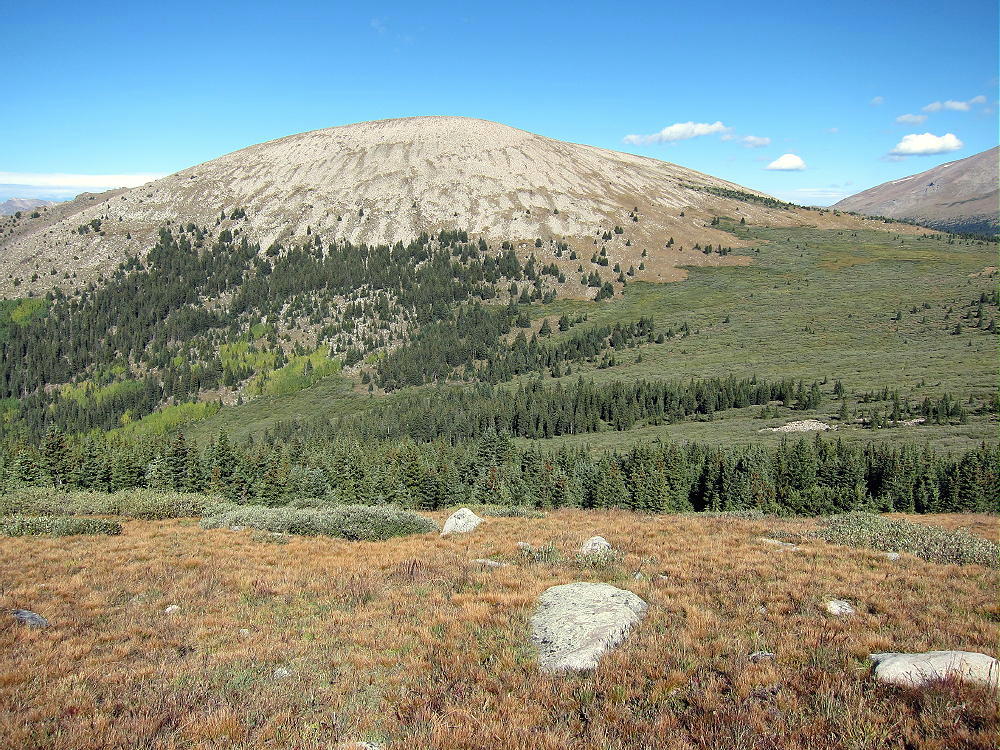
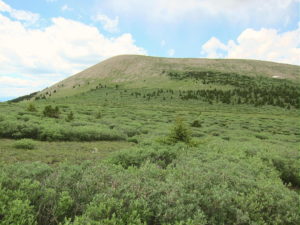
Kataka is visible above tree-line; at the sign where the trail splits, the dome-shaped mountain is obvious to the southwest.
-
- Kataka Mountain – Trail Junction
-
- Kataka Mountain – Southeast Side
It’s not far to the willows east of Kataka. The southern part of the willow area has gaps and paths through the bushes; avoid the dense northern part. This area looks like it would be wet in early summer, but it was no problem July 11, 2015.
The summit is about 700 vertical feet above the saddle near the willows. There’s no trail up to the top. The climb up the tundra is not difficult – stay north of the steep, rocky slopes on the southeast side. The Google satellite image shows many key details. The northeast slopes also may provide a good route.
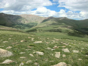
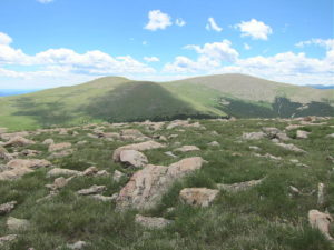
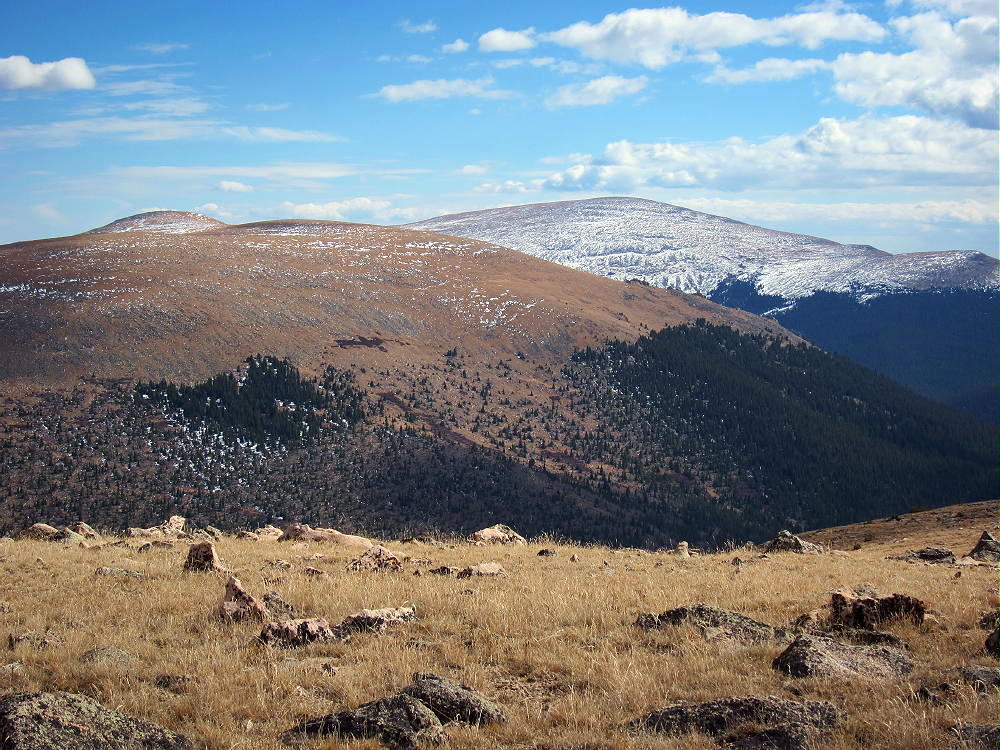
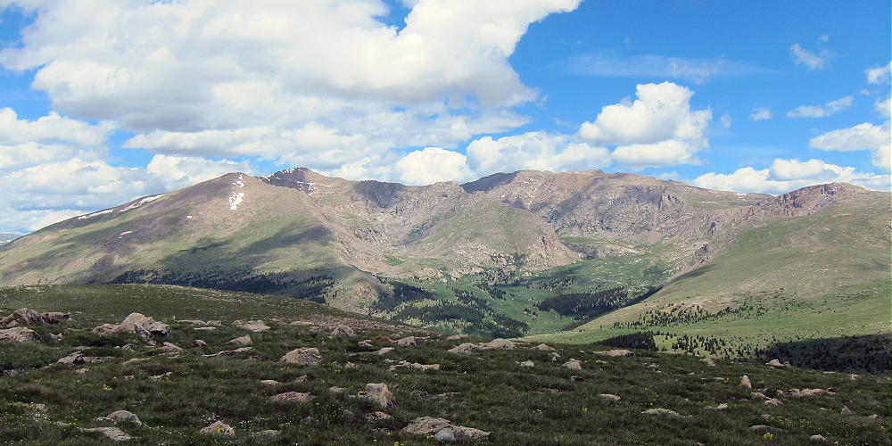
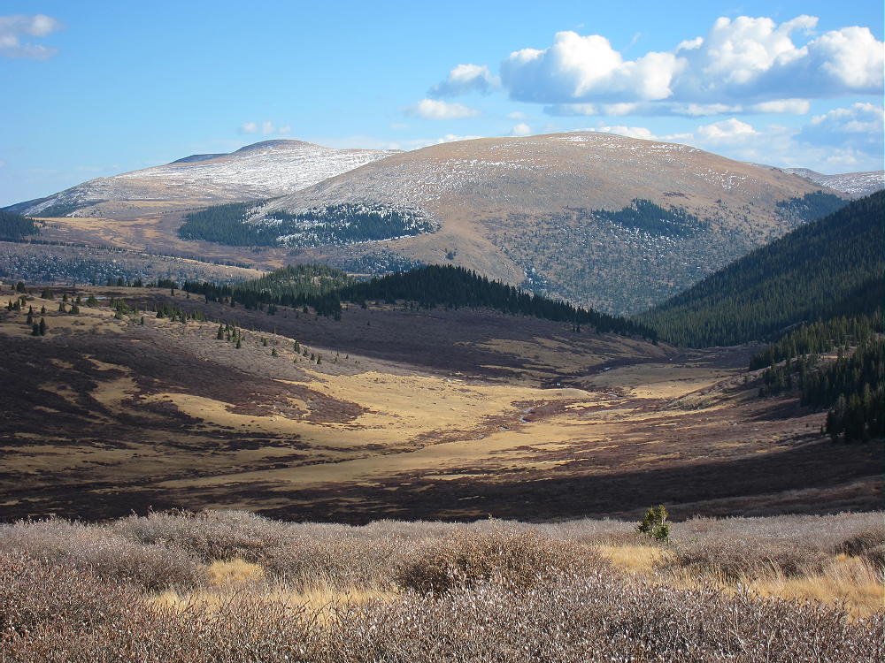
Kataka is a massive mountain with a large, rounded top. The summit surprised me – it was very beautiful, with lush vegetation and many alpine flowers. It’s a friendly place in good weather. There’s little evidence of other visitors. The views are wonderful in all directions! Mount Evans and Mount Bierstadt stand high to the north, and broad Mount Logan dominates the southeast.
-
- Kataka Mountain – View East toward Mount Evans
-
- Kataka Mountain – View South to Mount Logan
Rosalie Peak is three miles to the northeast, and Geneva Mountain is only two miles to the northwest. All of these mountains are fine SOTA peaks!
-
- Kataka Mountain and Mount Logan from Geneva Mountain, Mid-October
Kataka also looks southwest across Kenosha Pass into South Park. Some of the Collegiate Peaks are visible far beyond; if it’s clear, the tops of the Crestones are visible above other peaks far to the south.
The large activation zone is mostly alpine tundra and boulders. I set up my pole and gear slightly east of the peak to avoid the breeze. Because Kataka is surrounded by higher mountains in several directions, it’s probably not a good VHF/UHF site. There may be some coverage down the valley to the east, as well as into South Park.
-
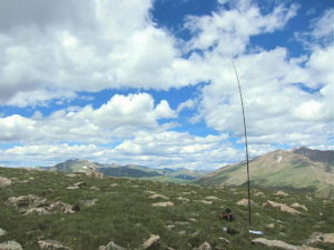
- Kataka Mountain – KX0R SOTA Activation
-
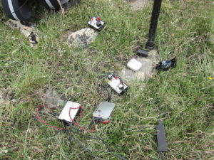
- Kataka Mountain – SOTA Activation Radio Gear
This peak is a fine HF location. All development is miles away, so the HF noise level is low. The surrounding peaks don’t attenuate HF sky-wave signals much. I had a fine SOTA session, with 32 contacts on 10-14-18-21 MHz CW. I was on the air for over 80 minutes, and I didn’t want to shut down.
Kataka Mountain should be climbed on a dry day with a low probability of thunderstorms. My hike required just over three hours from the trailhead to the summit – I was pushing pretty hard, because clouds were gathering as I climbed. An early start is essential, because the hike is long, and a good activation requires a long time on the summit.
Kataka Mountain is a SOTA Classic:
• Pristine wilderness location
• Beautiful hike up the Rosalie Trail
• Challenging distance
• Significant vertical gain
• Wonderful setting among higher peaks
• Seldom visited
• Friendly summit with flowers and great views
• Great HF radio site
-
- Kataka Mountain View of Mount Bierstadt and Mount Evans
This mountain is recommended only for SOTA activators who enjoy long, fast hikes at high altitude. Lightweight gear is essential.
It’s possible to climb Kataka from the west via the Three Mile Trail. The trailhead is along the southern part of the Guanella Pass Road, about three miles north of Grant. This equally-scenic route is about the same difficulty as the route from the east!
-
- Kataka Mountain and Mount Logan above Scott Gomer Creek, Mid-October
There are other SOTA peaks in the area of Kataka Mountain. Possibilities for a challenging dual activation include:
W0C/SP-050 Geneva Mountain 2 miles NW
W0C/FR-007 Rosalie Peak 3 miles NE
W0C/FR-017 Mount Logan 2-1/2 miles SE
Camping nearby might make it practical to activate multiple summits in the area. Numerous forest campgrounds and campsites are within a few miles of Kenosha Pass; backpack camping in the Mount Evans Wilderness is allowed – but special rules apply.
Let’s keep Kataka pristine – tread gently on its fragile alpine meadows!
73
George
KX0R
-
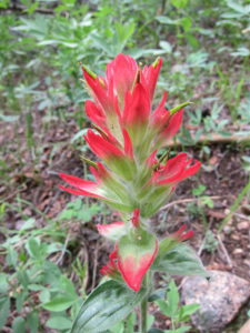
- Kataka Mountain Hike – Indian Paintbrush
-
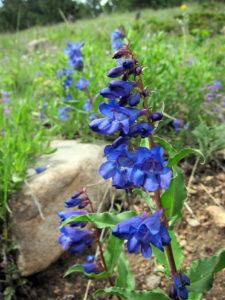
- Kataka Mountain Hike – Penstemons
-
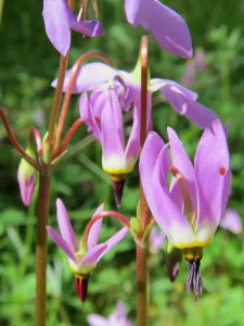
- Kataka Mountain Hike – Shooting Stars
![]() !! WARNING !! There are old mountaineers, and
bold mountaineers... there are no old-bold mountaineers.
Hiking and mountain climbing are potentially hazardous activities particularly in Colorado with its extreme elevations. I am not accepting responsibility for any death or injury resulting from activations based on my trip reports. Proper training, experience, and personal capability assessment is required - enjoy!
!! WARNING !! There are old mountaineers, and
bold mountaineers... there are no old-bold mountaineers.
Hiking and mountain climbing are potentially hazardous activities particularly in Colorado with its extreme elevations. I am not accepting responsibility for any death or injury resulting from activations based on my trip reports. Proper training, experience, and personal capability assessment is required - enjoy!