


W0C/FR-084
Palisade Mountain
2519 m / 8264 ft
Aug 3, 2015
By KX0R
Palisade Mountain is everything its name suggests! It towers high above the Big Thompson Canyon west of Loveland, and its cliffs look impossible to climb. Until I learned about the road up the back side, I avoided this prominent mass of rock.
Key points:
• Roosevelt National Forest
• Near Drake, west of Loveland
• Easy hike
• Maintained trail leads almost to the top
• Little development near the summit
• 2WD dirt road to the tiny trailhead
• ~2.5 miles round-trip
• ~860 vertical feet
• The climb takes less than an hour
-
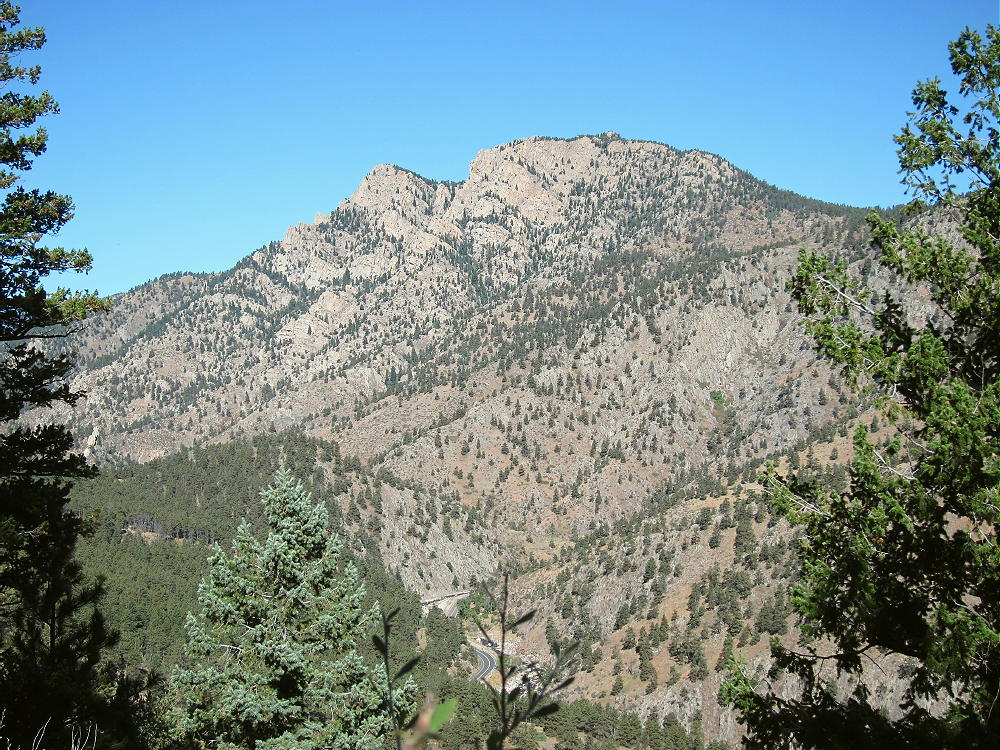
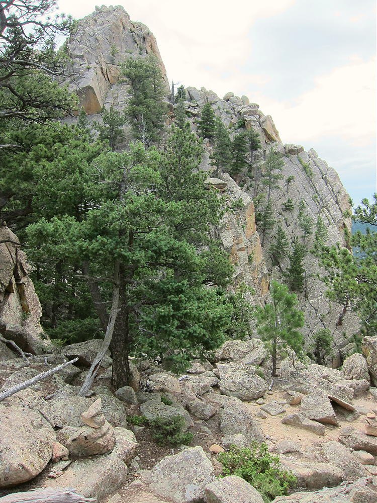
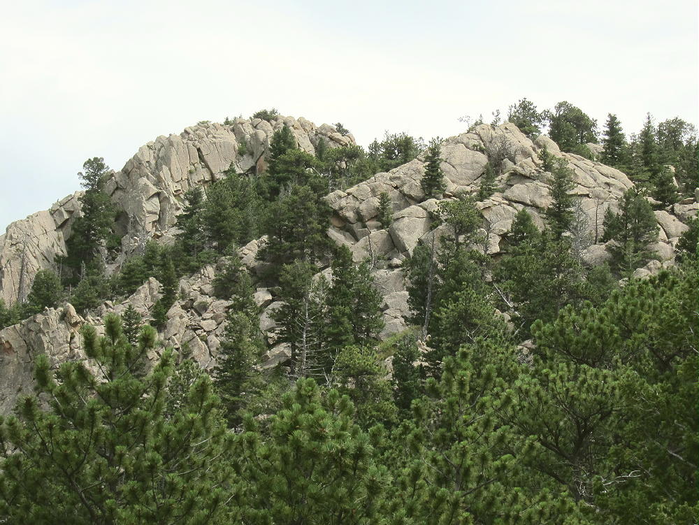
- Palisade Mountain from Round Mountain Trail
Driving Directions:
• Drive to Highway 34 and follow it west into the mountains.
• Continue several miles to the town of Drake. This area was heavily damaged in the 2013 floods, and reconstruction is underway.
• Check online about access before going up there
• Turn right on Road 43 at Drake
• Drive about ¼ miles to Storm Mountain Road.
• Turn right, north, and follow the steep 2WD road up a side-canyon.
• At about 7000 feet elevation, the road reaches a plateau and a mountain subdivision.
• Turn right on Palisade Mountain Drive and drive east about 0.3 mile.
• Turn right, south, on Snowtop Drive.
• Follow Snowtop up a small valley about a mile to the trailhead.
• The trailhead is west of a sharp bend in the road, on the south side, at a USFS gate.
• This spot is on the west ridge at about 7400 feet.
-
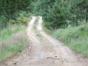
- Palisade Mountain – Road near Trailhead
-
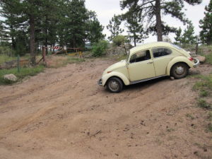
- Palisade Mountain Trailhead
Snowtop Drive is heavily posted with signs, and parking is allowed only at the tiny trailhead. The trailhead is so small that there’s space for only two or three vehicles. Posted private land is immediately west of the trailhead. This place is mostly used by local residents. In order to park here, avoid weekends, and/or get up there really early.
The Hike:
• Hike past the gate at the trailhead
• Follow a jeep road a short distance east
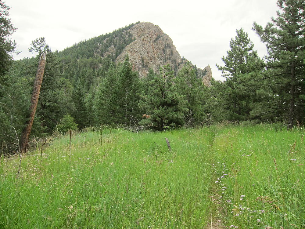
• An unmarked trail leads east through a meadow toward the mountain
• The route climbs northeast toward the peak
-
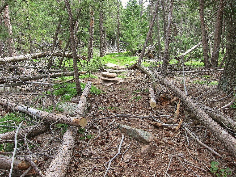
- Palisade Mountain Trail near Beginning
The trail ascends around the forested north side of the western sub-peak, avoiding cliffs and steep slopes.
-
- Palisade Mountain Hike, North of Western Sub-peak
At about 8000 feet, the route reaches the saddle between the sub-peak and the summit.
-
- Palisade Mountain Maintained Trail
• The path ascends east and then north, through a rocky section
• Follow the cairns toward the summit, for about ¼ mile from the saddle to the top.
• Scramble up a short, steep, rocky gully – there really is no trail here
• Cairns mark the route – it’s not difficult.
-
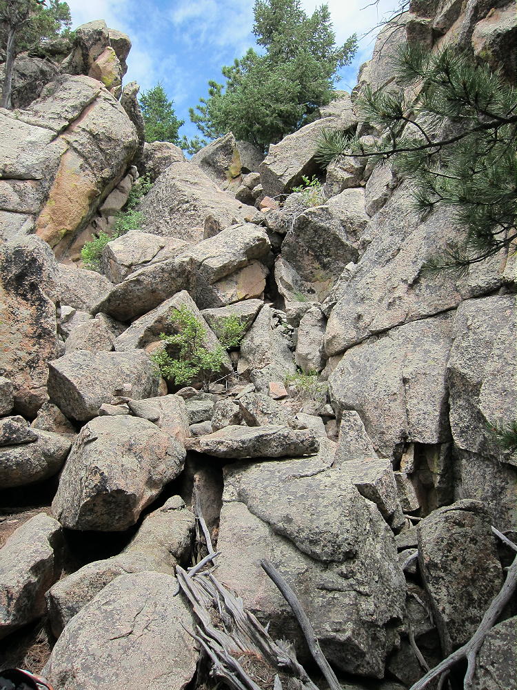
- Palisade Mountain Scramble near Summit
Useful Details:
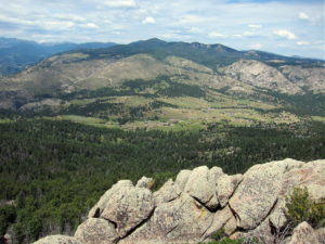
The summit’s a rocky knob with a few convenient trees. Fine views are all around. Sheep Mountain W0C/FR-080 stands across the canyon to the south, Crosier Mountain W0C/FR-057 is several miles to the west, Storm Mountain stands in the northwest, and the high peaks of Rocky Mountain National Park are visible to the west and southwest.
-
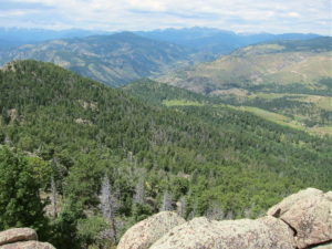
- Palisade Mountain – View Southwest
-
- Palisade Mountain – View West of Storm Mountain
The SOTA activation zone is all granite, but there’s plenty of room to set up HF radio equipment. A pole makes it easy to erect a wire antenna, but it would be possible to improvise with the small trees instead. This is a fine HF site! Palisade is extremely prominent, with no higher peaks close enough to affect HF propagation. It’s probably an excellent VHF/UHF site as well, being farther east than most other peaks in the area. It has an almost clear view out across the plains, as well as south and north across the greater Denver metro area.
-
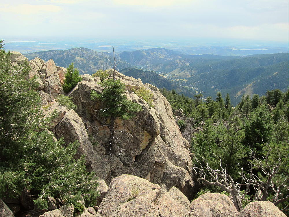
- Palisade Mountain – View East, Down the Canyon to the Plains
There’s very little HF radio noise on Palisade Mountain. The local houses are far enough away that the noise level is not elevated much. I had a pleasant HF activation on Palisade’s summit. I set up right on top, and the weather was stable.
-
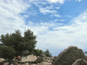
- Palisade Mountain KX0R SOTA Activation
-
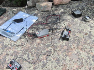
- Palisade Mountain SOTA Activation Radio Gear
Summary of radio contacts:
28 CW Contacts 10, 14, 18, 21 Mhz One S2S One DX – EA2LU
Palisade Mountain’s high local prominence makes it a target for lightning. Higher mountains to the west generate thunder storms in spring and summer; it’s essential to climb Palisade on dry days, or early enough to avoid storms.
-
- Palisade Mountain – Summit Knobs
Palisade is low enough that it should be relatively accessible in winter. If the road’s open, and if parking’s available at the trailhead, the route up the mountain would not be difficult with snowshoes, etc.
73
George
KX0R
-
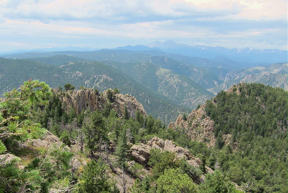
- Palisade Mountain View Southwest to Longs Peak
![]() !! WARNING !! There are old mountaineers, and
bold mountaineers... there are no old-bold mountaineers.
Hiking and mountain climbing are potentially hazardous activities particularly in Colorado with its extreme elevations. I am not accepting responsibility for any death or injury resulting from activations based on my trip reports. Proper training, experience, and personal capability assessment is required - enjoy!
!! WARNING !! There are old mountaineers, and
bold mountaineers... there are no old-bold mountaineers.
Hiking and mountain climbing are potentially hazardous activities particularly in Colorado with its extreme elevations. I am not accepting responsibility for any death or injury resulting from activations based on my trip reports. Proper training, experience, and personal capability assessment is required - enjoy!