


W0C/PR-021 (Mt. Parnassus) 4129 M / 13574 ft
W0C/FR-006 (Bard Peak) 4150 M / 13641 ft
August 21, 2013
by KØMOS
Mount Parnassus (no, not the famous Mountain from the Greek mythology) and Bard Peak are two summits in the Rocky Mountains of Colorado. They are just along I-70, shortly before entering the Eisenhower tunnel (coming from the east). I have driven by these unspectacular mountains numerous times without even noticing them. They are rather easy to access via Herman Lake TH which is right at the exit 218 of I-70. Looking at the SOTA map for WØC, I decided to pay them a visit.
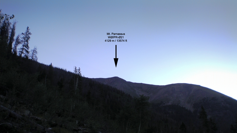
Mt. Parnassus as seen from the TH (almost)
 Trailhead:  10313 ft / 2526 m
 Summit:     13574 ft / 4137 m (Parnassus)
             13641 ft / 4150 m (Bard Peak)
 Elev. gain: 4574 ft  / 1394 m
 Roundtrip:  9.0  mi  / 14.5 km
Compare this summit with my other activated summits
How to get there:
From Denver, take I-70 West and take exit 218. If you go through the Eisenhower tunnel, you went too far. Take a right at the end of the ramp and drive back, parallel to I-70, for 0.15 mi (0.25 km). Information kiosk and outhouse are right there.
Parking/Trailhead
View Larger Map
Red Tape:
Both summits are part of Arapaho National Forest and their rules and regulations apply.
The Ascent:
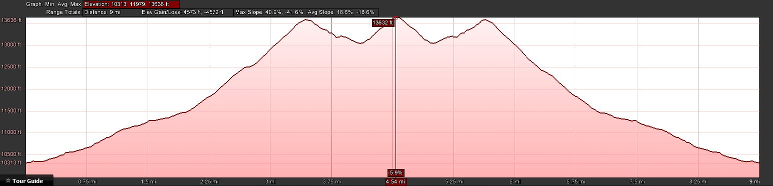
The elevation profile
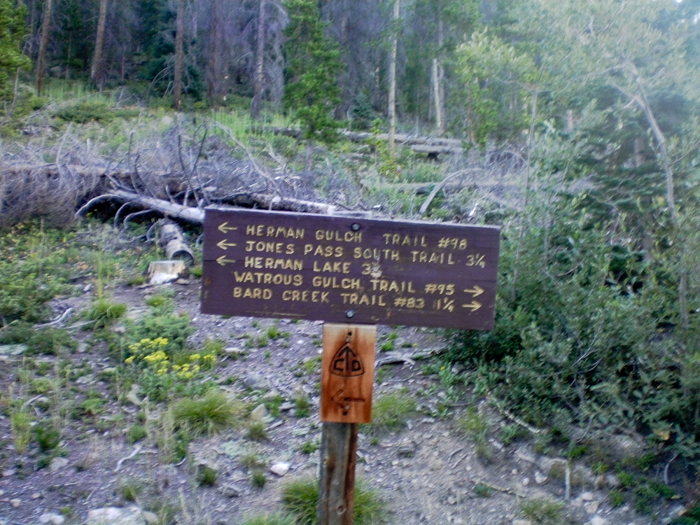
Trail splits after 300 yds
The first part of the trip follows the Watrous Trail. From the info kiosk I headed out east. After a few hundred yards the trail splits… I continued east on the trail through dead and downed trees and lots of noise coming from the highway :(
When I tried to take a few snapshots with my trusted Canon G9 I only got a ‘Lens error, restart camera’ error message combined with an ear piercing whining noise in return. A couple of restarts gave me the same result – the lens was stuck in the open position – therefore all photos were made with my video cam. My excuse for the ‘great’ quality of all the pictures. What I did not know at this point, more camera problems were to come.
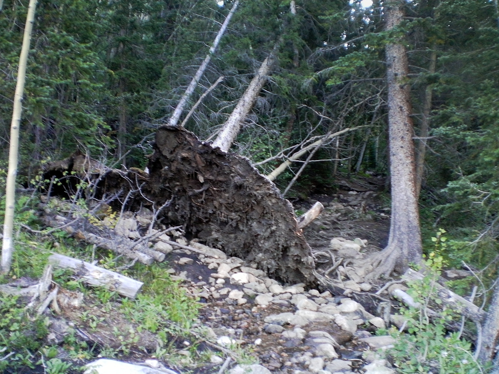
Down and dead trees
After about a mile into the hike the trail starts to head towards the north, along what I can only assume is Watrous Creek. Even though the creek was still carrying water, the noise coming from I-70 was still prominent. Eventually the forest/dead-tree environment makes room for alpine tundra with quite nice scenery and views of Woods Mtn. and Mt. Parnassus. The trail follows along the west side of the creek and disappears soon after it crosses over to the other side towards the saddle between Woods Mtn. and Mt. Parnassus.
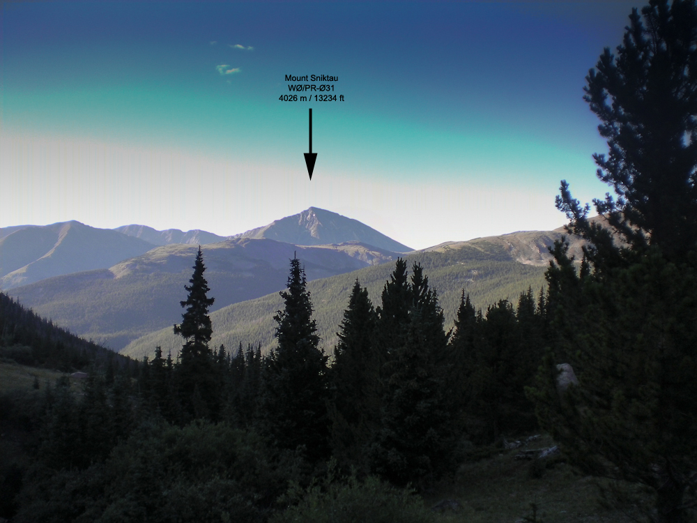
View of Mt. Sniktau
From here it is a straight shot to the saddle after passing through a few remaining trees. Conveniently, somebody erected a stone cairn near the top of the saddle. You can barely see it from here but aiming for the cairn brings you into perfect position for the last 3/4 miles or so up a rocky/grassy slope to the top of Mt. Parnassus. The views are rather nice, nearby Mt. Sniktau (WØC/PR-Ø31) clearly visible with Quandary Peak (WØC/PR-Ø14) in the background under mostly blue skies with only a few white clouds.
-
- Aim for the stone cairn
-
- View of Mt. Parnassus from the saddle
The Summit:
The rather steep west slope flattens towards the summit. The stone shelter can be reached without any obstacles. The large summit could host quite a few activators with their gear and antennas without getting too crowded. The views are stunning in all directions. Lot’s of high altitude SOTA peaks are in clear view.
Just after I finished shooting a 360 degree video, the battery of my remaining camera quit on me. Now I was sitting at 13574 ft / 4137 m with beautiful weather and a second summit to activate, and no camera – very disappointing.
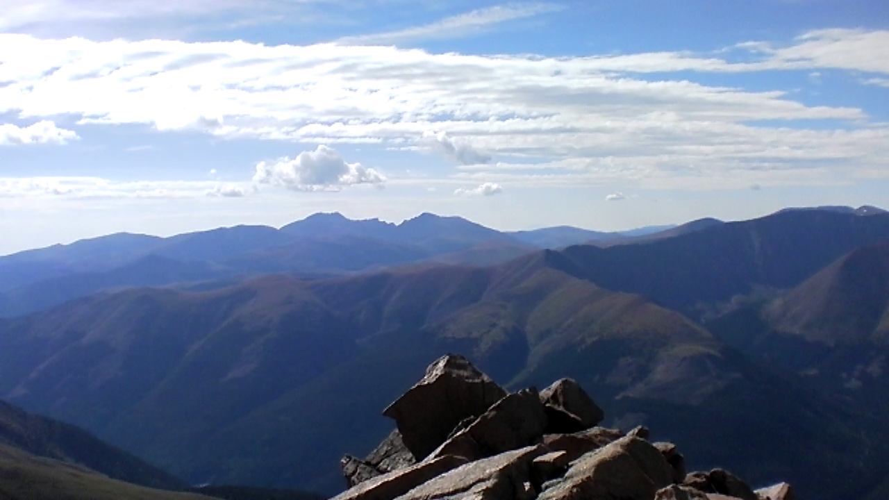
Mt. Evans and Mt. Bierstadt with the saw-tooth route in the distance
With hardly any wind and with very comfortable temperatures I started to setup my antenna and gear. I logged my first QSO at 16:00 UTC, exactly as planned. I handed out the wrong SOTA reference number at first. Realizing that something was fishy, I asked Glenn/N4MJ to verify it for me. I only logged four QSO’s in 25 minutes. Since I had still a lot of ground to cover and because there were no more takers, I started to pack-up and move towards Bard Mountain.

Bard Peak as seen from Mt. Parnassus
Mt. Parnassus to Bard Pk.:
The decent from Parnassus down to the saddle is similar to the west flank, a steep grassy slope with some rocks. Larger outcroppings can be circumnavigated without any problems . From the bottom of the saddle it is another ~600 ft (183 m) of elevation gain to the summit. I started to feel my knees and other body parts but having another 10 pointer so close by released some new energy.
It took me more than an hour to get to the top, slightly longer than planed. Setting up my shack went without hick-up under still amazing weather conditions. Logged 12 QSQ’s in 15 minutes on 20m SSB. Looked like all the chasers were finally awake ;)
After a few more but unanswered CQ’s I started my long hike back to the car.
The Descent:
Nothing noteworthy on the descent… took the same route via Parnassus. It felt like it took forever going down to the saddle and up again before heading down to the saddle of Parnassus and Woods Mountain. I reached the car, conked out after 9 miles and 4574 ft ASL (14.5 km / 1394 m). A snack and fresh water supply in the car gave me back the necessary energy for the drive home.
73, Matt/KØMOS
Feel free to leave comments and/or questions below.
![]() !! WARNING !! There are old mountaineers, and
bold mountaineers... there are no old-bold mountaineers.
Hiking and mountain climbing are potentially hazardous activities particularly in Colorado with its extreme elevations. I am not accepting responsibility for any death or injury resulting from activations based on my trip reports. Proper training, experience, and personal capability assessment is required - enjoy!
!! WARNING !! There are old mountaineers, and
bold mountaineers... there are no old-bold mountaineers.
Hiking and mountain climbing are potentially hazardous activities particularly in Colorado with its extreme elevations. I am not accepting responsibility for any death or injury resulting from activations based on my trip reports. Proper training, experience, and personal capability assessment is required - enjoy!