


W0C/PR-114 (Bald Mountain) 3040 M/ 9994 Ft
Central City Area
Oct 06, 2013
by KX0R
George Carey Fuller
Bald Mountain is a wonderful SOTA peak in the historic mining zone southwest of Central City. While it’s partly surrounded by private land, mines, and new homes, the summit is on National Forest land, and so is the hike and parking!
This is not obvious at first…
Drive to Central City and follow Main Street, which climbs and becomes the Nevadaville Road, west about 3 miles, until you reach a high point near 9500 feet. Turn right north on Co Rd 1N, go about 2000 feet to a junction, and turn left on Bald Mountain Lane. If you see Bald Mountain ROAD, do not follow that, it’s private, and they do not want you there! Bald Mountain LANE leads immediately to the Bald Mountain Cemetery, down on the right side, which has many historical graves and some spooky tales associated with the dead who are buried there. Google it for more info…
If you drive a little farther north from the cemetery, you will see USFS signs marking the forest boundary, and now you’re all set! Just go a bit farther, find a convenient parking spot on the east side, and park there, off the road. Cross the road and hike up the NE slope of the mountain on game trails – there is no marked route – just head straight up the slope through the forest. You’ll see the remains of old prospects here and there. It’s about 600 vertical feet and about 2/3 mile to the summit. If you go too far south, there is posted private land – but the NE route and the summit area is all in the National Forest.
The west summit is the high point – but the east summit is almost as high. There are lovely meadows surrounded by aspen trees all around the spacious top – this peak is colorful when the trees turn gold in the fall. The views are fabulous, right up to the Divide, and all around. Bald Mountain is a classic, and few people know about it or climb it.
You can set up and operate wherever you like within 75 vertical feet of the top. There are trees that could be used for an antenna – or bring a pole.
When you get down, it’s fun to drive around the Nevadaville – Russell Gulch area to see various old mines and buildings. The Virginia Canyon Road 279 provides an interesting alternative descent road down to Idaho Springs.
Some pictures (click onto the picture for a larger version):
-
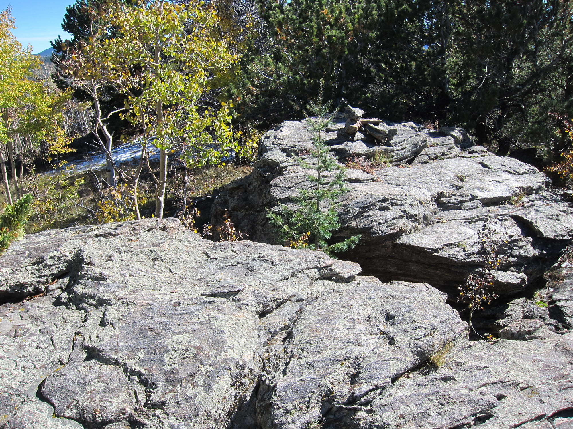
- Bald Mountain Summit
-
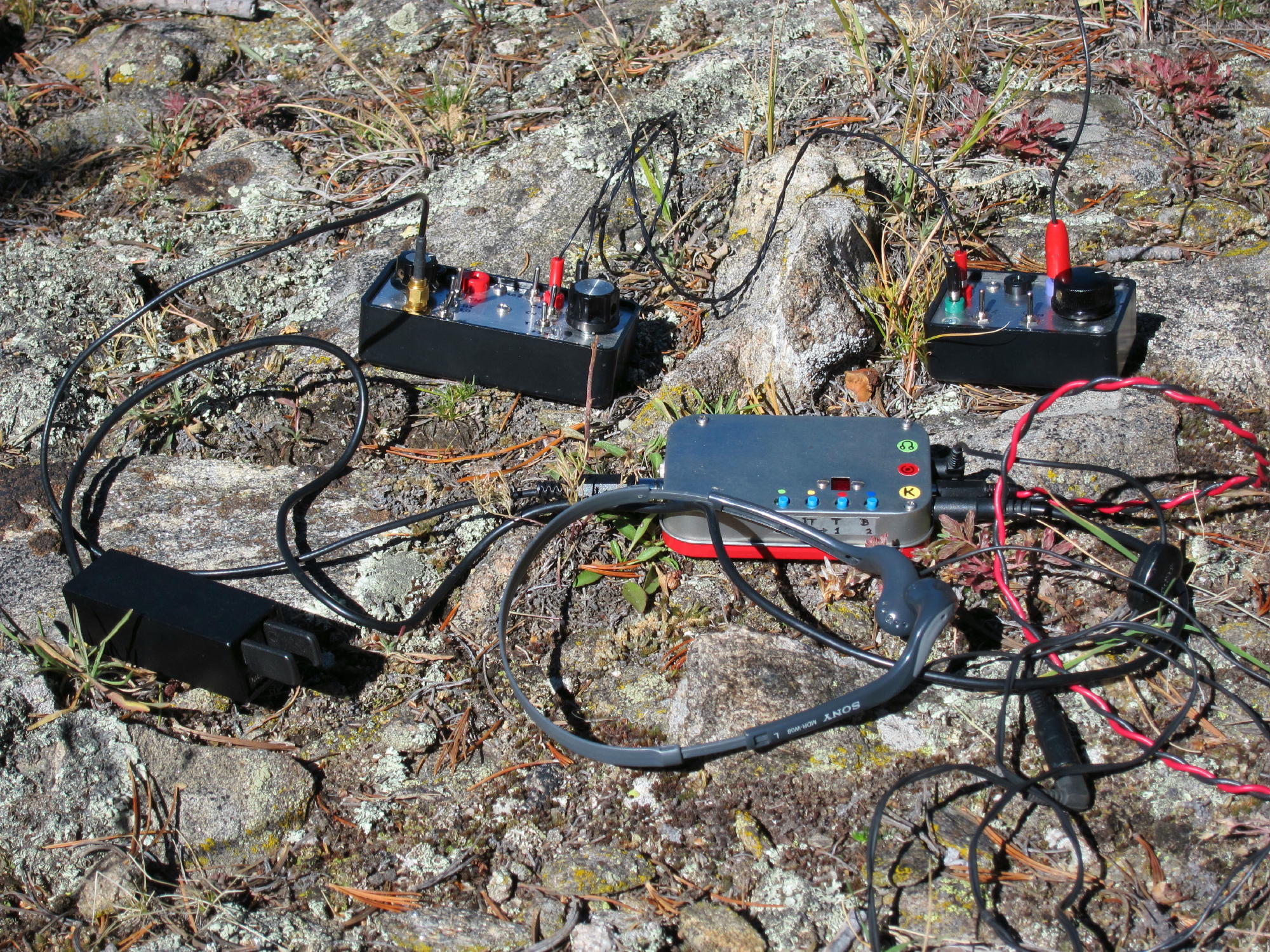
- Bald Mountain Radio Gear, ATS-3B and Tuners
-
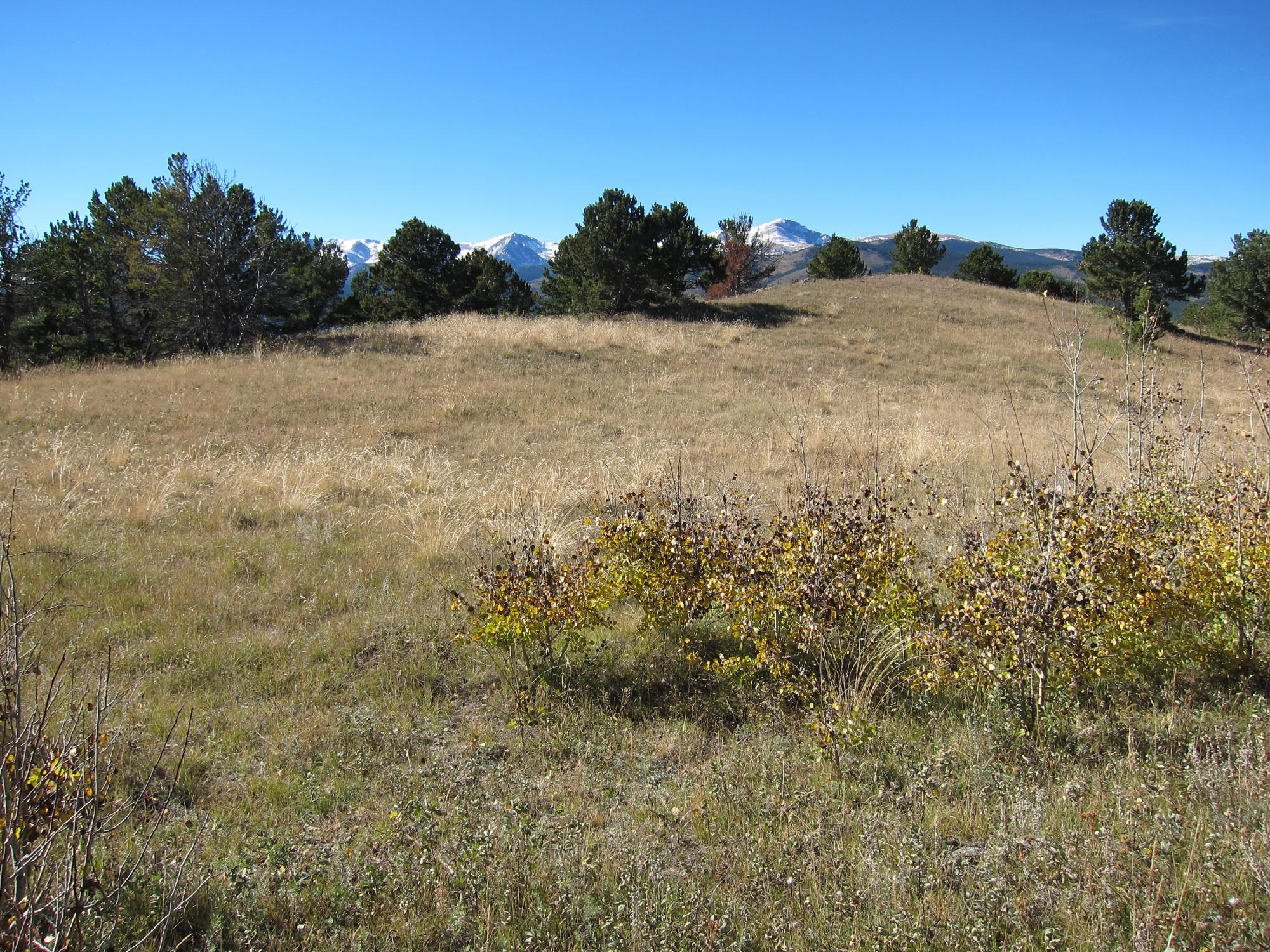
- Bald Mountain Meadow
-
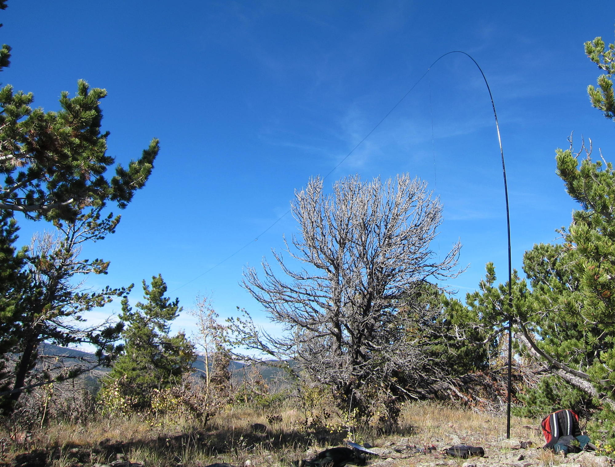
- Bald Mountain Activation Setup – KX0R
-
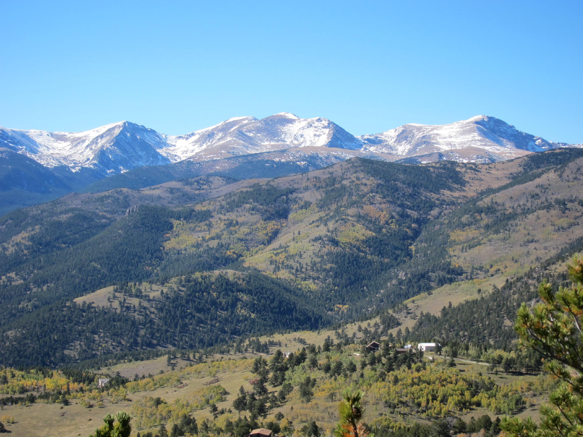
- Bald Mountain View West from Summit – Continental Divide
![]() !! WARNING !! There are old mountaineers, and
bold mountaineers... there are no old-bold mountaineers.
Hiking and mountain climbing are potentially hazardous activities particularly in Colorado with its extreme elevations. I am not accepting responsibility for any death or injury resulting from activations based on my trip reports. Proper training, experience, and personal capability assessment is required - enjoy!
!! WARNING !! There are old mountaineers, and
bold mountaineers... there are no old-bold mountaineers.
Hiking and mountain climbing are potentially hazardous activities particularly in Colorado with its extreme elevations. I am not accepting responsibility for any death or injury resulting from activations based on my trip reports. Proper training, experience, and personal capability assessment is required - enjoy!