


W0C/FR-152 The Needles 3063 M /10068 FT
Oct 25, 2013 by KX0R
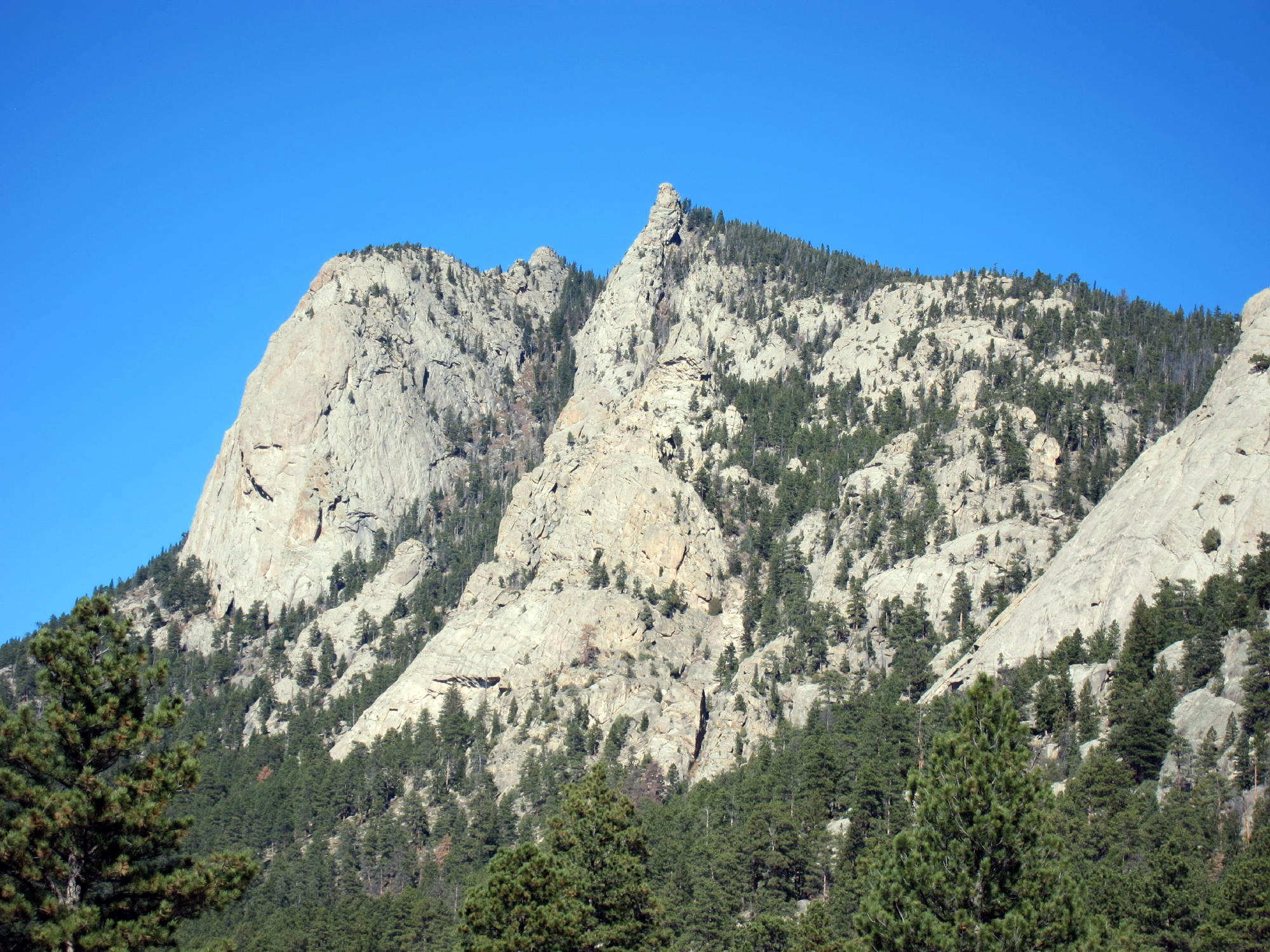
The Needles are the highest points along Lumpy Ridge, an elongated mass of granite summits and cliffs located north of Estes Park, next to the McGregor Ranch. It takes considerable effort to activate the Needles, but it’s a rewarding expedition.
The most practical route up to the Needles starts at the Gem Lake Trailhead, located northeast of McGregor Ranch. Drive into Estes Park on route 34 or 36, follow the bypass (34) west past the Stanley Hotel on the hill, and turn right, north, on the Devils Gulch Road (43). Go north about 2/3 mile, pass the left turn to McGregor Ranch (where parking is no longer allowed), and drive northeast for about ½ mile on Road 43. Turn left on Lumpy Ridge Road and go north a short distance uphill to the marked Gem Lake Trailhead.
From the popular trailhead, start up the trail, and be careful to choose the route northwest to the Black Canyon Trail and McGregor Ranch – don’t go north up toward Gem Lake. The hike traverses the wide valley of McGregor Ranch and passes several climbing areas along the cliffs of Lumpy Ridge. After a couple of miles you’ll see the Needles high above. Below the Needles the route crosses an impressive mudslide path created during the September 2013 floods; this slide gushed down from near the Needles all the way to the valley floor. After the mudslide, the trail gains altitude steadily for about a mile, until it reaches a junction with the Cow Creek Trail. Turn right, go about 100 yards east to an obvious saddle, have some water, and head southeast up the northwest ridge of the Needles. Climb steadily up through the trees along the ridge until it gets craggy; then head slightly north of the ridge and continue climbing, while heading toward the summits. If you try to follow the ridge all the way it’s too craggy. Avoid the obvious NW summit – it’s a false summit. Stay on the left side of the ridge going up, north of the first summit, until you see the middle summit. The third summit, The Needle, may not be visible until you pass the middle summit. As before, stay left – north – of the middle summit until you come to the higher Needle right behind it.
If you have time, climb the middle summit – it’s a fun scramble up from the west end of its summit rock.
The third (actual) summit requires a bit of class 3 scrambling, and the peak is a very airy point. It feels as high as it appears from below! The views are spectacular in all directions. Estes Park and Lumpy Ridge lie below, prominent McGregor Mountain is close by, and Ypsilon and Fairchild are just a few miles away. This hike would be much more popular if there were a trail up to the Needles.
Please note that the final half mile of this climb is not recommended unless you have experience with off-trail hiking and navigation. From the developed trail at the saddle, there is no reliable path, and visibility is limited. The route gets progressively rougher, and there are many large rocks and fallen trees to climb over toward the top. When I climbed the Needles, there were a couple of inches of snow in the woods, and care was required to negotiate the slippery slope northeast of the ridge.
The dramatic summit area near the Needles can be very pleasant; I found a nice sunny spot with protection from wind right below the summit rock; this was a better place for my activation than the exposed summit. There are several small trees and useful rocks, and propagation is excellent in most directions.
Except for the off-trail part of this expedition, this is a scenic low-altitude Rocky Mountain National Park hike, with grand views and a variety of terrain. The total distance is about 10 miles, with a vertical gain of about 2500 feet. Trail use is light to moderate. This climb is not recommended unless weather and other conditions are right. On the right day, the Needle is a classic SOTA peak, offering a rich experience for the operator who enjoys activating high, isolated places.
A few pictures:
-
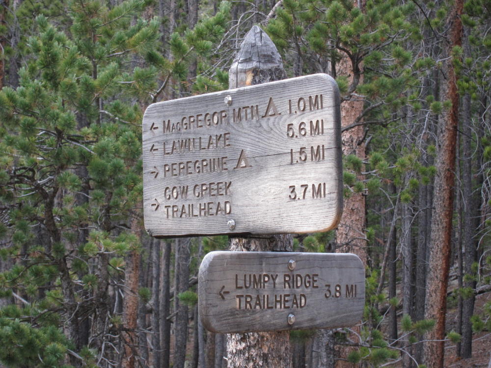
- Trail Sign at the Junction West of the Saddle
-
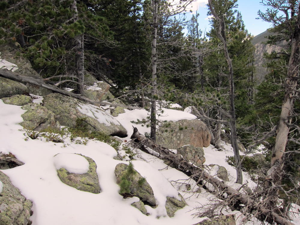
- Route NW of the Summits Showing Challenges
-
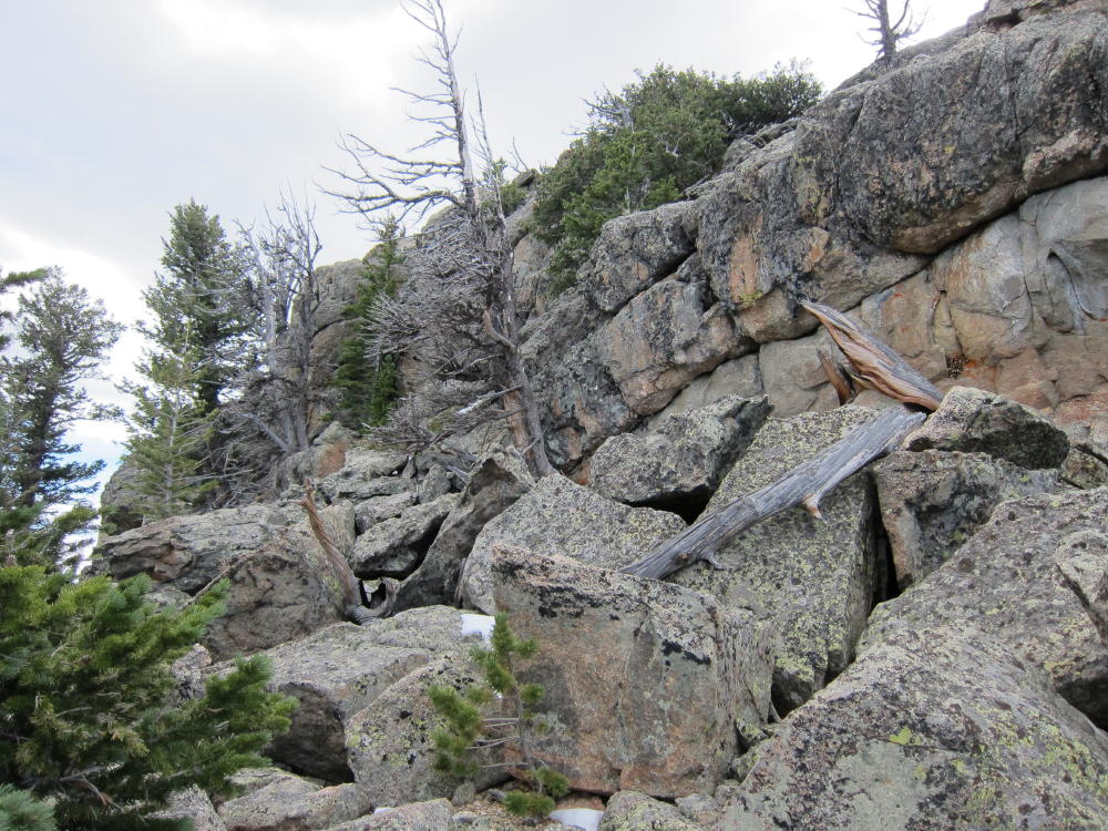
- NW Side of the Summit Rocks
-
- KX0R Activation of the Needles
-
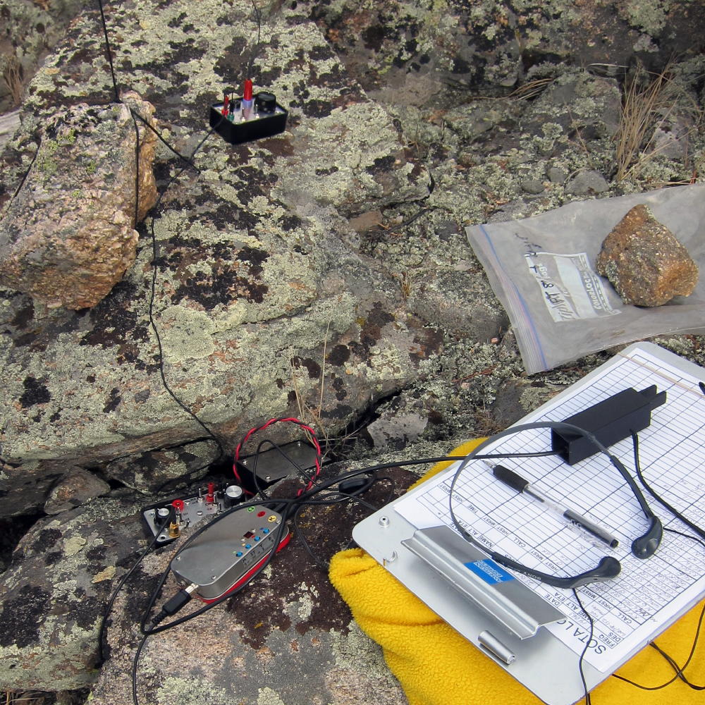
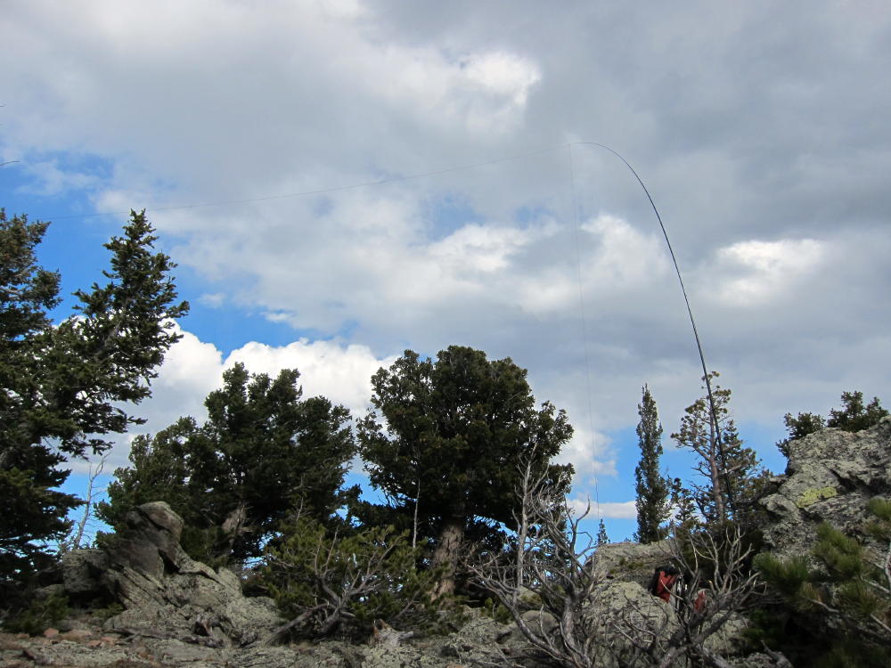
- ATS3B and Tuners
-
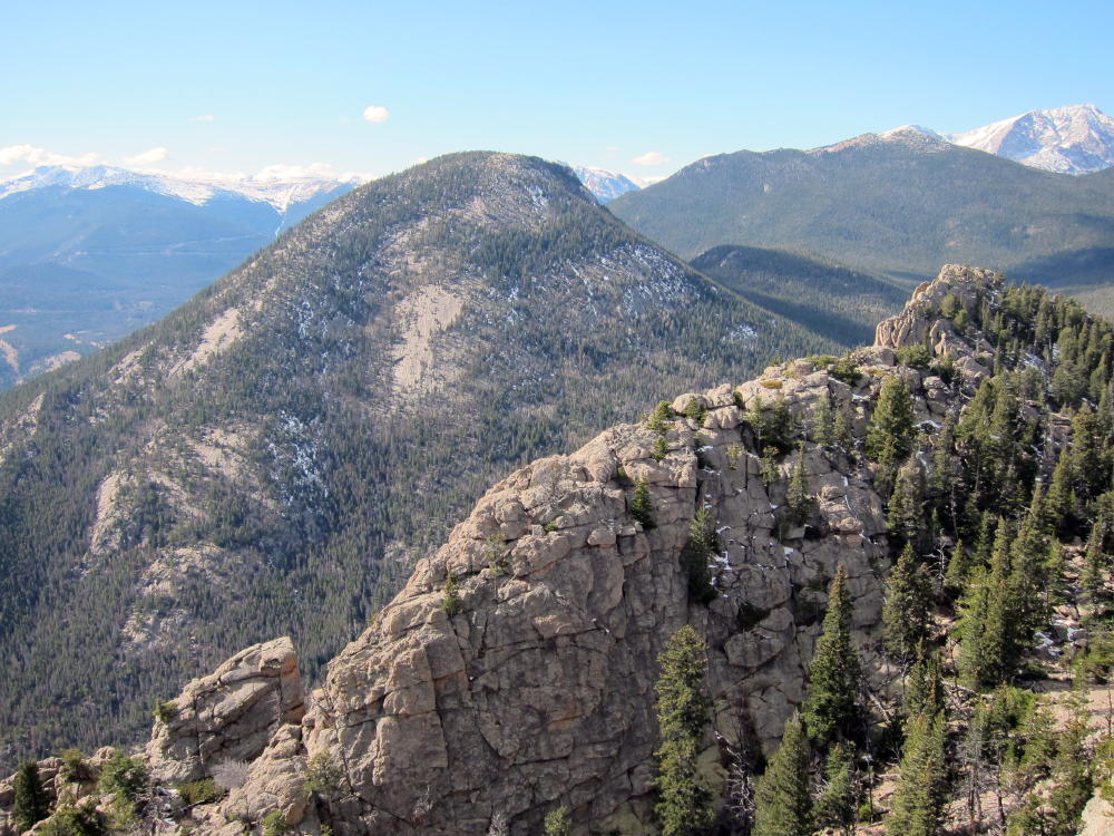
- McGregor Mountain and Middle Needle from Summit
-
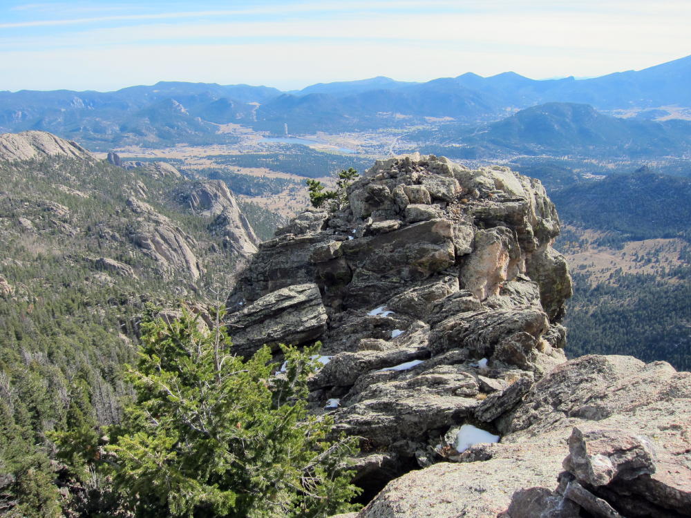
- Exposed Summit of The Needle
-
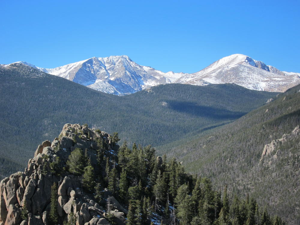
- Ypsilon and Fairchild from the Middle Needle
-
- Middle Needle and Summit from Below
-
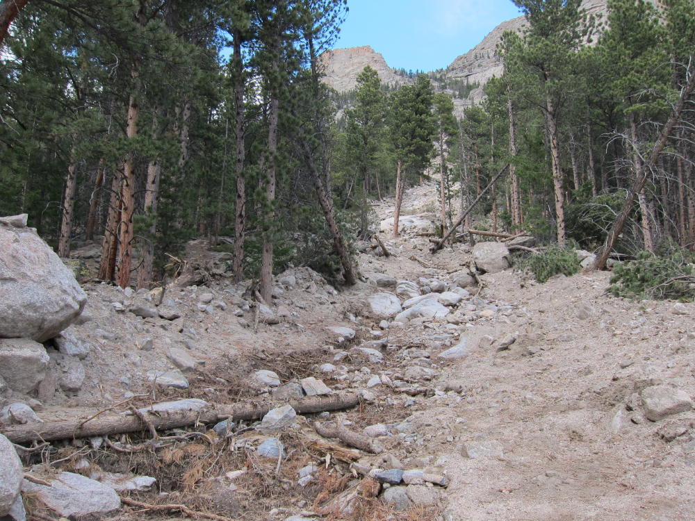
- Mudslide at Trail Crossing below The Needles
George Carey Fuller
KX0R
![]() !! WARNING !! There are old mountaineers, and
bold mountaineers... there are no old-bold mountaineers.
Hiking and mountain climbing are potentially hazardous activities particularly in Colorado with its extreme elevations. I am not accepting responsibility for any death or injury resulting from activations based on my trip reports. Proper training, experience, and personal capability assessment is required - enjoy!
!! WARNING !! There are old mountaineers, and
bold mountaineers... there are no old-bold mountaineers.
Hiking and mountain climbing are potentially hazardous activities particularly in Colorado with its extreme elevations. I am not accepting responsibility for any death or injury resulting from activations based on my trip reports. Proper training, experience, and personal capability assessment is required - enjoy!
Nice write-up / pics George! Will contact you today, if able.
Ken