


W0C/SP-125
9036
2754 m / 9036 ft
Nov 15, 2015 with N0TA
Nov 6, 2016 with N0TA
Feb 20, 2017 with N0TA
By KX0R
Peak 9036 is an obscure summit in the Pike National Forest north of Lake George.
Key Points:
• Pike National Forest
• Trail most of the way to the top
• Relatively easy climb
• Some deadfall near the top
• Summit area was burned up years ago
• Great views
• Excellent HF Site
• ~ 2.8 miles round trip
• ~ 530 vertical feet
-
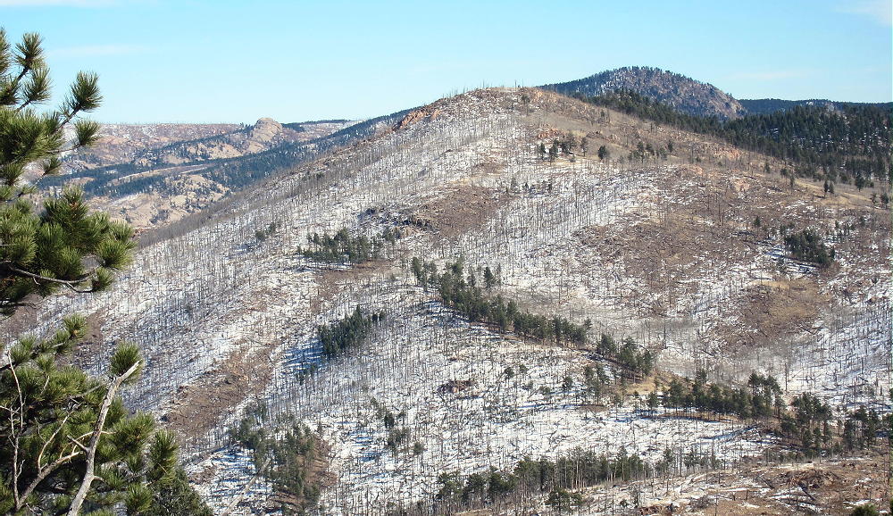
- 9036 – View of West Side, Taken from Tappan Mountain
Driving Directions:
THIS MAP is very useful in the Pike National Forest.
• Drive to Woodland Park on Highway 24, west of Colorado Springs
• Continue west through Divide, Florissant, and Lake George
• Almost 1 mile north of Lake George, turn north, right, on Highway 77, Tarryall Road
• Follow this road up a valley north for about 5 miles
• At 8280 feet, just before Highway 77 reaches a low pass, turn right on dirt FR-210, Platte Springs Road
• Drive up FR-210 about ½ mile, and then take the right fork, FR-601, east
• FR-601 requires moderate clearance, but not 4WD, unless it’s snowy or muddy
• Follow FR-601 east for about 1 mile: around the north side of a hill, across a fenced shallow valley, to a parking area with a gate
• This is the trailhead
-
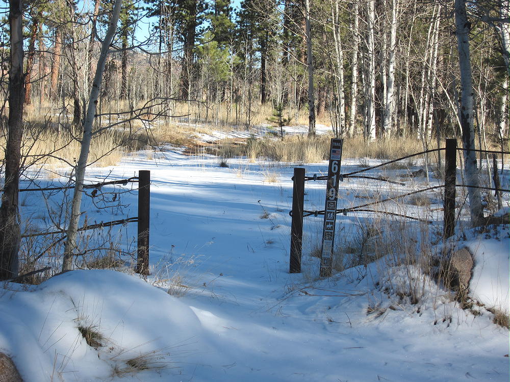
- 9036 – Trail 619 Trailhead
The Hike:
• A relatively new trail, marked 619, heads northeast from the parking area.
• This route is shown clearly on the Google satellite image, but not on the Google map.
• Don’t follow the gated Platte Springs Road east down the hill
• Trail 619 starts out flat, and then it ascends northeast up a wide draw.
-
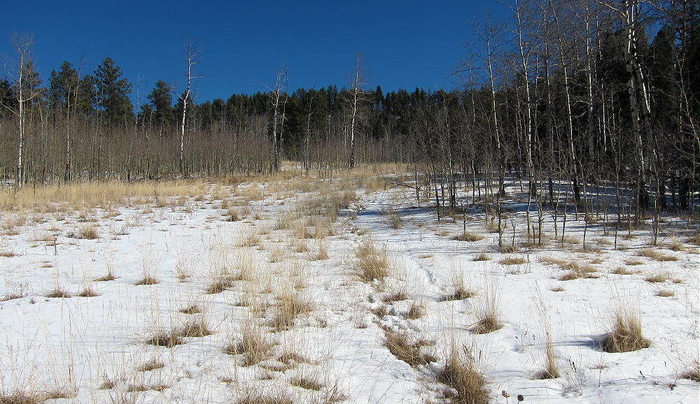
- 9036 – Trail in November 2015
• At the top of the draw, the trail reaches a saddle between the forested false summit on the east, and the actual summit farther west.
• Before the saddle, leave the trail and climb northwest up a draw to the ridge
• Hike west along the ridge less than 0.2 miles to the summit
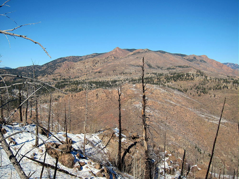
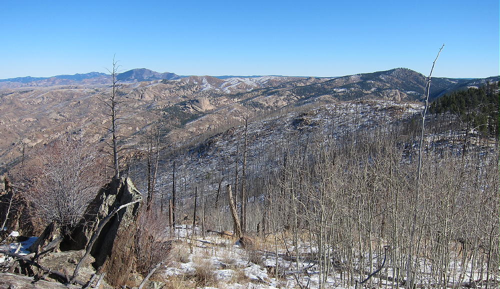
• The forest near the top was burned by fire.
• Follow game and cattle trails around the aspen thickets
-
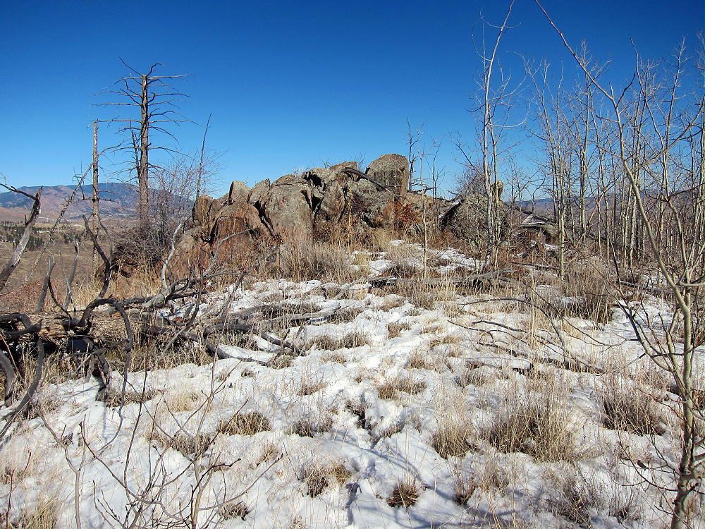
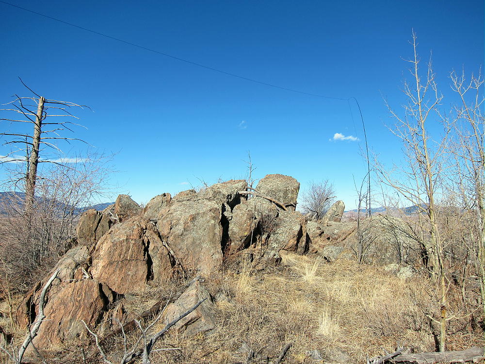
- 9036 – Summit Rocks
Additional Details:
The roads in this area are mostly easy 4WD or 2WD, with adequate clearance. If there’s considerable snow, it would be better to hike or snowshoe in than to risk getting stuck back there. When John Reilly N0TA and I climbed this mountain in mid-November 2015, it was fun, despite some snow on the roads and the trail.
Great views spread out for miles in all directions. Chessman Reservoir is visible in the South Platte Canyon several miles to the northeast; Devils Head and Long Scraggy Peak stand many miles beyond. Badger Mountain stands 8.5 miles to the west.
-
- 9036 – View Northwest to Pilot Peak
-
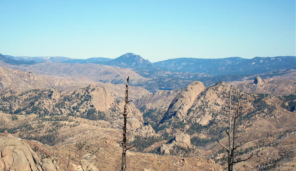
- 9036 – View Northeast of South Platte Canyon
-
- 9036 – View East of Hayman Burn
The summit of 9036 is a rocky knob, and numerous trees and rocks are available to support a pole or an antenna.
-
- 9036 – N0TA Antenna on Summit
Some shelter from wind is provided by various large rocks. We found this to be an excellent RF-quiet HF site in 2015 and 2016, but in 2017 we heard significant man-made noise on 7 MHz. Nevertheless, this is a fine SOTA site, and we both made plenty of HF CW contacts on all three of our activations up there.
The isolated location of 9036 suggests that VHF and UHF contacts may be hard to get.
-
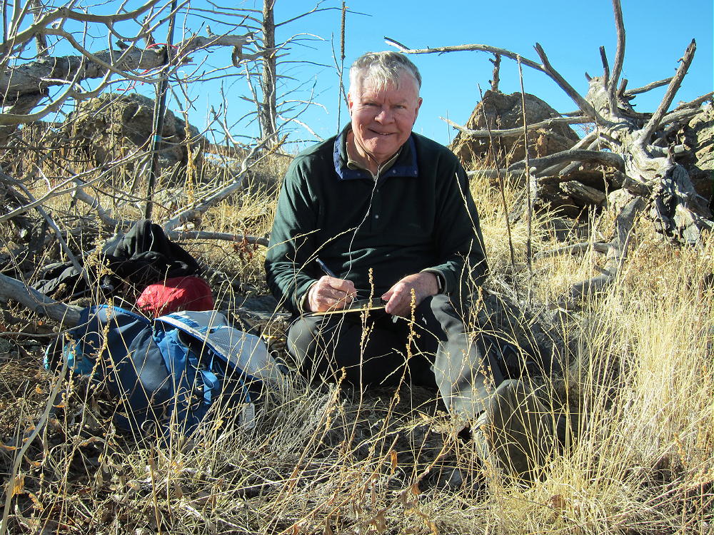
- 9036 – N0TA On The Air
Peak 9036 is close to several other SOTA peaks and might be combined with any of them for a dual or multiple activation:
Peak 9083 W0C/SP-124 2.6 miles south
Tappan Mountain W0C/FR-066 1.75 miles west
Blue Mountain W0C/SP-123 10.3 miles south
Signal Butte W0C/FR-165 7.3 miles east
The forest near Peak 9036 looks like good hunting territory – in the fall, be careful, and wear hunter orange clothing!
73
George
KX0R
-
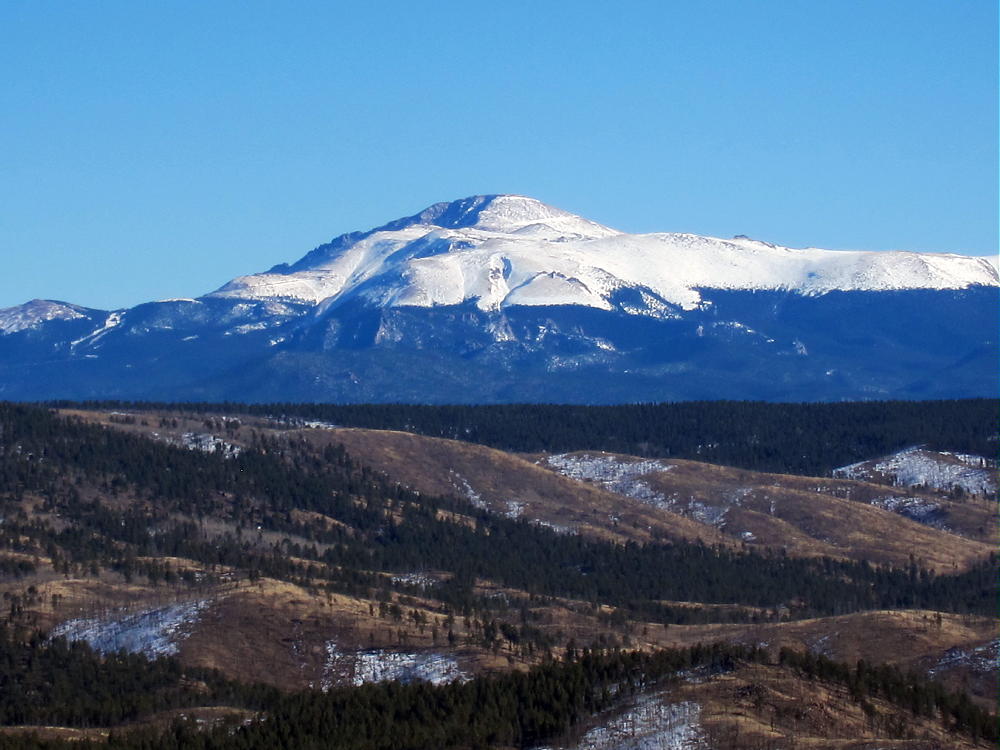
- 9036 – View of Pikes Peak
![]() !! WARNING !! There are old mountaineers, and
bold mountaineers... there are no old-bold mountaineers.
Hiking and mountain climbing are potentially hazardous activities particularly in Colorado with its extreme elevations. I am not accepting responsibility for any death or injury resulting from activations based on my trip reports. Proper training, experience, and personal capability assessment is required - enjoy!
!! WARNING !! There are old mountaineers, and
bold mountaineers... there are no old-bold mountaineers.
Hiking and mountain climbing are potentially hazardous activities particularly in Colorado with its extreme elevations. I am not accepting responsibility for any death or injury resulting from activations based on my trip reports. Proper training, experience, and personal capability assessment is required - enjoy!