


W0C/FR-066
Tappan Mountain
2724 m / 8954 ft
Nov 15, 2015 – with N0TA
Nov 11, 2016 – with N0TA
by KX0R
Tappan Mountain is an easy summit in the Pike National Forest a few miles north of Lake George.
Key Points:
• Pike National Forest
• Jeep road most of the way
• No marked trail, but path to the top
• Navigation and route-finding required
• Nice open summit
• ~ 1.6 miles round-trip
• ~ 450 feet vertical
-
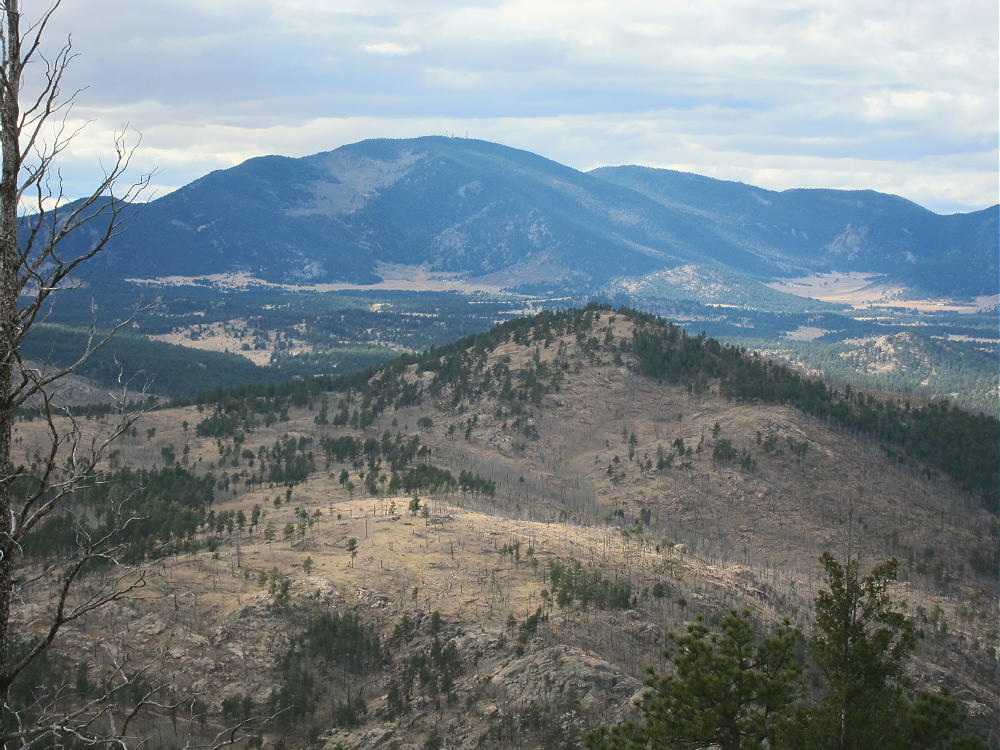
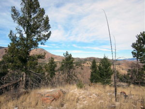
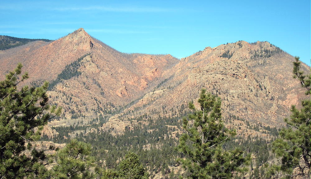
- Tappan and Badger Mountains from 9036
Driving Directions:
THIS MAP is very useful in the Pike National Forest.
• Drive to Woodland Park on Highway 24, west of Colorado Springs
• Continue west through Divide, Florissant, and Lake George
• Almost 1 mile north of Lake George, turn north, right, on Highway 77, Tarryall Road
• Follow this road up a valley north for about 5 miles
• At 8280 feet, just before Highway 77 reaches a low pass, turn right on dirt FR-210, Platte Springs Road
• Google Maps are inadequate for navigation in this area
• Drive up FR-210 about ¼ mile, and turn left on FR-292. This road may not be marked with a number.
• FR-292 climbs up a short, steep hill and then continues through open forest toward Tappan
• FR-292 is a jeep road, but 4WD may not be required, if the road’s dry and your vehicle has adequate clearance
• Where the road splits, go left on FR-292.A
• FR-292.A climbs up the south side of Tappan Mountain and eventually drops down a steep hill to a power line
• Park off the road
• If FR-292 is too rough, snowy, or muddy, park near the bottom and hike up – it’s about 1 mile to Tappan
• FR-293 also could be used to access Tappan’s east side
The Hike:
• Drive or hike up near where FR-292.A reaches maximum elevation on the south side of Tappan
• Head up the open southwest ridge toward the peak
• There’s no marked trail to the summit, but game trails provide easy access.
• It’s also possible to hike up the northeast ridge, or even the south side.
-
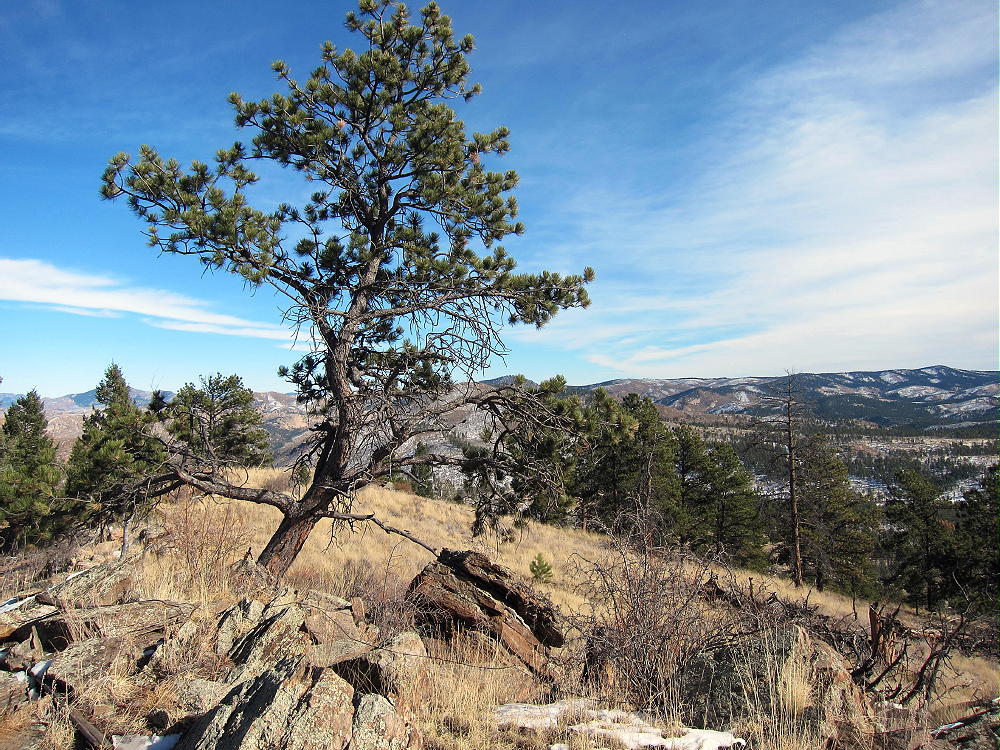
- Tappan Summit
-
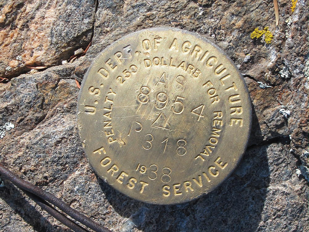
- Tappan Mountain Benchmark
Additional Details:
The roads in this area are mostly easy 4WD or 2WD with adequate clearance. If the snow is deep, it would be better to hike or snowshoe the roads than to take a chance of getting stuck back there. From the bottom of Road 210 to the top of Tappan is only about 1.5 miles each way. The road could be gated in winter at the bottom – but it wasn’t closed on various winter dates when we’ve been up there the past two years.
The summit of Tappan is a rocky point on an extended ridge; the activation zone is large, open, and pleasant.
-
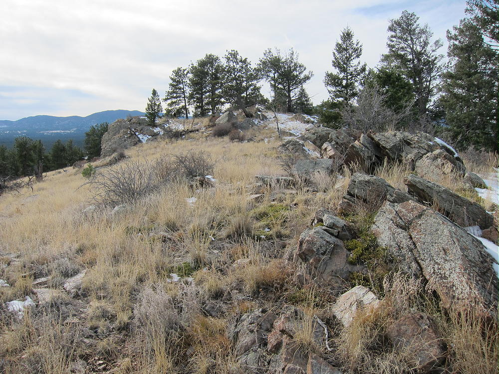
- Tappan Summit and East Ridge
There are many good trees and rocks to support a pole or an antenna, and there are views all around.
-
- Tappan – KX0R Activation Nov 2015
-
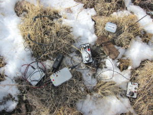
- Tappan – KX0R Snowy Activation Nov 2015
This is an excellent HF site – there’s no development near the summit, and the power lines southwest of the peak seem quiet.
-
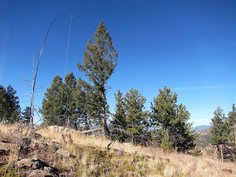
- Tappan – KX0R Activation Nov 2016
VHF and UHF contacts will be hard to get from Tappan, due to the isolated location.
Tappan Mountain stands close to several other SOTA peaks and might be combined with any of them for a dual or multiple activation:
9036 W0C/SP-125 ~ 1.7 miles east
9083 W0C/SP-124 ~ 2.6 miles southeast
Blue Mountain W0C/SP-123 ~ 10 miles south
Signal Butte W0C/FR-165 ~ 9 miles east
9036 is the easiest to combine with Tappan, since they share road access.
The National Forest near Tappan Mountain looks like good hunting territory – if you go there in the fall, be careful, and wear orange hunter clothing.
73
George
KX0R
-
- Tappan – View North to Pilot Peak
![]() !! WARNING !! There are old mountaineers, and
bold mountaineers... there are no old-bold mountaineers.
Hiking and mountain climbing are potentially hazardous activities particularly in Colorado with its extreme elevations. I am not accepting responsibility for any death or injury resulting from activations based on my trip reports. Proper training, experience, and personal capability assessment is required - enjoy!
!! WARNING !! There are old mountaineers, and
bold mountaineers... there are no old-bold mountaineers.
Hiking and mountain climbing are potentially hazardous activities particularly in Colorado with its extreme elevations. I am not accepting responsibility for any death or injury resulting from activations based on my trip reports. Proper training, experience, and personal capability assessment is required - enjoy!