


W0C/SP-111
9889
3014 m / 9889 ft
First Activation
Sep 9, 2016
By KX0R
9889 is a slightly challenging SOTA peak in the southern Puma Hills, several miles east of Eleven Mile Reservoir.
• Pike National Forest
• Access via forest roads
• No marked trail or trailhead
• Secret closed road leads most of the way
• Some off-trail hiking near the top
• Seldom visited
• Fine SOTA peak
• ~ 2.2 miles round trip
• ~ 800 vertical feet
-
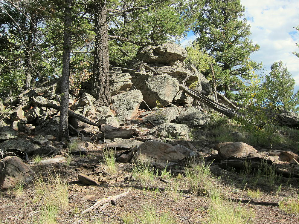
- 9889 Summit
Driving Directions:
• Drive to Lake George via Highway 24
• Continue north 0.8 mile, and turn left, west on CR 90
• Follow CR90 almost 4 miles, and turn left, southwest, on CR 92
• Climb up CR 92 into the Puma Hills for about 2 miles
• At a pass or saddle at 9040 feet, the second high point on this road, turn left, southeast, onto FR 246
• FR 246 is a good, humpy 2WD road requiring more clearance than some cars allow
• Drive FR 246 southeast for about one mile, past several dispersed campsites, to a large campsite located near a saddle in the road, on the north side of the road, with an obvious conical hill about 200 feet high on the north side. This is the only campsite in the immediate area with a big hill right behind it.
• The Google Map coordinates are 38.945715, -105.459343
• Park at or near this campsite. This is the “trailhead”. I camped there, and it was great!
The Hike:
• From the campsite above, walk west along FR-246 for about 100 feet.
• On the south side of FR-246, find a closed road with a pile of big rocks blocking access. You can see this junction on the Google satellite image.
• The old road is closed to motor vehicles but not to hikers. This route is not shown on most maps, including Pike NF and Google maps.
• This route is shown clearly on the Google satellite image, which is where I found it. At high magnification the entire trail is visible running through the forest.
• Hike southeast up the closed road as far as it goes. It’s not maintained, and there’s significant deadfall and erosion.
-
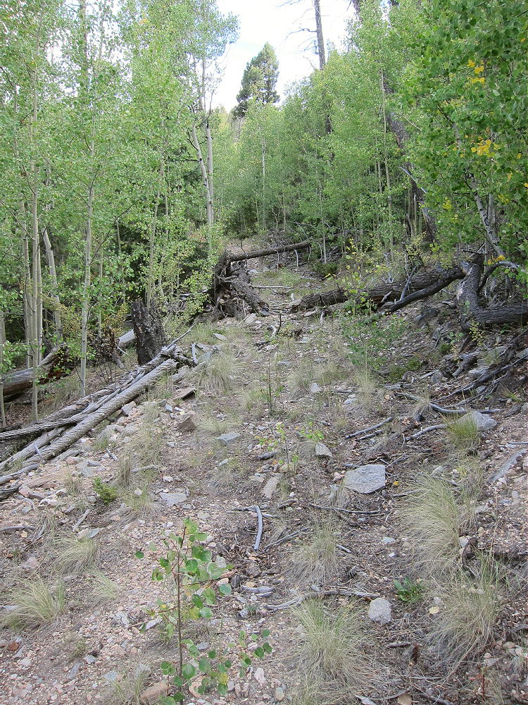
- 9889 Closed Forest Road
• This convenient secret trail climbs steeply and efficiently toward Peak 9889. It ends at about 9500 feet, about 1/3 mile from the summit.
• Continue south on a game trail leading up the slope from the end of the road – stay on the north side of the draw.
• After about ¼ mile, come to a saddle at about 9700 feet.
• The saddle is between Peak 9889 to the southeast, and its twin sister to the northwest, at almost the same elevation,.
• Make certain to ascend the peak southeast of the saddle!
• Hike up less than 0.2 mile, through easy open woods, to the rocky summit.
-
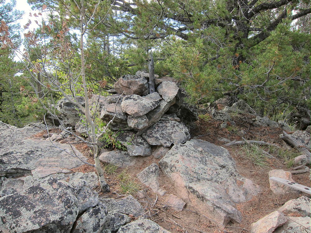
- 9889 Summit Cairn
Details:
The Pike National Forest Map is useful for planning a hike to 9889; it shows roads CR 90, CR 92, and FR-246.
The top of prominent Peak 9889 is a small rock formation with trees on it. The remains of a triangulation station lie near the peak – boards, wires, etc. There’s a cairn, maybe with a register-jar inside it, on the top. There’s little evidence of visitors. Most of the summit is forested, and views are limited.
-
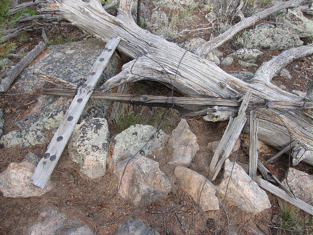
- 9889 Survey Station Remains
The large activation zone extends along the ridge-top, with sheltered spots, trees for a pole, etc. I set up immediately north of the peak; I ran my wire from a pole up to a tree at the summit rocks.
-
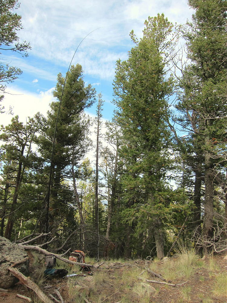
- 9889 SOTA Activation
The land falls away on the east side of the summit – it’s possible to see down into Eleven Mile Canyon.
There’s no development on the mountain, and the RF noise level is very low. This is a fine HF site! There are no close summits to block skip signals. This site has some VHF/UHF coverage of South Park, including around Hartsel, near Elevenmile Reservoir, near Lake George, Divide, and the country northwest of Pikes Peak.
It might be possible to activate Peak 9889 in the same day as another local summit. Possibilities include:
W0C/SP-079 Stoll Mountain
W0C/SP-092 The Pulverizer
W0C/SP-123 Blue Mountain
W0C/SP-072 Badger Mountain
W0C/SP-121 Sulphur Mountain
W0C/SP-118 Spinney Mountain
W0C/FR-165 Signal Butte
W0C/SP-091 10462
W0C/FR-038 South Tarryall Peak
W0C/SP-071 Schoolmarm Mountain
W0C/SP-113 Eagle Rock
W0C/SP-102 Observatory Rock
W0C/SP-065 Puma Peak
W0C/SP-074 Burntop
W0C/FR-066 Tappan Mountain
W0C/SP-124 9083
W0C/SP-125 9036
Etc.
This area is popular with hunters – there were bow hunters in the area when I was there. Wear bright color – be cautious.
73
George
KX0R
![]() !! WARNING !! There are old mountaineers, and
bold mountaineers... there are no old-bold mountaineers.
Hiking and mountain climbing are potentially hazardous activities particularly in Colorado with its extreme elevations. I am not accepting responsibility for any death or injury resulting from activations based on my trip reports. Proper training, experience, and personal capability assessment is required - enjoy!
!! WARNING !! There are old mountaineers, and
bold mountaineers... there are no old-bold mountaineers.
Hiking and mountain climbing are potentially hazardous activities particularly in Colorado with its extreme elevations. I am not accepting responsibility for any death or injury resulting from activations based on my trip reports. Proper training, experience, and personal capability assessment is required - enjoy!