


W0C/PR-110
Green Mountain
3143 m / 10313 ft
First Activation
Sep 13, 2014
By KX0R
There are many summits named “Green Mountain” in Colorado. Green Mountain W0C/PR-110 is a wild, rarely-climbed mountain on the west side of Rocky Mountain National Park. The ascent is not difficult, but good planning and route-finding are necessary. Although there is no marked route to the summit, a major trail leads more than half way, followed by a good game trail up the northeast ridge.
Green Mountain Route
Here’s how to access this peak:
1) Drive to the west side of the National Park via US 34.
2) Find the Green Mountain Trailhead, located about 2 miles north of the Grand Lake Entrance Station, and park there. The elevation at the trail-head is about 8800 feet.
3) Hike up the easy Green Mountain Trail about 1.7 miles to a small saddle at 9480 feet, just before the trail descends a short distance into Big Meadows, the huge valley of Tonahutu Creek. From this saddle you can look south and see the NE ridge of Green Mountain.
4) Head off the trail for the NE ridge of Green Mountain. First go over or around a small bump, east of a marshy pond. Stay east and out of the swamp. Start up the NE ridge of Green Mountain and continue up the obvious ridge.
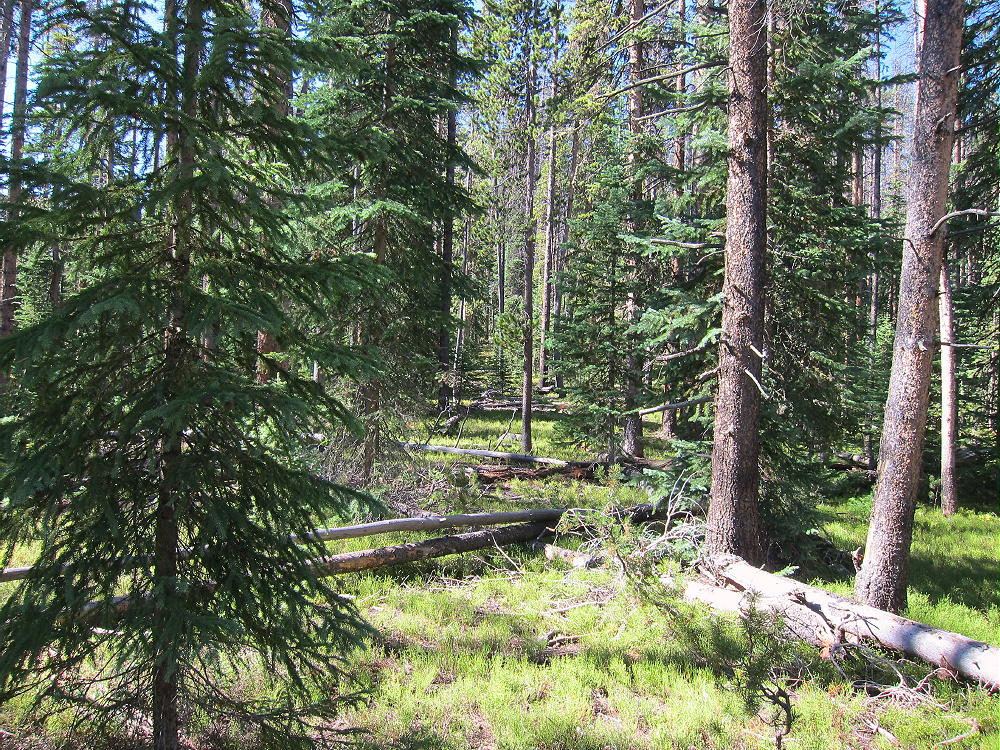
5) There is a good game trail most of the way up. The grade is moderate, and the forest is relatively open, with few fallen trees. It’s about a mile and about 900 vertical feet up the ridge. This is as nice an off-trail hike as you will find on a forested ridge in this part of the Park!
6) There is a false summit at about 10,120 feet – continue past it to the WSW, climb over another false summit at about 10,280 feet, and continue south along the ridge about 0.2 miles to the actual summit at 10,313 feet. A pile of rocks marks the spot.
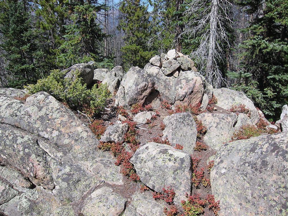
Green Mountain Summit
The peak is forested with large live and dead trees. There are limited views in several directions from this very prominent peak.
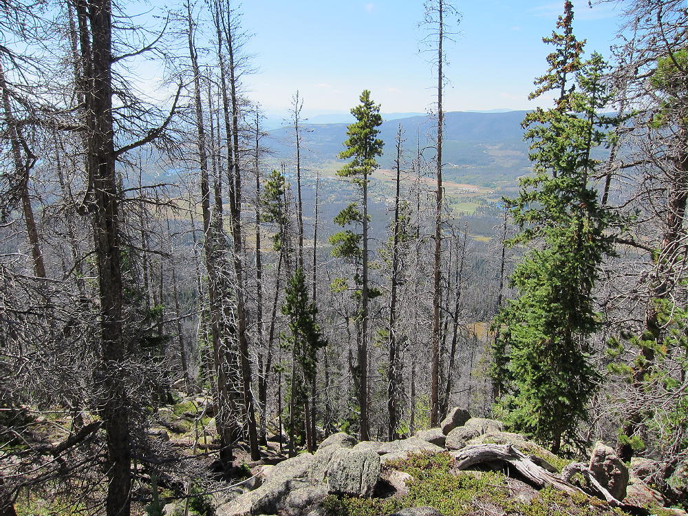
Green Mountain View Southwest
The summit area is craggy, but several good spots are available for a nice SOTA activation. The summit falls away steeply on the east and west, and it’s an excellent HF radio site. VHF/UHF coverage is probably limited by higher mountains nearby. No pole is needed, if you can get a line over a tree branch with a small fishing pole or other tool.
-
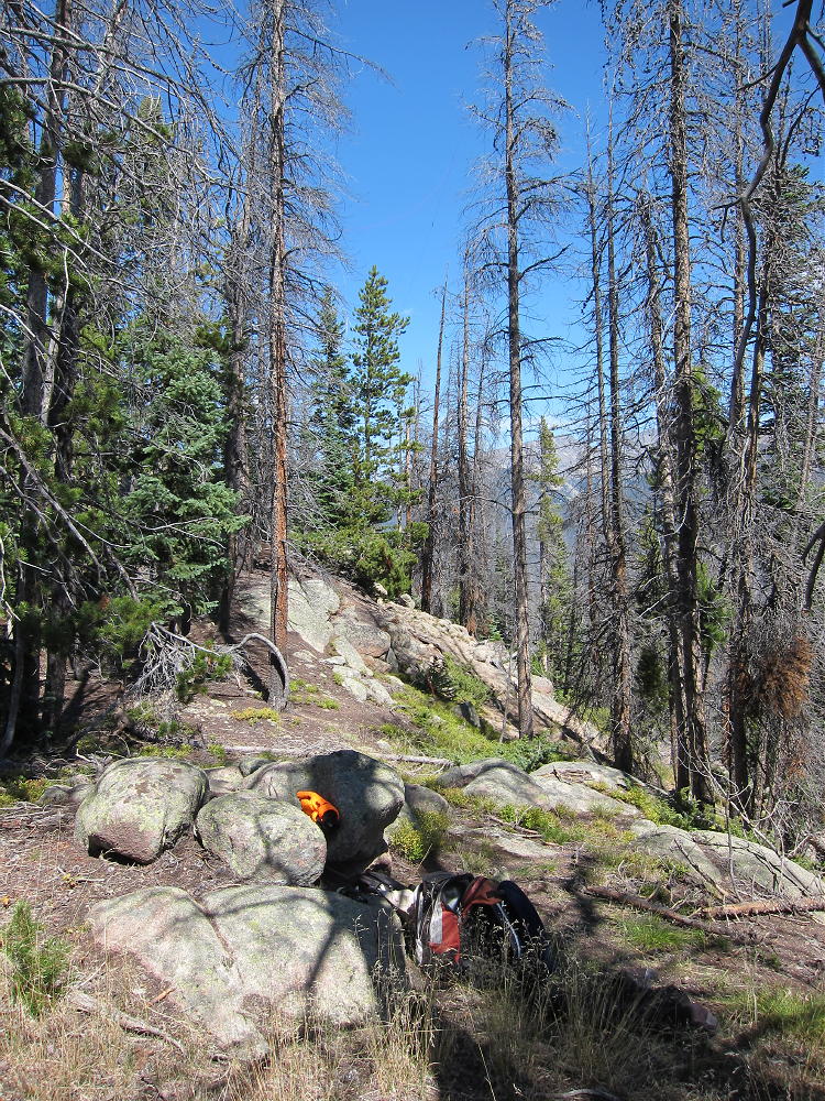
- Green Mountain Activation Site
-
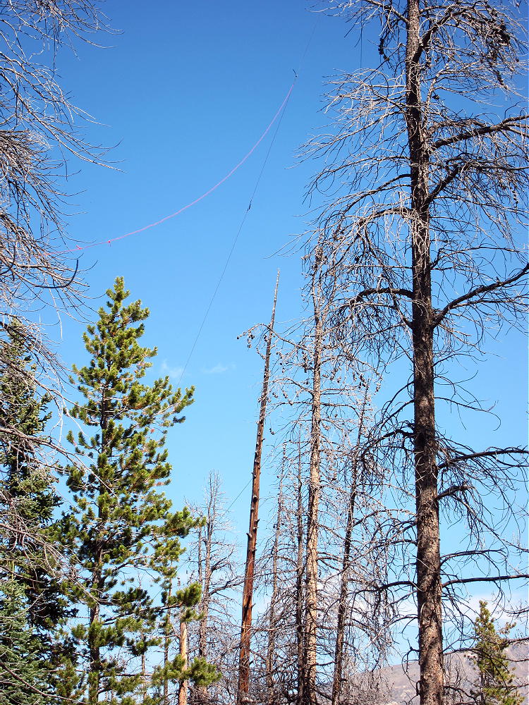
- Green Mountain Antenna
-
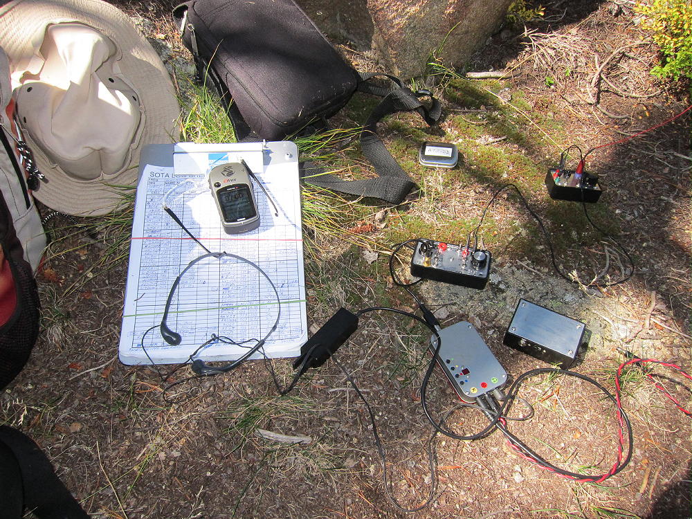
- Green Mountain Radio Gear
Be sure to descend via the same route up the NE ridge that you came up. Descending via the shorter route down the north or NW slope of the mountain may lead into a lot of fallen trees and rough country below – perhaps an unpleasant ordeal. The NE ridge route is a proven no-hassle way in and out.
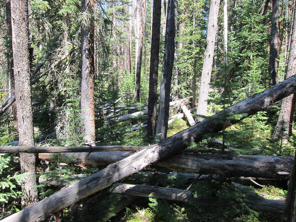
Stay on the Ridge or Pick Your Way Through This – or WORSE!
The round-trip distance for this expedition is about 5.8 miles, with a vertical gain of about 1600 feet.
Be aware that the entire area has a healthy population of elk, moose, and other wild animals. This is definitely a wilderness SOTA trip.
73
George Carey Fuller
KX0R
![]() !! WARNING !! There are old mountaineers, and
bold mountaineers... there are no old-bold mountaineers.
Hiking and mountain climbing are potentially hazardous activities particularly in Colorado with its extreme elevations. I am not accepting responsibility for any death or injury resulting from activations based on my trip reports. Proper training, experience, and personal capability assessment is required - enjoy!
!! WARNING !! There are old mountaineers, and
bold mountaineers... there are no old-bold mountaineers.
Hiking and mountain climbing are potentially hazardous activities particularly in Colorado with its extreme elevations. I am not accepting responsibility for any death or injury resulting from activations based on my trip reports. Proper training, experience, and personal capability assessment is required - enjoy!