


W0C/FR-116
Isolation Peak
3998 m – 13118 ft
First Activation
Aug 29, 2015
Isolation Peak stands high on the Continental Divide, among huge glacial cirques at the western head of Wild Basin, in the alpine wilderness of Rocky Mountain National Park.
• Long, challenging hike
• High altitude
• No marked route or trail to the summit
• Considerable navigation and route-finding
• Incredible alpine scenery
• Fine HF summit
• ~ 17 miles round trip
• ~ 4620 vertical feet
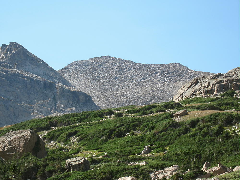
Isolation Peak from Pipit Lake
Of all the SOTA peaks I have climbed, Isolation Peak is the most accurately named. This was one of my best activations! The hike was huge, everything went incredibly well, and I made 30 contacts from the summit. My son Tom hiked with me all the way, we had a good day, and it was a long one!
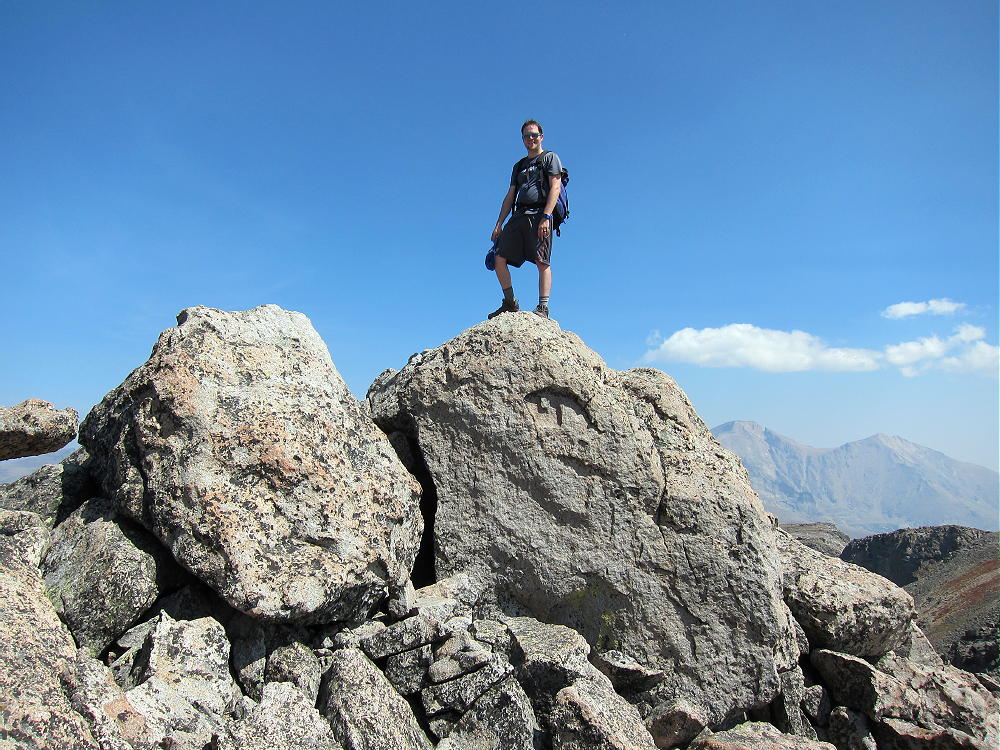
Tom Fuller on Isolation Peak Summit
I climbed Isolation Peak back in 1971, when I was much younger. It was the longest and most difficult climb I had done at that time. I had the USGS topo map “Isolation Peak”, and on a dry day in September, I found my way to the top – it was incredible! I was a little late getting to the summit back then, and I still remember marching out the last couple of miles in the twilight as fast as I could walk, with very sore feet.
When Tom and I got to the trailhead early in the morning, we were ready for the expedition. The hike is almost 17 miles round trip, from the Wild Basin Ranger Station at about 8500 feet, to the summit at 13118 feet, for a vertical gain of 4618 feet. The first part of the trip is on a good, popular trail up North Saint Vrain Creek and Ouzel Creek to Bluebird Lake at about 11,000 feet. We started hiking at 6:26 AM, and we were at Bluebird Lake by 9:30; that was the easy part. Isolation Peak came into view, over 2000 feet above us, and almost 2 miles away. We crossed at the lake outlet, and then we picked our way around the rocky north shore of the lake and up the slopes toward Pipit Lake. There’s no marked route, but there are a few cairns. Not many people go up beyond Bluebird.
We followed the north side of the beautiful creek up the drainage above Bluebird, through the alpine wilderness. We were alone. We ascended 600 vertical feet up the open slopes north of scenic Pipit Lake; at 10:42, we were standing at Isolation Lake, in its rocky cirque at 12,000 feet. The Peak stood silently in the sun, over 1100 feet above us.
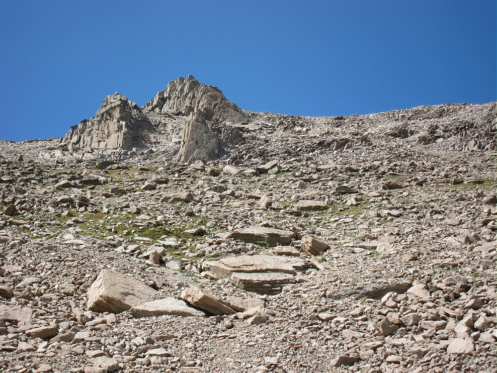
Isolation Peak South Side
After a short break to pump water, we climbed a steep slope above the west side of Isolation Lake; we continued up the rocks and tundra to the south shoulder of Isolation at 12,800 feet. It’s mostly all rocks after that – up the south ridge and then to the summit. Tom led around to the west side as we approached the top – that worked OK. At 11:43 we were next to the summit block at the top – it took 5 hours and 17 minutes for the entire ascent. We were both pleased with our climb!
KX0R near Isolation Peak Summit
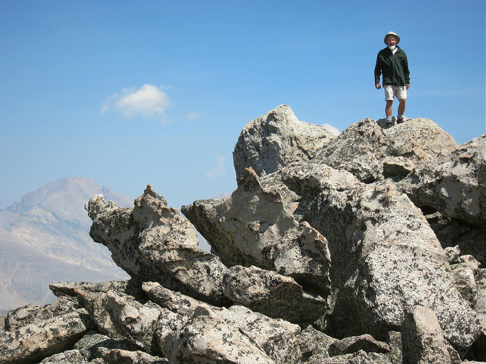
KX0R on Isolation Peak Summit
The weather was perfect, and we stayed on the summit for two hours. Tom climbed the summit block, we took pictures, ate food, drank water, and marveled at what we could see from the high peak. I got busy and set up my 20-foot Black Widow pole, connected up the rig, and got on the air. It was already a race against the clock!
I was on by 1821Z – 12:21 MDT – calling CQ on 15M CW. I made just one contact, so I went to 30M and ran through 13 stations in 12 minutes. Then I went to 20M CW and ran through 16 stations in 14 minutes. I would have enjoyed operating on more bands, but our time was limited. I logged 30 Q’s, including an S2S with W6AH on W6/CT-009, in just over 40 minutes – that would have to do. There certainly was no problem getting contacts up there!
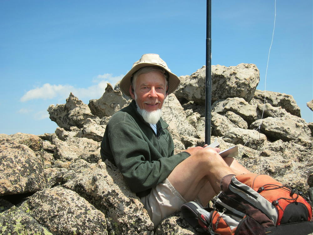
KX0R First Activation of Isolation Peak
The summit of Isolation Peak is a pile of large boulders on a long, narrow, east-west ridge. The activation zone has plenty of room to put up an HF antenna; I set up in a flat area among large rocks, just west of the summit block. This was a comfortable spot in the sun! The RF noise was very low – there’s no development for miles – and there were no storms in the area. There was only a breeze, and activating Isolation was almost an ideal alpine SOTA experience. Experience and light-weight gear were essential to activating such a remote peak and making it back to the trailhead at a reasonable time.

Isolation Peak View NW
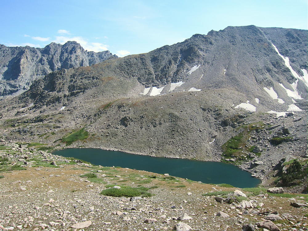
Pipit Lake below Isolation Peak
We headed down from Isolation at about 1:43, picking our way down the rocky south ridge; we wasted little time on the long trip down the valleys. We reached the parking lot at 7:20 PM MDT; our descent took 5 hours and 37 minutes. We were on the summit for two hours – a long time for such a peak; but we were on the trail for about 10.9 hours. The average speed for the 17 miles on the trail was about 1.56 mph, including all breaks and stops. While we were generally hiking about 2.0 to 2.5 miles per hour on the trail, sometimes even faster, we really slowed down off-trail. We averaged less than 1 mph in the steep rocks and thin air above 12,000 feet.
We made no errors – what a fine day!
I don’t recommend Isolation Peak, or similar wilderness peaks with long hikes and lots of vertical distance, for most SOTA activators. Almost everything has to go right, or such a trip can turn into a disaster. There’s very little margin for error!
Reasonably careful preparation helps control risks related to navigation and weather. Having established routines and familiar gear are essential. Taking too much equipment is as bad as not having enough, especially when the air is thin. Lots of experience is critical, but sometimes it creates a false sense of security.
On the right day, at the right time, the alpine wilderness can be lots of fun. Add a good SOTA activation on a high summit, and a rich, intense experience is possible.
Isolation Peak certainly is a SOTA Classic – but this summit is right for a small minority of athletic operators, and only on a limited number of days with safe weather. Most of the high, remote peaks of Rocky Mountain Park and the Indian Peaks are in the same class. There are listed SOTA peaks in this region that are much more difficult than Isolation, and some of them may never be activated!
73
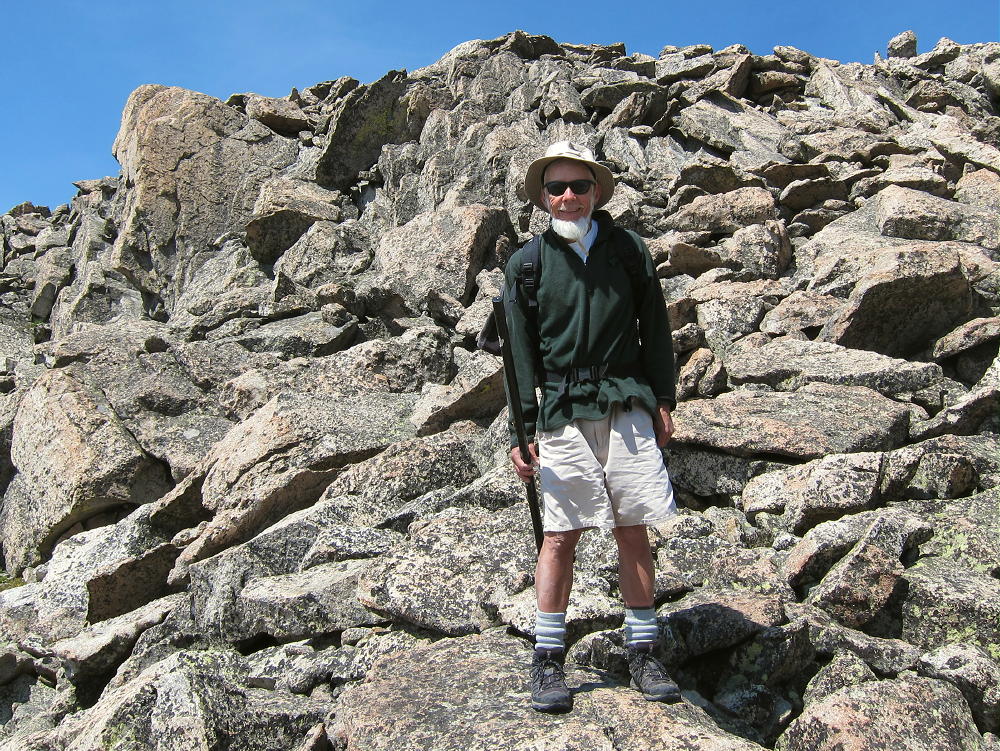
George Carey Fuller
KX0R
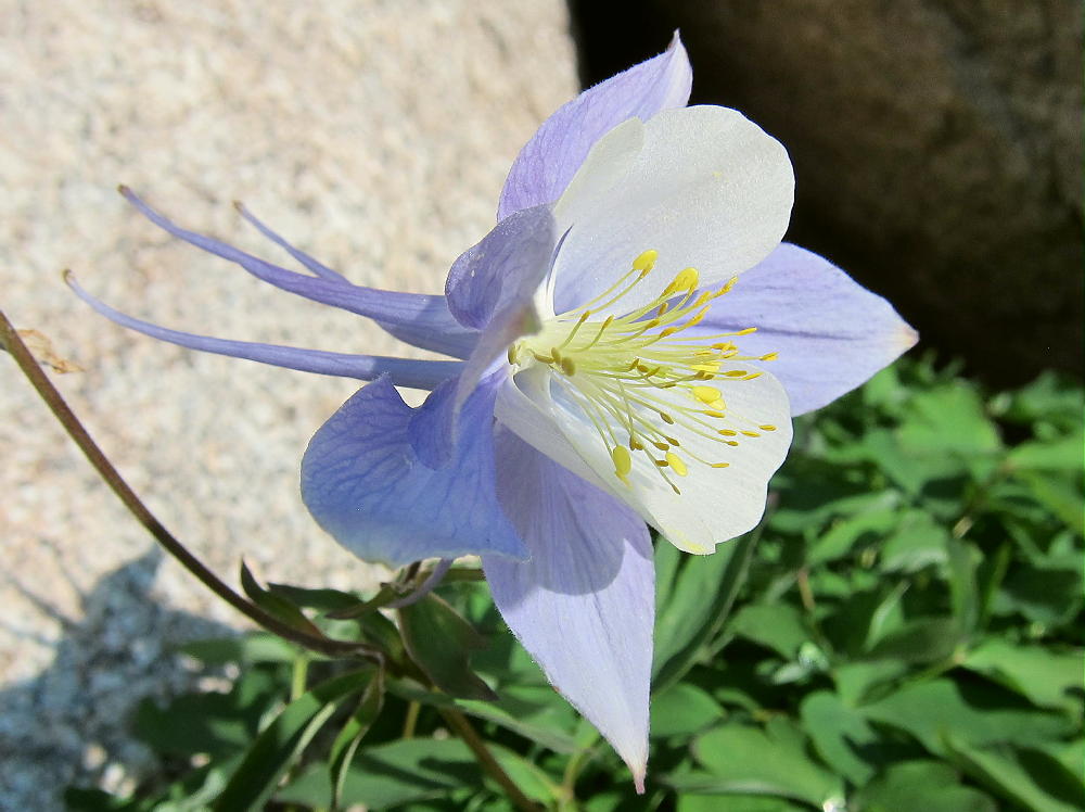
Columbine near Isolation Lake
![]() !! WARNING !! There are old mountaineers, and
bold mountaineers... there are no old-bold mountaineers.
Hiking and mountain climbing are potentially hazardous activities particularly in Colorado with its extreme elevations. I am not accepting responsibility for any death or injury resulting from activations based on my trip reports. Proper training, experience, and personal capability assessment is required - enjoy!
!! WARNING !! There are old mountaineers, and
bold mountaineers... there are no old-bold mountaineers.
Hiking and mountain climbing are potentially hazardous activities particularly in Colorado with its extreme elevations. I am not accepting responsibility for any death or injury resulting from activations based on my trip reports. Proper training, experience, and personal capability assessment is required - enjoy!