


W0C/FR-111
Chiefs Head
4139 m / 13579 ft
First HF Activation
Aug 23, 2015
By KX0R
Chiefs Head Peak is a classic alpine peak west of Longs Peak.
Key Points:
• Rocky Mountain National Park
• No marked trail much of the way
• Navigation and route-finding required
• 16 miles round trip
• 5200 vertical feet
• High altitude
• Spectacular summit and views
• Superb HF site
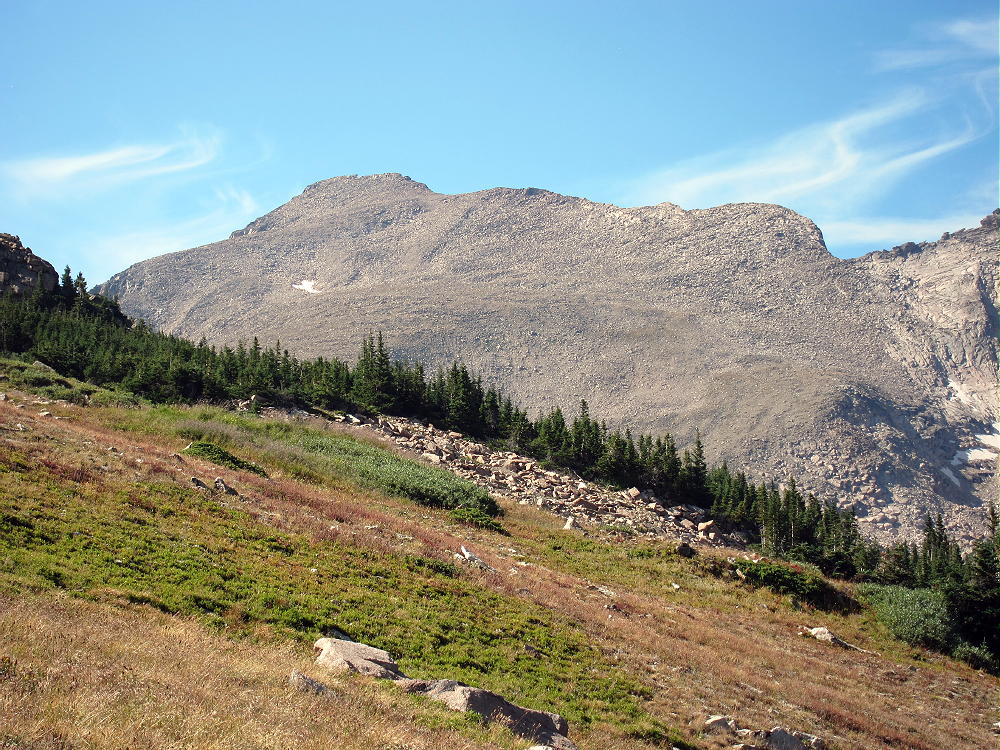
Chiefs Head from Mt. Orton North Ridge
Chiefs Head offers a challenging, high activation with proportional rewards. Climbing this big mountain requires a long, sustained, non-technical hike through scenic terrain; only activators with off-trail experience and good fitness should attempt Chiefs Head. Much of the route is on a long ridge, high above tree-line, and this trip should be reserved for a day with good weather. The summit is most accessible in summer and fall.
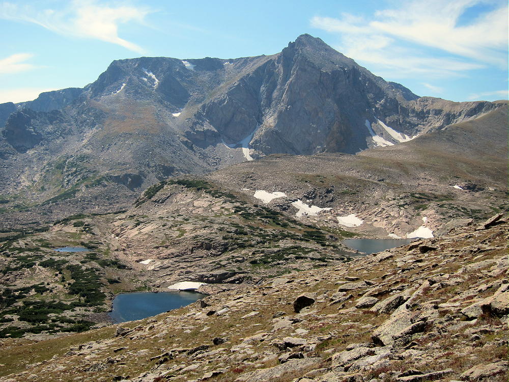
There are two standard hiking routes for climbing Chiefs Head. I had climbed this mountain twice prior to 2015, first via the eastern route, and later via the western route. I chose the shorter eastern route via Sandbeach Lake for my 2015 ascent. The trail starts at the Sandbeach Lake Trailhead, just west of the Peak-to-Peak Highway, Route 7. This route climbs to Sandbeach Lake, ascends west through the forest up Mount Orton, and continues across the alpine “North Ridge” between Orton and Chiefs Head. The unmarked route then climbs up the southeast slope of Chiefs Head to the east ridge, and then up the ridge to the top.
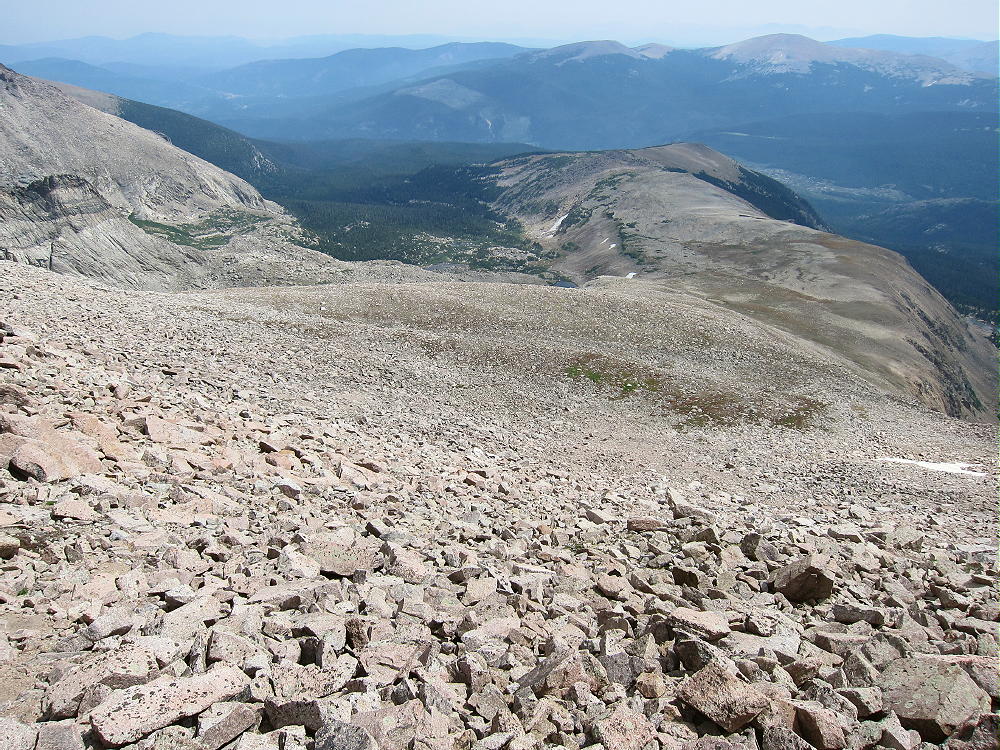
Chiefs Head Ascent Route Looking Back South along “North Ridge” to Mount Orton
This journey is Grade II, Class 2. More than half the route is not on marked trails; there’s some bushwhacking on game trails leading up Mount Orton. It took me almost 12 hours to climb Chiefs Head, do a 3-band HF CW activation, and return to the trailhead via the Sandbeach Lake route.
The western standard route is completely different – it starts at the Wild Basin Ranger Station trailhead. The hike initially follows the main trail west toward Thunder Lake; then it turns north up the Lion Lakes Trail to the Lion Lakes. The climb continues off-trail up the long ramp-like ridge northwest west of Lion Lakes, all the way to the Continental Divide at about 12,500 feet. The route then goes north and then east along the Divide, and finally up the west ridge of Chiefs Head to the top. The Lion Lakes route is longer than the Sandbeach Lake route, but the vertical gain is slightly less, about 5000 feet. The one-way distance is about 9.5 miles, 3 additional miles total for the round-trip; but no bushwhacking is needed, and the rocky parts are not as steep.
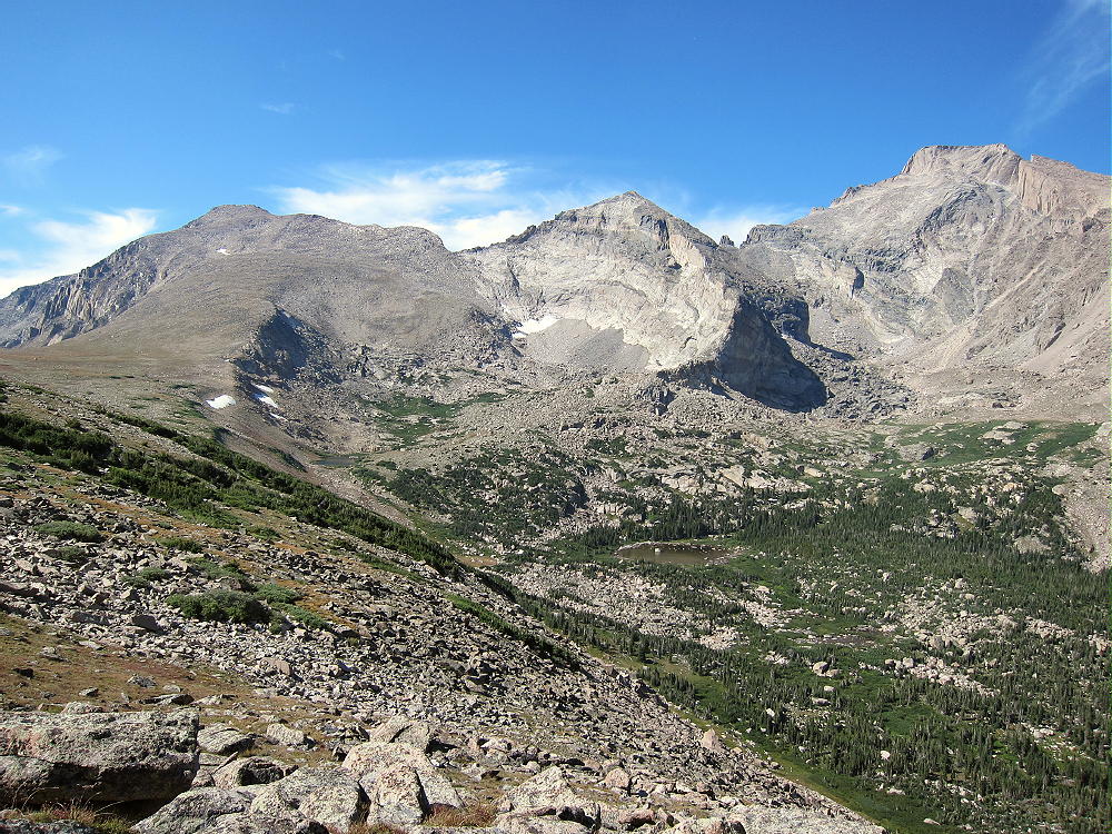
Both routes are incredibly spectacular, with close views of Longs Peak, Mount Meeker, Pagoda Mountain, Copeland Mountain, and Mount Alice. Chiefs Head has stunning views in all directions; the north face drops over 1500 feet. This is some of the most rugged, beautiful terrain in the National Park.
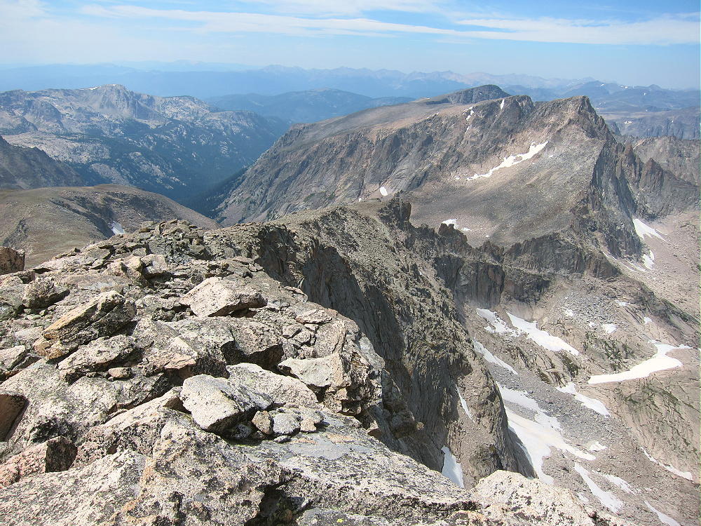
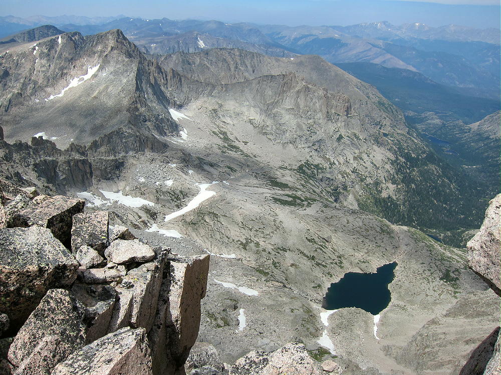
Chiefs Head North Ridge to McHenrys Peak
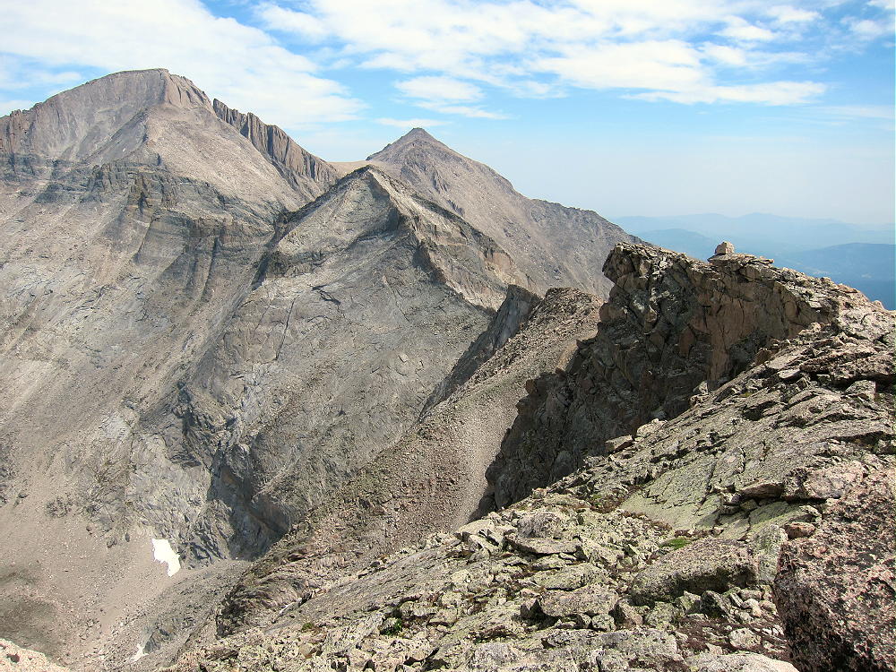
Chiefs Head East Ridge, Pagoda, Longs, and Meeker
Details of the Sandbeach Lake route I used in 2015:
The excellent Sandbeach Lake Trail starts at about 8400 feet elevation; it climbs about 4 miles west through the forest to Sandbeach Lake, a popular destination at about 10,300 feet.
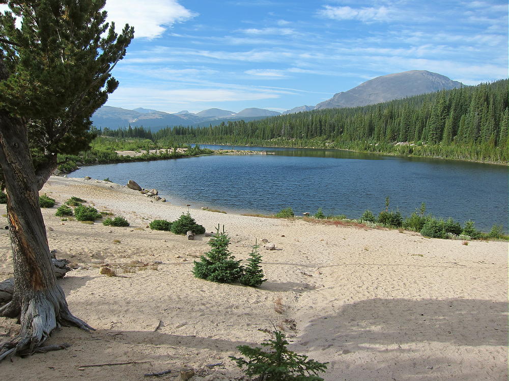
Sandbeach Lake
At the north end of the Lake, it’s necessary to bushwhack up through the trees for almost ½ mile to the open east slopes of Mount Orton above. Avoid going north of the Lake – that area is a tedious, rocky moraine. The forested gully northwest of the Lake leads steeply up where you need to go. An old trail is hidden under fallen trees, but there are game trails. Be sure to carry enough water, or pump it from the small creek; this is the last good water, except for snow up high. At 10,800 feet the route opens up into high flower meadows, and it’s a simple climb up toward Mount Orton at 11,700 feet. Occasional cairns help navigate this section. Work through the numerous rocks and traverse around the top of Orton – I went around the east side. There are only a few cairns, but it all works out.
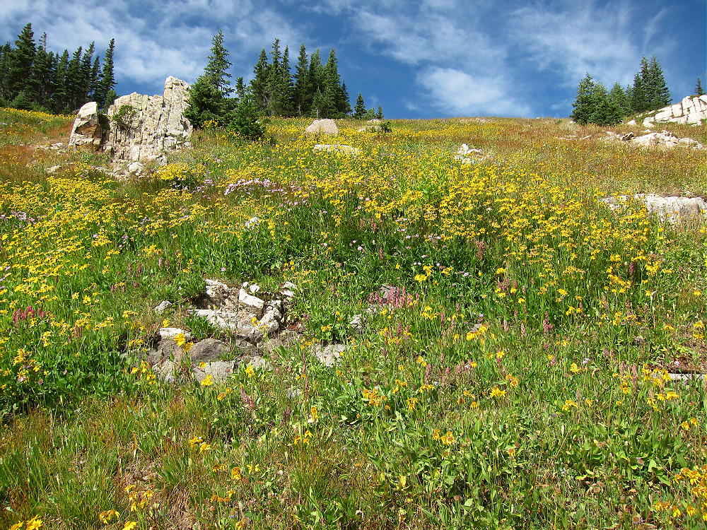
Flower-Meadow above Sandbeach Lake
South Side Route up Mount Orton
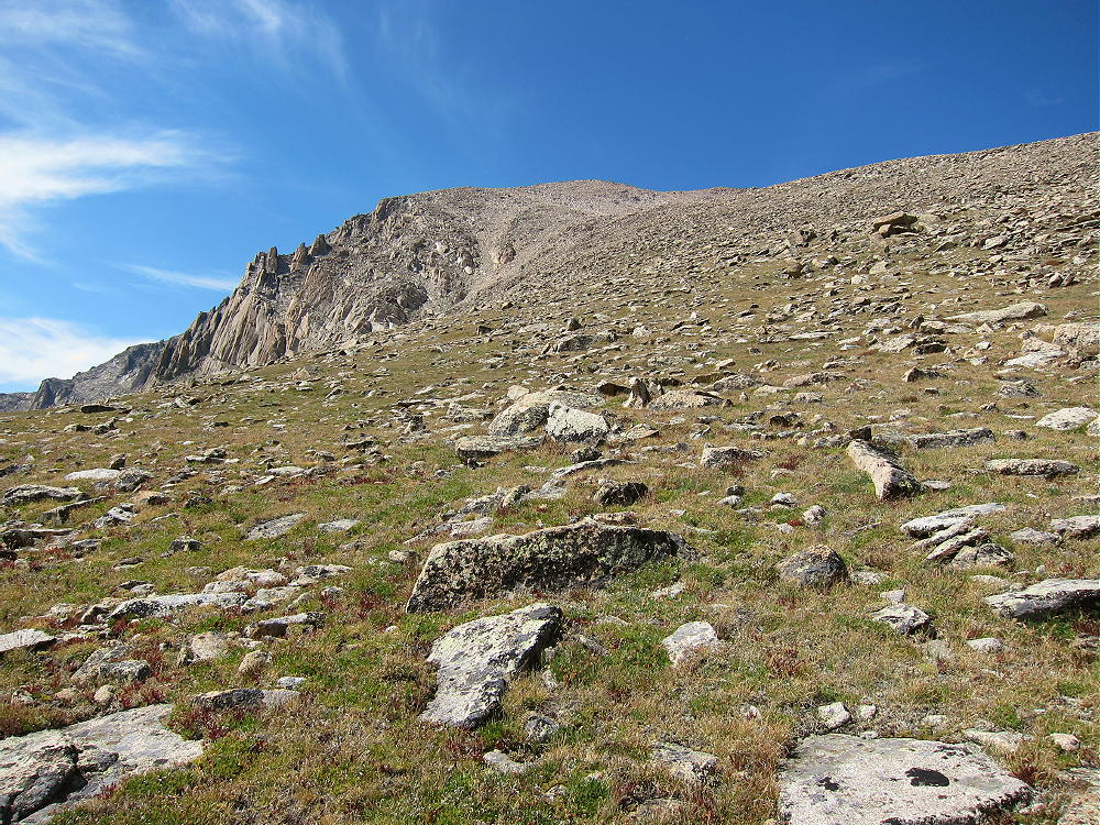
After Orton, the hike is a pleasant, fast trip for about a mile across “North Ridge”, the long, barren, broad ridge between Orton and Chiefs Head. Pagoda, Longs Peak and Mount Meeker stand high and close!
Chiefs Head, Pagoda, and Longs Peak from Orton North Ridge
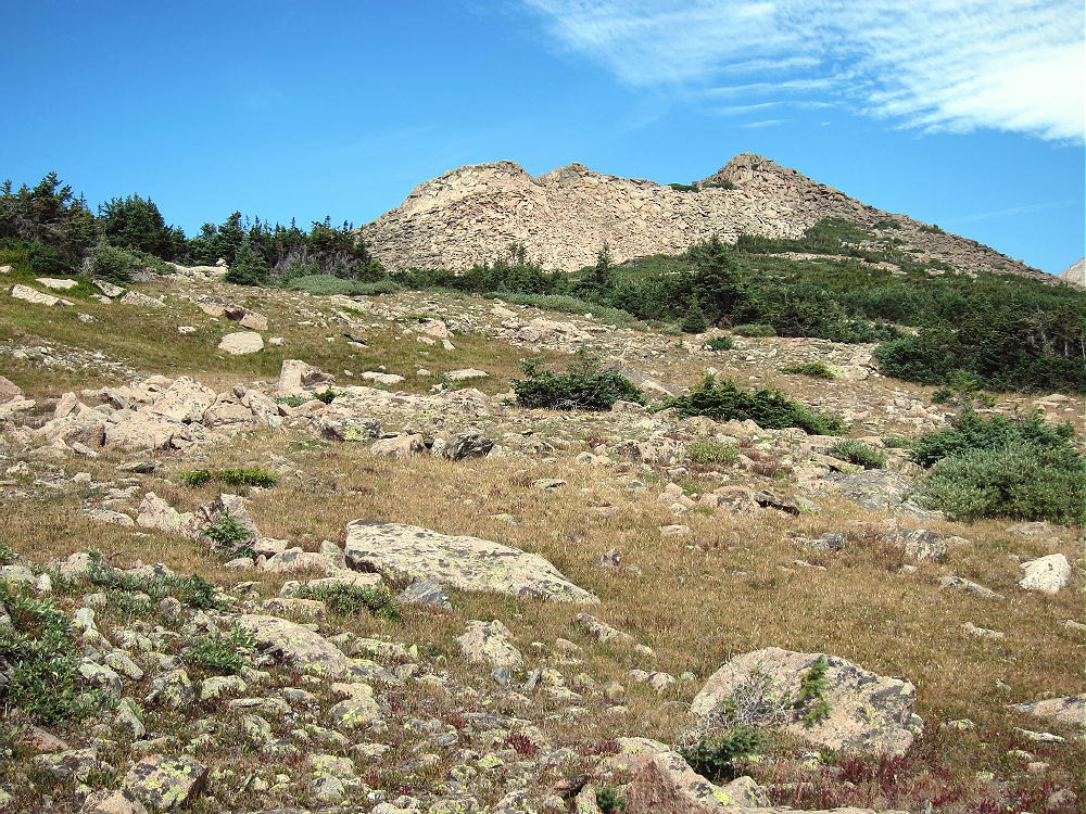
At 11,900 feet, climb any convenient route up the rocks and blocks on the southeast slope of Chiefs Head. Most of this slope is pretty solid, with a few climbers’ trails; climb 1400 vertical feet to the high, narrow ridge east of Chiefs Head. Then ascend west for about 1/3 mile to the top.
South Tundra Route up Chiefs Head
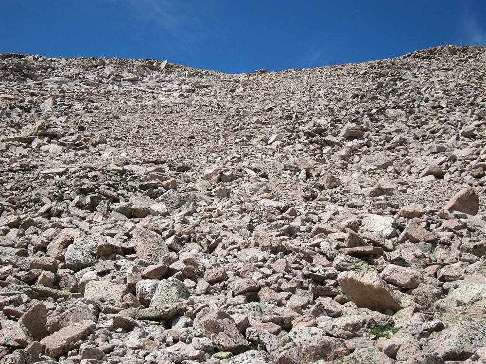
South Slope Rocks and Blocks up Chiefs Head
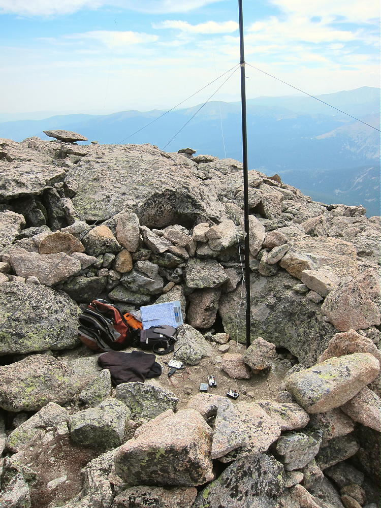
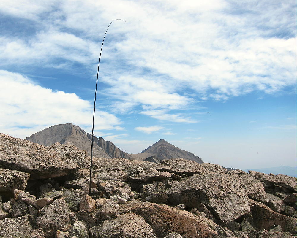
The rocky summit is not large, but there’s space to set up an HF antenna. Bring a pole for an HF antenna. There’s a convenient rock shelter near the top, and it’s easy to erect and guy a pole there. The site is miles from any development, and the RF noise level is very low. Chiefs Head has a view southeast across the Denver metro area, it’s a good VHF/UHF site in that direction; it’s blocked in most other directions. In good weather this mountain is a pleasant alpine SOTA peak!
Chiefs Head Activation in Wind Shelter
KX0R SOTA Antenna on Chiefs Head
I made 30 CW contacts on 3 HF bands from Chiefs Head. Setting up was relatively easy, and the 45-minute activation was a nice break after hours of hiking!
It’s possible to continue west across Chiefs Head, descend the west ridge to the Continental Divide, and then continue down into the Lion Lakes cirque via the long ridge northwest of the Lakes. Some navigation – or prior knowledge – is required to find the trail leading down into Wild Basin from the Lion Lakes. Unfortunately the Wild Basin route ends up at the Ranger Station, a couple of miles west of the Sandbeach Lake Trailhead at Copeland Lake; therefore the total distance from the summit back to Copeland Lake via the west route is 11.5 miles! This is too long for an ideal loop hike.
Mount Alice and Lion Lakes from Chiefs Head South Slope
Both routes up Chiefs Head are long and hard, and an early start is required, even on a day with perfect weather. In order to have time for a good activation, the summit should be climbed before noon. On a day with storms, noon is usually too late. It took me almost 5 hours to do the climb – this included breaks for water, food, and navigation. This required an average of over 1000 vertical feet per hour, with a higher rate on some slopes. I saw no one after Sandbeach Lake until I returned back there!
In some ways the western Lion Lakes route is better than the Sandbeach Lake route. It might be worth starting earlier in the morning to climb the longer route up the west side of Chiefs Head; this avoids the rough off-trail route from Sandbeach Lake to Mount Orton.
It might be possible to do a dual activation of Mount Alice and Chiefs Head, but only if you’re Superman. Both peaks are accessible from the spot where the long ramp ridge from the Lion Lakes meets the Divide. A dual activation would require a very early start, or part of the descent might be after sunset.
Chiefs Head is one of the more difficult SOTA peaks I’ve activated. The weather was pleasant, except for some gusty wind along the ridge north of Mount Orton. In bad weather this summit should be avoided! The entire area around Longs Peak and Wild Basin is prone to serious lightning storms in summer! Rain, snow, hail, and high winds are possible any time of year.
Chiefs Head is a SOTA Classic in every way. Climbing and activating this spectacular peak, while surrounded by even higher and more rugged summits, is an incredible experience! Only activators with high-altitude experience, sufficient fitness, and light-weight gear should attempt this mountain.
73
George Carey Fuller
KX0R
Chiefs Head View North
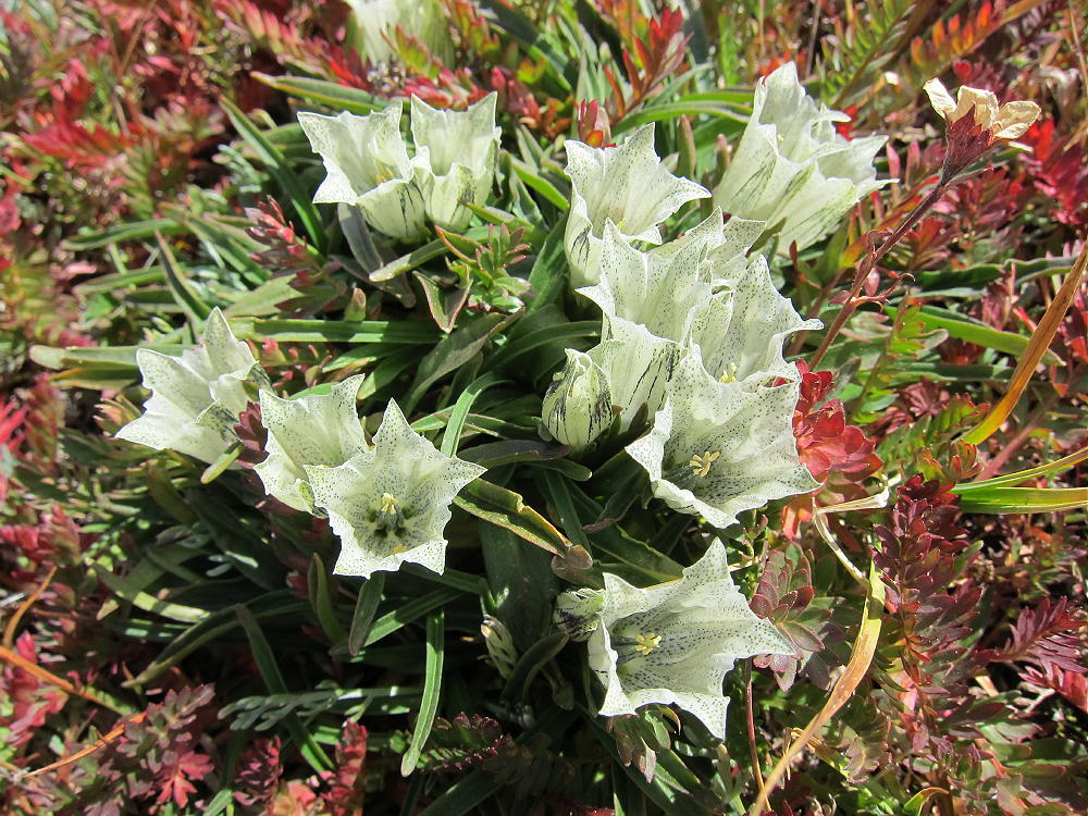
White Gentians on Chiefs Head
![]() !! WARNING !! There are old mountaineers, and
bold mountaineers... there are no old-bold mountaineers.
Hiking and mountain climbing are potentially hazardous activities particularly in Colorado with its extreme elevations. I am not accepting responsibility for any death or injury resulting from activations based on my trip reports. Proper training, experience, and personal capability assessment is required - enjoy!
!! WARNING !! There are old mountaineers, and
bold mountaineers... there are no old-bold mountaineers.
Hiking and mountain climbing are potentially hazardous activities particularly in Colorado with its extreme elevations. I am not accepting responsibility for any death or injury resulting from activations based on my trip reports. Proper training, experience, and personal capability assessment is required - enjoy!