


W0C/FR-052
Ormes Peak
2965 m / 9727 ft
Nov 1, 2015
May 28, 2016
By KX0R
Ormes Peak is a relatively accessible SOTA peak located in the Rampart Range northwest of Colorado Springs.
Key Points:
• Pike National Forest
• Access via forest roads
• Good unmarked social trail
• Easy hike
• Minimal route-finding required
• Roads closed in winter
• ~ 0.4 mile one way
• ~ 375 vertical feet
-
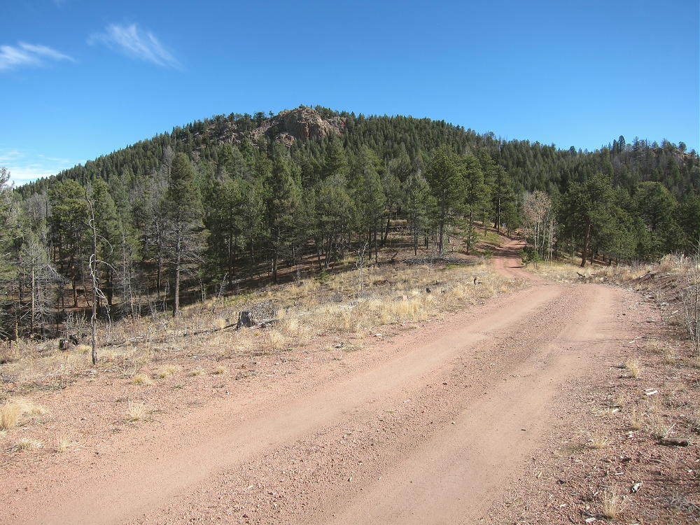
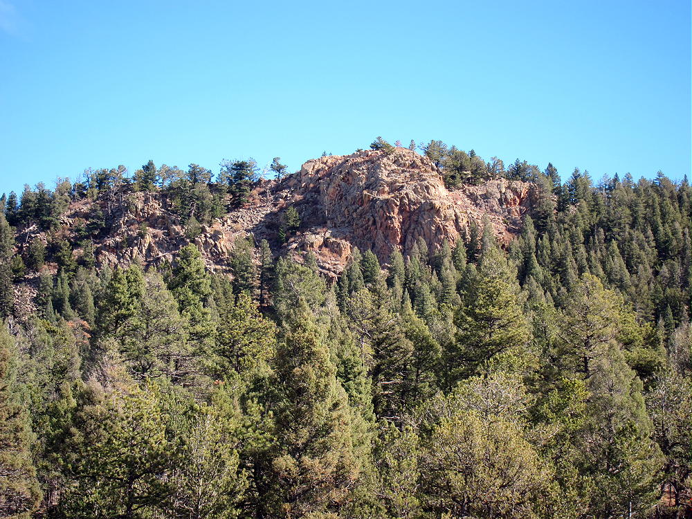
- Ormes Peak from FR 302
Driving Directions:
Start by driving to the Rampart Range Road FR 300:
Colorado Springs Access:
• Start at Garden Drive, at the northwest corner of Garden of the Gods Park, north of Highway 24 in Colorado Springs.
• The bumpy, heavily-used gravel road FR 300 ascends the range via numerous switchbacks.
• FR 300 then leads northwest along the Rampart Range.
• After ascending for several winding miles, the road levels off somewhat.
• It continues north along the ridge at about 9200 feet.
• About 1-1/4 miles north of the turn to Eagle Lake, marked FR 303 heads .northeast at an intersection at about 9320 feet.
• FR 303 is a good 2WD dirt road.
• Follow FR 303 for about ¾ mile to a fork.
• Turn right on FR 302 and follow it southeast toward Ormes Peak.
Woodland Park Access:
• From Highway 24 at Woodland Park, turn north on Baldwin Street at a stop light at the east side of town.
• This becomes Road 22 and is called “Rampart Range Road” locally.
• Follow this paved road about 3 miles, northeast and then east, up into a canyon.
• Loy Creek Road forks off to the right.
• Follow Loy Creek Road about one mile up to the actual Rampart Range Road FR 300.
• Turn right, south, on the Rampart Range Road FR 300.
• Follow FR 300 for about 6 miles, well past the marked road to Rampart Range Reservoir.
• Marked FR 303 heads northeast at an intersection at about 9320 feet
• FR 303 is a good 2WD dirt road.
• Follow FR 303 about ¾ mile to a fork.
• Turn right on FR 302 and follow it southeast toward Ormes Peak.
-
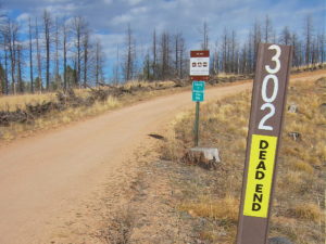
- Ormes Peak – FR 302 Signs
-
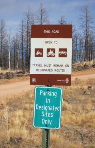
- Ormes Peak – FR 302 Signs
Regardless of how you drive there:
• Follow Road 303 and then FR 302 up over a little hill and down a gully toward Ormes Peak, which is visible to the east.
• If this road is wet or snowy, 4WD may be required. The section where the road leads down has bad drainage and can become muddy.
• If the road is muddy or snowy, it may still provide a good hiking route to Ormes – the distance is only about a mile from the 2WD section of the road to the south side of Ormes.
• If the FR 302 is dry, it may be passable in cars with adequate clearance.
-
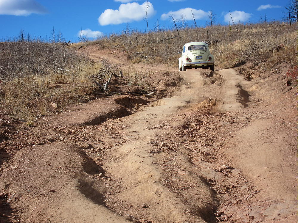
- Ormes Peak – FR 302 Bad Section
Note: in May of 2016 the muddy spot had an official “Road Closed” sign, but a few people were driving 4WD vehicles through the mud or around it. If the road is closed, park back up at the top of the hill west of the closure and hike in.
• FR 302 is good east of the muddy section – it contours around the southwest, south, and east sides of the mountain.
-
- Ormes Peak Summit from FR 302
• Follow this FR 302 to a point about 0.3 mile southwest of the summit
• Find a small side road leading north up into the woods on the left (north) side of FR 302.
• This is the only such road on this side of the peak.
• The only marking is a small sign with a letter “P”, indicating that it’s OK to park there.
• Follow the little side road up to a large campsite on a low ridge.
• Continue east along the ridge to a second campsite; then follow a faint social trail east up the hill toward the summit.
• This trail gradually gets steeper as it ascends.
• Occasional cairns mark the route as it approaches and climbs the southwest side of the peak.
-
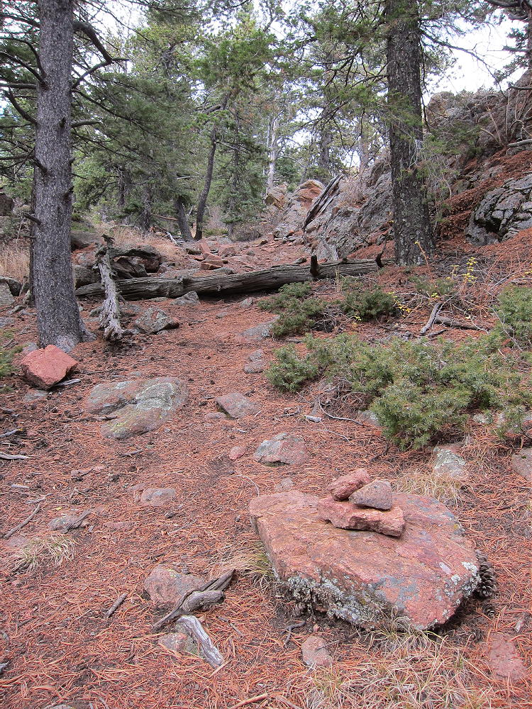
- Ormes Peak – South Side Trail near Summit
• The path leads north up a sloping ramp through some rocks to the top.
• The actual summit is a short distance up to the north.
• This route measures about 0.4 miles, with about 375 vertical feet of gain, from FR 302 to the summit.
-
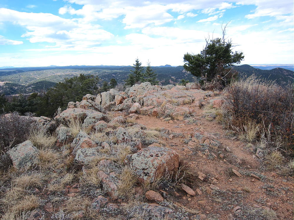
- Ormes Peak Summit
There’s also an OK route up the moderate southeast ridge of Ormes.
• There’s a large marked parking spot where the road bends sharply around the southeast ridge toward the east side.
• Hike northeast along the partially-burned ridge toward the summit.
• There’s no marked trail, but game trails lead through the open forest.
• The south ridge is rocky near the top.
• Skirt around the outcrops as required.
• Near the top, hike along the west side of the ridge.
• A small trail is marked with cairns (see above).
• The path leads north up a sloping ramp through some rocks to the peak.
• The actual summit is a short distance up to the north.
• This route to the top is about 2/3 mile from the road, with a vertical gain of about 350 feet.
The top of Ormes Peak is mostly open, with fine views in several directions. Pikes Peak stands high to the south, Devils Head is up north, and Mount Herman rises northeast above the Plains. Thunder Butte W0C/FR-048 is lined up with nearby Rampart Range Reservoir and some alpine peaks on the other side of South Park, way out to the northwest. Some of the Collegiate Peaks, including Mount Princeton, are visible on the horizon. Huge burned areas stand dead, killed by the Waldo Canyon Fire southeast of the peak.
-
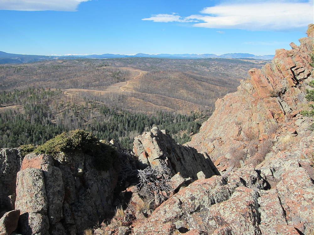
- Ormes Peak – View West
-
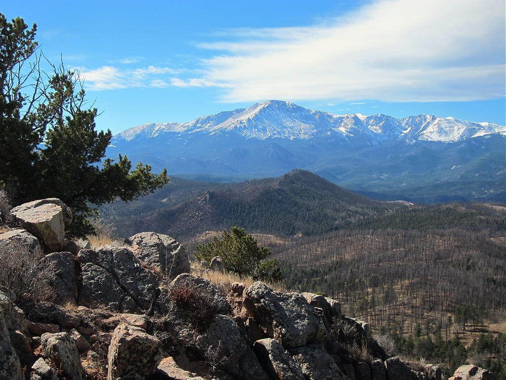
- Ormes Peak – View of Pikes Peak
The SOTA Activation Zone is large; there are useful trees and many bushes. I found a pleasant spot to set up my gear southeast of the peak. Setting up on top would be OK if the weather’s ideal.
-
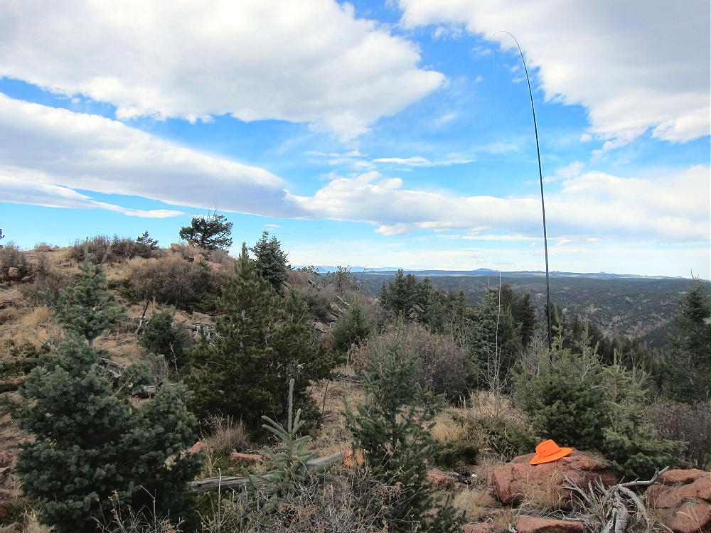
- Ormes Peak – KX0R SOTA Activation
Ormes Peak is an excellent HF summit, with no close development; the RF noise level is low. It also is fine VHF/UHF peak – it has coverage of populated areas in and near Colorado Springs, as well as large areas of the Plains.
Ormes could be combined with other SOTA peaks nearby for a dual activation:
Devils Head W0C/FR-051
Bennett Mountain W0C/FR-087
Mount Herman W0C/FR-063
Ormes has relatively good access in late spring, summer, and fall. It’s easy to climb and activate, and it offers a pleasant summit not visited by many people. Give it a try!
73
George
KX0R
![]() !! WARNING !! There are old mountaineers, and
bold mountaineers... there are no old-bold mountaineers.
Hiking and mountain climbing are potentially hazardous activities particularly in Colorado with its extreme elevations. I am not accepting responsibility for any death or injury resulting from activations based on my trip reports. Proper training, experience, and personal capability assessment is required - enjoy!
!! WARNING !! There are old mountaineers, and
bold mountaineers... there are no old-bold mountaineers.
Hiking and mountain climbing are potentially hazardous activities particularly in Colorado with its extreme elevations. I am not accepting responsibility for any death or injury resulting from activations based on my trip reports. Proper training, experience, and personal capability assessment is required - enjoy!