


W0C/FR-145
McGregor Mountain 3190M / 10,486 FT
Sep 01, 2013
by KX0R
McGregor Mountain is a seldom-climbed prominent granite dome located in Rocky Mountain National Park, close to Estes Park. At 10486 feet it towers over 2000 feet above its immediate surroundings, but it’s dwarfed by major peaks several miles away. Activating this peak requires considerable effort with some risks no matter how you do it. There are no trails up or near McGregor. Activating this giant dome provides an exciting challenge – it’s a SOTA classic!
My ascent up McGregor was full of surprises. The original plan was to ascend the major gulch west of McGregor – the gulch route looks reasonable on the topo map. I parked just west of RMNP Fall River Entrance Station. There is a service road up the gulch, but it’s closed to the public. I skirted above and to the west, and I was able to drop into the gulch and go a short distance upstream, but I found the route blocked by huge boulders and thickets. I headed NW up a tributary gulch, up steep slopes covered with fallen trees, loose rocks, thickets, and thorny bushes. It was so bad I almost quit and went down; but I gradually gained altitude, and above 9000 feet the route became more reasonable. I found a game trail and headed NW up to a forested bench at about 9400 feet. The problem was that I had gone NW, away from McGregor, so I had to head northeast and then east toward the mountain.
The route over the forested bench was tedious but much better than the steep slopes down in the gulch. The whole place is covered with thousands of fallen pine trees, most with snagly limbs, so traveling requires picking over and around hundreds of trees. Closer to McGregor there are several forested, rocky ridges to negotiate, but there were no major problems getting over or around these obstacles. The last of these ridges is at about 9800 feet, and from there I descended northeast and then ascended up to the saddle below the west slope of McGregor. There is a faint trail near the saddle – it looks like it comes up from Black Canyon Creek 600 vertical feet and 1/2 mile to the north.
I climbed McGregor via the west ridge. There is no trail, and the route gradually gets steeper and more challenging as you climb higher. There are fallen trees, big rocks, and steep slopes, but most of the route is solid. There is a section of rocks requiring a bit of class 3 climbing, but on the descent I found that most the problems can be avoided by staying a slightly south on the ridge; the route is not technical. Toward the summit the route becomes really fun, as you pass through an amazing area filled with huge ancient twisted trees and granite formations. The top of the mountain is large and impressive – the awesome view looks half a mile down into the valleys to the south and east. To the northwest the high MummyRange summits tower at 13,500 feet, about 6 miles away. All of Lumpy Ridge and the Needles are close below and to the east.
There are plenty of good spots for activating McGregor near the summit. There are good antenna trees, so it’s not necessary to take a pole up there. Various rocky knobs are available for shelter, and if the weather’s OK, it’s a great place to relax and get on the air.
There are certainly other routes up McGregor. Trip reports online suggest going up the southeast side of the mountain, but any southern approach requires over 2000 vertical feet of steep bushwhacking and climbing. There may be routes up the SE side from Black Canyon Creek, but you’re on your own. In mid-September of 2013 torrential rains caused flooding throughout the area, and there’s an enormous mudslide path down a gulch on the SE side of McGregor. To climb McGregor’s SE ridge, a possible approach is from Black Canyon Creek. Since there’s no legal parking at MacGregor Ranch, hikers must park far to the east, at the GemLake – Lumpy Ridge trailhead.
I don’t recommend my gulch-and-bench route described above for activating McGregor. While it’s only a few miles, parts of it are very steep and/or covered with numerous fallen trees. The return trip requires precise navigation (GPS) in order to descend without peril into the gulch. Instead, I suggest:
- Park at the Lumpy Ridge/Gem Lake TH north of Devils Gulch Road 43
- Hike through MacGregor Ranch and past the Lumpy Ridge climbing formations north of the trail
- Follow Black Canyon Creek Trail all the way up to 9100 feet and the junction with the Cow Creek Trail
- Head west 2/3 mile through Black Canyon, down and then up to about 9040 feet, where the trail approaches the Creek
- Cross Black Canyon Creek
- Head south up the moderate forested valley, over 600 vertical feet to the saddle west of McGregor at about 9650 feet
- Ascend the west ridge of MacGregor as in my description above
This is probably the safest and least stressful route up McGregor, even though it’s long. There should be no problems navigating, as long as you carry a topo map and compass – you don’t need GPS. Be sure you return down McGregor’s west ridge the same way you came up – an incorrect descent on McGregor might be somewhere between miserable and tragic. If you take a pump filter, there’s usually good water in Black Canyon. The hike through MacGregor Ranch and below Lumpy Ridge is spectacular, and you can see McGregor looming ahead all the way. Start early.
This mountain is nothing to mess with in bad weather – in particular, the lichens on the steep rocks get slick when they’re wet. If there’s ice or snow on the steep slopes, climbing may be too risky. Save this summit for a good day – McGregor is a classic!
George Carey Fuller
KX0R
-
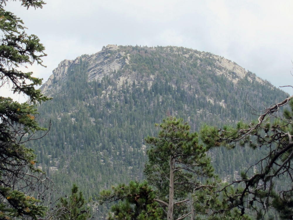
- McGregor’s NW Side
-
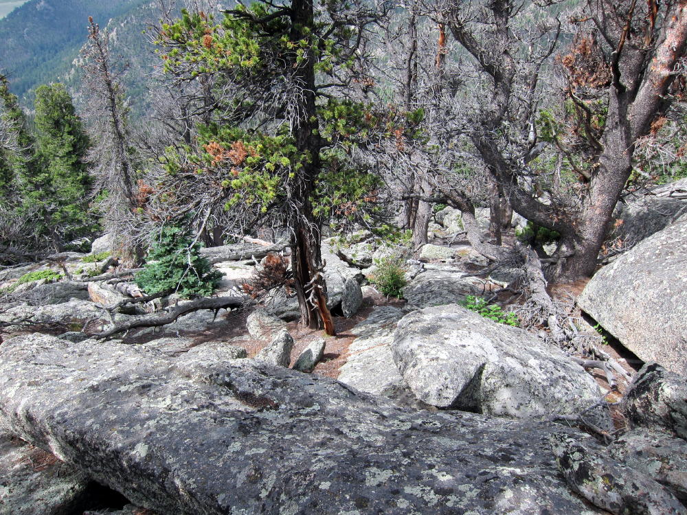
- Route down NW Side of McGregor
-
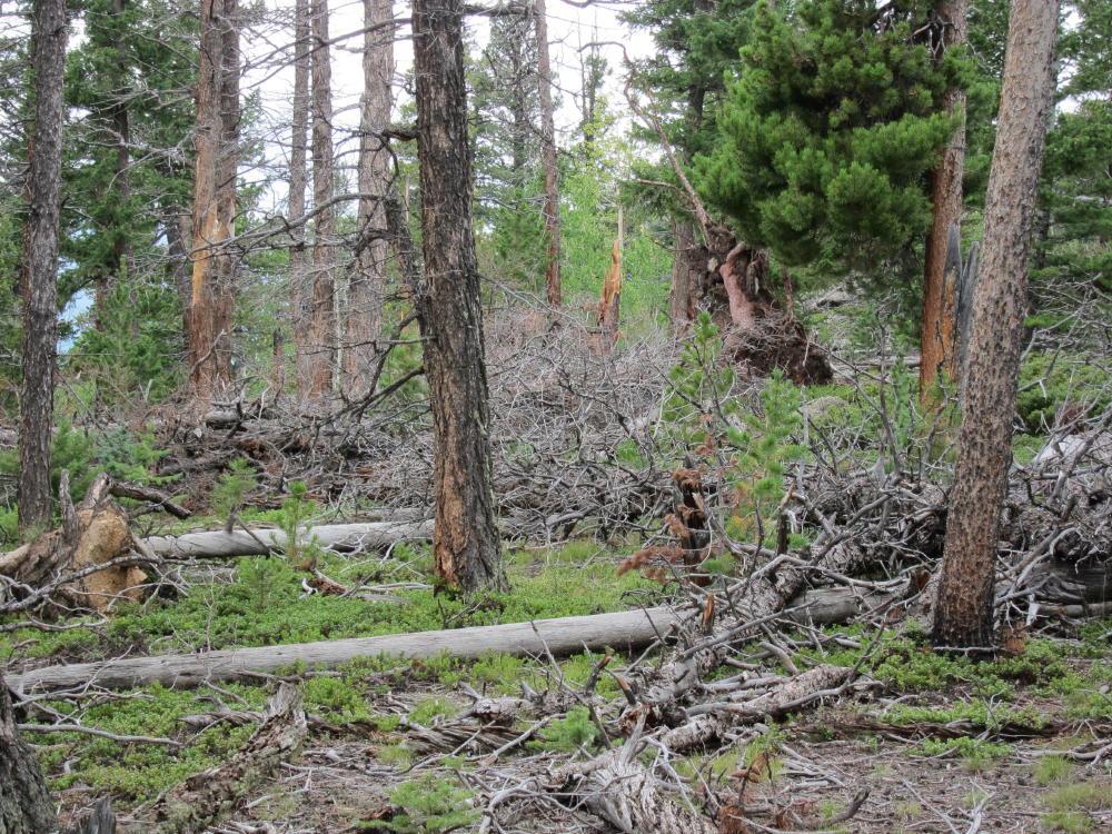
- McGregor Route through Downed Trees
-
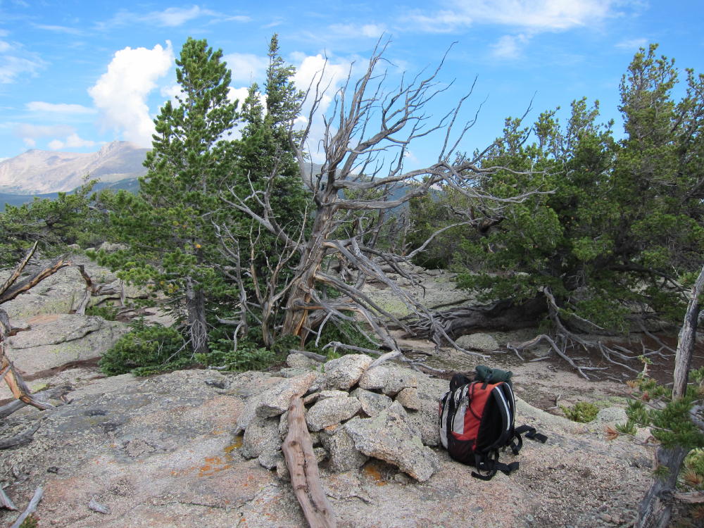
- Summit Area
-
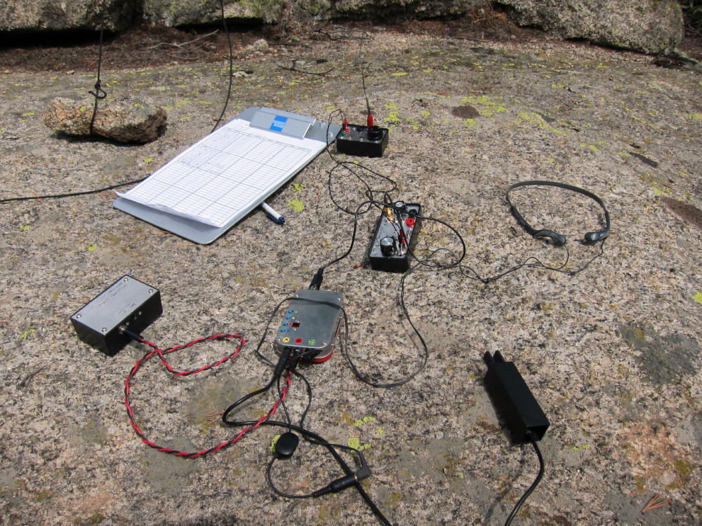
- ATS-3B Rig and Tuners
-
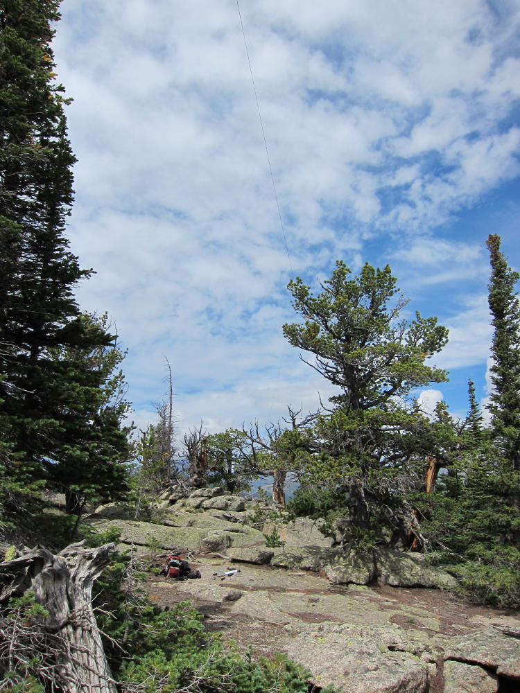
- Activation Site with Antenna in Tree
-
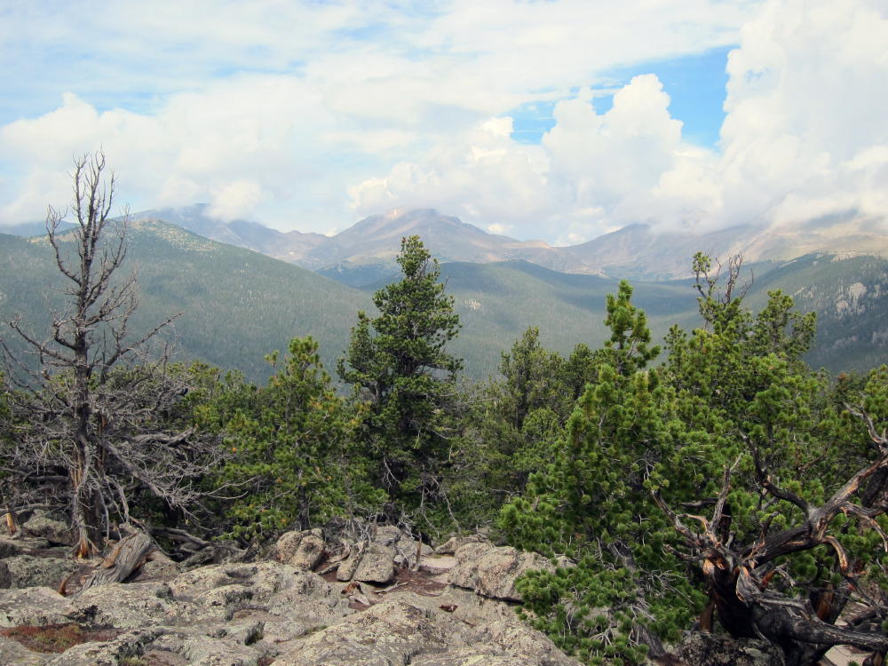
- View of Mummy Range
-
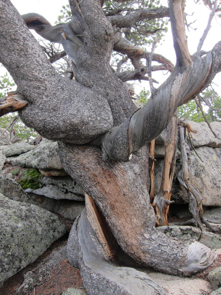
- Twisted Tree near Summit
![]() !! WARNING !! There are old mountaineers, and
bold mountaineers... there are no old-bold mountaineers.
Hiking and mountain climbing are potentially hazardous activities particularly in Colorado with its extreme elevations. I am not accepting responsibility for any death or injury resulting from activations based on my trip reports. Proper training, experience, and personal capability assessment is required - enjoy!
!! WARNING !! There are old mountaineers, and
bold mountaineers... there are no old-bold mountaineers.
Hiking and mountain climbing are potentially hazardous activities particularly in Colorado with its extreme elevations. I am not accepting responsibility for any death or injury resulting from activations based on my trip reports. Proper training, experience, and personal capability assessment is required - enjoy!