


W0C/FR-092
Mount Morrison 2397 M / 7837 FT
Nov 10, 2013 by KX0R
Mount Morrison is a very accessible peak located right above Red Rocks Park and Amphitheater, just west of Denver. The trip starts with a drive to Morrison near Red Rocks.
Drive west from Morrison on Bear Creek Road almost ½ mile. Turn north into Red Rocks Park Entrance 4 – the west entrance. Look for parking about 100 yards up the road on the right. There is no charge for entering the Park or for parking, but parking might fill at the trailhead on busy weekends. The trailhead is obvious on the west side of the road, but there are no signs or facilities. The rough, mostly unimproved South Ridge Trail goes up almost 2000 vertical feet, starting near 5900 ft, to the summit at 7837 ft, in less than 2 miles. The trail is direct and steep – there are no switch-backs. The first half mile is steep, the middle part is easy, and the last half mile is the very steep. There is some Class 3 scrambling for about 200 feet or more on the exposed rocky ridge below the summit. Going down the steep part is worse than going up – it’s better to sit down than to slip and fall.
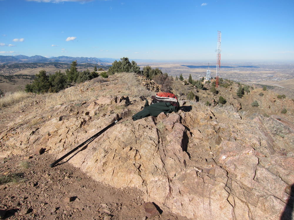
The South Ridge trail is the only one that is “approved” and OK to hike. Hiking on closed trails is strongly discouraged. Mount Morrison has had a hard life during the past hundred years or so. Currently the peak is a major transmitter site for the Denver Metro Area – there are a couple of large towers about 150-200 yards north of the actual (south) summit. Concrete pads, tower anchors, and assorted junk remain from radio facilities that previously existed on the south summit. An old steam boiler lies rusting near the top – was it used for power for a radio transmitter long ago? On the northwest side of the mountain there’s a jeep road, but this is not open to the public for driving up to the summit.
Just north of the summit a power pole stands, with the high voltage disconnected from a transformer. The high voltage line appears to be live, radiating line noise, because I had about 5-10 db of AC RF noise on 20M. I heard almost no noise on 40M. The big surprise was that there was no RFI from the nearby transmitters! Those antennas look really serious, and the site nearby is posted with warnings for RF exposure limits.
I set up my rig about 50 feet west of the south summit, about 15 feet below the summit rock, with a wire stretched from my pole southwest down the hill. There are few useful trees on the summit. A SOTA location up there is a compromise between the power pole, the transmitters, visitors, wind, abundant cactus, and the limited flat ground. The front (east side) of the mountain is very steep. Needless to say, this is probably an awesome VHF/UHF site, unless the RFI level creates intermod or overload problems.
In spite of the AC line noise on 20M, I had a nice CW activation with 34 contacts on 20M and 7 on 40M. The view was spectacular, and it was exciting to be so high above Denver in the late afternoon.
The trip down is steep, relatively fast, and OK – if you have good knees.
Until I did this hike, I didn’t understand why Mount Morrison wasn’t previously activated, given its proximity to Denver and public access. There are a couple of fourteeners that are easier to climb than Mount Morrison! It certainly requires a lot of work for one SOTA point; there are peaks in other states where a similar climb might be worth 8 or 10 points.
This is actually a very rewarding SOTA adventure, if you’re in good condition and don’t carry a pack full of heavy gear.
George Carey Fuller
KX0R
-
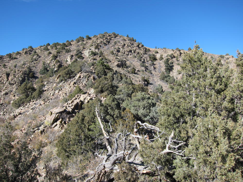
- Mount Morrison South Ridge Route
-
- Summit of Mount Morrison
-
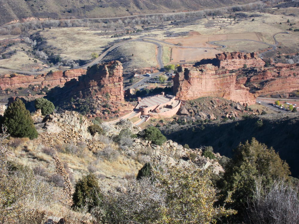
- Red Rocks from Mount Morrison Summit
-
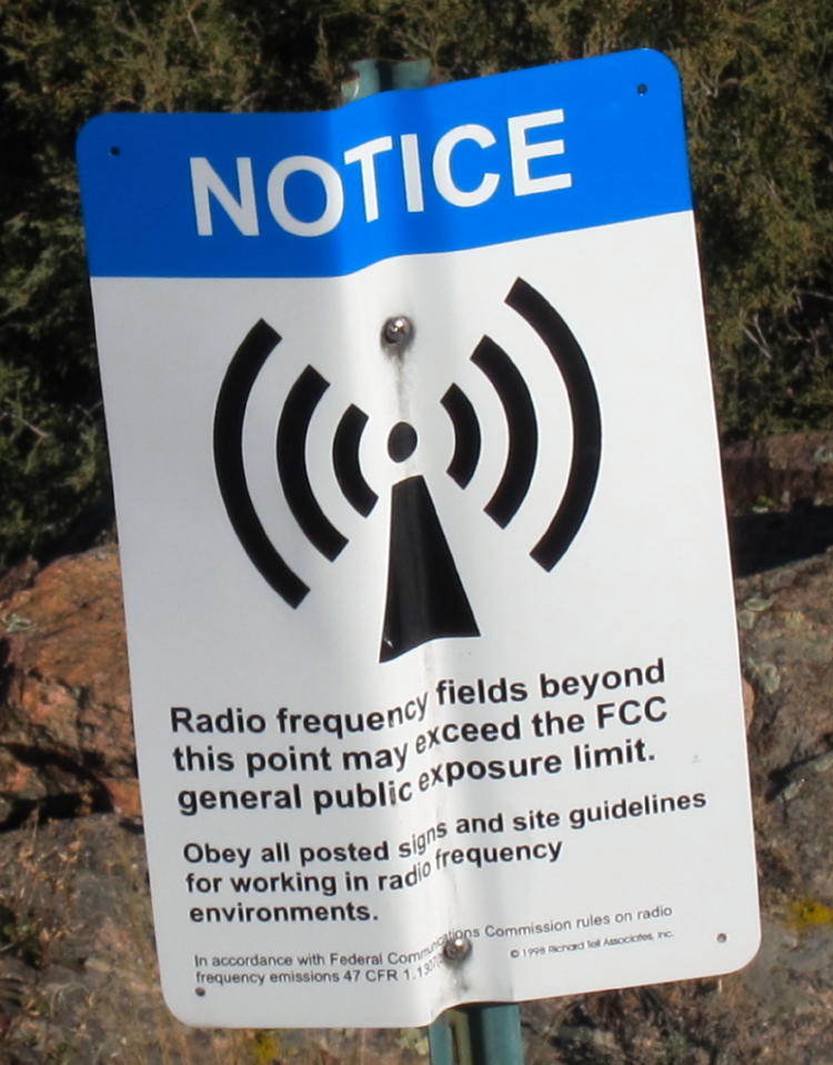
- RF Fields Warning Sign near Transmitters
-
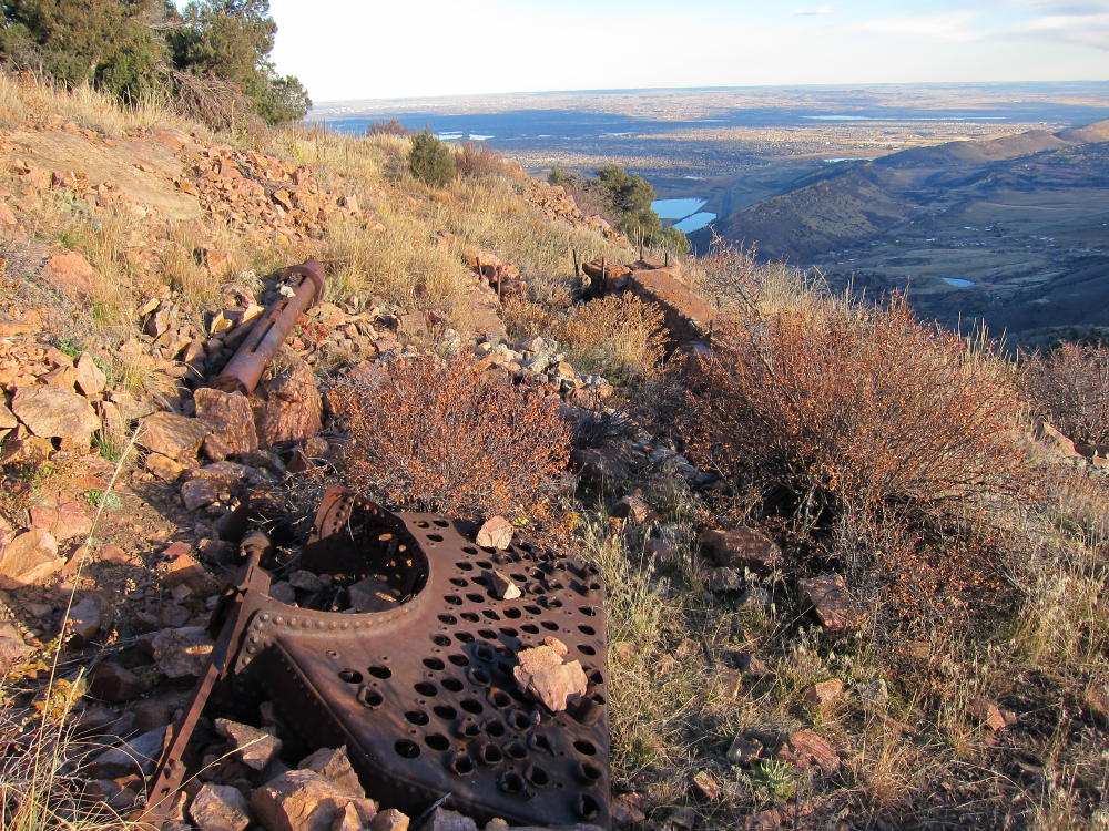
- Old Boiler near Mount Morrison Summit
-
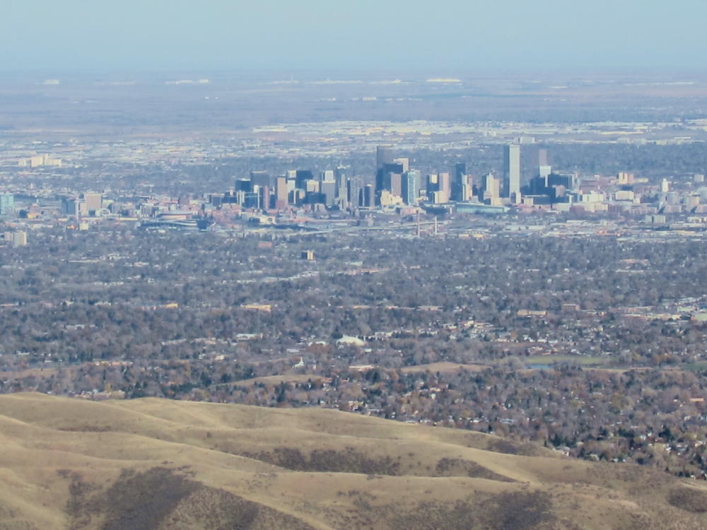
- View of Denver from Mount Morrison
-
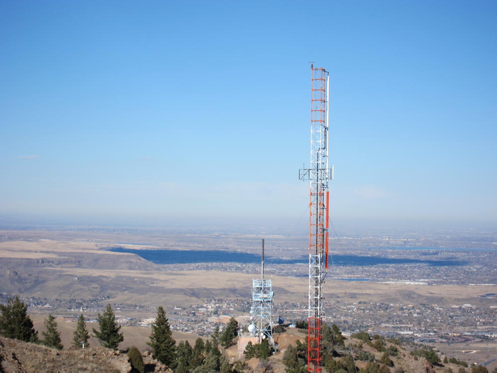
- Radio Towers on Mount Morrison
-
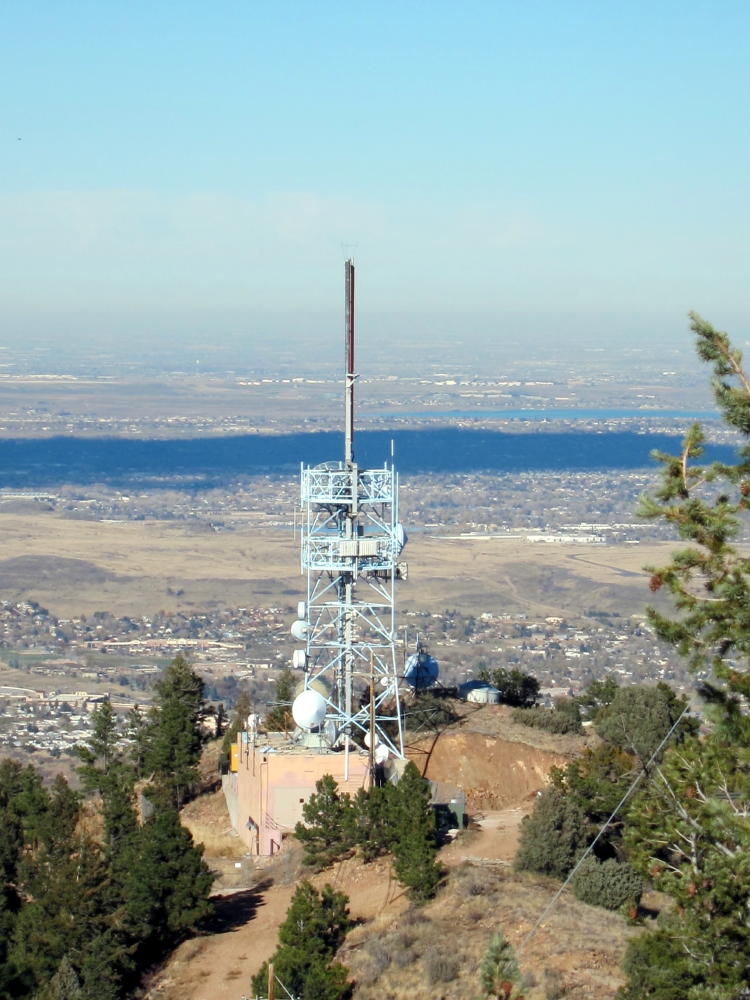
- Transmitter on Mount Morrison
-
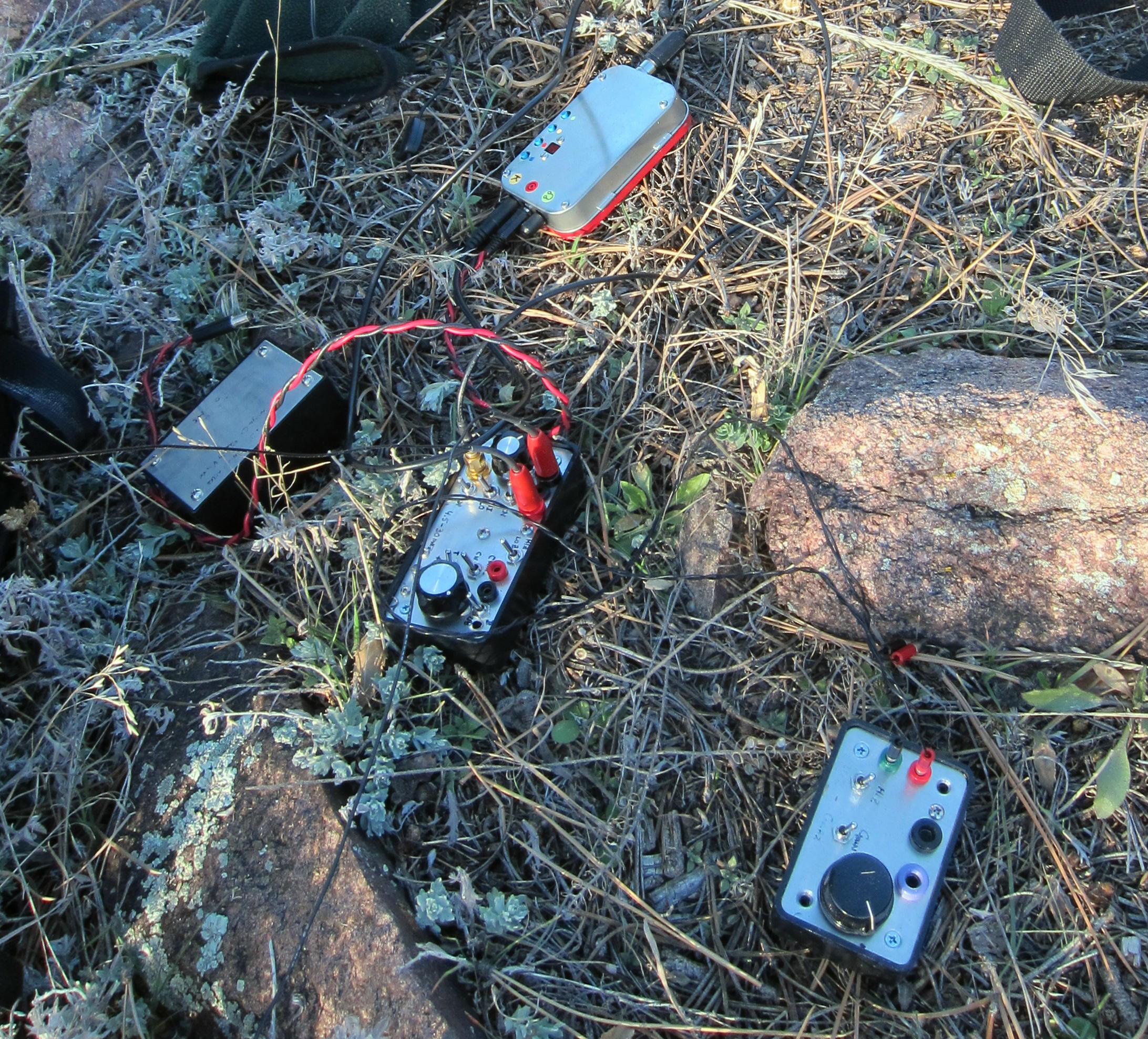
- KX0R Activation Gear
-
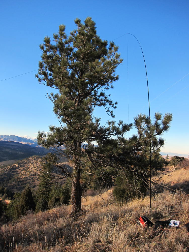
- KX0R Activation near Summit
<
![]() !! WARNING !! There are old mountaineers, and
bold mountaineers... there are no old-bold mountaineers.
Hiking and mountain climbing are potentially hazardous activities particularly in Colorado with its extreme elevations. I am not accepting responsibility for any death or injury resulting from activations based on my trip reports. Proper training, experience, and personal capability assessment is required - enjoy!
!! WARNING !! There are old mountaineers, and
bold mountaineers... there are no old-bold mountaineers.
Hiking and mountain climbing are potentially hazardous activities particularly in Colorado with its extreme elevations. I am not accepting responsibility for any death or injury resulting from activations based on my trip reports. Proper training, experience, and personal capability assessment is required - enjoy!
Greetings, George.
You were roughly my present age when you activated this summit. Kudos! I tried to Google Maps my way to it yesterday (12/16/2023), and I found what I thought was the Northwest approach, only to find that the FCC had blocked the access road (Grapevine) here:
https://www.google.com/maps/@39.6710322,-105.2414978,3a,19.4y,79.33h,87.87t/data=!3m6!1e1!3m4!1sB6xABhcbzSeTVd1PStL09g!2e0!7i16384!8i8192?entry=ttu
I understand why now – the RF exposure hazard! Reading your description of the hike to the summit, I am glad I didn’t find a way to approach from either the northwest, or the Red Rocks side! I don’t think extended Class 3 scrambles are for me!
I am seriously impressed with your SOTA activation record on SOTLAS. You have made me realize that I need to spend more time researching a summit before I strike out. Equally impressive are your electronics craftsmanship chops evident on your QRZ.com bio! Hope to QSO with you soon, and perhaps even meet you on a /FR activation.
Thanks for writing about your SOTA adventures!
-Brian Dotson (KN4RDF) in Westminster