


W0C/SP-078
10874
3314 m / 10874 ft
Oct 5, 2016
By KX0R
Peak 10874 is a somewhat challenging SOTA peak in the Puma Hills, on the east side of South Park.
• Convenient access via Pike National Forest roads
• No marked trail or trailhead
• Relatively challenging off-trail ascent
• Excellent SOTA peak
• ~ 3.5 miles round-trip from parking near 9600 feet
• ~ 1.8 miles round-trip from parking at 4WD saddle at 10,100 feet
• ~ 1300 vertical feet from parking near 9600 feet
• ~ 800 vertical feet from parking at 4WD saddle at 10,100 feet
-
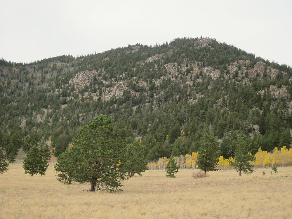
- 10874 – Summit Ridge from FR 231
Driving access:
• Drive west from Denver on Highway 285
• Cross Kenosha Pass
• Continue to Jefferson
• Turn south on Highway 77
• Drive about 16 miles to Tarryall Reservoir
• Continue south about 12 miles to Tarryall
• Turn west on CR 31 – good 2WD dirt road
• Follow CR 31 southwest for about 0.7 mile
• Turn west on rough dirt road FR-231
-
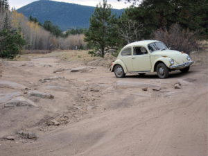
- 10874 – FR-231 Has Some Bumps
-
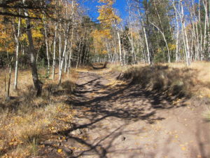
- 10874 – FR-231 at about 9500 Feet
• Follow FR-231 almost 4.0 miles to the base of the mountain
• Park near 9600 feet, or continue about 0.6 mile up to the saddle, if you have enough clearance and maybe 4WD
-
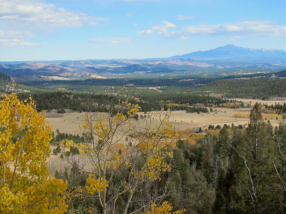
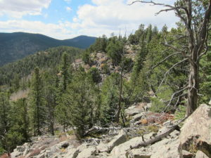
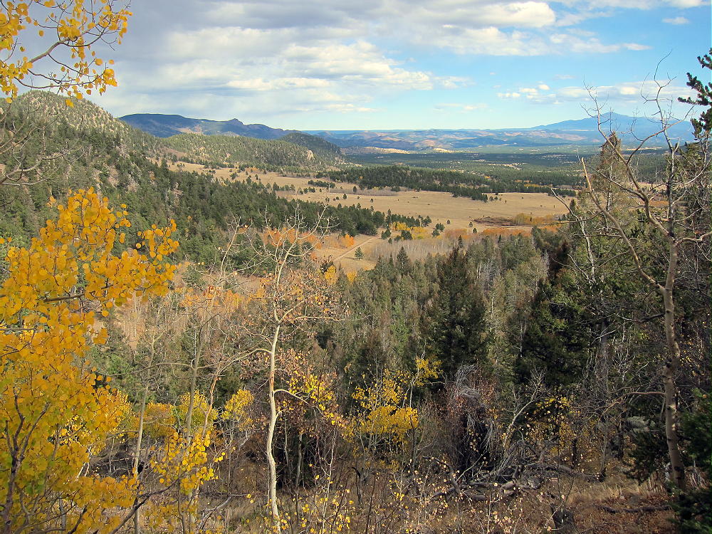
- 10874 – View Southeast from FR-231, near Saddle
The climb:
• If you park near the bottom of the mountain, hike about 0.7 mile up FR-231 road to the saddle at 10,040 feet
• Head northeast into the forest toward the summit
• The route is steep, with few game trails
• There’s considerable deadfall, but much of it can be dodged
-
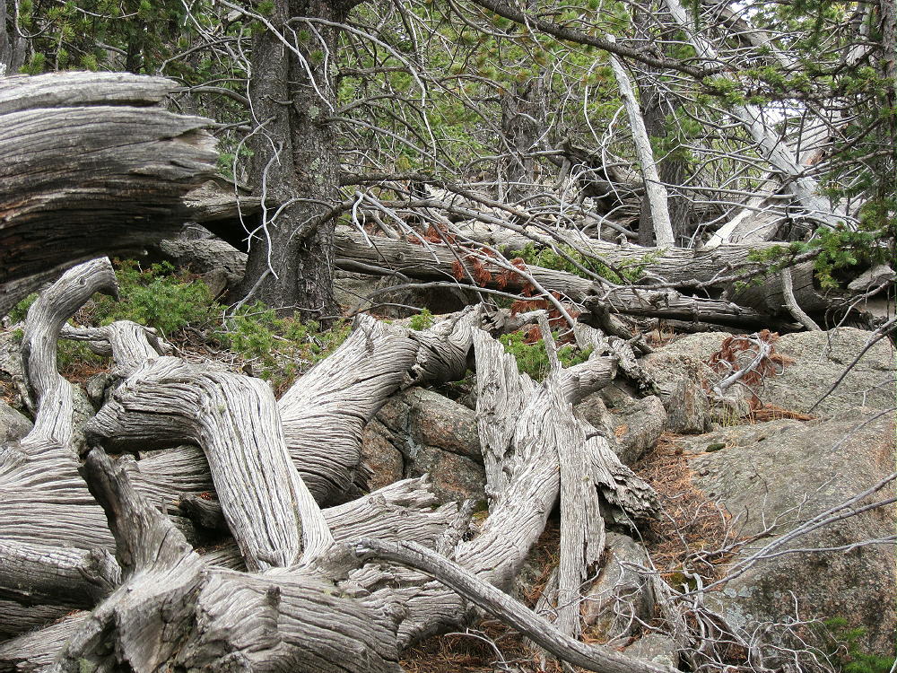
- 10874 – Deadfall on the West Side
• After climbing to the 0.4-mile-long summit ridge, continue east for about 0.3 mile toward the actual peak
• Pick your way carefully over gneiss rocks, chunks of pegmatite, and numerous large dead trees
-
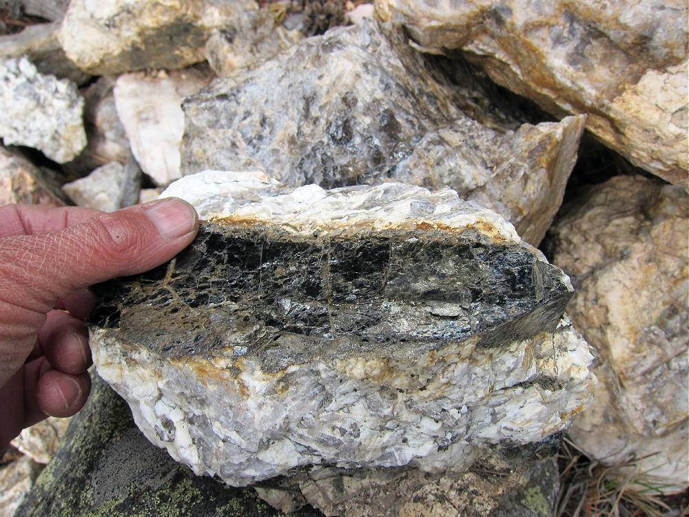
- 10874 – Pegmatite on the Summit Ridge
• There are several rocky sub-peaks near the real summit – be sure you pick the correct one for your activation
Details:
The Pike National Forest Map is useful for planning a hike to 10874; it shows the useful roads CR 31 and FR-231.
FR-231 is not quite a 4WD road, but high clearance is required, especially for the upper sections near the peak. Hiking part of the road is a reasonable option.
Very few people climb this summit – there’s little evidence of hikers along the rocky summit ridge. Thanks to WG0AT, Steve, for his First Activation!
-
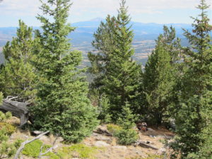
- 10874 – Summit Ridge, View Southwest from near Summit
-
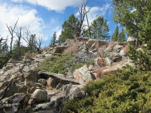
- 10874 – Summit Area
10874 is an excellent SOTA peak. The large activation zone extends along the ridge-top; there are good south-facing spots, with shelter and trees for a pole, wire, etc.
-
- 10874 – KX0R SOTA Activation
-
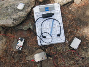
- 10874 – KX0R SOTA Activation
There’s no development on the mountain, and the RF noise level is low. This is a fine HF site. It’s not blocked much for skip signals. This site has limited VHF/UHF coverage of the east side of South Park and the area toward Pikes Peak.
-
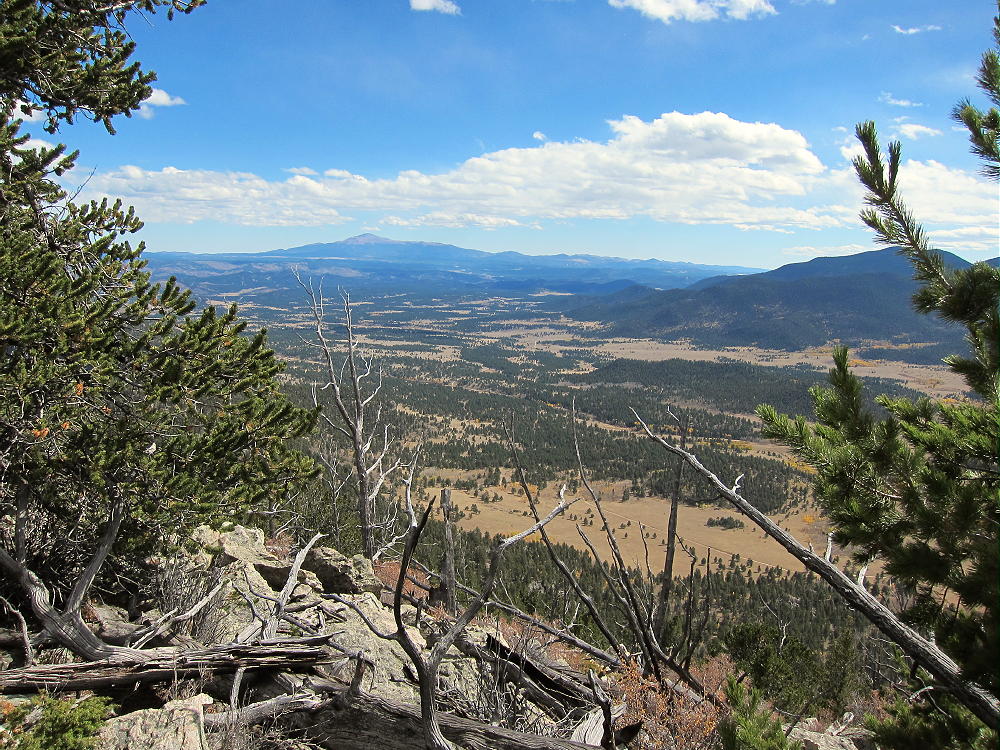
- 10874 – View Southeast from near Summit
The summit of 10874 offers fine views in many directions. Many other local SOTA peaks are visible. The most obvious is Badger Mountain, almost 6 miles to the south; Pikes Peak is large, although it’s 34 miles to the southeast. Peak 10462 can be glimpsed through the trees from the east end of the summit ridge. Schoolmarm Mountain W0C/SP-071 is only about 2-1/2 miles to the west, and Puma Peak stands about 2-3/4 miles to the northwest. Thirtynine Mile Mountain W0C/SP-066 is easily visible 20 miles to the south, above La Salle Pass; the Sangre de Christo Range stands along the horizon more than 60 miles away.
-
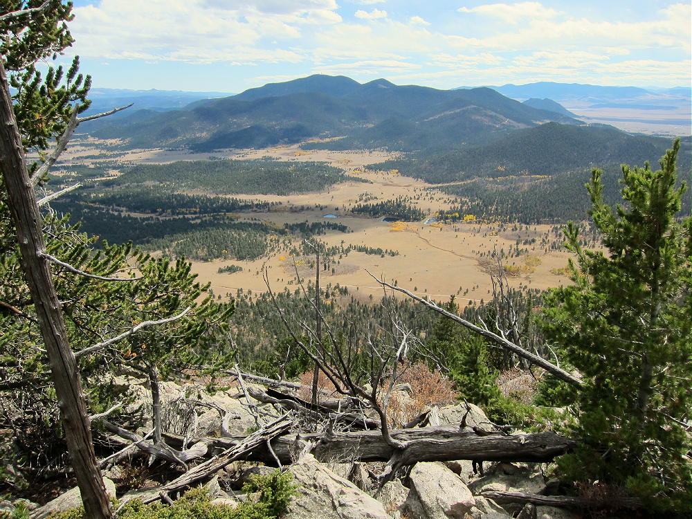
- 10874 – Summit View of Badger Mountain
While climbing the west side and traversing the summit ridge is somewhat tedious – sort of an obstacle course – some of the deadfall looks to be centuries old. From the summit one can see the actual extent of the Puma Hills far to the north and south. The wind blows through the bristlecone pines, and even the rocks are interesting! This mountain offers perfect solitude.
It might be possible to activate Peak 10874 in the same day as another local summit – possibilities include:
W0C/SP-091 10462
W0C/FR-038 South Tarryall Peak
W0C/SP-072 Badger Mountain
W0C/SP-121 Sulphur Mountain
W0C/SP-118 Spinney Mountain
W0C/SP-071 Schoolmarm Mountain
W0C/SP-113 Eagle Rock
W0C/SP-102 Observatory Rock
W0C/SP-065 Puma Peak
W0C/SP-074 Burntop
W0C/FR-066 Tappan Mountain
W0C/SP-124 9083
W0C/SP-125 9036
W0C/SP-092 The Pulverizer
W0C/SP-123 Blue Mountain
W0C/FR-065 Signal Butte
Etc.
73
George
KX0R
-
- 10874 – View Southeast from FR-231
![]() !! WARNING !! There are old mountaineers, and
bold mountaineers... there are no old-bold mountaineers.
Hiking and mountain climbing are potentially hazardous activities particularly in Colorado with its extreme elevations. I am not accepting responsibility for any death or injury resulting from activations based on my trip reports. Proper training, experience, and personal capability assessment is required - enjoy!
!! WARNING !! There are old mountaineers, and
bold mountaineers... there are no old-bold mountaineers.
Hiking and mountain climbing are potentially hazardous activities particularly in Colorado with its extreme elevations. I am not accepting responsibility for any death or injury resulting from activations based on my trip reports. Proper training, experience, and personal capability assessment is required - enjoy!