


W0C/PR-103
Sheep Mountain
3253 m / 10671 ft
Oct 2, 2016
By KX0R
Sheep Mountain is a moderately challenging SOTA peak standing west of Fraser, Colorado.
Key Points:
• Convenient access via Arapaho National Forest roads
• Summit is on public BLM land
• No marked trail or trailhead
• Relatively challenging off-trail ascent via game trails
• Pleasant summit
• ~ 2.6 miles round-trip
• ~ 1175 vertical feet
-
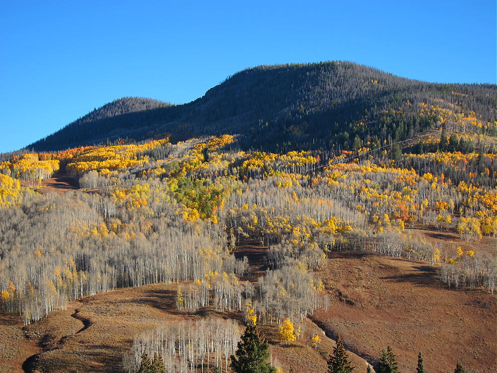
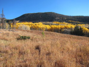
- Sheep Mountain – Southwest Side, Aspen Groves and Elk Meadows
Driving Directions:
• Drive west from Denver on I-70
• Turn north on Highway 40
• Cross Berthoud Pass, drive through Winter Park, and continue north to Fraser
• At Fraser, turn west on CR 73
• Follow CR 73 west about a mile, and turn right on CR 50S
• CR 50S merges with CR 50 after about 1 mile
• Follow good dirt road CR 50 about 3 more miles west to the National Forest
• Continue on CR 50/FR-139 up the Crooked Creek Drainage almost 3 miles, to where the road crosses to the north side of Crooked Creek, at about 9240 feet
• A small road FR-880.1 heads off to the right and northeast up a hill
-
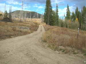
- Sheep Mountain – Start of FR 880.1
-
- Sheep Mountain – FR 880.1 near Rocky Point
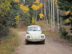
• Drive up this narrow 2WD road about ¾ mile to where it curves sharply at about 9680 feet, just north of Rocky Point
• This is near some large power lines, as well as campsites
• Park near the bend in the road
The Climb:
• From the parking spot, hike east and slightly down, along the power line right-of-way, for about ¼ mile
-
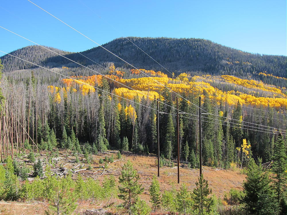
- Sheep Mountain – Route from Rocky Point along Power Lines
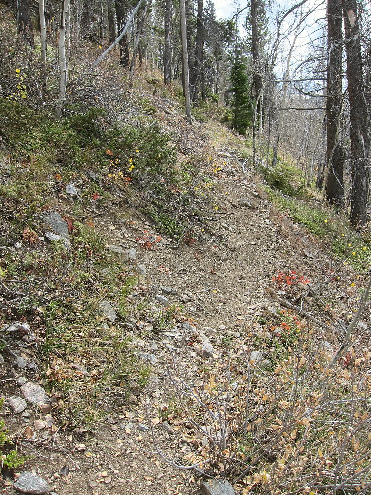
• Head north up through meadows and aspen groves
-
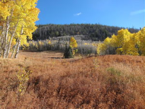
- Sheep Mountain – Start of Meadow Route
-
- Sheep Mountain – Ascent Route HIgher Up
-
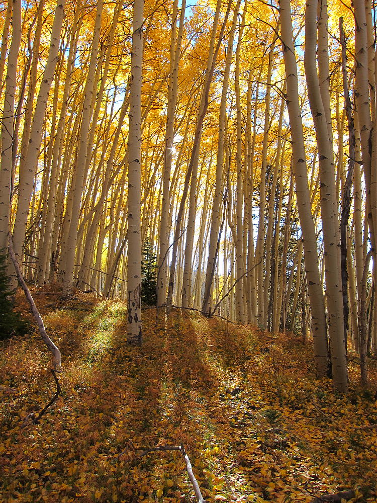
- Sheep Mountain – Up Through the Aspens
• Gradually climb more to the northeast, toward Sheep Mountain
-
- Sheep Mountain – Meadow Route Border
• Near the top of a meadow area, a game trail leads east and climbs steeply around the south ridge of Sheep Mountain
-
- Sheep Mountain South Side Game Trail
• Follow this game trail up, and then follow other game trails more or less north up the south side of the mountain
• Soon you’ll ascend the distinct summit ridge
-
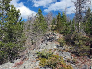
- Sheep Mountain South Ridge Route
-
- Sheep Mountain, South Summit
• Follow the ridge north to the summit
Sheep Mountain has two similar summits – the southern one is the actual summit – the slightly lower northern summit is about 1500 feet along the ridge to the north.
Details:
The Arapaho and Roosevelt National Forest Map is useful for planning a hike to Sheep Mountain. In particular it shows the useful roads FR-139 (CR 50) and FR-880.1. The route I found is rarely used by humans, but it’s short and sweet.
The entire summit ridge is made of hard, gray, resistant gneiss.
-
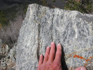
- Sheep Mountain South Ridge Gneiss
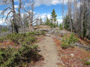
There’s a geocache in a bottle on the peak. A visible trail runs north along the ridge from the summit. People climb Sheep Mountain mostly from the north. There’s access at the YMCA Snow Mountain Ranch, and perhaps elsewhere. The Ranch calls this peak “Snow Mountain”.
Sheep Mountain is an excellent SOTA peak. The activation zone is of moderate size, with good trees and nice spots to set up. There’s no development on the mountain, except for the power lines, and they seem to be quiet – the RF noise level was low. This is a fine HF site. It’s not blocked much for skip signals, except to the south. The peak has limited VHF/UHF coverage of Winter Park, Fraser, Granby, and Grand Lake.
-
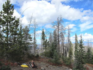
- Sheep Mountain Summit – KX0R Activation
-
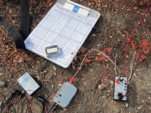
- Sheep Mountain – KX0R Radio Gear
My log shows 33 CW contacts on three HF bands. These included three summit-to-summit (S2S) contacts:
KE7BGM Kay on W7A/AP-033
NM5S Alan on W2/NJ-009
K2JB Dean on W4C/CM-110
Sheep Mountain is easily combined with nearby Blue Ridge, W0C/PR-100, for a dual activation. After Sheep Mountain, Blue Ridge is just a pleasant walk.
The peak offers good views of nearby Ptarmigan and Byers Peaks to the south, Blue Ridge to the west, as well as more distant ranges.
-
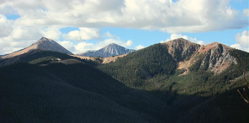
- Sheep Mountain – View South to Bottle, Byers, and Ptarmigan Peaks
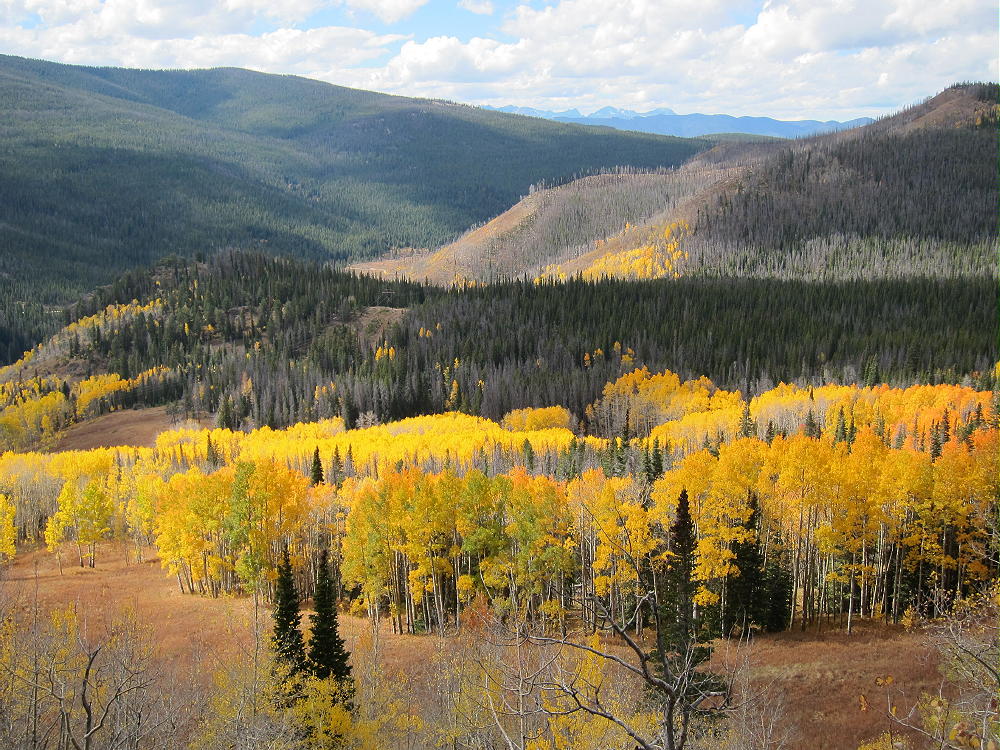
When I was there in early October, the aspen trees were spectacular!
Sheep Mountain Aspen Gallery:
-
- Sheep Mountain View Southwest to Rocky Point
-
- Sheep Mountain – View Down Southwest
-
- Sheep Mountain – Meadow Route
-
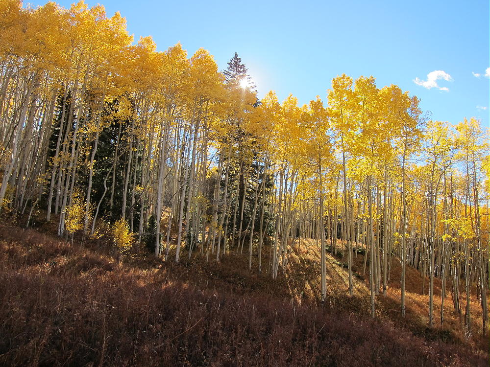
- Sheep Mountain – Amazing Aspens
73
George
KX0R
![]() !! WARNING !! There are old mountaineers, and
bold mountaineers... there are no old-bold mountaineers.
Hiking and mountain climbing are potentially hazardous activities particularly in Colorado with its extreme elevations. I am not accepting responsibility for any death or injury resulting from activations based on my trip reports. Proper training, experience, and personal capability assessment is required - enjoy!
!! WARNING !! There are old mountaineers, and
bold mountaineers... there are no old-bold mountaineers.
Hiking and mountain climbing are potentially hazardous activities particularly in Colorado with its extreme elevations. I am not accepting responsibility for any death or injury resulting from activations based on my trip reports. Proper training, experience, and personal capability assessment is required - enjoy!