


W0C/PR-085
Mount Patterson
3482 m / 11424 ft
First Activation
Sep 12, 2015
By KX0R
Mount Patterson is located on the west side of the Continental Divide in the backcountry of Rocky Mountain National Park.
Key Points:
• Rocky Mountain National Park
• Wilderness Trip
• Seldom climbed
• No marked trail
• Navigation and route-finding required
• Game trails all the way to the top
• ~ 8.5 miles round trip
• ~ 2750 vertical feet
• SOTA Classic !
-
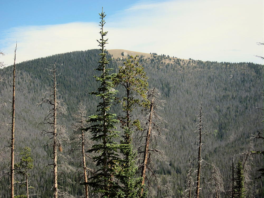
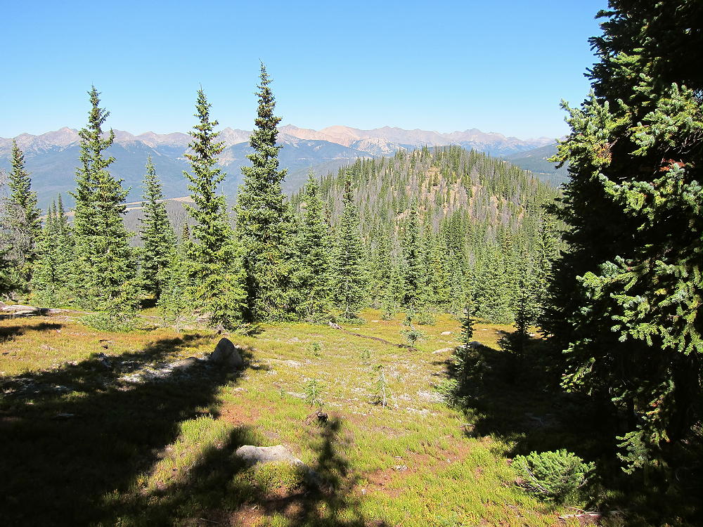
- Mount Patterson from Green Mountain
Figuring out how to climb Mount Patterson, navigating up to the summit, and doing the first activation on a fine day in September was a lot of fun!
The ascent required a little more than 2-1/2 hours, and the descent took slightly less time. I was on top almost three wonderful hours! This is not a family hike.
Driving Directions:
• Drive to the west side of Rocky Mountain Park.
• The only road is US 34
• Either motor across Trail Ridge Road, or
• Drive via Grand Lake
• Continue to the Green Mountain Trailhead, about 4 miles north of Grand Lake
• This popular trailhead is on the east side of the highway.
The Hike:
• Follow the easy trail about 1.5 miles to Big Meadows
• The vertical gain in this sections is 600 feet
• Turn right, south, on the Tonahutu Creek Trail
• Continue south about 0.4 mile
• Find a marked path leading east toward the Meadows
-
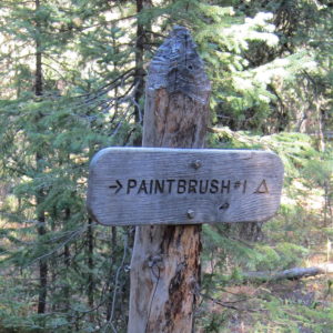
- Mount Patterson Route – Trail Sign to Campsite
• This trail leads to a backcountry campsite called Paintbrush #1
• This path includes a very useful bridge across the large creek
-
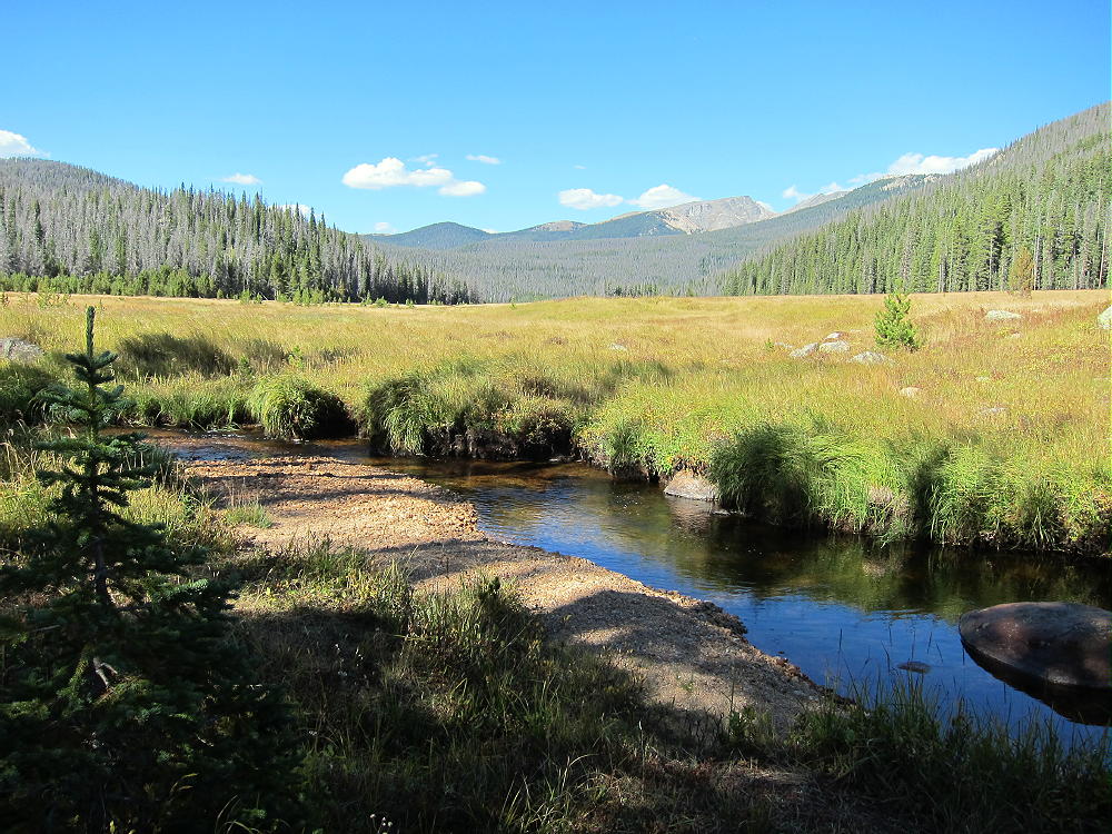
- Mount Patterson Trip – Big Meadows
• Follow the path east across the meadow to the forest
• Choose a route up the big mountain
Key Details:
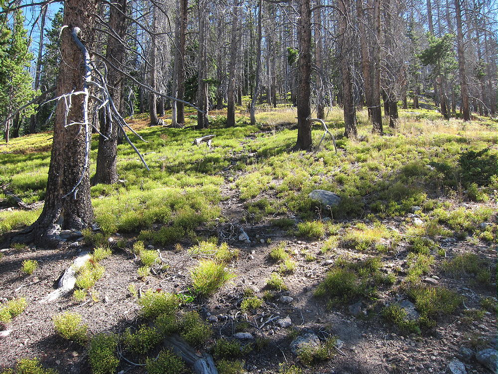
Several game trails lead up the slope, and a few contour through the forest. The easiest way to climb Patterson is to ascend to the broad saddle at 10,880 feet, northwest of the summit. A ridge route leads all the way up, starting southeast of the Paintbrush campsite path. Study a topographic map carefully before going up there – the navigation is really easy with preparation!
The immediate goal is to find a game trail leading southeast to the ridge that climbs towards the saddle northwest of Patterson – many game trails are available on the slope. The ridge is the northern edge of the basin west of Patterson’s summit. This ridge route is the key to the climb.
-
- Mount Patterson – West Side Game Trail Route
There’s an established game trail up this ridge, all the way to the high saddle. This major game trail provides an efficient, pleasant ascent through open pine woods. It climbs east, up along the ridge, or slightly north (left) of it, all the way up the slope, for 1500 vertical feet to the saddle! This route even includes a couple of nice overlooks, with views down the Tonahutu Creek valley toward Grand Lake; Green Mountain W0C/PR-110 stands across the valley at 10313 feet. This route is as efficient as many constructed trails!
-
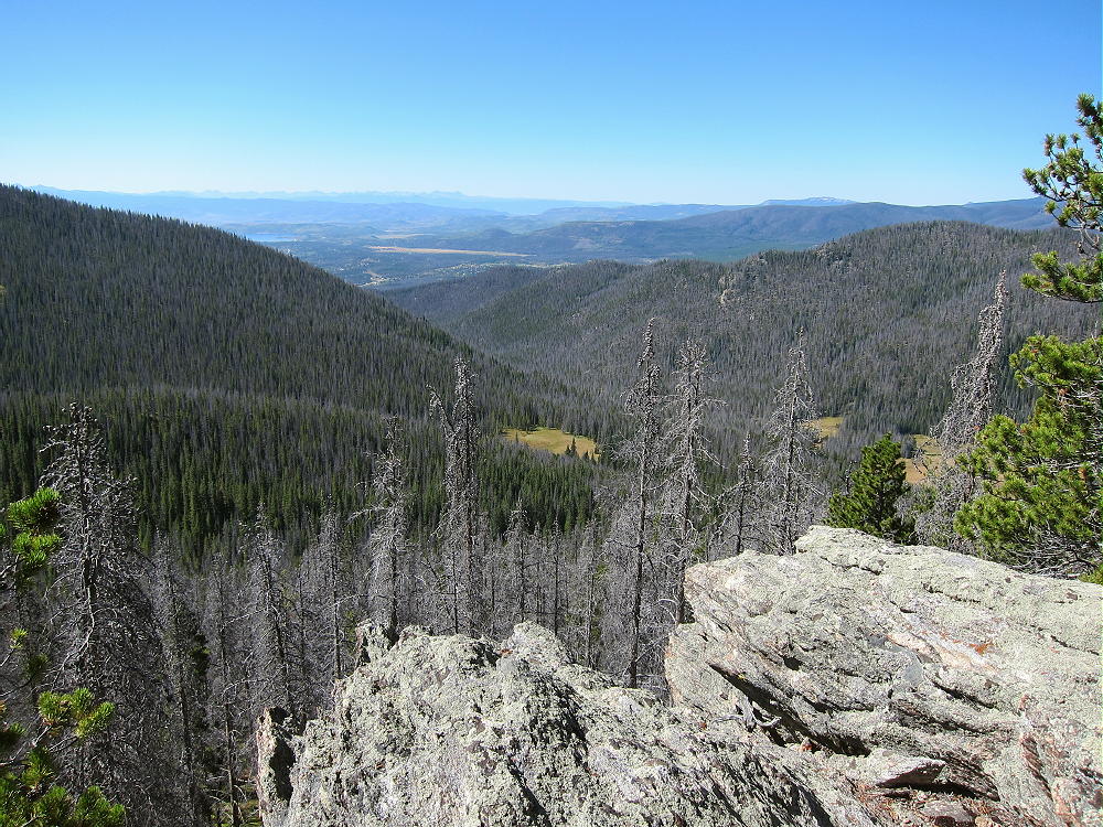
- Mount Patterson – West Side Route Overlook, View Southwest, Green Mountain at Right
In the image above, the ridge leading to Mount Nisa is on the left. This provides another route to the summit of Mount Patterson. Nisa Ridge is south of the ridge route described here.
Plan on spending well over an hour to climb from the valley to the saddle at 10,880 feet – I did it in 1:08 on a good day. From the saddle, hike southeast up through open sub-alpine forest on the gentle northwest ridge of Patterson; it’s about ½ mile and 500 vertical feet from the saddle to the top. There are good game trails there also.
-

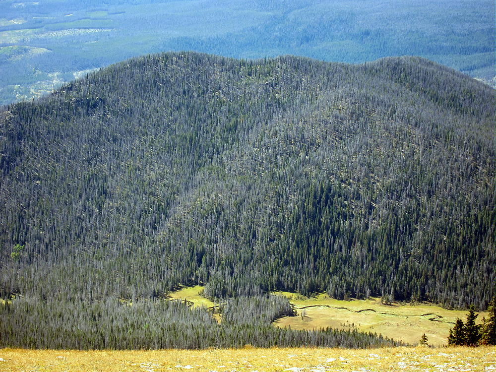
- Mount Patterson North Slopes
The mountain top is a huge meadow of many acres – I was stunned when I first saw it! Wide views extend out in all directions. Chiefs Head and Mount Alice stand high behind the Divide to the east; lakes shimmer down below to the south; several high peaks along the Divide are visible to the north. The Never Summer Range extends like a wall across the western horizon.
-
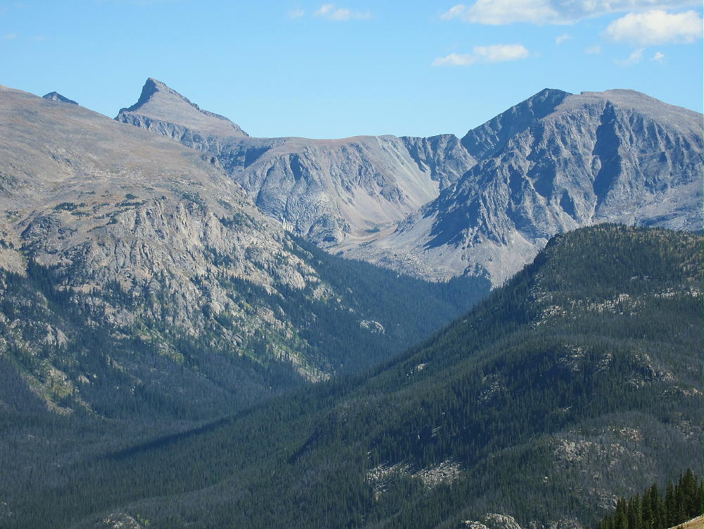
- Mount Patterson – Chiefs Head and Mount Alice
The actual peak is at a cairn on the west side of the meadow.
-
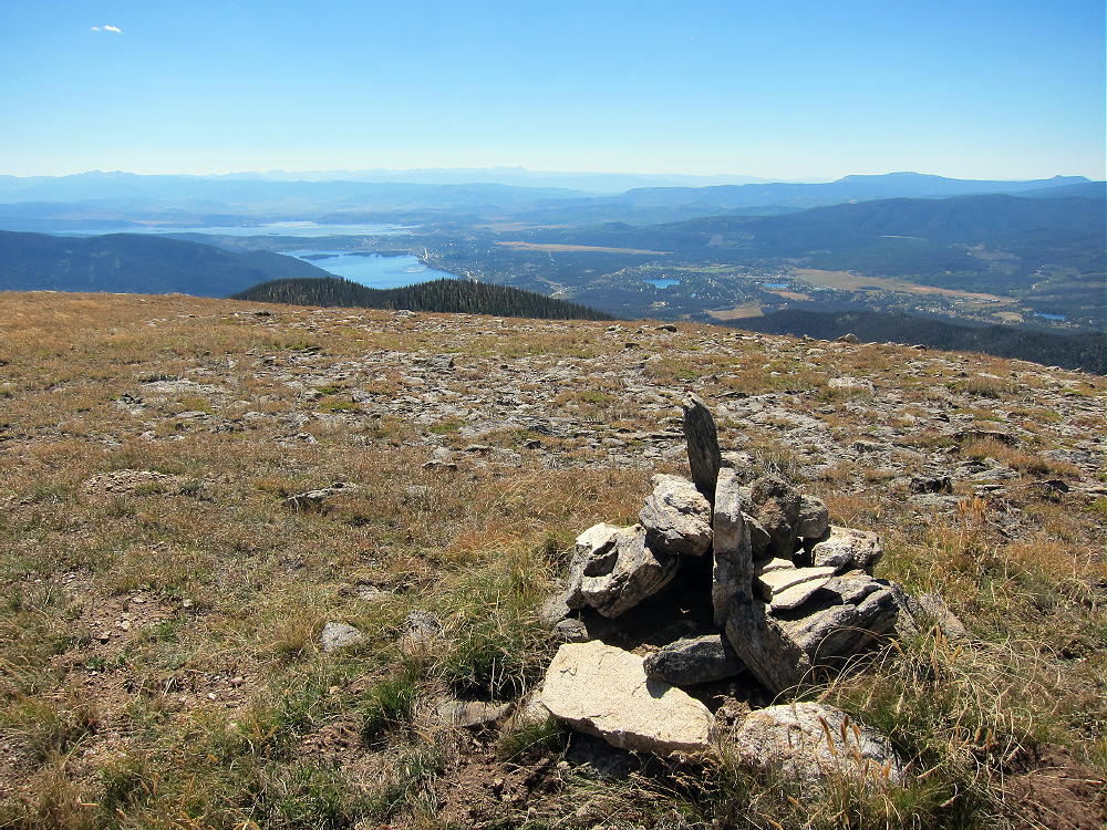
- Mount Patterson Summit Cairn – View South
-

- Mount Patterson Summit Cairn – View East
The vast activation zone offers choices. Large trees north of the summit offer shelter from wind; smaller trees in the meadow are ideal for supporting a pole; the southern part of the meadow is wide open, with fine views and flowers in summer.
-
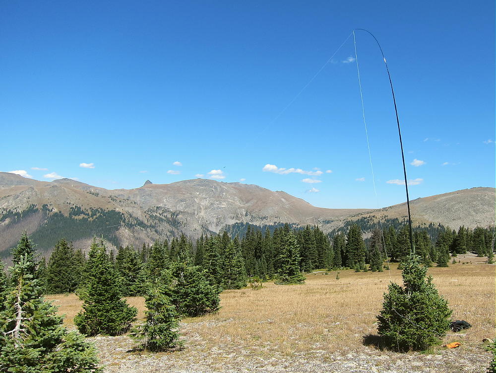
- Mount Patterson Summit – Radio Activation
Mount Patterson is miles from any development, so the RF noise level is very low. The summit is high, but higher mountains stand a few miles away – HF propagation is still be OK in most directions. The only VHF/UHF coverage is down the valley to the south. I was on the air for over 1-1/2 hours on the 7-10-14-18 MHz bands, CW only. The log has 34 QSO’s, including 6 amazing summit-to-summit (S2S) contacts!
Mount Patterson offers a wilderness experience combined with a scenic SOTA activation. There are many deer, elk, and moose, and other wild animals in that area. There’s no hunting, but camping is allowed at specific backcountry sites, with a formal permit. It’s possible to camp at one of the sites below Mount Patterson, and then hike up the mountain from camp. Information on camping is available online.
If you climb Patterson, start your drive very early; tell someone exactly where you plan to go and when you expect to return. Take the Ten Essentials. GPS is not required for this hike, if you have a detailed topographic map, a compass, and a good sense of direction. However, a GPS unit with internal topo map data is good for resolving questions about the route, keeping a record of the track, and helping to backtrack accurately.
-
- Mount Patterson Northwest Saddle
Mount Patterson could be combined with other SOTA peaks in the area for a dual activation, or for a group of activations while visiting the National Park:
W0C/PR-110 Green Mountain
W0C/PR-144 Green Ridge
W0C/PR-076 Jackstraw Mountain
W0C/PR-092 Gray Jay
W0C/FR-016 Mount Ida
W0C/FR-123 Trail Ridge
W0C/FR-019 Sundance Mountain
Plus many other SOTA summits…
-
- Green Mountain from Mount Patterson
Mount Patterson is a SOTA Classic in every way. It offers a combination of the best characteristics of Colorado SOTA peaks:
• A challenging, fun hike
• Superb high-mountain scenery
• Wilderness experience
• Nearly ideal quiet radio site
• Huge activation zone
• Accessible in summer and fall
• Summit is rarely visited by people
• No access to vehicles
If you go up there, tread lightly on the meadow, and please leave things just as they are…
73
George
KX0R
![]() !! WARNING !! There are old mountaineers, and
bold mountaineers... there are no old-bold mountaineers.
Hiking and mountain climbing are potentially hazardous activities particularly in Colorado with its extreme elevations. I am not accepting responsibility for any death or injury resulting from activations based on my trip reports. Proper training, experience, and personal capability assessment is required - enjoy!
!! WARNING !! There are old mountaineers, and
bold mountaineers... there are no old-bold mountaineers.
Hiking and mountain climbing are potentially hazardous activities particularly in Colorado with its extreme elevations. I am not accepting responsibility for any death or injury resulting from activations based on my trip reports. Proper training, experience, and personal capability assessment is required - enjoy!