


W0C/PR-002
Mount Richthofen
3944 m / 12940 ft
First Activation
Sep 27, 2015
By KX0R
Mount Richthofen is the highest peak in the rugged Never Summer Range in Rocky Mountain National Park. This special mountain offers a very challenging SOTA activation, with all of the rewards that come with high alpine summits.
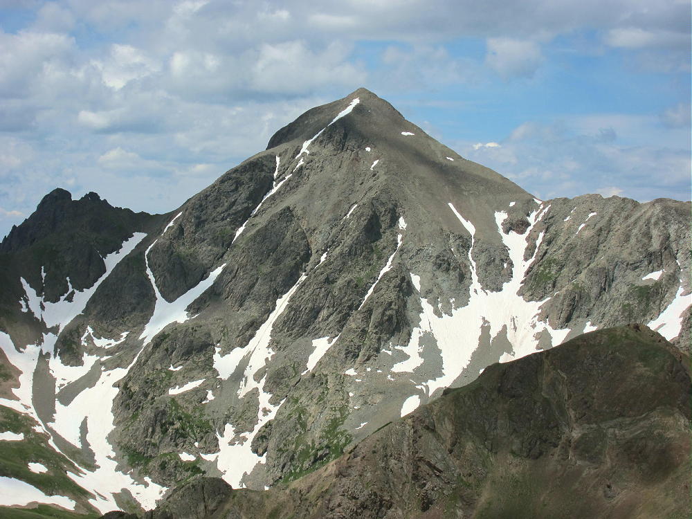
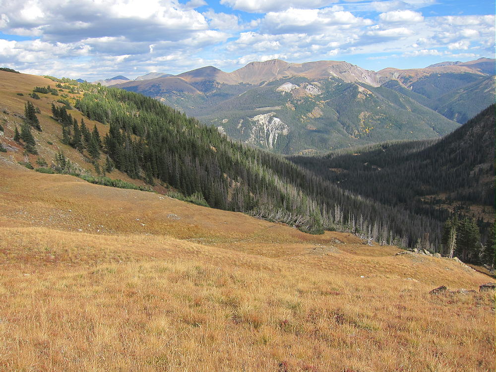
Mount Richthofen from Lulu Mountain
I waited until everything was just right to activate Richthofen, and the experience was superb. Mount Richthofen demands plenty of respect, and only climbers with off-trail alpine experience should venture near it. Decades ago I climbed this peak, and I thought it was hard then. It certainly wasn’t any easier in 2015!
Key points:
• Rocky Mountain National Park
• Wilderness journey
• There are two primary routes – the east side and the west side
• The east side route can be accessed from either the Colorado River Trailhead in RMNP, or from the Thunder Pass route starting near Cameron Pass
• The west side route is accessed from near Cameron Pass via Lake Agnes
• This report is about the longer route from the Colorado River Trailhead
• The total round-trip distance is 15.4 miles
• The total elevation gain is about 3900 feet
• This trip is Grade II, Class 2, with Class 2 on some of the summit ridge
• The route is via the big ridge southeast of Richthofen, and then up the rocky southeast slope to the top
• Most of the route above 10,400 feet is off-trail, in wilderness
• It takes a long day to climb and activate Richthofen
• My ascent required about 4-1/2 hours, including breaks, etc.
• I was on top about 1-1/2 hours
• My descent time was about 4-1/3 hours
• The driving time from Boulder to the trailhead was about 2 hours each way
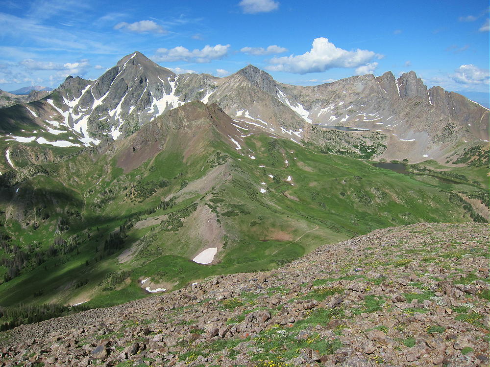
Richthofen, Static Peak, and Nokhu Crags from Lulu Mountain
A few details:
The Colorado River Trailhead is on the west side of Rocky Mountain National Park. The easiest route from the Denver Metro Area is across the Divide via Trail Ridge Road, Route 34.
From the Colorado River Trailhead, hike north, and take the trail to Lulu City at the first junction. The trail follows the valley of the Colorado River to the site of an old mining town. Continue north to a major split just south of Lulu City; take the left fork to Lulu City and Thunder Pass; don’t follow the trails to Little Yellowstone or La Poudre Pass. Where the trail splits north of Lulu City, again take the left fork toward Thunder Pass; don’t go to Little Yellowstone Canyon. The correct trail ascends northwest, following the path of an old stage road up to about 10,160 feet, where the path divides again. This junction is well-signed; take the left fork southwest toward Ditch Camp #3 Campsite, Skeleton Gulch, and Mount Richthofen; don’t go right, northeast, toward Box Canyon Campsite or Thunder Pass.

Key Sign to Mount Richthofen East Ridge Route
Follow the trail about ¼ mile, past the campsite, to the Grand Ditch. Turn right on the Ditch Road, walk a short distance north, and find the marked trail leading over a bridge across the Ditch, and into Skeleton Gulch.
Cross the bridge and take a break. This is a good spot to pump some water, have a snack, and prepare for the climb; there’s no water on Richthofen above Skeleton Gulch.
The route to Richthofen requires climbing the long east-west ridge southeast of the summit.
East Ridge Route of Richthofen – View SE from near the Summit
There are various ways to ascend the ridge from the Skeleton Gulch Trail. I walked about ½ mile west on the Skeleton Gulch trail from the Ditch; then I chose a route up the south side of the ridge, at a place where the slope looked reasonable.
Game Trail up from Skeleton Gulch ot East Ridge
Further west in the Gulch, the slope becomes steep and craggy. There’s no marked route, but several game trails lead up to the ridge. It’s also possible to climb up the southeast end of the ridge without going very far into Skeleton Gulch.
The open ridge-top is a grand place with fine views; an easy hike leads west across the grassy tundra toward Richthofen.
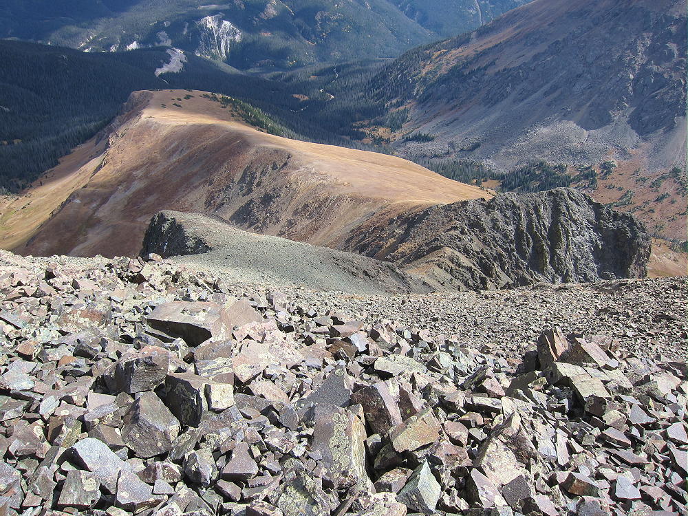
East Ridge of Richthofen – View toward the Southeast
This is a good place to see bighorn sheep. At 12,000 feet, the easy ridge-route ends with a steep ascent up a rocky gully to a dark buttress southeast of Richthofen.
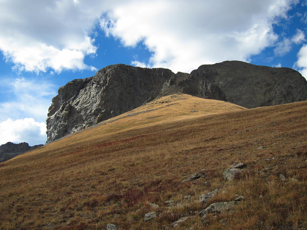
Route up East Slopes of Richthofen to Buttress
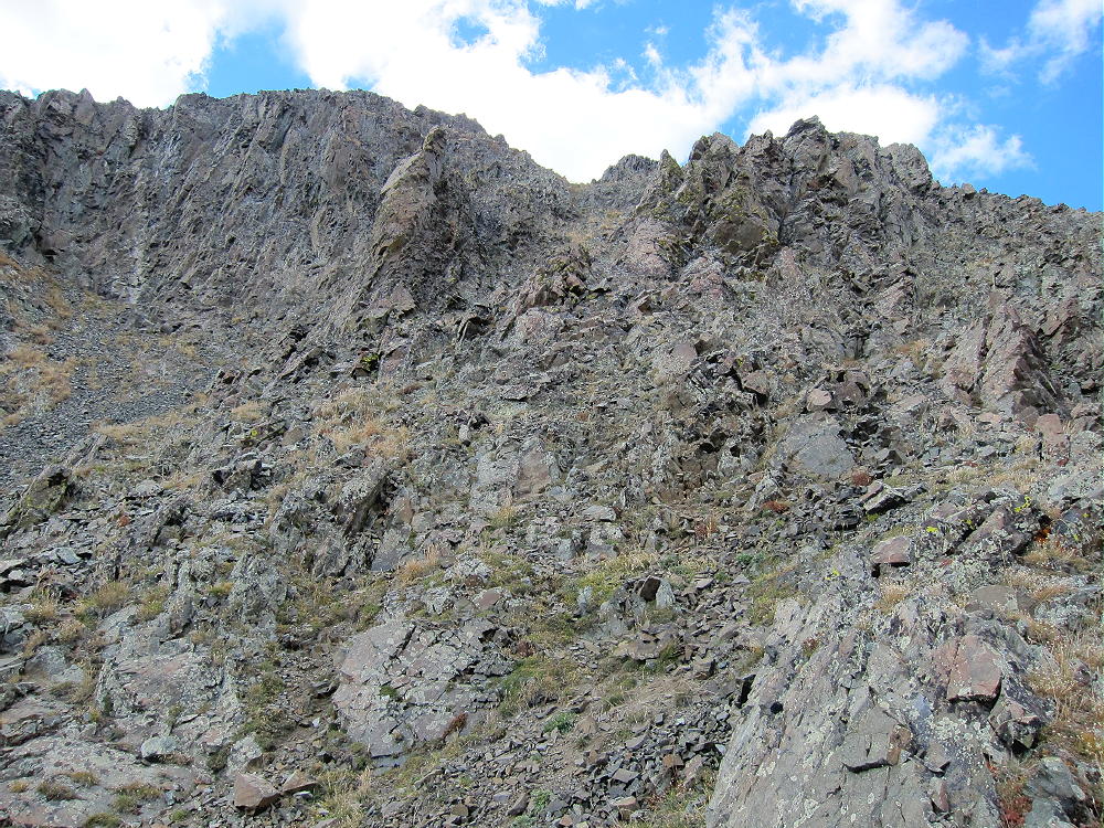
Class 2 Route up Rocky Gully to top of Buttress
There are climbers’ trails up through the talus. You have to get over or around the east side of the buttress – no difficult moves or serious exposure are required. A route through the obvious notch is OK, as well as a traverse east of the notch.
Looking down at Buttress Route
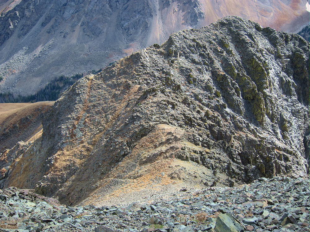
Past the knob descend to an easy saddle, and then do a steep, challenging ascent up about 600 vertical feet of loose rocks. Pick the best route you see, and avoid any really steep areas. The Class 2 route leads right up to the east end of Richthofen’s summit ridge.
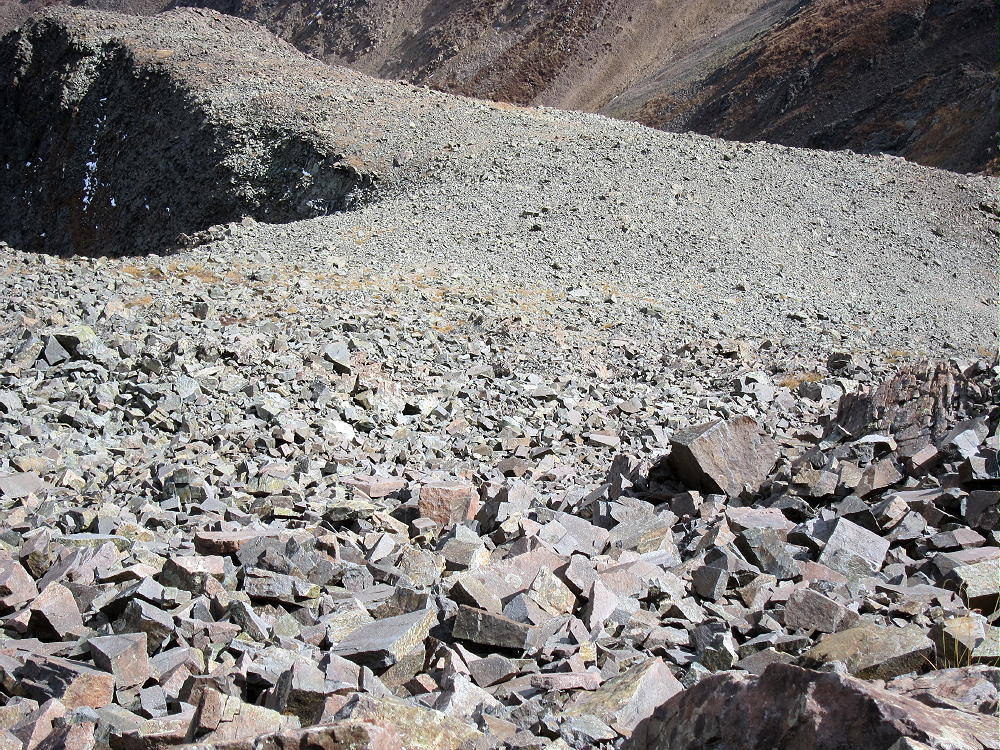
Rocky Southeast Slope of Richthofen
The summit is small and rocky, but it’s a spectacular, exciting place. As you look at the incredible views all around, you may forget about your activation! Lake Agnes, Mount Mahler, Tepee Mountain, Lead Mountain, Static Peak, the Nokhu Crags, Lulu Mountain, and the Diamond Peaks fill the amazing scene.
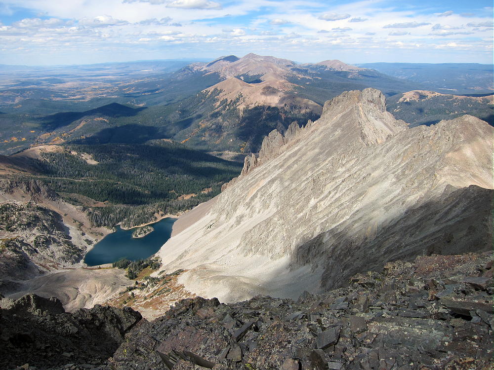
View North from Richthofen across Nokhu Crags
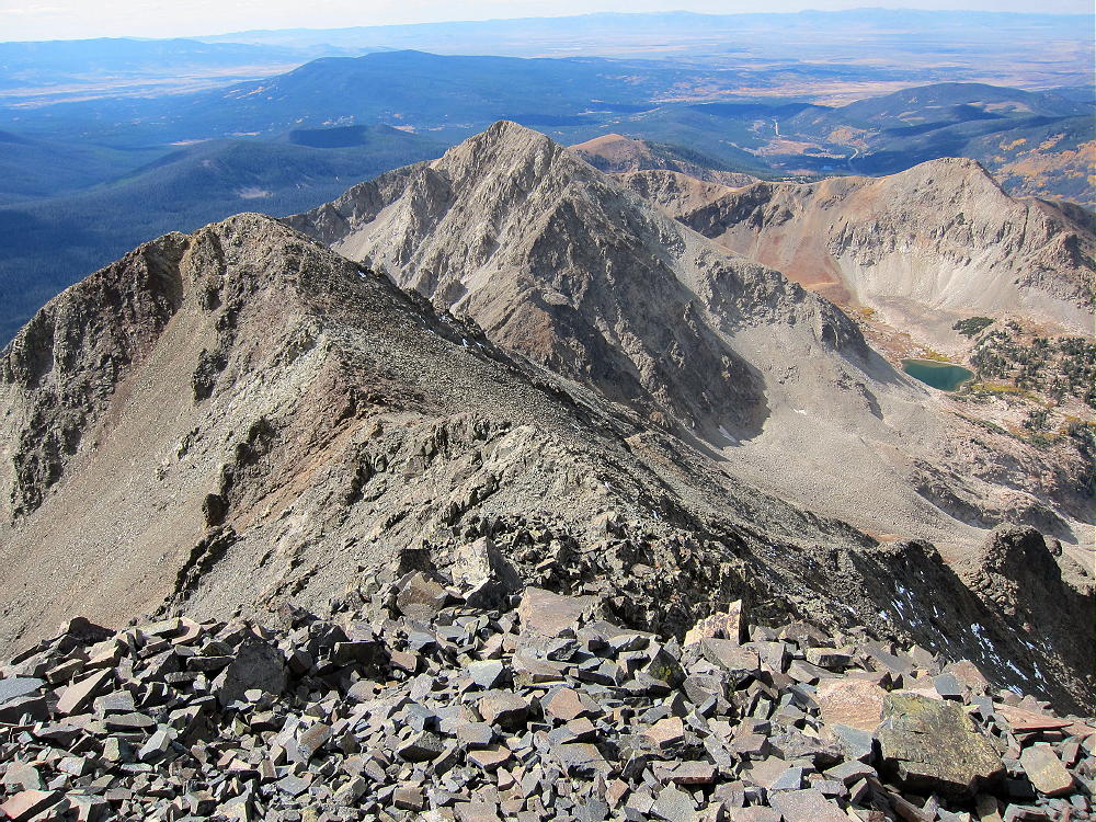
Richthofen West Ridge to Mount Mahler – North Park Beyond
On Richthofen you may feel suspended above all the other local summits! Many more high peaks stand far beyond the local summits. The Medicine Bow Range runs north in the distance, the Never Summer Range leads south for miles, and the Park Range stands like a wall on the west side of North Park.
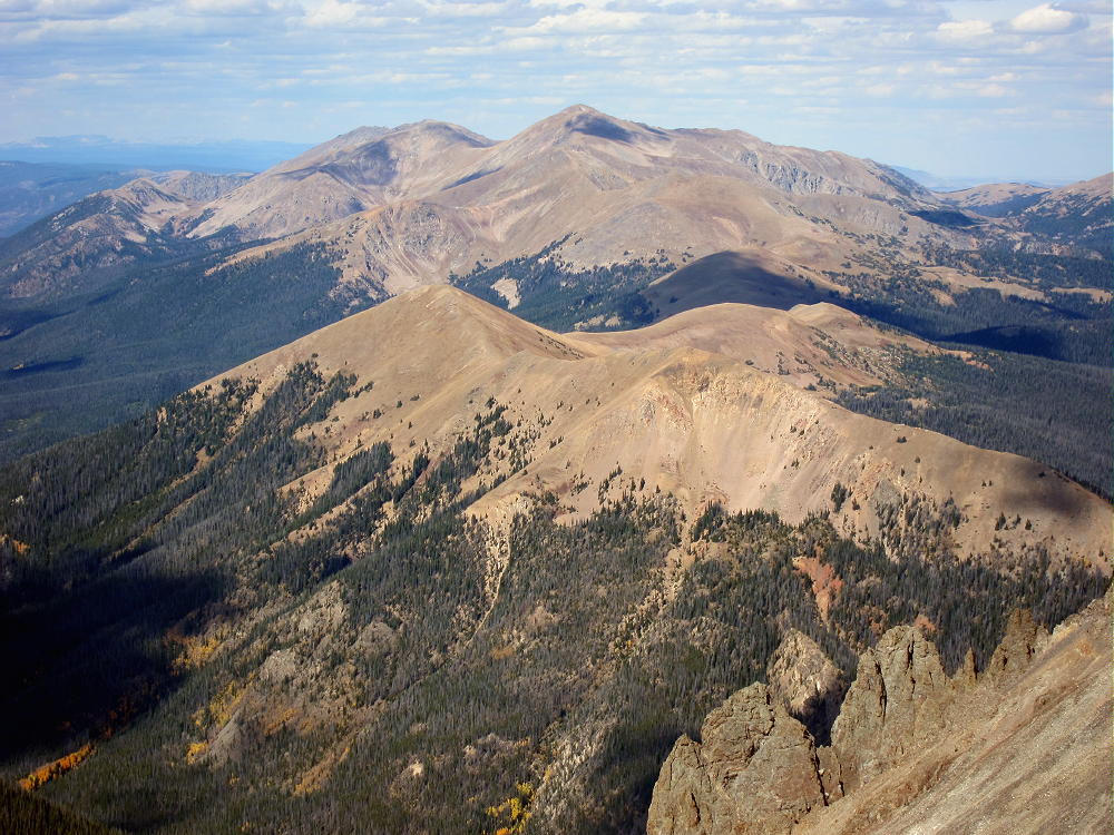
View North to Clark Peak – Medicine Bow Range Beyond
Richthofen has a nice rock shelter right on top. If no one else is there, you can set up radio gear in the shelter and run a wire along the ridge.
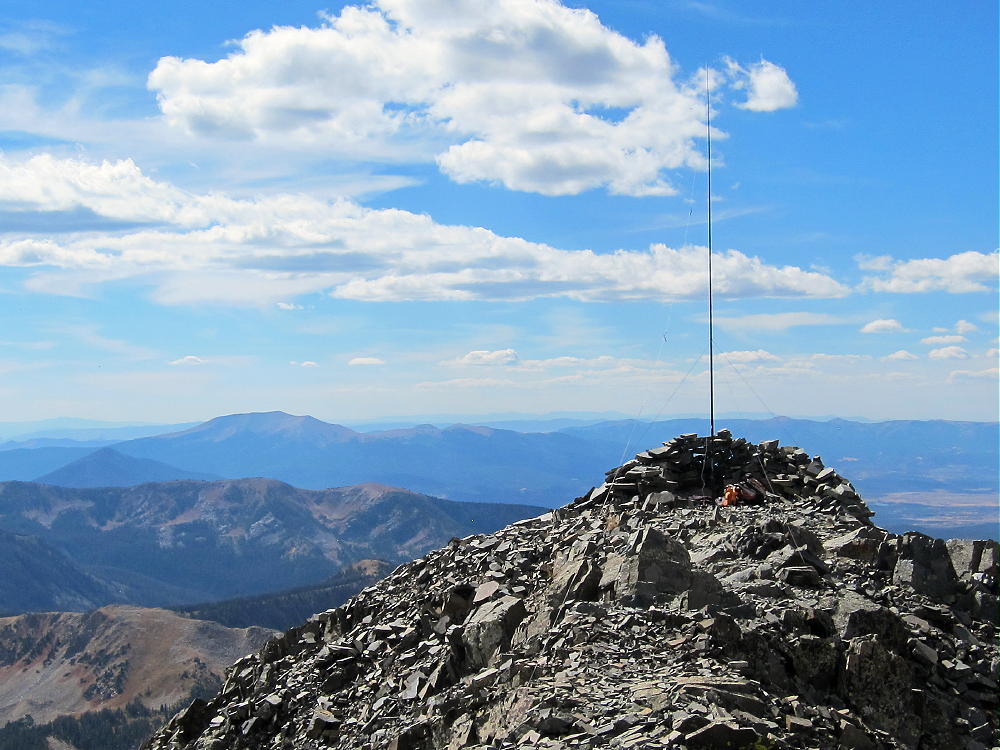
First SOTA Activation of Mount Richthofen
The summit is all rocks, and a pole is required for a good HF activation. As Richthofen is the highest mountain in the area, it’s a great HF site. No development lies within several miles of the peak, so man-made RF noise is minimal. The only possible problem with Richthofen is that because its slopes are so steep, it offers no ground plane to reflect and enhance HF signals toward the horizon.
I was concerned about time, so I limited my activation to 20M CW. Propagation was excellent, and I made 28 contacts in 25 minutes; these included an S2S with W7TAO on W7W/OK-164 in Washington, and S58AL in Slovenia, about 5500 miles to the northeast! If I had it to do again, I would have operated on more HF bands.
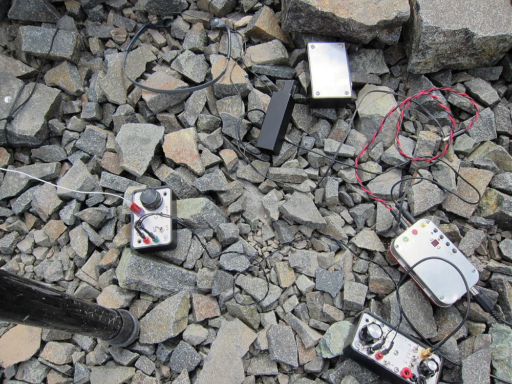
KX0R Radio Equipment on Mount Richthofen
Mount Richthofen probably is a poor summit for VHF/UHF contacts. It looks out across North Park and southern Wyoming, but not many people live there; the eastern Plains are barely visible to the northeast, but again, not a very populated area. All the major population centers are mostly blocked to VHF/UHF signals by numerous mountains standing south, east, and north of Richthofen.
Mount Richthofen is a SOTA Classic for many reasons:
• Superb views
• Beautiful sub-alpine journey
• Challenging alpine hike
• Very prominent summit
• Lightly visited
• Interesting geology
• Pristine wilderness in Rocky Mountain National Park
• Miles from development
• Low RF Noise
The Never Summer Range breeds lightning storms in summer. Avoid this area if storms are likely! The entire ridge route is dangerous in bad weather! Don’t go near this place, unless the weather is good and predicted to stay dry.
There are many opportunities for camping, backpacking, fishing, and other recreation in the nearby National Forests, the Colorado State Forest, and Rocky Mountain National Park. There are nice back-country campsites in Skeleton Gulch and near the trails below Mount Richthofen – reservations are required.
Unfortunately Mount Richthofen is too difficult a mountain for most hikers and SOTA activators. This summit calls to the few who seek the challenge of a long, hard day combined with an incredible alpine activation.
73
George Carey Fuller
KX0R
Suggestions for the north approaches:
Starting from Cameron Pass might be a better choice from Fort Collins or other northern areas; this requires driving about 60 miles up the Poudre Canyon via Highway 14. Both the American Lakes Trailhead and the parking area near Cameron Pass provide access to the Thunder Pass Trail, for the eastern route, as well as the Lake Agnes Trail, for the western route.
About 2-1/2 miles southwest of Cameron Pass, Road 62 leads east, down from Highway 14 into the Michigan River Valley. This 2WD road is passable by most cars to the American Lakes Trailhead – it’s about 1-1/2 miles east of the turnoff from the highway. Part of the trail is in the Colorado State Forest, and a pass is required for parking and entry – there is a fee.
An alternate place to park and enter this area exists – a large parking area off the main highway is just north of Cameron Pass. This is a popular spot; get there early, especially on weekends. There is no fee to park.
Cross Highway 14 and look for a gated dirt road that parallels a ditch. A fee is requested to walk this road into the State Forest. Follow the almost level road for about two miles southeast along the ditch to where it intersects the American Lakes Trail near 10,400 feet elevation. This route adds about one easy mile each way, but it avoids several miles of driving on the highway and the dirt road. The total time is about the same with either route. This is a beautiful area, with moose, deer, elk, trout, lush vegetation, and many wildflowers in summer.
The American Lakes Trail leads up past American Lakes to Thunder Pass, and then down southeast about 1-1/2 miles to Grand Ditch and the Skeleton Gulch Trail. From there, the climb up Richthofen via the big ridge southeast of the summit is the same as described above. Unfortunately the north route via the Thunder Pass Trail requires an ascent of about 1100 vertical feet up from Grand Ditch on the return trip north, so this adds to the difficulty. The total vertical gain of the climb from the American Lakes Trailhead to Thunder Pass, the climb from Grand Ditch up Richthofen, and the return climb from the Ditch to Thunder Pass is about 5250 feet. This is somewhat extreme.
The alternate more-efficient route is to climb the west side of Richthofen via Lake Agnes. I have not done this route. The climb is steep, but it requires only about 2700 feet of vertical gain from the Lake Agnes Trailhead, accessible from Road 62. This climb is Class 3, with plenty of talus and steep rocks above Lake Agnes. From the top of Richthofen, the west route looks harder than the southeast route, but it’s much shorter.
Please be careful!
KX0R
![]() !! WARNING !! There are old mountaineers, and
bold mountaineers... there are no old-bold mountaineers.
Hiking and mountain climbing are potentially hazardous activities particularly in Colorado with its extreme elevations. I am not accepting responsibility for any death or injury resulting from activations based on my trip reports. Proper training, experience, and personal capability assessment is required - enjoy!
!! WARNING !! There are old mountaineers, and
bold mountaineers... there are no old-bold mountaineers.
Hiking and mountain climbing are potentially hazardous activities particularly in Colorado with its extreme elevations. I am not accepting responsibility for any death or injury resulting from activations based on my trip reports. Proper training, experience, and personal capability assessment is required - enjoy!
Pingback: More hiking and some QRP radio | BackCountryJournal.net
Pingback: Amateur Radio Fox Hunts? | BackCountryJournal.net