


W0C/FR-179
8849
2697 M / 8849 ft
Aug 25, 2013 First Activation
June 8, 2014 Second Activation
by KX0R
Initially Summit 8849 looks like an insignificant 2-point SOTA peak, so unimportant that it doesn’t have a regular name. One of the best aspects of the SOTA program is that we visit summits like this, and so discover these special places.
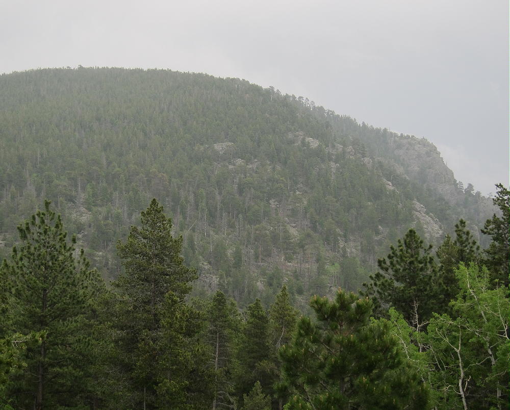
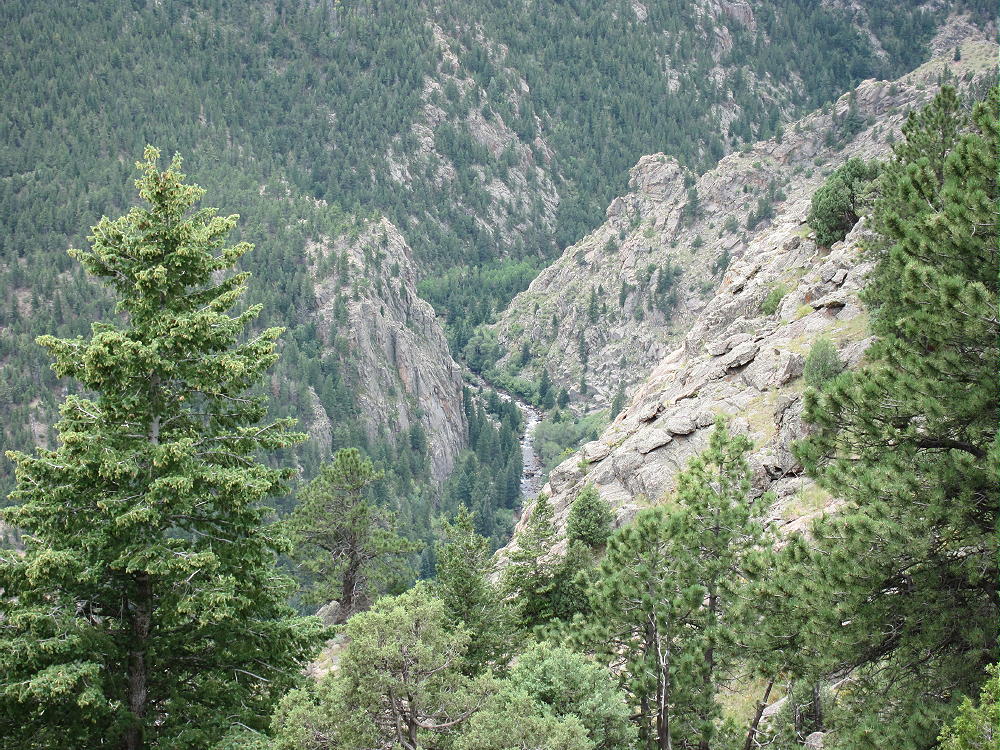
Summit 8849 with Balcony at Right
Getting to 8849 is not hard – drive up the Peak to Peak Highway, Highway 119, north of Allens Park, to Meeker Park, east of huge Mount Meeker. Turn east on Boulder County Road 82, a fair dirt road; follow it about a mile to a fork; and then turn right on Road 82E. Stay on 82E through private property for about 2 more miles; head east down along Cabin Creek, and then follow the winding road up a steep hill to the USFS boundary. The road has been recently repaired, and it’s OK for ordinary cars, as long as it’s dry. At the hilltop, there’s parking and a few informal campsites. Forest Road 118 branches off to the right and leads to 8849, as well as to Johnny Park – several more miles further east. When I was there on June 8, 2014, there were several groups of campers at the hilltop; road 118 was gated, but not closed to hiking.
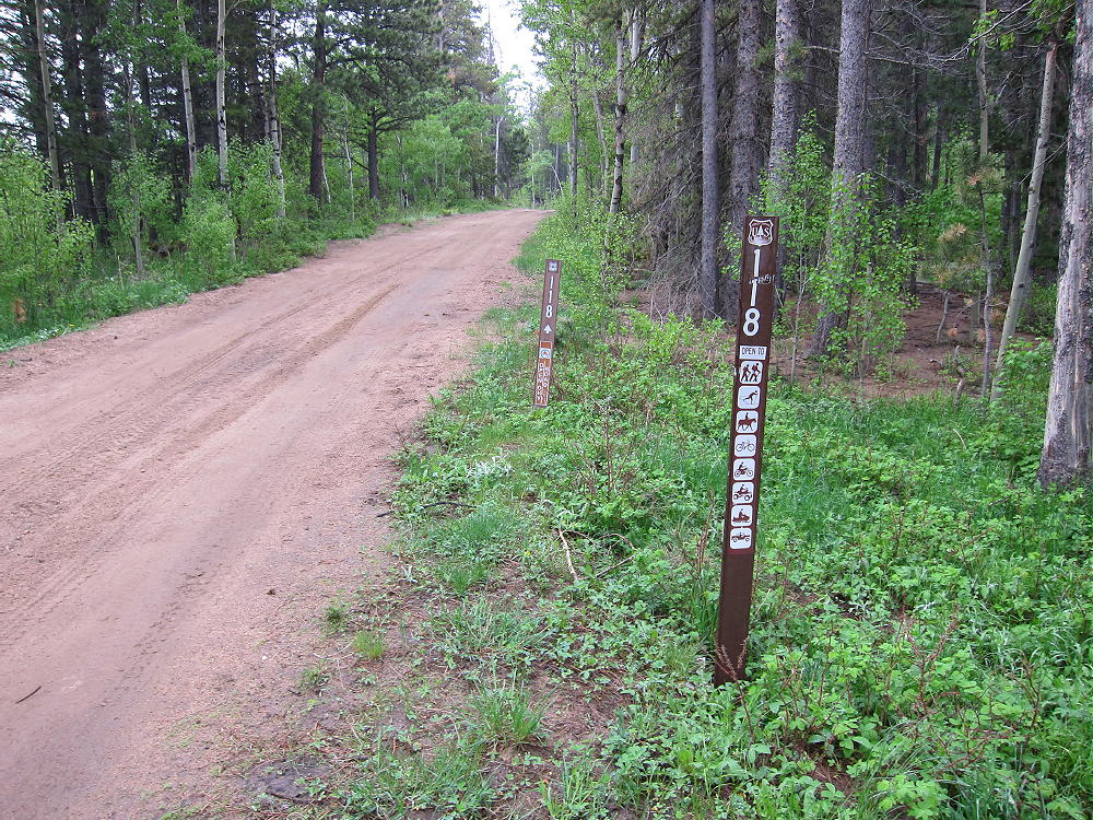
8849 Road 118
Summit 8849 is 1.6 miles from the hilltop parking spot where Road 118 begins; there is only about 600 vertical feet of gain. If the gate is open on Road 118, it may be possible to drive within 3/4 mile of the summit, with only about 400 vertical feet of gain required.
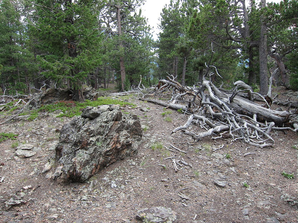
Road 118 is not shown on Google maps, but it’s clear in the satellite images. It leads to a saddle between an un-named summit and 8849; 8849 is visible from this saddle – the broad forested summit and the distinctive cliff “balcony” on the southwest side can be seen almost a mile away. Just past the saddle, head right off the road, and enter an obvious firebreak that has been cleared through the forest.

8849 Route via Firebreak
Hike up through this firebreak for about half a mile, being careful not to trip over the debris. At this point you may wonder if this hike is worth the hassle – but the ugly firebreak may save this wild forest from total destruction some day. The firebreak route is efficient and direct – but if you don’t like it, head up through the forest south of the cleared area. If you stay with the firebreak, follow it as far up as it goes; then head right, south, at about a 45 degree angle, and follow game trails up a moderate slope through open woods, for about 1/3 mile to the broad summit.
The top of the mountain is forested, and there are plenty of good trees to use for antenna supports. There are several open areas where stringing a wire is easy. This is actually a very friendly summit for radio operating! The Activation Zone is huge. There is a pile of rocks on top, but no register; few people visit this summit.
-
- 8849 Summit Rock
-

- 8849 First Activation Tree Antenna Setup
-
- 8849 First Activation Tree Antenna
-
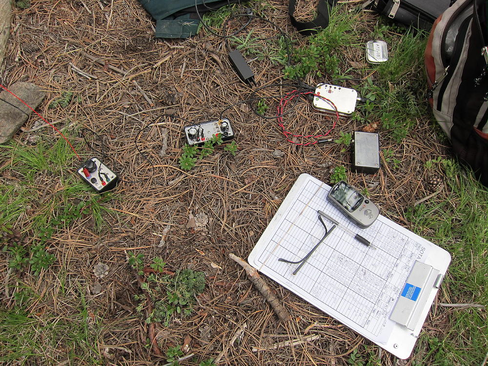
- 8849 Activation Gear 2014
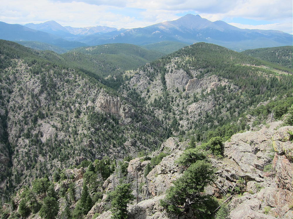
If weather permits, be sure to see the sights of 8849. Head down the meadows of the south side, where there are many dead trees, and see the stunning view of the huge Canyon of the North Saint Vrain. This is one of the wildest regions of Boulder County, and most residents of Boulder have never seen it. This is part of the area that captured immense amounts of torrential rain during the September 2013 floods, creating incredible floods that caused massive destruction in Lyons and Longmont, miles to the east.
-
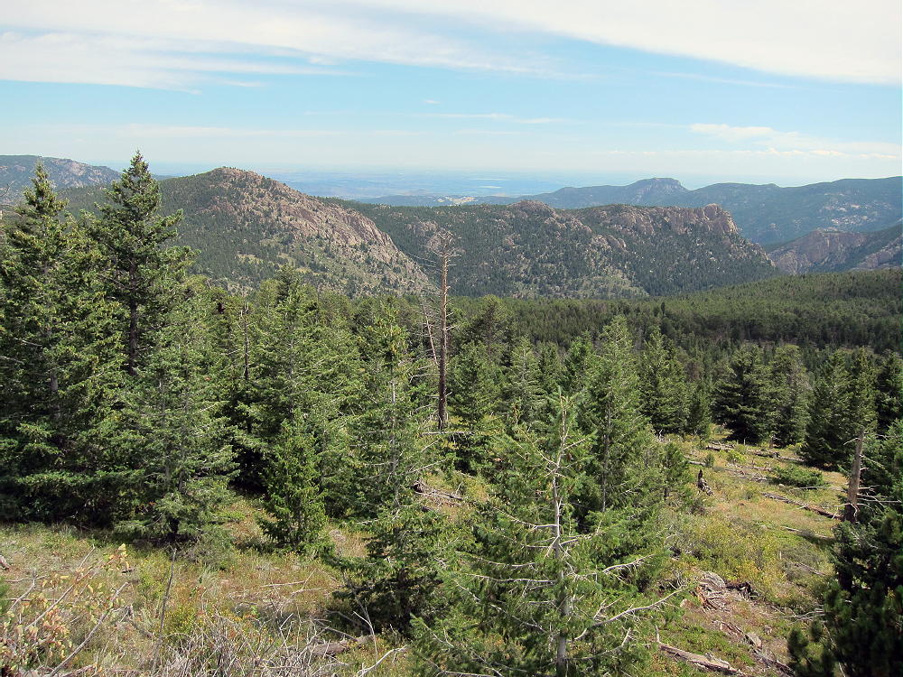
- 8849 View Southeast
-
- 8849 View South across Saint Vrain Canyon
-

- 8849 View West
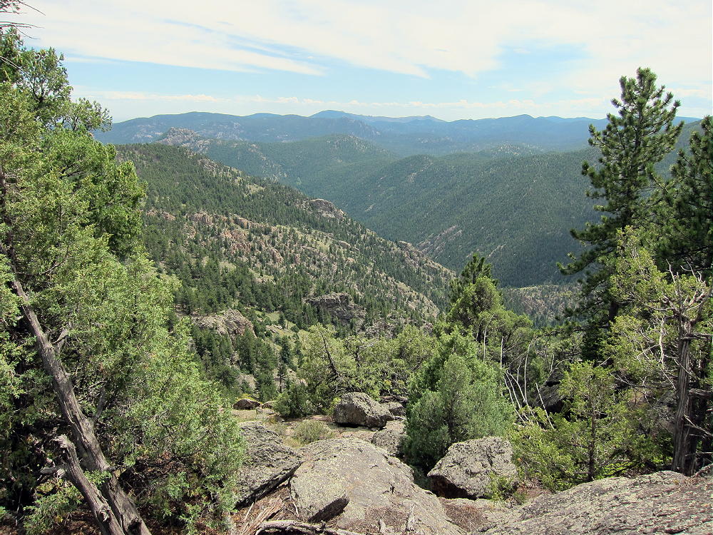
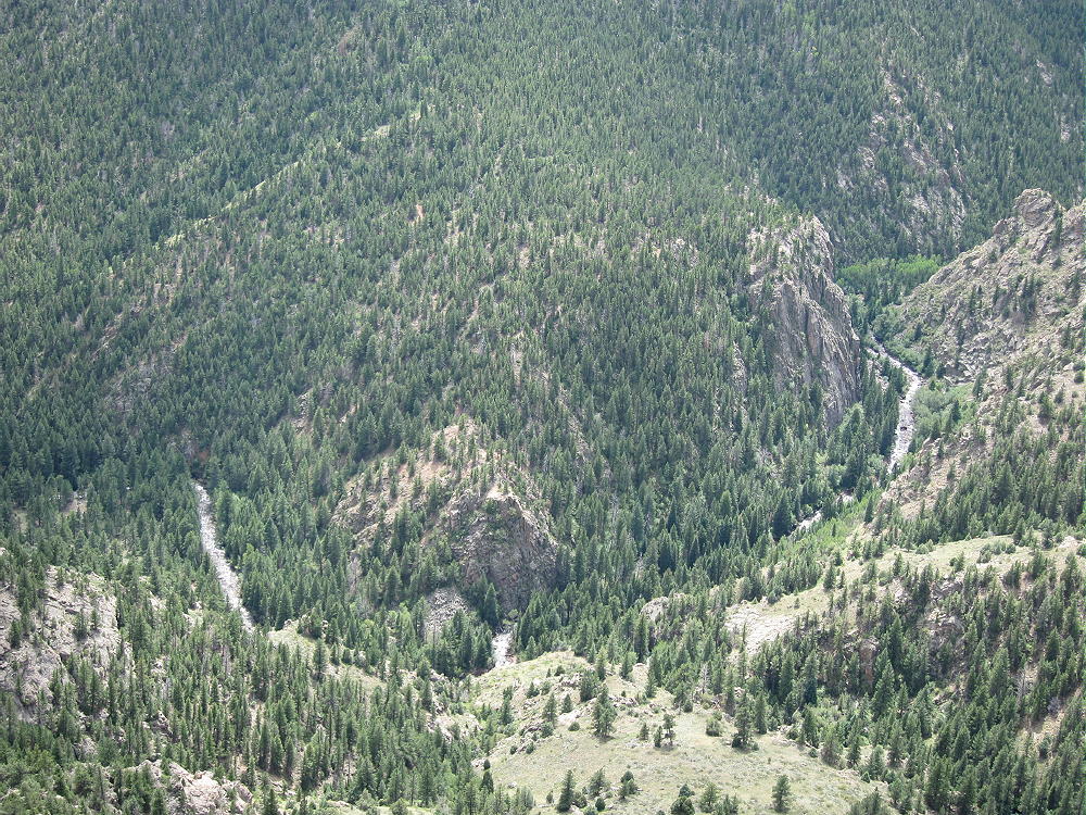
The best part of 8849 is almost a secret. On the southwest side of the mountain, perhaps 200 vertical feet down from the summit, is a prominent rock outcrop that forms an exposed buttress – this “balcony” lets you look down over 1000 vertical feet to the confluence of the steep, wild canyons of Cabin Creek and the North Saint Vrain! Until you pick your way down to the balcony, you won’t see the view; but when you stand there, it’s hard to believe you’re on the same 2-point mountain you just climbed via the ugly firebreak. For miles around, nothing but wilderness and airy space going down and further down! Be careful on the balcony – this is not a place to hike with small children – and don’t get too close to the edge. If the balcony was closer to the highway they could put in stairs and guardrails, and then charge admission to see the incredible view!
-

- 8849 View into Saint Vrain Canyon 3
-
- 8849 View into Saint Vrain Canyon 2
-
- 8849 View Into Saint Vrain Canyon 1
-
- 8849 View into Cabin Creek Canyon
The first time I went up 8849, I didn’t know about the Balcony, but I saw it from a distance, and I’m sure glad I took the time to see it. The second activation on June 8, 2014, I planned to go see the view again, but right after my activation, a thunderstorm developed close by, and then cold fog came rolling up through the trees. There was no view, and the mountains were filled with clouds and fog – I did well to leave the area before heavy rain fell later that afternoon.
If you activate this summit, I hope you enjoy it as much as I have!
73
George Carey Fuller
KX0R
-
- 8849 to Meeker
-
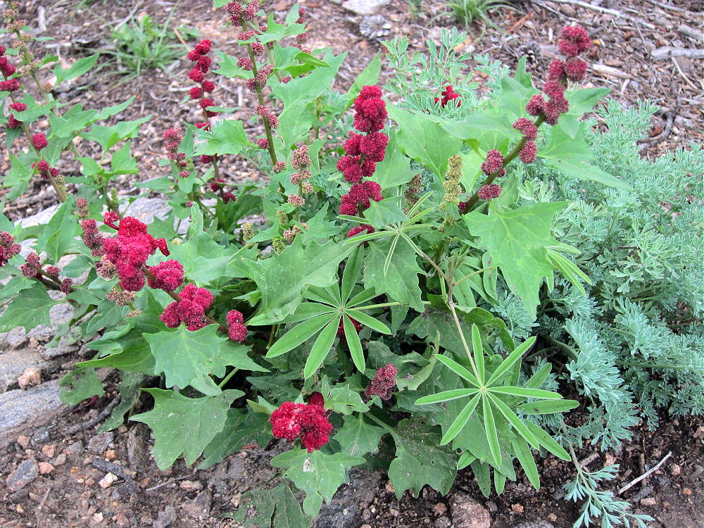
- 8849 Firebreak Flowers
![]() !! WARNING !! There are old mountaineers, and
bold mountaineers... there are no old-bold mountaineers.
Hiking and mountain climbing are potentially hazardous activities particularly in Colorado with its extreme elevations. I am not accepting responsibility for any death or injury resulting from activations based on my trip reports. Proper training, experience, and personal capability assessment is required - enjoy!
!! WARNING !! There are old mountaineers, and
bold mountaineers... there are no old-bold mountaineers.
Hiking and mountain climbing are potentially hazardous activities particularly in Colorado with its extreme elevations. I am not accepting responsibility for any death or injury resulting from activations based on my trip reports. Proper training, experience, and personal capability assessment is required - enjoy!