


W0C/FR-089
Cheesman Mountain
2422 m / 7946 ft
Oct 24, 2015
April 7 & 8, 2016
By KX0R
Cheesman Mountain is an obscure peak located in the South Platte Canyon area near Cheesman Reservoir.
Key Points:
• Mountain and surrounding area were burned up
• Pike National Forest
• No trail
• Accessible trailhead
• Incredible views of the Hayman Burn area
• Superb HF site
• Unique summit composed of orange Pikes Peak Granite
• Seldom climbed
• ~ 2.6 miles round-trip
• ~ 725 feet of vertical gain, plus ~ 100 feet on the return
Summary:
Chessman Mountain stands high on the north side of Chessman Reservoir. The entire area burned in the huge Hayman Fire of 2002. There’s no trail, the route’s rough, but the reward is a fine radio site with spectacular views. This is another Colorado 1-point SOTA mountain to be climbed more for the total experience than for the points!
-
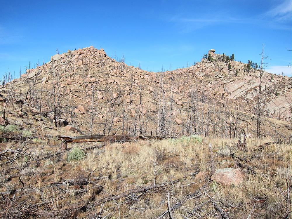
- Cheesman Mountain Summit – West Side
Driving Directions:
Drive to the town of Deckers in the South Platte Canyon.
- Deckers may be reached from the south via Highway 24 west of Colorado Springs to Woodland Park, then north on Highway 67.
Northern routes are:
• Highway 285 west to Pine Junction, then Highway 126 south to Deckers
• Highway 85 to Sedalia southwest of Denver, then Route 67 across the Rampart Range and south down the Canyon
• Highway 285 west to Conifer, Foxton Road 97 to the Canyon, Road 96 southwest to Highway 126, and 126 south to Deckers.
• Highway 285 west to Conifer, Foxton Road 97 to the Canyon, 97 southeast to Road 67, and 67 south to Deckers
All of these routes are scenic mountain drives!
About 2 miles west of Deckers, marked dirt road FR-211 heads off Highway 126, goes south across a bridge, and then ascends west up Wigwam Creek. The first section of the narrow road along the shadowy north side of Cheesman Mountain is scary if it’s snowy or wet. After about a mile, the road leads south up a hill toward Cheesman Reservoir; the road reaches a pass near 7200 feet, and the reservoir is visible about half a mile down to the south. Cheesman Mountain stands high above the east side of the road.
At the pass, FR-211 forks off to the southwest. A good designated parking spot is available a short distance up road 211, on the south side. I parked there and hiked back to the pass to climb Cheesman Mountain. Parking along this road is restricted and is allowed only at the “P” signs – however, parking is free, and the land near the summit is in the Pike National Forest.
The Hike:
From the pass at 7200 feet, hike up a moderate slope and ascend to the long south ridge of Cheesman. The easiest route ends up on the ridge at about 7500 feet. There’s no need to do any steep scrambling. Once on the Cheesman ridge, ascend progressively north, dodging burned trees and numerous rocks.
-
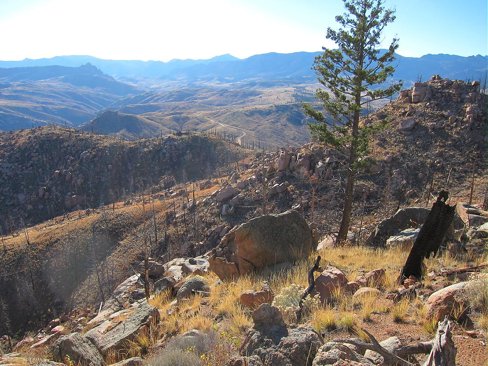
- Cheesman Mountain Ridge Route from Summit Area
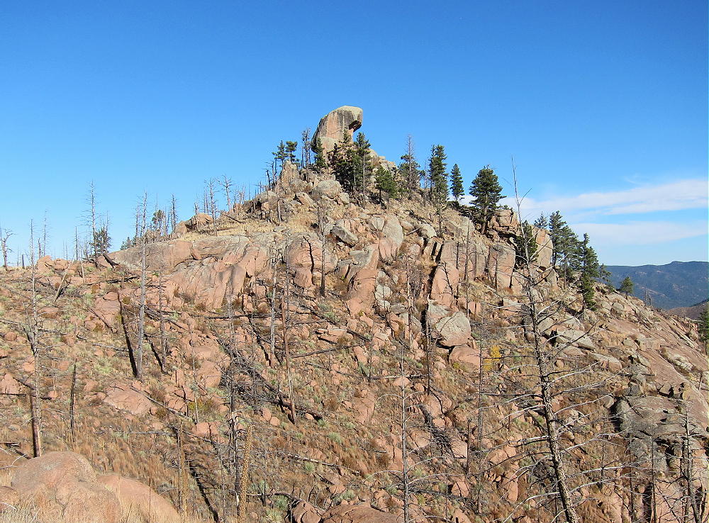
Soon the twin summits of Cheesman appear. From the ridge the rocky west summit looks like it’s the peak, but it’s not; contour around either side of this false summit and hike to the saddle between the two knobs.
-
- Cheesman Mountain and Sub-Peak
The actual summit block of Cheesman looks impossible from the saddle. This huge rock has steep sides all around.
-
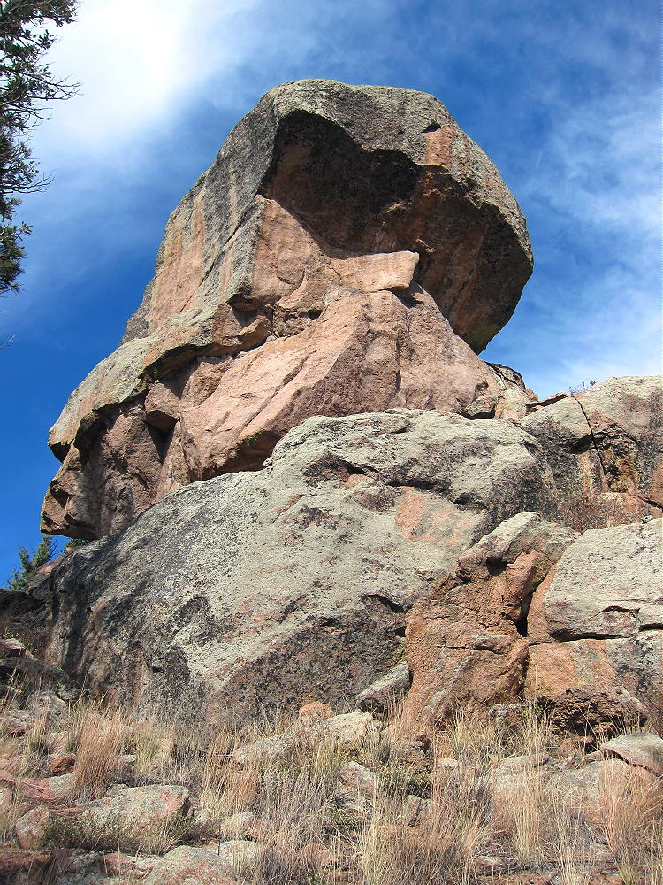
- Cheesman Mountain Summit Block
Fortunately it’s not necessary to climb the rock to access the Activation Zone. Simply follow a small trail from the saddle around the south side of the summit, ascend southeast of the big rock, and climb up to a convenient flat area just east of the summit. This flat area is about 15 feet below the peak.
Useful Details:
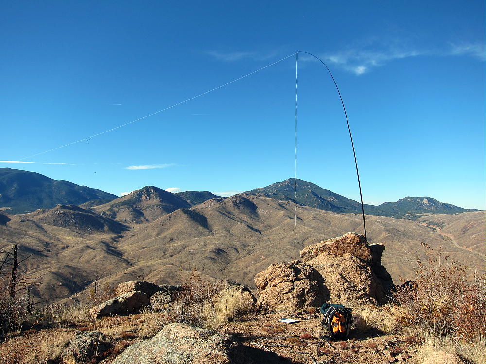
The flat area is large enough for an HF antenna. No good trees are available, but there are some large, useful rocks. I anchored my pole to one large rock and ran my wire west to another rock near the summit block. I was on the air in minutes.
-
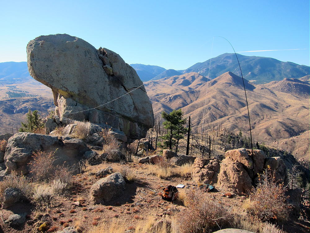
- Cheesman Mountain Activation Complete
Climbing the summit block is technical. There are some old wire loops hanging from the east side – someone has used these as aids to ascend, but they’re dangerous. It would be possible to get a rope across the summit block to use for an antenna support, but it’s not worth the hassle, since the site is practically perfect for HF already – just bring a pole and maybe a few guy lines.
-
- Cheesman Mountain Activation
Cheesman Mountain is very prominent above the South Platte Canyon, and it’s good for HF in all directions. There’s little development nearby, and the RF noise level is low. Chessman is probably a poor VHF/UHF site because of its isolated location in the South Platte Canyon. It has a view of the land north of Pikes Peak, but there’s no clear path out to the east.
-
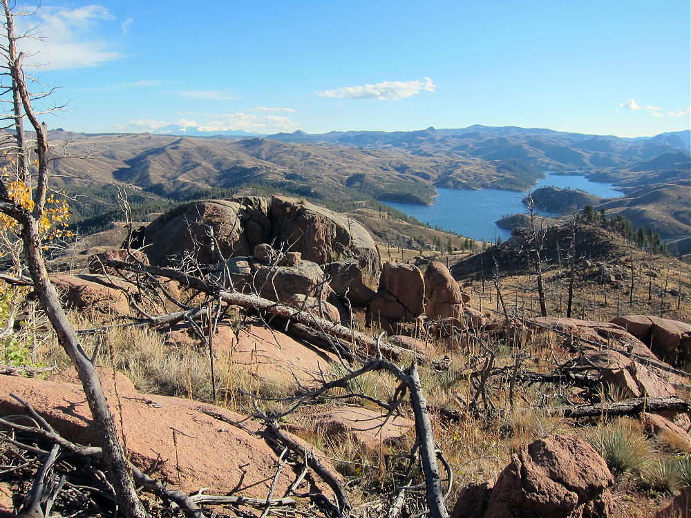
- Cheesman Mountain View South
Cheesman Mountain can be combined with nearby Sugarloaf Peak, W0C/FR-077, for a convenient double activation. Another local SOTA peak is prominent Thunder Butte, W0C/FR-048, about 6 miles southeast of Cheesman Mountain.
73
George
KX0R
-
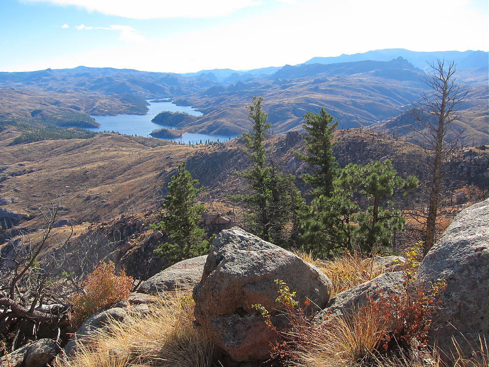
- Cheesman Mountain View Southwest
![]() !! WARNING !! There are old mountaineers, and
bold mountaineers... there are no old-bold mountaineers.
Hiking and mountain climbing are potentially hazardous activities particularly in Colorado with its extreme elevations. I am not accepting responsibility for any death or injury resulting from activations based on my trip reports. Proper training, experience, and personal capability assessment is required - enjoy!
!! WARNING !! There are old mountaineers, and
bold mountaineers... there are no old-bold mountaineers.
Hiking and mountain climbing are potentially hazardous activities particularly in Colorado with its extreme elevations. I am not accepting responsibility for any death or injury resulting from activations based on my trip reports. Proper training, experience, and personal capability assessment is required - enjoy!