


W0C/FR-087 (Bennett Mountain)
2447 m / 8045 ft
Activated Nov 8, 2014
By KX0R
Bennett Mountain eluded me the first time I tried to activate it; here’s how to find this easy SOTA peak.
Start with the SOTA web page for Bennett. Study the maps showing where Bennett is. Google maps is pretty good; the DeLorme atlas is also useful; the Garmin GPS maps are good. The online satellite image is your best resource – it clearly shows the forest roads and the final path up the mountain.
Drive southwest from Denver on Santa Fe, Highway 85, to Sedalia, and then head southwest on paved highway 67. Continue up steep Jarre Canyon, pass the marked Rampart Range Road, and drive almost 2 additional miles on winding highway 67 to a hilltop community called Moonridge. Look sharp to the northwest side of the road, find a dirt road with a sign that says “Archery Range”, and turn onto this one-lane road that looks like someone’s private driveway. This road goes up steeply and provides access to the Pike National Forest, but it’s not so marked! After passing several houses, come to a locked gate and a parking area next to the Archery Range. Park here and hike north on the closed forest road, as it climbs along a gentle forested ridge toward Bennett Mountain. Eventually you can spot the modest summit in the distance.
The road climbs up a long ridge southwest of the summit and then descends slightly while heading northeast. Continue toward Bennett – you can see the summit not far away. To climb Bennett you must leave the road where it bends sharply to the left and descends, and then follow an obvious path northeast across a meadow on the saddle, and then climb up to the broad summit ridge.
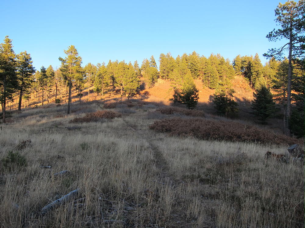
Bennett Mountain and Path to Top
There are several places to set up in the large Activation Zone. Convenient trees and some shelter from the wind are available.
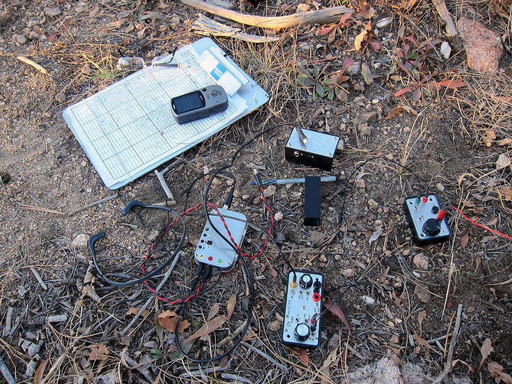
Bennett Activation Rig
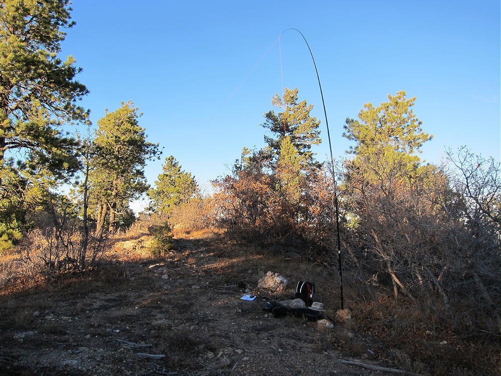
Bennett Activation near Summit
This is a pleasant 2-point summit with an easy 1-1/2 mile hike, with only about 400 vertical feet of gain. Finding the forest road to the Archery Range is the key to the activation. Bennett has nice views of the surrounding terrain, including Devils Head to the south. Beware during hunting season!
George Carey Fuller
KX0R

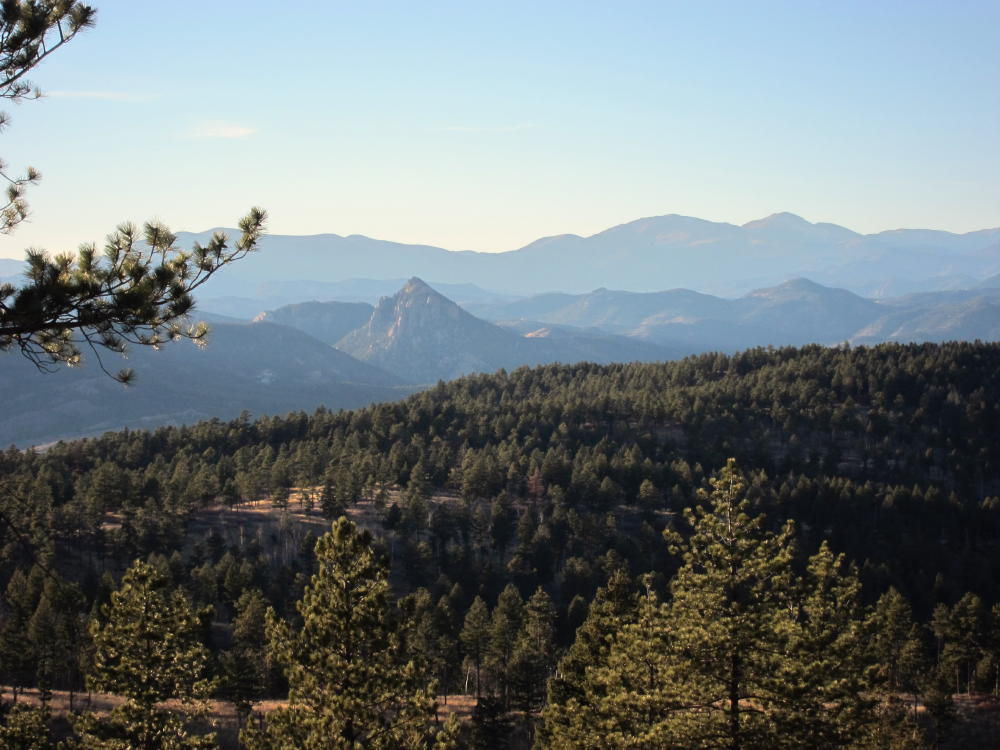
Devils Head from Bennett
View West from Bennett Mountain
![]() !! WARNING !! There are old mountaineers, and
bold mountaineers... there are no old-bold mountaineers.
Hiking and mountain climbing are potentially hazardous activities particularly in Colorado with its extreme elevations. I am not accepting responsibility for any death or injury resulting from activations based on my trip reports. Proper training, experience, and personal capability assessment is required - enjoy!
!! WARNING !! There are old mountaineers, and
bold mountaineers... there are no old-bold mountaineers.
Hiking and mountain climbing are potentially hazardous activities particularly in Colorado with its extreme elevations. I am not accepting responsibility for any death or injury resulting from activations based on my trip reports. Proper training, experience, and personal capability assessment is required - enjoy!