


W0C/FR-008 (Hagues Peak)
4125 m / 13560 ft
First Activation
Sep 2, 2014
By KX0R
Hagues Peak is a high, wild mountain in the northern part of Rocky Mountain National Park. It is the highest summit in the Mummy Range, and it takes a serious effort to climb and activate this peak.
The Lawn Lake Trail is the standard approach to Hagues Peak. This trail runs from the Fall River Road all the way up the Fall River to Lawn Lake. In 1982 the old Lawn Lake Dam failed, and the Fall River flooded. Most of Lawn Lake came rapidly down the steep valley, causing a fatal flood and massive damage for miles downstream. Lawn Lake still exists, but the dam was not rebuilt, so the Lake is smaller than before the flood. It’s a beautiful place, so it’s a popular hiking and backpacking destination.
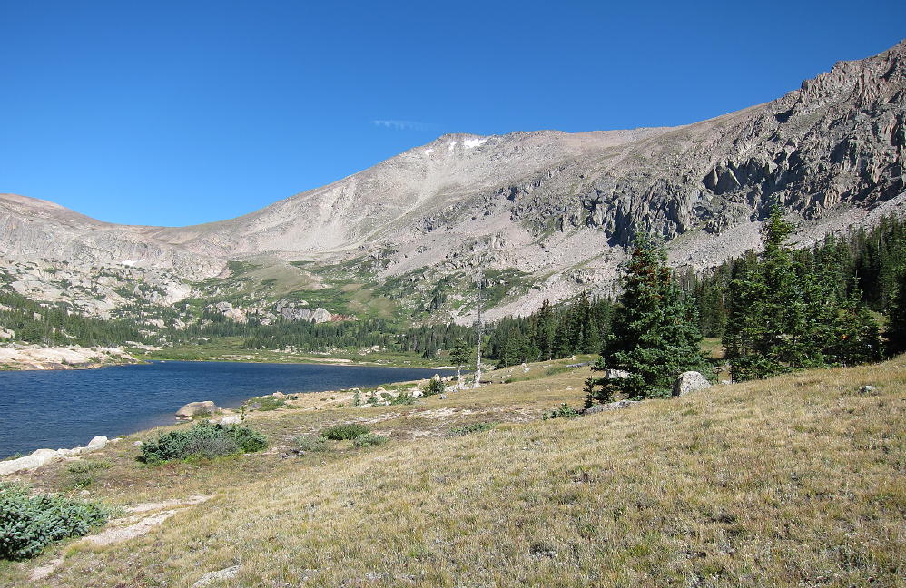
Hagues from Lawn Lake
The trail starts at 8550 feet, and it’s over 6 miles to Lawn Lake, at 11,000 feet. The trail was damaged in the September 2013 floods, so it’s rocky in spots, but it’s still a fast route up into the Mummy Range. The trail continues past Lawn Lake on the east side, and it efficiently ascends to “The Saddle” at 12,400 feet. From The Saddle it’s possible to climb Hagues Peak via the southwest ridge. This is mostly a rocks-and-blocks climb, and the crux is near the top. Depending on the amount of snow, there are several ways to access the summit from the southwest ridge – some scrambling may be required.
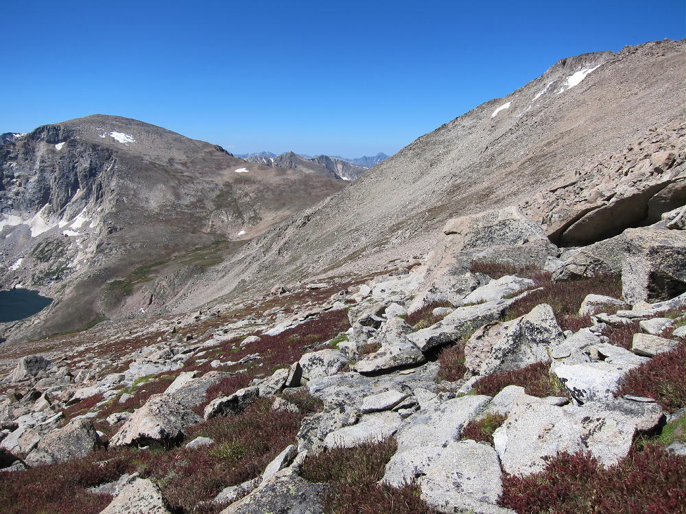
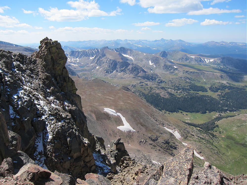
Fairchild, The Saddle, and Hagues
The day I climbed Hagues it was dry, sunny, and very windy; I wanted nothing to do with The Saddle and the southwest ridge! I climbed via the steep tundra slopes south of the Hagues Summit. This unmarked route leaves the main trail at about 11,700 feet, just above where another trail heads southwest toward Crystal Lake. It is possible to climb gullies and steep grassy slopes, eventually heading diagonally, northeast up the slope. The immediate goal is to reach the long saddle between Hagues and Mummy. The higher part of the route up the slopes is easier to the east, but then the trip along the saddle back toward Hagues is longer. The slopes are mostly grass toward the east, and mostly steep scree and rocks toward Hagues. There are many ways to climb, and it’s just personal preference to pick a route.
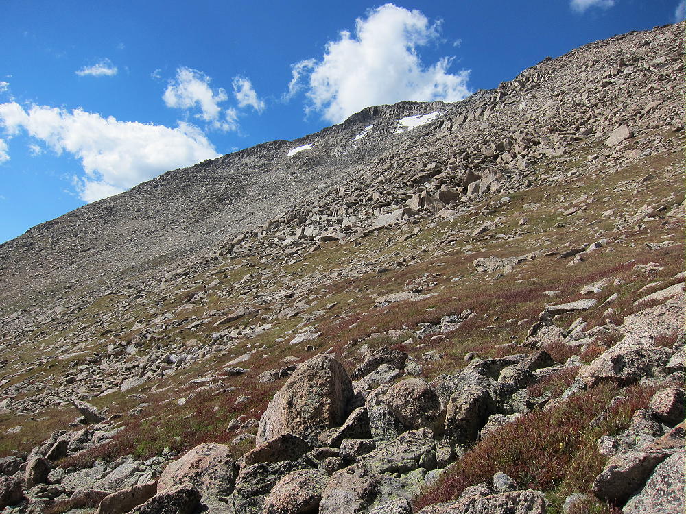
Hagues South Slopes
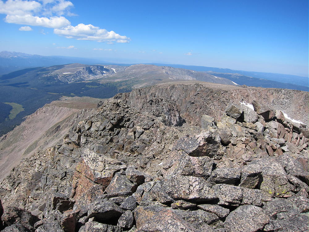
The route along the ridge between the Mummy-Hagues saddle and Hagues summit is mostly rocks and blocks, and it may be easier and safer to hike north of the ridge-top to avoid some of the larger blocks and occasional problems on the ridge. Eventually the ridge reaches the summit, which is a class 2 ascent if everything is dry.
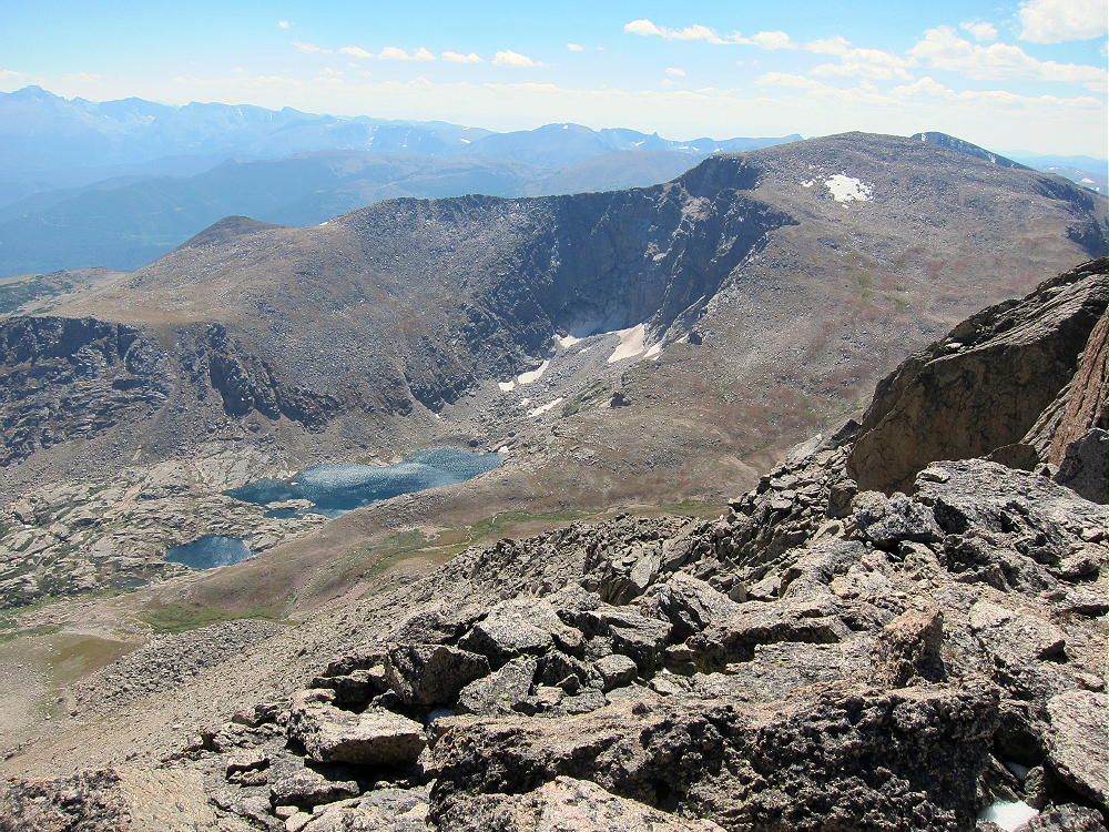
Mummy and Lawn Lake from Hagues
There is a solar-powered NPS repeater on top of Hagues. This is an excellent site with coverage of a huge area, and relatively few visitors climb Hagues, so the location of this device makes good sense. It’s best not to activate close to the repeater, to avoid any possibility of interference.
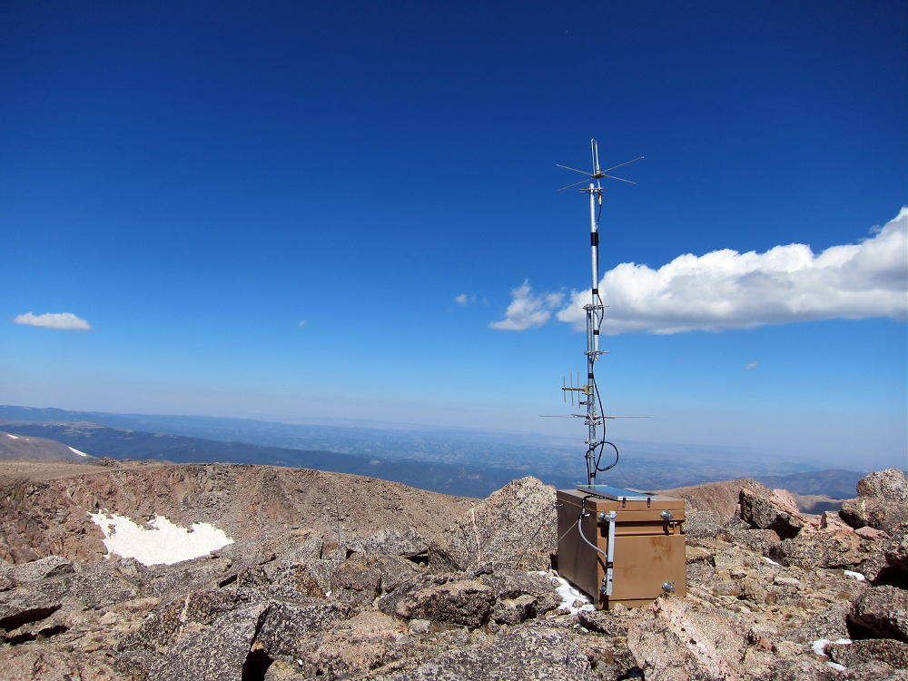
NPS Repeater on Hagues
I was able to set up about 30 feet below and north of the summit in a spot where the wind was reduced. Had I not been able to do this, I’m not sure I could have done a successful activation. The wind was gusty and harsh on the summit and ridges, but it was amazing how well everything worked in the lee of the Peak! I had to securely guy my pole and use the tension on the wire to help stabilize the dancing, gyrating mast. The temperature was about 40 degrees during my activation, the sun was bright, and there was corn snow on the shady rocks.
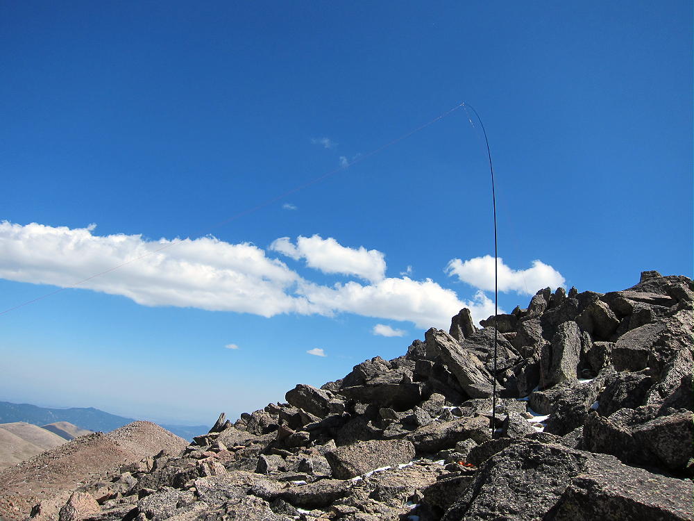
Hagues First Activation
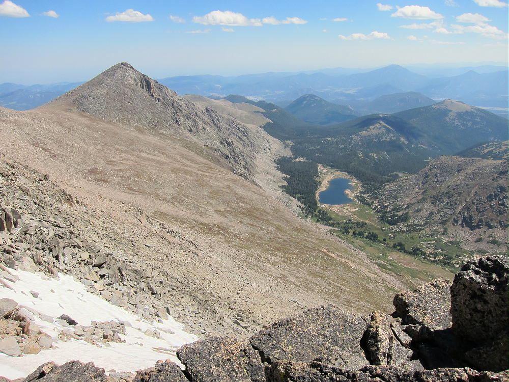
Antenna, Rowe Peak & Rowe Glacier
The route I took to Hagues was approximately 18 miles round trip, with 5000 feet of vertical gain. It took about five hours to hike to the summit. With a normal activation this peak requires most of the day to do. While the weather is windier and colder in late summer, there are more dry days. Hagues and Fairchild Peaks have long approaches and are difficult to activate in mid-summer, because thunderstorms often develop by mid-day, so a very early start is required to reach the summit before storm clouds gather.
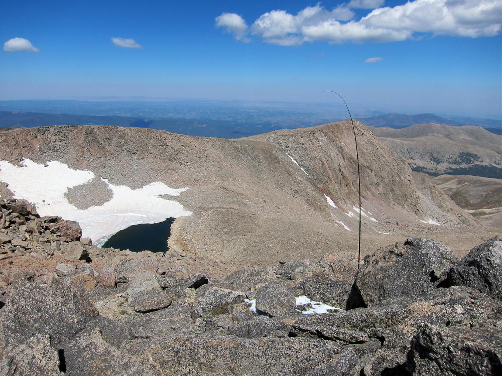
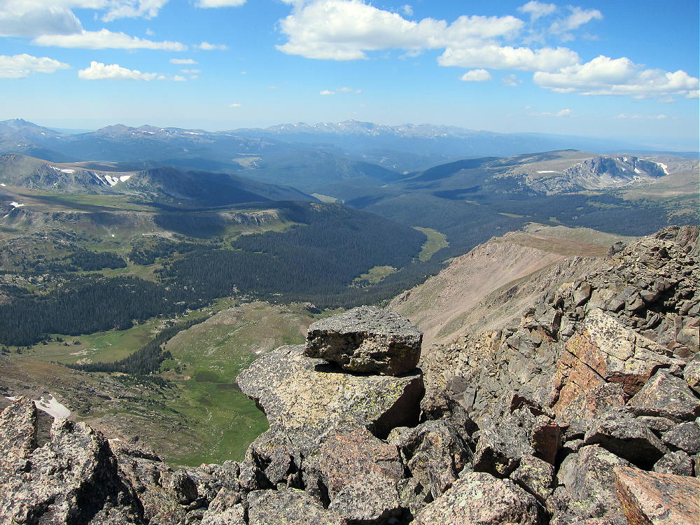
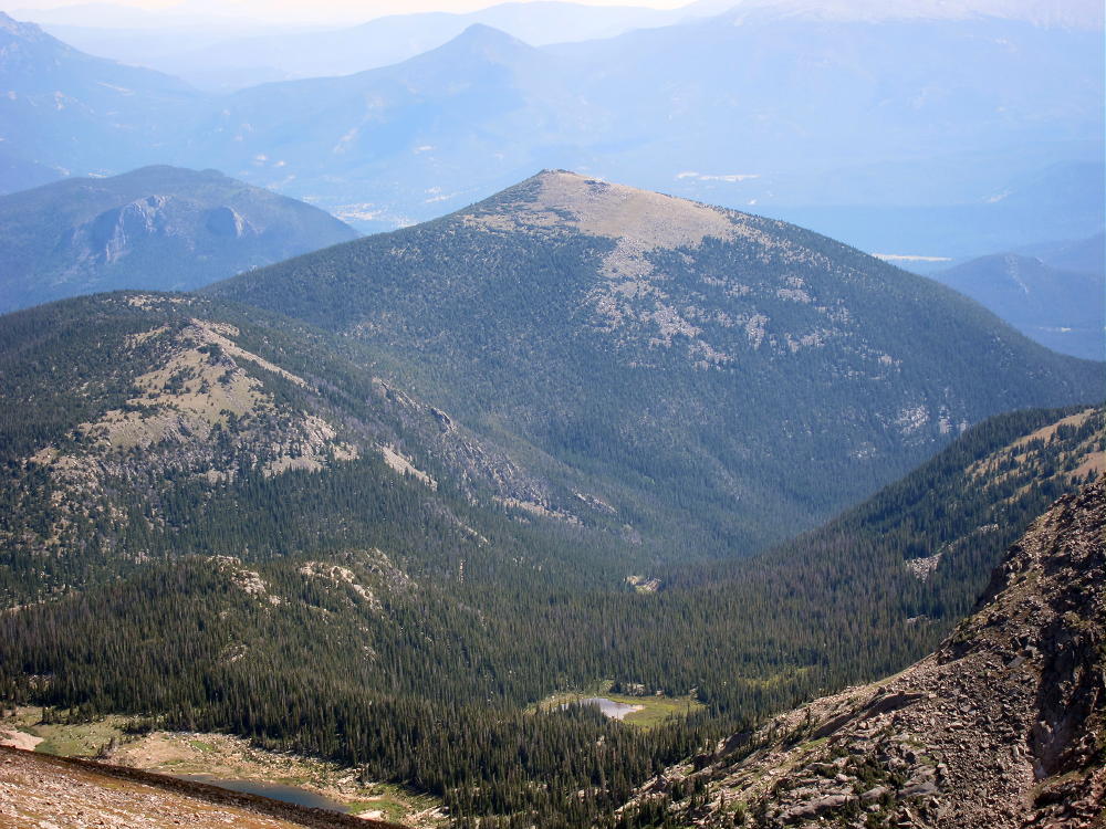
The views from Hagues are some of the best in Rocky Mountain National Park. The entire Mummy Range is heavily glaciated, and it’s half a mile vertically down to Lawn Lake. Rowe Peak and Rowe Glacier to the north are a nice surprise, the Rawah Wilderness is impressive up north, and the Laramie Range is visible in Wyoming. The Plains are visible out east, from north to south, and most of the local high summits are easy to see.
View Down Hague Creek to NW
View off the Back Side of Hagues
View North from Hagues
Numerous SOTA peaks in the Estes Park area and elsewhere stand far below!
Bighorn Mountain from Hagues
Fairchild dominates the view south, with the summit of Ypsilon peeping over. A vast wilderness fills the space north of the Mummy Peaks. Mummy Peak stands like Hagues’ sister 1-1/2 miles to the southeast.
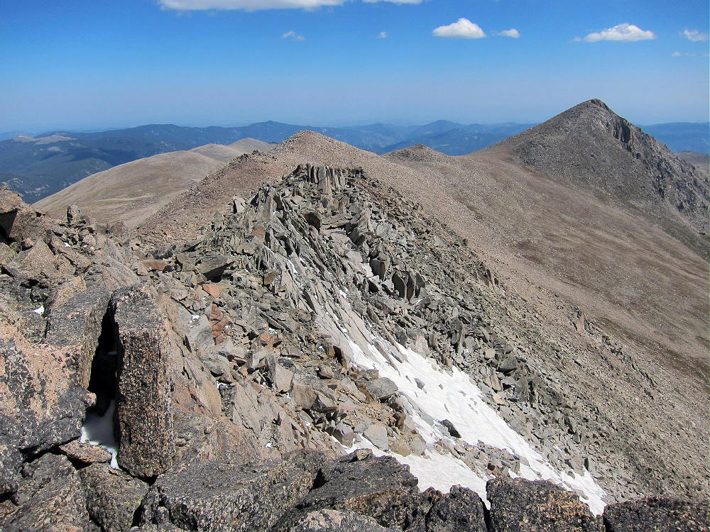
Hagues – Mummy Ridge
Unfortunately Mummy is not quite a SOTA peak, but Hagues and Mummy are a nice pair of high summits on the same very high ridge – they are often climbed together. It is not hard to go over Mummy on the way up or down Hagues. The south slopes of Mummy are a convenient, efficient route up or down from Mummy and Hagues. Bighorn sheep live up on these peaks.
With a base camp at Lawn Lake, it would be possible to activate Hagues or Fairchild with the same hike up to the Saddle between the two big peaks. From the camp, with a dry day, activating both peaks is possible. They are less than 2 miles apart, but the rocky route takes time.
Crystal Lake & Fairchild from Hagues
All this alpine terrain above 11,500 feet is exposed to weather, and it’s a dangerous area in stormy, windy, or cold weather – check the forecast and be prepared!
Hagues Peak is certainly challenging, and it’s a true SOTA Classic!
George Carey Fuller
KX0R
![]() !! WARNING !! There are old mountaineers, and
bold mountaineers... there are no old-bold mountaineers.
Hiking and mountain climbing are potentially hazardous activities particularly in Colorado with its extreme elevations. I am not accepting responsibility for any death or injury resulting from activations based on my trip reports. Proper training, experience, and personal capability assessment is required - enjoy!
!! WARNING !! There are old mountaineers, and
bold mountaineers... there are no old-bold mountaineers.
Hiking and mountain climbing are potentially hazardous activities particularly in Colorado with its extreme elevations. I am not accepting responsibility for any death or injury resulting from activations based on my trip reports. Proper training, experience, and personal capability assessment is required - enjoy!