


W0C/FR-060 Berrian Mountain 2783 M / 9147 FT
Nov 02, 2013 by KX0R
Berrian Mountain is almost a secret mountain. It’s very prominent north of Aspen Park near Highway 285, close to the Denver area, and it’s a fine SOTA peak. The summit and approach are owned by Denver Mountain Parks (DMP) and held as conservation property, so the peak is not developed. However, most of the land around the mountain is private, so access is tricky. Fortunately there is an unmarked trailhead with a small parking place along a public road on the northwest side of the peak.
The trailhead is on Armadillo Trail road, about 1000 feet north of “Grand Summit Trail”. Look on Google maps for this. If you look at the satellite image, you can see the parking area on the west side of Armadillo. The DMP land extends all the way down to the road, and the land at the trailhead is posted “DMP”. There is an official sign for the trailhead up about 100 feet east of the road, but it’s hard to see from the road while driving. Please obey the rules posted on the sign to preserve public access. In particular, camping, fires, and bicycles are prohibited.
A trail heads up a small gully behind the DMP sign, and it leads to a massive fire-mitigation and deforestation project on the ridge above. The trail is hard to follow through the cut-down forest, but just keep heading uphill, following the ridge SSE, and eventually ascend into the uncut forest. The upper trail is distinct, and trees are marked with red and orange paint along the path. When you come to a large elevated rock formation below and northwest of the summit, climb up and have a look at the fine view. This nice spot is the primary destination for hikers and locals who enjoy their mountain.
From the rocks, head east about 50 feet, and then climb SSE up the ridge on a faint unmarked path until you come to the ridge-top. There are several rocky summits spaced along the ridge, all within a few vertical feet of each other. The northern summit is probably the actual peak, but it’s almost academic. The southernmost summit has a really fine view south, so be sure to go there and have a look down at Aspen Park, Highway 285, and across to several other peaks visible around the area.
The Berrian summit ridge is mostly flat and forested, and there are several nice sites to set up an antenna and operate. There are some sunny spots with shelter from wind, and the trees are high enough – over 40 feet – to be useful for supports. Few people visit the summit area, so it’s relatively private. This is a good SOTA peak for the fall – hunting is not allowed. The road is maintained, so winter access is probably good. The ascent route looks OK for snowshoes. It’s a little more than a mile up there, and about 1000 vertical feet.
Please treat this mountain, the trailhead, and other visitors with total respect so that access is preserved. Berrian Mountain is one of the best SOTA peaks near the greater Denver area; practice Leave No Trace if you visit this special place.
George Carey Fuller
KX0R
A few pictures:
-
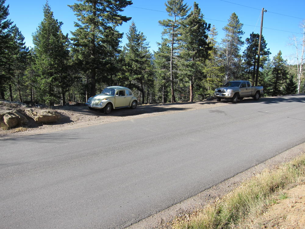
- Small Parking Area at Berrian Trailhead
-
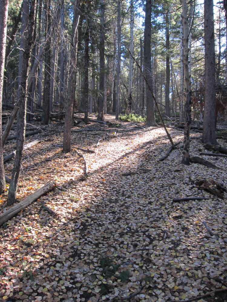
- Berrian Trail near the Rocks
-
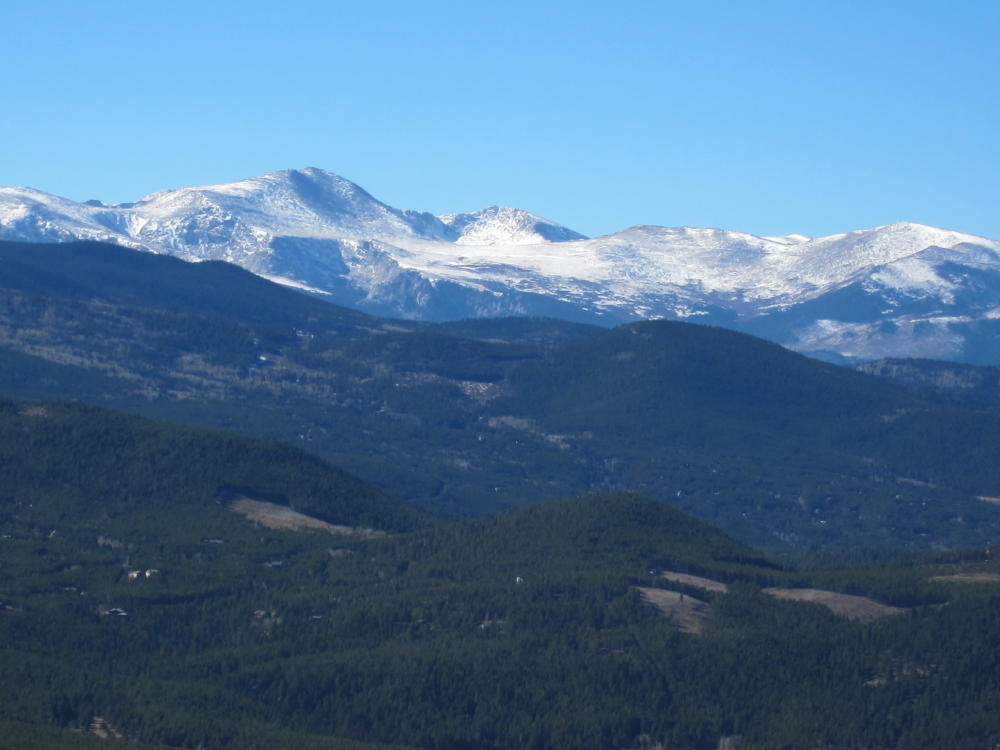
- View of Mount Evans from Berrian
-
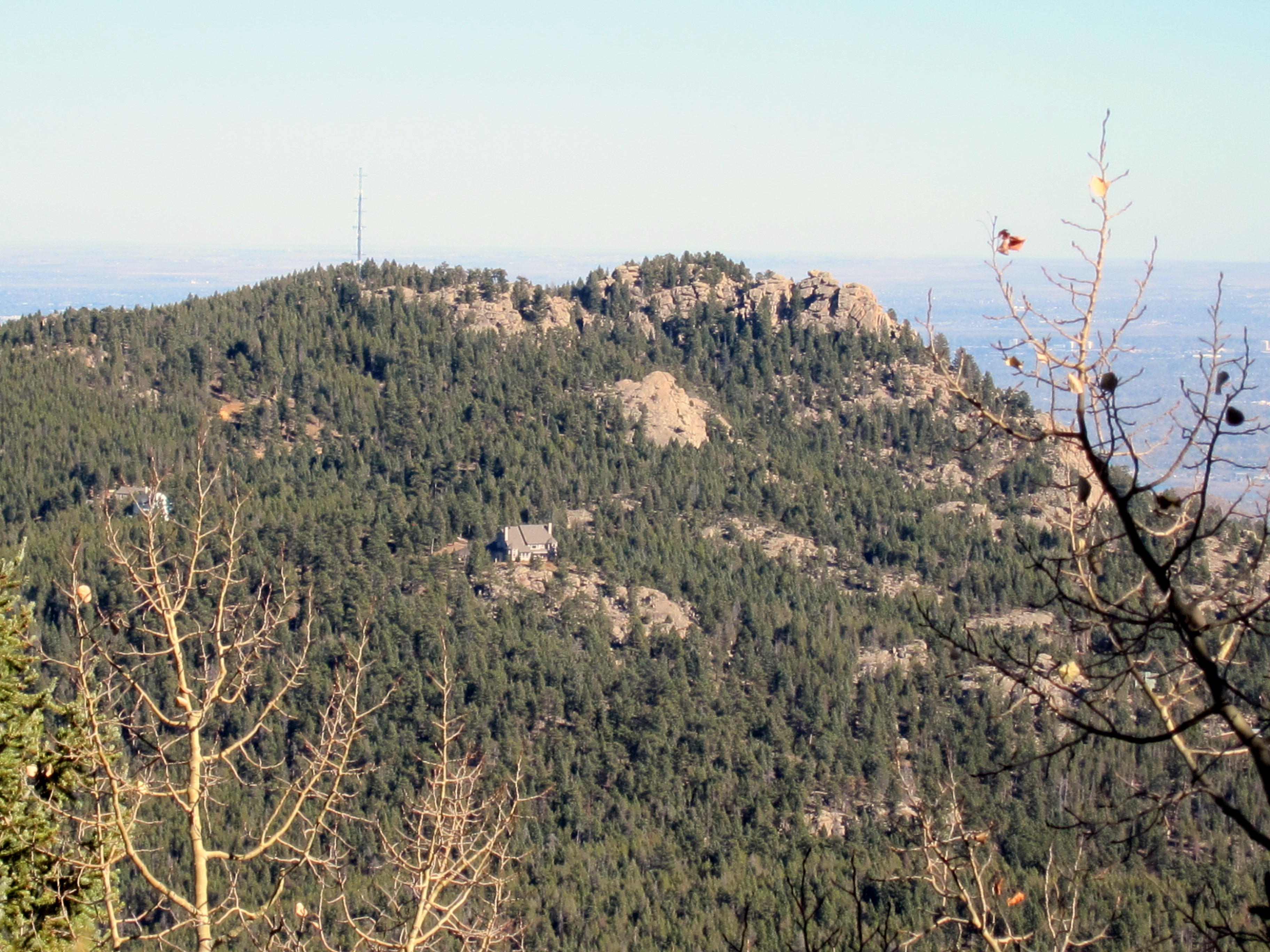
- Doublehead Mountain from Berrian Mountain
-
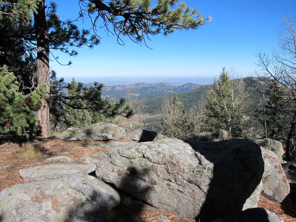
- View East from Berrian
-
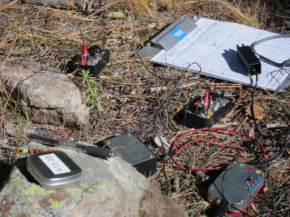
- KX0R Radio Gear on Berrian
-
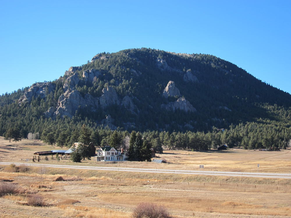
- Berrian Mountain from Highway 285
-
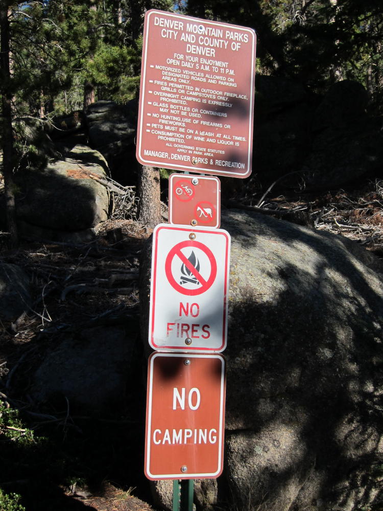
- Berrian Trailhead Sign and Rules
-
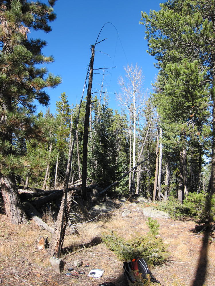
- KX0R Antenna and Gear on Berrian
-
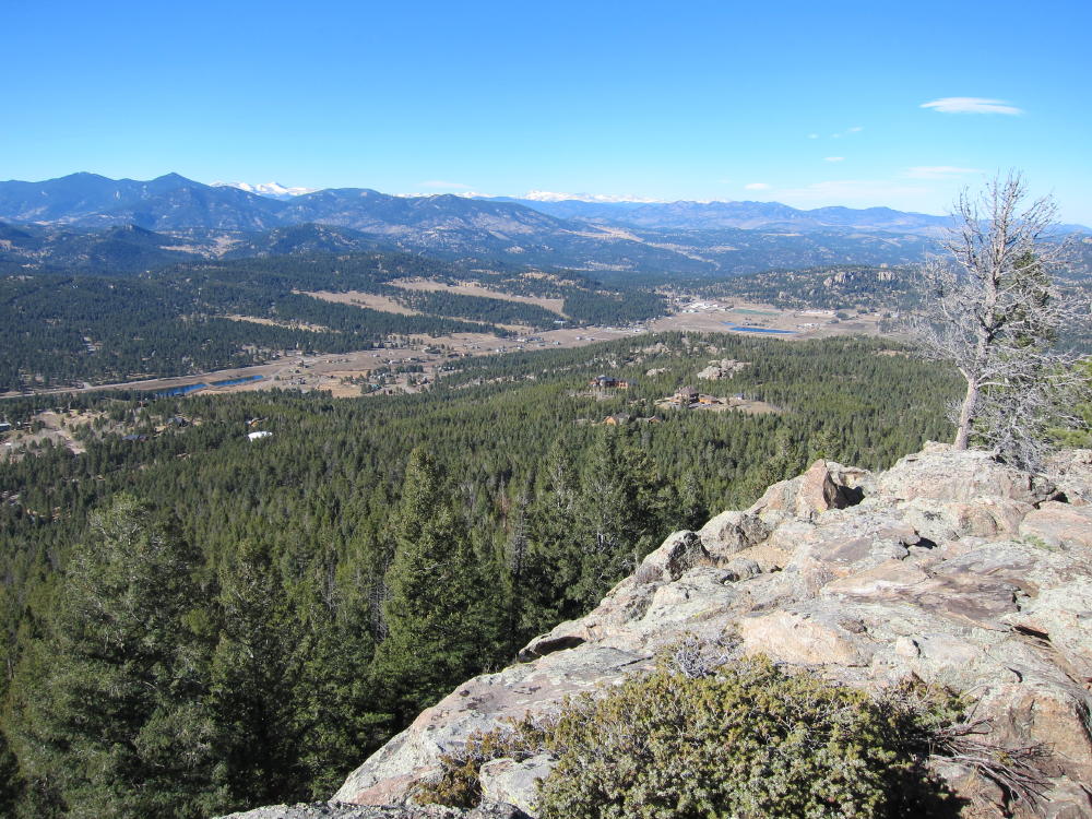
- View NW from Berrian Rocks
![]() !! WARNING !! There are old mountaineers, and
bold mountaineers... there are no old-bold mountaineers.
Hiking and mountain climbing are potentially hazardous activities particularly in Colorado with its extreme elevations. I am not accepting responsibility for any death or injury resulting from activations based on my trip reports. Proper training, experience, and personal capability assessment is required - enjoy!
!! WARNING !! There are old mountaineers, and
bold mountaineers... there are no old-bold mountaineers.
Hiking and mountain climbing are potentially hazardous activities particularly in Colorado with its extreme elevations. I am not accepting responsibility for any death or injury resulting from activations based on my trip reports. Proper training, experience, and personal capability assessment is required - enjoy!