


W0C/SP-124
9083
2769 m / 9083 ft
Dec 9, 2015 – First Activation by N0TA with KX0R
Nov 6, 2016 – Second Activation by N0TA and KX0R
By KX0R
Peak 9083 is a modest SOTA summit hidden in the South Platte Canyon a few miles north of Lake George.
Key Points:
• Pike National Forest
• No marked trail, but paths most of the way
• Not difficult
• Navigation and route-finding required
• Nice partly-forested summit
• Fine SOTA peak
• “South Trailhead” at ~ 8170 feet
• ~ 3.3 miles round-trip hiking from “South Trailhead”
• ~ 910 vertical feet hiking from “South Trailhead”
• “North Trailhead” at ~ 8740 feet
• ~ 0.9 miles round-trip hiking from “North Trailhead”
• ~ 360 vertical feet hiking from “North Trailhead”
-
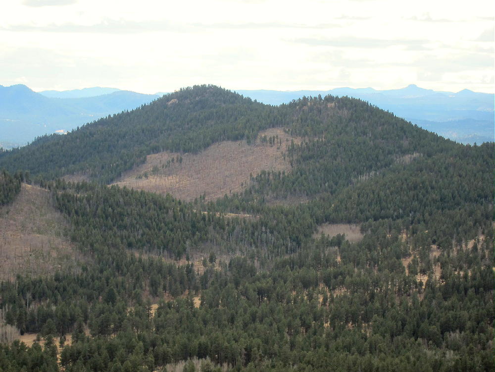
- Peak 9083 and Northern Sub-Peak 9021, Northeast Side, from Peak 9036
Driving Directions to the “South Trailhead”:
• Drive to Woodland Park, either from Colorado Springs on Highway 24, or via Highway 67 from Deckers, etc.
• Continue west on Highway 24 through Divide, Florissant, and Lake George
• About ½ mile northwest of Lake George, turn right, north, on paved Tarryall Road 77.
• After driving about one mile on Highway 77, turn right on unpaved CR 112.
Use THIS MAP for the details of the forest roads. Note that Peak 9083 is not shown on this USFS map.
• After several hundred feet, CR 112 comes to a T – turn left on a small forest road, 295/296.
• This road leads north past some private land on the west
• About 2/3 mile from the original T, there’s another split.
• The left fork FR-295 the main fork – it leads north several miles into the National Forest (see alternate route details below).
• FR-295 isn’t shown on Google Maps, but it’s on the satellite images.
• The straight-ahead fork FR-296 continues north up a long draw, past several campsites, until it dead-ends.
• This road requires high clearance, and it might be 4WD when snowy or muddy.
• Park near the end of the road – this is the “South Trailhead”.
The Hike from the end of FR-296:
• From the parking spot, continue up the draw, following the remaining tracks of the closed road.
• The route climbs gently and passes through open forest and meadows.
• The ruts gradually disappear, but an old trail and game trails continue on.
-
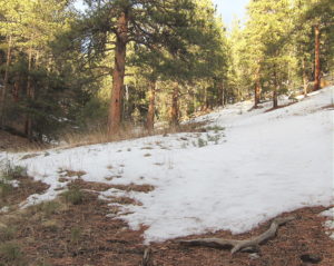
- 9083 Southern Route up the Draw
-
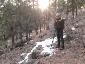
- 9083 Southern Route – N0TA on Old Trail
• Less than a mile up the draw from the “trailhead”, a large power line is visible ahead in a cleared right-of-way.
• Follow the power line northwest – this is the most challenging part of the trip.
• Downed trees and bushes obstruct passage through the cleared land beneath the wires.
• When we were there, this part of the route was covered by snow.
• Follow the power line north almost ¼ mile.
• Peak 9083 is visible to the north.
-
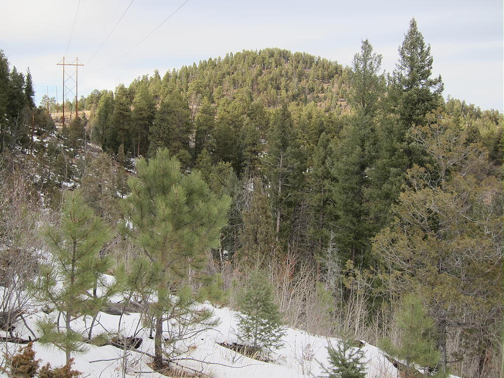
- 9083 South Ridge, from Southern Route near Powerline
• Contour northwest around a gully that drops below the lines.
• Continue to an obvious saddle at 8680 feet.
• The power line runs around the west side of Peak 9083, but don’t follow it past the saddle.
• From the saddle, climb about ½ mile up the pleasant south ridge to the summit.
Driving Directions to the “North Trailhead”:
• With a high-clearance 4WD vehicle and good road conditions, it’s possible to drive much closer to the summit via FR-295.
• At the split between FR-295 and FR-296, take FR-295, the left fork
• Drive north up FR-295 for about 2.5 odometer miles to this point:
N39 02.697 W105 22.052 Deg Min WGS 84
39.04495 -105.36753 Deg WGS 84
• This is the “North Trailhead” – there’s room to park and turn around
• It’s also possible to access the north end of FR-295 via the Platte Springs Road FR-210.
• The “North Trailhead” is about 1.7 odometer miles south of FR-210
• FR-295 is not suitable for ordinary cars – it’s a jeep road
The Hike from the “North Trailhead”
• There’s no marked trail, but game trails are available
• Hike southeast from the parking spot
• Cross under the large power lines
• Aim for the visible saddle north of the summit
• From the saddle, hike south, up the north ridge of the southern peak – don’t climb the northern sub-peak
• The climb is only about 0.45 mile and 360 vertical feet
• This hike requires only about 20 minutes in good conditions
Additional Details:
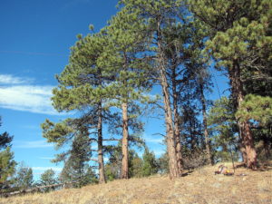
The hikes up the partly-forested south and north ridges of 9083 are pleasant – nice views reveal the surrounding terrain. Little of the local area has been burned by wildfire.
The actual summit of 9083 is a small, pleasant flat spot among trees and rocks – views are somewhat limited.
-
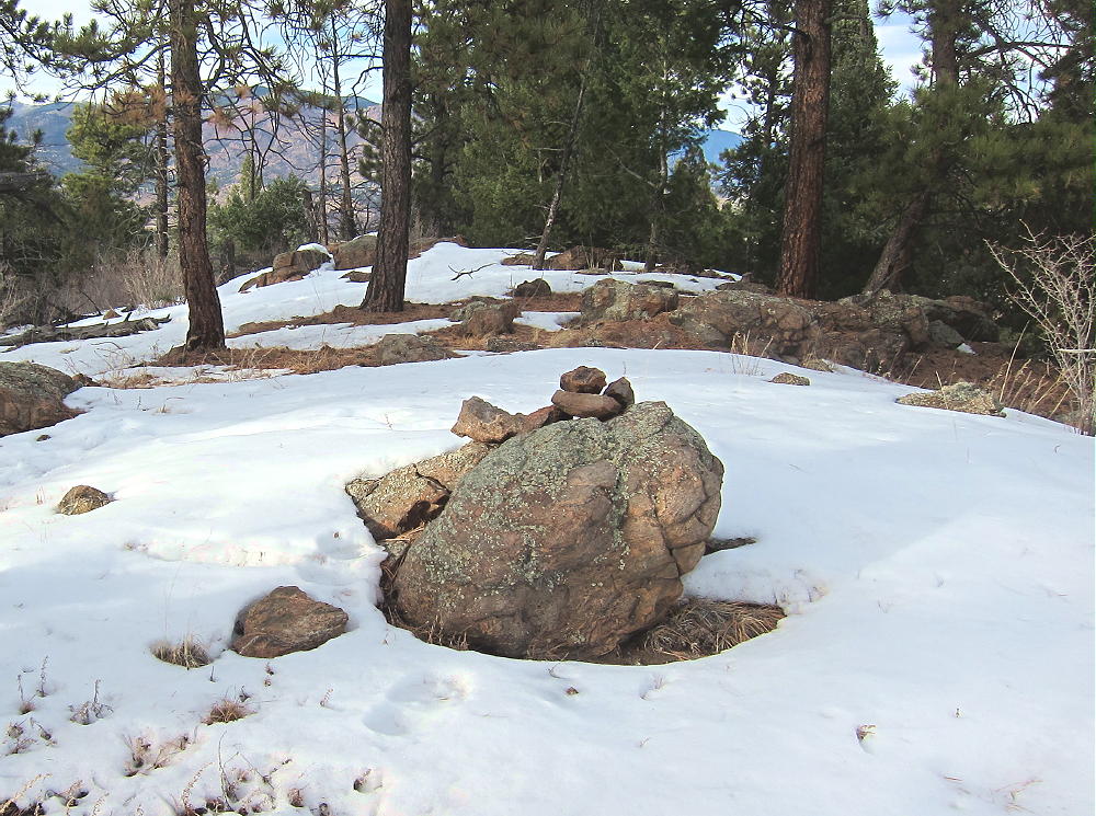
- 9083 Summit
This peak is an almost perfect SOTA site – the large activation zone extends down the south ridge, where there are sunny, grassy areas with nice trees and few rocks. Even though the power line is only a couple hundred yards west of the peak, we heard no HF line noise. Since we heard no corona noise when we walked under the high-voltage wires in 2015, it’s possible that the lines weren’t energized while we were there. In 2016 we also heard no obvious line noise.
N0TA and I activated 9083 simultaneously on different bands:
On Dec 9, 2015, KX0R logged 22 contacts on 7, 10, and 18 MHz CW; N0TA logged 25 contacts on 14 MHz CW.
On Nov 6, 2016, KX0R logged 22 contacts on 7, 10, and 18 MHz CW. N0TA logged 19 contacts on 10 and 14 Mhz CW.
-
- 9083 – KX0R SOTA Antenna
-
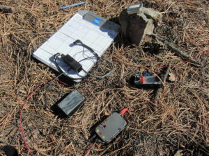
- 9083 – KX0R Radio Gear
VHF and UHF coverage from Peak 9083 is limited by various surrounding mountains, but views suggest that contacts might be possible toward the Denver area to the northeast, as well as the area north of Pikes Peak.
-
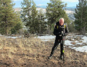
- 9083 – N0TA on South Ridge of 9083
-
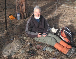
- 9083 – KX0R Operating SOTA on 9083
Even though the routes described require a high-clearance vehicle and good conditions, Peak 9083 could be reached by hiking or snow-shoeing from FR-295/296 in the south, or from Platte Springs Road 210 up north.
Peak 9083 lies close to several other accessible SOTA peaks and might be combined with any of them for a dual or multiple activation:
Peak 9036 W0C/SP-125 ~ 3 miles north
Tappan Mountain W0C/FR-066 ~ 3 miles northwest
Blue Mountain W0C/SP-123 ~ 8 miles south
Signal Butte W0C/FR-165 ~ 7 miles east
The trailhead for Peak 9036, W0C/SP-125 is at the same place on Road 210 where FR-295 heads south about 1.7 miles toward Peak 9083
In 2015 we activated Blue Mountain the same day, and that worked well, even on December 9, a short day near winter solstice. In 2016 we activated 9036 the same day, for an easy dual activation.
Hiking through the forest near Peak 9083 requires caution during hunting season. Wear hunter orange there in the fall!
73
George
KX0R
-
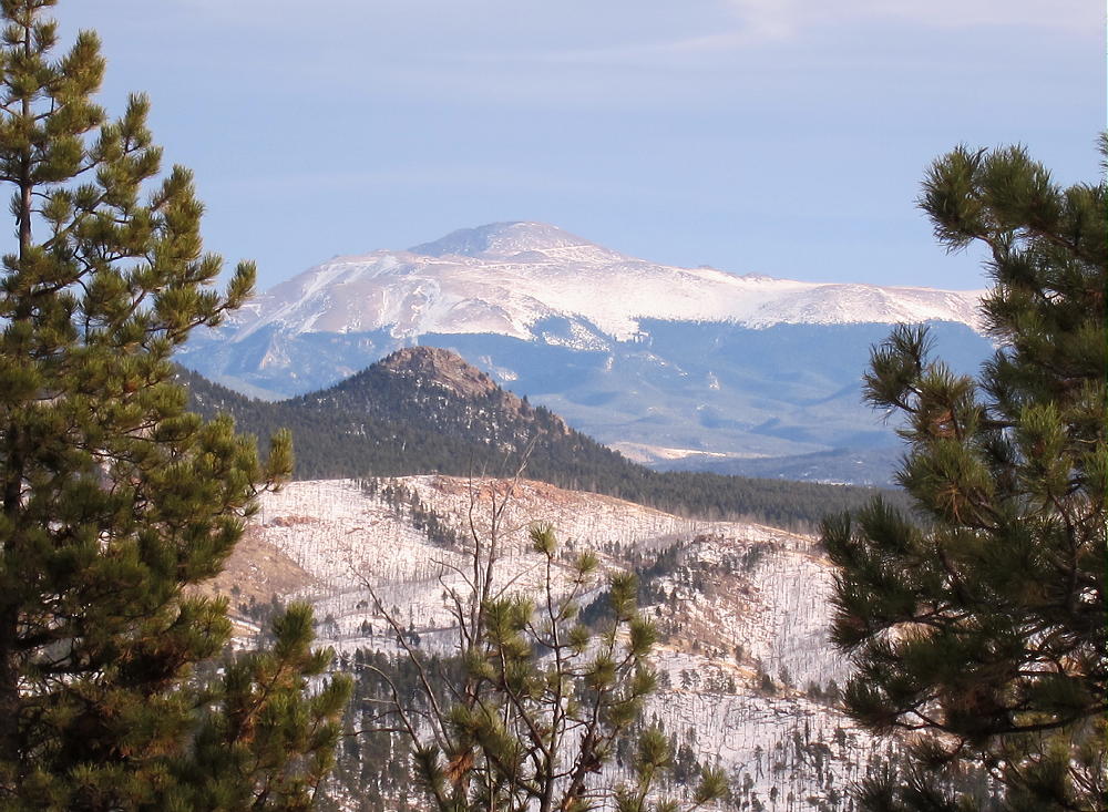
- 9083 – View of Pikes Peak
![]() !! WARNING !! There are old mountaineers, and
bold mountaineers... there are no old-bold mountaineers.
Hiking and mountain climbing are potentially hazardous activities particularly in Colorado with its extreme elevations. I am not accepting responsibility for any death or injury resulting from activations based on my trip reports. Proper training, experience, and personal capability assessment is required - enjoy!
!! WARNING !! There are old mountaineers, and
bold mountaineers... there are no old-bold mountaineers.
Hiking and mountain climbing are potentially hazardous activities particularly in Colorado with its extreme elevations. I am not accepting responsibility for any death or injury resulting from activations based on my trip reports. Proper training, experience, and personal capability assessment is required - enjoy!