


W0C/PR-113
10004
3049 m / 10004 ft
First Activation
Sep 22, 2016
By KX0R
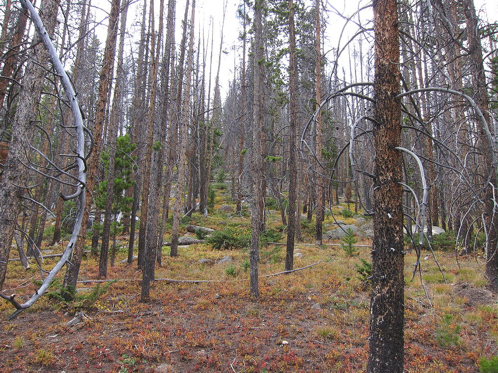
Peak 10004 is a fun SOTA peak hidden in the forest south of Lake Granby.
• Arapaho National Forest
• Good marked trail much of the way
• Near scenic Strawberry Lake
• Off-trail final climb, about one mile to a pleasant summit
• Nice scenery – near-wilderness
• Summit is rarely visited
• ~ 6.4 miles round-trip
• ~ 1700 vertical feet
-
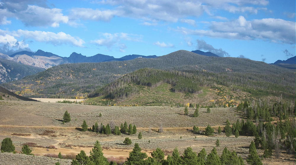
- 10004 – View from Near Lake Granby – Forested Peak Just Right of Center
Driving Directions:
• Drive west from Denver on I-70
• Turn north on Highway 40
• Cross Berthoud Pass, drive through Winter Park, and continue north to Granby
• Just past Granby, turn north on Highway 34
• Follow 34 about 5 miles to Lake Granby
• Turn right, east, on Road 6
• Drive east along the lake, toward Monarch Lake, for about 6 miles
• The Strawberry Lake Trailhead is where the trail along Strawberry Creek reaches the road.
• Google Maps shows the trailhead, but not the trail.
• Google Maps trailhead coordinates: 40.1138, -105.804
• USFS maps don’t show the trailhead or the trail
• The trailhead is about ¼ miles west of a visible point of land that extends north along the shoreline.
• The trail may be marked, but there’s no large sign or anything obvious.
• Park on the north side of the road
• Parking is free.
The Hike:
• Even though poorly mapped and marked, the Strawberry Lake Trail is a good built, maintained trail.
-
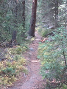
- 10004 – Strawberry Lake Trail
• The trail follows Strawberry Creek up to Strawberry Bench and Strawberry Lake.
• Hike the trail up about a mile to the huge meadows west of Strawberry Lake.
-
- 10004 Route – Strawberry Bench
• At a marked trail junction with Strawberry Bench Trail 9, head west on Strawberry Creek Trail 9.1.
-
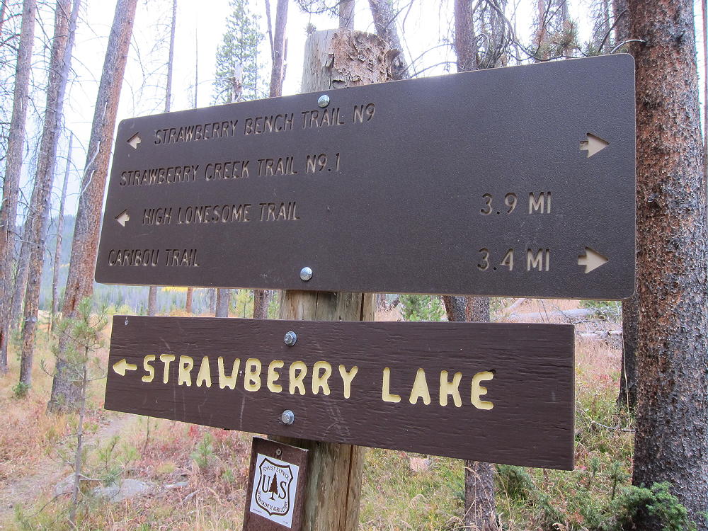
- 10004 – Trail Junction for Trail 9.1
• Trail 9.1 isn’t shown on Google Maps.
• Follow this good trail west for almost a mile, as it climbs to a saddle.
• 10004 is visible to the right, west of the saddle.
• Near the saddle, east of where the trail descends southwest into a valley, head northwest off the trail through open forest.
• Climb NW about 0.2 mile up to a saddle on a low ridge running east-west at about 9350 feet.
• Follow the ridge WSW, and climb about ¼ mile up to another ridge at about 9680 feet.
• Game trails help make this route relatively easy.
• At 9680 feet, follow game trails northwest along the obvious ridge, up to the summit
• The off-trail part of this hike is relatively easy, with little actual bush-whacking, but there’s some deadfall.
-
- 10004 Route up Summit Ridge
• GPS is useful and recommended for this hike.
• Be careful to return to the main trail by the same route used for the ascent.
Additional Details:
The hardest part of this trip was finding the Strawberry Lake Trailhead! I was looking carefully for it and still drove right past it. You have to look for the actual trail – there wasn’t much to see when I was there. Perhaps someone removed a sign. The place where the Creek comes down is at an indentation in the shoreline of the Reservoir, just west of a point on the shore, near the west end of Arapaho Bay. Look for the Creek and its valley, and you’ll eventually see the trail. Be sure you have a map or GPS handy when you approach the trailhead.
The summit is pretty easy to find. You can see where it is before you leave Trail 9.1. Once on the ridge, just continue to the highest bump. The large activation zone is forested and pleasant, and there are plenty of trees to support an antenna or a pole.
-
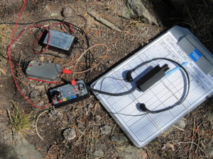
- 10004 SOTA Activation Radio Gear
-
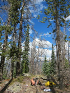
- 10004 SOTA Activation
There’s no development for miles, so there’s little RF noise, and the site is perfect for HF. It’s not blocked in any direction for skip signals. However, this is likely a poor site for VHF/UHF, except in the area around Lake Granby.
Views from the summit of 10004 are limited by the trees, but Lake Granby is visible far below.
-
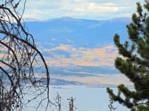
- 10004 View North Across Lake Granby
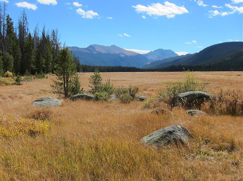
From the east ridge, there’s an open view of Strawberry Lake on its immense glacial bench, with the Indian Peaks not far in the distance.
-
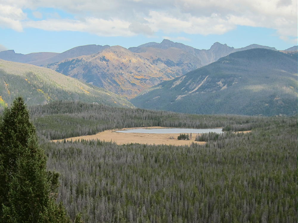
- 10004 – View East Across Strawberry Bench to Indian Peaks
Along with activating 10004, you might want to take a short side-trip east on Trail 9 to Strawberry Lake. This is a special place, and access is restricted to a protected viewing spot. A sign near the lake explains about the fragile shoreline and why protection from people walking there is important. There are no fish in the lake. The area gets some use from campers and hikers in the warmer months. This might be a good place to see elk or moose, but I saw none – but there are game trails and tracks all through the woods.
-
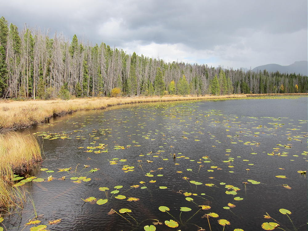
- 10004 – Side Trip to Strawberry Lake
The day I was there, a brief rain squall came in suddenly, and it was fun to be there with rain drops splashing in the lake.
73
George
KX0R
![]() !! WARNING !! There are old mountaineers, and
bold mountaineers... there are no old-bold mountaineers.
Hiking and mountain climbing are potentially hazardous activities particularly in Colorado with its extreme elevations. I am not accepting responsibility for any death or injury resulting from activations based on my trip reports. Proper training, experience, and personal capability assessment is required - enjoy!
!! WARNING !! There are old mountaineers, and
bold mountaineers... there are no old-bold mountaineers.
Hiking and mountain climbing are potentially hazardous activities particularly in Colorado with its extreme elevations. I am not accepting responsibility for any death or injury resulting from activations based on my trip reports. Proper training, experience, and personal capability assessment is required - enjoy!