


W0C/FR-148
Buckeye Mountain
3091 M / 10140 ft
Aug 10, 2013 First Activation
Jan 25, 2014
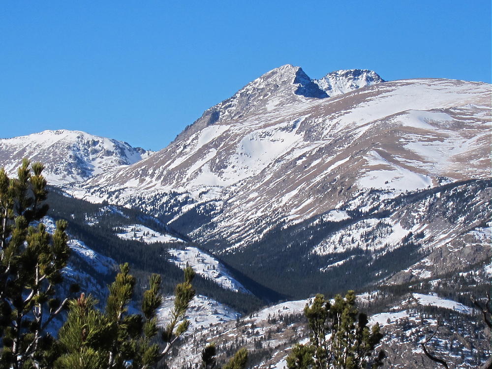
Buckeye Mountain is a prominent sub-alpine summit between South Boulder Creek and Middle Boulder Creek, about three miles southwest of Nederland. The peak is on the south side of the Eldora Mountain Resort; access is tricky because of private land.
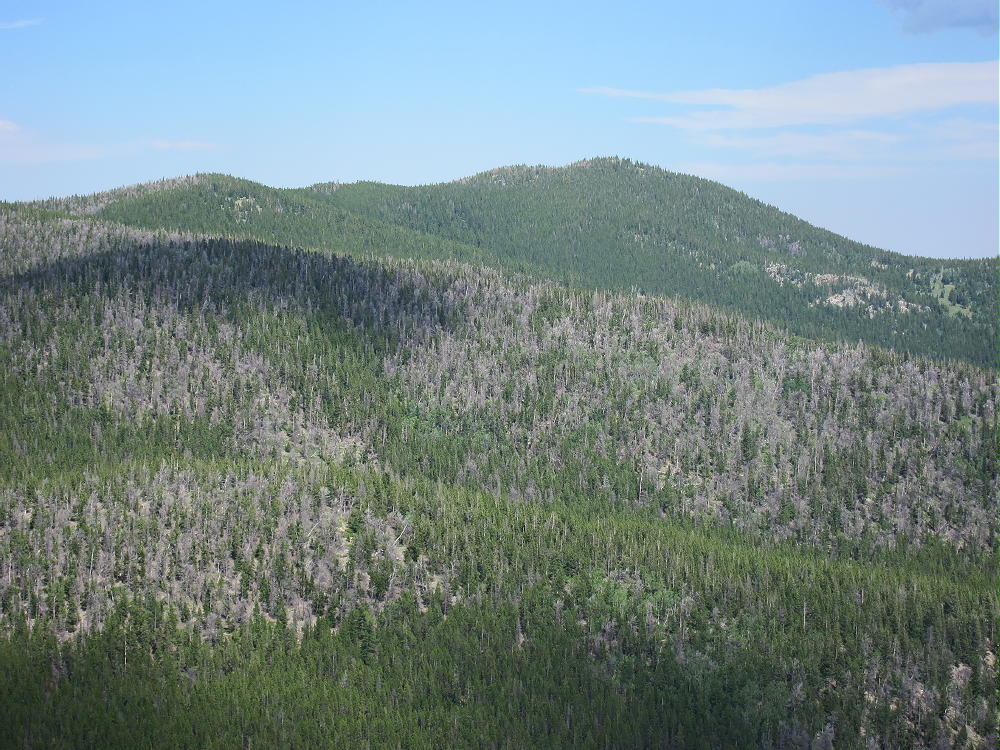
Buckeye Mountain West Side
Some of the Nordic trails controlled by the Eldora Resort lead close to the summit of Buckeye, so the easiest and best way to activate this peak is to climb it using those Nordic trails! This wild and beautiful mountain offers a fun, unique winter activation.
To climb Buckeye, start by driving to Nederland, and follow Highways 119, 130, and 140 about 3 miles west to the Eldora Mountain Resort. To avoid crowds and parking problems, get there early. Park on the east side of large parking area and walk over to the Nordic Center, east of the main ski area. Walk inside and purchase a day pass from the friendly folks, and be sure to get a copy of the trail map.
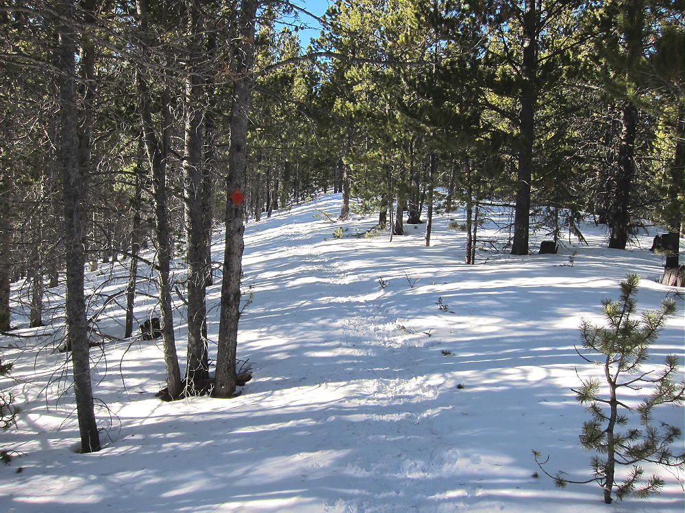
The groomed ski trails and the snowshoe paths overlap somewhat, and a map is needed in order to navigate this complex Nordic recreation area. Skiers don’t want snowshoe tracks on their groomed trails, so separate snowshoe trails are provided and marked.
The Eldora Nordic Trail Map provides much key information required to approach Buckeye, but there are a few points to note:
1) The Nordic map is upside down – south is at the top. Compass directions are not shown on the map, and there is no distance scale either! Just remember that Buckeye is south of the parking area, and you’ll be going uphill to the south. When comparing to a GPS or topo map, turn the Eldora map upside down to reduce confusion.
2) The Nordic map does not show Buckeye or the route to the summit. Good navigation is required for the last part of the climb. You must leave the marked trail, travel on unmaintained trails, and climb off-trail through the woods to the peak.
3) Although the lower parts of the Nordic area are busy with skiers and hikers on snowshoes, few people visit the upper trails near the top of Buckeye. Almost no one summits Buckeye in winter – you’re on your own up there! The return trip could be tricky if you make a navigation error.
4) The Google map on the SOTA page for Buckeye shows the Buckeye summit incorrectly – the summit is about 1000 feet south of where it’s shown – this is obvious from the contours. The Google map also doesn’t show any of the trails up there.
I recommend using snowshoes for this expedition. If you’re good on Nordic skis, go for it! The last part of the ascent is off-trail and somewhat rough, and snowshoes are useful. If the snow is not too deep, it certainly would be OK to ski most of the way and then hike to the summit.
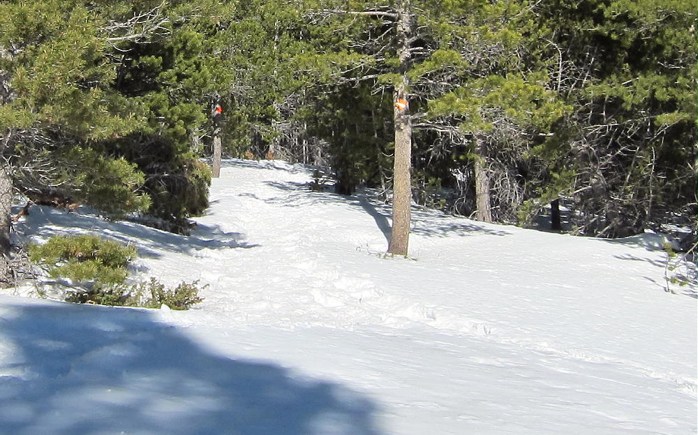
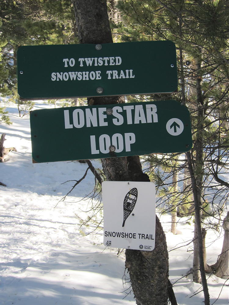
From the Nordic Center, ski or snowshoe generally south up toward Buckeye. Depending on whether you skiing or snowshoeing, you will use differently named trails to ascend the first half mile or so. Then either climb via the eastern Rising Sun Trail or one of the western trails (Setting Sun, or Lone Star). You need to end up at the southern Lone Star Loop, shown as a red snowshoe route at the top of the Nordic Center map (south).
Here’s my somewhat incomplete GPS Track:
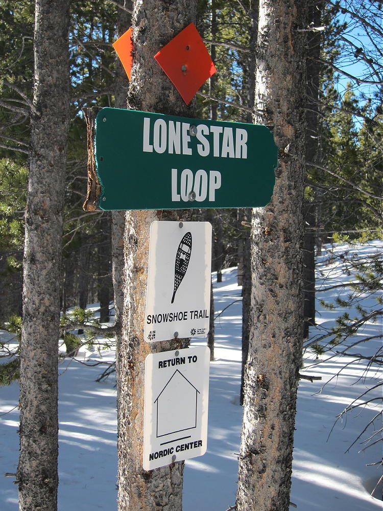
Eldora Nordic Area Lone Star Loop Sign
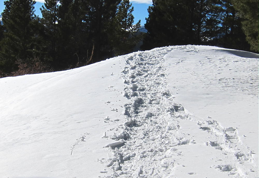
There are unmaintained trails south of the Nordic trails, off the Nordic map, and these trails provide access close to the Buckeye summit. I climbed up the Rising Sun trail to the intersection with the marked cutoff to the Tennessee Mountain Cabin. Buckeye is somewhat visible once you get up there. I headed south along an unmaintained trail, and after about 1/2 mile, I reached a saddle at 10,000 feet, only about 1000 feet west of Buckeye’s summit. Then I left the trail and headed for the northwest ridge of Buckeye. It gets a bit steep and rocky near the top, but it’s no problem to reach the peak.
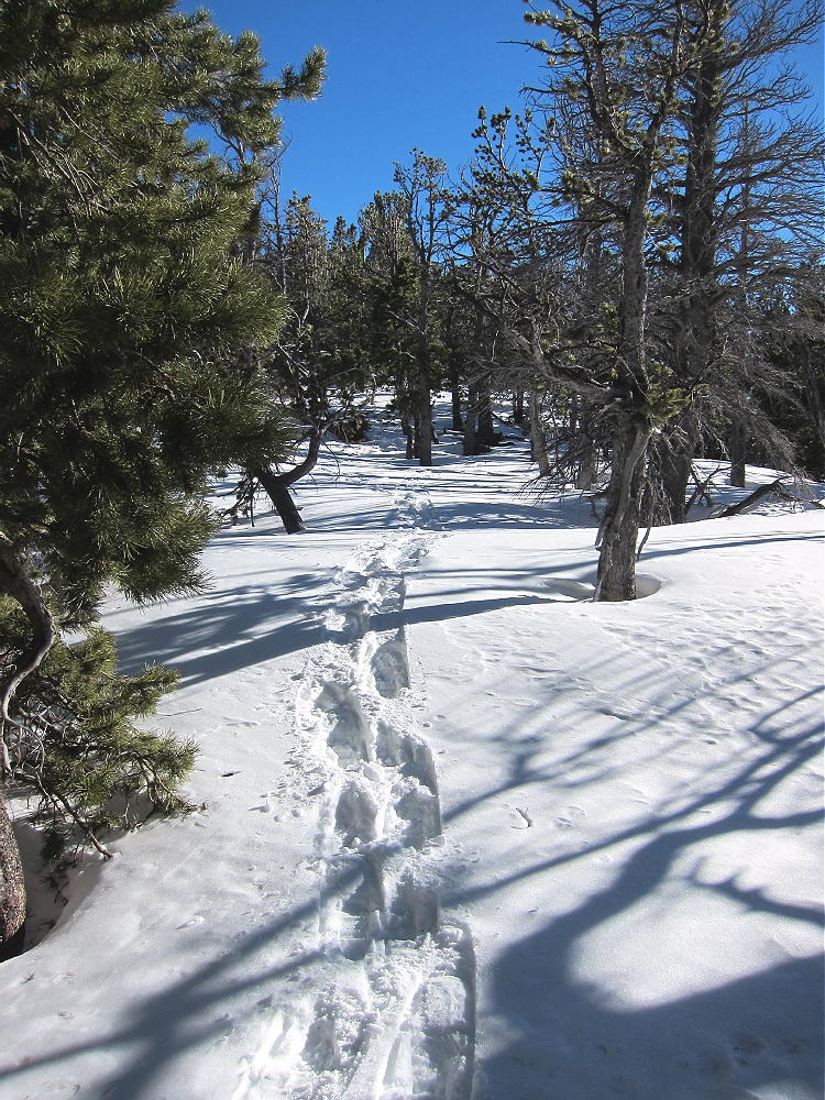
Off-trail Route to Buckeye
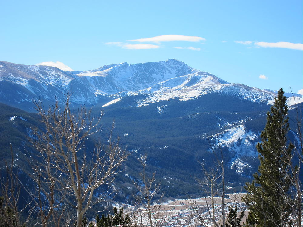
The summit is a rocky ridge with many live and dead trees. The activation zone is large, and there are several places where you can set up and get on the air. I went to the eastern part of the ridge to minimize wind. On a calm, sunny day the views east, south, and west are spectacular! Be prepared for wind on top.
Click this Image!
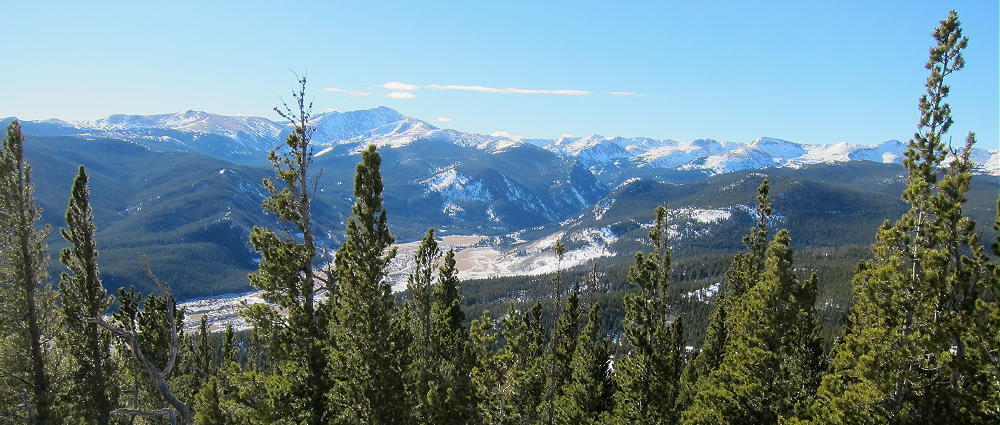
View Southwest from Buckeye Mountain
I didn’t take a pole, because I wanted to be inconspicuous on the Nordic trails. There are plenty of trees on the summit ridge that can be used to support a wire for a successful HF activation – a pole is unnecessary.
-
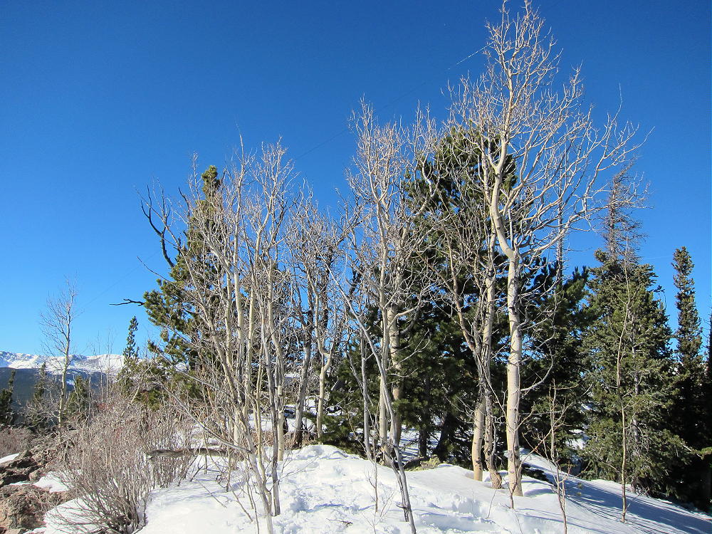
- Buckeye Activation Site and Almost Invisible Antenna in the Trees
-
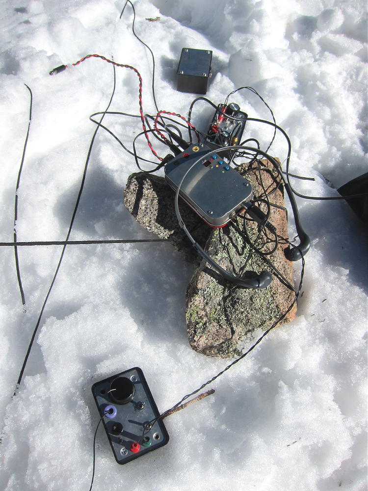
- Buckeye Activation Radio Gear
Buckeye is a near-perfect radio site, with a clear shot in most directions. It’s not ideal for VHF/UHF, but it does have a view out across the plains. The summit is wild, with no path and little evidence of visitors at the top. Please treat this place with due respect.
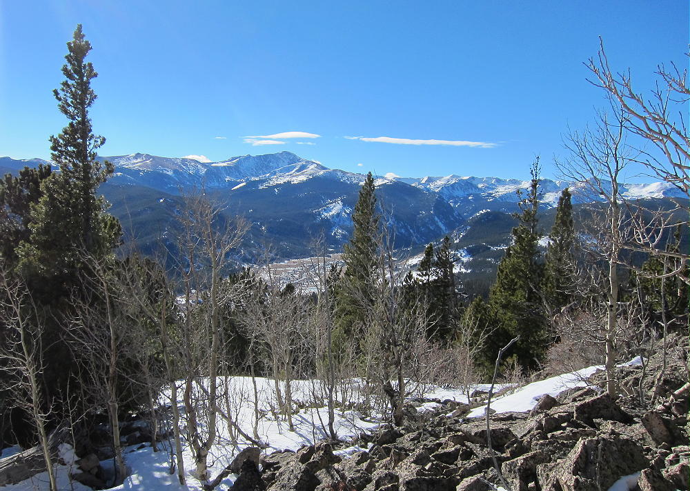
View of James Peak Southwest from Buckeye
The route to the top of Buckeye is not signed or posted. There are several trails in the area, and they appear to be open to the public. There is no prohibition on leaving the Eldora Nordic trails and climbing Buckeye Mountain. This summit is difficult to access without using the Eldora Resort trails. All things considered, climbing Buckeye by way of the Eldora Nordic area is a fun challenge. I got good value for my Nordic ticket on January 25, 2014. If you try it, pick a day with a good weather forecast, get an early start, and take a GPS device with maps – and a topo map.
This would be a tough trip with a lot of soft, fresh snow. The upper part of the Nordic area is not groomed, and even with snowshoes, access could be difficult if the snow is deep. On old consolidated snow, the off-trail route is easy; the unmaintained trails are easy to find, because people use them occasionally.
-
- Unmaintained Trail West of Buckeye 1
-
- Unmaintained Trail West of Buckeye 2
-
- Unmaintained Trail West of Buckeye 3
The route described here is about 2 miles each way, with a vertical gain of about 800 vertical feet. It took me less than two hours for the ascent with snowshoes and good snow conditions, including breaks and navigation. The descent was about 1 hour and 10 minutes.
Return to the Nordic area the way you came. If you lose the route, all you have to do is to head north until you meet the Lonestar Loop. Then return to the Nordic area. The vaious trails are marked clearly at the lower elevations. As the crow files, it’s less than 1.5 miles from Buckeye’s summit to the Eldora parking lot.
73
George Carey Fuller
KX0R
-
- James Peak from Buckeye Mountain
-
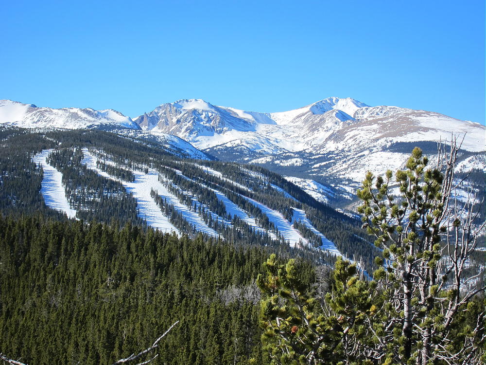
- Eldora Ski Area from Buckeye
-
- Arapaho Peak from Buckeye
-
- Eldora Nordic Area Trail Sign
![]() !! WARNING !! There are old mountaineers, and
bold mountaineers... there are no old-bold mountaineers.
Hiking and mountain climbing are potentially hazardous activities particularly in Colorado with its extreme elevations. I am not accepting responsibility for any death or injury resulting from activations based on my trip reports. Proper training, experience, and personal capability assessment is required - enjoy!
!! WARNING !! There are old mountaineers, and
bold mountaineers... there are no old-bold mountaineers.
Hiking and mountain climbing are potentially hazardous activities particularly in Colorado with its extreme elevations. I am not accepting responsibility for any death or injury resulting from activations based on my trip reports. Proper training, experience, and personal capability assessment is required - enjoy!