


W0C/FR-047
Mount Judge
3140 m / 10301 ft
Dec 20, 2014
By KX0R
Thanks to AG5CQ for his first activation of Mount Judge on August 9, 2014!
Mount Judge is an easily-overlooked summit about 2 miles southeast of Squaw Mountain and about 7 miles northwest of Evergreen. This seldom-visited mountain has no marked routes, and climbing it requires navigating up through a thick forest on the north side of the mountain. The ascent is about 1100 vertical feet, and about 1.2 miles. It takes about an hour to climb.
Drive up I-70 west of Denver, take exit 252 onto Evergreen Parkway, route 74, and drive several miles west to Bergen park. Turn right, northwest, on marked route 66, the Squaw Pass Road, and climb this paved road for several winding miles. At a pass and intersection where Road 475 forks off down to the south, a convenient trailhead is located on the north side of the road. There is a large gate with a closed USFS road leading north across a huge meadow; Santa Fe Mountain dominates the view 2 miles to the north. The forested slopes of Mount Judge beckon above to the southwest, but there is no trail.
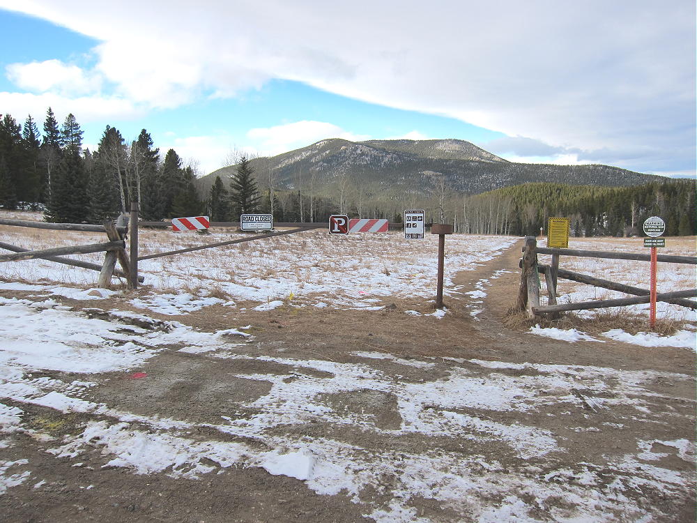
Trailhead along Squaw Pass Road
Cross the highway and walk up along the paved road for about 500 feet. Note the position of Mount Judge, head up into the forest at any convenient place, and climb southwest toward the summit. Try not to head too far to the east. Except for an unreadable sign at an old closed road down near Road 475, there are no signs along this section of Squaw Pass Road, or on the forest route I used for the climb. Several hundred feet up into the woods I found an old abandoned logging trail, and I was able to follow it to an elevation exceeding 9800 feet.
-
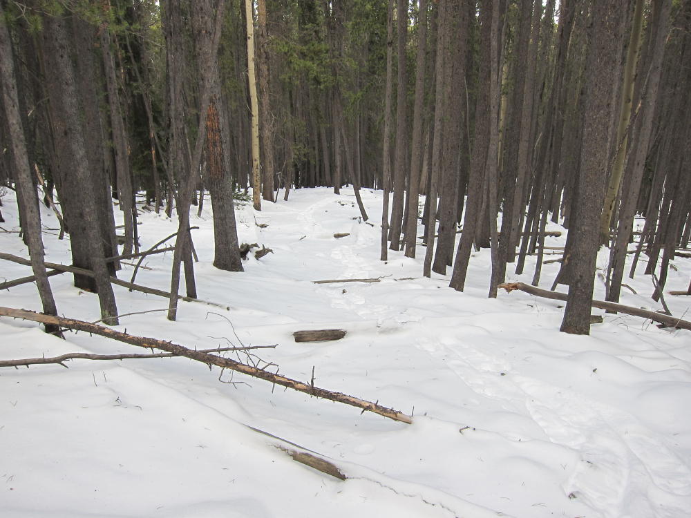
- Mount Judge Hidden Logging Road
-
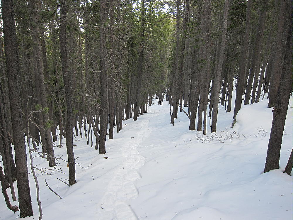
- Mount Judge Secret Route
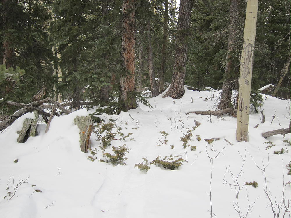
If you don’t find this or another logging road, the route is through a thick lodge-pole pine forest. There are numerous fallen trees and old logs, and it gets worse as you go up the steep section about half way to the top. I was on snowshoes in about 5-6” of snow the day I ascended, and the logging trail was pure joy compared to the alternatives I saw.
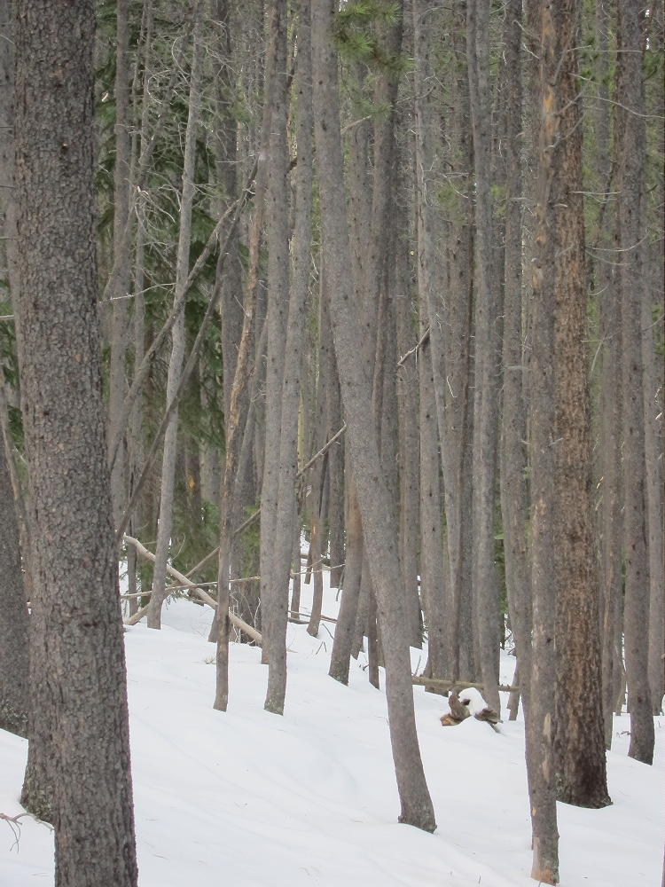
Mount Judge Lodgepole Forest
Be sure to take a map and compass. I used GPS for primary navigation, and it was very helpful. The summit is not visible from the route in the forest. At about 10000 feet, the position of the peak can be inferred, although it isn’t visible. The last 300 vertical feet is a bushwhack hike, a bit tricky on snowshoes, with fallen trees, rocks, and other obstacles. There may be a better, more gentle route west of where I went up. I came up at the east summit, which is a large rock with a couple of stones placed on top. This is a false summit – the actual peak is a hump in the woods about 300 feet to the west – the real summit is about 10 feet higher.
Mount Judge Summit
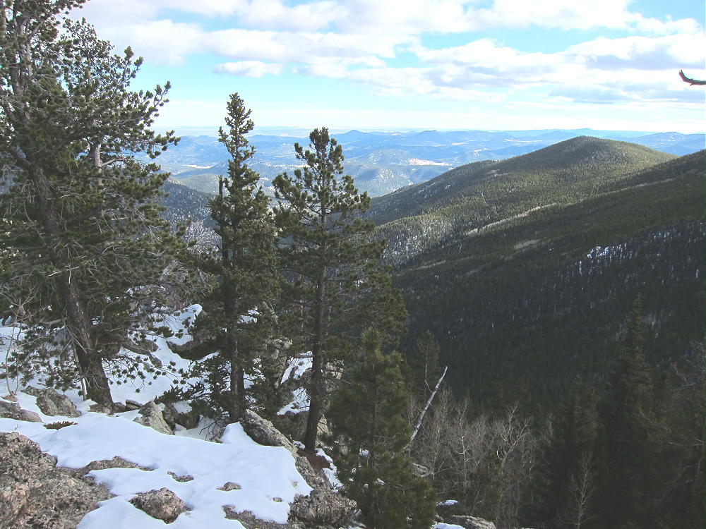
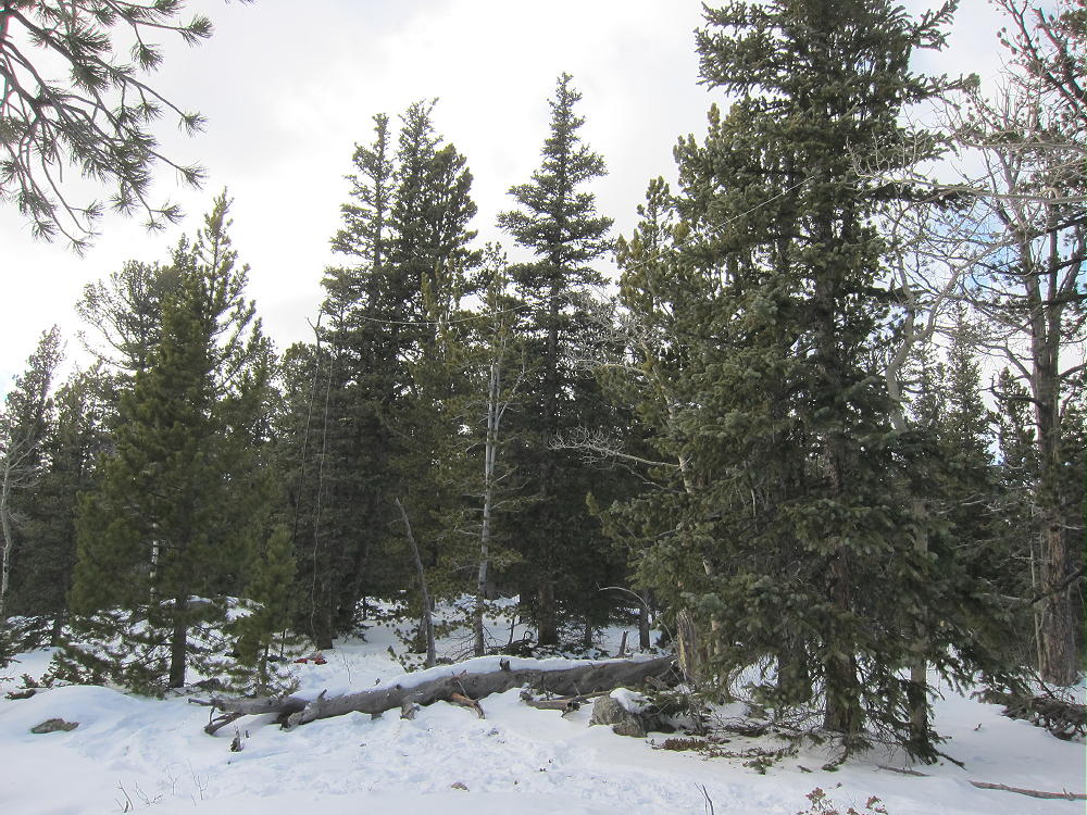
The top part of the mountain is flat and is forested with medium and large trees; the activation zone is large and convenient. There are a couple of viewpoints off the south and east sides. The views are impressive – the vertical relief down to Bear Creek below is about 2700 vertical feet.
-

- Mount Judge View to the Southeast
-

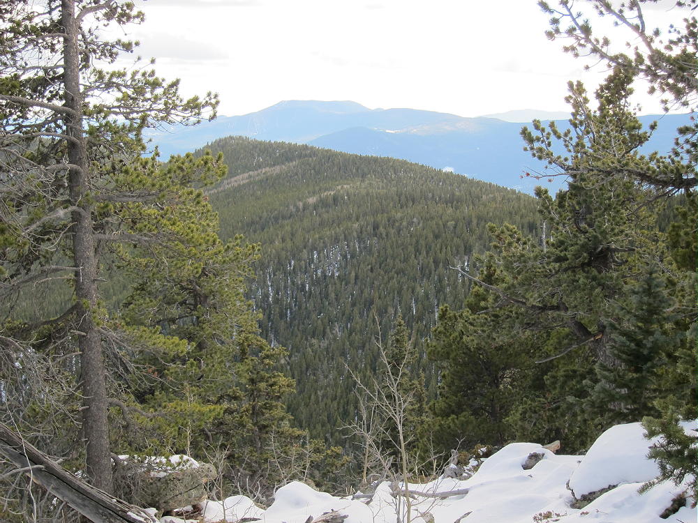
- Mount Judge Southeast Ridge
This is an excellent, quiet HF site, as well as a good VHF and UHF site, with good coverage of much of the Denver area. I had a fine activation up there, despite the temperature in the mid-20’s at 1 PM, and it was well worth the climb up through the forest.
-
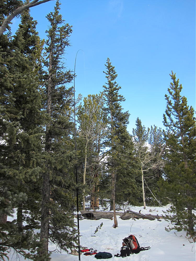
- Mount Judge Activation near Summit
-
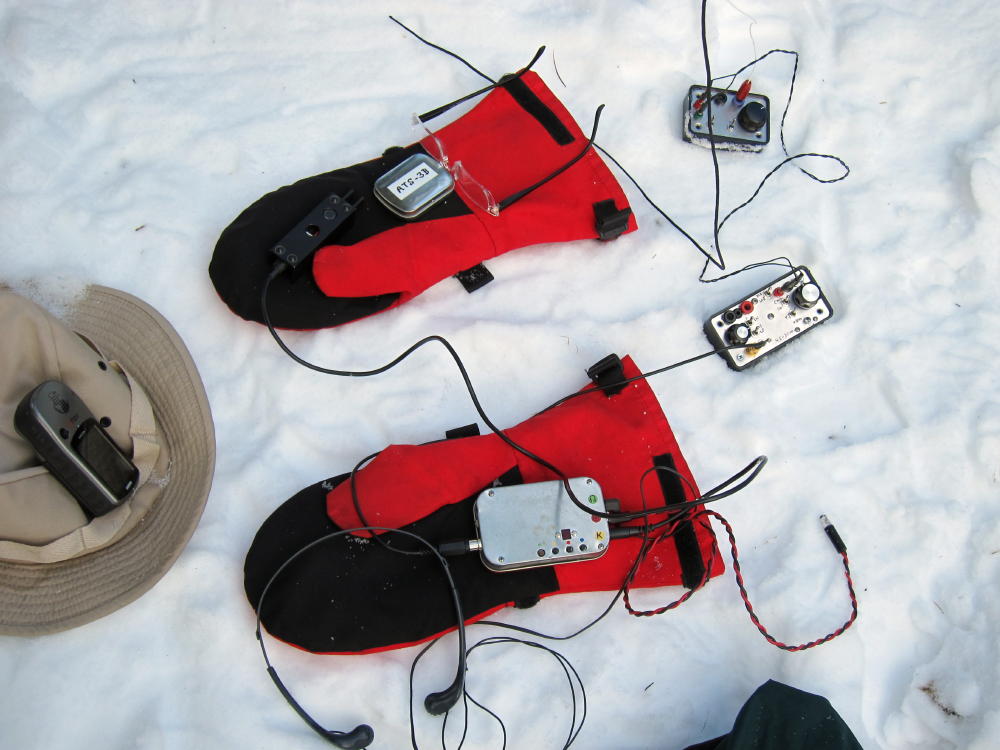
- Mount Judge Activation Gear
-
- Mount Judge Activation Antenna
There are other routes to the summit, and at least one other trip report is available online. The natural NW ridge route from Squaw Pass appears to cross private land SE of Squaw Pass. There is an old closed road that contours around the east side of Mount Judge following the 9200 foot contour – this might provide access via a steep slope up to the long south ridge – but I have not attempted this route. The route I used appears to have no access problems, and it’s the most direct route from the trailhead. In summer it should be a shady, cool route to the top. Since the road is usually plowed in winter, Mount Judge provides a practical 4-point summit close to Denver, with snowshoe access and a 3-point seasonal bonus. I don’t recommend doing the north-side route in deep snow, unless someone has broken trail.
Please be careful on Mount Judge – and tell someone where you’re going and when you expect to return.
73
George Carey Fuller
KX0R
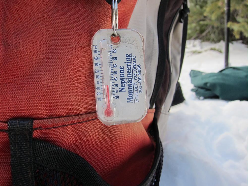
Mount Judge Activation Temperature
![]() !! WARNING !! There are old mountaineers, and
bold mountaineers... there are no old-bold mountaineers.
Hiking and mountain climbing are potentially hazardous activities particularly in Colorado with its extreme elevations. I am not accepting responsibility for any death or injury resulting from activations based on my trip reports. Proper training, experience, and personal capability assessment is required - enjoy!
!! WARNING !! There are old mountaineers, and
bold mountaineers... there are no old-bold mountaineers.
Hiking and mountain climbing are potentially hazardous activities particularly in Colorado with its extreme elevations. I am not accepting responsibility for any death or injury resulting from activations based on my trip reports. Proper training, experience, and personal capability assessment is required - enjoy!