


W0C/FR-042
Santa Fe Mountain
3212 m / 10537 ft
Oct 26, 2014
By KX0R
When Walt W0CP posted the first SOTA activation of Santa Fe Mountain on Oct 18, 2014, I was surprised! I believed that the prominent mountain was private land. It actually is public, and it’s a nice place to activate, but access takes some work. Read Walt’s directions, and perhaps try the steep jeep trail up from Idaho Springs, if you have a 4WD vehicle. Otherwise, here’s how to hike up from the east side – thank you for the suggestion Walt!
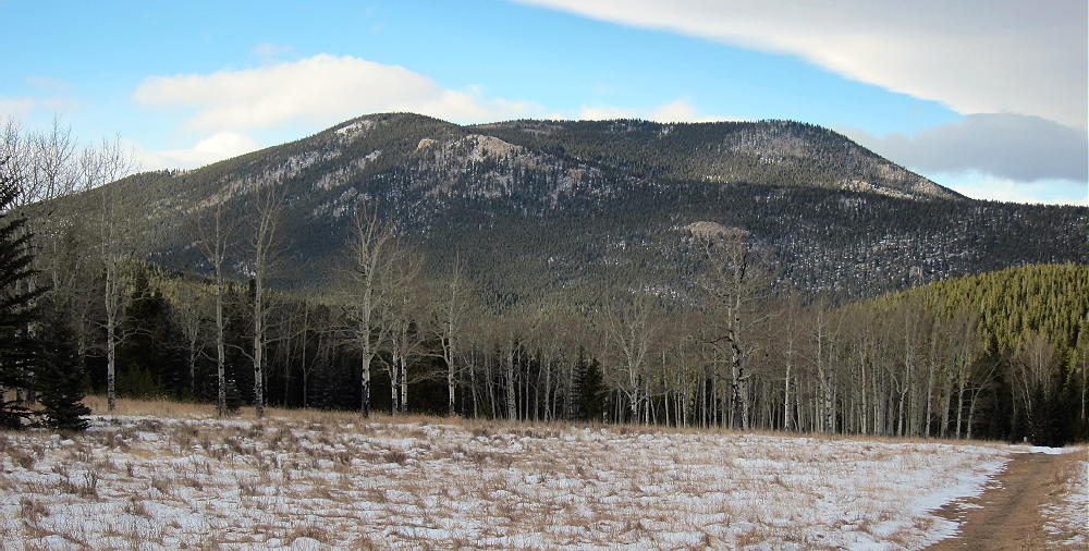
Santa Fe Mountain from Squaw Mountain Road
Drive to Exit 247 on I-70 west of Denver. This is just before the highway drops down into Clear Creek Canyon. It’s also possible to reach this point by coming up the connecting road from Highway 6. Head south from the exit and immediately go left, southeast, on paved Road 181. 181 soon splits, and 182 leads down into Beaver Brook Canyon – this is where you need to go. Once in the narrow canyon, the road becomes unpaved and steep in spots – but most cars should have no problem in good weather. After about 2 miles, look for a marked parking spot on the north side of the road – if you come to Pat Creek Road, turn around and go back to the designated Open Space parking. There is no legal parking on Pat Creek Road.
From the parking spot, hike up the main road a short distance, turn left (south) on Pat Creek road next to the creek, continue past several houses on the marked trail, and pass around a gate with a sign designating the Beaver Brook Watershed. The rules are posted: dogs on leash, no camping, no fires, no dumping, and no motorized use. Hiking, horses, bicycles, and legal hunting are allowed.
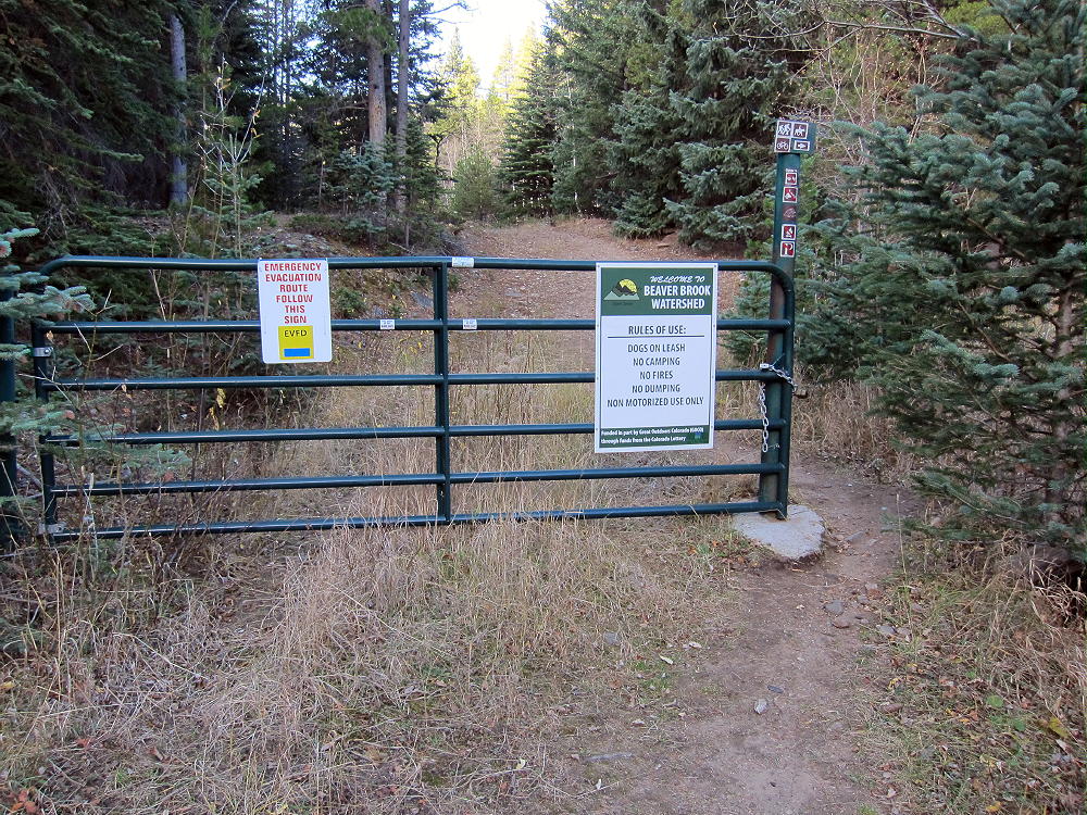
Gate into Beaverbrook Watershed leading to Santa Fe Mountain
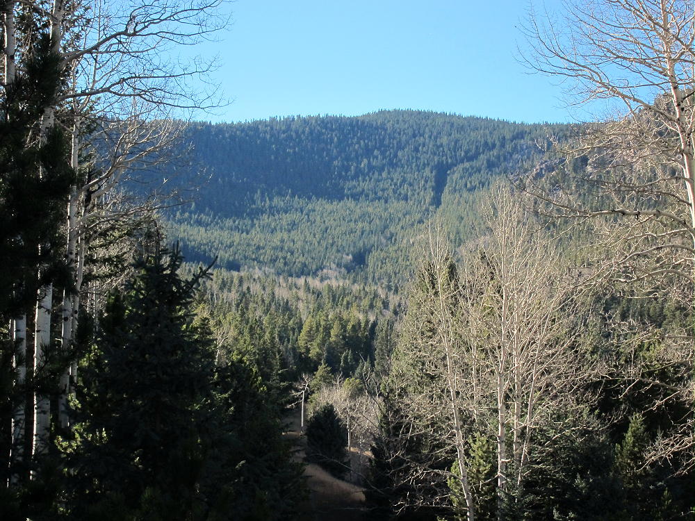
Just past the gate, the road enters a huge meadow area, and that’s when it becomes clear what a special place this Watershed is, as you look up the long valley to the top of Santa Fe. Please respect the access we enjoy – this is a large tract of wild land, perhaps several square miles, with aspen groves, elk and deer, and a fine SOTA peak!
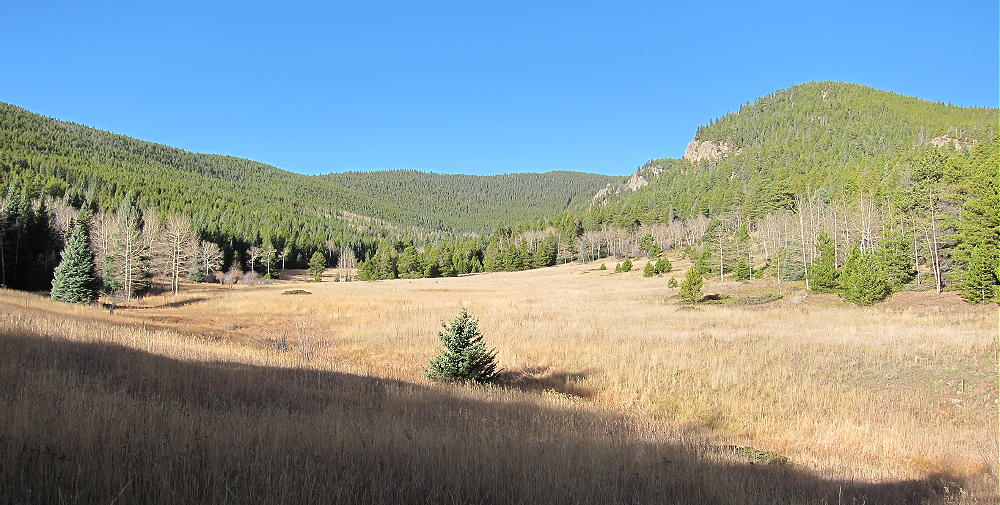
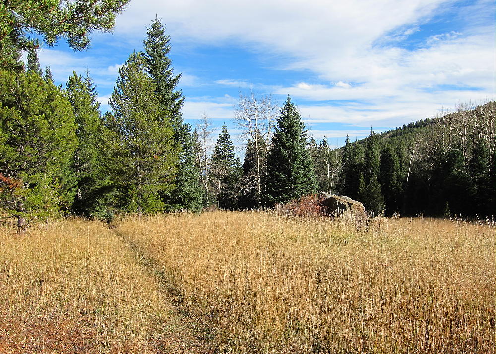
Beaverbrook Watershed Meadows leading to Santa Fe Mountain
Head up the road to the south, and at the first obvious junction, head right, west, along a path that goes up the south side of the valley toward the summit. This is actually the route of a large, high-pressure, underground Xcel gas line, and that’s why the route shown on Google Maps exists.
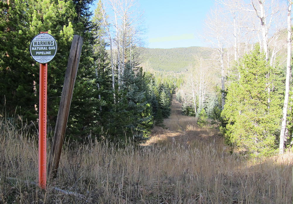
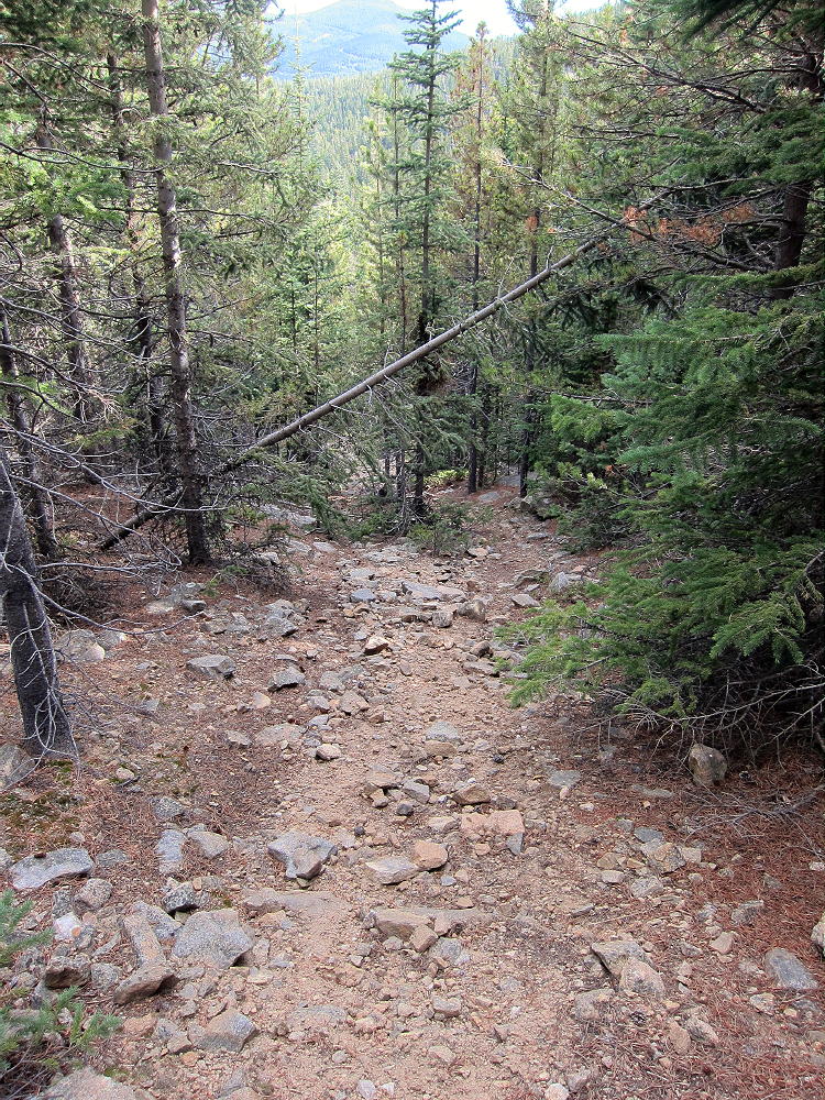
Santa Fe Pipeline and Hiking Route in the Watershed
The gas line goes right up the steep east drainage of Santa Fe and through the saddle south of the peak. Signs mark the pipeline most of the way up the valley. It’s easy to follow until about 9200-9400 feet. There are multiple old logging roads in that area, and the gas line disappears into the thickets!
Gas Pipeline Route up East Side of Santa Fe Mountain
Google Maps shows this as a jeep trail, but it is not – at least not all of it. Parts of this route are obscure. The steepest part of the pipeline still has steel cables left from the construction, and it’s too steep for most 4WD vehicles. When I climbed the mountain, with my GPS running, I lost the pipeline route, so I just followed some good old logging roads up the slope, slightly north of the pipeline route, and eventually I headed up through aspen and pine forests to the summit. This climb was never difficult. When I came back down, I followed the pipeline steeply down the rocky slope, and then I saw why the route is so tricky. There is a long section of the pipeline that is completely overgrown with thousands of lodgepole pines, and they are so close together that they’re impenetrable. The place where this overgrowth exists is right in the valley bottom, along the small creek, so the trees have had plenty of water over the years. Following the pipeline through this section is possible, but it’s not worth the hassle!
Use your creativity and choose a reasonably open line that heads up toward the saddle, or toward the summit. Use the old roads as long as they head where you need to go. Avoid any steep outcrops – go south around them. If you go too far north near the top, you’ll end up on the east ridge of Santa Fe, which is a gentle, viable route to the summit. I recommend using GPS for this hike. The steep bushwhacking part is actually not long, and the route gets easier toward the top. It’s about three miles from the parking spot to the summit, with a gain of about 2000 vertical feet – figure on a couple of hours – maybe more.
Gas Pipeline Route down East Side of Santa Fe
Here’s a good report on this hike – including winter conditions.
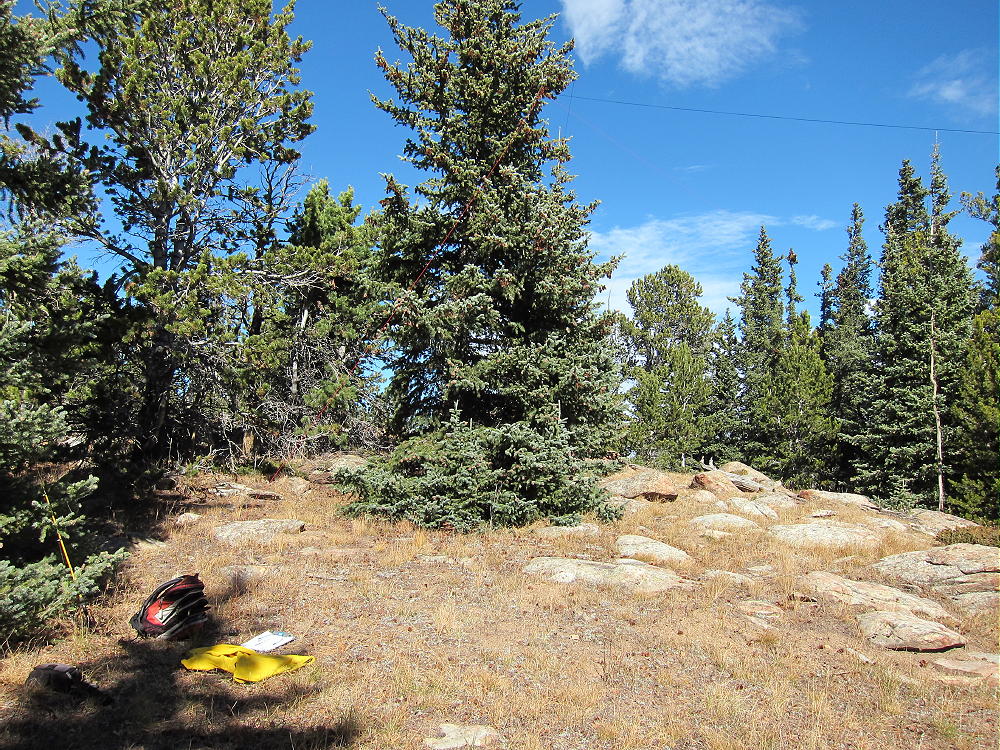
The broad summit area is forested, with limited views, and few people go there. There is a nice sheltered meadow spot north of the summit rocks; I set up my end-fed wire there using a small fishing pole to cast lines into two trees. This is an ideal HF site, and a good VHF/UHF site. Despite the trees, the radio view east is mostly open.
-
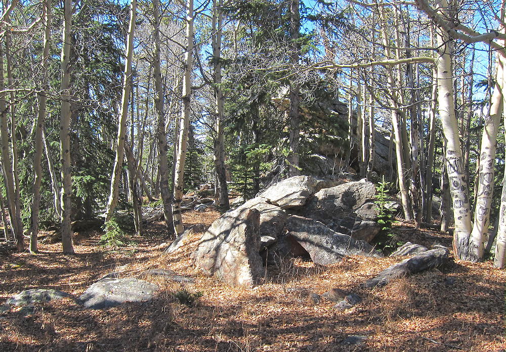
- Santa Fe Mountain Summit Area
-
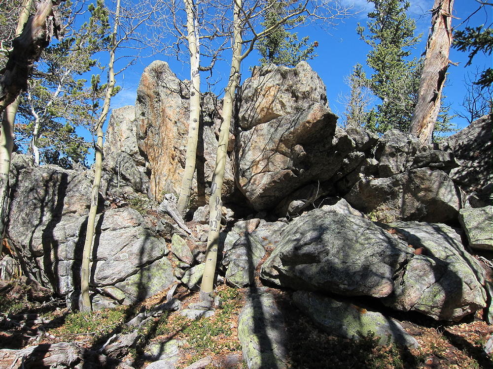
- Santa Fe Mountain Summit
-
- SOTA Activation near Santa Fe Summit
From this almost secret spot you can have a private activation, deep in wilderness, except for the roar of motorcycles on the Squaw Pass Road to the south. The south slope of the peak is covered with old prospect holes, suggesting a previous flurry of mining activity long before the pipeline was put in.
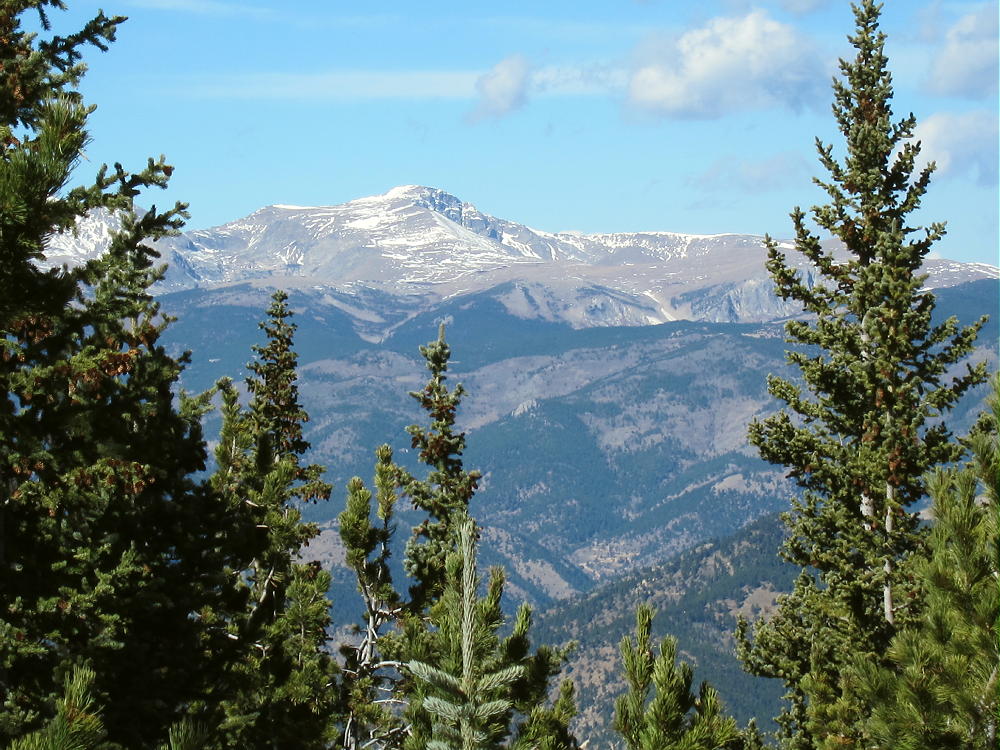
James Peak from Santa Fe Mountain
Santa Fe Mountain combines near–wilderness, scenic open space, a gas pipeline through the mountains, and a pleasant SOTA peak waiting to be activated, close to Denver – thank you Walt W0CP!
73
George Carey Fuller
KX0R
Meadow along the Pipeline Route
![]() !! WARNING !! There are old mountaineers, and
bold mountaineers... there are no old-bold mountaineers.
Hiking and mountain climbing are potentially hazardous activities particularly in Colorado with its extreme elevations. I am not accepting responsibility for any death or injury resulting from activations based on my trip reports. Proper training, experience, and personal capability assessment is required - enjoy!
!! WARNING !! There are old mountaineers, and
bold mountaineers... there are no old-bold mountaineers.
Hiking and mountain climbing are potentially hazardous activities particularly in Colorado with its extreme elevations. I am not accepting responsibility for any death or injury resulting from activations based on my trip reports. Proper training, experience, and personal capability assessment is required - enjoy!