


The first part of our planned activations was targeted at the northern cluster of La Sal Mountain Range. Three possible SOTA summits were in reach:
- Mount Waas – W7/SU-003 – 12,331 feet (3758 m)
- Manns Peak – W7/SU-004 – 12,272 feet (3741 m)
- Mount Tomasaki – W7/SU-005 – 12,239 feet (3730 m)
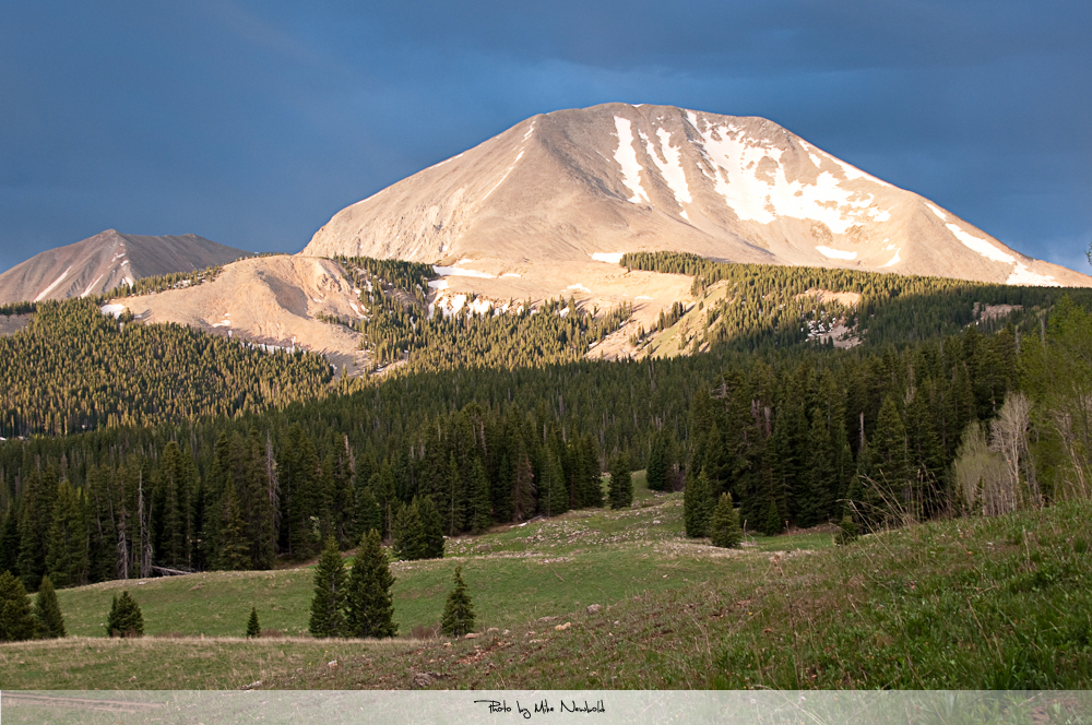
View from base-camp
Mike is not what you call an ‘early bird‘ when it comes to crawling out of a sleeping bag. We compromised on a 6AM wake-up call to get a chance to activate all three summits. After a quick breakfast and a final equipment check we were on our way from our camp at the base of Mt. Tomasaki up to Burros Pass.
Trailhead: 8552 ft/ 2565 m
Summits: Manns – 12272 ft / 3741 m Mt. Tomasaki – 12239 ft / 3730 m
Elev. gain: 2853 ft / 870 m
Roundtrip: 5.0 mi / 8.0 km
Compare this summit with my other activated summits
How to get there:
Check out Part-1 of the story.
Red Tape:
The La Sals are withing the Manti La Sal National Forest and thus all their rules apply. It is a remote area and for the most part without cell-phone coverage . VHF/UHF repeaters are also scarce and they can only be reached from very high elevations. If you are traveling off season it’s a lonely place and help in case of an emergency is not available. I was driving a Subaru OUTBACK and had no major issues but I was lucky that the creek we had to cross was quite low. However, for the Subi it was borderline. The ‘roads’ after Geyser Pass are indeed rough for this kind of a car and some help from a second person to navigate critical sections would come in handy. I also recommend taking a chain-saw to avoid being trapped by falling trees – and there are tons of them, sometimes barely enough road to scrape through. Make sure to carry a map with all the NFS roads. Roadsigns are scarce and typically used for target practice or used as floss/toothpicks by Porcupines making them unreadable. Keep that in mind when you travel.
The Ascent:
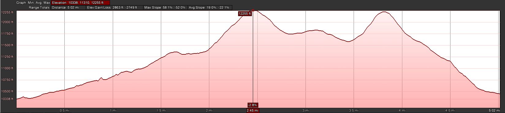
Manns/Tomasaki – Elevation Profile
We decided to ascent Manns Peak first which is located between Mt. Tomasaki and Mt. Wass. The idea was to get a good look at the route to Mt. Wass and Mt Tomasaki to determine whether snow is still an issue and activate accordingly.
From our base-camp we traveled north and then slightly NW up the gulch towards Burros Pass. After reaching the pass, the trail forks towards the NE and the other continues back down on the other side.
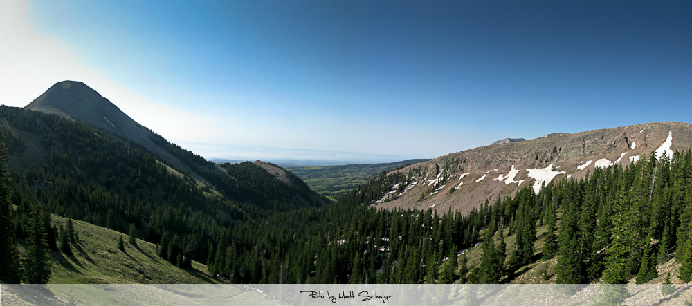
The view from Burros Pass towards our base-camp
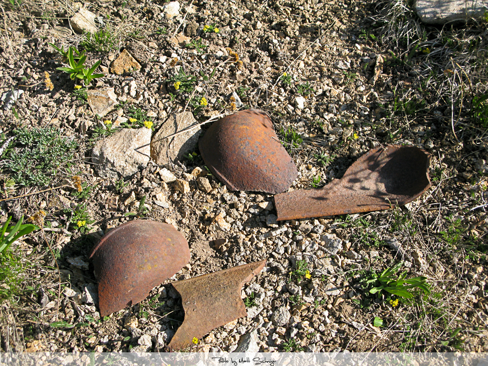
Cast Iron ‘something‘
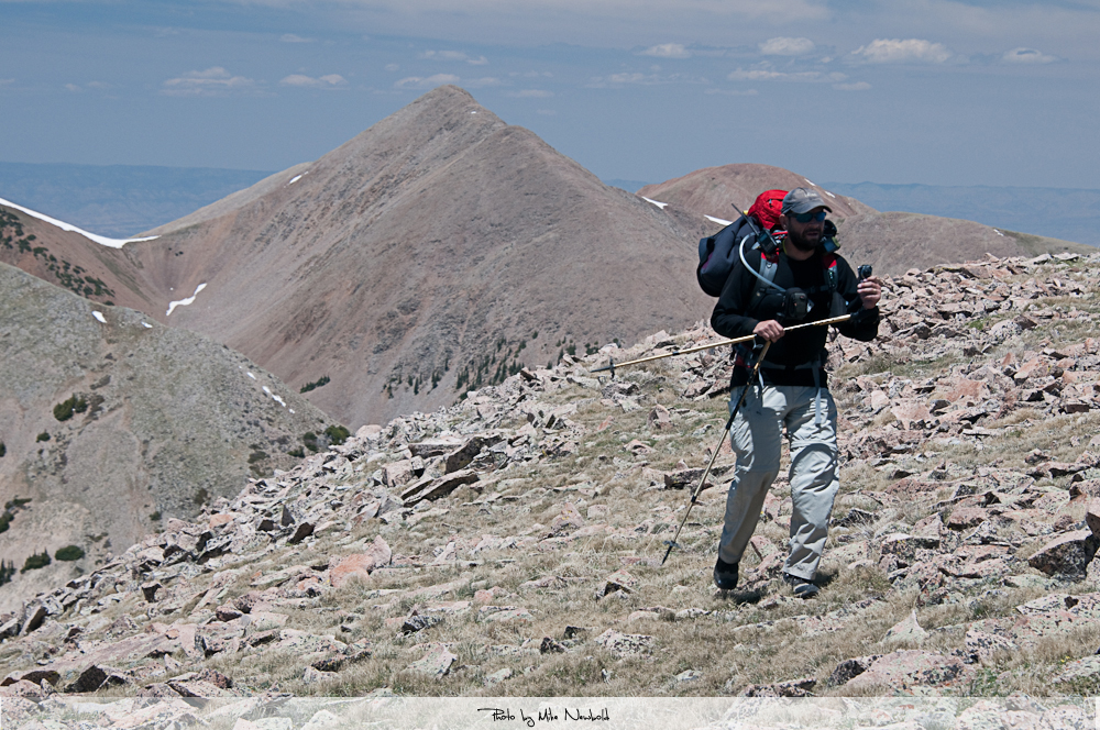
We followed the NE trail and along the east side of Manns Pk. Retrospectively I would choose a more northern route to gain more elevation and then follow the ridge all the way to the top. On the positive side, we discovered several interesting remnants from mining activities along this route. Since Mike used to be a Mining Engineer in his former life, he was a fountain of useful information related to geology and mining operation.
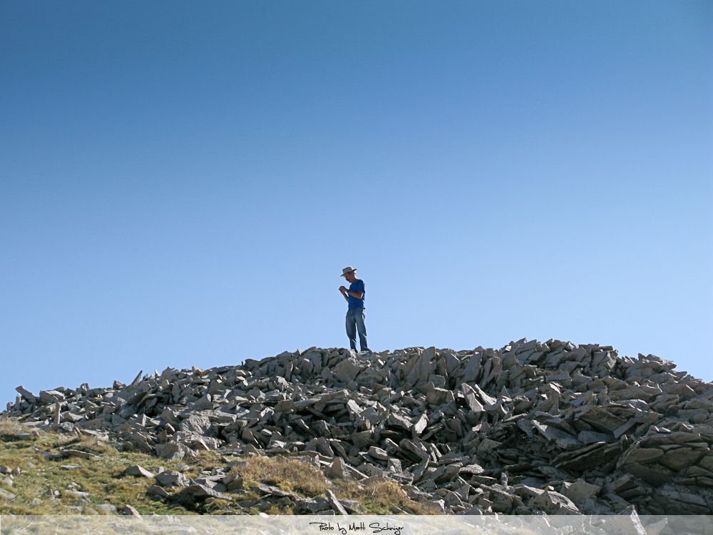
Mike reached the Talus
The La Sal Mountains are famous for Talus or Scree. So far we hiked on solid ground but that was about to change… the final approach to Manns Pk. gave me an idea what to expect for the next couple of days. Mike called it: ‘Potato chips on ball-bearings’. They indeed look like giant potato chips, they behave as if they were lying on top of ball-bearings and they sound as if they are hollow. Needless to say that hiking on this stuff can be difficult at times. You will see what I am talking about on some of the pictures and videos clips. Nevertheless we made it to the top without any troubles.
The Summit:
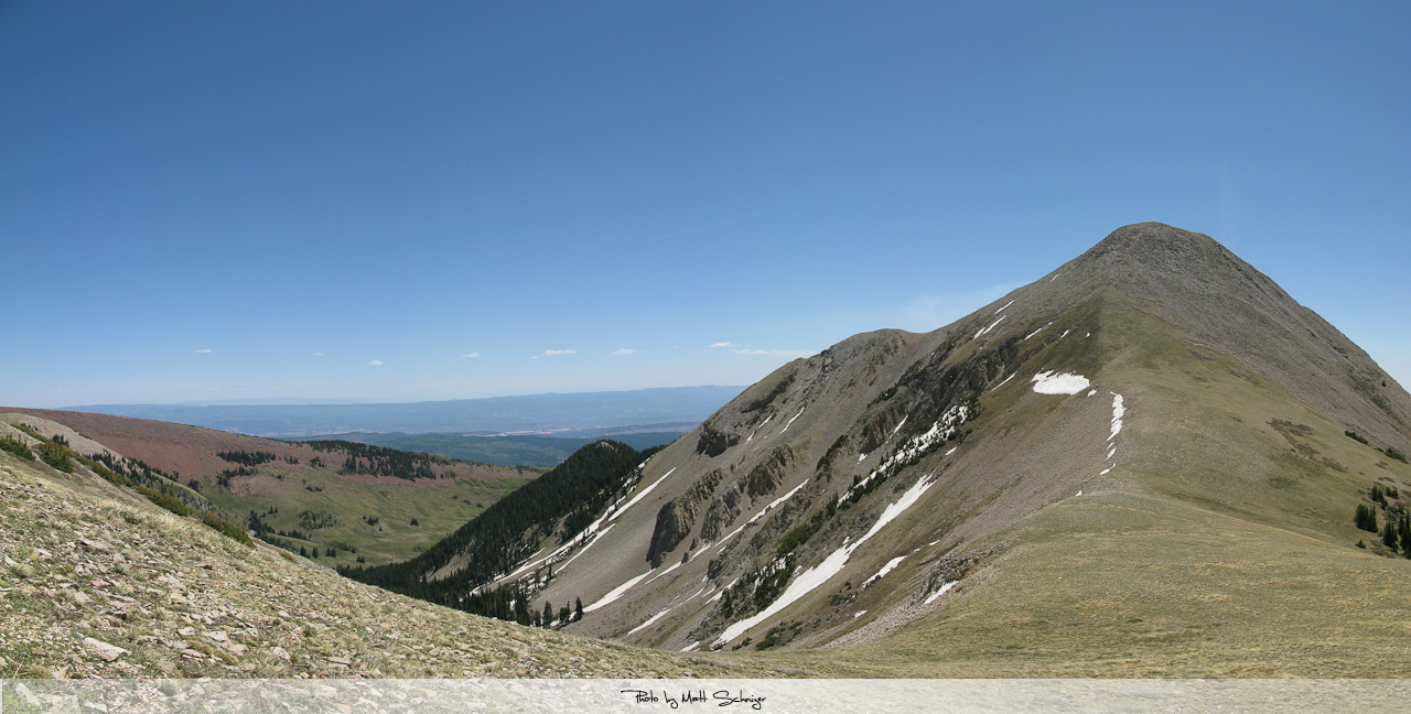
The summit is basically a huge pile of loose rocks (Talus) with a wind shelter built from rocks at the top. Plenty of room to setup antennas. The views are spectacular and very unique. The La Sals are a relatively small Mountain Range towering high over the Colorado Plateau and therefore offering (almost) unobstructed views to the horizon in every direction. Despite a forest fire to the East, the air was clear and crisp with blue skies and pleasant temperatures. From up here we could actually see the only repeater in the area (Bald Mesa/146.76- tone: 88.5 Hz), operated by Royce/K7QEQ in Moab.
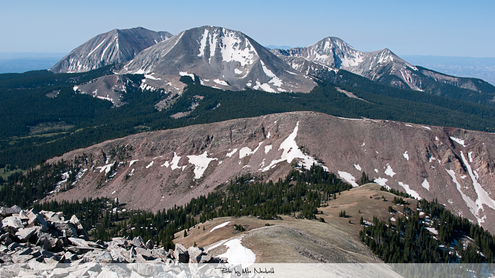
Mt. Mellenthin, Mt. Peale, Mt. Tukuhnikivatz as seen from Manns Peak
Our priority was to set-up for 2m first to keep our “appointment” with Bob/KIØG who climbed another SOTA summit, WØC/SJ-Ø15 (Crags Crest) in nearby Colorado. Our Google Earth plots (see below) were in favor of a S2S contact on 2m. LOS looked good and a distance of 80 mi (~130 km) should not be a problem with 5W and a tape-measure YAGI.

Elevation Profile between Manns Pk. (left) and Crag Crest (right)
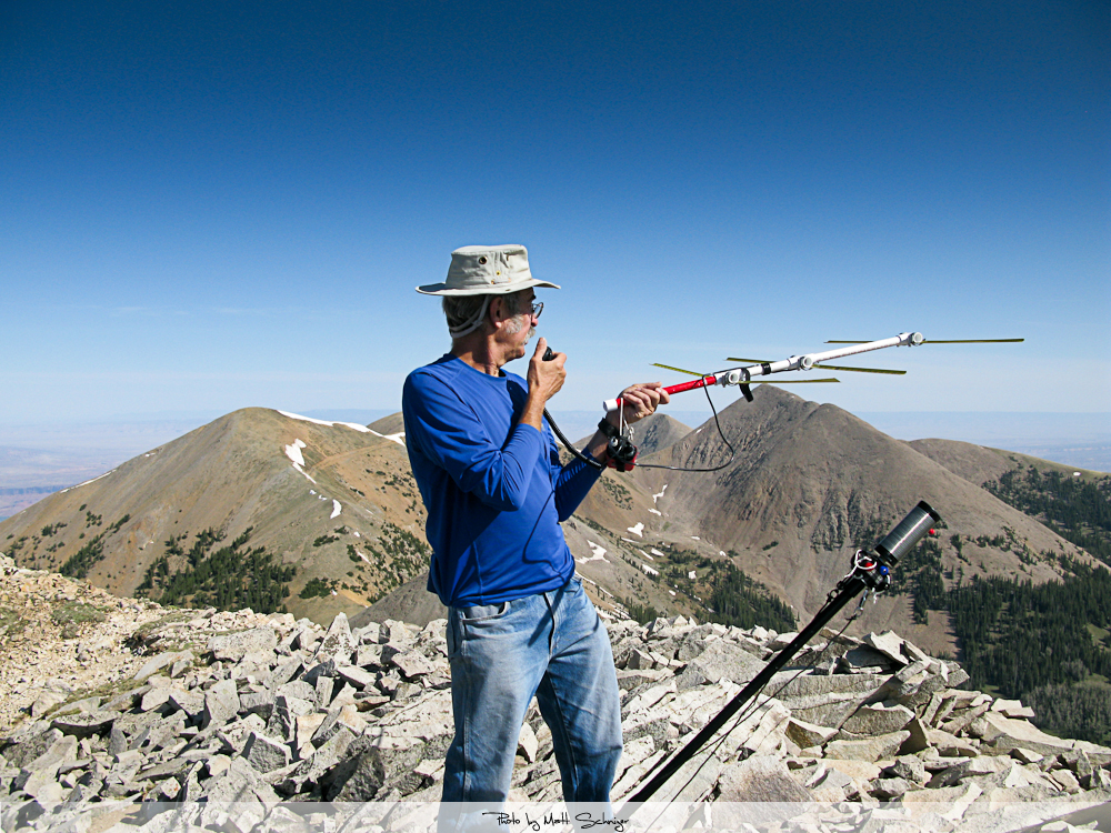
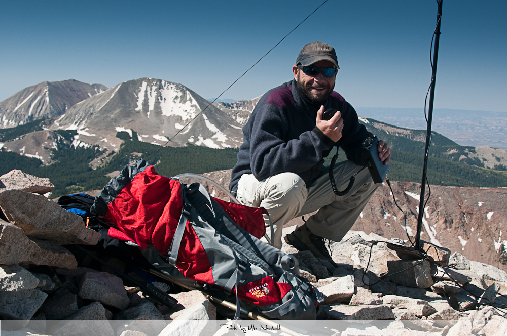
Mike/KØYO using a tape-measure YAGI on 2m.
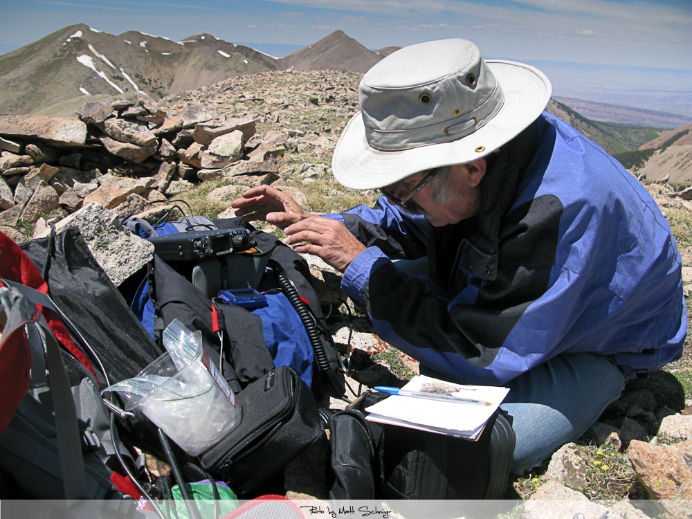
After fiddling for a while with the HT to punch in the right frequency, Mike raised KIØG quickly on 146.520. The first contact and successful first activation of both summits, a nice start of our trip. During Mike’s and Bob’s QSO, I set-up the Buddipole for 20 m, eager to make some more contacts and move-on to the next summit – you never know how the weather develops in the mountains.
Here some more pictures from the summit:
Mike/KØYO doing some Voodoo to the FT-817
Matt/KØMOS operating on 20m
After a total of 13 QSO we started to pack-up the gear and evaluate our options. In order to get to Mt. Waas we would have to follow the ridge-line, bagging several unnamed summits including Pilot Mountain (which is not a SOTA summit). With the help of binoculars we were able to determine a rather big snow cornice still hanging in the saddle just before the steep ascent to Mt. Waas. Not a big surprise since it is only May and snow can hamper your activities in the La Sals even in August. Mike was firmly against making an attempt under these circumstances and I had no good arguments to go forward with this summit – after all that is the advantage of having a hiking buddy who is familiar with the area and conditions.

APRS coverage
We turned in the opposite direction instead where Mount Tomasaki was waiting for us. Tomasaki is only about 1.5 mi (~2.5 km) SE of our current position and the cross over is straight forward and no snow was hampering our efforts. Only the Talus…. and I think I used a few swear words on our way up to the summit. Luckily we were high enough to have APRS coverage between the two summits in case chasers were watching our progress.
Mt. Tomasaki from the saddle
KØMOS on the ascent
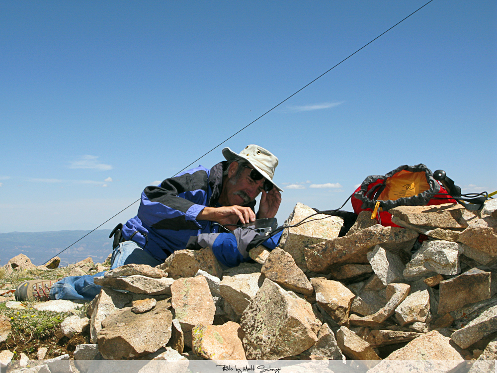
The summit of Mount Tomasaki is very similar to Manns Pk. The shelter was little smaller, the wind had picked-up a bit but the views were also stunning. We followed the same procedure, Mike tried to get contacts on 2m with the Yagi and I prepared the Buddipole in the mean time.
Why are these radios so darn small?
The Descent:
We tried to keep the descent as short as possible and turned SW as soon as we reached the saddle. This led us into steep and treacherous territory and we had to scout our options carefully. We finally reached the trail just a few hundred yards above our camp.
Plenty of time to charge our batteries with the solar panels, cooking and sharing stories and making plans for the upcoming day. The cold wind after sunset finally drove us into the sleeping bags – as far as I am concerned, it was a great day even-though we missed one of the summits.
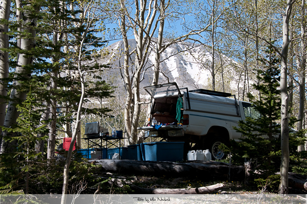
Bascamp
Some video impressions:
httpvh://youtu.be/r-JkcnNGlT4
If you would like to leave questions or comments, please do so through Youtube.
Wondering how our trip progressed? Click the FOLLOW button at the bottom right corner of this page to sign-up.
73, Matt/KØMOS
![]() !! WARNING !! There are old mountaineers, and
bold mountaineers... there are no old-bold mountaineers.
Hiking and mountain climbing are potentially hazardous activities particularly in Colorado with its extreme elevations. I am not accepting responsibility for any death or injury resulting from activations based on my trip reports. Proper training, experience, and personal capability assessment is required - enjoy!
!! WARNING !! There are old mountaineers, and
bold mountaineers... there are no old-bold mountaineers.
Hiking and mountain climbing are potentially hazardous activities particularly in Colorado with its extreme elevations. I am not accepting responsibility for any death or injury resulting from activations based on my trip reports. Proper training, experience, and personal capability assessment is required - enjoy!
Super
Great FUN !
73 QRO
Thanks…
Thanks Roger…
super Aktivierung Matt! Gratuliere!
Thanks Werner… war wirklich super da oben. Es kommt noch mehr von dem trip. 73
Again, nice video Matt, got my ebay account sorted out and have that pouch for my TH-72
73
Arie
PG1A
Thanks Arie, glad it finally worked out with your ebay account.
73
Hi Matt and Mike. Your joint activation is very good, I like it. Best 73
Thanks Fred…
73