


Black Mountain is a very prominent summit located adjacent to Staunton State Park, several miles west of Connifer, CO. Because of its proximity to the Denver metro area, it could become more popular as a SOTA site. This mountain presents significant physical and navigational challenges; the ascent is about 5 miles and 2500 vertical feet from the parking lot; and more than half of that climb is up through rocky, heavily forested slopes with limited visibility. You’ll be lucky if you see the top part of the mountain before you’re on top. Your success depends on your physical conditioning and how well you’ve studied the topo map before you try the climb.
As far as I know, there are no trails up the peak; nevertheless, a few people occasionally get up there. On the SW summit at point 10756, marked with an X on the USGS 7-1/2 minute quad, there’s a summit register consisting of a jar with a small notebook inside, and some people have signed their names! A cairn marks the top of the highest rock.
Here’s what you need to know to get up there. To get to Staunton State Park, drive 6 miles SW of Conifer on Route 285 and turn right at Shaffers Crossing – a sign to the Park marks the exit. Drive 1-1/2 miles north and enter the Park. Show your pass or buy a day pass for $7. You’ll get you money’s worth. Be sure to get a visitor map showing the trails and topography. Park at the upper group picnic area if possible – otherwise park in the main lot. There are several possible routes up to the top – I chose to climb via the major ridge SW of the peak. Find the Staunton Ranch (SR) trail at the parking lot and follow it north and then northwest, for about 3 miles, enjoying the fine Western scenery, until you come to the intersection with the Border Line (BL) trail. This spot is in a large clearing, with thick forest and higher terrain just to the north. Don’t follow the BL trail, or the nearby Marmot Passage (MP) trails. Look north to the forest, spot the USFS boundary markers and signs, and head directly north into the woods. Although off-trail hiking is not allowed in the State Park, it’s a very short distance from the SR and BL trails to the federal land, where hiking off-trail is OK. The map in the Park brochure shows this boundary clearly. To be perfectly legal, proceed a short distance NW up the Bugling Elk (BE) trail, cross into the USFS land, and then head NE up into the woods. Once on federal land, proceed north uphill into the obvious gulch leading up to the saddle just east of point 9715. There is a good game trail about 50 to 100 feet east of the creek gully – the route to the saddle is easier if you find this game trail. It looks like there are plenty of deer and elk up there. From the saddle turn right, hike NE up the ridge, and reach another saddle at 9800 feet. I found bear poop there. Pick a route NE and climb up a steeper section to about 10200 feet, and then hike more gently toward the next saddle near 10400. Stay left (west) of cliffs located to the east. As you approach the saddle at 10400, stay about 50 to 100 yards west of the actual saddle and climb up the SW slopes of Black Mountain. Stay left, north of talus and cliffs south of the summit. Although there is no trail, you can find a natural steep route all the way up, through a mix of boulders, trees, logs, and pine needles. You want to end up just south of summit 10756. The actual summit is marked by a cairn on top of some large boulders. Most of the top of Black Mountain is a long, rocky, heavily forested ridge curving around north and then east. If you climb the east side of the mountain, you’ll have to traverse this entire ridge to get to the actual summit near the SW end. There is a nice little flat clearing, with convenient tall trees and rocks, about 50 to 100 feet north of the summit rocks. The view is limited but stunning. This is a great place to do SOTA – you don’t need a pole if you have a way to get a rope up in a tree. I put up a 66-foot inverted L at 25 feet with no problem. It would be possible to erect a 40 meter dipole up there. This looks like a good VHF/UHF site, with excellent coverage of local mountains, and fair coverage of the eastern plains. I suggest you descend the same way you came up. A GPS device makes it easy to backtrack. The key point is to avoid going down the south side of Black Mountain, which is mostly steep slopes and cliffs. If you find another good route up, please write it up and post it here.
Please don’t try this climb unless you have a topo map, good map-and-compass skills, and plenty of off-trail hiking experience; a GPS device may save you time by preventing mistakes, provided you know what you’re doing without it. This trip is best done in spring or fall, and in good weather. Take plenty of water, start early, and allow enough time. Tell someone where you’re going. Please read and respect Park rules, and remember that the hours are 8 AM to 8PM.
Some pictures (click on the picture for a larger version):
-
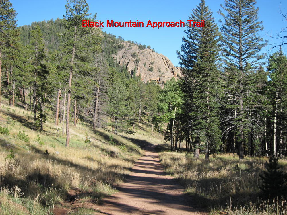
- Staunton State Park Trail below Black Mountain
-
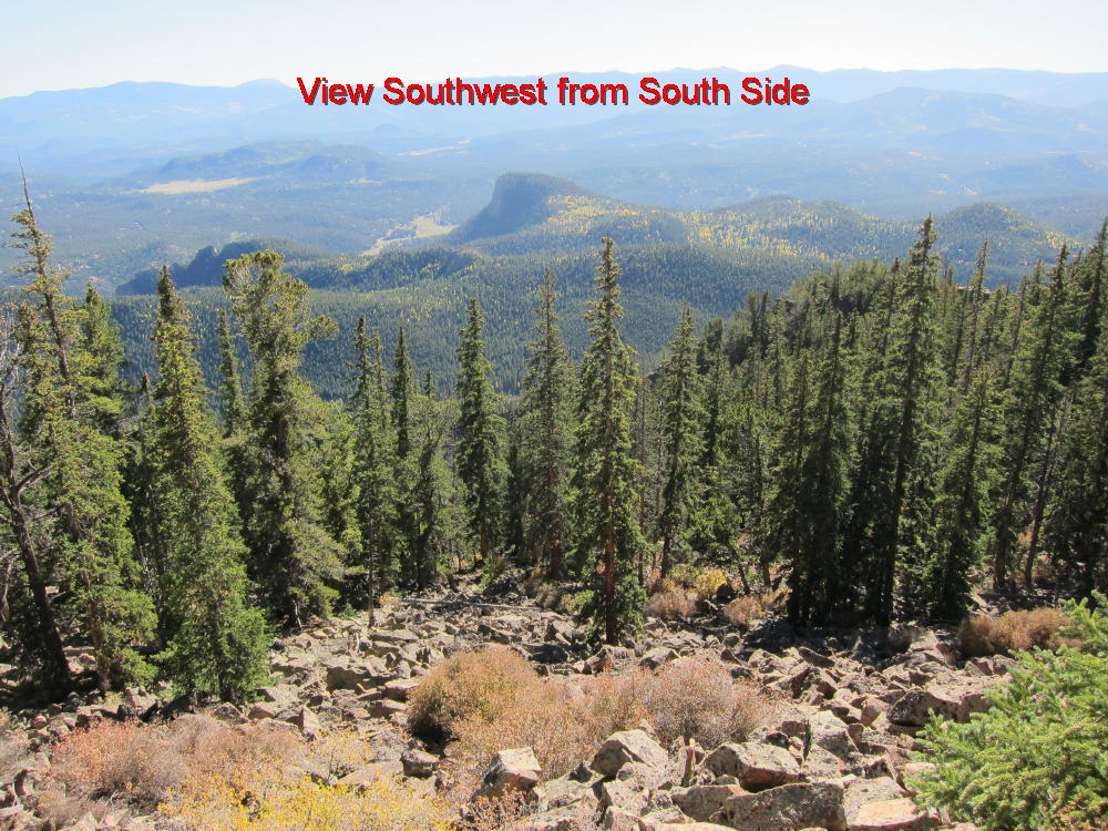
- View SW from South Side
-
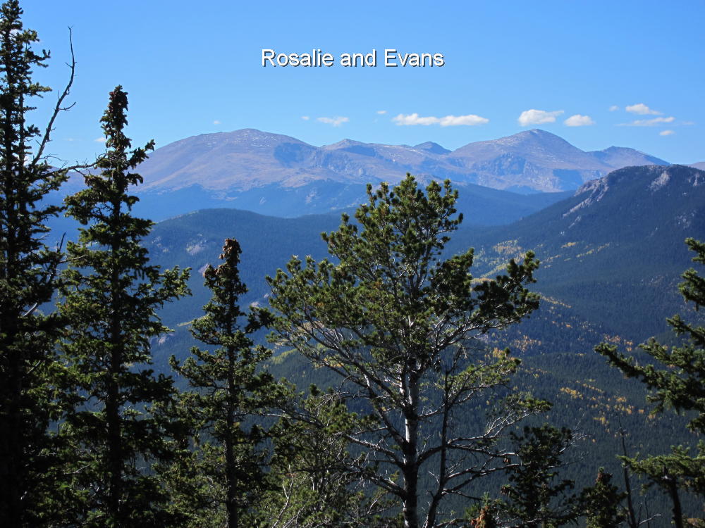
- Rosalie and Evans
-
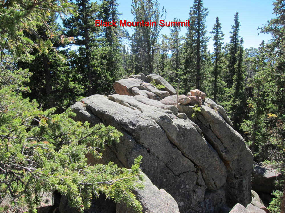
- Black Mountain Summit
-
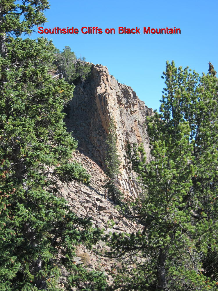
- South Side Cliffs – Black Mountain
-
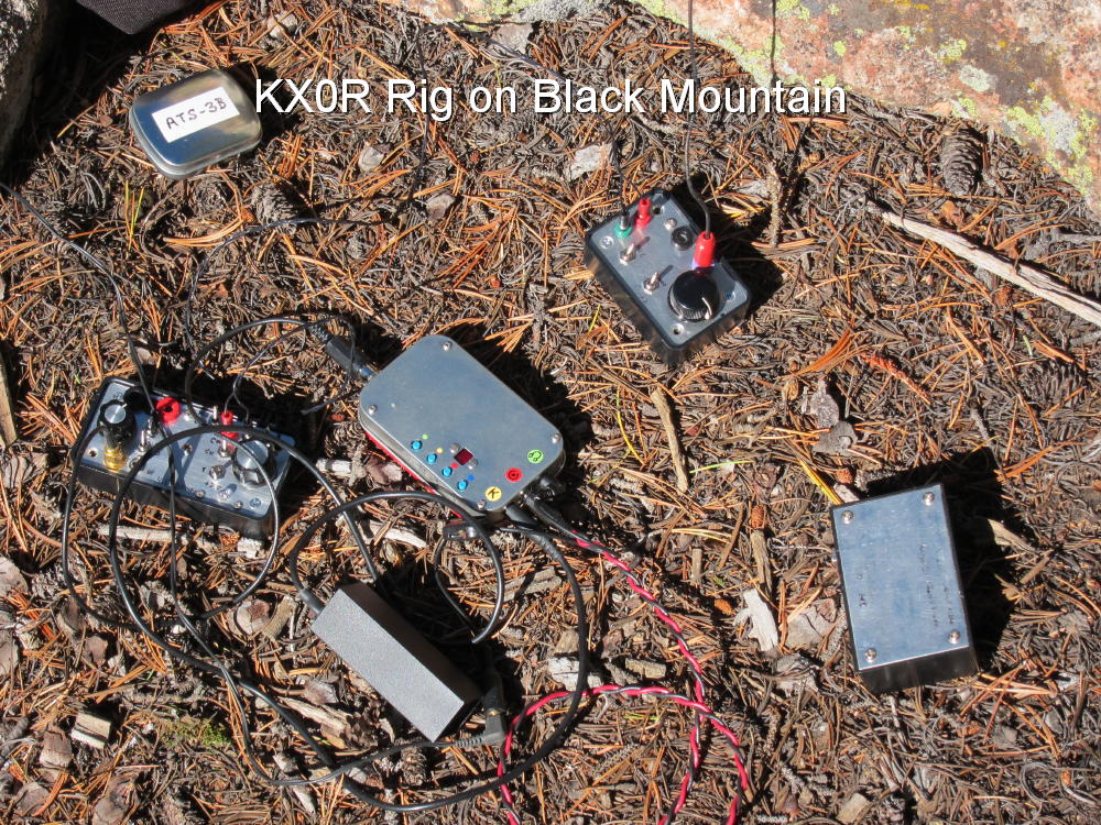
- KX0R Activation Rig
George Carey Fuller
KX0R
![]() !! WARNING !! There are old mountaineers, and
bold mountaineers... there are no old-bold mountaineers.
Hiking and mountain climbing are potentially hazardous activities particularly in Colorado with its extreme elevations. I am not accepting responsibility for any death or injury resulting from activations based on my trip reports. Proper training, experience, and personal capability assessment is required - enjoy!
!! WARNING !! There are old mountaineers, and
bold mountaineers... there are no old-bold mountaineers.
Hiking and mountain climbing are potentially hazardous activities particularly in Colorado with its extreme elevations. I am not accepting responsibility for any death or injury resulting from activations based on my trip reports. Proper training, experience, and personal capability assessment is required - enjoy!