


Ring Mountain (W7Y/EW-020), the second activation of the day, presented some obstacles… my planned route coming from Jelm Mountain (see picture below) was blocked by a closed gate with a NO TRESPASSING sign. There is a separate trip report for Jelm Mtn. if you are interested.
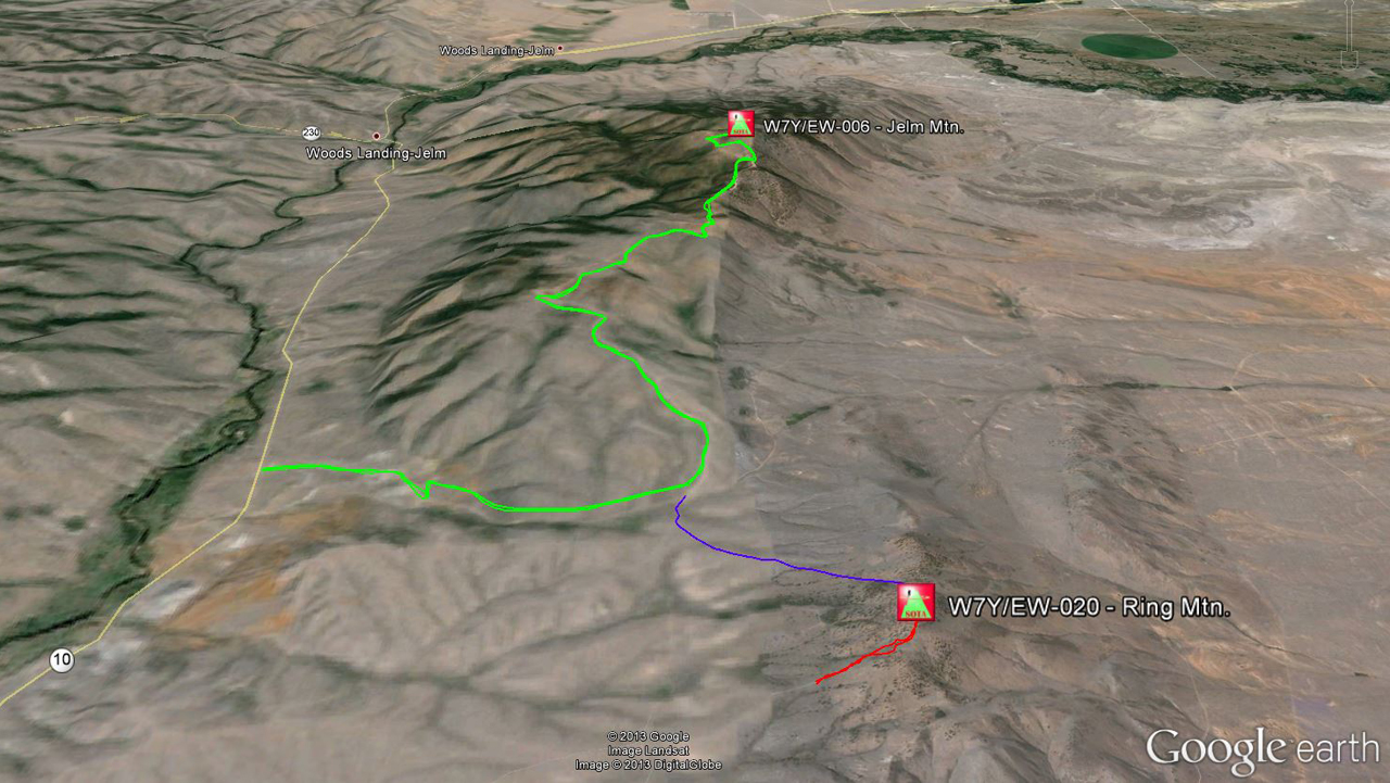
Green = route to Jelm Mtn.
Blue = planned route to Ring Mtn.
Red = actual route to Ring Mtn.
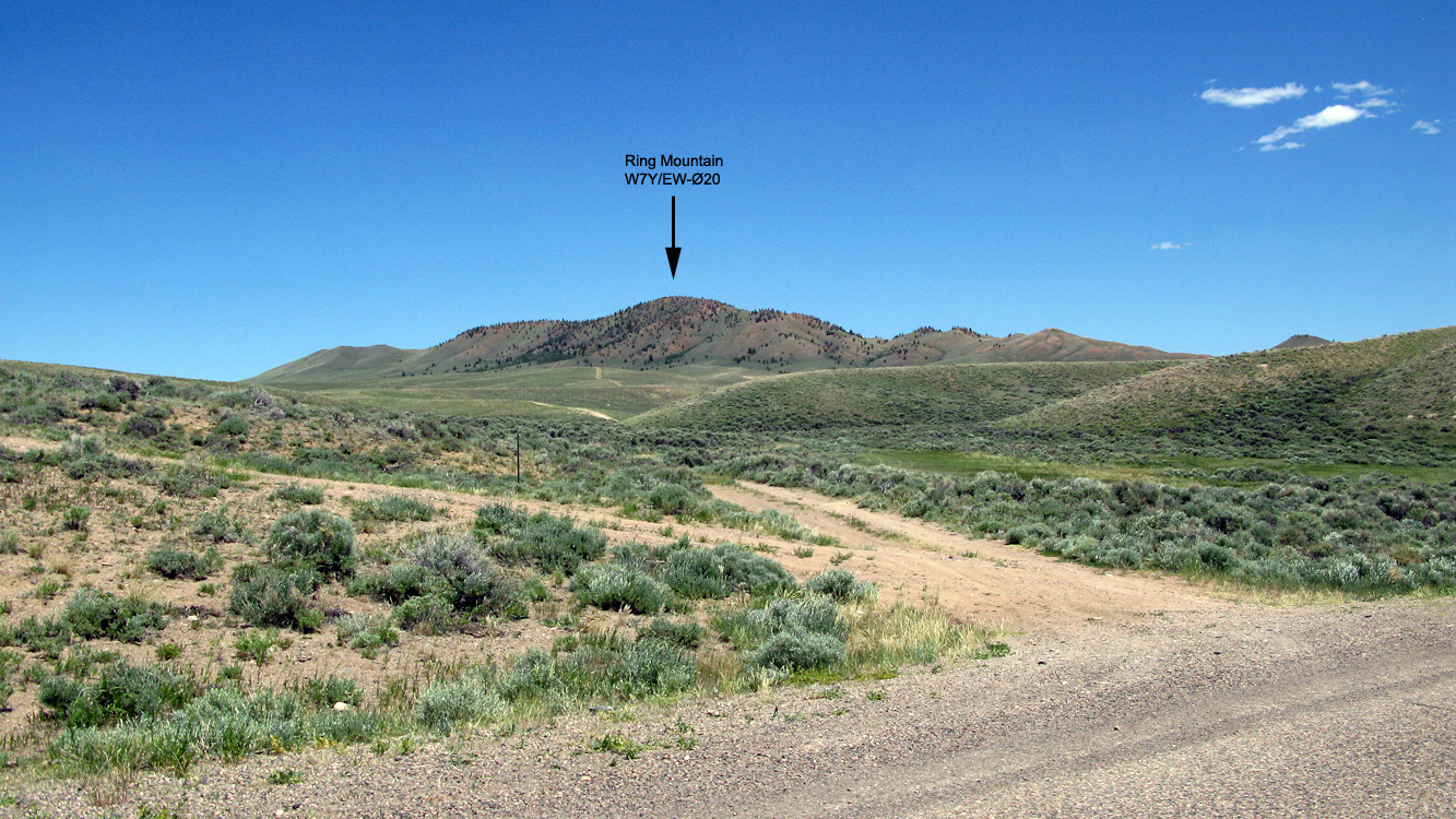
To find public access, I continued to drive south on Wy10. The only possible access I could find was a small two-track, not even a dirt road… I almost missed it and had to back up to turn east.
Access to Ring Mtn.
Being hot, tired and thirsty from my prior 10+ mile hike up Jelm Mopuntain, I decided to drive my old Subaru as far up the hill as I could. It was an adventure for the old Subi, some of the ruts were deeper than the ground clearance of my Subi and I had to make sure not to get stuck up here… who knows when the next car would come by… towing would become expensive.
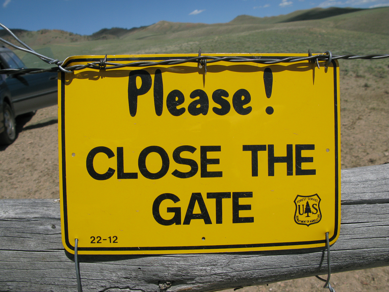
US Forest Service Gate
I managed to reach a gate with the car hitting the ground only once. I was sure hoping not to encounter another NO TRESPASSING sign. Luckily it was a US Forest Service gate, just 0.5 miles from WY10. I passed the barbed wire fence/gate in no time and continued to follow the two-track up the hill.
Finally the track disappeared completely and it became too steep to continue by car. I left the vehicle, declared this point as the trail-head and continued my climb by foot.
Trailhead: 8288 ft / 2526 m
Summit: 8818 ft / 2688 m
Elev. gain: 519 ft / 158 m
Roundtrip: 0.8 mi / 1.2 km
Compare this summit with my other activated summits
How to get there:
From Laramie WY, take WY-230 W for about 26 miles. Take a left onto WY-10 S for another five miles. The exact coordinates for the two-track:
Latitude:  41° 2'32.49"N
Longitude: 106° 0'3.75"W
Parking/Trailhead
View Larger Map
Red Tape:
There is private land everywhere and the two-track seems to be the only public access to the summit.
The Ascent:
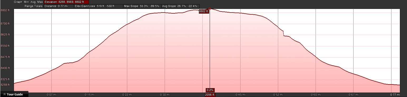
The elevation profile
The summit is close and clearly visible. Taking the route of least resistance, I crawled up the mountain in scorching temperature. The ground beneath me radiated the heat to uncomfortable levels and no shade was in sight.
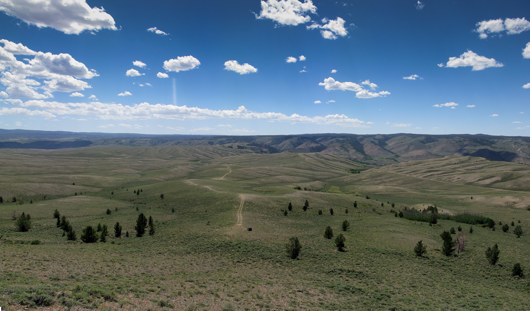
View back towards the TH (you can see the car if you look closely)
The Summit:
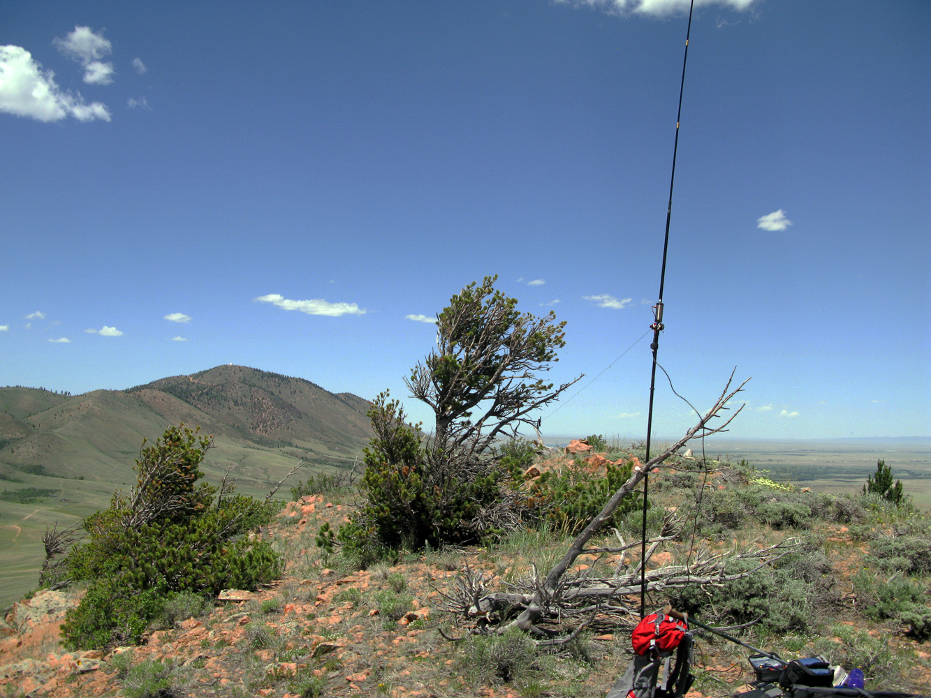
My shack with Jelm Mtn. in the background
The summit offers a nice 360 degree view, Jelm Mountain with the WIRO dome clearly visible just a few files to the north. The sun was already high in the sky and the scarce vegetation provided no shade what so ever. I used a dead tree to tie my mast to and tuned the antenna for 20m, only to encounter the same kind of QRM I ‘enjoyed’ on Jelm Mtn. This time I did not try other bands but moved my shack immediately a little further down the mountain to have the summit between my antenna and Jelm Mtn, still blaming some of the radio installations up there for the noise – BINGO, the noise was gone and Phil/NS7P answered my call, spotted me and I logged ten contacts in no time – thanks Phil.
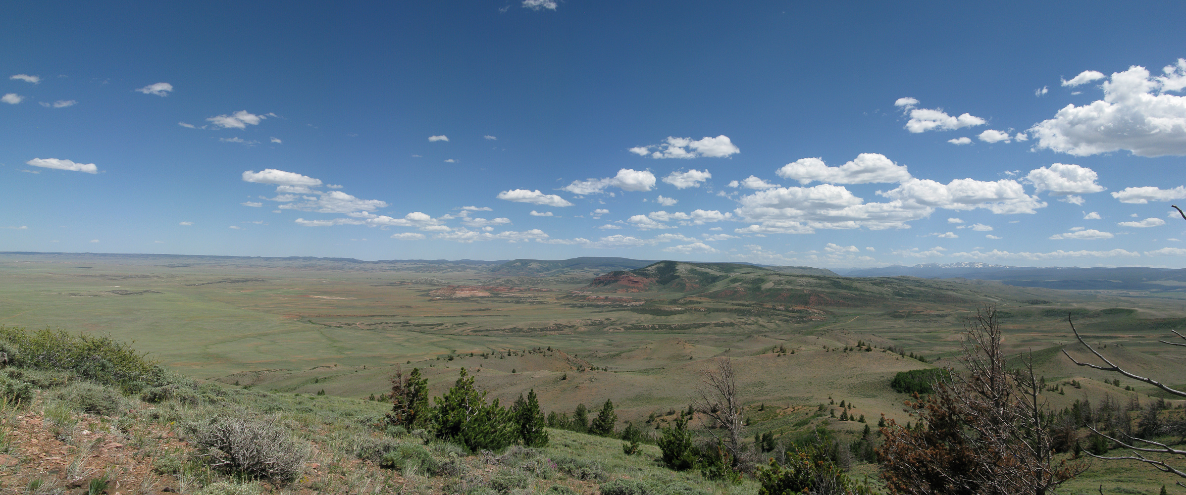
Panorama view towards north-west
The Descent:
Nothing noteworthy on the descent… did I mention that it was HOT? I reached the car, turned on the air-condition to max and carefully navigated my way back to the road while nibbling on my sandwich – thanks to the heat with a layer of melted cheese – yummy.
Some video impressions:
If you would like to leave questions or comments, please do so through Youtube.
![]() !! WARNING !! There are old mountaineers, and
bold mountaineers... there are no old-bold mountaineers.
Hiking and mountain climbing are potentially hazardous activities particularly in Colorado with its extreme elevations. I am not accepting responsibility for any death or injury resulting from activations based on my trip reports. Proper training, experience, and personal capability assessment is required - enjoy!
!! WARNING !! There are old mountaineers, and
bold mountaineers... there are no old-bold mountaineers.
Hiking and mountain climbing are potentially hazardous activities particularly in Colorado with its extreme elevations. I am not accepting responsibility for any death or injury resulting from activations based on my trip reports. Proper training, experience, and personal capability assessment is required - enjoy!
great landscape.nice video.73
Tu es choyé d’habiter au colorado belle température et chemins qui mènent aux montagnes :) 73
Tu as raison mon ami… :)
73, Matt
Hello Matt. In this video I like the look of b/w too, Matt. Best 73
Maya send its best thought to Pepino. It is 19 years old … 73 Roger
Thanks Roger, my regards to Maya (take good care of her)
Matt
NIce IR video! Cool… very retro video.. I like it!