


W0C/SR-046
Stanley Mountain
3816 m / 12521 ft
Aug 29, 2013
July 26, 2014
by KX0R
Stanley Mountain is an easy SOTA peak on the Continental Divide, southwest of Berthoud Pass.
Please see the superb photos posted by first activator Chuck Sale N6UHB. His photo gallery sparked my interest in activating Stanley Mountain – thanks Chuck!
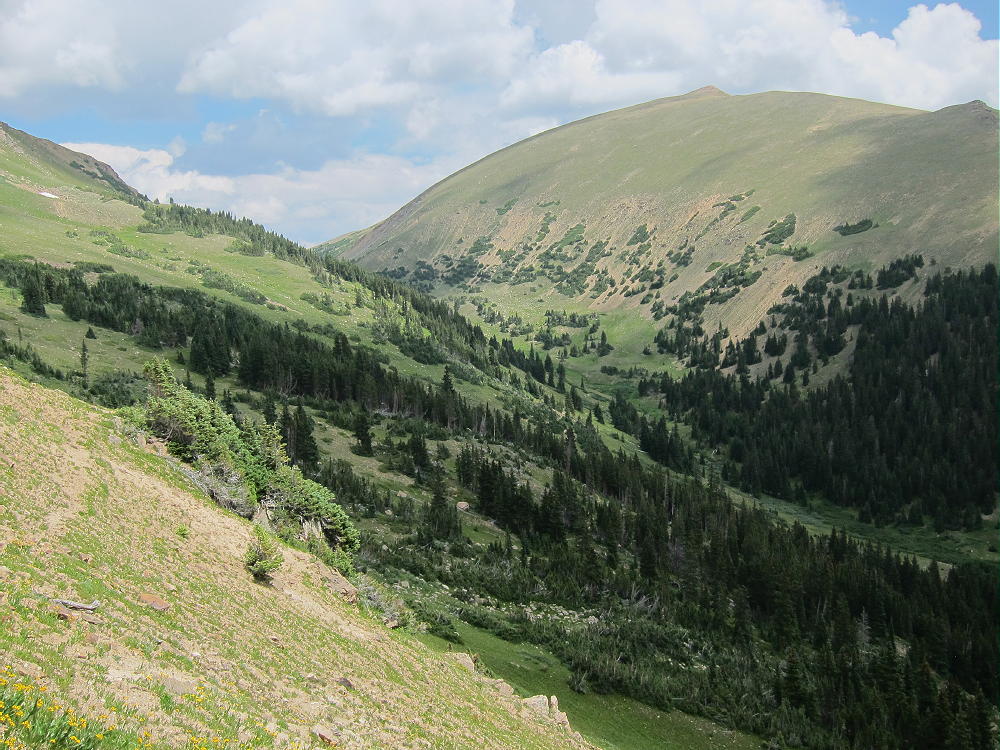
Stanley Mountain East of Vasquez Pass
There are two routes along the Continental Divide Trail (CDT) to Stanley. The easiest route starts at the Berthoud Pass Trailhead at 11,307 feet elevation. To reach Berthoud Pass, drive west of Denver on I-70 and exit northwest toward Winter Park on US 40. Park on the east side of the highway at the Pass; there are facilities there.
Cross the highway and find the marked CDT Trail leading up the hill to the west. Follow this trail up for about 1-1/2 miles, and ascend multiple switchbacks to a high, vast area of alpine tundra at about 12,400 feet. The rest of the hike follows a relatively flat trail for more than 2 miles southwest along the Divide to Stanley Mountain.

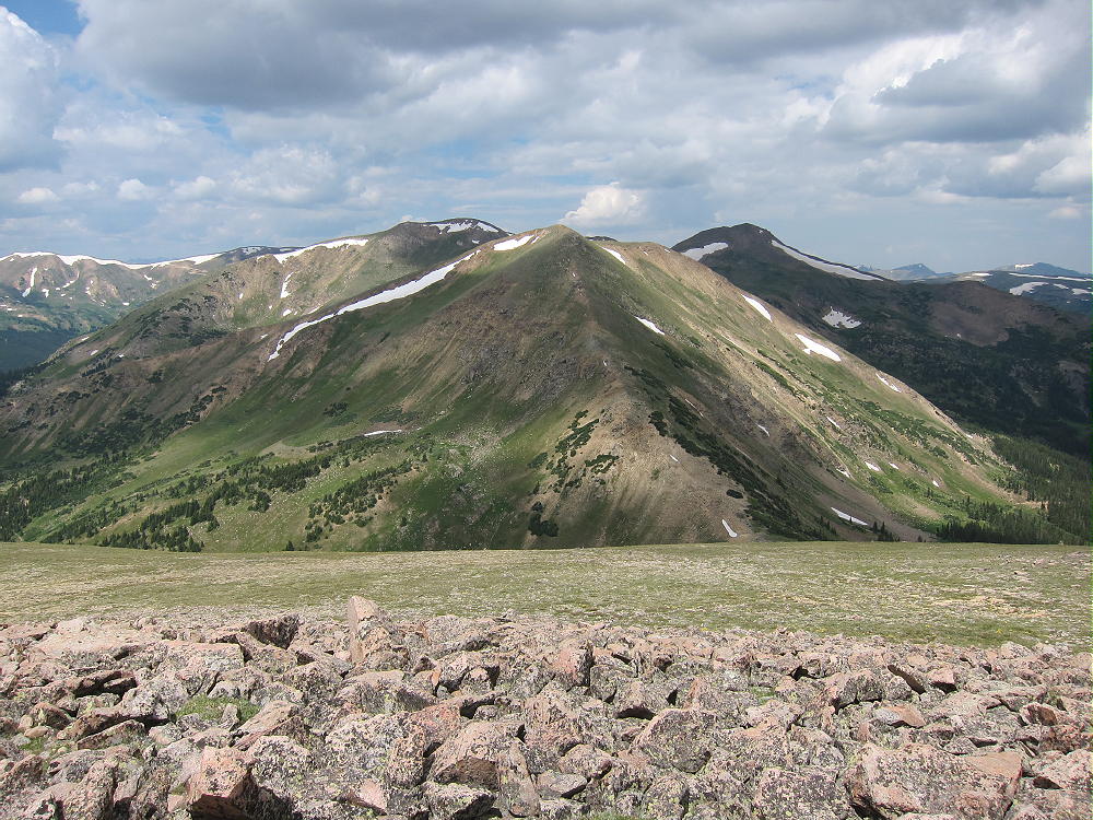
Stanley Mountain Hike on Divide
Don’t be fooled by the false summits along the way – the actual peak is about 800 feet above Vasquez Pass, visible down a steep slope to the west. Stanley is the last high point along the trail on the Divide ridge; after the real summit, the CDT descends steeply to the southwest.
View West from Stanley Mountain to Vasquez Pass and Peak
The hike from Berthoud Pass to Stanley is 7.5 miles round-trip; the vertical ascent is about 1300 vertical feet. It takes 1-1/2 hours or more to hike from Berthoud Pass to Stanley.
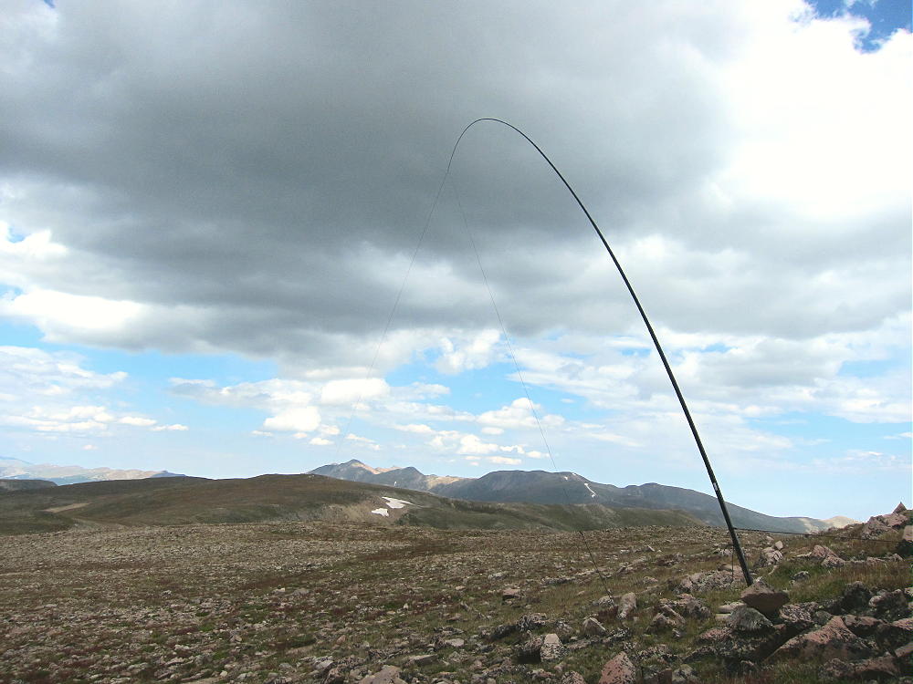
The summit is a small rocky hill on the south side of the trail. Since it’s far above tree-line, be sure to bring a pole for an HF antenna. I found a convenient spot out of the wind, in the activation zone on the east side of the mountain.
-
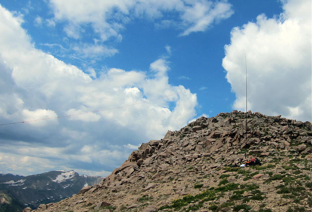
- Stanley Mountain 2014 Activation with 67 Foot EF Wire
-
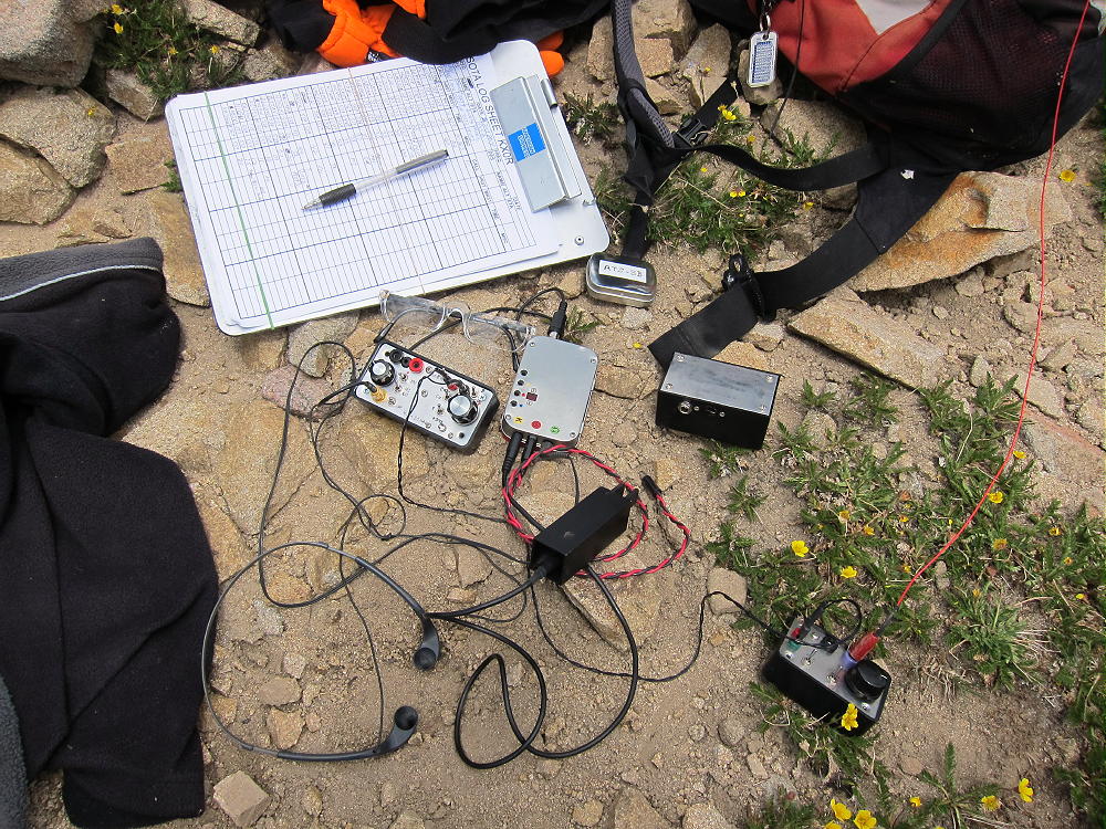
- Stanley Mountain Radio Gear
-
- Stanley Mountain 2013 Activation and View Northeast
The view is vast and superb; if the weather is OK, Stanley is an easy peak to activate. It’s probably a better site for HF than for VHF/UHF, because of higher mountains around the area.
An alternate route to Stanley starts along the Jones Pass Road 202, just past the Henderson Mine complex.

Henderson Molybdenum Mine
A marked trail starts on the north side of the road and climbs up the slope via switchbacks to a junction with the CDT. This is the trail I used to access Vasquez Peak W0C/SR-040, and that route is described in my report for Vasquez. From the junction with the CDT at 11,300 feet elevation, climb up the CDT about 2 miles and 1200 vertical feet northeast to Stanley Mountain. The total vertical distance from the valley trailhead to the mountain is about 2100 vertical feet, and the horizontal distance is comparable to the 3.7 mile route from Berthoud Pass.
There are two points that make the Jones Pass Trailhead worth considering for a hike to Stanley:
1) If the weather turns bad, the trail to the valley is much less exposed than the high route along the Divide.
2) On a good day it might be possible to activate both Stanley and Vasquez by using the valley trail up from the Jones Pass Road. Climb and activate Stanley first, hike back down the CDT from Stanley to 11,400 ft, and then climb the ridge route described in the report on Vasquez; or reverse the order of the summits. Note that I have not done this challenging dual activation!
There are two points that suggest using the Berthoud Pass trailhead for Stanley:
1) It is possible to do a dual activation of both Mount Flora and Stanley Mountain from the Berthoud Pass trailhead. I have done this – it was a long day, but it worked well.
2) The route to Stanley is scenic and pleasant on a good day. The trail up from the Jones Pass Road is not as scenic, and it takes more work.
Any way you climb them, there are some fine SOTA peaks near Berthoud Pass. Stanley Mountain is not difficult to climb and activate, and it offers a nice alpine experience. On a nice day, the Continental Divide is a wonderful place to go for a SOTA activation.
Always check the forecast, respect the mountain weather, and be careful above tree-line. The mountains don’t care.
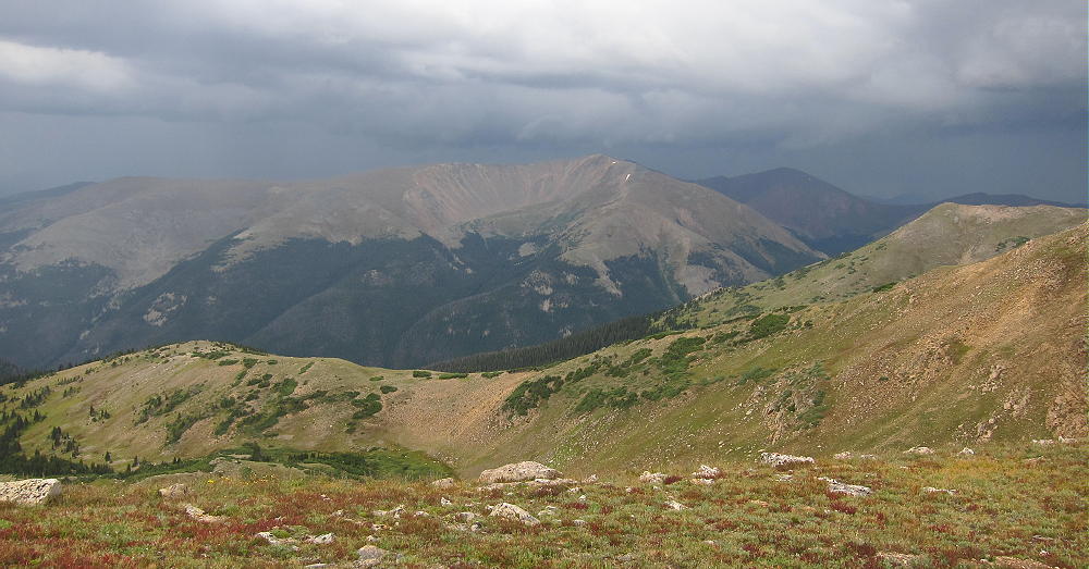
View of Approaching Storm South of Stanley
Click this picture!
73
George Carey Fuller
KX0R
![]() !! WARNING !! There are old mountaineers, and
bold mountaineers... there are no old-bold mountaineers.
Hiking and mountain climbing are potentially hazardous activities particularly in Colorado with its extreme elevations. I am not accepting responsibility for any death or injury resulting from activations based on my trip reports. Proper training, experience, and personal capability assessment is required - enjoy!
!! WARNING !! There are old mountaineers, and
bold mountaineers... there are no old-bold mountaineers.
Hiking and mountain climbing are potentially hazardous activities particularly in Colorado with its extreme elevations. I am not accepting responsibility for any death or injury resulting from activations based on my trip reports. Proper training, experience, and personal capability assessment is required - enjoy!