


W0C/FR-099
Livermore Mountain
2287 m / 7504 ft
First Activation
Nov 02, 2015
By KX0R
Livermore Mountain is a prominent, seldom-visited summit several miles northwest of Fort Collins, Colorado.
Key Points:
• Roosevelt National Forest
• Prominent summit
• Private land blocks access from County Road 74E
• Long, difficult access
• Adventure trip in the backcountry
• Fine HF site
• No marked trail for miles
• Game trails and bushwhacking
• Challenging navigation and route-finding
• Area burned by wildfire
• North Greyrock W0C/FR-094 included on the return
• Total round trip of 14 miles, including North Greyrock
• Total round-trip vertical ascent of 4200 feet, including North Greyrock
-
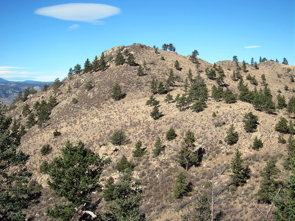
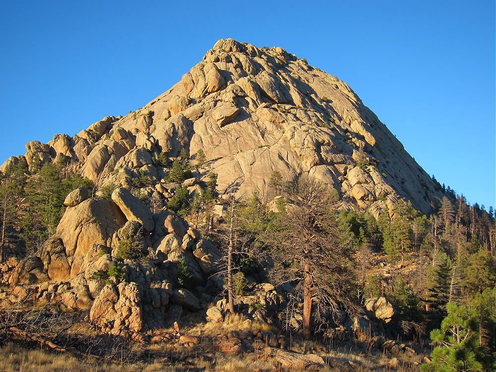
- Livermore Mountain Southeast Ridge 2
Livermore Mountain is at the north end of a long ridge running from the vicinity of Greyrock Mountain. Livermore is rarely climbed, because private land partially surrounds the mountain. It’s possible to access this peak from the south, by hiking through the National Forest, along the ridge, all the way from Greyrock. This is an interesting trip!
-
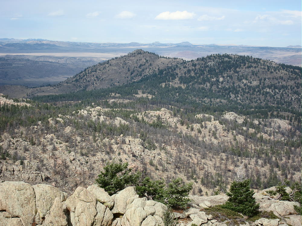
- Livermore Mountain from Greyrock
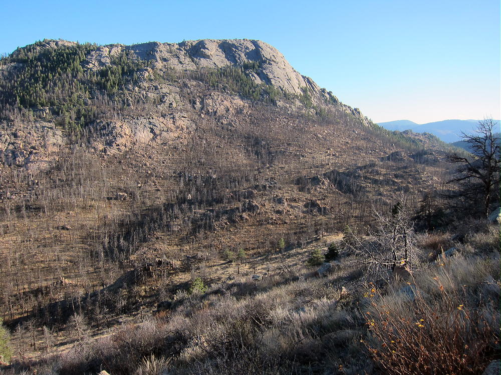
My key to this route was climbing Greyrock Mountain a few days earlier. From the north side of Greyrock, Livermore Mountain and the rugged terrain between it and Greyrock are clearly visible. Much of this rocky, forested land was burned by wildfire; deadfall and post-fire growth make travel challenging. The view from Greyrock revealed that it might be practical to access Livermore from Greyrock Meadows.
A long valley immediately north of Greyrock leads down to the northeast, all the way to Seaman Reservoir. I viewed this valley from Greyrock, and I took pictures for additional study. I devised a plan for approaching Livermore via Greyrock Meadows and the valley north of Greyrock – this plan worked out well.
-
- Livermore Mountain Route from Greyrock
My hike began at the Greyrock Trailhead in Poudre Canyon. For more information, see the K0MOS report on Greyrock Mountain W0C/FR-095. There are two possible routes – the main Greyrock Trail #946, or the Greyrock Meadows Trail #947; I chose the Meadows Trail.
-
- Greyrock Meadows Trail Views
The Meadows trail is slightly longer, but since the route to Livermore runs through the Meadows, the two routes are approximately equal in time. The Meadows Trail offers wonderful views of Poudre Canyon, Greyrock Mountain, and Greyrock Meadows.
-
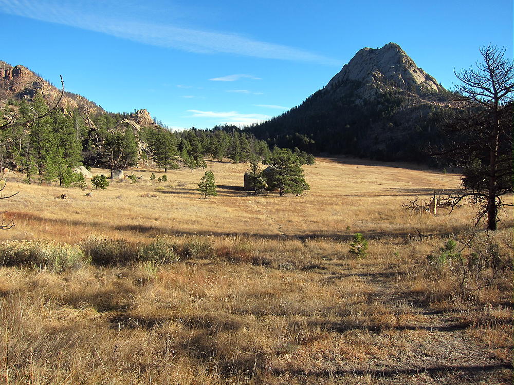
- Greyrock Meadows and Greyrock in the Morning
When I reached Greyrock Meadows, I walked north across the brown, dry grass and climbed up to the saddle northeast of the Meadows and northwest of Greyrock Mountain; a good game trail leads up from the Meadows to this saddle. The path continues northeast from the saddle and then leads down the valley. I followed this pleasant trail – which is occasionally used by horses – for about 1/3 mile, down to about 6740 feet. Then I left the path and headed directly north, up a steep, rocky slope, for about ¼ mile horizontally, until I reached a large bench at about 7200 feet. I didn’t find a good game trail up the open slope – this was the roughest part of the trip.
-
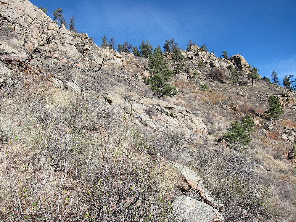
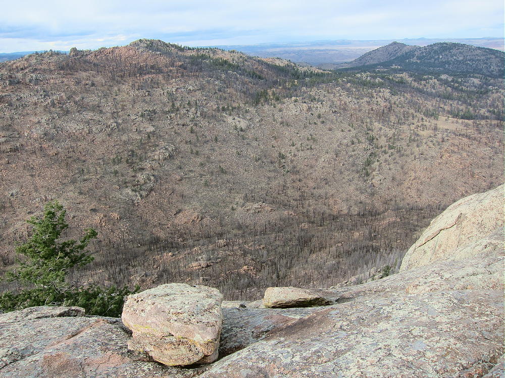
- Livermore Mountain Bushwhack Route
The large flat bench at 7200 feet was like paradise compared to what preceded it. It was very grassy, with many elk beds and other signs of game – elk heaven.
I followed game trails north through the grassy bench, and then I found remains of an old road continuing north. I avoided possible routes on north-running ridges nearby, because the road was so inviting. The road leads out onto the main ridge and stays near 7040 feet for a long time. I made very good time from the elk bench via this road. Eventually the road leads off to private land on the west side of the main ridge – horses use this trail. Near the 7000 foot contour I left the road, continued north along the ridge a short distance, and descended to a large, open saddle at about 6840 feet. There’s a fence-line running north through this area – the land on the east side is public. It’s not necessary to cross west of the fence – but none of the land I saw was posted along the ridge.
From the big saddle the next challenge is to climb the peak that looms to the north at about 7440 feet. I stayed east of the fence and climbed up the ridge toward the top. At about 7060 feet, I spotted a game trail, followed it northeast, and then continued up the southeast ridge and up “Peak 7440”. I went over the rocky top and saw Livermore Mountain out to the northwest. From the north ridge of “Peak 7440”, there’s a game-trail leading down to the next saddle; and from that saddle, there’s another game trail leading up the southeast ridge of Livermore to the top.
-
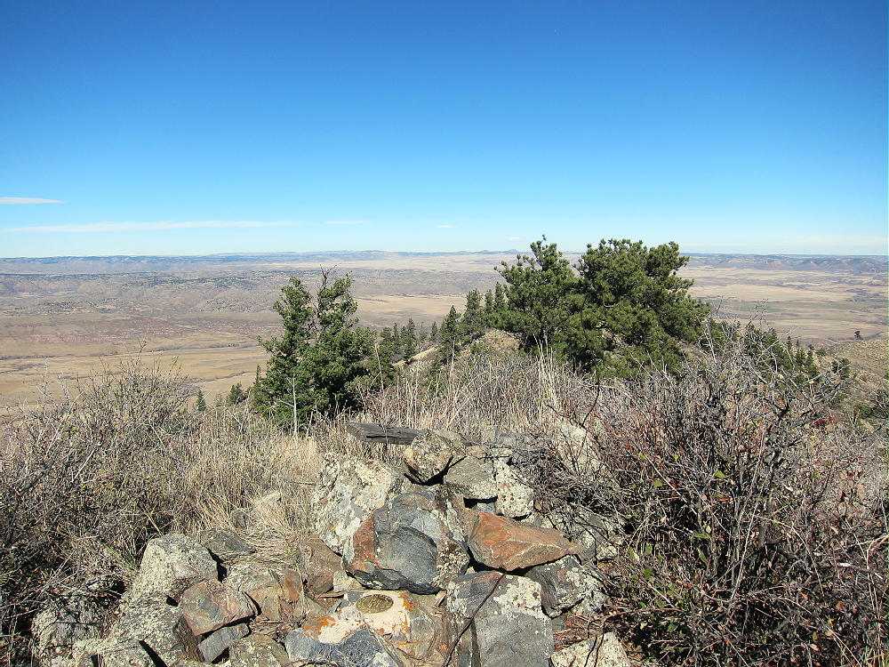
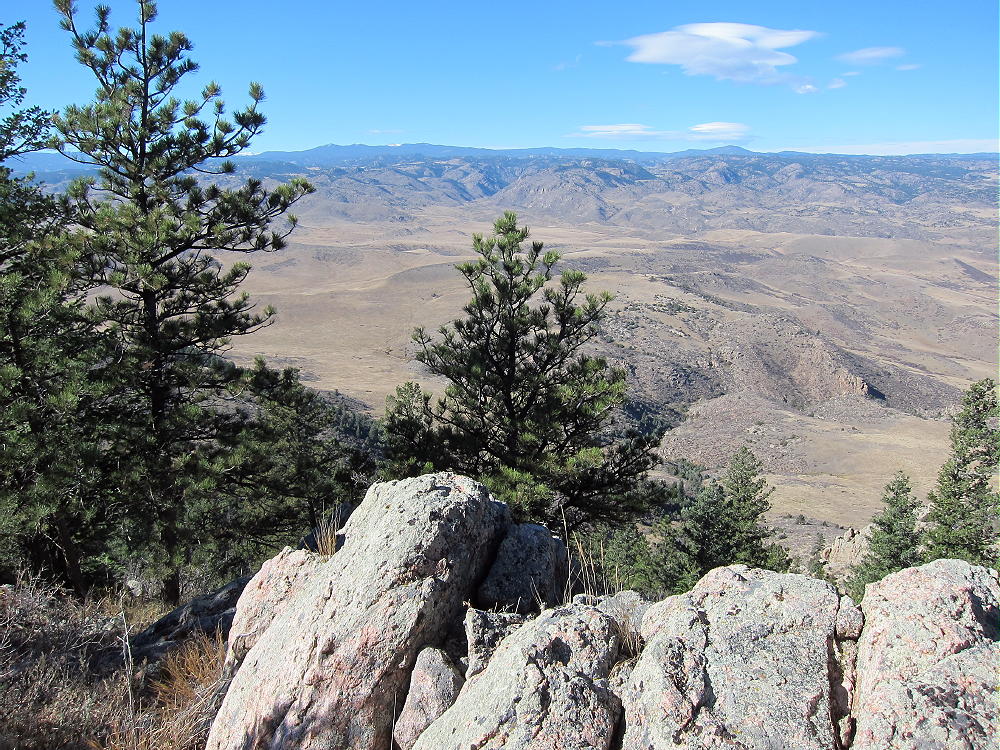
- Livermore Mountain Summit
Livermore Mountain’s summit is the high point of a long, crescent-shaped ridge that curves down toward the northeast. From the summit the land drops away to about 6000 feet, so the small mountain seems large and prominent! It has a wide view all around – the Red Feather Lakes Highway CR 74E is visible about 2 miles to the north. Greyrock looks very far away to the south! Even though the Google Maps show a small road northwest of Livermore Mountain – suggesting possible easy access – I barely spotted the small tracks. This is probably an old ranch road, and it’s probably not accessible to the public.
The rocky summit has been used for a survey. There are remains of the survey station, and there’s a brass USGS bench mark.
-
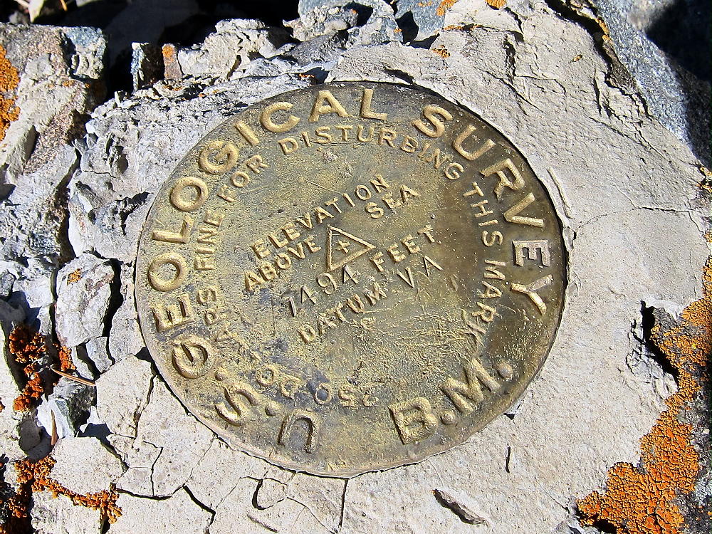
- Livermore Mountain USGS Benchmark
Because it was very windy, I set up my radio gear slightly down the north side of the ridge. There are some trees in the activation zone, so it’s easy to set up and get on the air. To save time, I got on the air as fast as possible, and I only operated 20M CW. I made 22 contacts in about 20 minutes. This is an excellent low-noise HF site!
-
- Livermore Mountain Summit View North
Livermore Mountain has a partial view across the northeastern plains, so it’s probably OK for a few VHF/UHF contacts.
I returned toward Greyrock Meadows by the same ridge-route I used to travel to Livermore. When I reached the elk bench at 7200 feet, I headed directly up a burned-up gully toward North Greyrock; eventually I arrived on a rocky ridge southeast of the summit – the top was not far.
I set up and activated North Greyrock very quickly. I was on 20M CW for about 30 minutes – I made 22 easy contacts, including EA2LU Jorge in Spain, and XE2ES Marco in Ensenada! North Greyrock is a fine, quiet HF summit. It looks out across the far eastern plains, so it’s likely good for a few VHF/UHF contacts.
This side trip to North Greyrock is not far, but it requires an additional rough bushwhack climb and descent of over 400 vertical feet. It’s probably as difficult to climb North Greyrock from the east side as from the west side. Both sides are rocky and burned-up; both sides have false summits and other problems. On the way up from the elk bench through the burned forest, I found the rock foundation of an old road or trail built running southeast up the slope. I was unable to follow it due to the deadfall – it remains a mystery – I have no explanation for why it was built.
-
- Greyrock North Side from Livermore Route
On the trip back I was rewarded by sunset in Greyrock Meadows. I was all alone – it was a beautiful place and time to enjoy, after hiking for hours through rough country.
-
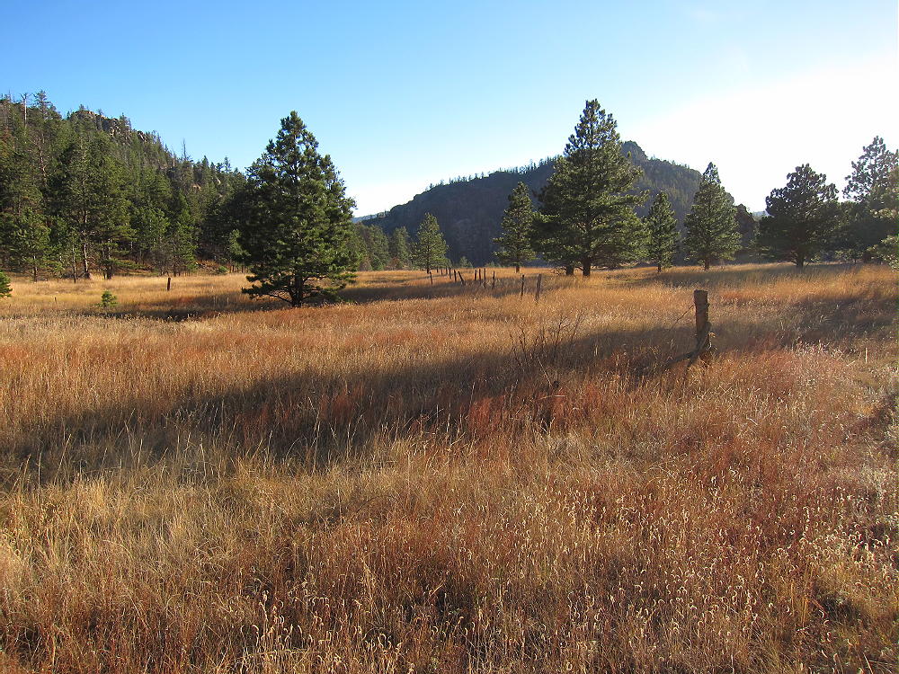
- Greyrock Meadows near Sunset
A few points are worth mentioning:
1. The trip from Poudre Canyon, out to Livermore Mountain, and back to the trailhead is a long day. An early start is required to reach Livermore, do the activation, and return to the trailhead before dark.
2. If an additional activation of North Greyrock or Greyrock is added, much more time is required.
3. I was able to activate Livermore and North Greyrock and get back to the trailhead before dark on November 2. If I had done the trip much later in the year, I would have been in the dark for part of the route.
4. Take a headlamp and the 10 Essentials!
5. Tell someone where you’re going and when you expect to return. Parts of this route are through rough country, so be careful.
6. Don’t attempt this hike unless you have done and enjoyed comparable off-trail trips before, including tricky navigation with map, compass, GPS, etc.
7. In the fall expect hunters to use this area. This is particularly true north of Greyrock Meadows, in the valley, on the elk bench, and along the ridge. This land is accessible from nearby private ranches. I met one friendly hunter the day I was there. Wear bright colors if you go during hunting season.
*** There’s little available water on most of the route detailed here – be sure to pack enough water !!
This is a big, challenging cross-country hike with a couple of one-point SOTA activations included for rest stops!
73
George Carey Fuller
KX0R
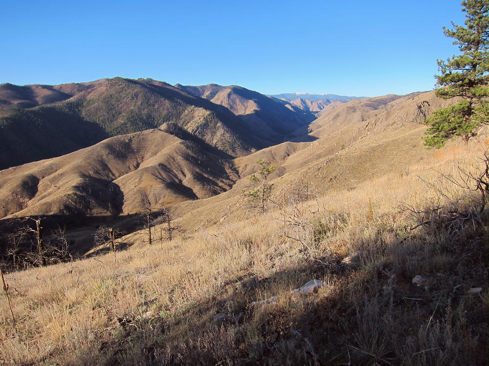
-
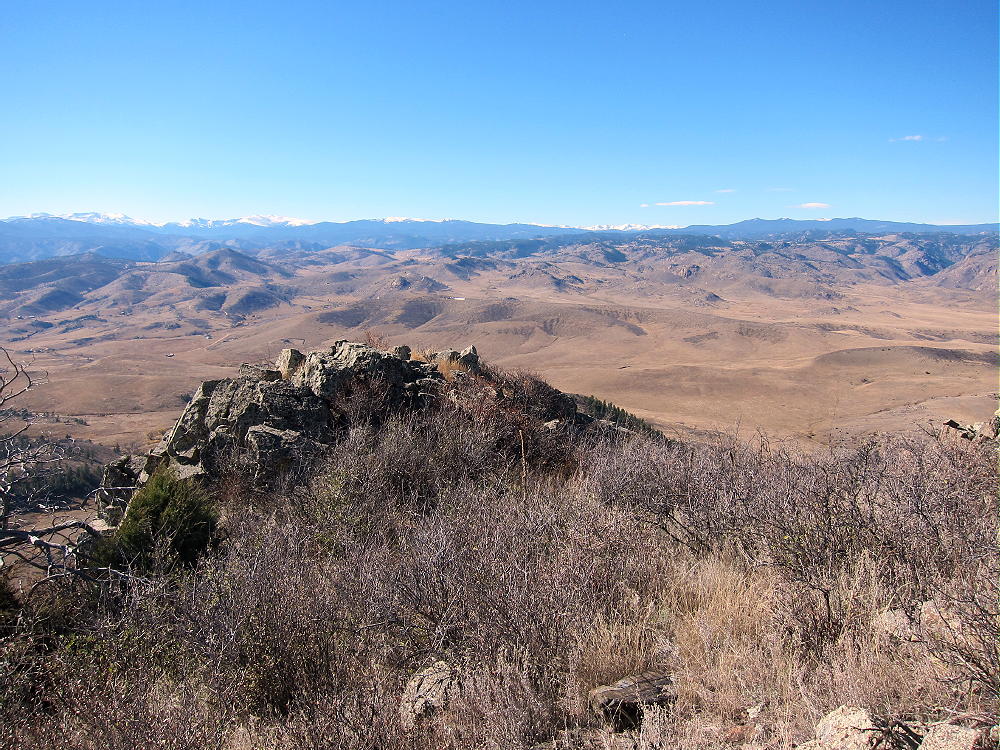
- Livermore Mountain Summit View West
-
- Greyrock Mountain
![]() !! WARNING !! There are old mountaineers, and
bold mountaineers... there are no old-bold mountaineers.
Hiking and mountain climbing are potentially hazardous activities particularly in Colorado with its extreme elevations. I am not accepting responsibility for any death or injury resulting from activations based on my trip reports. Proper training, experience, and personal capability assessment is required - enjoy!
!! WARNING !! There are old mountaineers, and
bold mountaineers... there are no old-bold mountaineers.
Hiking and mountain climbing are potentially hazardous activities particularly in Colorado with its extreme elevations. I am not accepting responsibility for any death or injury resulting from activations based on my trip reports. Proper training, experience, and personal capability assessment is required - enjoy!