


W0C/FR-082
Triangle Mountain
2565 m / 8415 ft
Nov 2, 2014
By KX0R
This report is an update on Matt K0MOS’s excellent report and video.
Triangle Mountain is a small, fun SOTA summit located less than a mile north of the flood-ravaged town of Glen Haven, about 6 miles northeast of Estes Park.
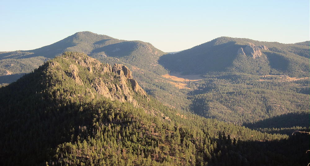
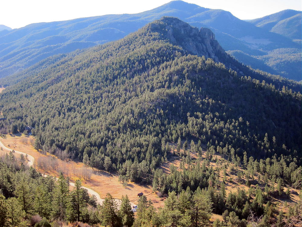
Triangle Mountain, Crosier Mountain, Piper Meadows, and West Crosier Mountain from Signal Mountain Trail
In September of 2013, sustained heavy rains flooded the mountains and canyons of northeast Colorado, and Glen Haven suffered extreme damage.
To reach the trail-head, first drive to Estes Park, and follow Devil’s Gulch Road 43 to Glen Haven; or drive up Highway 34, Big Thompson Canyon, from the Loveland area. The roads near Glen Haven were not re-paved in November 2014, but they were passable.
Now in March 2015 Matt K0MOS says there is heavy construction in the area, and parking is not possible. Long delays are required due to repair work.
While it might seem logical to try to climb Triangle from near Glen Haven, the land there seems to be mostly private. Drive about 1 mile down the canyon east of Glen Haven, and find what remains of the Lower North Fork Picnic Area. The day I was there, a large sign designated the spot, which was destroyed during the September 2013 floods.
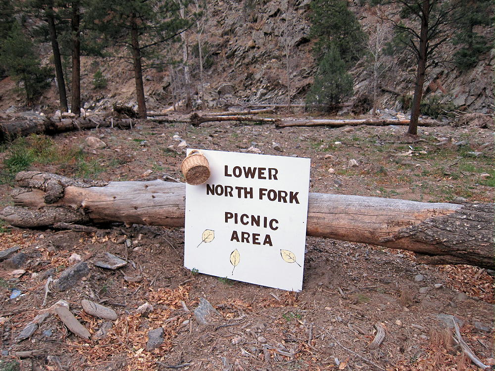
Triangle Mountain Trailhead at Lower North Fork Picnic Area
This is USFS property, even though it’s no longer a nice place for a picnic.
3/4/2015: Parking may not be possible until this area is re-built.
Cross the road, go slightly east a short distance, and look carefully for a small, steep path heading up the rough slope. If you find this path, you’ll be all set for the rest of your hike. Climb the steep ridge – this is the hardest part. On the ridge crest, the path firms up, and it leads most of the way to the summit. This social trail runs right along the ridge-top, and finding it is the key to climbing Triangle. No bushwhacking is required, as long as you stick with the path.
Part way up the route, I came to a large insulated power line lying on the ground, and a phone line hanging in the pine trees. These are probably essential services temporarily routed across the mountain to Glen Haven, because the floods destroyed almost everything in the Canyons. Needless to say, don’t touch any utilities you find up there. Follow the path along the open ridge, and when it becomes faint, stay on the ridge – including going across or slightly around a couple of rocky knobs. Eventually the path steepens, and the route leads through forested meadows, right up to the summit. The views get better as you climb. The total climb is 1.5 miles each way, with about 1400 vertical feet of gain.
Here’s another detailed report – written before the flood.
The summit has a classic exposed viewpoint to the west, as well as a sheltered area near the top, with several good spots to set up and activate.
-
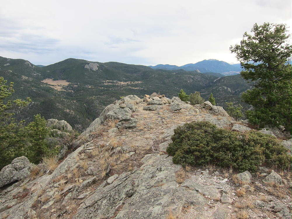
- Triangle Mountain Summit Cairn
-
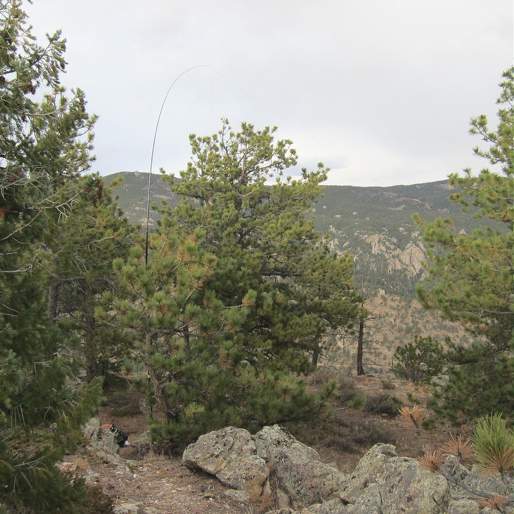
- Triangle Mountain Activation
There are some good trees available, so creative activations are possible with and without a pole. The view is larger and wider than I expected. Several valleys join right below at Glen Haven – this increased the volume of the flood waters – no wonder the secluded, peaceful canyon was washed out!
Triangle is a fine HF site, but its VHF-UHF coverage is probably limited by the higher terrain nearby. It looks like it could be activated in winter, since the route is mostly in the sun, but there are no bonus points on this 2-pointer.
I first tried to access Triangle from the Dunraven Trailhead, northwest of the summit, on Dunraven Glade Road 51B.
Triangle Mountain North Ridge and Dunraven Glade Trailhead
This is a logical approach, but when I headed up the NW ridge toward the summit, I found multiple “No Trespassing” signs posted on the trees. The north part of the Mountain is private, as well as the east and west sides. Follow the South Ridge route detailed above to avoid problems.
On the descent be sure to follow your original ascent route to avoid descending into the wrong area. Matt’s comments are appropriate!
Triangle can be combined with other accessible summits in the Estes Park area for a double activation.
73
George Carey Fuller
KX0R
-
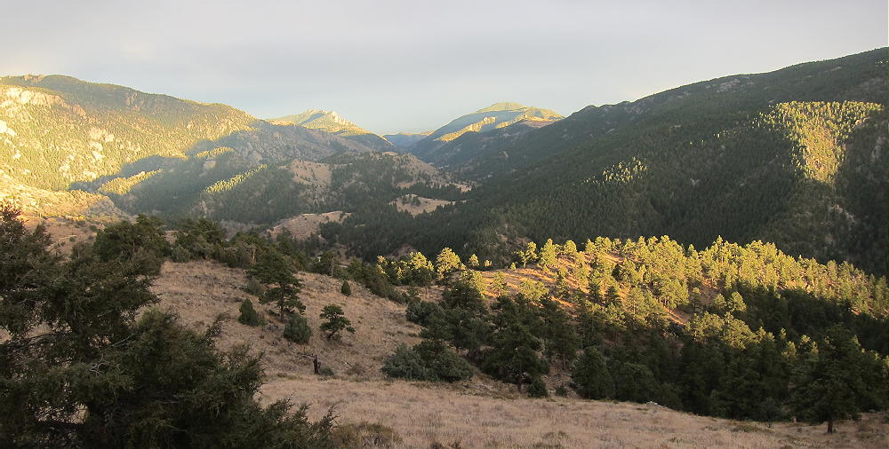
- Sunset from Triangle Mountain Trail
![]() !! WARNING !! There are old mountaineers, and
bold mountaineers... there are no old-bold mountaineers.
Hiking and mountain climbing are potentially hazardous activities particularly in Colorado with its extreme elevations. I am not accepting responsibility for any death or injury resulting from activations based on my trip reports. Proper training, experience, and personal capability assessment is required - enjoy!
!! WARNING !! There are old mountaineers, and
bold mountaineers... there are no old-bold mountaineers.
Hiking and mountain climbing are potentially hazardous activities particularly in Colorado with its extreme elevations. I am not accepting responsibility for any death or injury resulting from activations based on my trip reports. Proper training, experience, and personal capability assessment is required - enjoy!
Just an update on the situation around Glen Heaven. As of February 2015 there is major construction going on in the canyon between Glen Heaven and Drake. The road is unpaved and mostly a one lane route, waiting times to get through (from either direction) is up to 1h. They are widening the canyon and heavy equipment is everywhere. The mentioned trail-head in the report is no longer :(
There is NO WAY you can park you car anywhere in the area.
Matt/KØMOS
Thanks – I’ll update the report.