


W7U/SJ-032
La Sal Benchmark
2197 m / 7207 ft
Nov 28, 2016
By KX0R
La Sal Benchmark is an accessible SOTA peak about 27 miles southeast of Moab, UT. The prominent summit is not difficult to climb.
Key Points:
• The mountain top is BLM land
• Hogback ridge – tilted mesa – runs for miles
• Somewhat wild area on top – pinion/juniper forest and bushes
• Seldom visited by people
• Considerable development east of the mountain – uranium mines and ponds, old buildings, machines, and homes
• The land is used for cattle, but it’s not posted.
• Access via paved County Highway 113 from up north, near La Sal
• Area north of the summit is posted
• My “trailhead” access was along Homestake Road 114, southeast of the summit
• Trailhead elevation ~ 6920 ft
• ~ 1.0 mile round-trip
• ~ 300 vertical feet
• Ascent requires about 25 minutes
-
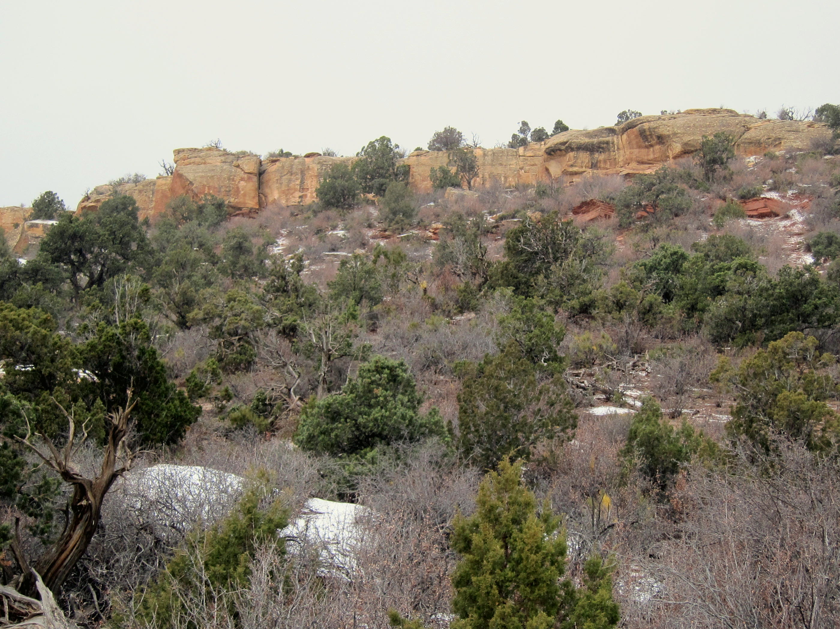
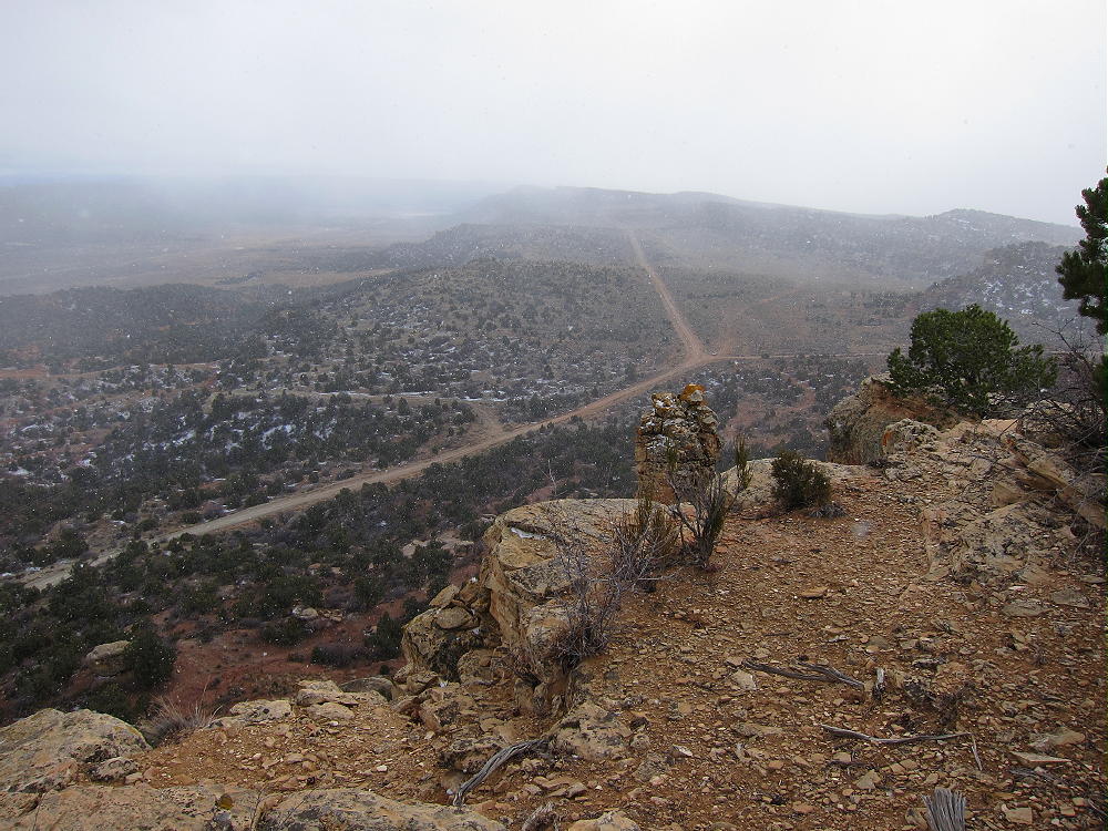
- La Sal Benchmark – Summit Cliffs
Driving Directions from central Moab:
• Head south on Highway 191 and drive about 20 miles
• Turn east on Highway 46 toward La Sal
• Drive about 6.5 miles
• Turn south on CR 113 about a mile west of La Sal
• CR 113 is a pretty good paved road
• Go south 5.0 miles on CR 113
• Turn right on small 2WD dirt road CR 114, Homestake Road
-
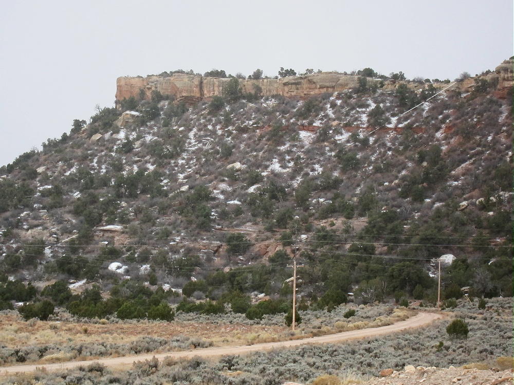
- La Sal Benchmark – Summit, Cliffs, and Pipeline, North Side above CR 114
• Drive southwest and then south about 0.8 mile total
• Part just north of the stock tank, near where CR 302 heads off to the southwest
-
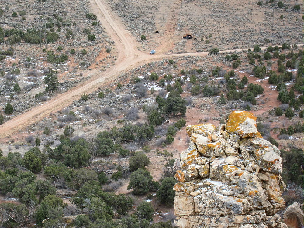
- La Sal Benchmark – Summit View to Parking Spot at Road Fork and Stock Tank
The Hike:
From the parking spot, hike northwest up toward the ridge south of the summit. Note that the summit ridge is mostly a cliff-line, much like a wall. It’s impractical to climb up most of this outcrop. Instead, hike up to the obvious saddle in the cliff, about 1000 feet southwest of the summit.
-
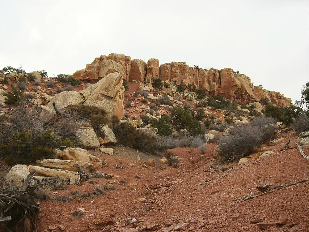
- La Sal Benchmark – Route up through Cliff at Upper Left
When I climbed up to this saddle, I thought the ridge route on the rocks looked tricky, so I went northwest and down into the little gulch west of the ridge rocks. I then followed the gulch most of the way northeast and up to the summit. It’s brushy but not difficult.
-
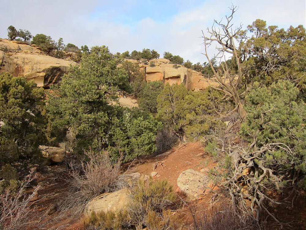
- La Sal Benchmark – Route up Gulch
It might be possible to approach the summit from the northwest via CR 116 and BLM 1141 jeep road. I didn’t try this, but the route is certainly visible on the Google map and satellite image. If these roads are open and OK, access to the summit might be easier than the off-trail route I took from CR 113.
There also appears to be a jeep road southwest of the summit leading north from CR 302. This appears to connect with BLM 1141 not far northwest of the summit. Whether open to driving or not, this route is likely OK to hike.
Avoid trying to ascend the cliffs just east of the summit, or anywhere on the northeast or north side of the peak. The only conveniently accessible break in the cliff wall is described above!
-
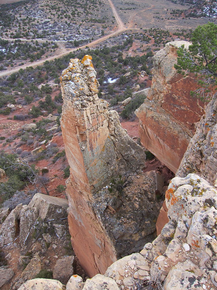
- La Sal Benchmark – Summit View off Cliffs
Note that land along Road 113, well north of the peak, is clearly posted “No Trespassing”, etc.
Useful Details:
Thanks to Fred WS0TA for his first SOTA activation of La Sal Benchmark!
-
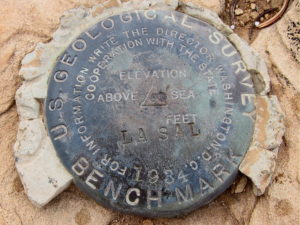
- La Sal Benchmark – USGS Marker from 1934
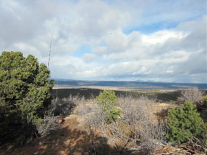
The summit’s rocky with great views of the entire area.
-
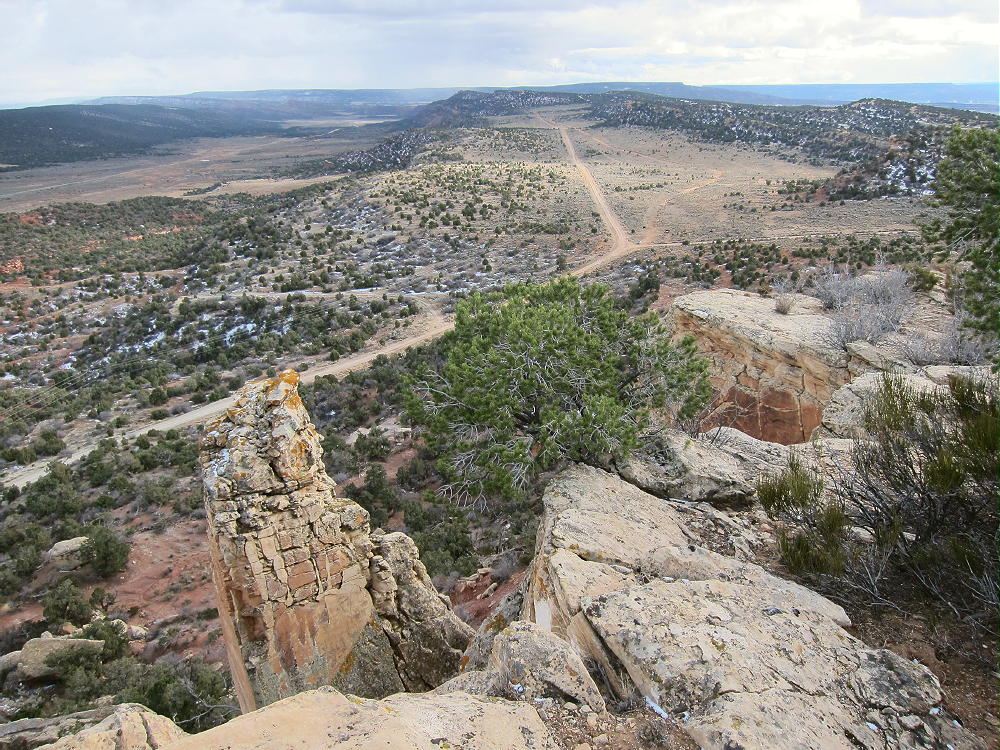
- La Sal Benchmark – Summit View South – Road 114
There are good shelter trees, and the SOTA Activation Zone is large. When I was there, the summit area was inhabited by large black cows. Several snow squalls came through as I was setting up my gear, but the activation went well.
-
- La Sal Benchmark – Snow Showers along Road 114
La Sal Benchmark is a fine radio site – the HF noise level is low, despite power lines nearby along CR 114. Propagation is not affected significantly by any nearby mountains.
In spite of the cows, snow showers, and frigid weather, I made 47 CW contacts on 7-10-14-18 MHz. One contact was summit-to-summit (S2S) on 14 MHz with KE5AKL on W5T/DW-018. I ran 5W and stayed on the air for almost an hour.
-
- La Sal Benchmark – KX0R SOTA Activation
-
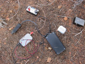
- La Sal Benchmark – KX0R Radio Gear
Making random VHF or UHF contacts would be unlikely from this summit, due to its isolation from significant population centers; however, Moab and Monticello may be within range of the peak.
Please look at the satellite image for these details:
A white oil pipeline crosses the summit ridge about 200 yards north of the summit:
-
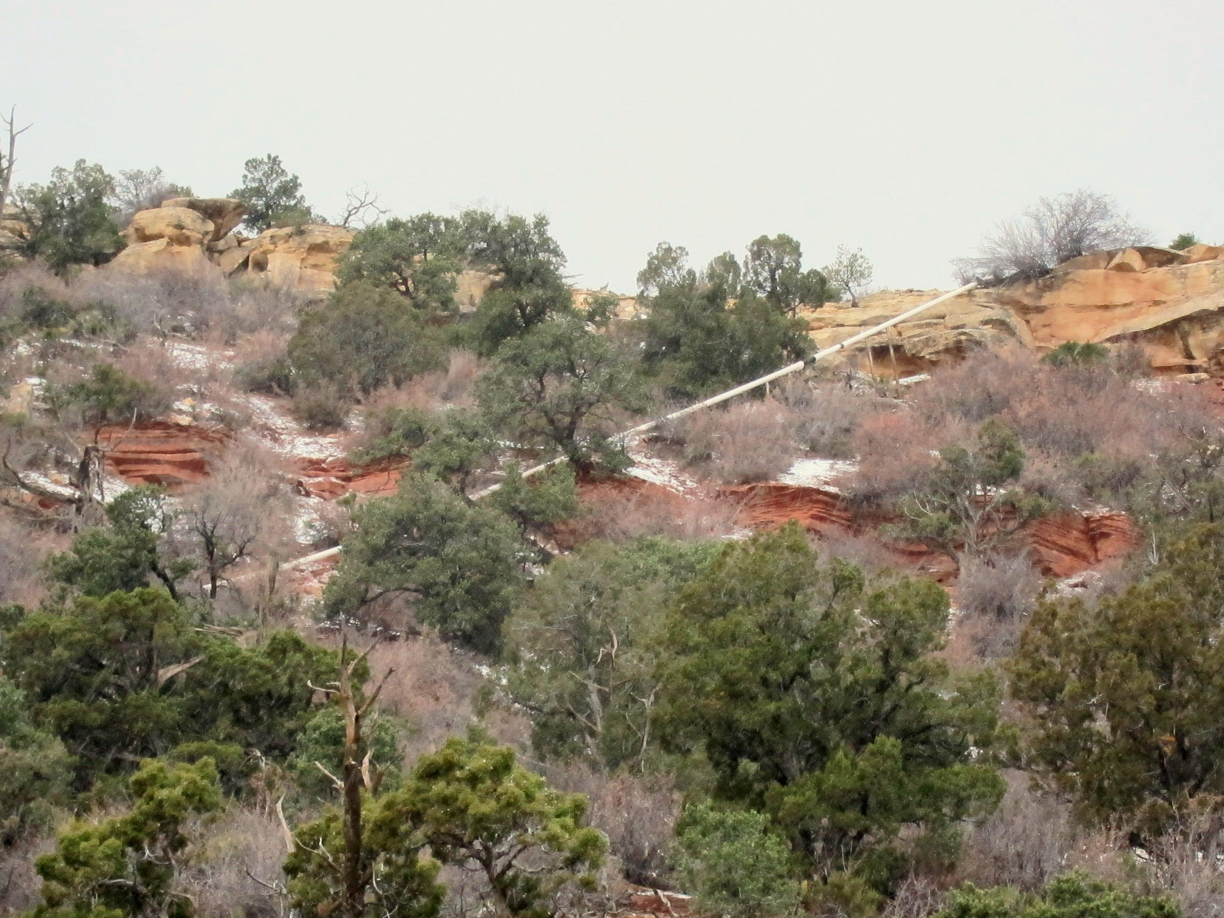
- La Sal Benchmark – Oil Pipeline near Summit
This pipeline runs near a couple of tanks visible on the satellite image about 0.2 mile northwest of the peak, near the upper end of BLM 1141. This seems to be an oil well site – not sure if it’s still active. I didn’t go near this area, and I couldn’t see it from the peak, so I have no other information. An old jeep track runs from the site to just east of the summit. The entire west slope of the mountain is riddled with numerous jeep tracks – perhaps these were related to exploration for minerals?
In addition to several large mine developments nearby, the satellite images reveal a large oil field with many pads and pumps several miles east and southeast of La Sal Benchmark.
La Sal Benchmark has a fine view of the nearby La Sal Mountains, but they were socked in when I was there.
-
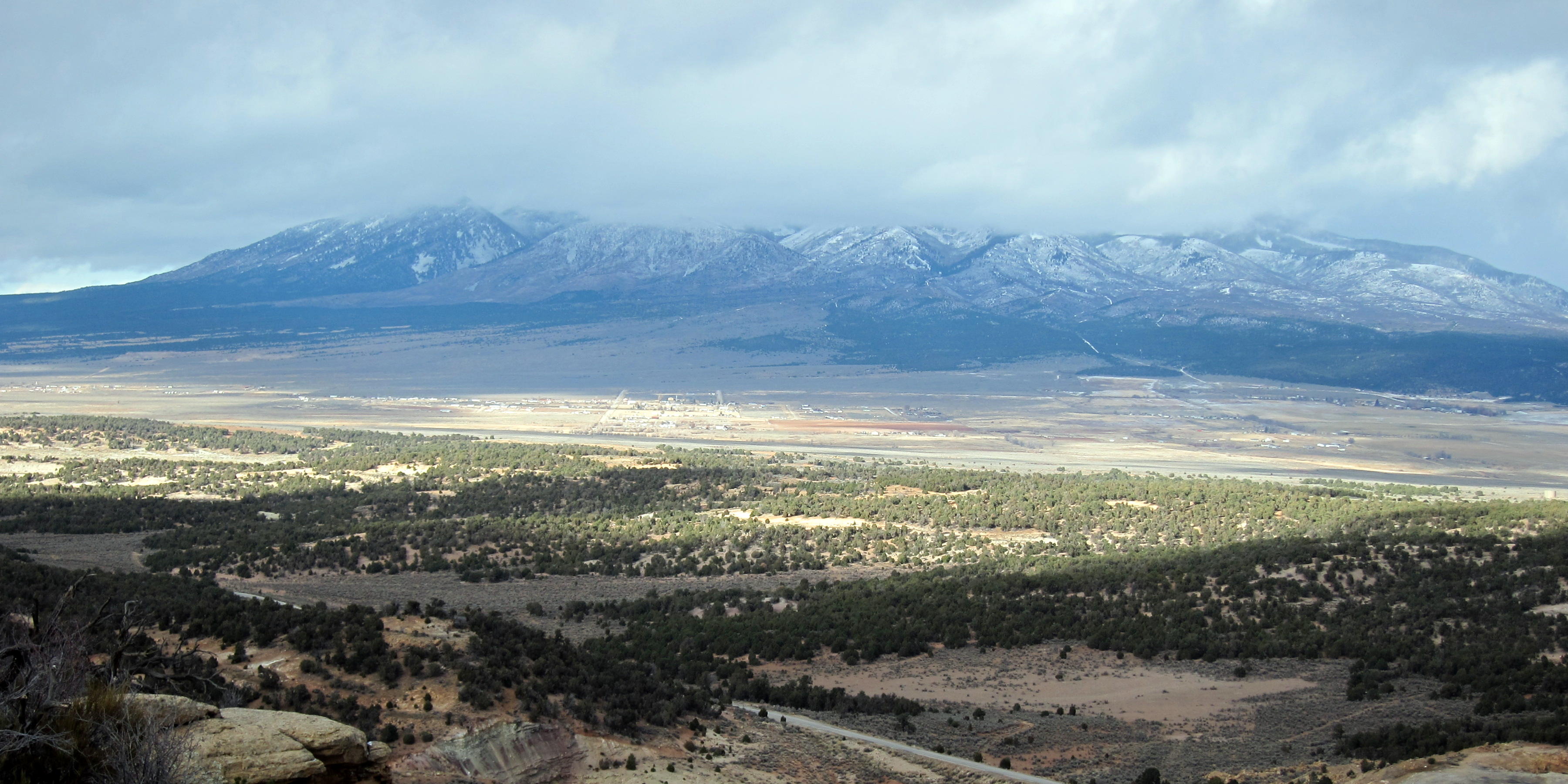
- La Sal Benchmark – La Sal and La Sal Mountains
73
George
KX0R
![]() !! WARNING !! There are old mountaineers, and
bold mountaineers... there are no old-bold mountaineers.
Hiking and mountain climbing are potentially hazardous activities particularly in Colorado with its extreme elevations. I am not accepting responsibility for any death or injury resulting from activations based on my trip reports. Proper training, experience, and personal capability assessment is required - enjoy!
!! WARNING !! There are old mountaineers, and
bold mountaineers... there are no old-bold mountaineers.
Hiking and mountain climbing are potentially hazardous activities particularly in Colorado with its extreme elevations. I am not accepting responsibility for any death or injury resulting from activations based on my trip reports. Proper training, experience, and personal capability assessment is required - enjoy!