


W0C/FR-169
Middle Mountain
2848 m / 9344 ft
First Activation
Nov 4, 2016
By KX0R
Middle Mountain is a fun SOTA peak hidden along the Laramie River in northern Colorado.
• Roosevelt National Forest
• No marked trail, but many game trails
• Somewhat steep climb to a pleasant, prominent summit
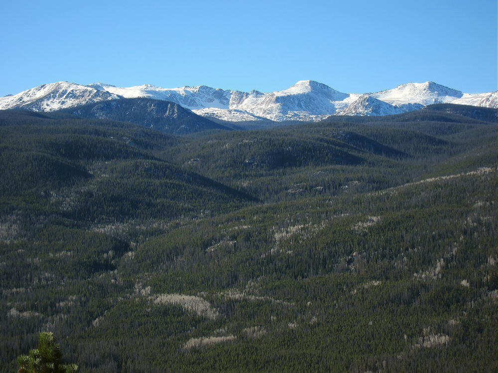
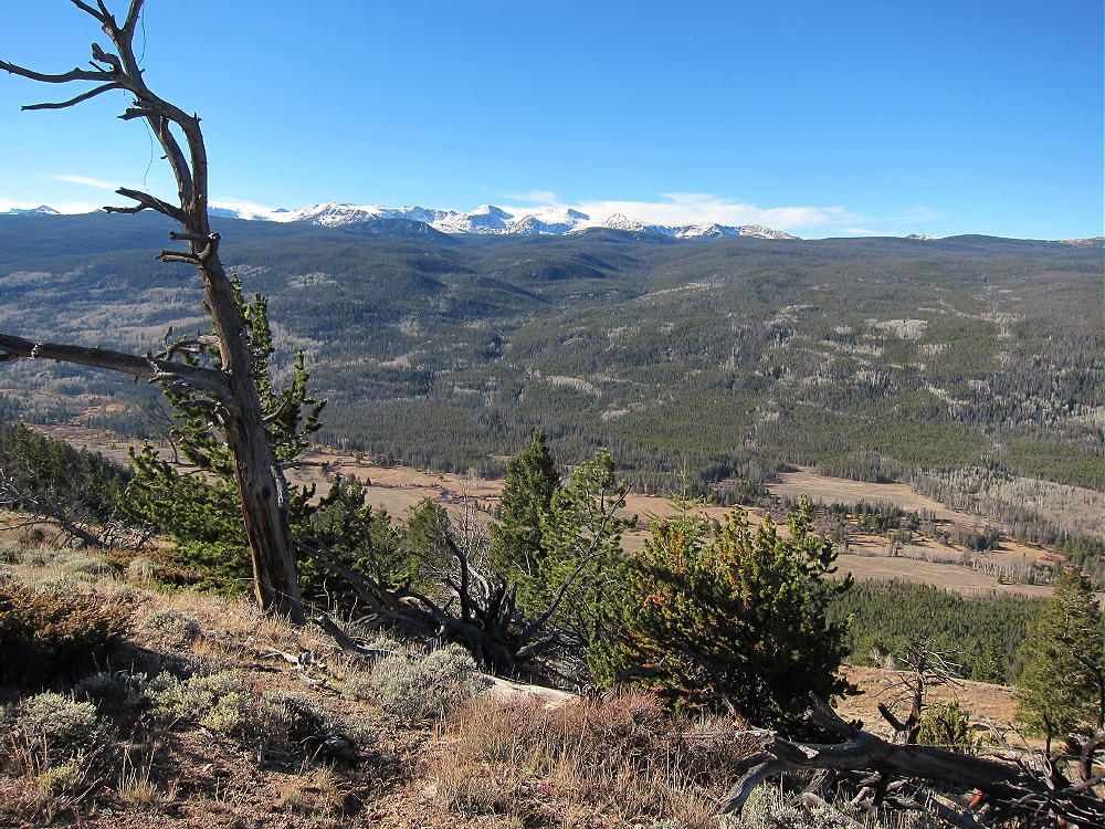
• Nice scenery – fine views of Rawah Peaks and the Laramie River Valley
• Fine HF site
• Not visited frequently
• Limited points of access
• ~ 4.0 miles round trip via southern route
• ~ 2.3 miles round trip via steeper northern route
• ~ 900 vertical feet via southern route
• ~ 1000 vertical feet via steeper northern route
• SOTA Classic!
Middle Mountain Summit from Northwest
Driving access:
• First drive to Fort Collins, Colorado
• Take Highway 287 northwest to Ted’s Place
• This is about 10 miles from downtown
• At Ted’s Place, turn west on Highway 14 – large Shell gas station there
• Drive up the Poudre Canyon via Highway 14 for about 51 miles
• Turn north on the Laramie River Road, CR 103, near Chambers Lake – this is a good dirt road, but it’s likely closed late fall to mid-spring
• Continue north for about 11 miles to Middle Mountain
• The well-named mountain stands in the center of the wide valley
• Either park at the Rawah Trailhead on the right, across the road from the large Rawah Guest Ranch – see below
• Otherwise, park along the east side of the road about 1-1/2 miles further north, beyond the “posted” signs on the east side of the road – see below
• Do not park on the west side of the road!
The climb:
• There are two general routes to the summit of Middle Mountain
Southern Route:
• This is probably the best route. It starts at the Rawah Trailhead – however, I have not climbed this way – I climbed via the northern route (see below)
• This route is probably not visible, nor is it marked or signed at the trailhead
• From the Rawah Trailhead, climb up the steep embankment east of the parking lot.
• Follow game trails, or just hike, about ¼ mile northeast, up almost 500 vertical feet, to a secret/game trail that runs north along the south ridge of Middle Mountain
• This trail is easily visible on the Google satellite image at moderately high magnification. Once you see it on the image, you’ll have no problem finding it on the mountain.
• The south end of this trail runs down to private land further south, and is probably not accessible to the public.
• Once on the trail, continue north up the prominent south ridge of Middle Mountain, all the way to the summit.
Northern Route:
• This is the route I used – it worked OK, but later I saw the southern route on the satellite image. The southern route is mostly better, despite the steep beginning.
• However, if you park north of the posted signs along the east side of Road 103, you can just hike into the National Forest and head up the northwest side of Middle Mountain toward the summit.
• There are so many game trails that you can pretty much just follow whatever you find that heads SSE and up the steep slopes.
• The animals know where to go, and as long as you think about getting up to the ridge north of the summit, you’ll find trails to take you there!
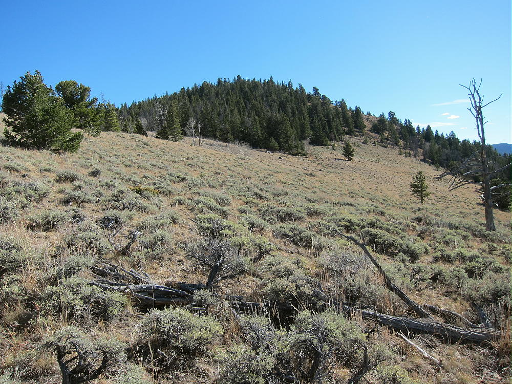
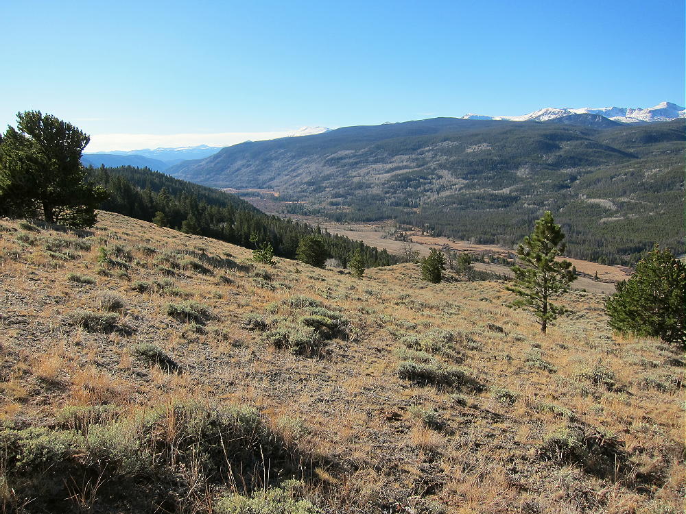
• This steep route is spectacular, up through steep meadows and bits of forest, with amazing views of the Laramie River Valley below, and the high Rawah Peaks directly to the west.
Middle Mountain Northwest Slopes
Middle Mountain, Rawah Peaks
• There were elk tracks everywhere up there!
• Stay just west of the summit ridge to avoid dense woods near the top.
Details:
Middle Mountain is a SOTA Classic! Everything about this summit provides an exciting, interesting climb and activation. It’s not long or excessively arduous, and the summit seems special.
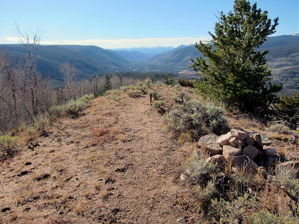
Middle Mountain Summit, View South
The activation zone on the summit ridge is long and narrow. Shelter from wind is available from trees and the summit ridge. There are nice sunny spots with good trees for a pole. I ran my wire straight north-south along the summit, and I had a fine activation! This peak works about like a 1000 foot tower! The ground drops steeply on the east and west, and no high peaks significantly block HF signals from any direction.
A USCGS benchmark from 1949 stands on a pipe on top.
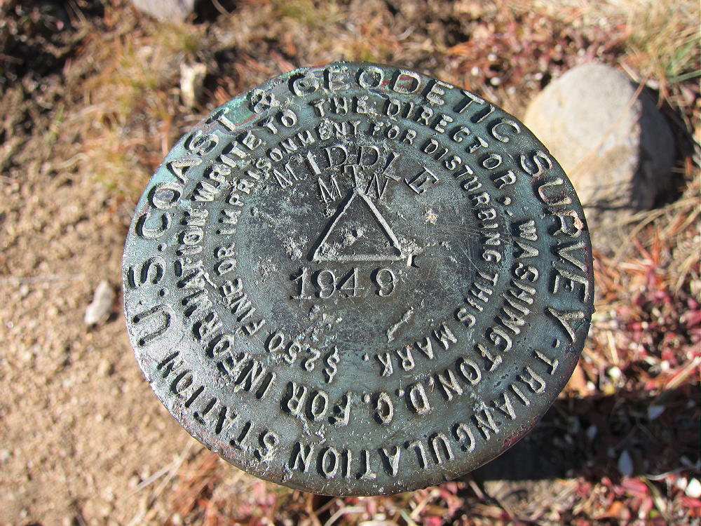
Middle Mountain Benchmark
There’s a summit cairn, but no jar. It’s a perfect summit to activate, with several useful trees. I supported my 66-foot wire between a pole at the summit and a tree to the north. I made 50 CW contacts on 4 bands with my 5-watt ATS-3B. The wire was north-south along the ridge-top. The weather was just perfect.
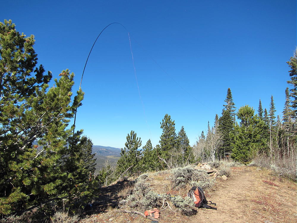
Middle Mountain – Summit Activation
There’s some development down below at local ranches, but no man-made RF noise is audible up on the peak. No significant communities exist for many miles. This is an almost perfect HF site. However, VHF and UHF contacts appear very unlikely, as higher mountains block coverage in every direction.
After I climbed Middle Mountain, I realized that at some time in the past, the entire Laramie River Valley was filled with a large, deep glacier flowing north for many miles. This is a classic wide glacial valley – it’s obvious even from the road.
From the summit, and on the topo map, it appears that at Middle Mountain, the glacier split into two rivers of ice, leaving Middle Mountain as an island standing in the middle. The ice eroded both sides of the mountain, leaving steep slopes, but the glaciation ended before the mountain was completely removed by the ice. Both valleys on each side of the mountain are wide and glaciated.
Imagine what it must have looked like, with the ice on both sides, perhaps as deep as where the summit is today! The high, steep contours on the east side of the drainage bear this idea out.
There is another possible glacial remnant in the Valley further north – North Middle Mountain. The topo map suggests that glaciation of the Laramie River Valley was quite extensive for miles north of Middle Mountain.
The climb up Middle Mountain is definitely worth the long drive up Poudre Canyon. This is a Classic SOTA peak!
73
George
KX0R
Middle Mountain View West
![]() !! WARNING !! There are old mountaineers, and
bold mountaineers... there are no old-bold mountaineers.
Hiking and mountain climbing are potentially hazardous activities particularly in Colorado with its extreme elevations. I am not accepting responsibility for any death or injury resulting from activations based on my trip reports. Proper training, experience, and personal capability assessment is required - enjoy!
!! WARNING !! There are old mountaineers, and
bold mountaineers... there are no old-bold mountaineers.
Hiking and mountain climbing are potentially hazardous activities particularly in Colorado with its extreme elevations. I am not accepting responsibility for any death or injury resulting from activations based on my trip reports. Proper training, experience, and personal capability assessment is required - enjoy!