


W0C/FR-037 (Twin Sisters Pk. East) – 3476 m / 11428 ft
January 18, 2014
by KØMOS
This post ist just a summary of today’s observations during my activation of WØC/FR-Ø37 (Twin Sisters Pk. East). If you are interested in a complete trip report with pictures and video, check out my first activation trip report.
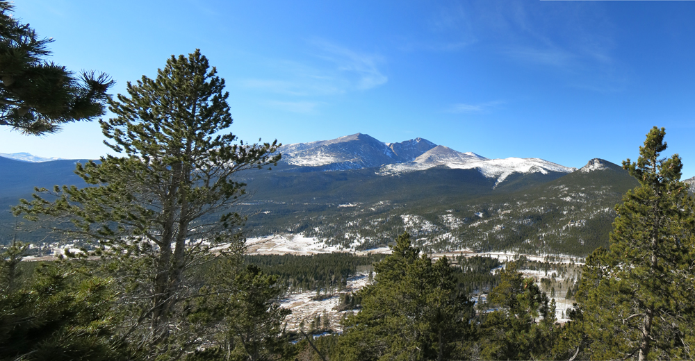
View of Mt. Meeker, Longspeak and Estes Cone
1) CDOT (Colorado Department of Transportation) started with the permanent repairs on US36 (which was badly damaged during the flood in September 2013). As a result, US36 between Lyons and Estes Park is a one lane road in several spots. This might delay your travels up to 30 minutes.
- The first one lane section is just after you leave Pinewood Springs. There is some heavy equipment busy widening the canyon, removing the rock wall on the right side of the road. Traffic is controlled by flag persons.
- The second one lane section is at mile marker eight and is controlled by a automated traffic light (Access to public land is still closed in this area, leaving several SOTA summit inaccessible from here).
I was lucky on my way up and I caught the ‘green wave’ (= no delays). Different story on my way back.
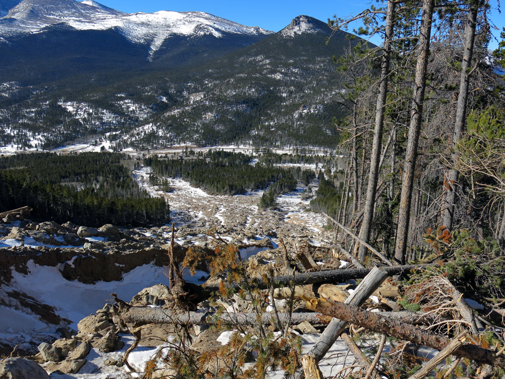
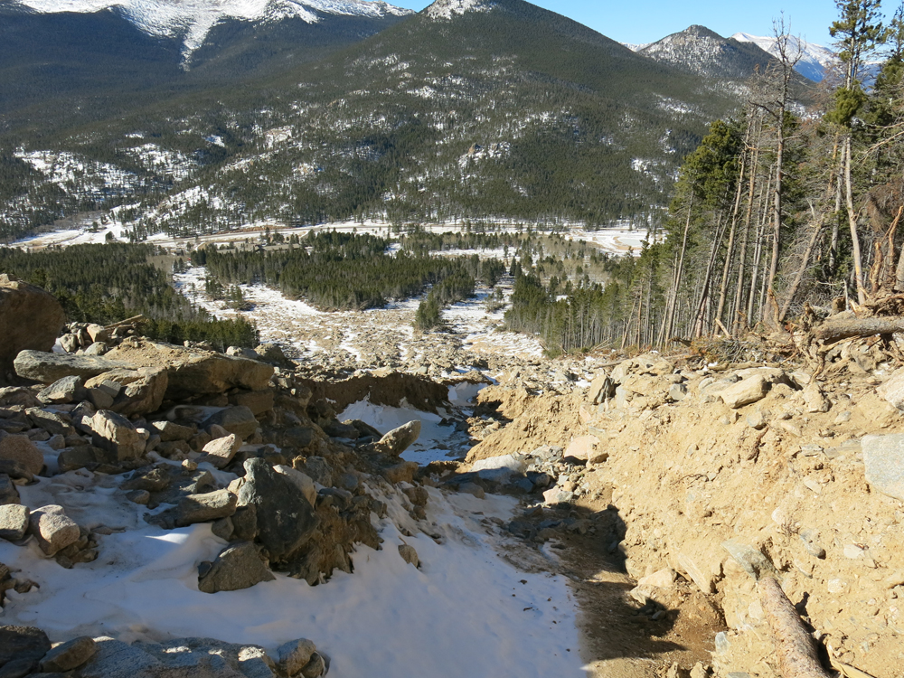
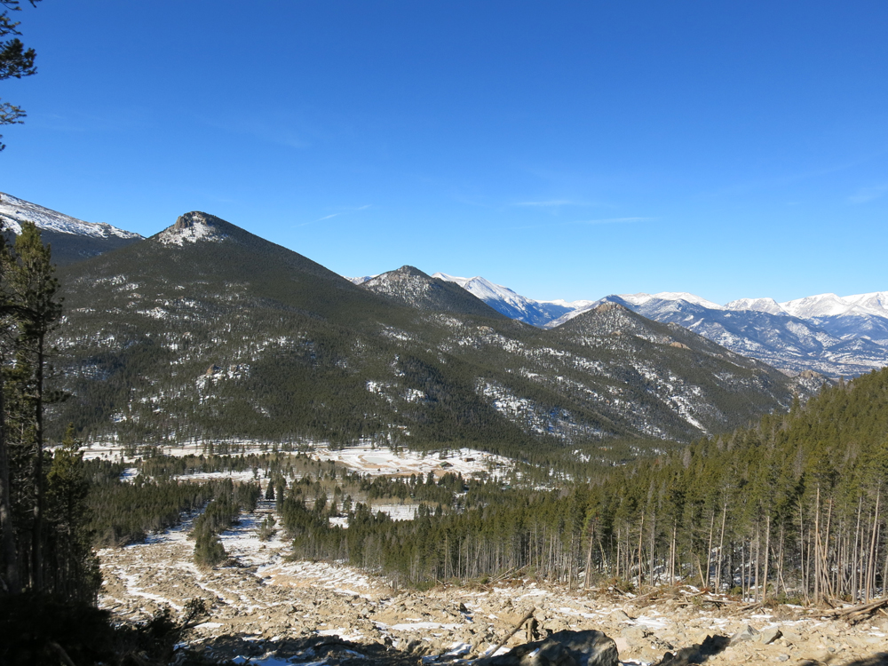
2) There was quite a sizable landslide (during the same flooding event) on the west side of the mountain where the trail goes up to the summit.
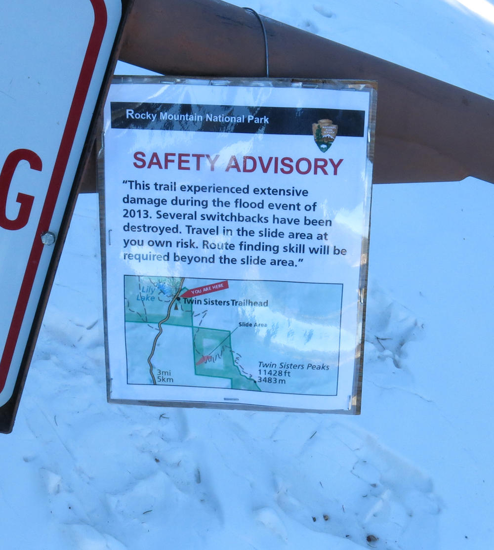
RMNP Warning Sign
There is a warning sign at the winter TH, indicating that the normally easy hike has some obstacles in store for you.
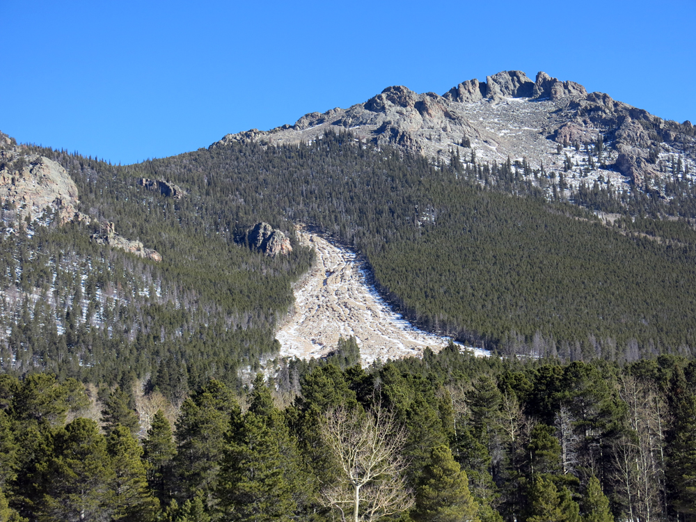
Landslide as seen from the road
The slide does not look too bad from the road but entering the area and trying to find you route up to the summit was quite challenging.
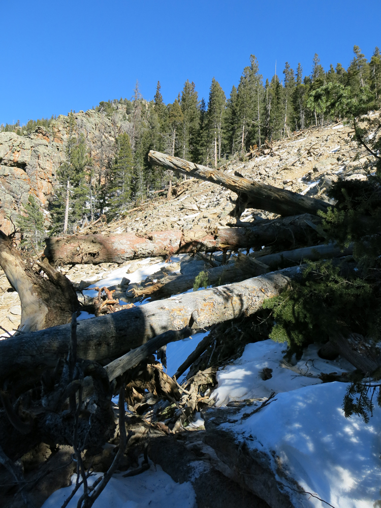
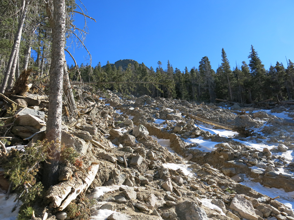
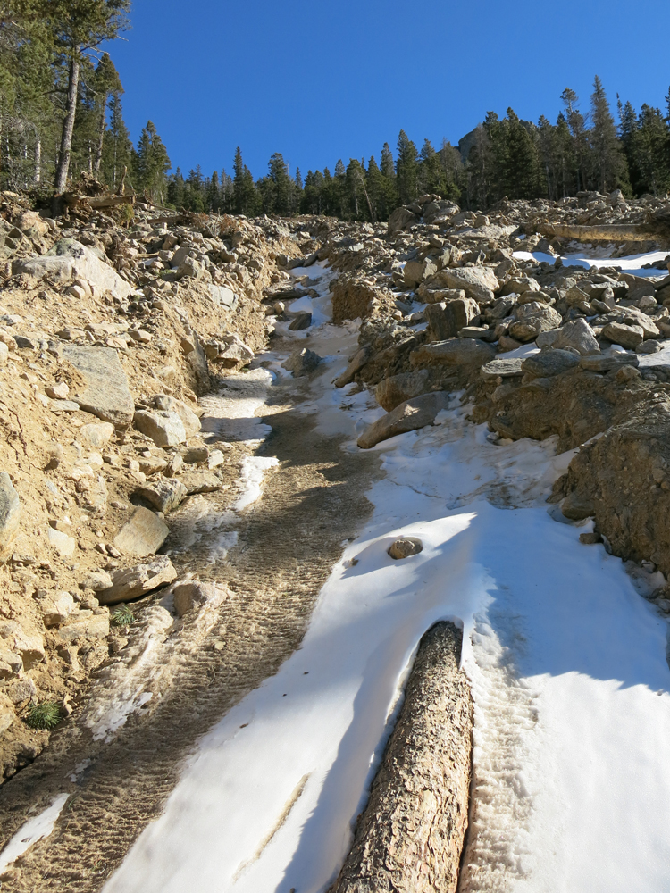
The first time you reach the slide area, there is gap in the forest of about 200 ft (60m). The forest got replaced by huge bolders and loge pole pines pile ontop of each other stuck in frozen mud. The frozen mud/ground is treacherous and finding the trail is difficult. You have to cross over this section and try to find the trail on the other side. Since it’s a switchback trail, you are doing that several times. Without a map/compass, or even better a GPS device with the tracks from my last ascent, not recommended. There are several channels carved out by the rushing water, some of them ~10 ft (3m) deep – quite an obstacle.
Here a few more pictures but without having a comparison, the scale is hard to grasp.
And last but nor least, a raw video clip.
httpvh://www.youtube.com/watch?v=LnR5B1LjNDA
At the bottom of the land slide is/was the Aspen Lodge. It looks as if none of the buildings got destroyed by the land slide. It seems that it just stopped before reaching the buildings. However, the rushing waters must have damaged the main building and probably several of the smaller cabins quite a bit.
That’s all from today, thanks for the contacts and 73, Matt/KØMOS
![]() !! WARNING !! There are old mountaineers, and
bold mountaineers... there are no old-bold mountaineers.
Hiking and mountain climbing are potentially hazardous activities particularly in Colorado with its extreme elevations. I am not accepting responsibility for any death or injury resulting from activations based on my trip reports. Proper training, experience, and personal capability assessment is required - enjoy!
!! WARNING !! There are old mountaineers, and
bold mountaineers... there are no old-bold mountaineers.
Hiking and mountain climbing are potentially hazardous activities particularly in Colorado with its extreme elevations. I am not accepting responsibility for any death or injury resulting from activations based on my trip reports. Proper training, experience, and personal capability assessment is required - enjoy!