


W0C/PR-004
Ute Peak
3750 m / 12303 ft
First Activation
Sep 7, 2016
By KX0R
Ute Peak is a fun alpine SOTA peak in the Williams Fork Mountains north of Silverthorne.
Key Points:
• Arapaho National Forest
• Somewhat challenging hike at high altitude
• Marked trail most of the way
• Trail is inefficient and confusing
• Superb scenery – nice alpine area
• Excellent HF site
• 11 miles round-trip
• ~3100 vertical feet total
-
- Ute Peak – Summit and Northwest Ridge
Driving Directions:
• Drive west on I-70, pass through the Tunnel, and exit to Silverthorne
• Turn north on Highway 9
• Drive along the Blue River for about 11 miles to Ute Pass Road CR 15
• Turn east on paved CR 15, and drive up to Ute Pass at 9570 feet
• The trailhead is on the east side of the road
• Park off the road near the Pass
-
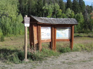
- Ute Peak – Ute Pass Trailhead
-
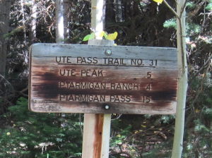
- Ute Peak – Ute Pass Trail Sign
The Hike and Climb:
• Google Maps show none of the Ute Peak Trail
• Use an up-to-date map to navigate this area – part of the route has been changed
• GPS is very useful up there
• Follow the marked Ute Pass Trail #31 as it ascends southeast along the ridge
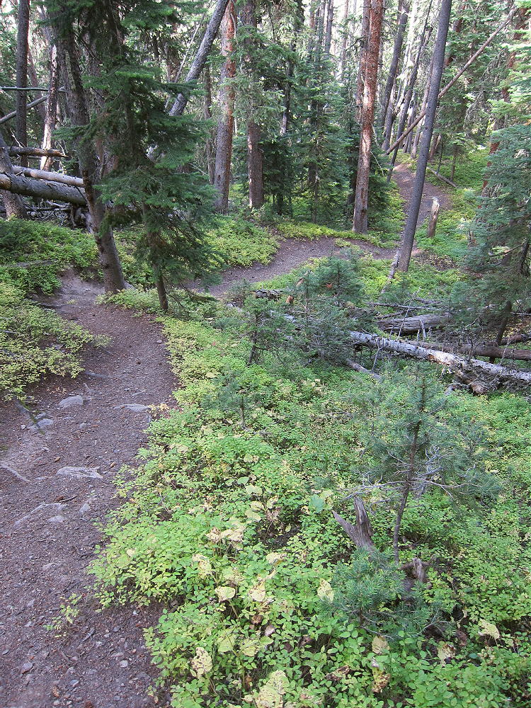
• The trail leads up through dense sub-alpine forest
• After climbing up the ridge to about 10,200 feet, the trail leaves the ridge, contours to the east, and descends to about 9900 feet
• This is contrary to what’s required to ascend the peak – this part of the trail seems designed to connect with a trailhead down in the valley to the east, near the Williams Fork River
• Eventually a fork leads southwest, and Trail #24 climbs steeply back up toward the ridge
-
- Ute Peak – Trail 24 above Junction
• The trail continues ascending south along the northwest ridge
• The path becomes smaller near treeline, but it continues up the steep tundra and flattens out near 12,000 feet
-
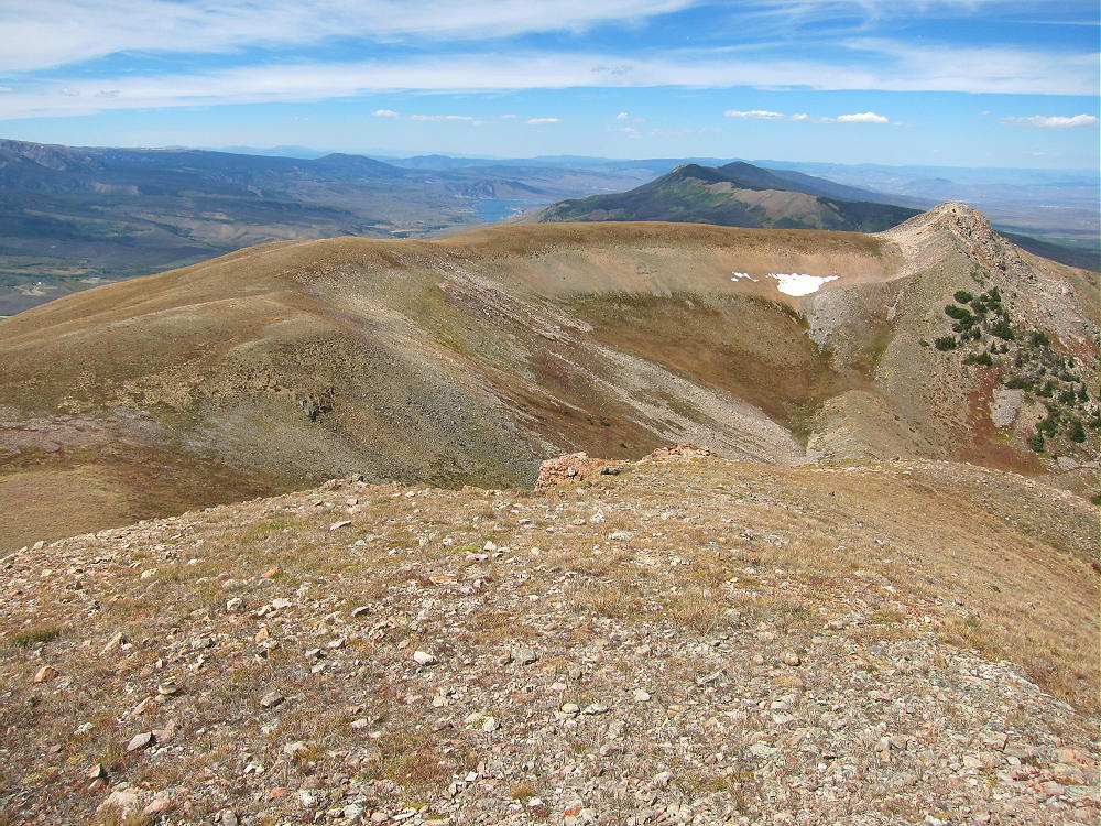
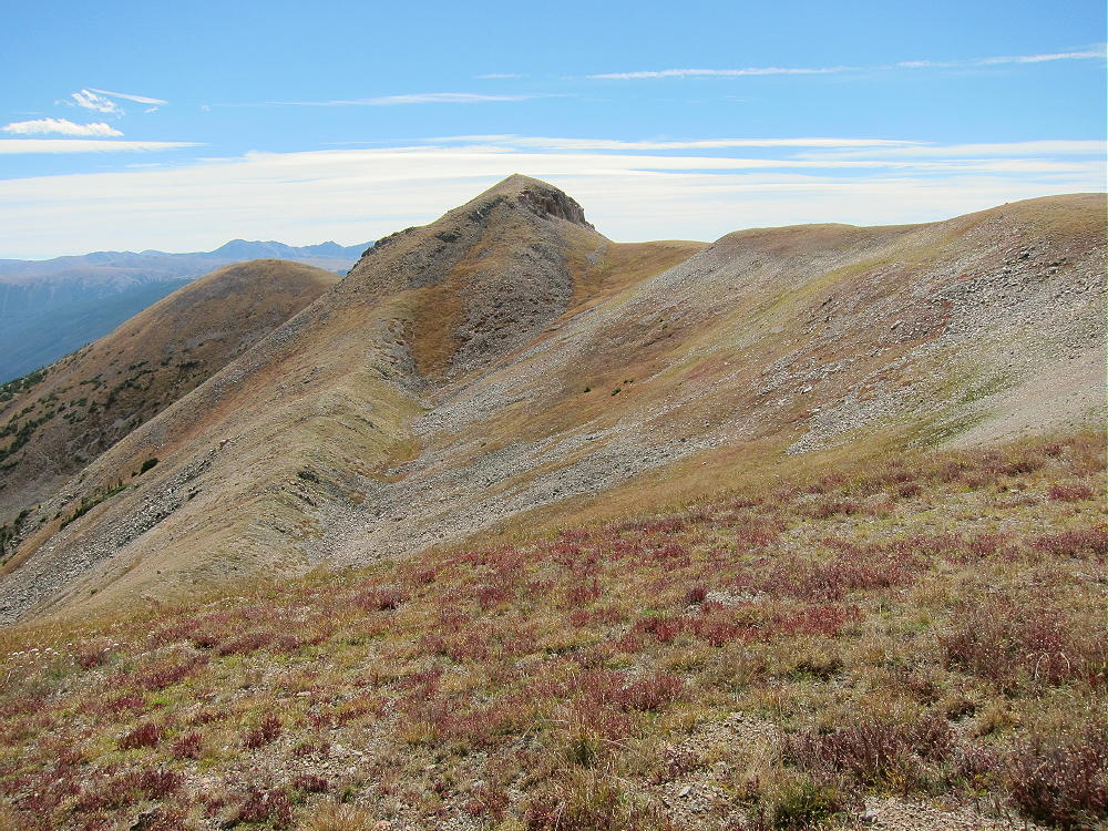
- Ute Peak – Northwest Ridge, View North from Summit
• The trail runs along the west side of the ridge and gradually climbs toward the prominent summit
• To climb Ute Peak, head slightly east on a climbers trail that ascends around the north side of the summit and up to the top
-
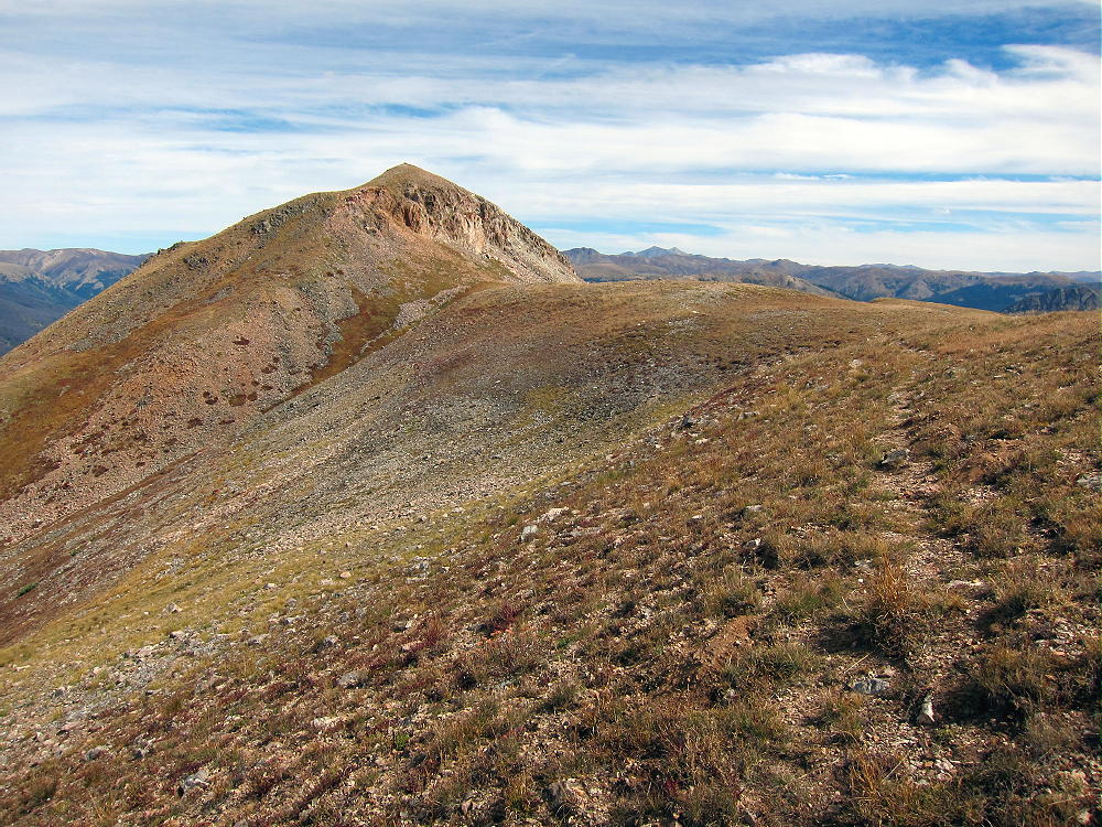
- Ute Peak – Summit from Northwest Ridge
Additional Details:
Perhaps a more direct trail previously ran right up the northwest ridge, all the way from Ute Pass to tree-line. This route is shown on my GPS map-set, but I didn’t find it when I was up there. It’s possible that this route still exists, but it might be covered with deadfall now.
When I ascended the mountain, I realized that the current trail was taking me too far to the east and downhill, so I decided to head off-trail, up through the forest, to re-gain the ridge. My route was steep and involved some bush-whacking. Before long I met the designated trail at about 10,400 feet. When I went down from the summit, I followed the main route all the way to see how it works.
Even though the current trail is inefficient, it’s a better route to the summit than bushwhacking up the thickly-forested northwest ridge!
Above tree-line, the hike to Ute Peak goes fast. The alpine scenery is exciting, and the trail runs close to the ridge-top. The peak looks tricky at first sight; but the path around the north side makes the final ascent easy. There’s a pole marking this route.
-
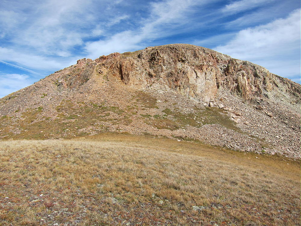
- Ute Peak – Summit Formation – Note Faint Trail Around Far Left Side
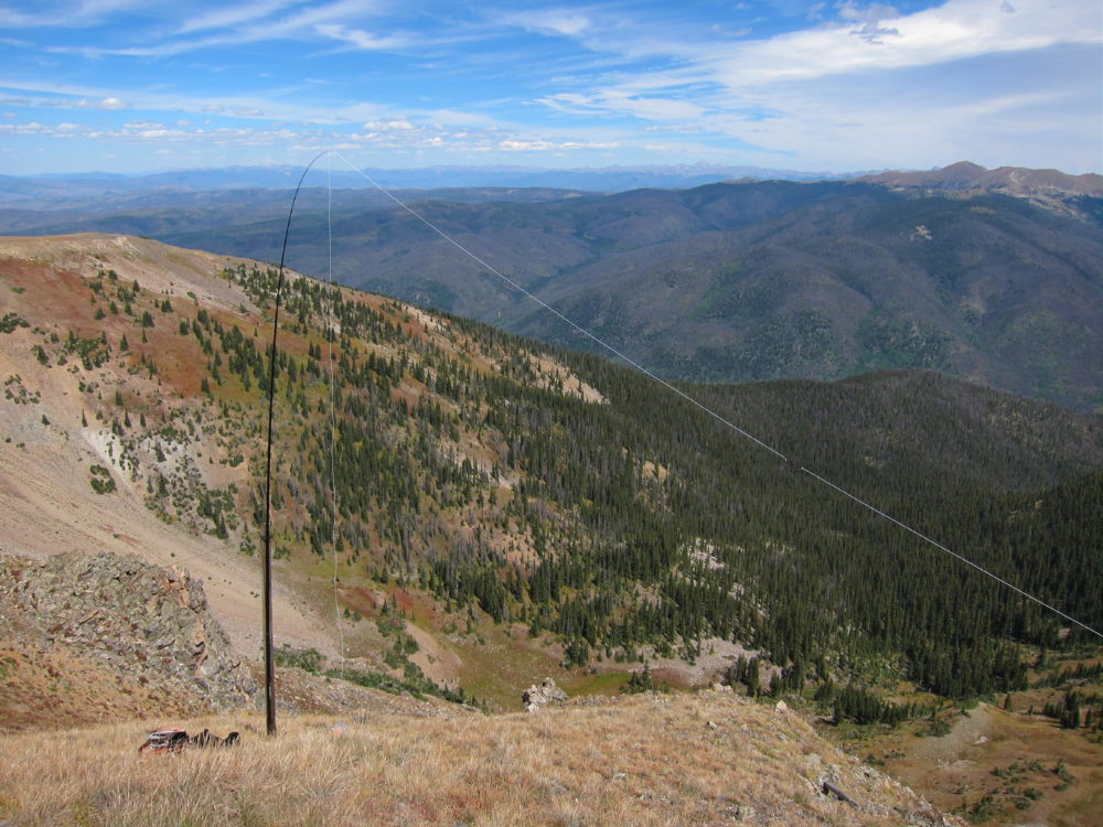
There was a triangulation station on the summit, and parts of it lie on the slope below – wood posts, steel pole, wires, etc. The peak was windy when I was there, so I set up my radio gear about 30 feet below the top, on the east slope.
-
- Ute Peak – KX0R Antenna near Summit
-
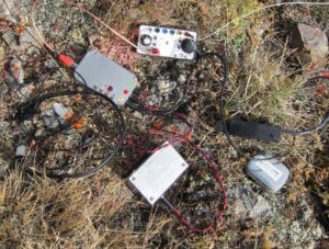
- Ute Peak – KX0R SOTA Radio gear
Ute Peak’s the highest point in the area, so it’s a fine HF summit. No trees are available so high, so a guyed pole is appropriate. I used a wood post from the trig station to help support my pole.
No development’s nearby, and the RF noise level is very low. Even though my wire antenna was no higher than the summit, I had fun with my 3-band activation. My log shows 42 CW contacts on 7-10-14 Mhz.
VHF/UHF coverage is probably limited to the Blue River Valley and parts of Middle Park up north.
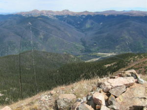
The views from the ridge and summit are spectacular. The Gore Range stands wild and rugged only a few miles to the west. Other mountain ranges are visible to the northeast and northwest.
-
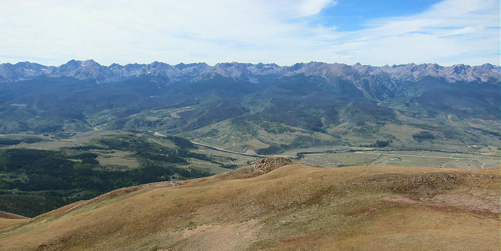
- Ute Peak – View West of Gore Range
The Byers Peak Wilderness is about 5 miles northeast, Vasquez Peak Wilderness is about 8 miles east, and the Ptarmigan Peak Wilderness is just south along the ridge.
-
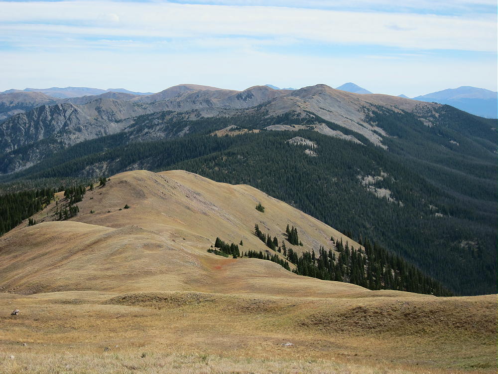
- Ute Peak – View South to Ptarmigan Peak
The view down the coulours to the cirque far below the summit is scary – be careful here. This is no place to take chances, especially if there’s snow or ice on the slope.
-
- Ute Peak – KX0R Antenna near Summit
73
George
KX0R
![]() !! WARNING !! There are old mountaineers, and
bold mountaineers... there are no old-bold mountaineers.
Hiking and mountain climbing are potentially hazardous activities particularly in Colorado with its extreme elevations. I am not accepting responsibility for any death or injury resulting from activations based on my trip reports. Proper training, experience, and personal capability assessment is required - enjoy!
!! WARNING !! There are old mountaineers, and
bold mountaineers... there are no old-bold mountaineers.
Hiking and mountain climbing are potentially hazardous activities particularly in Colorado with its extreme elevations. I am not accepting responsibility for any death or injury resulting from activations based on my trip reports. Proper training, experience, and personal capability assessment is required - enjoy!