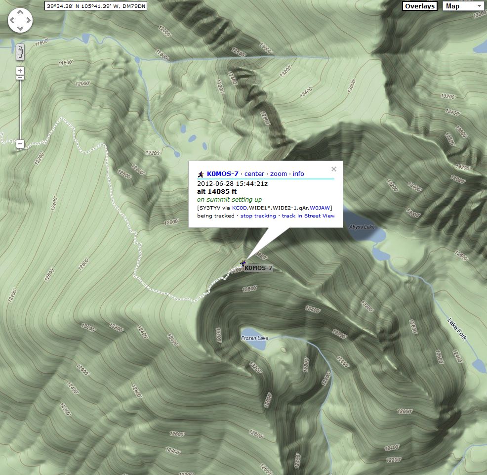
Fairburn Mountain is a convenient and pleasant SOTA peak with great access. The trailhead and parking are at Cold Springs Campground, about 1000 feet southwest of where Golden Gate Canyon Road 46 intersects Highway 119, near the major hilltop at about 9350 feet on 119. Park in the free lot just to the right of the forest road – do not enter the campground.
There is no developed trail up Fairburn, but there’s a path with some cairns most of the way up the south ridge. The ascent from the parking lot to the SE summit is 1000 vertical feet in about 1 mile – it’s a pleasant hike up through aspens and evergreens. Unfortunately the SE summit at 10,360 feet is a false summit. The actual SOTA peak at 10390 feet, 3161M, is almost ½ mile to the northwest along the forested ridge. Fortunately there’s little loss of altitude between the summits, but you have to pick your way through some fallen trees, rocks, and other minor obstacles – there is no real trail. Few people visit the real summit. There are numerous places to set up and operate within 75 vertical feet of the top, and good trees for antenna supports are available.
This summit offers the possibility of camping for an overnight outing, and winter access seems likely as well.
It might be possible to access this peak from the Missouri Gulch Road Co Rd 51-S to the west, via the NW ridge of Fairburn, with less ascent and a shorter hike; but I have no information on whether that route is practical.
Fairburn Mountain provides a good SOTA outing with a moderate amount of effort required. Its proximity to the Denver-Boulder area should make it more popular for SOTA activations.
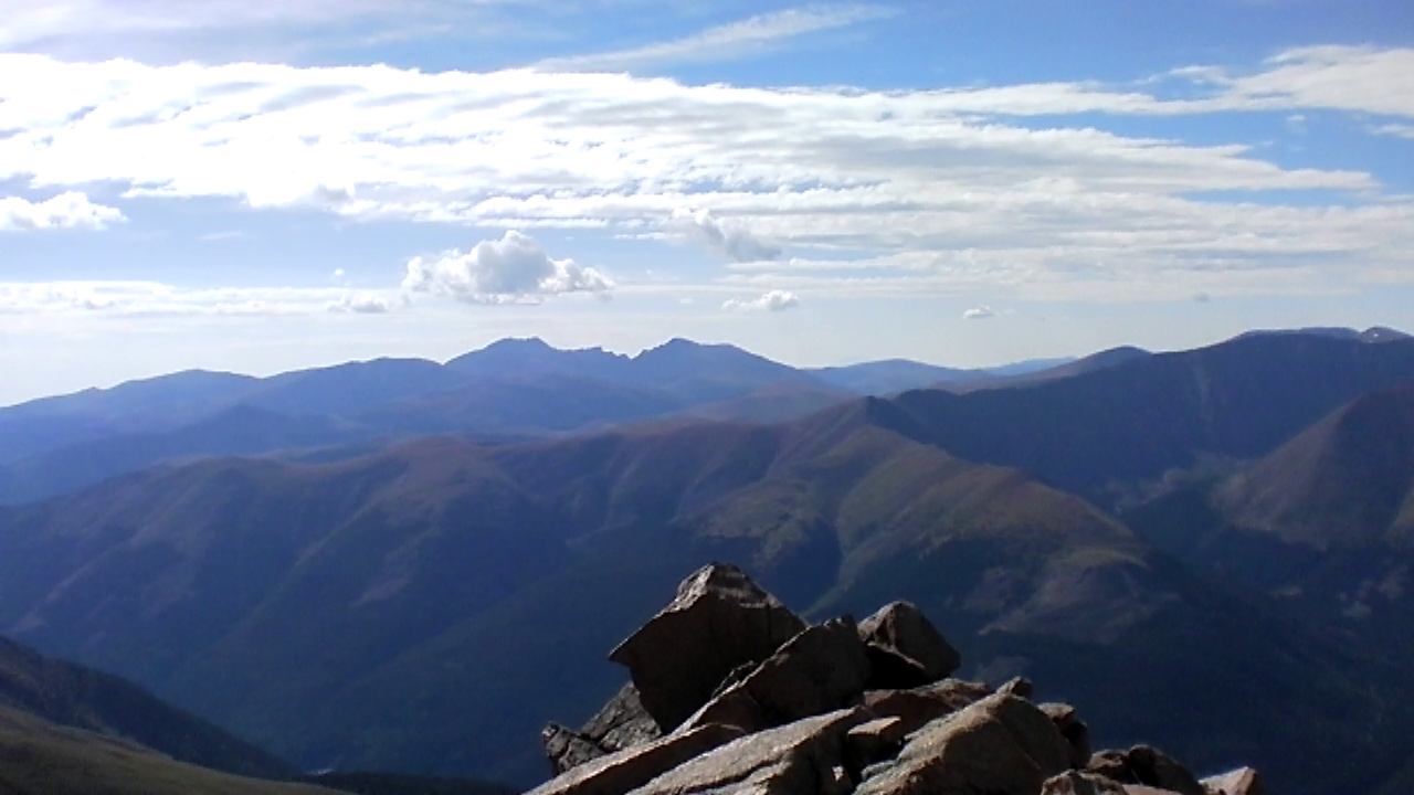
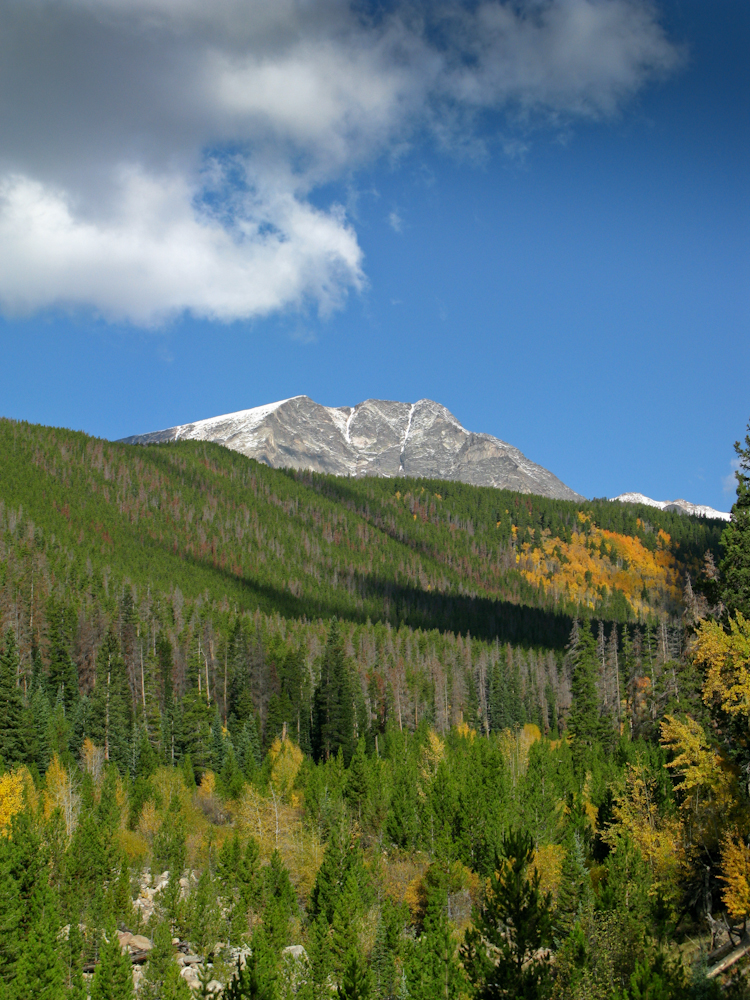
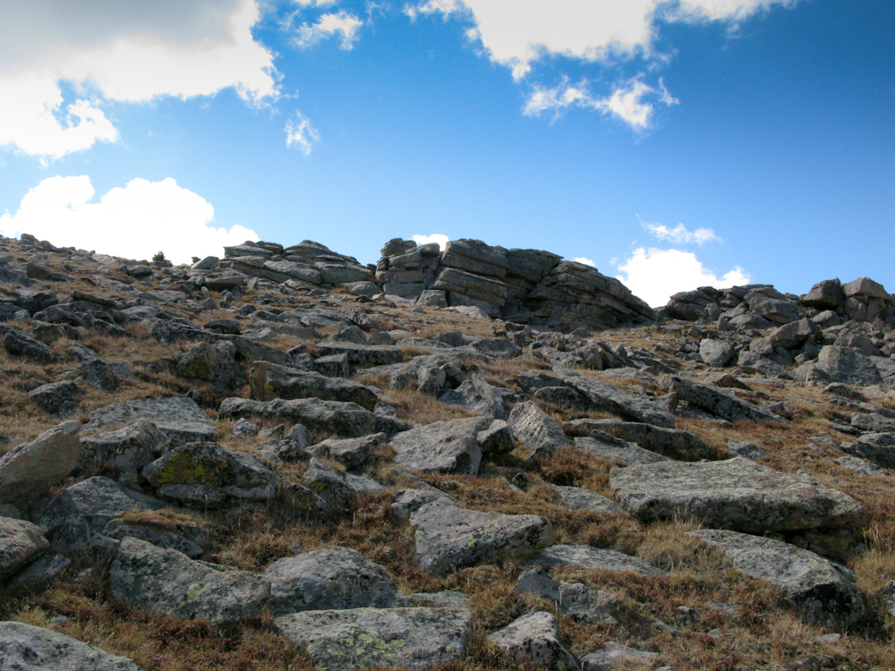
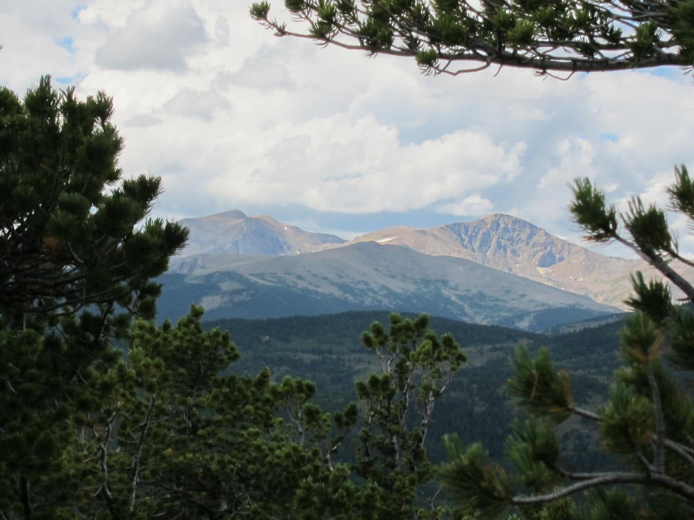
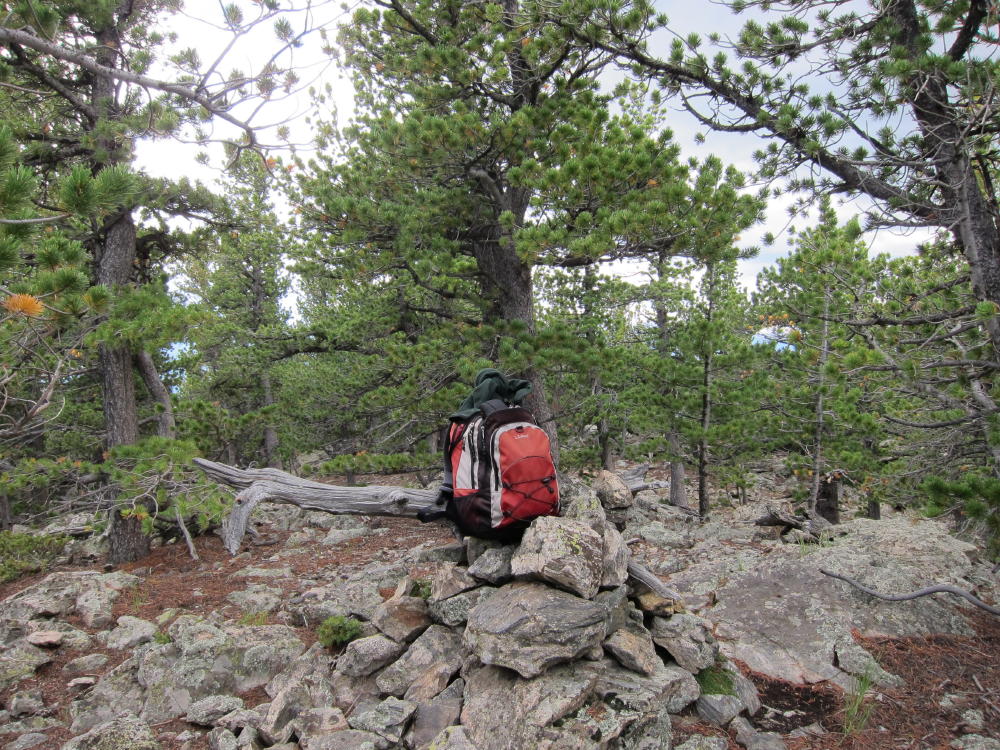
Fairburn View to James Peak and Continental DivideFairburn Southeast Summit Area
!! WARNING !! There are old mountaineers, and
bold mountaineers… there are no old-bold mountaineers.
Hiking and mountain climbing are potentially hazardous activities particularly in Colorado with its extreme elevations. I am not accepting responsibility for any death or injury resulting from activations based on my trip reports. Proper training, experience, and personal capability assessment is required – enjoy!
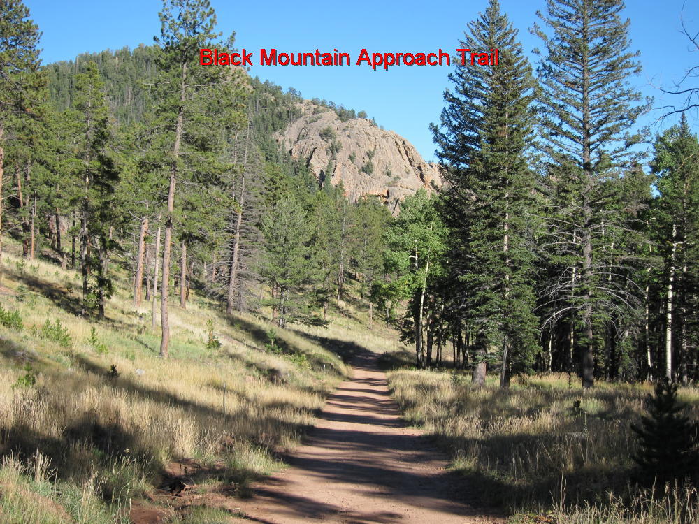
Black Mountain is a very prominent summit located adjacent to Staunton State Park, several miles west of Connifer, CO. Because of its proximity to the Denver metro area, it could become more popular as a SOTA site. This mountain presents significant physical and navigational challenges; the ascent is about 5 miles and 2500 vertical feet from the parking lot; and more than half of that climb is up through rocky, heavily forested slopes with limited visibility. You’ll be lucky if you see the top part of the mountain before you’re on top. Your success depends on your physical conditioning and how well you’ve studied the topo map before you try the climb.
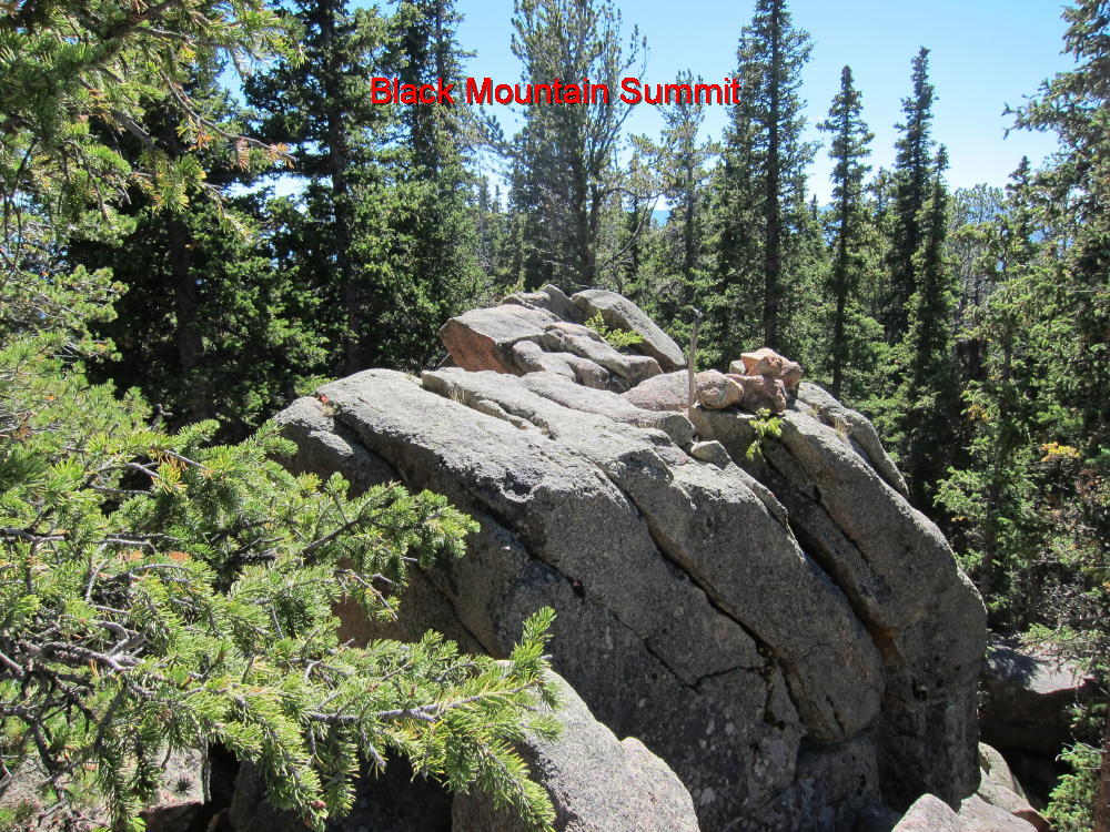
As far as I know, there are no trails up the peak; nevertheless, a few people occasionally get up there. On the SW summit at point 10756, marked with an X on the USGS 7-1/2 minute quad, there’s a summit register consisting of a jar with a small notebook inside, and some people have signed their names! A cairn marks the top of the highest rock.
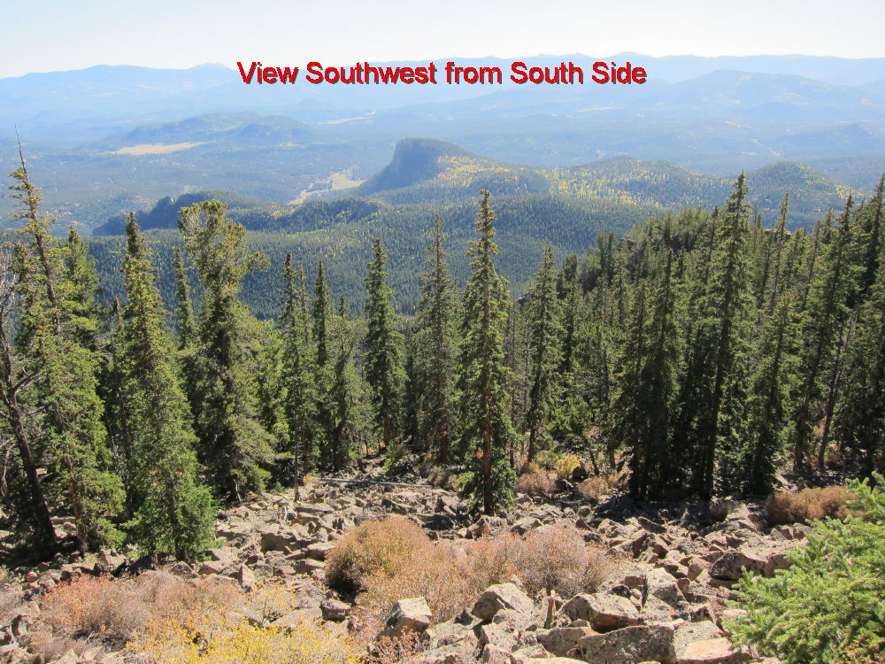
Here’s what you need to know to get up there. To get to Staunton State Park, drive 6 miles SW of Conifer on Route 285 and turn right at Shaffers Crossing – a sign to the Park marks the exit. Drive 1-1/2 miles north and enter the Park. Show your pass or buy a day pass for $7. You’ll get you money’s worth. Be sure to get a visitor map showing the trails and topography. Park at the upper group picnic area if possible – otherwise park in the main lot. There are several possible routes up to the top – I chose to climb via the major ridge SW of the peak. Find the Staunton Ranch (SR) trail at the parking lot and follow it north and then northwest, for about 3 miles, enjoying the fine Western scenery, until you come to the intersection with the Border Line (BL) trail. This spot is in a large clearing, with thick forest and higher terrain just to the north. Don’t follow the BL trail, or the nearby Marmot Passage (MP) trails. Look north to the forest, spot the USFS boundary markers and signs, and head directly north into the woods. Although off-trail hiking is not allowed in the State Park, it’s a very short distance from the SR and BL trails to the federal land, where hiking off-trail is OK. The map in the Park brochure shows this boundary clearly. To be perfectly legal, proceed a short distance NW up the Bugling Elk (BE) trail, cross into the USFS land, and then head NE up into the woods. Once on federal land, proceed north uphill into the obvious gulch leading up to the saddle just east of point 9715. There is a good game trail about 50 to 100 feet east of the creek gully – the route to the saddle is easier if you find this game trail. It looks like there are plenty of deer and elk up there. From the saddle turn right, hike NE up the ridge, and reach another saddle at 9800 feet. I found bear poop there. Pick a route NE and climb up a steeper section to about 10200 feet, and then hike more gently toward the next saddle near 10400. Stay left (west) of cliffs located to the east. As you approach the saddle at 10400, stay about 50 to 100 yards west of the actual saddle and climb up the SW slopes of Black Mountain. Stay left, north of talus and cliffs south of the summit. Although there is no trail, you can find a natural steep route all the way up, through a mix of boulders, trees, logs, and pine needles. You want to end up just south of summit 10756. The actual summit is marked by a cairn on top of some large boulders. Most of the top of Black Mountain is a long, rocky, heavily forested ridge curving around north and then east. If you climb the east side of the mountain, you’ll have to traverse this entire ridge to get to the actual summit near the SW end. There is a nice little flat clearing, with convenient tall trees and rocks, about 50 to 100 feet north of the summit rocks. The view is limited but stunning. This is a great place to do SOTA – you don’t need a pole if you have a way to get a rope up in a tree. I put up a 66-foot inverted L at 25 feet with no problem. It would be possible to erect a 40 meter dipole up there. This looks like a good VHF/UHF site, with excellent coverage of local mountains, and fair coverage of the eastern plains. I suggest you descend the same way you came up. A GPS device makes it easy to backtrack. The key point is to avoid going down the south side of Black Mountain, which is mostly steep slopes and cliffs. If you find another good route up, please write it up and post it here.
Please don’t try this climb unless you have a topo map, good map-and-compass skills, and plenty of off-trail hiking experience; a GPS device may save you time by preventing mistakes, provided you know what you’re doing without it. This trip is best done in spring or fall, and in good weather. Take plenty of water, start early, and allow enough time. Tell someone where you’re going. Please read and respect Park rules, and remember that the hours are 8 AM to 8PM.
Some pictures (click on the picture for a larger version):
Staunton State Park Trail below Black Mountain
View SW from South Side
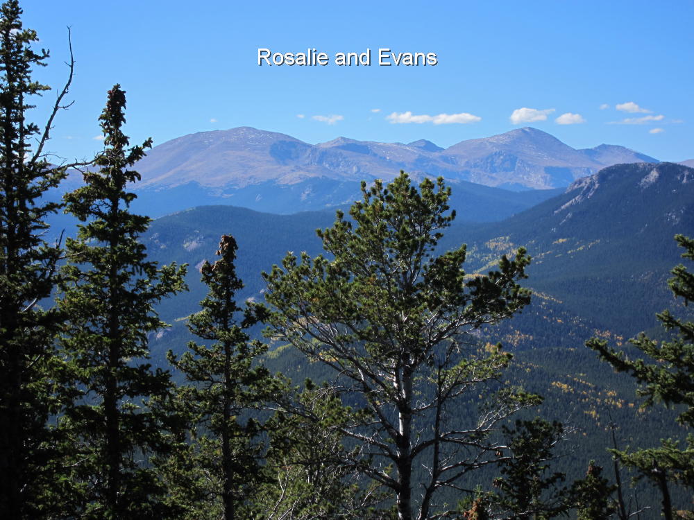
Rosalie and Evans
Black Mountain Summit
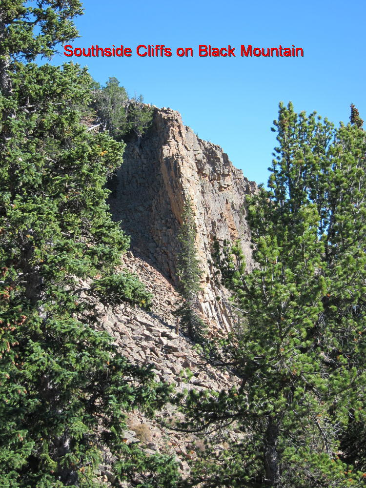
South Side Cliffs – Black Mountain
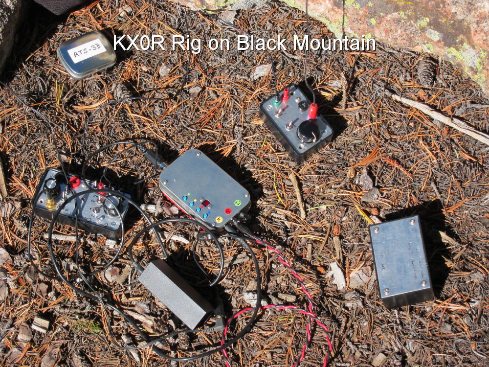
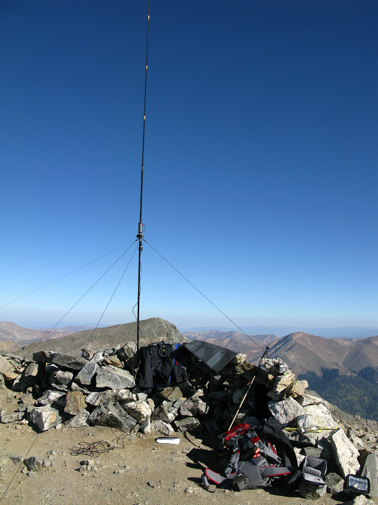
KX0R Activation Rig
George Carey Fuller
KX0R
!! WARNING !! There are old mountaineers, and
bold mountaineers… there are no old-bold mountaineers.
Hiking and mountain climbing are potentially hazardous activities particularly in Colorado with its extreme elevations. I am not accepting responsibility for any death or injury resulting from activations based on my trip reports. Proper training, experience, and personal capability assessment is required – enjoy!
W0C/PR-021 (Mt. Parnassus) 4129 M / 13574 ft
W0C/FR-006 (Bard Peak) 4150 M / 13641 ft
August 21, 2013
by KØMOS
Mount Parnassus (no, not the famous Mountain from the Greek mythology) and Bard Peak are two summits in the Rocky Mountains of Colorado. They are just along I-70, shortly before entering the Eisenhower tunnel (coming from the east). I have driven by these unspectacular mountains numerous times without even noticing them. They are rather easy to access via Herman Lake TH which is right at the exit 218 of I-70. Looking at the SOTA map for WØC, I decided to pay them a visit.
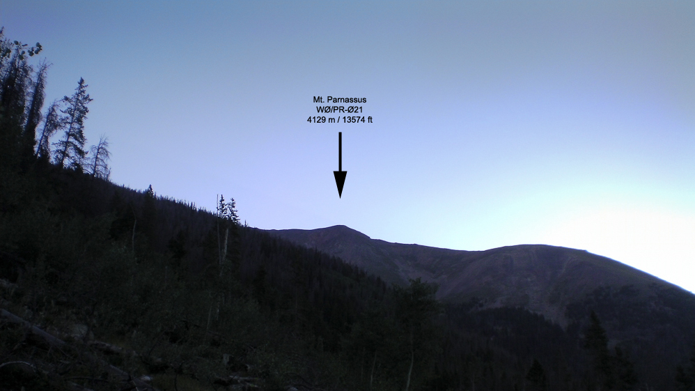
Mt. Parnassus as seen from the TH (almost)
 Trailhead:  10313 ft / 2526 m
 Summit:     13574 ft / 4137 m (Parnassus)
             13641 ft / 4150 m (Bard Peak)
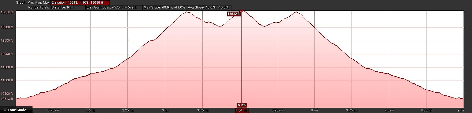
 Elev. gain: 4574 ft  / 1394 m
 Roundtrip:  9.0  mi  / 14.5 km
From Denver, take I-70 West and take exit 218. If you go through the Eisenhower tunnel, you went too far. Take a right at the end of the ramp and drive back, parallel to I-70, for 0.15 mi (0.25 km). Information kiosk and outhouse are right there.
Red Tape:
Both summits are part of Arapaho National Forest and their rules and regulations apply.
The Ascent:
The elevation profileTrail splits after 300 yds
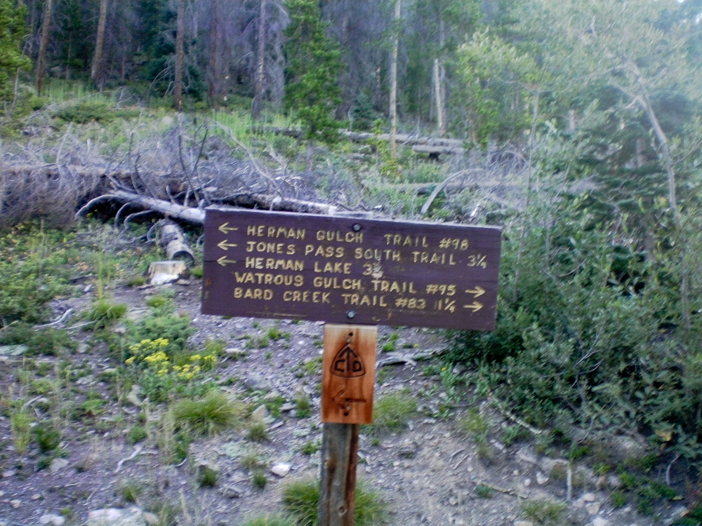
The first part of the trip follows the Watrous Trail. From the info kiosk I headed out east. After a few hundred yards the trail splits… I continued east on the trail through dead and downed trees and lots of noise coming from the highway :(
When I tried to take a few snapshots with my trusted Canon G9 I only got a ‘Lens error, restart camera’ error message combined with an ear piercing whining noise in return. A couple of restarts gave me the same result – the lens was stuck in the open position – therefore all photos were made with my video cam. My excuse for the ‘great’ quality of all the pictures. What I did not know at this point, more camera problems were to come.
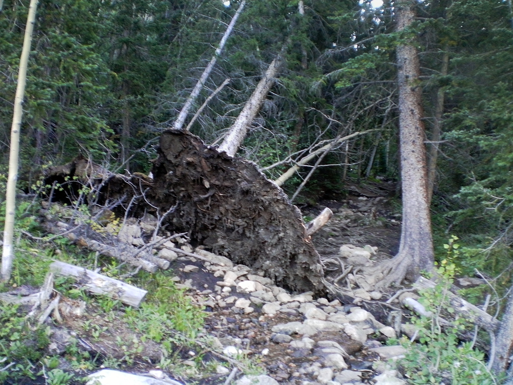
Down and dead trees
After about a mile into the hike the trail starts to head towards the north, along what I can only assume is Watrous Creek. Even though the creek was still carrying water, the noise coming from I-70 was still prominent. Eventually the forest/dead-tree environment makes room for alpine tundra with quite nice scenery and views of Woods Mtn. and Mt. Parnassus. The trail follows along the west side of the creek and disappears soon after it crosses over to the other side towards the saddle between Woods Mtn. and Mt. Parnassus.
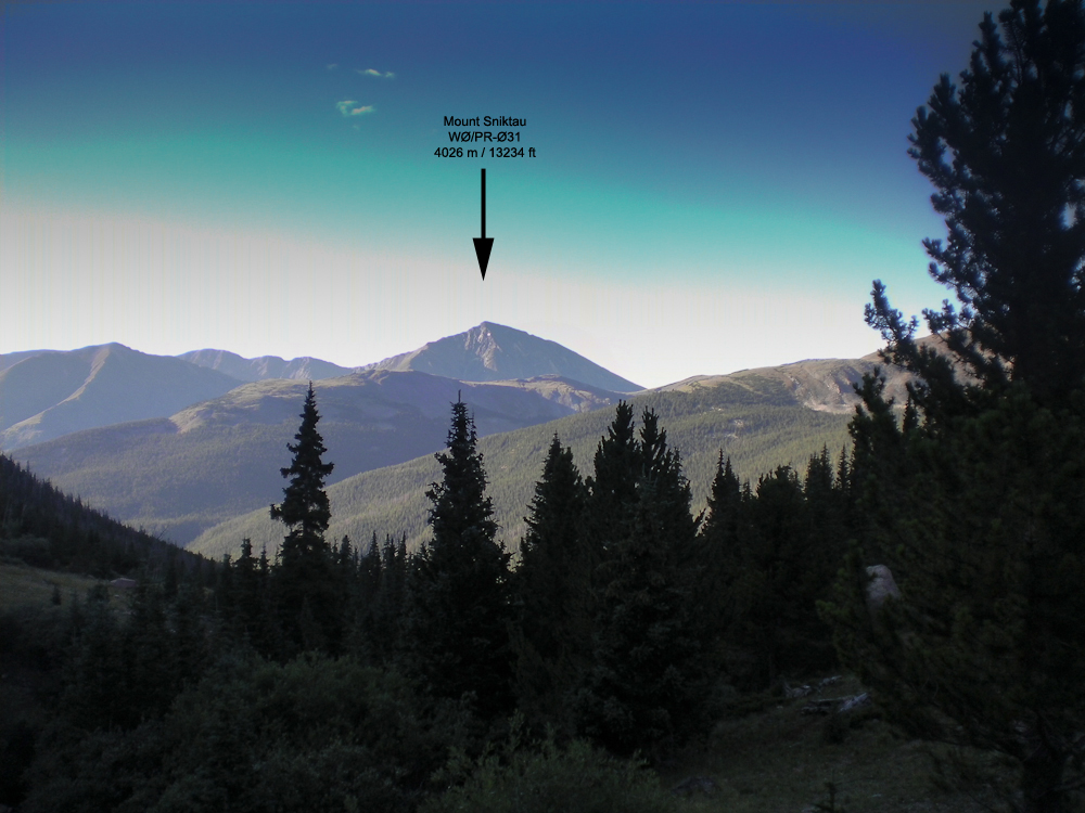
View of Mt. Sniktau
From here it is a straight shot to the saddle after passing through a few remaining trees. Conveniently, somebody erected a stone cairn near the top of the saddle. You can barely see it from here but aiming for the cairn brings you into perfect position for the last 3/4 miles or so up a rocky/grassy slope to the top of Mt. Parnassus. The views are rather nice, nearby Mt. Sniktau (WØC/PR-Ø31) clearly visible with Quandary Peak (WØC/PR-Ø14) in the background under mostly blue skies with only a few white clouds.
Aim for the stone cairn
View of Mt. Parnassus from the saddle
The Summit:
The rather steep west slope flattens towards the summit. The stone shelter can be reached without any obstacles. The large summit could host quite a few activators with their gear and antennas without getting too crowded. The views are stunning in all directions. Lot’s of high altitude SOTA peaks are in clear view.
Just after I finished shooting a 360 degree video, the battery of my remaining camera quit on me. Now I was sitting at 13574 ft / 4137 m with beautiful weather and a second summit to activate, and no camera – very disappointing.
Mt. Evans and Mt. Bierstadt with the saw-tooth route in the distance
With hardly any wind and with very comfortable temperatures I started to setup my antenna and gear. I logged my first QSO at 16:00 UTC, exactly as planned. I handed out the wrong SOTA reference number at first. Realizing that something was fishy, I asked Glenn/N4MJ to verify it for me. I only logged four QSO’s in 25 minutes. Since I had still a lot of ground to cover and because there were no more takers, I started to pack-up and move towards Bard Mountain.
Bard Peak as seen from Mt. Parnassus
Mt. Parnassus to Bard Pk.: The decent from Parnassus down to the saddle is similar to the west flank, a steep grassy slope with some rocks. Larger outcroppings can be circumnavigated without any problems . From the bottom of the saddle it is another ~600 ft (183 m) of elevation gain to the summit. I started to feel my knees and other body parts but having another 10 pointer so close by released some new energy.
It took me more than an hour to get to the top, slightly longer than planed. Setting up my shack went without hick-up under still amazing weather conditions. Logged 12 QSQ’s in 15 minutes on 20m SSB. Looked like all the chasers were finally awake ;)
After a few more but unanswered CQ’s I started my long hike back to the car.
The Descent:
Nothing noteworthy on the descent… took the same route via Parnassus. It felt like it took forever going down to the saddle and up again before heading down to the saddle of Parnassus and Woods Mountain. I reached the car, conked out after 9 miles and 4574 ft ASL (14.5 km / 1394 m). A snack and fresh water supply in the car gave me back the necessary energy for the drive home.
73, Matt/KØMOS
Feel free to leave comments and/or questions below.
!! WARNING !! There are old mountaineers, and
bold mountaineers… there are no old-bold mountaineers.
Hiking and mountain climbing are potentially hazardous activities particularly in Colorado with its extreme elevations. I am not accepting responsibility for any death or injury resulting from activations based on my trip reports. Proper training, experience, and personal capability assessment is required – enjoy!
I had been planning all along to participate in the CO-14er Event this year. This event is organized by Bob/KØNR, for Portable Mountaintop Operation on the 54 official 14er summits (Summits higher than 4267m) in Colorado. It was however uncertain until late Friday whether I would actually be able to do so. Since it is mainly a VHF/UHF event, I home-brewed a lightweight 4-element Yagi-Uda for 2m – you can read more about it in a separate blog entry.
I selected Mount Evans as a target since it is ‘only’ a 2.5h drive from my home QTH and it has several other SOTA peaks nearby… a good chance to bag more than one summit.
The Plan:
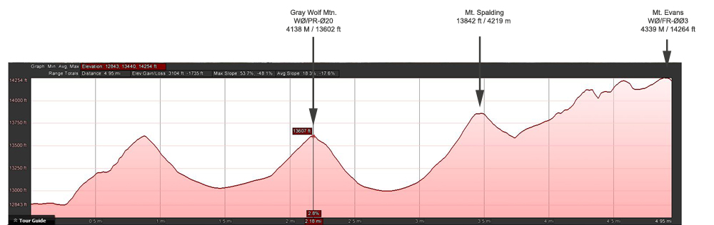
I planned an early morning (8:30 MST) SOTA activation of nearby Gray Wolf Mtn. (4138 m/13602 ft), hoping to be on the air by 11:00 MST on Mt Evans (4339 M / 14264 ft) via Mt. Spalding (13842 ft / 4219 m). A total of 5 miles (8 km) and 3100 ft (945 m) ASL.
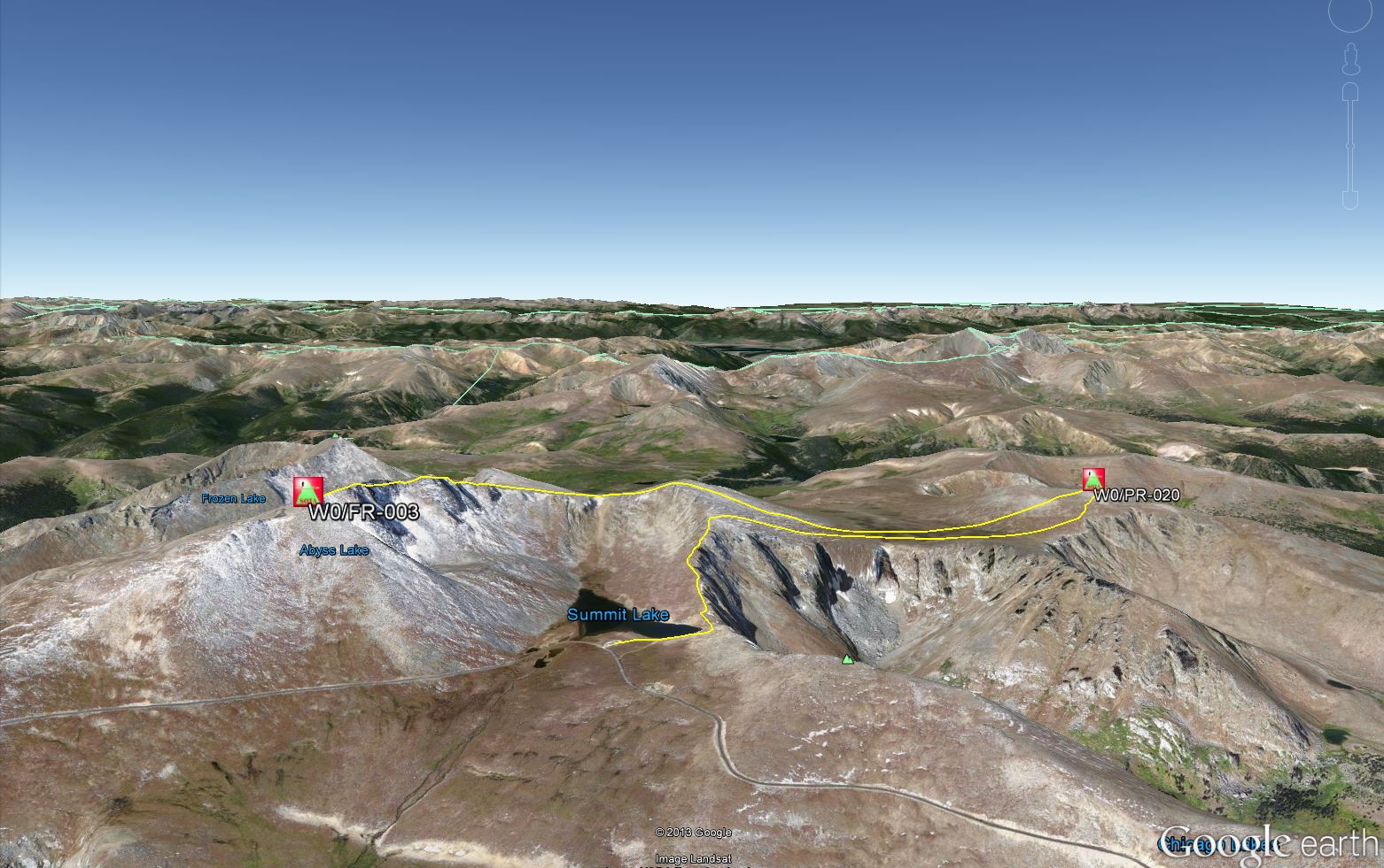
The route I took
I drove up to Summit Lake in the Mt. Evans Wilderness to start my hike. I left my car at 6:30 MST under blue skies but with a fierce and chilly wind. Wool hat and gloves felt nice.
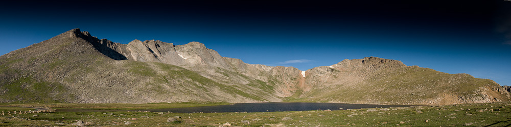
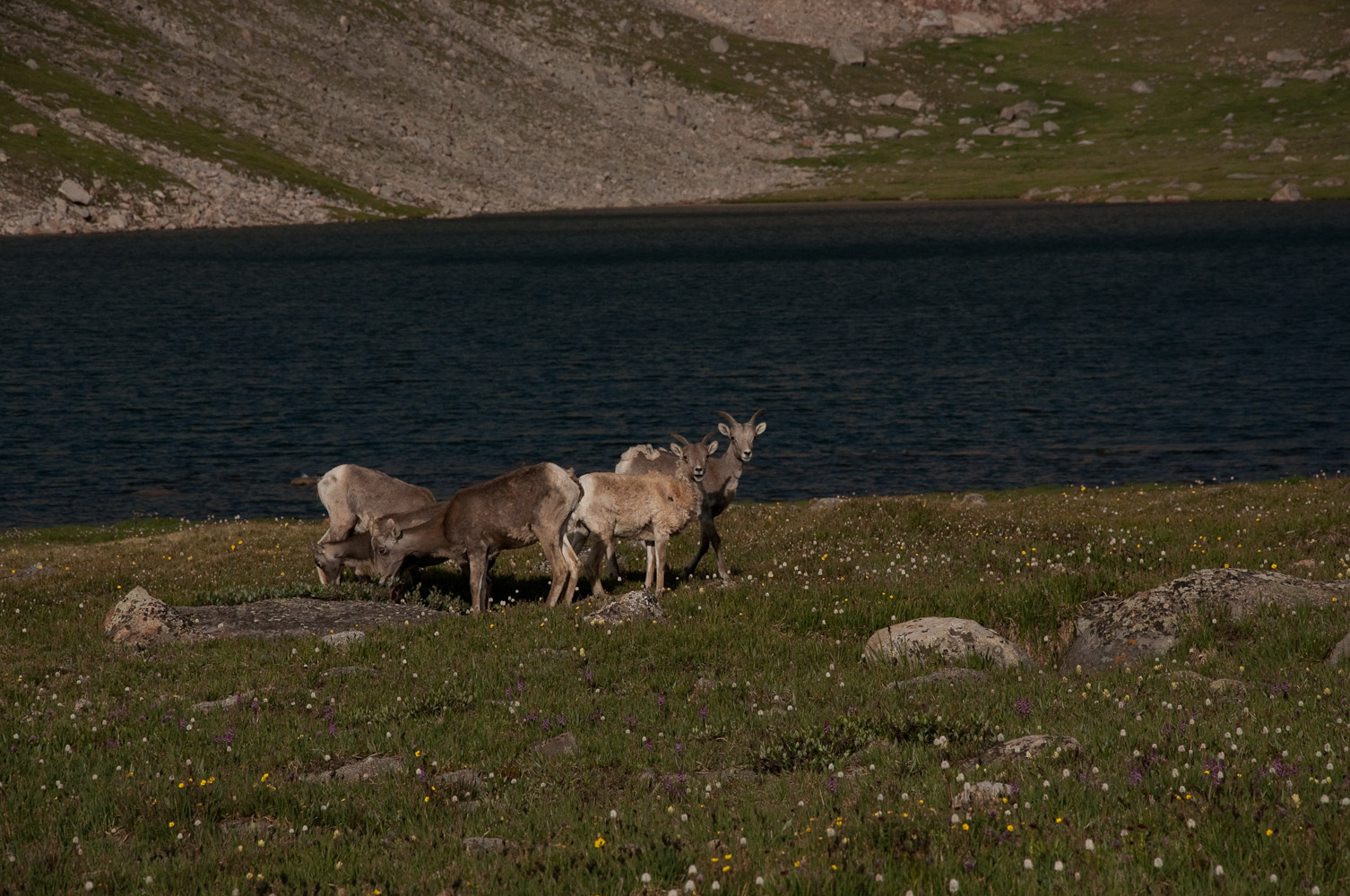
Summit Lake AreaBighorns at the lake
There were only a few cars at the parking lot and a small herd of Bighorns observed my last preparations. I set my HT to 146.52 and 147.42 (Co-14er event primary frequency) hoping to catch any early 14er activators on my hike up. I moved quickly to warm up and passed only one group of hikers in front of me. The initial steep ascent towards Mt. Spalding had the desired effect and I could remove one layer of clothing under heavy breathing. I talked to two stations near Denver on 146.52 who were already aware of the event going on before I moved on.
Elevation Profile
I joined another hiker from Boulder who was also heading towards Gray Wolf Mountain. We continued our hike through the ‘wetlands‘ between Spalding and Gray Wolf. It’s a delicate endeavor to cross the fragile alpine tundra under any circumstances but with the wet area in front of us we had to pick our route carefully to keep our feet dry and our impact to a minimum. The remaining route is pretty straight forward, a steep and rocky final ascent and and we reached the summit at 8:30 MST as planned.
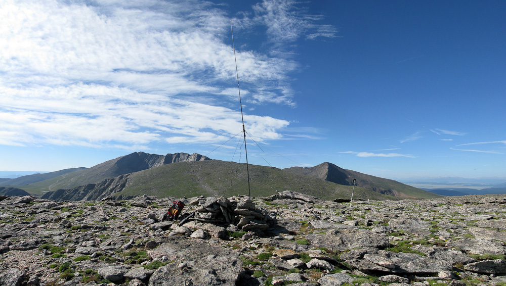
My shack on Gray Wolf – Mt. Spalding (center) / Mt. Evans (left) and Mt. Bierstadt (right) in the background
Just as I was setting up my HF antenna I heard W1DMH/Doug (a SOTA Mountain goat) calling CQ on 2m from Mt. Bierstadt – just ~2.5 miles S of me. My first S2S contact in the log :)
Thanks to decent propagation conditions, 20m contacts were easy to make and my log filled-up fast. I was just done with packing up my gear to continue towards Mt. Spalding, when I heard NM5S/Alan and WSØTA/Fred on 2m. These accomplished SOTA Mountain goats are normally not heard on voice frequencies – two more S2S contacts in the log and my first on the air contacts with Alan and Fred.
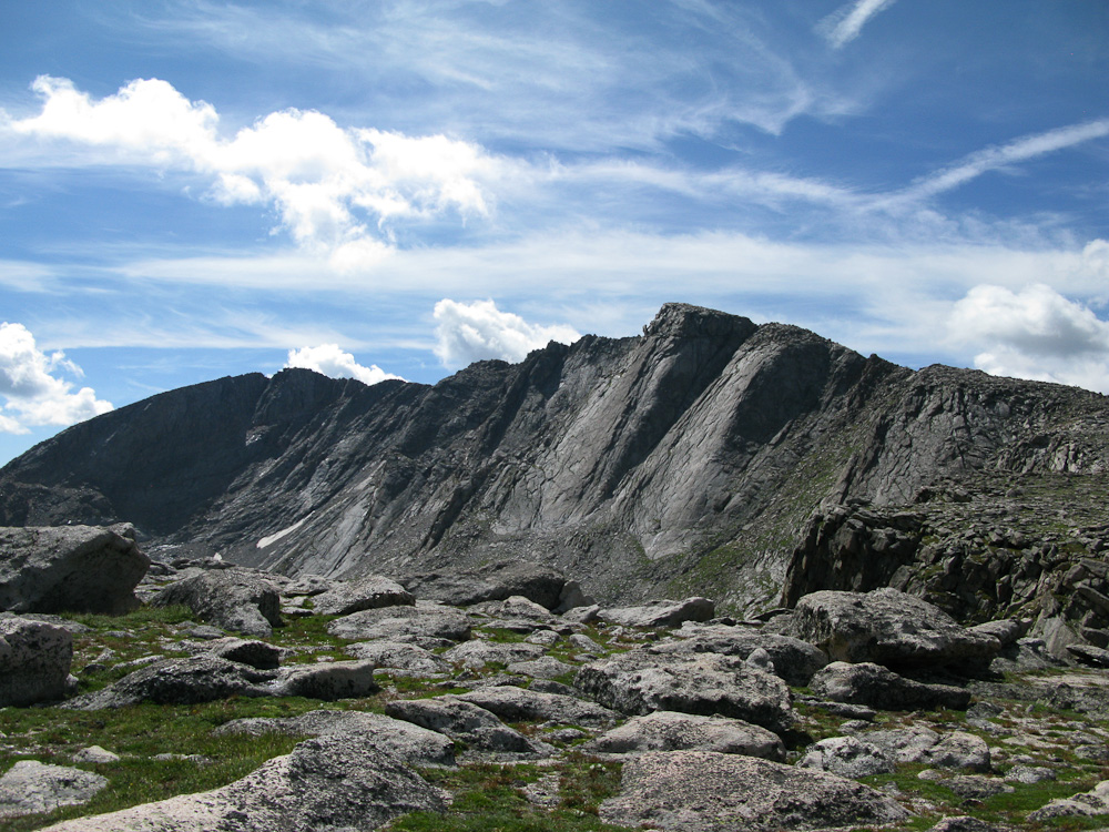
Mt Evans as seen from Mt. Spalding
I was now 30 minutes behind my schedule and started to head down the mountain towards the ‘wet lands‘ again. For quite a while now, I had been hearing a dog barking towards the east of me. That’s well off the beaten path of Mt. Evans and I was wondering what was going on. The continuous barking was frantic at times so I finally decided to investigate and check what was going on… perhaps a runaway dog ? Hiker with dog in distress? It turned out to be nothing like that at all, just some morons climbers who decided to tie their dogs to a rock and go rock-climbing – it was not appreciated by the dogs at all.
Now I was really behind schedule and I rushed up Mt. Spalding, hoping to make good on some of the lost time. From Mt. Spalding I talked to KCØRPS on Quandray Peak and WE7C on Mt. Bierstadt. Coming up to the ridge-line to Mt. Evans, I could copy NØBCB/Bryan on Castle Peak (another 14er). Since I wanted a S2S contact I pressed on to the summit, not realizing that Bryan was already in process of packing up for the day.
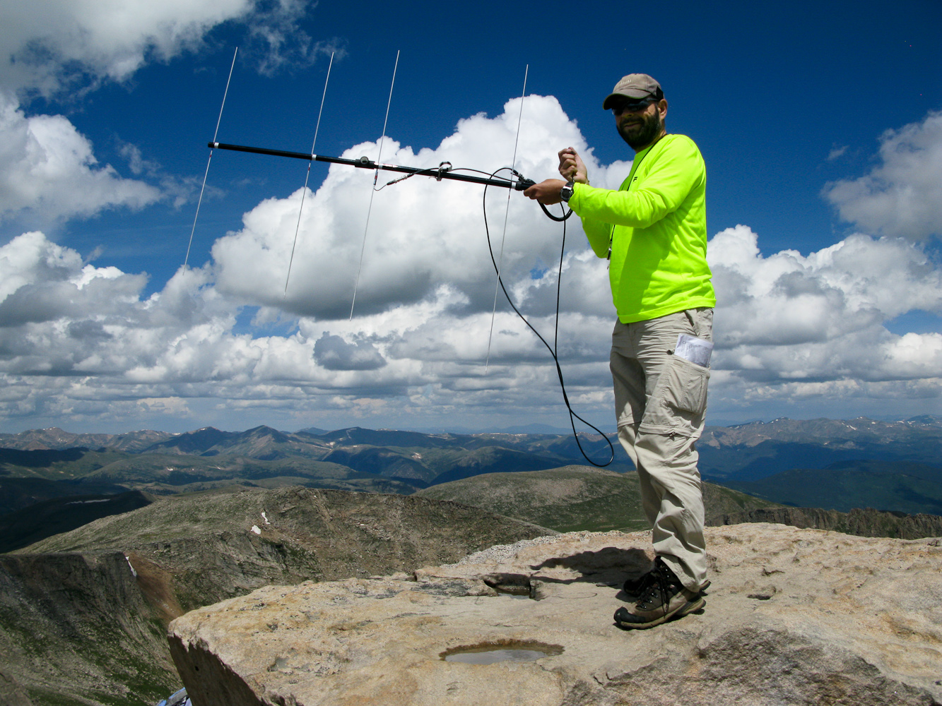
I reached the summit of Mt. Evans at 11:35 MST and had my first contact at 11:37 MST with KDØWBB/Scott, a young ham in Loveland on 2m, using my new homebrew Yagi-Uda antenna.
On Mount Evans 4339 m/14264 ft – WØC/FR-ØØ3
My log from Mt. Evans:
[table id=2 /]
At this time, most of the other 14er activators had already left the summit or they were packing up their gear. It was now past noon and rain clouds were moving in. With the strong monsoon season this year we are currently blessed with daily rain showers and thunderstorms (at least in northern Colorado).
I was in a comfortable position… with a road going all the way to the summit I was planning to hitch a ride back to Summit Lake where my car was parked in case of rain/thunderstorm. A friendly couple from Cincinnati gave me a ride. Shortly after reaching the car… the rain started :)
My final word: Mt. Evans is very crowded thanks to the road going all the way to the top. Barking dogs, crying babies and screaming people (out of excitement) made it sometimes hard to copy the signals. Even though I was sitting at the very edge of the summit, I constantly had to be careful not to poke somebody in the eye with my antenna. Putting down the Yagi is also a bad idea… it might get crushed. That’s why I opted not to setup my HF antenna. If you decide to activate Mt. Evans, go early in the morning and if you are lucky, you might have the summit all to your self.
Feel free to leave questions and/or comments below.
73, Matt/KØMOS
!! WARNING !! There are old mountaineers, and
bold mountaineers… there are no old-bold mountaineers.
Hiking and mountain climbing are potentially hazardous activities particularly in Colorado with its extreme elevations. I am not accepting responsibility for any death or injury resulting from activations based on my trip reports. Proper training, experience, and personal capability assessment is required – enjoy!
ATTENTION: This trip report is outdated. The City of Estes Park implemented a (new) trail up the mountain. You cannot access the summit legally from the new trail. Reports say you can get into the AZ.
Prospect Mountain is a prominent landmark in downtown Estes Park, the gateway to the Rocky Mountain National Park (RMNP). It is easily accessible by a short but enjoyable hike up the south side or even with a tramway from the north. The actual summit is about 300 ft above the tramway summit station and can be reached by walking along a gravel road. The summit hosts a bunch of communication equipment, which is visible from most of Estes Park. I have chosen to hike up the south side, an approximately 30 minute hike.
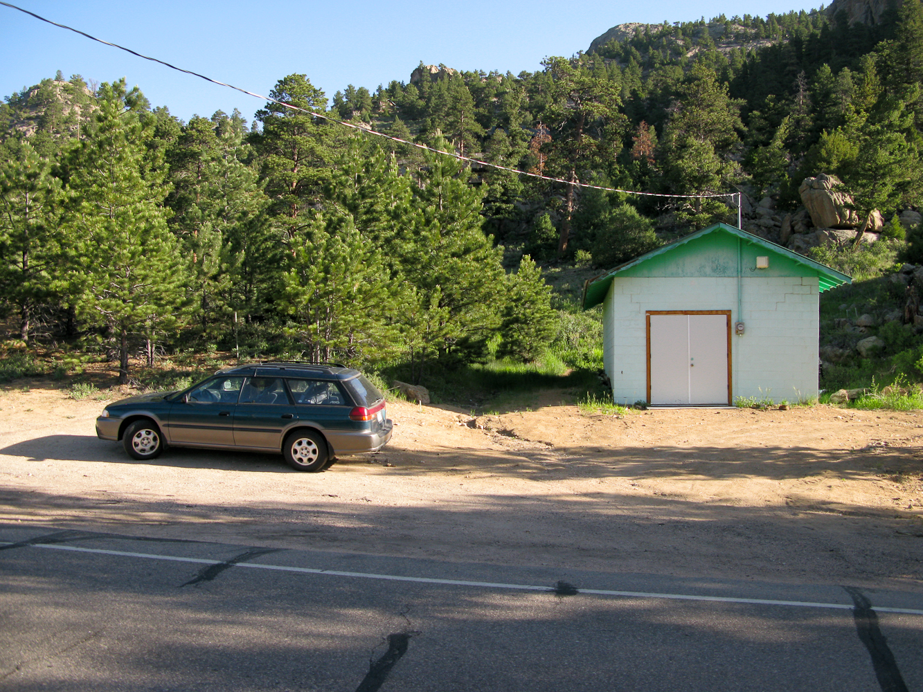
The Trailhead
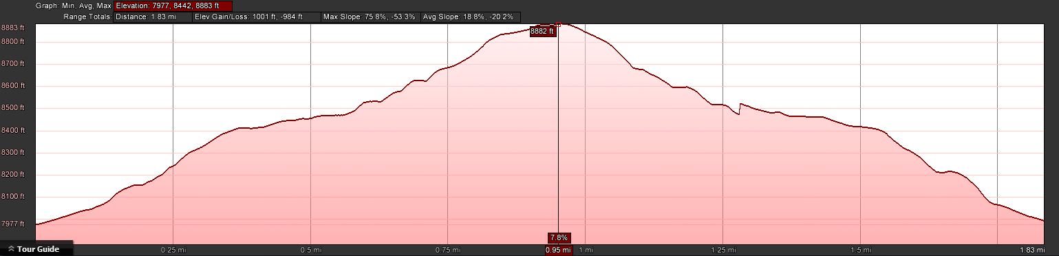
Trailhead: 7977 ft/ 2431 m Summit: 8900 ft / 2713 m Elev. gain: 1001 ft / 305 m Roundtrip: 1.8 mi / 2.9 km
How to get there: From downtown Estes Park, take S. St. Vrain Avenue (US 7) towards Allenspark. Take a right onto Peak View Drive after about 2 miles (there is a wind turbine on the left, just before Peak View Drive). After about 1.1 miles, park you car at a small pull out with a cinder block structure on the right (see picture above) . The trail starts behind the cinder block structure.
Red Tape: There is some private property along the trail.
The Ascent:
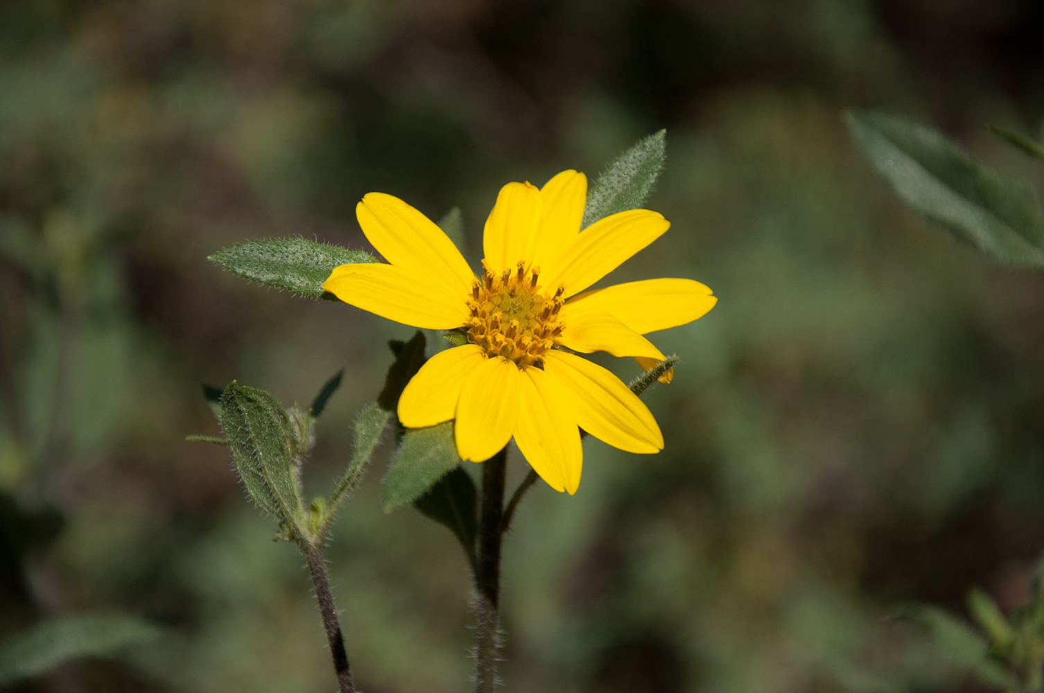
Prospect Mtn – Elevation ProfileWildflowers along the way
The ascent does not present any challenges. The well established trail follows along private property before turning north east. Every now and then you will find stone cairns to help with navigation, increasingly towards the summit. It continues to meander through Pines and rock outcroppings before reaching the flat and rather large summit. Since we had some late moisture this year, wildflowers and Cacti are blooming everywhere and hummingbirds were buzzing around my head.
The Summit: There is plenty of space to setup the equipment on the rather large summit, even for larger groups of activators. Many trees, dead and alive to strap you mast or antenna to.
Buddipole on the summit
I have chosen a large dead tree with one of it’s branches sticking up in the air to bungee my mast for the Buddipole to. With all the commercial antennas up on the mountain, it was no surprise that my SWR meter went bonkers. The FT-817 was fine though and I was calling CQ on 20 m in no time. Since this was only the first of several activations planned for today, I spent only a short time on the summit, packing up after I did no longer get any responses to my calls.
The Descent: Descent is straight forwards, following the same route I cam up.
Some video impressions: http://www.youtube.com/watch?v=QSL8PRR1MNo
If you would like to leave questions or comments, please do so through Youtube.
!! WARNING !! There are old mountaineers, and
bold mountaineers… there are no old-bold mountaineers.
Hiking and mountain climbing are potentially hazardous activities particularly in Colorado with its extreme elevations. I am not accepting responsibility for any death or injury resulting from activations based on my trip reports. Proper training, experience, and personal capability assessment is required – enjoy!
Bryan/NØBCB and I attempted to activate Bighorn Mountain for the TTF/SOTA event on Saturday. The summit (3487 M / 11463 ft) is in beautiful Rocky Mountain N.P., the weather forecast was excellent with temperatures in the 70s (~20 C) and the amount of ALERTS posted on SOTAwach promised a very busy activation with tons of S2S possibilities.
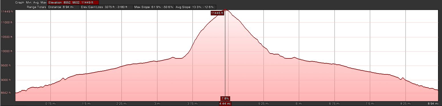
Bighorn Mtn. – ElevationProfile
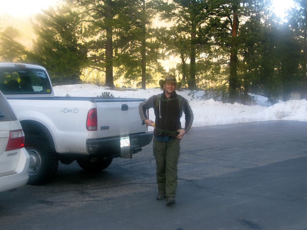
Bryan/NØBCB at the Trailhead of Bighorn Mtn.
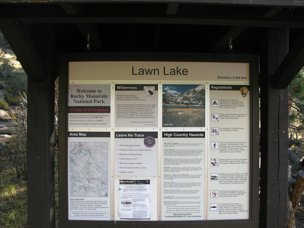
We started early at the Lawn Lake trail-head to have enough time available on the summit. We headed up at 7:00 AM with temperatures around 30F (~0 C). The snow on the ground was hard and crunchy. The first three miles of the trip climbs rather steadily along the banks of Roaring River on an established trail.Thanks to the fresh snow we received last week, the trail was snow covered and soon became a major obstacle on our way up. Snow-depth was around 2-3+ feet and we had to take turns to break the trail. It got increasingly difficult and we made very little progress, on occasions sinking in all the way to out belly-buttons.
Bryan/NØBC breaking trail
Upon reaching the point where we would have to turn SE, leaving the trail and bushwhack our way up the steep slopes, we assessed our situation and options. So far we had only covered 3 miles in 2.5h and we estimated at least another 2h of ascent in deep snow. That would have put us on the summit at least 2h late of our plans and therefor we opted to head back to the TH, and to setup our radios to at least participate in the TTF event.
It took us almost 2.5h to reach the TH and we logged our first QSO around 18:15 (UTC). Band conditions and our location (surrounded by mountains) were less than ideal. All bands we tried (10/15/20/40) were pretty quiet, even Megawatt stations barely copyable. The only SOTA/TTF station I was able to contact was Jeremy/NH6Z in Oregon and a few stations in Florida.
Overall a disappointing SOTA/TTF day for us but a nice outing in the RMNP. More snow is in the forecast for tomorrow, looks like the snowshoes have to stick around for a little while longer.
Since we had no chance to take pictures on the summit, check out last years trip-report with video footage.
73, Matt/KØMOS
!! WARNING !! There are old mountaineers, and bold mountaineers… there are no old-bold mountaineers.
Hiking and mountain climbing are potentially hazardous activities particularly in Colorado with its extreme elevations. I am not accepting responsibility for any death or injury resulting from activations based on my trip reports. Proper training, experience, and personal capability assessment is required – enjoy!
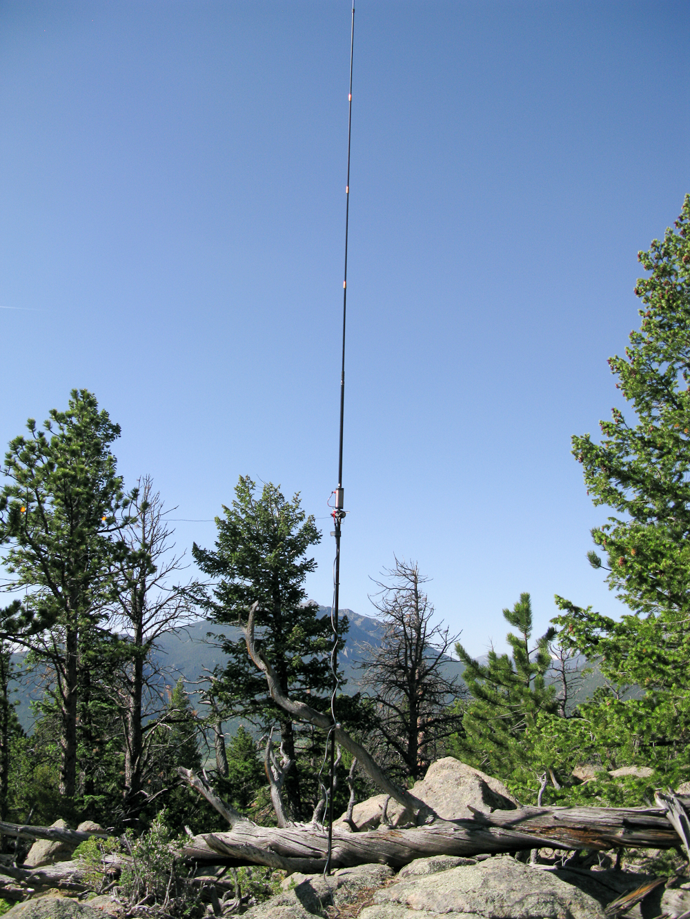
It was a ‘last minute’ decision to go on this activation. WØC/FR-Ø36 or Bighorn Mtn. is located within Rocky Mountain National Park (RMNP), just east of the Mummy Range (Continental Divide). Yesterday we got some snow/rain in the mountains and the road to Mt. Evans is already closed for the season. Trail-ridge road was temporarily closed as well. The weather forecast for today was excellent (at least until later in the afternoon). However, I woke up to thick fog so I could not even see the road, let alone the mountains. The drive up to Estes Park was slow, thanks to the fog and to some heavy trucks in the canyon. I arrived ten minutes later than planned at Lawn Lake trail-head to a beautiful blue sky, bugling elks and pleasant temperatures.
Bighorn Mtn. – Trailhead
Trailhead: 8552 ft/ 2565 m
Summit: 11463 ft / 3847 m
Elev. gain: 3280 ft / 1000 m
Roundtrip: 9.0 mi / 14.5 km
How to get there: Take US34 from Loveland towards Estes Park through Big Thompson Canyon. Enter RMNP through the Fall River Entrance Station and take a right at the Lawn Lake trail-head sign. A rather large parking lot which can be found shortly after.
Since there is no established trail to Bighorn Mtn., I consulted Google Earth to find a suitable route. An approach from the west seemed to be a good solution because I could follow the Lawn-Lake Trail for about 3.5 miles before turning east, bushwhacking my way up to the summit. The Lawn-Lake trail follows the Roaring River through a gorgeous forest, mainly pines but with a few Aspens groves which sparkled yellow and golden already. On several occasions along the the river you get an idea of the massive flood that occurred here in 1982, killing several hikers/campers. Huge boulders were swept down-rivers like marbles. The steep banks of the river also allow some very scenic views of the northern Mummy Range. Shortly after passing the sign to the Cutbank and Golden Banner camp areas, I left the comfortable trail and started the steep and unpleasant bushwhacking part. I tried to aim for the saddle between Bighorn and Tileson. It was very slow going. Thick forest, steep terrain and slippery boulders (thanks to the rain, the lichens on the boulders were very slick) hampered my progress. Every now and then, I could get a glimpse through the trees to the Mummy Range – a spectacular view from the summit seemed very likely.
The Summit:
Bighorn Mtn – The Summit?
After breaking through the tree-line, I could finally see where I was heading. There were several rock-outcroppings at the top to choose from. The first one I climbed was of course not the summit, but the second one was the highest point and I found a summit book which confirmed that I had indeed reached the top of Bighorn Mtn. The summit is rather large, ideal for multiple activators at the same time. The views are spectacular, one of the best in this area for sure. My initial calls on 2m were unanswered but the HF antenna was up and tuned in no time. Phil/NS7P was the first who answered on 14.343 and thanks to his spot the summit was activated successfully in no time.
The Descent:
I tried to find a gentler and easier way down, heading more towards the saddle. The fact that I could actually see where I am going helped quite a bit. The first part was just fine but I ended up in similarly steep terrain, trying to find the Lawn Lake trail. I hit the trail at the same location I had left it, thanks to GPS technology :)
Some video impressions: httpvh://www.youtube.com/watch?v=f4DjZ5q9cj0
If you would like to leave questions or comments, please do so through Youtube.
!! WARNING !! There are old mountaineers, and bold mountaineers… there are no old-bold mountaineers.
Hiking and mountain climbing are potentially hazardous activities particularly in Colorado with its extreme elevations. I am not accepting responsibility for any death or injury resulting from activations based on my trip reports. Proper training, experience, and personal capability assessment is required – enjoy!
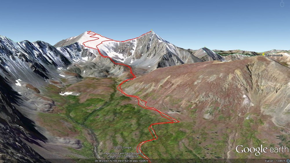
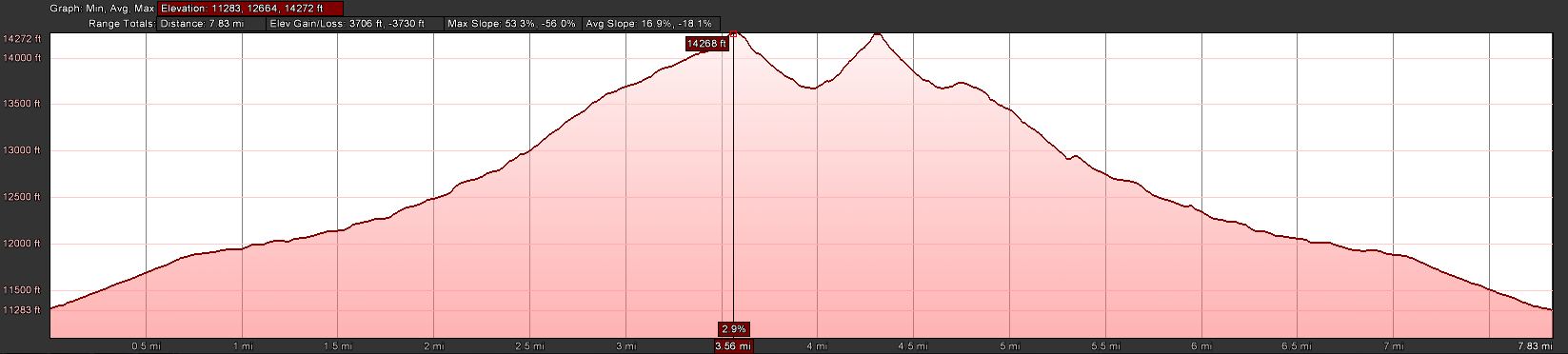
I picked the perfect early fall day to activate Grays Pk. (WØC/FR-ØØ2) and Torreys Pk. (WØC/PR-Ø13). There was no cloud in the sky all day long to threaten the activations. The two 14ers, which can easily be reached from Denver, are separated by only about 0.7 mi / 1.1 km and are commonly climbed together. Besides the scarcity of oxygen they do not pose any challenges. A well established and easy to follow trail leads up from the parking lot through Stevens Gulch all the way up to the summits. Pick either one to start with but in my opinion you are better off climbing Grays Pk first (meaning it is easier). Both peaks can be climbed all year round. To assist a winter climb, they have huge stone cairns along the way. If you are familiar with the French comic book series Astérix le Gaulois, the cairns have the size and form of Obélix. Or maybe my brain just played tricks on me, lacking oxygen.
Grays/Torrey – View up the valley
Trailhead: 11300 ft/ 2565 m
Summit: 14270 ft / 4341 m (Grays) – 14267 ft / 4340 m (Torreys)
Elev. gain: 3731 ft / 1137 m
Roundtrip: 7.8 mi / 12.6 km
How to get there: As mentioned, access to Grays/Torreys is rather easy coming from Denver. Follow I70 West, take exit Bakerville (#221) and turn left just after the ramp. This is the winter TH (FSR 189). Follow the dirt road for about 3 miles to the parking lot at the TH. Make sure to check the status off the dirt road if you are driving a ‘normal’ car. It’s kind of rough but my Outback made it without problems. Just take it slow.
Red Tape:
– Parking lots fill up quickly, specifically on week-ends.
– Rough road
The Ascent:
Grays/Torreys – Elevation Profile
One of the best resources to check the status of the trail, trail-head etc. is the 14ers.com Website. Check the latest trip reports and photos before you leave.
As already mentioned the trail is easy to find and follow. I went up Grays Pk. first. Since I left my QTH at 3:30 AM, I arrived early at the TH and pulled into an almost empty parking lot at 5:40. It was still pitch dark and below freezing, there was no wind or cloud in the sky. I used my headlamp for the first minutes to cross the bridge and get on my way. On my way up I passed two groups of hikers and finally arrived on the summit at 8:45 AM. A group of Mountain goats welcomed me on the summit – but kept a safe distance, not like the one on Mt. Evans.
The Summit:
Grays Pk. – My Shack
Arriving at the summit of Grays Pk (North Americas highest elevation in the Continental Divide) I setup my shack in one of the two stone shelters on the summit. A group of six hikers were having a good time in the other one. I setup and tuned the antenna for 20m. Going through the frequencies I heard special event station W6P calling CQ on 14.285 and I got my first contact within minutes of arriving on the summit – an excellent start. Just over 30 minutes later I had no more takers to my calls and started to pack up my stuff to move on to the next summit. By then, I had a lot of interested people surrounding me and enough time to answer all the questions. The most asked question was: “How far does your signal go?” Most were amazed to hear all the states I just contacted with just 5W. And it is amazing thinking about it… one just stops thinking about it after doing it for 14 months.
The route over to Torreys Pk. is again easy to find, even without the people caravan. You loose about 600 ft ASL before the steep ascent to Torreys Pk. When I arrived, the summit was very crowded and I could not find a safe location to setup the antenna. I opted for a spot about 10 ft below the summit to make sure nobody trips over my guy-lines. As usual during the HF setup I called CQ on 2m, hoping to make some local contacts but my calls were not returned. I definitely had better luck on 20m. The most unusual contact I had up there (or at all) was KB5FJN/Bill. We exchanged our signal reports (both 55) and our QTH… he was sitting on Grays Pk., the summit I just activated an hour ago just 0.7 miles north of me. Too bad I did not bring my binoculars… I sure could have spotted him up there.
The Descent:
The climb down was never ending , or at least it felt that way. I waited for Bill/KB5FJN on the saddle between Gray Pt. and Torreys Pk., trying to meet him in person – no luck. I could not spot him among all the people coming from Grays. I pressed on after about 15 minutes to avoid some of the heavy traffic on I70 going back to Denver on a Sunday afternoon. I am glad I did, turns out Bill never made it towards Torreys Pk. Driving back down slowly to I70 I was able to enjoy the yellow/golden Aspens glowing in the afternoon sun along the road – fall certainly arrived in Colorado.
Some video impressions:
If you would like to leave questions or comments, please do so through Youtube.
!! WARNING !! There are old mountaineers, and bold mountaineers… there are no old-bold mountaineers.
Hiking and mountain climbing are potentially hazardous activities particularly in Colorado with its extreme elevations. I am not accepting responsibility for any death or injury resulting from activations based on my trip reports. Proper training, experience, and personal capability assessment is required – enjoy!
My First S.O.T.A. Activation by Frank Skinner KØJQZ
Some of the best things are unplanned, or half planned. After a grueling morning planting bushes in the 100 degree heat that we have known in Southern Colorado as the norm I asked the XYL (Lynn, KC0YQF) if she was game to head out to San Isabel National Forest near Buena Visita for an overnighter and a hike up Midland Hill the next day. She was game. We hastily packed, feed the fur kids and headed out.
I had no plan and the only thing for sure is I knew the road to turn off to get to the National Forest. We found a campsite and decided to set up camp before the storm hit.
While relaxing in the camper listening to the rain fall I looked at the topo map and noticed there were two ways to get to the trail head. One was to go up a ways and take another county dirt road and one was to go into town to “Riverside Park” on the Arkansas River and I opted for that. The next morning we woke at 5am, had some coffee, stopped in Buena Vista for breakfast and headed to the park. There were a few cars but not many. We headed out.
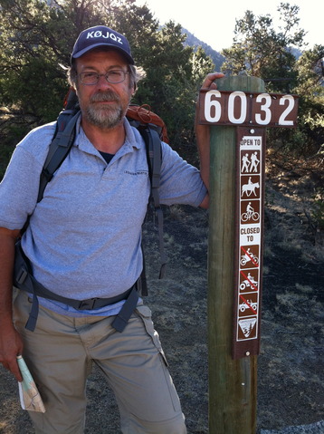
KØJQZ at the Trailhead
Of course I did get lost once and that cost us about 15 to 20 minutes and this was before we got to the Midland Hill Summit Trailhead. After making it to the summit trailhead, we had already hiked about an hour, I realized I may had made a mistake and should of parked at the summit trailhead and forgone the nice but unnecessary visit to Buena Vista’s Riverside Park. No matter we where on our way up to the summit.
Onward we marched. I was sick for a few years so while this is no big feat it has taken me a long time to be able to send code again, walk, run and of course climb up to a summit. We tried Mt Herman a few months ago and I was not really up to the task but walking 3 miles everyday at lunch has really helped me prepare for this.
We saw two people on bicycles on the lower trail but not a sole on the upper trail to the summit.
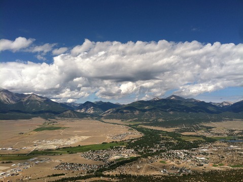
The view from the Summit
Upon arrival at the summit it was time to setup the buddistick vertical and start some QSOs. It is rather funny to think that at 9,500 feet that the little KX1 and Buddistick is a much better station than my K3 (QRP Version) and my vertical at 6,000 feet. A couple of CQs and nothing…. I decided to check to see if I could self -spot and I was able to do a shameless spot and the QSOs started rolling in.
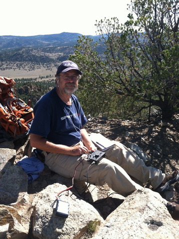
KØJQZ working the pileup
I was only able to operate for a little less than 20 minutes and made only 8 QSOs. I was pretty disappointed but the clouds were moving in and I knew it would take us an hour to get to county road 304 and at least another 30 minutes to make it back to the truck. We made it with about 15 minutes to spare before the sky opened up. Of course we celebrate rain lately and enjoyed the cool down. I apologize for those that waited for me but I had to bug out. One thing I did not want to do is to get stuck on the summit with the ham gear.
I have a few lessons learned. I took too much stuff and while I like the buddistick I just hate carring coax. I built Stu’s tuner and will fashion something else for next time. I took two rigs, the ATS4b and the KX1, I just wanted to make sure I could operate just in case something happened to one of them. The KX1 has the advantage of the built in tuner but the AS4b is smaller and with Stu’s tuner I may just use it next time. There will be a next time.
So my first activation came to an end. I have been following all the hams in Colorado that do this and have worked a few from home. I am fairly active as a chaser but really never had the appreciation for the activators until I tried it. Lucky for me Lynn came along, as it is nice to chat while on the trail. She is studying for her General and when she passes I promised her a rig to get on HF with (KX3 is a top choice). I am just a cw operator so I will leave the fancy SSB Ops to her.
I want to thank the following operators I was able to chat with for my first SOTA Activation.
W6ZKH
W7CNL
K6ILM
WO6M
NS7P
WA2USA
K7NEW
N4EX
72, Frank K0JQZ
f_skinner at yahoo dot com
Some video impressions:
httpvh://www.youtube.com/watch?v=p0d2MFrfu10
If you would like to leave questions or comments, please do so through Youtube.
!! WARNING !! There are old mountaineers, and bold mountaineers… there are no old-bold mountaineers.
Hiking and mountain climbing are potentially hazardous activities particularly in Colorado with its extreme elevations. I am not accepting responsibility for any death or injury resulting from activations based on my trip reports. Proper training, experience, and personal capability assessment is required – enjoy!
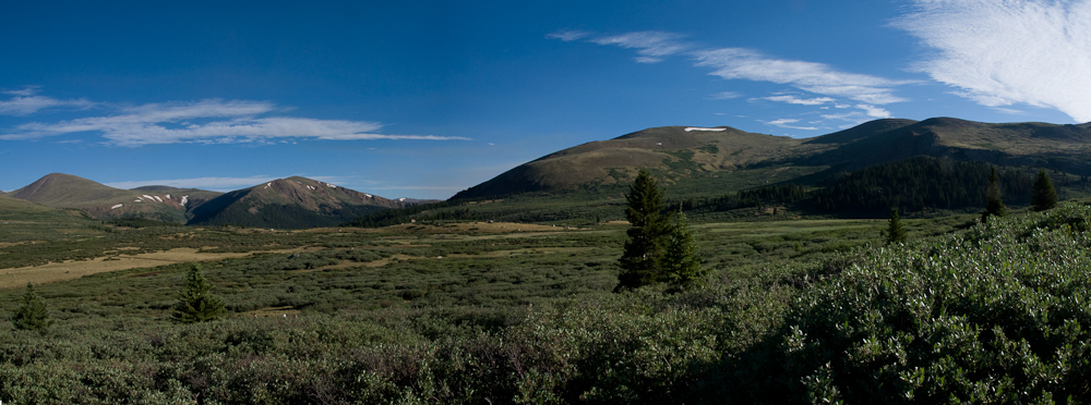
Mount Bierstadt or WØC/FR-Ø15 is one of the easier fourteeners (mountains with peaks above 14,000 ft (4267 m)) in Colorado. It is located near Denver in the Frontrange of the Rocky Mountains. The peak is named after the German/American painter Albert Bierstadt. The easy access from Denver and the close proximity to Mt Evans (another 14er) makes this summit a popular destination all year round. There are several routes to the summit, I have chosen the ‘standard’ route from Guanella Pass over the west slopes.
Mt. Bierstadt – Guanella Pass
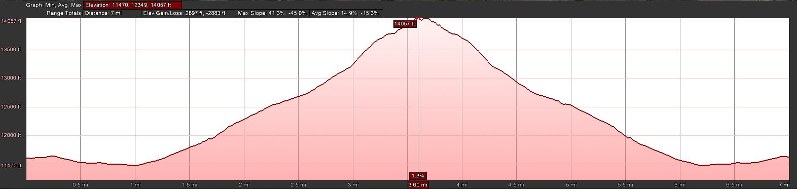
Trailhead: 11607 ft/ 2565 m
Summit: 14060 ft / 4285 m
Elev. gain: 2897 ft / 883 m
Roundtrip: 7.0 mi / 11.3 km
How to get there: As mentioned, access to Mt. Bierstadt is rather easy coming from Denver. Take I70 West, exit at the Georgetown. Follow the many signs to Guanella Pass Scenic Byway. Follow the road for ~12 miles all the way to the pass. The road is brand new and two large parking lots (on either side of the road) cannot be missed. The trail starts near the parking area on the east side of the road (first parking lot coming from Goeorgetown), just behind the restrooms.
Red Tape:
Parking lots fill up quickly, specifically on week-ends.
The Ascent:
Mt. Bierstadt – ElevationProfile
The ascent does not present any challenges. The summit is clearly visible from the parking lot and so is the route. The well maintained trail starts rather easy, slightly downhills through the Guanella Pass marsh area with a thick willow growth. To lessen the impact on the trail, you will find wooden bridges leading you towards the base of the mountain. You have to cross a creek and interestingly you will not find a bridge but you have to jump from rock to rock to get to the other side – with quite a few people on the trail, you might have to wait in line until it’s your turn. That’s when I remembered why I am not a big fan of fourteeners… it’s not the elevation, the thin air or the steep slopes – it’s their popularity and the resulting crowds trying to summit. Needless to say that I was never alone during my hike to the summit. I tried to stay equidistantbetween a larger group in front of me and a group of eight college students behind me. You can’t see the other groups as long as you are hiking in the willows, you can however hear them – a problem which was resolved when the trail got steeper about half way up the mountain. After reaching the saddle, most of the elevation gain was behind me and the remaining part to the top consists mostly of boulder hopping.
The Summit:
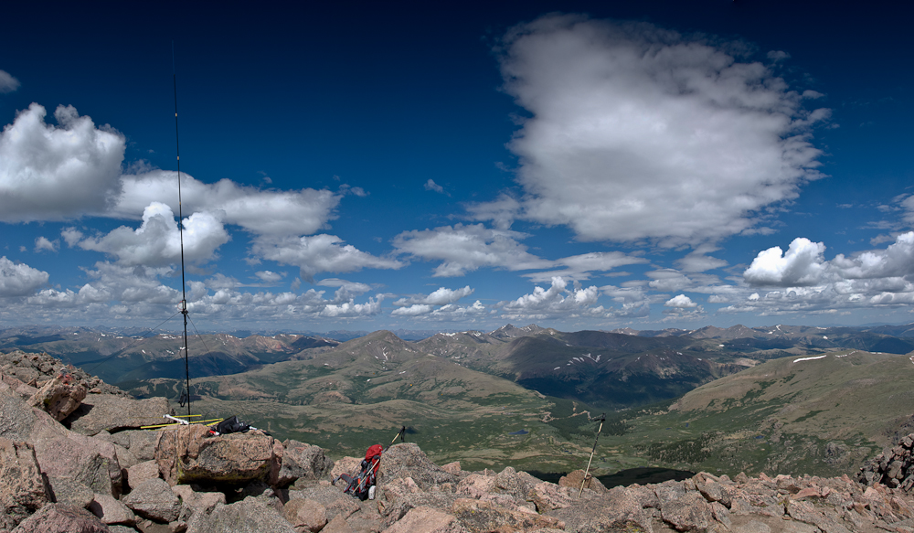
Mt. Bierstadt – The view from the summit
The view from the summit is of course spectacular. Mount Evans (WØC/FR-ØØ3) is just a mile or two to the north-east and can be reached crossing a class 3 ridge (over Sawtooth). Many higher SOTA peaks can be spotted including Torrey Pk. and Gray Pk. (both 14ers) to the west. The summit never had less than probably 25-30 people during the time I was up there. Finding an appropriate location to setup my HF antenna with all the guy lines and counterpoise was important to me… with all the people mulling around, there was a danger that somebody trips and takes down the antenna (or worse).
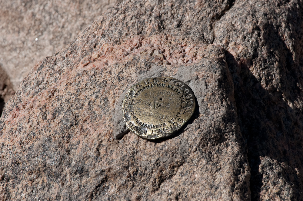
Mt. Bierstadt – The Summit
I set up my 2m tape measure Yagi and pointed it towards the west, hoping to catch Bob/KIØG near Glenwood Springs on the HT. Bob did not answer my call, but Tom/K7HRO picked-up my signal in Cheyenne (WY). Since there were no more takers on 2m, I put down the Yagi (still pointed towards the west) and started to setup my vertical Buddipole. Tuned for 20m, I made contact with the usual suspects, Elliott/K6ILM leading the way. There were also some new (to me) stations who were chasing before I picked up KIØG on the HT. The signal wasn’t great and I started to jump from boulder to boulder, waving my Yagi towards the west in the hope to pick-up a better signal. My behavior attracted the attention of my fellow hikers on the summit who started to wonder whether I had lost my mind, waving a magic wand and speaking in code. Nevertheless, Bob and I had a successful QSO on 2m and I spend the next few minutes answering questions about amateur radio and SOTA.
Keeping an eye on the clouds and weather in general, I re-tuned the BP for 17m… realizing that I would have to leave soon. One of the clouds looked kind of black, but not quite threatening (yet). Made only one contact on 17m withing 10 minutes and decided to call it quits and get off the summit due to the increasingly dark cloud hanging over us. Some newly arrived hikers assured me that they are not worried at all about the clouds – but I was. Within a few minutes I was on my way.
The Descent:
Mt. Bierstadt – APRS
About 300 ft below the summit I saw the first lightning strike towards the west, followed by loud and rolling thunder echoing back from the mountains. Dense rain and hail showers developed quickly and I spent the remaining descent in heavy hail and rain showers. I put on my gaiters and rain jacket before the first wave of hail hit – a smart move… the constant hail and rain made the descent a slippery slope – literally. By the time I reached the flatter area down in the willows, it was a swamp with several inches of hail/rain mix to wade through. Thanks to the gaiters, my feet stayed (mostly) dry – however I was dirty all the way up to my knees as if I had been shoveling manure on a pig farm.
I was wondering how the sandals wearing crowds I had met on my way up and on the summit were coping with the icy situation – I am sure it was tough.
Luckily I still had all my winter equipment in my Subaru Outback. The car was covered in ~2 inches of heavy/wet hail. I literally had to dig out the car – in June.
Some video impressions: httpvh://www.youtube.com/watch?v=opAyuMhfffA
If you would like to leave questions or comments, please do so through Youtube.
!! WARNING !! There are old mountaineers, and bold mountaineers… there are no old-bold mountaineers.
Hiking and mountain climbing are potentially hazardous activities particularly in Colorado with its extreme elevations. I am not accepting responsibility for any death or injury resulting from activations based on my trip reports. Proper training, experience, and personal capability assessment is required – enjoy!
 !! WARNING !! There are old mountaineers, and
bold mountaineers… there are no old-bold mountaineers.
Hiking and mountain climbing are potentially hazardous activities particularly in Colorado with its extreme elevations. I am not accepting responsibility for any death or injury resulting from activations based on my trip reports. Proper training, experience, and personal capability assessment is required – enjoy!
!! WARNING !! There are old mountaineers, and
bold mountaineers… there are no old-bold mountaineers.
Hiking and mountain climbing are potentially hazardous activities particularly in Colorado with its extreme elevations. I am not accepting responsibility for any death or injury resulting from activations based on my trip reports. Proper training, experience, and personal capability assessment is required – enjoy!