Horsetooth Mountain (WØC/FR-1Ø2), part of the Front Range of the Rocky Mountains, is just west of the City of Fort Collins (CO). It is a prominent landmark and easily distinguishable by it’s large rock formation at the summit. It was acquired by the City of Ft. Collins in 1982 from the Soderburg family and is now a popular destination for hikers/mountain-bikers/horseback-riders with approx. 2700 acres (11 square kilometers) and about 30 miles (48 kilometers) of trails. It provides some spectacular views of Fort Collins to the east and to the highest mountains of the Rockies to the west (see the video at the end of the post).
More info
Trailhead: 5538 ft / 1688 m
Summit: 7613 ft / 2320 m
Elev. gain: 1454 ft / 443 m
Round trip: 5.2 mi / 8.4 km
Compare this summit to my other activated summits
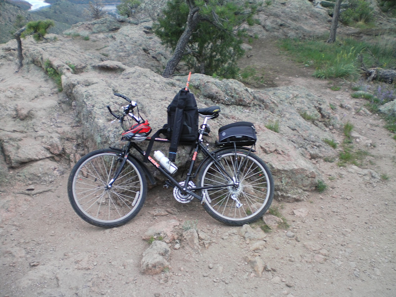 I have choosen this target for my first SOTA activation due to it’s proximity to my QTH. I can actually see the summit from my house. It is just a short drive to the trail-head and usually a nice hike. I took my mountain bike to accelerate my ascent in order to have more time available on the summit to fumble with all my new equipment – or so I thought.
How to get there:
Take exit #265 on I25 and follow Harmony road west for ~7 miles where it becomes Larimer County Road 38E. Continue west and you will find the entrance/parking lot/trail head on the north side of the road after about 6.5 miles.
Trailhead/Parking lot:
Red tape:
Horsetooth Mountain Open Space requires a $5 day use permit for all visitors. You have to share the trail with hikers/mountain-bikes and horseback riders.
The Ascent:
There are at least two options to get to the top.
Follow the forest (dirt) road. Highly recommended using a mountain bike
- Follow the forest (dirt) road. Highly recommended using a mountain bike
- Take the hiking trail from the parking lot (a lot nicer)
The route I took was a combination of the two. As a result I carried my bike for most of the way up due to the fact that MBs are not allowed on the hiking trail and the fact that it is impossible to bike the hiking trail anyway (at least for me). Since I started early, the temperatures were still comfy and some lingering rain clouds over the city provided a shady ascent to the summit.
The Summit:
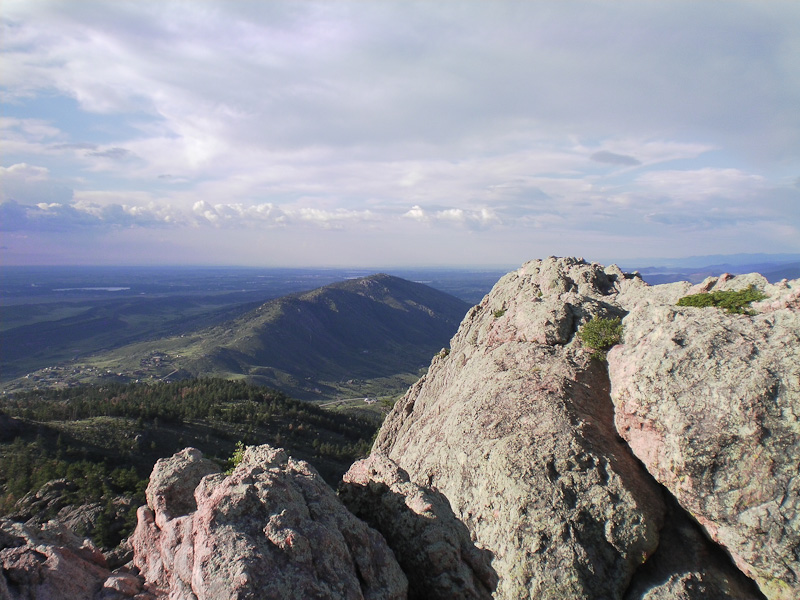
To reach the summit, a short scramble (~30 ft/10 m elevation) on all your extremities is required. The reward is worth it – undisturbed views in all directions for miles and miles.
My setup exercises in the backyard paid off. Within twenty minutes, my Buddipole was up and tuned and I was able to send my first CQs well ahead of my announced time slot. My second contact was Budd (W3FF) in California. He confirmed a strong signal and was very helpful in drumming up support (contacts) for my activation. Within one hour I had thirteen SSB contacts on 20m – good enough for my first activation. Sadly, my internal battery was slowly giving up (note to myself: improve power setup).
Going off the air was amazing… the constant noise of the radio was gone and I just sat there enjoying the sounds of nature. Since it was still early morning, the light and therefore the views were spectacular.
The Descent:
Packing up was a breeze. I climbed down the rock formation back to my bike and saddled up. It was a fast and furious ride downhills. My bike was literally smoking… at least my break pads!
Some Impression:
httpvh://www.youtube.com/watch?v=JpakVv1Xeyw
If you would like to leave questions or comments, please do so through Youtube.
 !! WARNING !! There are old mountaineers, and
bold mountaineers… there are no old-bold mountaineers.
Hiking and mountain climbing are potentially hazardous activities particularly in Colorado with its extreme elevations. I am not accepting responsibility for any death or injury resulting from activations based on my trip reports. Proper training, experience, and personal capability assessment is required – enjoy!
!! WARNING !! There are old mountaineers, and
bold mountaineers… there are no old-bold mountaineers.
Hiking and mountain climbing are potentially hazardous activities particularly in Colorado with its extreme elevations. I am not accepting responsibility for any death or injury resulting from activations based on my trip reports. Proper training, experience, and personal capability assessment is required – enjoy!