


W0C/FR-071
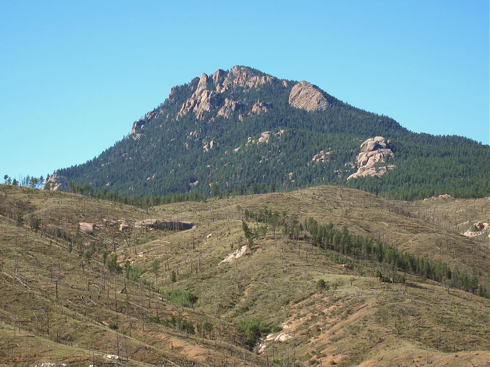
Long Scraggy Peak
2686 m / 8812 ft
Sep 30, 2015 1st Activation
Sep 21, 2016 2nd Activation
By KX0R
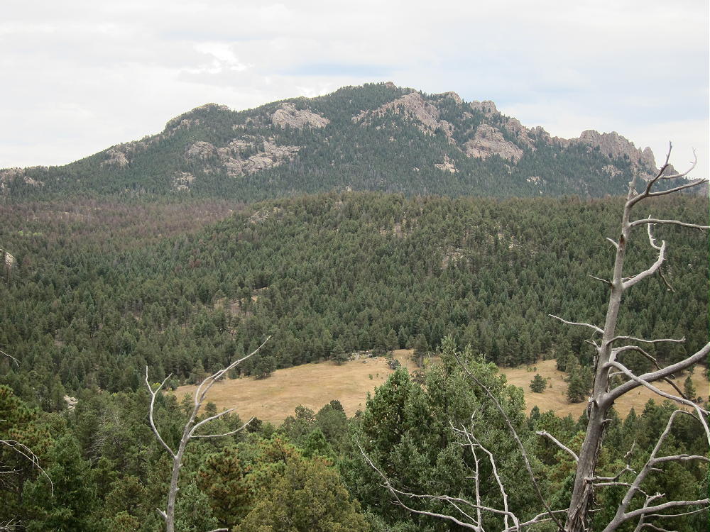
Long Scraggy Peak is a very prominent mountain in the South Platte Canyon near Deckers, southwest of Denver.
Key Points:
• Pike National Forest
• No marked route to the mountain
• Trail leads up the summit
• Navigation and route-finding required
• Private land nearby
• None of the recommended route is posted
• In 2016 signs on trees suggested that a large forestry management project was about to begin
• ~ 8.4 miles round trip
• ~ 2060 vertical feet total, including return trip
Long Scraggy Peak West Side
For a long time I believed that Long Scraggy Peak was essentially off-limits, due to difficult access and private land around the peak. After some research on the internet, I found that climbing Long Scraggy might be practical and legal. There’s no marked trailhead for Long Scraggy, but there’s access via public land all the way to the mountain. A good cairned trail runs right up to the top! However, having a fun day on Long Scraggy requires research and accurate navigation – GPS is very useful, and good map skills are required.
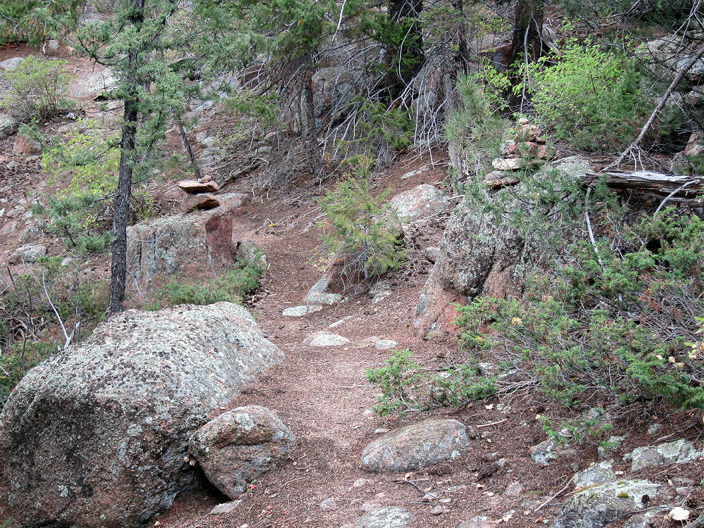
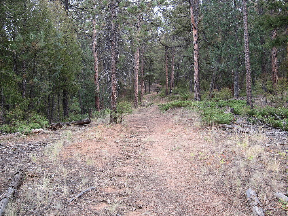
Long Scraggy Summit Trail with Cairns
Private property, including the Long Scraggy Mountain Ranch, lies along the west side of the mountain. This area is accessed from Highway 126 by private Spring Creek Road. The Ranch is a Christian Retreat, and trespassing is forbidden. Because of its location near the mountain, the Ranch effectively has priority use of Long Scraggy. Marked trails lead directly from the property up the mountain, as well as north into the National Forest. The land east of the ranch, including almost all of Long Scraggy Peak, is in Pike National Forest, according to the Forest Visitor Map.
Access to the National Forest is available from paved Highway 126 northwest of Long Scraggy. The trailhead is the gated Raleigh Peak Road, FR-538, which leads southeast and then north for several miles. The Colorado Trail also provides access from both north and south of the private property.
Climbing Long Scraggy legally requires knowing where the public land is, and navigating to avoid the private land east of the Peak. This is not hard, and the route I found requires only moderate bushwhacking.
Driving Directions:
• Start by driving to the town of Buffalo Creek.
• Northern routes are via Highway 285 and Highway 126 from Pine Junction, or via 285 and Foxton Road from Conifer.
• From the south, take Highway 24 west from Colorado Springs to Woodland Park; turn north on Highway 67 and go to Deckers; and continue north on Highway 126 to Buffalo Creek.
• All of these roads are good paved mountain highways.
• From Buffalo Creek, drive almost 2 miles south on 126, most of the way up the big hill, to Raleigh Peak Road, FR-538, on the east side at about 7440 feet
• This is about ½ mile north of a highway maintenance facility near the hilltop
• This road is shown on the Google satellite image
The road is gated, with room for a few cars to park off the highway; the road’s popular with mountain bikers. It’s not posted; hiking and non-motorized access is OK. Park off the highway and away from the gate.
The Hike:
Walk southeast on the dirt road and follow it up the hill as it bends north. Long Scraggy Peak stands beyond private property to the southeast. The Colorado Trail runs parallel to Raleigh Peak Road, 100-200 yards to the east; it roughly follows the 7600 foot contour.
After reaching about 7640 feet, the road runs up over a little rise; a low ridge runs out to the east. Leave the road and head east – there’s a faint trail along the ridge.

Long Scraggy Route East from FR-538
Stay north of any fence you see. This land was burned in the Buffalo Creek fire, and visibility is excellent. To avoid any chance of error, stay on the ridge, or just north of it. The route soon crosses the Colorado Trail. Continuing east, the path eventually becomes a real trail. This east-west route is easily visible on the Google satellite image. Horses, people, and wild animals all share this unmarked trail, which probably predates the fire. Eventually the trail drops steeply east into the valley of Spring Creek.
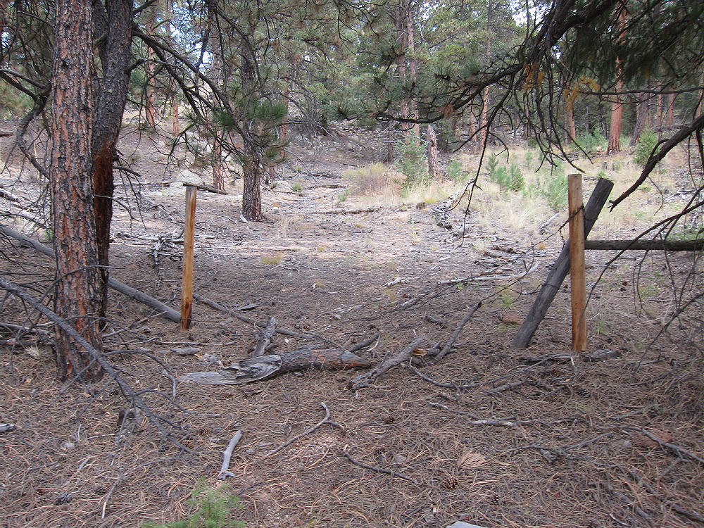
Before the route reaches the creek, a fence runs near the south side of the trail. Stay north of any fence to avoid private land. The ranch owns land along Spring Creek, northeast and downstream from most of their other property. Near Spring Creek, I saw ranch buildings to the south. I didn’t cross any fence. A “no trespassing” sign on a fallen fence indicated that the land south of the fence line was/is closed to the public. I also found a USFS Cadastral Benchmark, as well as USFS signs, indicating that they have accurately surveyed the public land, and marked it accordingly. Clearly the trail north of the fence is on USFS land, close to the private land.
At a marshy area near the creek, a small boardwalk conveniently leads across the creek. The land east of the creek is in Pike National Forest, according to the Forest Visitor Map. This includes all of Long Scraggy Peak and most of the land for more than a mile all around the summit. Anyone considering climbing Long Scraggy should study the USFS map to see where the green National Forest land is in relation to the white private land. Private land should be respected, and there’s no need to cross posted land to access this mountain.
Just east of Spring Creek, there’s a trail junction. The GPS coordinates of this junction are:
N39 21.856 W105 13.329
This is a useful waypoint to put in your GPS, because it’s key to the route in and out.
A sign points to a trail leading downstream to a waterfall. This trail is likely mostly on USFS land, but the sign and trail condition suggests it’s often used by the ranch guests.
• To avoid ranch land, hike east into the woods from the junction into the forest – this route isn’t posted or marked.
• Follow an old abandoned road/track east up a ridge.
Long Scraggy Old Road
• Using any convenient route, hike uphill southeast for about 0.6 mile, in the direction of the summit
• An OK route leads up along a wide draw
• Intersect a modern forest road shown on the Google satellite image
• This road provides access to the east slopes of Long Scraggy.
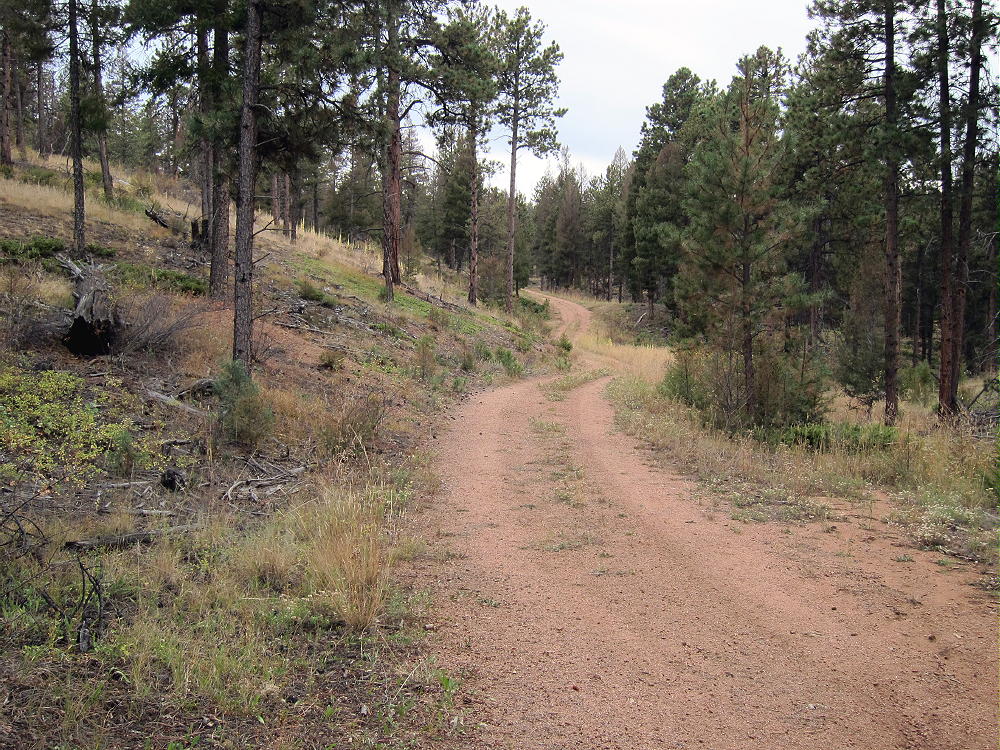
Long Scraggy Forest Road Leading South
• Various signs along the road indicate it’s National Forest land
• Using GPS, hike south on the road to a trail junction at this point:
N39 21.646 W105 12.628
• Follow the obvious trail east into the forest
Long Scraggy Secret Summit Trail
This trail is mostly used by folks from the ranch – they have direct access. However, their trailhead isn’t open to the public. Long Scraggy Peak is on National Forest land adjacent to their property, and it’s no surprise that they have a trail up there. This trail isn’t posted or signed on the mountain, and there’s nothing to suggest that it’s private. I saw no signs at all. It has been maintained for a long time, possibly for decades. Large trees lying near the trail were sawed long ago.
• The Long Scraggy Trail leads up the mountain – there are cairns.
• The trail isn’t shown on maps that I have seen, and most of it’s hidden on the Goggle satellite image.
• The route climbs up through various rocky outcrops.
• The path ascends about 1200 vertical feet from the forest road.
• The summit forest wasn’t burned by the Buffalo Creek Fire, so the trail is very pleasant trail to climb
• The steep trail leads efficiently up to the summit area
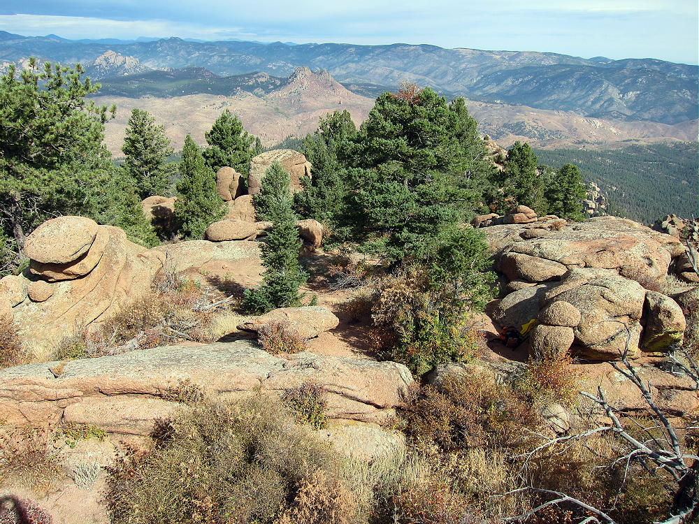
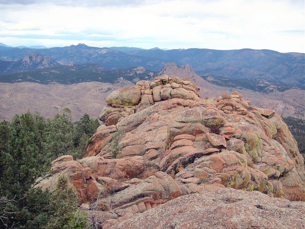
Long Scraggy Peak Summit Area
Additional Details:
The huge top of Long Scraggy Peak consists of massive granite outcrops of orange Pikes Peak granite. The actual summit is just south of the end of the trail – one large step is required, but the granite has excellent friction, and there’s little exposure.
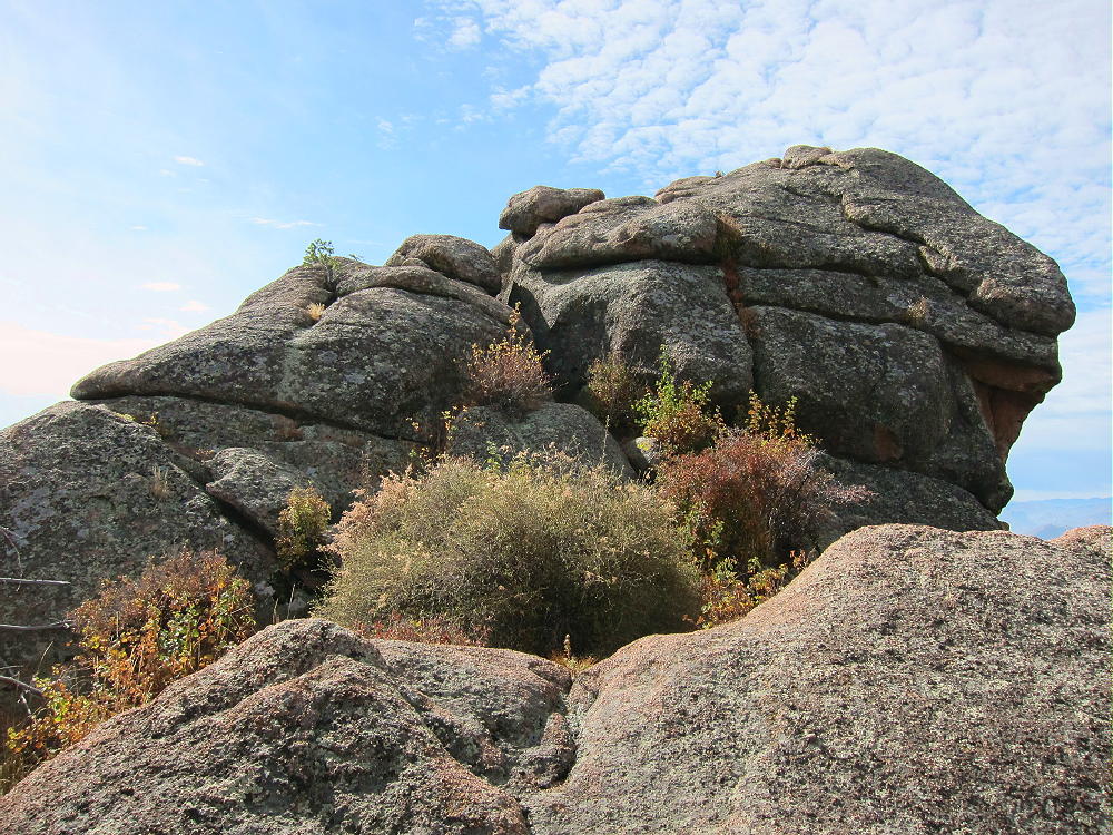
Long Scraggy Peak Summit
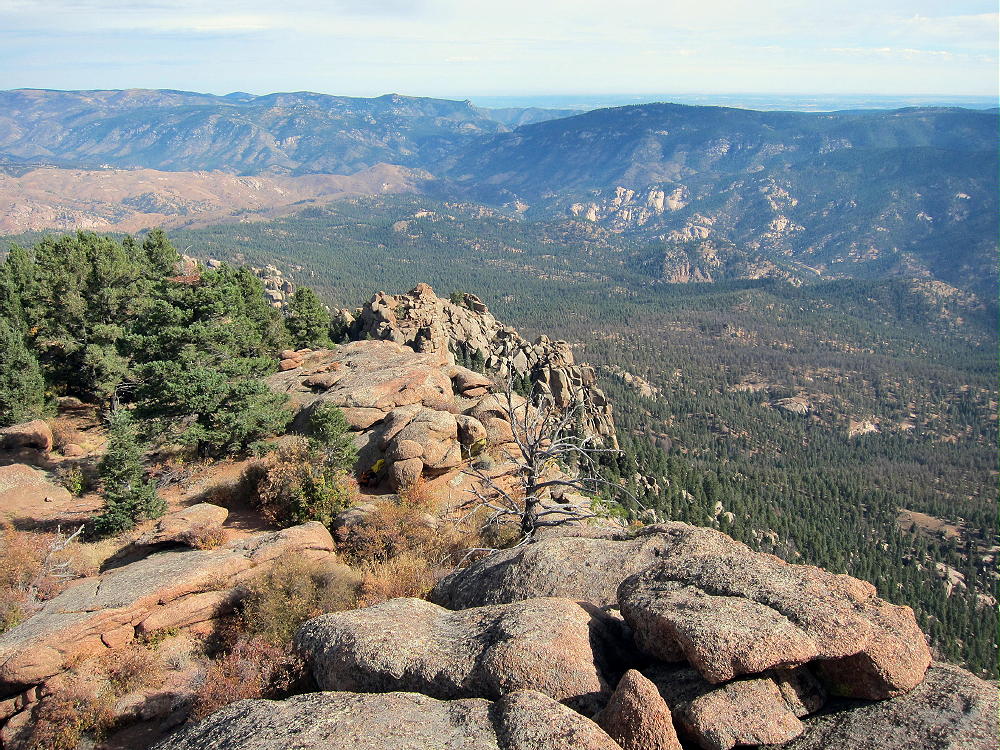
The prominent mountain falls away about half a vertical mile to the south and east – it feels very high – and the views of the South Platte Canyon region are spectacular.
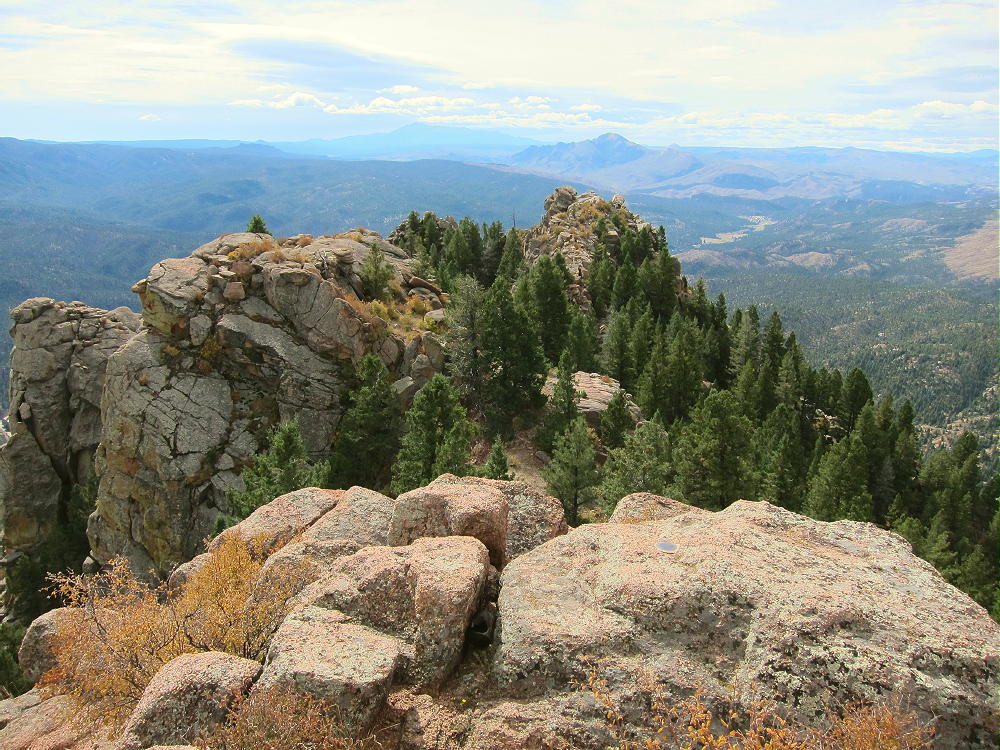
Long Scraggy Peak Summit, South View
The activation zone is large, and it’s practical to erect a pole right on the granite, as I did. The peak is an ideal HF site, much like a very high tower. No nearby peaks are high enough to block HF signals. There’s almost no man-made RF noise – the closest development is far down at the ranch.
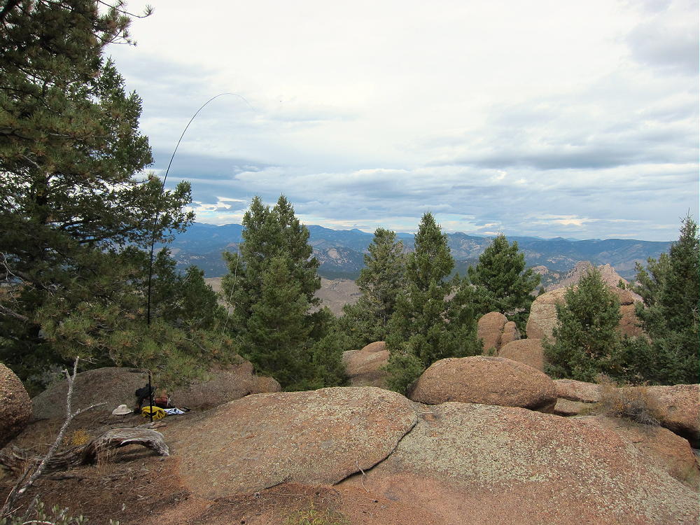
Long Scraggy Peak Activation Sep 21, 2016
There’s some limited VHF/UHF coverage east of Long Scraggy – the eastern Plains are visible in a few directions. Long Scraggy looks across part of the Rampart Range to the northeast. Nevertheless, most populated areas to the east are not visible.
• Return via the same route – be sure to stay north and east of the ranch land near Spring Creek.
The total round-trip length of the Long Scraggy hike, starting at the Raleigh Peak Road gate, is about 8.4 miles. It requires about 2-1/2 to 3 hours each way, assuming some route-finding and breaks. The total vertical ascent is about 1700 feet from trailhead to summit. There’s an additional 360 feet of gain on the way out, from Spring Creek up to the ridge-top east of Raleigh Peak Road; the total vertical gain for the trip is 2060 feet.
Long Scraggy Sub-peak on North Ridge
Even though the hike is a lot of work for a 2-point summit, Long Scraggy Peak is a SOTA Classic!
• Requires good navigation and route-finding
• Some traveling off-trail
• Fun hike up the mountain on a trail marked with cairns
• Huge, prominent, exciting summit
• Large activation zone
• Massive orange granite outcrops
• High cliffs
• Amazing views of the South Platte Canyon region
• Almost perfect HF peak
“Take nothing but pictures and leave nothing but footprints” is especially good advice for this amazing summit. People from the Ranch may visit the summit or use the trails – please respect their interests. Their Christian retreat is just as important as our SOTA activations.
Long Scraggy Peak stands close to nearby SOTA peaks and might be combined for a dual activation:
• Raleigh Peak W0C/FR-195 – only about 3 miles north, same trailhead
• Little Scraggy Peak W0C/FR-059 – about 4 miles to the southwest
The National Forest around Long Scraggy Peak looks like good hunting territory – many deer live there – wear hunter orange clothing in the fall, and be aware of hunters.
It would be difficult to climb Long Scraggy from the South Platte Canyon on the east side. That side of the mountain is very steep and rocky, with many cliffs, and the net vertical gain from the River, at about 6200 feet, is 2600 feet. Even more critical is that the road in the canyon is on the wrong side of the river the entire way. There’s a public foot bridge across the river where the Colorado Trail crosses several miles northeast of the mountain, but it’s a long off-trail hike through burned-up land just to the base of Long Scraggy.
Both the long north and south ridges of the mountain are craggy and challenging to ascend.
In September of 2016, signs on trees indicated that a large forest management project had started. Please be aware that parts of route described here may be affected – contact Pike National Forest, South Platte Ranger District, at 303-275-5610, for more information.
73
George
KX0R
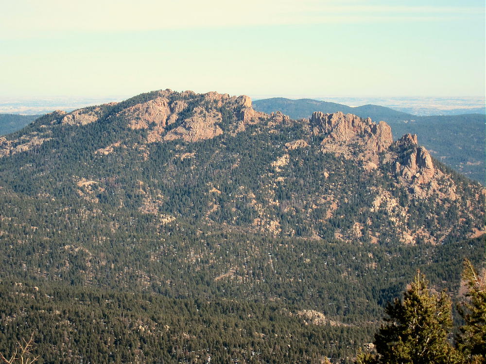
Long Scraggy Peak View Northeast
Long Scraggy Peak, Northeast Side
Long Scraggy Peak Ridge
![]() !! WARNING !! There are old mountaineers, and
bold mountaineers... there are no old-bold mountaineers.
Hiking and mountain climbing are potentially hazardous activities particularly in Colorado with its extreme elevations. I am not accepting responsibility for any death or injury resulting from activations based on my trip reports. Proper training, experience, and personal capability assessment is required - enjoy!
!! WARNING !! There are old mountaineers, and
bold mountaineers... there are no old-bold mountaineers.
Hiking and mountain climbing are potentially hazardous activities particularly in Colorado with its extreme elevations. I am not accepting responsibility for any death or injury resulting from activations based on my trip reports. Proper training, experience, and personal capability assessment is required - enjoy!