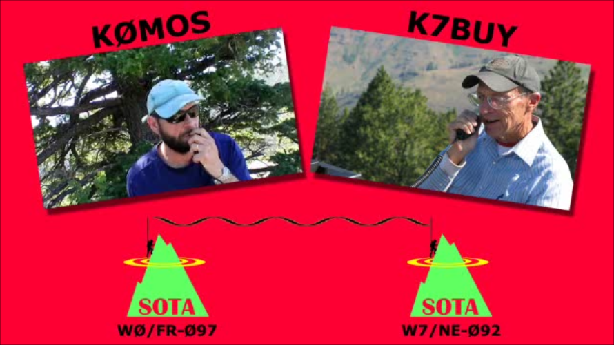
SOTA outings by KØMOS and contributors

Tag: nature

  • WØC/PR-Ø12 (Mount Werner) – 10565 ft / 3220 m

    Mount Werner is located in the Park Range of the Rocky Mountains in Routt County and is part of Routt National Forest. It is a popular winter destination, since it is getting some of the highest levels of snowfalls in all of Colorado. At the base of the Mountain is Steamboat Springs and the Mountain is operated by Steamboat Ski Resort Corporation (which has a long term lease from the National Forest I believe).
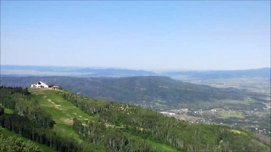
    Thunderhead Station and Steamboat Springs at the base of Mt. Werner

    In summer the main activity seems to be Mountain-biking. A ski resort in summer is never an attractive sight. Hiking trails are scarce due to the fact that the resort makes most of their money with Bikers (just an assumption). If you want to do some nice hiking in this area, try Rabbit Ears Pass instead, you will not be disappointed. During my hike to Mount Werner,  I could never get the feeling to be in a remote location and was unable to connect to nature on this disturbed and heavily scared mountain.

    Trailhead: 6900 ft / 2103 m (Gondola Base) or  9080 ft / 2768 m (Thunderhead)
    Summit: 10565 ft / 3220 m
    Elev. gain: 3665 ft / 1117 m (from base)  or 1485 ft / 453 m (from Thunderhead)
    Roundtrip: 10.4 mi / 16.7 km (from base) or 7.2 mi / 11.6 km (from Thunderhead)

    Compare this summit to my other activated summits

    I took the Gondola to Thunderhead (about $20 for a ticket if I remember correctly – you can use the ticket all day long) and hiked up to the summit on the hiking trails (really just a dirt road) indicated on the official resort map.

    How to get there:
    The Gondola base is impossible to miss if you are in Steamboat Springs.  The base-station of the Gondola is the heart of the Resort.

    Gondola Basestation

    View Larger Map

    Red Tape:
    The whole mountain is managed/controlled by the Steamboat Ski Resort Corporation and the rules of the National Forest do not apply here. According to the official resort map and the info I received locally by talking to their staff, it is not allowed to hike up to the highest point. The  trails above Four Points Hut are reserved for Mountain-bikes only!!! In order to comply with SOTA rules I went up on a day where they had a mountain race (runners) and they changed the trail assignments to accommodate the racers. Optionally you could rent a mountain-bike or go up there in winter (you can go up all the way with Gondola and Ski-lifts and have an easy traverse to the Mt. Werner summit).

    The Ascent:
    It is pretty straight forward. It is a maintenance dirt-road from the Gondola station all the way to the highest point. You will get some nice views of Steamboat Springs and the valley. I always had to keep an eye on all the MBs coming downhills – not all are in complete control of their equipment.

    The Summit:
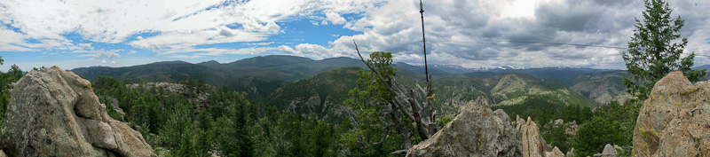
    The summit is very extensive and hosts several huge antenna installations.  The views in easterly direction are undisturbed and were definitely the best feature on this trip.
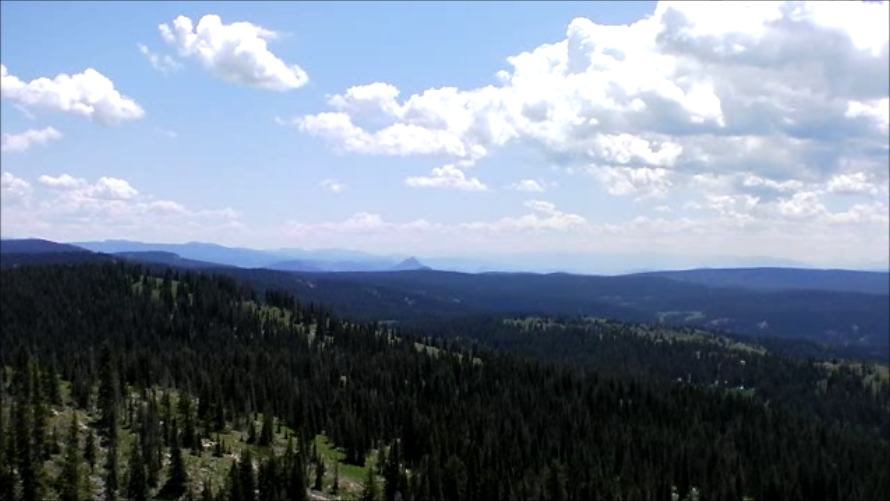
    View from the top of Mt. Werner (10565 ft / 3220 m)

    The Descent:
    You are limited to the same route back, either to the Gondola station or you could hike all the way down.

    Video Impressions:
    httpvh://www.youtube.com/watch?v=mSLBl6AOp2s

    If you would like to leave questions or comments, please do so through Youtube.


    ATTENTION !! WARNING !! There are old mountaineers, and bold mountaineers… there are no old-bold mountaineers. Hiking and mountain climbing are potentially hazardous activities particularly in Colorado with its extreme elevations. I am not accepting responsibility for any death or injury resulting from activations based on my trip reports. Proper training, experience, and personal capability assessment is required – enjoy!
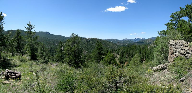
  • WØC/FR-Ø82 (Triangle Mtn.) – 8415 ft / 2565 m

    Triangle Mountain (WØC/FR-Ø82) is part of the Front Range of the Rocky Mountains and within a one hour drive from my home QTH.

    Overview from the first ridge

    The summit is located within the Roosevelt National Forest and ranked 147th tallest peak in Larimer County. There is no established trail that goes all the way to the top (so don’t look for one on a map), but it seems to be climbed regularly by visitors from nearby Estes Park (a popular gateway to Rocky Mountain National Park [RMNP]). A clearly visible trail goes about about half-way up the mountain, before it fades out. Be prepared to use your map and compass. I certainly needed my navigation equipment on my way down. There are some steep cliffs on the south-west side of the summit which you should definitely avoid. The summit provides some very scenic views into the nearby Mummy Range and some impressive 14ers in the heart of the Rockies.

    Trailhead: 7020 ft. / 2140 m
    Summit: 8415 ft. / 2565 m
    Elev gain: 1987 ft. / 606 m
    Roundtrip: 3.5 mi / 5.6 km

    Compare this summit to my other activated summits

    The trail-head is a very close to a picnic area at the north-fork of Big Thompson River. The drive up the canyon from Loveland is quite scenic.

    How to get there:
    Take US34 from Loveland towards Estes Park through Big Thompson Canyon. When you pass through Drake, take a right on CR43 along the north-fork. Park at the Lower North Fork picnic area on the left side of the road. There is space to park about five cars.

    Parking/Trailhead

    View Larger Map

    Red Tape:

    Not everybody makes it to the top

    The east side of Triangle Mountain is private property. The trail follows the fence line closely at some points. Since you have to bushwhack part of the way, you will find out that most of the flora has some sort of poky, prickly and/or thorny part. Make sure to stay away from the steep cliffs on the south-west side.

    The Ascent:
    Look directly across the street from the picnic area where a faint trail leads up the steep hillside. The trail becomes more prominent until a grassy  area where the trail becomes faint but marked with some stone cairns. Follow the ridge line and climb across the rock outcroppings. The south-west side is private property and your route might get very close to it.

    The Summit:

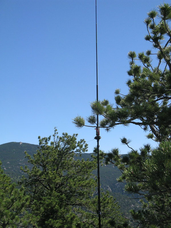
    Antenna on the summit

    The summit is on a nice rock-outcropping and gives you unobstructed views in all directions. Most spectacular are the views into the nearby RMNP and Crosier Mountain (another SOTA summit). Is is a rather small area and a larger group cannot setup on the summit. More space is available a few feet below the actual summit (without the breathtaking views).

    The Descent:
    Basically you go back the same way, following the ridge. Unfortunately I made some unplanned detours, exploring the cliffs on the south-west side – not recommended. Map and compass brought me back to the ridge and finally to the trail-head.

    Some video impressions:
    httpvh://www.youtube.com/watch?v=JJn_HwEeyUs

    If you would like to leave questions or comments, please do so through Youtube.


    ATTENTION !! WARNING !! There are old mountaineers, and bold mountaineers… there are no old-bold mountaineers. Hiking and mountain climbing are potentially hazardous activities particularly in Colorado with its extreme elevations. I am not accepting responsibility for any death or injury resulting from activations based on my trip reports. Proper training, experience, and personal capability assessment is required – enjoy!
  • WØC/FR-Ø88 (Mt. McConnel) – 8020 ft / 2444 m

    Mount McConnel (WØC/FR-Ø88), part of the Front Range of the Rocky Mountains, is located about 25 miles (40 km) north-west of Fort Collins, CO. The mountain is within the Roosevelt National Forest in the Cache La Poudre Canyon. The trail up to the summit consists of two overlapping loops.

    1. William Kreutzer Nature Trail and (#936)
    2. Mount McConnel Summit Trail (#992)

    The Summit Trail splits off the Nature Trail at t it’s highest point and loops over the ridge and finally re-joins the Nature Trail making it an easy and enjoyable 4.23 miles (6.8 km) hike.

    Trailhead: 6612 ft / 2015 m
    Summit: 8020 ft / 2444 m
    Elev. gain: 1408 ft / 429 m
    Roundtrip: 4.23 mi / 6.8 km

    Compare this summit with my other activated summits

    How to get there:
    Take US287 N from Fort Collins towards Wyoming. Go west  at Ted’s Place on CO14.

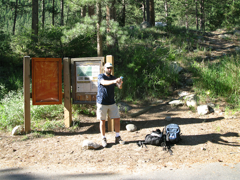
    KØMOS at the trail-head of Mount McConnel

    About 24 miles into the Canyon turn left into the Mountain Park Campground where you will find about five parking spaces. There is an bulletin board right at the parking lot with information, regulations and a map. It seems that the board was relocated at some point in time. The label You Are Here on the map is certainly not were you are. Keep that in mind. You have to go uphills towards the campground where the trail-head is located, despite of what the sign says. Alternative parking can be found just after the bridge alongside the road (facing downhills – on the side of the river).

    Parkinglot/Trailhead

    View Larger Map

    Red Tape:
    The National Forest requires a day use fee of $5.00. Dogs are required to be leashed.


    The Ascent:
    The trail  leaves the Mountain Park Day Use Area at the east end of the campground. I went up Kreutzer Nature Trail (#992). The trail climbs gradually up the south face through Ponderosa pines and Douglas firs. It is a well established trail with several interpretative signs along its way. After about 3/4 of a mile (1.2 km), the Summit Trail splits off and you will get to a quite spectacular overview of Poudre Canyon. Following the trail will bring you very close to some cliffs and several really nice overlooks. Shortly after entering the Cache la Poudre Wilderness (there is a sign), the trail forks again. You have to take the right fork to get to the near summit (approx. 0.2 mi/500m), the left fork continues the Summit Trail (going down to the river again).

    The Summit:
    The trail ends at the base of some large rock outcroppings where you will experience spectacular views into the Mummy Range of the Rocky Mountains.

    View of the Mummy Range from atop Mt. McConnel
    View of the Mummy Range from atop Mt. McConnel


    The available rocks and trees/tree-stumps provided ample and comfortable space for my equipment. Setting it up was a breeze and my signal got out well.

    Setting up the antenna

    After finishing my eighth QSO, I turned off the radio and enjoyed the gorgeous views, the warm sun and the solitude. After an hour or so, another hiker stumbled onto the summit… an RF engineer from Florida who was vacationing in Colorado. After a little chat, he went back down and I packed up my equipment, leaving this place as well.

    The Descent:
    At the fork, I turned south continuing on the Summit Trail which descends back into the Poudre Canyon through very a scenic landscape. The trail is not as well established as on the ascent, but keeping an eye on the stone cairns will help you find the way just fine. The descent is longer, steeper and rockier as well, providing several opportunities for panoramic views over  the Poudre Canyon. It finally joins the Nature Trail again before going down a gulch and emerging east of the bridge leading to the campground.

    Some video impressions:
    httpvh://www.youtube.com/watch?v=XY7SjK-mvrw

    If you would like to leave questions or comments, please do so through Youtube.

    Update: Read the trip report of my second activation of Mt. McConnel


    ATTENTION !! WARNING !! There are old mountaineers, and bold mountaineers… there are no old-bold mountaineers. Hiking and mountain climbing are potentially hazardous activities particularly in Colorado with its extreme elevations. I am not accepting responsibility for any death or injury resulting from activations based on my trip reports. Proper training, experience, and personal capability assessment is required – enjoy!
  • WØC/FR-Ø95 (Greyrock Mtn.) – 7613 ft / 2320 m

    W0C/FR-095 (Greyrock Mtn.) – 7613 ft / 2320 m
    June 23rd, 2011

    by KØMOS

    Greyrock  Mountain (WØC/FR-Ø95), part of the Front Range of the Rocky Mountains, is located in the Poudre Canyon about 20 miles north- west of Fort Collins (CO).  As the name suggest, Greyrock is a large granite outcropping rising well above the scenic meadow at it’s base. In the 1930, the Civilian Conservation Corps established the Greyrock Summit Trail – one of two different options to the summit. In 1978, a second trail – Greyrock Meadows Trail was established and is IMHO the more scenic route to the top. Greyrock Mountain has actually two distinguished peaks and between the peaks are several small ponds. Quite amazing. You have to climb the peak to the west to find the highest point.

    Trailhead: 5538 ft / 1688 m
    Summit: 7613 ft / 2320 m
    Elev. gain: 2075 ft / 632 m
    Roundtrip: 8 mi / 13 km

    Compare this summit to my other activated summits

    On my second endeavor to activate a summit for SOTA I tried to improve my radio setup. Mainly the power-department needed some upgrades. I used an external powerpack and a foldable 10W solarpanel to increase my operation hours on the summit (check My Radio Equipment for details). I left my QTH early in the morning to beat the heat and to avoid other hikers since the summit is quite small, exposed and not well suited for lots of people – specifically not with an antenna and all the guy lines and counter-poise.

    How to get there:
    Take US287 N from Fort Collins towards Wyoming. Go west  at Ted’s Place on CO14. About eight miles into the Canyon is a parking lot on the left side of the street. Shortly before that is a sign for the parking lot.

    Trailhead/Parking lot:

    View Larger Map

    Red Tape:
    This trail is one of Fort Collins most popular. Try to avoid on week-ends and go early in the day. There is a lot of Poison Ivy along the trail (in the beginning).

    The Ascent:
    There are two options to get to the top and it is possible to hike a loop. From the parking lot, cross the Poudre River over the bridge to the trailhead. Follow the well established trail to the west through dense underbrush (and Poison Ivy) until the Greyrock Trail splits into Greyrock Meadows Trail and Greyrock Summit Trail.

    1. The Greyrock Summit Trail follows a small canyon towards the north and gains approx. 1000 ft (300 m) in just a mile. It joins the Greyrock Meadows Trail at the base of Greyrock Mountain – a mere 0.75 miles from the summit.
    2. The Greyrock Meadows Trail – my favorite – follows the ridge to the west and reveals some scenic overviews along its way. It’s more moderate and more open than option #1. It reveals some majestic views of Greyrock Mountain and the Meadow below before the trail goes down to the Meadow, loosing about 390 ft (120 m) in elevation. Continue along the meadow before ascending up into the pine/fir and spruce forest (burned down in a recent wild fire) all the way to the junction with the Greyrock Summit Trail.
    Greyrock Mtn. as seen from the Meadow

    The Meadow is a very nice spot for an overnight camp. Make sure to brink your own water. There is hardly any and certainly nothing you wanna drink under normal circumstances.

    The junction of the two trails is a good spot for a short break and to get re-hydrated for the remaining 0.75 miles to the top. They are steep and you have to keep an eye on the trail – it is not always obvious where to go and people get lost every year. The trail winds it’s way around the south-east flank of the summit. Cairns and signs are leading the way – not necessarily to the summit. Some minor scrambling is required during the final approach to the plateau between the two summits. Take some time to enjoy the views and the unique ponds with all their wildlife.

    Between the two summits of Greyrock Mountain

    The Summit:
    It’s an easy stroll from here through pines and ponds to the west summit. Shortly before reaching the summit you will encounter another pond. The remaining 30 ft/10 m is a scramble again. The summit itself is small and can only accommodate a limited amount of people. Luckily I was all alone up there.

    It took me about 20 minutes to setup my gear and tune the antenna. Several Chipmunks were eyeballing my backpack, waiting for the right moment to feast on my sandwich. The weather was sunny and nice and my signal got out. I made eight SSB QSOs on 20 m within an hour and successfully defended my lunch (simply by eating it).

    The Descent:
    At the junction, the shorter Summit Trail lead me down to the trailhead – completing a loop and I experienced heavy uphill traffic on the last mile or so.

    Some video impressions:
    httpvh://www.youtube.com/watch?v=U1KJqe0N9KY

    If you would like to leave questions or comments, please do so through Youtube.


    ATTENTION !! WARNING !! There are old mountaineers, and bold mountaineers… there are no old-bold mountaineers. Hiking and mountain climbing are potentially hazardous activities particularly in Colorado with its extreme elevations. I am not accepting responsibility for any death or injury resulting from activations based on my trip reports. Proper training, experience, and personal capability assessment is required – enjoy!
  • WØC/FR-1Ø2 (Horsetooth Mtn.) – 7613 ft / 2320 m

    Horsetooth Mountain (WØC/FR-1Ø2), part of the Front Range of the Rocky Mountains, is just west of the City of Fort Collins (CO). It is a prominent landmark  and easily distinguishable by it’s large rock formation at the summit. It was acquired by the City of Ft. Collins in 1982 from the Soderburg family and is now a popular destination for hikers/mountain-bikers/horseback-riders with approx. 2700 acres (11 square kilometers) and about 30 miles (48 kilometers) of trails. It provides some spectacular views of Fort Collins to the east and to the highest mountains of the Rockies to the west (see the video at the end of the post).
    More info

    Trailhead: 5538 ft / 1688 m
    Summit: 7613 ft / 2320 m
    Elev. gain: 1454 ft / 443 m
    Round trip: 5.2 mi / 8.4 km

    Compare this summit to my other activated summits

    I have choosen this target for my first SOTA activation due to it’s proximity to my QTH. I can actually see the summit from my house. It is just a short drive to the trail-head and usually a nice hike. I took my mountain bike to accelerate my ascent in order to have more time available on the summit to fumble with all my new equipment – or so I thought.

    How to get there:
    Take exit #265 on I25 and follow Harmony road west for ~7 miles where it becomes Larimer County Road 38E. Continue west and you will find the entrance/parking lot/trail head on the north side of the road after about 6.5 miles.

    Trailhead/Parking lot:

    Open Larger Map

    Red tape:
    Horsetooth Mountain Open Space requires a $5 day use permit for all visitors. You have to share the trail with hikers/mountain-bikes and horseback riders.

    The Ascent:
    There are at least two options to get to the top.

     Follow the forest (dirt) road. Highly recommended using a mountain bike

    1. Follow the forest (dirt) road. Highly recommended using a mountain bike
    2. Take the hiking trail from the parking lot (a lot nicer)

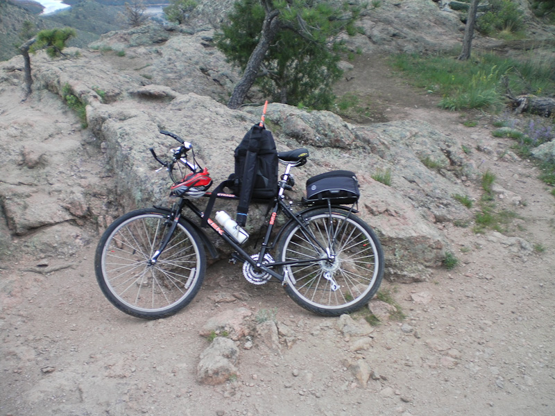
    The route I took was a combination of the two. As a result I carried my bike for most of the way up due to the fact that MBs are not allowed on the hiking trail and the fact that it is impossible to bike the hiking trail anyway (at least for me). Since I started early, the temperatures were still comfy and some lingering rain clouds over the city provided a shady ascent to the summit.

    The Summit:
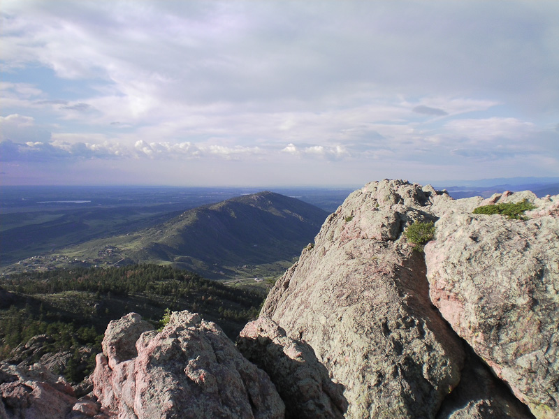
    To reach the summit, a short scramble (~30 ft/10 m elevation) on all your extremities is required. The reward is worth it – undisturbed views in all directions for miles and miles.

    View from the top of Horsetooth Mtn.

    My setup exercises in the backyard paid off. Within twenty minutes, my Buddipole was up and tuned and I was able to send my first CQs well ahead of my announced time slot. My second contact was Budd (W3FF) in California. He confirmed a strong signal and was very helpful in drumming up support (contacts) for my activation. Within one hour I had thirteen SSB contacts on 20m – good enough for my first activation. Sadly, my internal battery was slowly giving up (note to myself: improve  power setup).

    Going off the air was amazing… the constant noise of the radio was gone and I just sat there enjoying the sounds of nature. Since it was still early morning, the light and therefore the views were spectacular.

    The Descent:
    Packing up was a breeze. I climbed down the rock formation back to my bike and saddled up. It was a fast and furious ride downhills. My bike was literally smoking… at least my break pads!

    Some Impression:
    httpvh://www.youtube.com/watch?v=JpakVv1Xeyw


    If you would like to leave questions or comments, please do so through Youtube.


    ATTENTION !! WARNING !! There are old mountaineers, and bold mountaineers… there are no old-bold mountaineers. Hiking and mountain climbing are potentially hazardous activities particularly in Colorado with its extreme elevations. I am not accepting responsibility for any death or injury resulting from activations based on my trip reports. Proper training, experience, and personal capability assessment is required – enjoy!
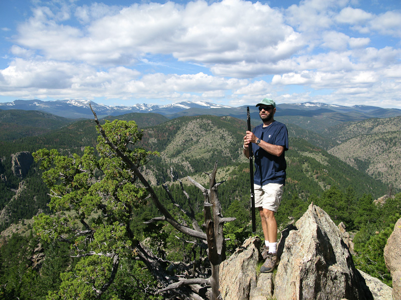
  • WØC/FR-Ø97 (Sheep Mountain) – 7555 ft / 2303 m

    Sheep Mountain (WØC/FR-Ø97), one of several summits with this name in my vicinity, is part of the Front Range of the Rocky Mountain and the Roosevelt National Forest. It is located about 20 miles (30 km) north-west of the town of Fort Collins in the Cache La Poudre Canyon. Several other SOTA summits are close by. Access to Sheep Mountain is via CO14. The mountain rises sharply from the side of the road and parking and access is very limited.

    Trailhead: 6201 ft / 1585 m
    Summit: 7555 ft / 2303 m
    Elev. gain: 1391 ft / 424 m
    Roundtrip: 1.9 mi / 3.1 km

    Compare this summit to my other activated summits

    How to get there:
    Take US287 N from Fort Collins towards Wyoming. Go west  at Ted’s Place on CO14. About 18 miles into the Canyon is a small gravel/dirt patch on the the right side of the street. It is shortly after the bridge over Poudre River. It is easy to miss on the first try. Watch the video below  @ about 6:00 minutes into the clip.

    Parkinglot/Trailhead

    View Larger Map

    Red Tape:
    Nothing I am aware of, it is part of Roosevelt National Forest – therefore NF rules apply.

    The Ascent:
    Once you found the parking spot outlined above, it is pretty obvious where to go. The (very) steep south facing slopes can only be tackled one way – through a steep gulley. It is not only steep but rocky with large boulders, sagebrush and tons of prickly stuff. I switch-backed up the slope up to a ridge to the west which provided the first nice overview of the Canyon and the road below. It also provided nice views to the east on some previously hiked mountains and some grazing deer which were not amused by my presence.  I continued to follow the ridge until it got kind of steep but I forced my way through/up the giant boulders all the way to the peak. The best approach – in retrospect  – is to move east and summit from the north-east side to avoid scrambling up the scraggy peak.

    The Summit:
    The summit provided a nice shady place beneath the Douglas firs. Setup was easy, the abundance  of boulders provided ample opportunities to guy the mast for the antenna. Finding a quiet spot on the 20m band was a different story.
    The highlight was certainly the QSO with Larry (W7BUY) who was activating SOTA W7/NE-Ø92 in Oregon. My first S2S QSO.

    The Descent:
    The descent does not provide any more challenges than the ascent, and you have gravity working in your favor. The area can be easily navigated, since the flora consists only of grasses, sagebrush and prickly pears. The only thing you have to watch out for is the heat, the slope is south-facing – so don’t forget your sun-protection.

    Some Video Impressions:
    httpvh://www.youtube.com/watch?v=bVCwCRRVhMU

    If you would like to leave questions or comments, please do so through Youtube.


    ATTENTION !! WARNING !! There are old mountaineers, and bold mountaineers… there are no old-bold mountaineers. Hiking and mountain climbing are potentially hazardous activities particularly in Colorado with its extreme elevations. I am not accepting responsibility for any death or injury resulting from activations based on my trip reports. Proper training, experience, and personal capability assessment is required – enjoy!