SOTA outings by KØMOS and contributors

Tag: Estes Park

  • WØC/FR-Ø39 (Estes Cone) – 3348 m / 11006 ft – 2nd activation

    This was a re-activation for me. If you are looking for all the details on how to get there and other useful info, you can find the original trip-report with the necessary details right here. This post has only a few specifics from today’s activation.
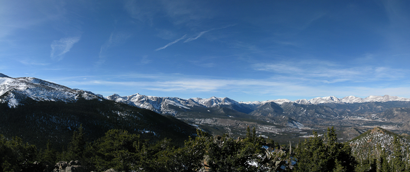
    Estes Cone: View of RMNP from the summit

    After two days of high winds here in northern Colorado (I clocked 45 mph winds in my back yard – the news reported even higher winds in the mountains of up to 75 mph gusts) the weather forecast for today was excellent. I woke up to 17 degrees F (~minus 8 C) and blue skies. Since everybody in the family had the day off, I was joined by my wife and my daughter – making this a fun family affair. We left the house at nine o’clock with the goal of being at the trail-head of Estes Cone by 10, and on the air by noon local time (or 1900UTC). That’s how I announced my activation on SOTAwatch.org. Since today was a federal holiday, traffic was minimal and the mostly dry roads allowed me to pass through Big Thompson Canyon rather quickly. Nevertheless, we  arrived at the TH 15 minutes later  as expected because I underestimated the time it took to drive from Estes Park to the trail-head.
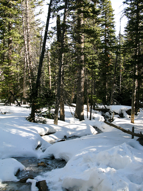
    Estes Cone: On the way up

    Determined to keep my ‘appointment’ on the summit, I shouldered my pack and headed towards the mountain – splitting up our ‘activation team’. My seven year-old cannot yet keep up with me in deep snow and we planned to re-join later somewhere on the trail after the activation.

    There were two chances for an S2S contact today, one with VA2OTA on HF and the other with KF6LHX (Tim) who was activating WØC/PR-Ø14 near Breckenridge on VHF – that’s only 70 miles (~115 km), I covered larger distances on my HT before. On my way up, I was able to copy KT5E on 2m saying:”Your are Summits on the what?” and knew immediately that Tim was OTA. I was unable to contact him directly however. I was still in the valley and surrounded by trees and mountains.  I contacted KT5E and he relayed my message to Tim. By the time I arrived on ‘my’ summit he had already moved on – you can’t stay too long at 14236 ft (4339 m) in winter.
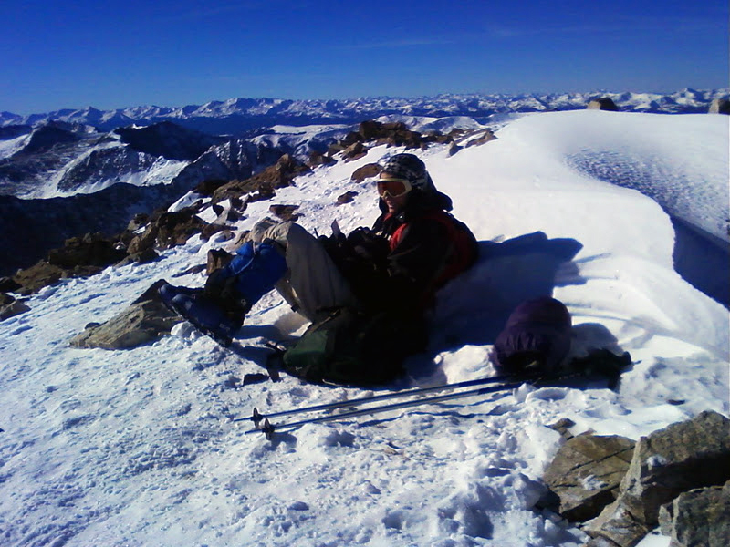
    Photo by Tim – KF6LHX

    You can find Tim’s trip-report on the SOTA reflector and see Tim’s PQL (Personal QSO Logger) shivering at high elevation on the right. Back home I learned that VA2OTA’s activation was cancelled due to bad weather – so that took care of all the S2S contacts possibilities for today.

    Today I looked a little closer at the topography between Quandary Peak and Estes Cone to see whether a contact would have been feasible… it does not look promising (see below):
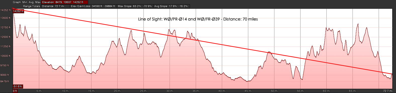
    Estes Cone: LOS to Quandary Peak (click for larger view)

    It took me an hour and 45 minutes to hike the three miles (~4.5 km) and 2000 ft (~600 m) of elevation through about two feet of (mostly) packed snow. I reached the summit at 11006 ft (3348 m) on-time and logged my first QSO at 19:00 UTC. The wind was blowing pretty strongly and I setup my equipment under the same rock formation than last time – about 30 feet below the summit. That blocked my signal towards the East and South-East but made the high winds a lot more bearable. The views from up here are spectacular. Longs Peak (4344 m / 14255 ft ) and Mt.Meeker (4240 m / 13911 ft ) at a close range (~4 miles / 6.5 km as the crows fly) and the snow-covered Mummy Range with several 13000+ ft (~4000 m) summits towards  the NNW are all within view. On the other side, one can spot beautiful Lily Lake and in the distance Estes Park.

    I tuned the antenna for 17m and started calling CQ. N4EX (Rick) was the first who answered my call on HF and he spotted me as well (thanks Rick). I was forced to move to another frequency after my 12th QSO since some other HAM’s decided to settle on ‘my’ frequency – they did not react to any of my calls and I could not get any other contacts on 17m. Since my extremities started to feel cold, I was tempted to wrap it up and head out of the cold wind. Instead, I opted to give it a try on 20m and re-tuned the antenna, looked for a free frequency and started to announce my presence… no takers after five minutes on this band… time to pack-up and move my body to get warm.
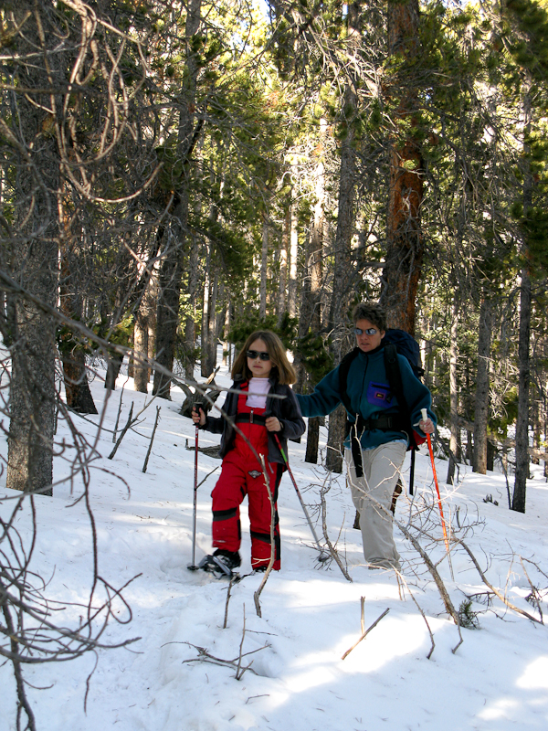
    Estes Cone: In the woods

    I was pretty much running/sliding down the south-westerly facing route to catch-up with the rest of the family. I found them just below the saddle, singing Christmas songs while trudging through the trees on their snow-shoes.

    I was a perfect day in the mountains and it felt great to burn some of the calories which had accumulated around my waist over the holidays – too bad I could not reach Tim for a S2S.

    Some video Impressions:
    httpvh://www.youtube.com/watch?v=NFeMLIAqpdA

    If you would like to leave questions or comments, please do so through Youtube.


    ATTENTION !! WARNING !! There are old mountaineers, and bold mountaineers… there are no old-bold mountaineers. Hiking and mountain climbing are potentially hazardous activities particularly in Colorado with its extreme elevations. I am not accepting responsibility for any death or injury resulting from activations based on my trip reports. Proper training, experience, and personal capability assessment is required – enjoy!
  • WØC/FR-Ø58 (Emerald Mountain) – 2810 M / 9237 ft

    I got up at 6:00 AM this morning, facing a moderate 18 degrees F (approx. -8C) and clear skies outside – just a sliver of the moon and clouds over Longs Peak towards the west. A winter storm warning was issued for later in the day, but I thought I had enough time to activate WØC/FR-Ø58 (Emerald Mountain). The dogs were not too excited to go for a walk in the dark and at these freezing temperatures – but I guess they were relieved that they did not have to join me on the mountain.
    The drive up through Thomson Canyon followed the frozen river all the way up to Estes Park. Entering Estes Park through US34 always presents a perfect overview of the surrounding mountains. Even though I was still driving under clear skies, clouds were settling in the mountains in every direction – guess the weather forecast had not lying.

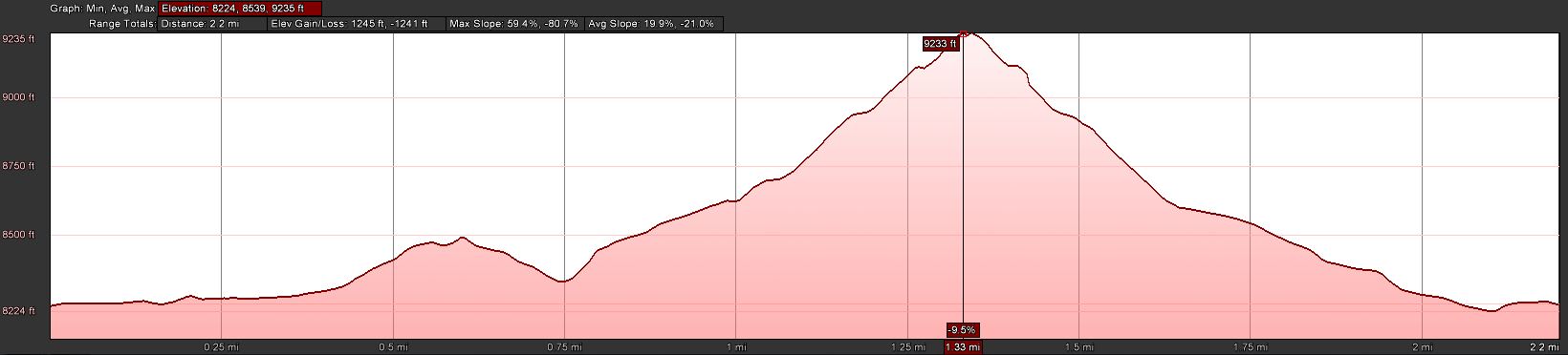
    Trailhead: 8244 ft / 2513 m
    Summit:   9237 ft / 2810 m
    Elev. gain: 1245 ft / 380 m
    Roundtrip: 2.2  mi / 3.5 km

    Compare this summit with my other activated summits

    How to get there:
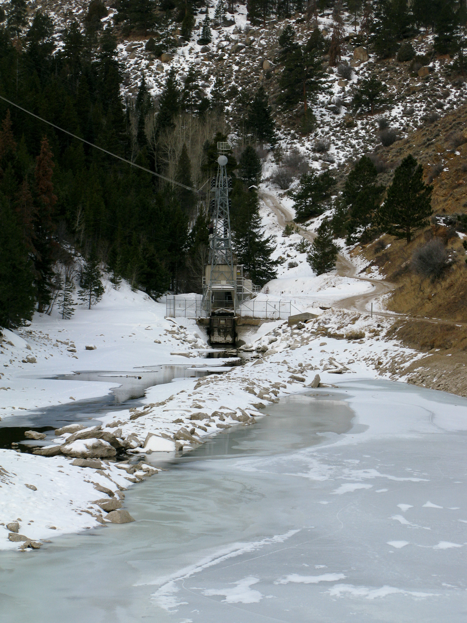
    Take US34 from Loveland towards Estes Park through Big Thompson Canyon. Emerald Mountain is on the south-west side of Estes Park. Stay on US34 towards Rocky Mountain NP. Go left on County Road 66 (or Tunnel Road), following the signs to the YMCA campus. Follow the road all the way to the end. There is a campground at the very end – so is the East Portal of the Big Thompson Project Pipeline. Park your car at the loop of the road (there is room for about 10 cars on a gravel strip at the south side of the loop.

    Parking/Trailhead

    View Larger Map

    Red Tape:

    East Portal

    At the East Portal of the Big Thompson Project Pipeline is a small (really small) reservoir – and the surrounding area is Federal property. You are not supposed to park, fish, boat, pee etc. within 100 yards of the dam – Homeland security and such. Emerald Mountain is – at least partially – within the RMNP, ergo it is a fee area and their rules apply (no dogs etc.) I am not sure about RMNP entry fees… since the trail starts outside of the park, I think you are not required to have a NP pass. I have a yearly pass anyway and did not investigate this aspect so far.


    The Ascent:

    Elevation Profile

    I selected the south face of the mountain for my ascent. It can be tackled from almost any side but I was hoping that the south would  have less snow compared to the other options. In addition, for part of the way I could use a trail going from the East Portal TH to the Glacier Basin campground in RMNP. I just passed the reservoir of the East Portal when I realized I forgot my camera in the car… so I turned around to get it. That is when I broke my sun-glasses… not that I needed them today but still… #$@%. Walking back to the reservoir, snow flurries started to fall and a stiff wind came up from the west. I continued the road uphills when a Jeep drove towards me, driving downhills but backwards? It was  Sam, a RMNP Ranger patrolling ‘his’ park. We talked for almost half an hour. He was very interested in SOTA and I was interested in his insider’s know-how of all the different routes to SOTA summits in the park and around Estes Park. We finally parted ways and I headed uphills in a (almost) straight line, trying to make up for lost time to keep my appointment on the summit. Luckily the south face was almost snow free – even better, the soil was frozen and I made good time. Every now and then, I could even see a faint trail going up the mountain.

    The Summit:
    The summit is rather small. I pretty much used up most of the space with my antenna guy-lines. It could host two small teams of activators. There are some rocks which can provide shelter from the wind – unfortunately the lee side was filled in with a deep snow drift. I had about six inches of snow on the top with some clear areas under (Christmas) trees – I claimed this spot immediately as my operating position.

    Operating position

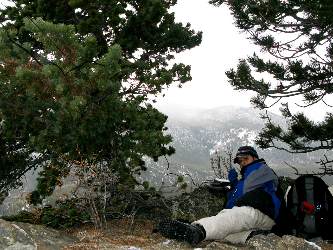
    Setting up the equipment and antenna took a little longer than usual – fiddling with  Buddipole coil-taps with cold fingers is not easy. I did not want to drop one into the snow. Turned on the SWR analyzer and…. nothing… lets hope it is just an empty battery. So I had to use the internal meter of the FT-817. Turned on the radio on 20m and I experienced S8 noise throughout the band… I am used to S8-S9 noise at home but on a summit? No clue why… I had activated several summits nearby and never before had an issue on 20. Two adjustments to the counterpoise and I was on the air, calling CQ 20 minutes ahead of plan. The temperature was below freezing and the wind ~15-20 mph (guesstimate). There was a small blue cloud and the sun tried to peak out every now and then but finally gave up, overwhelmed.
    Thanks to the high noise level, I could only hear strong stations. After 12 contacts on 20m in 25 minutes I had to wrap it up. My feet and hands started to get uncomfortably cold and I was shivering.

    The Descent:
    Soon after leaving the summit it got warmer. Getting out of the wind and moving my body certainly felt good. I soon found a faint trail and followed it all the way down directly to the car – a route I would recommend to the next activator.

    Some video impressions:
    httpvh://www.youtube.com/watch?v=PcCG2f8j5og

    If you would like to leave questions or comments, please do so through Youtube.

    I activated this summit again on January 10th, 2012. You can find the trip-report right here.


    ATTENTION !! WARNING !! There are old mountaineers, and bold mountaineers… there are no old-bold mountaineers. Hiking and mountain climbing are potentially hazardous activities particularly in Colorado with its extreme elevations. I am not accepting responsibility for any death or injury resulting from activations based on my trip reports. Proper training, experience, and personal capability assessment is required – enjoy!
  • WØC/FR-Ø37 (Twin Sisters Pk. East) – 11404 ft / 3476 m

    Twin Sisters Peak East (WØC/FR-Ø37) is located at the border of Rocky Mountain National Park (RMNP) and the Roosevelt National Forest, just a few short miles south from Estes Park. There is a new trail-head which is not marked on the relatively old USGS maps. The trail eventually joins the one on the map. The weather forecast was excellent (temps near record highs) – what a difference a week can make. During last week’s activation of Ypsilon Mountain (WØC/FR-ØØ9) in the same area we had single digits temperature (5-10 F or ~minus 20C) compared to upper 70s  (20-25 C) today. What made the trip even more enjoyable was the company of my wife.

    Trailhead: 9192 ft / 2386 m
    Summit:   11404 ft / 3476 m
    Elev. gain: 2939 ft / 896 m
    Roundtrip: 7.0 mi / 11.3

    Compare this summit with my other activated summits

    How to get there:
    Take US34 from Loveland towards Estes Park through Big Thompson Canyon. In Estes Park, take Highway 7 (S St. Vrain Avenue) to the Lily Lake area. The approx. seven mile drive is very scenic and represents the Estes Park area very well. Between mile-marker 6 and 7 (just across Lily Lake) take a left (east), bypass the visitor center and follow the dirt road up the mountain until the road ends. There is parking on the right side of the road only. Everything is marked very clearly and easy to find.

    Parking/Trailhead

    View Larger Map

    Red Tape:
    There are no fees, even-though the trail crosses RMNP area. No dogs are allowed on the trail.

    The Ascent:

    The Trail-head

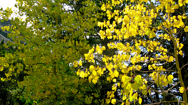
    The official trail-head is about 0.5 miles from the parking area on an old logging road with the usual trail-head signs and posters. From there, the well maintained trail leads in and out of NP land through a uniform (boring?) lodgepole forest with only scarce views of the surrounding mountains. The lodgepole pines are eventually replaced by  fir and spruce trees and patches of Aspens. Thanks to last week’s cold weather pattern, the leaves were already turning golden, creating a very

    Aspens in full fall colors

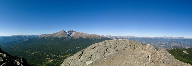
    nice contrasts in the early morning sun. The higher we climbed, the better the view of nearby Longspeak (14259 ft / 4346 m), Mt. Meeker (13911 ft / 4240 m) and Estes Cone (11006 ft / 3355 m). After reaching the treeline at approx 11000 ft / 3350 m, the Twin Sisters Peaks are visible for the first time. The trail above the treeline leads over a barren, exposed scree-laden path to the saddle between the West and East peak. Either summit can be easily reached. The last 30 ft elevation to the east peak requires some scrambling.

    The Summit:
    Besides the unobstructed views, the summit also provides comfortable  and wind-sheltered space to setup the equipment. There is ample space for several SOTA teams if necessary.

    View of Longspeak and Mt. Meeker from the summit

    We had the summit exclusively  for ourselves for about an hour. Then, the hikers started to come in thick and heavy. The number of established contacts was disappointing on 20m as well as 40m and 2m. I just made five contacts on the three bands even though the conditions were not bad at all.

    The Descent:
    After about two hours on the warm and sunny summit we descended the same way we came up.

    Some video impressions:

    If you would like to leave questions or comments, please do so through Youtube.


    ATTENTION !! WARNING !! There are old mountaineers, and bold mountaineers… there are no old-bold mountaineers. Hiking and mountain climbing are potentially hazardous activities particularly in Colorado with its extreme elevations. I am not accepting responsibility for any death or injury resulting from activations based on my trip reports. Proper training, experience, and personal capability assessment is required – enjoy!
  • WØC/FR-ØØ9 (Ypsilon Mountain) – 13514 ft / 4119 m

    Ypsilon Mountain (WØC/FR-ØØ9) is located in Rocky Mountain National Park (RMNP) and is part of the Mummy Range. The Mummy Range is a sub-range of the Front-Range of the Rocky Mountains and consists of six 13’ers (and a slew of lower ones). Starting with Mount Chapin in the south-west, it arcs to the north-east and ends with Signal Mountain. Some of the more prominent peaks are also SOTA summits. Ypsilon Mtn. was first activated about a month ago by N7UN (Guy) – here is his activation report.

    The trip was planned for Sunday and we got the first snow-fall of the season on the Wednesday before. Thus, the access road to the trail-head was closed by the Park-Service  on Thursday but re-opened on Friday. The weather forecast was great for Sunday, and even better – my wife was going to join me on this trip as well – all signs pointed towards a great trip.

    The original plan was to activate Fairchild Mountain (WØC/FR-Ø1Ø – 4115 m / 13502 ft) which is just a mile or two from Ypsilon Mountain. However, after reaching the steep ridge joining Ypsilon and Fairchild Mountain we reconsidered the plan for safety reasons. The amount of snow and ice on the ridge combined with the high winds (30-40 mi/h) made us abandon the plan and we climbed Ypsilon Mtn. instead.

    The first few peaks in the south-west of the Mummy Range can be reached from the Chapin Pass trail-head.

    Trailhead: 11041 ft / 3365 m
    Summit:   13514 ft / 4119 m
    Elev. gain: 3019 ft / 920 m
    Roundtrip: 7.34 mi / 11.8 km

    Compare this summit with my other activated summits

    How to get there:
    Take US34 from Loveland to Estes Park through Big Thompson Canyon. In Estes Park, stay on US34 and enter RMNP through Fall River Entrance Station. Just after Sheep Lakes, take a right onto Old Fall River Road – a one way dirt road going all the way up to the RMNP Alpine Visitor Center. The dirt road is in pretty good shape but be careful in some of the switchbacks if you do not have a high-clearance vehicle. Around mile-marker six, the trail-head is on the right side of the road and the car can be parked across the road. Space is limited to 10-12 cars max.

    Parking/Trailhead

    View Larger Map

    Red Tape:

    • RMNP charges an entrance fee of $20/car (valid for seven consecutive days). The usual passes are accepted as well. For details check their website.
    • Old Fall River road is a one-way dirt road which is often closed due to adverse weather conditions. You can check the road conditions on this website.
    • Few parking spots – you have to be early to claim your spot at the TH.
    • It is high country… weather conditions can change really fast. Afternoon lightning storms are not uncommon in summer.

    The Ascent:
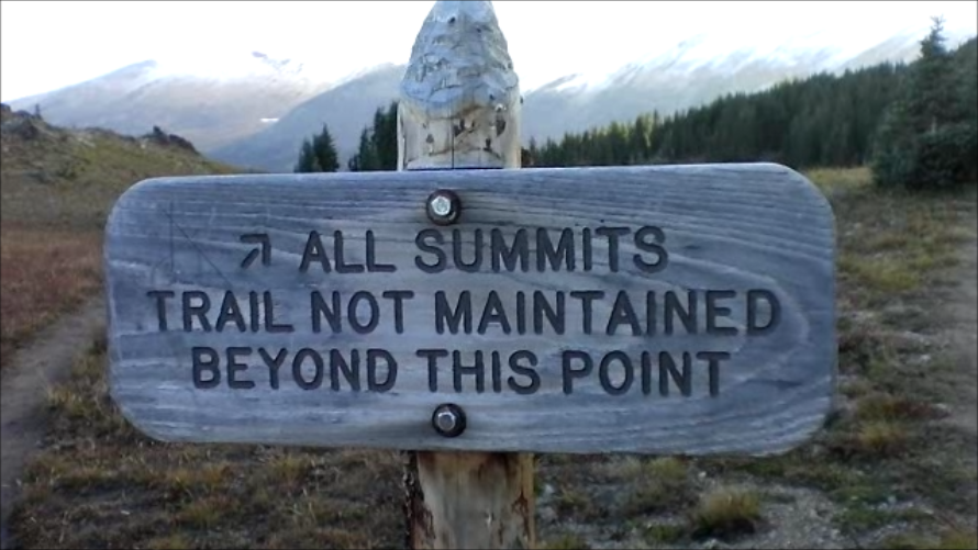
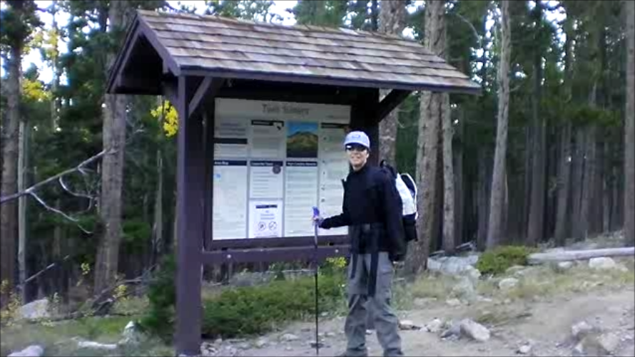
    The first section of the trail leads through large and mature pine trees. The trail is well established and clearly marked by NP signs. After reaching the treeline, a last sign  indicates

    To all summits

    the direction to reach ALL SUMMITS and the fact that the trail is not maintained beyond the sign. Nevertheless, it is quite easy to follow the rock-slide area to the saddle between Chapin (3795 m/12454 ft) and Chiquita Mountain ( 3983 m/13069 ft). Here we experienced the first snow on the ground and extreme winds on the saddle. We followed the trail up to the fake summit of Ypsilon Mtn. Walking upright and in a straight line was rough at times – the icy, howling wind felt like a thousand needles in the face and the summit was engulfed in blowing snow and ice crystals. It felt, sounded and looked more like an ascent to Nanga Parbat – but the GPS confirmed that we are still in Colorado. We tried to stay on the contour line leading directly to the ridge between Ypsilon and Fairchilk Mountain to avoid unnecessary elev gain/loss. A trail was no longer available/visible. The rocky and barren surface was covered by wind-pressed snow and ice. On several occasions I sank into deep snow-drifts well above my knees. However, the route is easy to pick – there are no obstacles to navigate.

    The Summit:
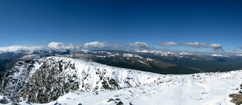
    The summit offers incredible views in all directions. It also provides two stone wind-shelters which were filled with drifting snow and could unfortunately not be used at all – leaving us exposed to the howling winds.

    Panoramic view from the summit

    Under normal circumstances the summit provides ample space to set up the equipment – however, the low temperatures (~10 to 15 F [-12 to -15 C] ) and high winds (~30-40 mi/h) made my teeth chatter (literally), and taking off the gloves was not something I was looking forward to either. Setting up the equipment for 15-20 minutes under this conditions was just not an option. In order to still be able to activate the summit and claim my SOTA points I used my HT on 146.52 MHz to quickly get some QSO’s. I wrapped it up within 5 minutes on the summit, took a few snapshots, put my gloves back on (trying to get the blood flowing in my fingers again ) and we headed downhills with the wind now in our face.

    The Descent:
    It was a quick retreat against the wind, following basically the same route. We had not had an opportunity yet to eat lunch, and we were looking for sheltered space. There was nothing until we reached the treeline – it was still cold but getting out of the wind after more than 5 hours was a nice change.
    To get back to Estes Park, we had to follow the Old Fall River Road up to the Alpine Visitors Center of the RMNP. From there we took Trail Ridge Road east – a quite scenic drive through the heart of the Rockies.

    Some video impressions:
    The weather conditions were not ideal to take a lot of photo/video shots. I only have a few clips when the wind was not too bad.
    httpvh://www.youtube.com/watch?v=-K1YZeKOido

    If you would like to leave questions or comments, please do so through Youtube.


    ATTENTION !! WARNING !! There are old mountaineers, and bold mountaineers… there are no old-bold mountaineers. Hiking and mountain climbing are potentially hazardous activities particularly in Colorado with its extreme elevations. I am not accepting responsibility for any death or injury resulting from activations based on my trip reports. Proper training, experience, and personal capability assessment is required – enjoy!