SOTA outings by KØMOS and contributors

Tag: Buddipole antenna

  • WØC/FR-Ø39 (Estes Cone) – 3348 m / 11006 ft – 2nd activation

    This was a re-activation for me. If you are looking for all the details on how to get there and other useful info, you can find the original trip-report with the necessary details right here. This post has only a few specifics from today’s activation.
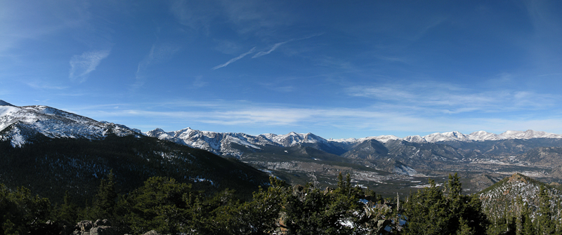
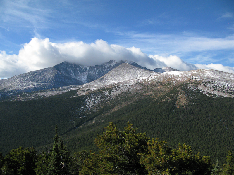
    Estes Cone: View of RMNP from the summit

    After two days of high winds here in northern Colorado (I clocked 45 mph winds in my back yard – the news reported even higher winds in the mountains of up to 75 mph gusts) the weather forecast for today was excellent. I woke up to 17 degrees F (~minus 8 C) and blue skies. Since everybody in the family had the day off, I was joined by my wife and my daughter – making this a fun family affair. We left the house at nine o’clock with the goal of being at the trail-head of Estes Cone by 10, and on the air by noon local time (or 1900UTC). That’s how I announced my activation on SOTAwatch.org. Since today was a federal holiday, traffic was minimal and the mostly dry roads allowed me to pass through Big Thompson Canyon rather quickly. Nevertheless, we  arrived at the TH 15 minutes later  as expected because I underestimated the time it took to drive from Estes Park to the trail-head.
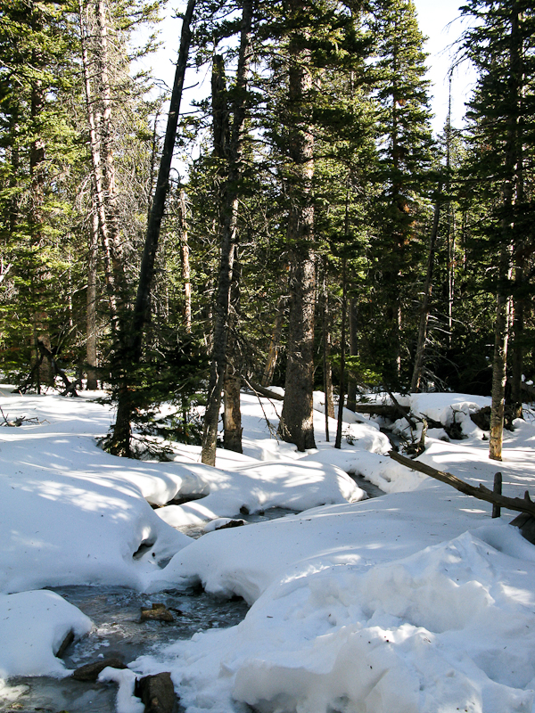
    Estes Cone: On the way up

    Determined to keep my ‘appointment’ on the summit, I shouldered my pack and headed towards the mountain – splitting up our ‘activation team’. My seven year-old cannot yet keep up with me in deep snow and we planned to re-join later somewhere on the trail after the activation.

    There were two chances for an S2S contact today, one with VA2OTA on HF and the other with KF6LHX (Tim) who was activating WØC/PR-Ø14 near Breckenridge on VHF – that’s only 70 miles (~115 km), I covered larger distances on my HT before. On my way up, I was able to copy KT5E on 2m saying:”Your are Summits on the what?” and knew immediately that Tim was OTA. I was unable to contact him directly however. I was still in the valley and surrounded by trees and mountains.  I contacted KT5E and he relayed my message to Tim. By the time I arrived on ‘my’ summit he had already moved on – you can’t stay too long at 14236 ft (4339 m) in winter.
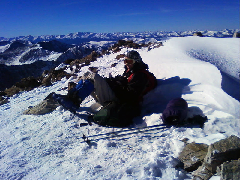
    Photo by Tim – KF6LHX

    You can find Tim’s trip-report on the SOTA reflector and see Tim’s PQL (Personal QSO Logger) shivering at high elevation on the right. Back home I learned that VA2OTA’s activation was cancelled due to bad weather – so that took care of all the S2S contacts possibilities for today.

    Today I looked a little closer at the topography between Quandary Peak and Estes Cone to see whether a contact would have been feasible… it does not look promising (see below):
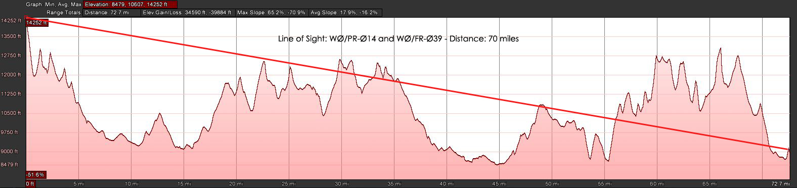
    Estes Cone: LOS to Quandary Peak (click for larger view)

    It took me an hour and 45 minutes to hike the three miles (~4.5 km) and 2000 ft (~600 m) of elevation through about two feet of (mostly) packed snow. I reached the summit at 11006 ft (3348 m) on-time and logged my first QSO at 19:00 UTC. The wind was blowing pretty strongly and I setup my equipment under the same rock formation than last time – about 30 feet below the summit. That blocked my signal towards the East and South-East but made the high winds a lot more bearable. The views from up here are spectacular. Longs Peak (4344 m / 14255 ft ) and Mt.Meeker (4240 m / 13911 ft ) at a close range (~4 miles / 6.5 km as the crows fly) and the snow-covered Mummy Range with several 13000+ ft (~4000 m) summits towards  the NNW are all within view. On the other side, one can spot beautiful Lily Lake and in the distance Estes Park.

    I tuned the antenna for 17m and started calling CQ. N4EX (Rick) was the first who answered my call on HF and he spotted me as well (thanks Rick). I was forced to move to another frequency after my 12th QSO since some other HAM’s decided to settle on ‘my’ frequency – they did not react to any of my calls and I could not get any other contacts on 17m. Since my extremities started to feel cold, I was tempted to wrap it up and head out of the cold wind. Instead, I opted to give it a try on 20m and re-tuned the antenna, looked for a free frequency and started to announce my presence… no takers after five minutes on this band… time to pack-up and move my body to get warm.
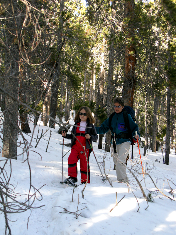
    Estes Cone: In the woods

    I was pretty much running/sliding down the south-westerly facing route to catch-up with the rest of the family. I found them just below the saddle, singing Christmas songs while trudging through the trees on their snow-shoes.

    I was a perfect day in the mountains and it felt great to burn some of the calories which had accumulated around my waist over the holidays – too bad I could not reach Tim for a S2S.

    Some video Impressions:
    httpvh://www.youtube.com/watch?v=NFeMLIAqpdA

    If you would like to leave questions or comments, please do so through Youtube.


    ATTENTION !! WARNING !! There are old mountaineers, and bold mountaineers… there are no old-bold mountaineers. Hiking and mountain climbing are potentially hazardous activities particularly in Colorado with its extreme elevations. I am not accepting responsibility for any death or injury resulting from activations based on my trip reports. Proper training, experience, and personal capability assessment is required – enjoy!
  • WØC/FR-Ø58 (Emerald Mountain) – 2810 M / 9237 ft

    I got up at 6:00 AM this morning, facing a moderate 18 degrees F (approx. -8C) and clear skies outside – just a sliver of the moon and clouds over Longs Peak towards the west. A winter storm warning was issued for later in the day, but I thought I had enough time to activate WØC/FR-Ø58 (Emerald Mountain). The dogs were not too excited to go for a walk in the dark and at these freezing temperatures – but I guess they were relieved that they did not have to join me on the mountain.
    The drive up through Thomson Canyon followed the frozen river all the way up to Estes Park. Entering Estes Park through US34 always presents a perfect overview of the surrounding mountains. Even though I was still driving under clear skies, clouds were settling in the mountains in every direction – guess the weather forecast had not lying.

    Trailhead: 8244 ft / 2513 m
    Summit:   9237 ft / 2810 m
    Elev. gain: 1245 ft / 380 m
    Roundtrip: 2.2  mi / 3.5 km

    Compare this summit with my other activated summits

    How to get there:
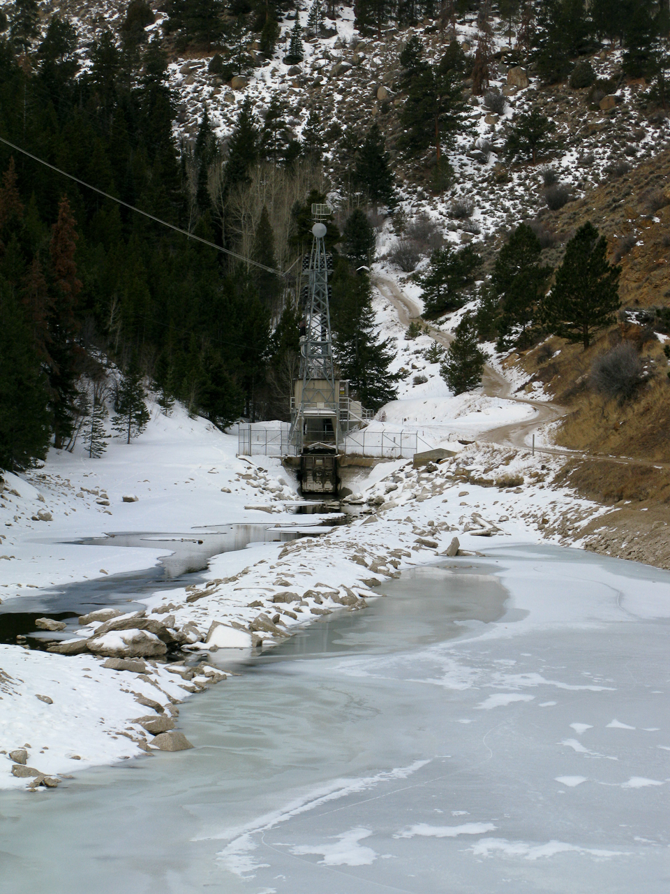
    Take US34 from Loveland towards Estes Park through Big Thompson Canyon. Emerald Mountain is on the south-west side of Estes Park. Stay on US34 towards Rocky Mountain NP. Go left on County Road 66 (or Tunnel Road), following the signs to the YMCA campus. Follow the road all the way to the end. There is a campground at the very end – so is the East Portal of the Big Thompson Project Pipeline. Park your car at the loop of the road (there is room for about 10 cars on a gravel strip at the south side of the loop.

    Parking/Trailhead

    View Larger Map

    Red Tape:

    East Portal

    At the East Portal of the Big Thompson Project Pipeline is a small (really small) reservoir – and the surrounding area is Federal property. You are not supposed to park, fish, boat, pee etc. within 100 yards of the dam – Homeland security and such. Emerald Mountain is – at least partially – within the RMNP, ergo it is a fee area and their rules apply (no dogs etc.) I am not sure about RMNP entry fees… since the trail starts outside of the park, I think you are not required to have a NP pass. I have a yearly pass anyway and did not investigate this aspect so far.


    The Ascent:

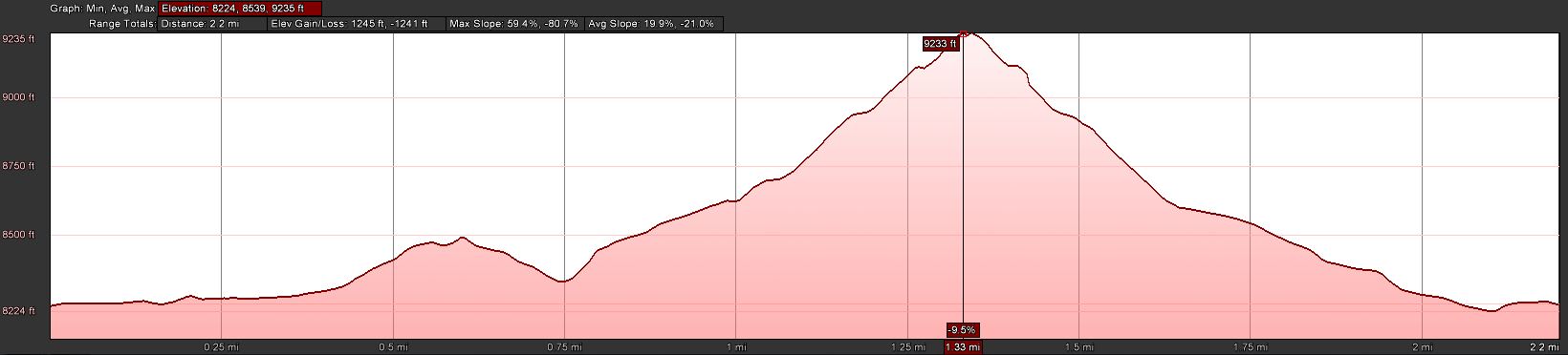
    Elevation Profile

    I selected the south face of the mountain for my ascent. It can be tackled from almost any side but I was hoping that the south would  have less snow compared to the other options. In addition, for part of the way I could use a trail going from the East Portal TH to the Glacier Basin campground in RMNP. I just passed the reservoir of the East Portal when I realized I forgot my camera in the car… so I turned around to get it. That is when I broke my sun-glasses… not that I needed them today but still… #$@%. Walking back to the reservoir, snow flurries started to fall and a stiff wind came up from the west. I continued the road uphills when a Jeep drove towards me, driving downhills but backwards? It was  Sam, a RMNP Ranger patrolling ‘his’ park. We talked for almost half an hour. He was very interested in SOTA and I was interested in his insider’s know-how of all the different routes to SOTA summits in the park and around Estes Park. We finally parted ways and I headed uphills in a (almost) straight line, trying to make up for lost time to keep my appointment on the summit. Luckily the south face was almost snow free – even better, the soil was frozen and I made good time. Every now and then, I could even see a faint trail going up the mountain.

    The Summit:
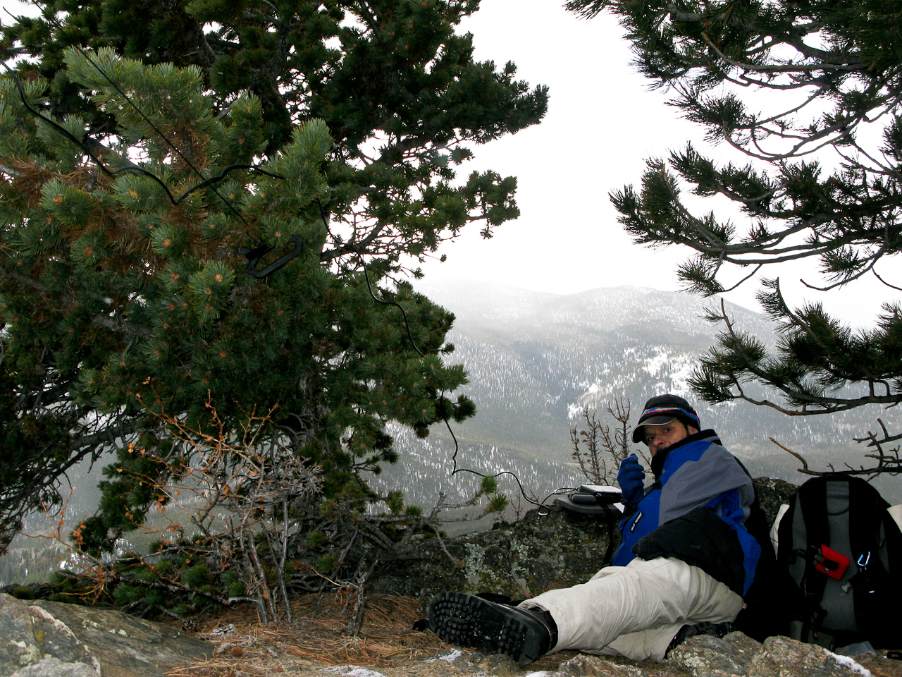
    The summit is rather small. I pretty much used up most of the space with my antenna guy-lines. It could host two small teams of activators. There are some rocks which can provide shelter from the wind – unfortunately the lee side was filled in with a deep snow drift. I had about six inches of snow on the top with some clear areas under (Christmas) trees – I claimed this spot immediately as my operating position.

    Operating position

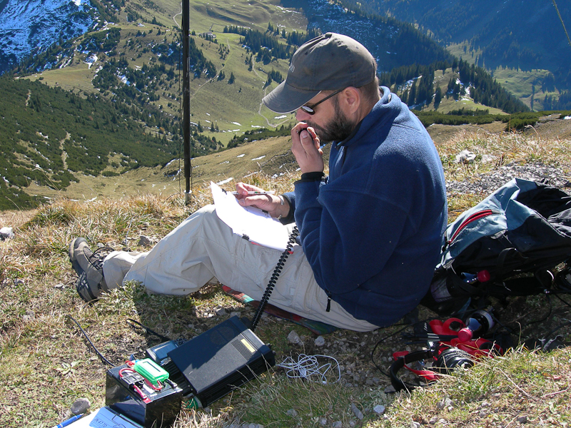
    Setting up the equipment and antenna took a little longer than usual – fiddling with  Buddipole coil-taps with cold fingers is not easy. I did not want to drop one into the snow. Turned on the SWR analyzer and…. nothing… lets hope it is just an empty battery. So I had to use the internal meter of the FT-817. Turned on the radio on 20m and I experienced S8 noise throughout the band… I am used to S8-S9 noise at home but on a summit? No clue why… I had activated several summits nearby and never before had an issue on 20. Two adjustments to the counterpoise and I was on the air, calling CQ 20 minutes ahead of plan. The temperature was below freezing and the wind ~15-20 mph (guesstimate). There was a small blue cloud and the sun tried to peak out every now and then but finally gave up, overwhelmed.
    Thanks to the high noise level, I could only hear strong stations. After 12 contacts on 20m in 25 minutes I had to wrap it up. My feet and hands started to get uncomfortably cold and I was shivering.

    The Descent:
    Soon after leaving the summit it got warmer. Getting out of the wind and moving my body certainly felt good. I soon found a faint trail and followed it all the way down directly to the car – a route I would recommend to the next activator.

    Some video impressions:
    httpvh://www.youtube.com/watch?v=PcCG2f8j5og

    If you would like to leave questions or comments, please do so through Youtube.

    I activated this summit again on January 10th, 2012. You can find the trip-report right here.


    ATTENTION !! WARNING !! There are old mountaineers, and bold mountaineers… there are no old-bold mountaineers. Hiking and mountain climbing are potentially hazardous activities particularly in Colorado with its extreme elevations. I am not accepting responsibility for any death or injury resulting from activations based on my trip reports. Proper training, experience, and personal capability assessment is required – enjoy!
  • WØC/FR-198 (Peak 978Ø) – 2428 M / 798Ø ft

    There was a winter storm watch in effect for later in the day… hard to believe in light of the unusually warm weather in the morning. To get another SOTA peak on my record before the next snow arrives, I picked an unnamed peak WØC/FR-198 (798Ø) in the Poudre Canyon. The peak is located between Young’s Gulch, a popular hiking/biking area, and CO Rd 27 (Stove Prairie Road). It is part of the Front Range of the Rocky Mountains  and is managed by the Roosevelt National Forest.
    Since there is no trail to the summit, I had been wondering about the best way to bushwhack my way up there. There is private property on the south side of the mountain and the approach from the Canyon is too steep (well, it’s a Canyon after all). The approach from the west (Stove Prairie Road) seemed to be short but steep and appeared to be in wooded area. The approach from the east however seemed to be more open and it allowed me to use the hiking/biking trail into Young’s Gulch (along a creek) for a while, with some bushwhacking later in the trip over the south-easterly ridge. Even-though this route was substantially longer, I opted for it, specifically considering the approaching winter storm with forecast high winds out of the west – I would be better protected. Winter storms in the Rockies and Foothills can be fast and furious.

    Trailhead: 5848 ft / 1782 m
    Summit:   7980 ft / 2432 m
    Elev. gain: 2851 ft / 869 m
    Roundtrip: 7.5 mi / 12.1 km

    Compare this summit with my other activated summits

    How to get there:
    Take US287 N from Fort Collins towards Wyoming. Go west  at Ted’s Place on CO14. You will find a sign for the Young’s Gulch TH around mile 13 into the Canyon on the south side of the road. The section between CO14 and the parking lot is in very bad shape. Luckily it’s only about 100-200 yards but some of the pot-holes are  huge. The parking lot is quite big and was completely deserted.  The usual TH signs, warnings and maps can be found, but no potable water, toilet etc.

    Parkinglot/Trailhead

    View Larger Map

    Red Tape:
    It’s a very dog friendly trail, one of the few trails in the Poudre Canyon where you are allowed to let your dogs run off leash. That’s one of the reasons why this trail is very popular on week-ends. Be prepared  to encounter quite a few people/dogs/mountain bikers in summer and on week-ends.


    The Ascent:

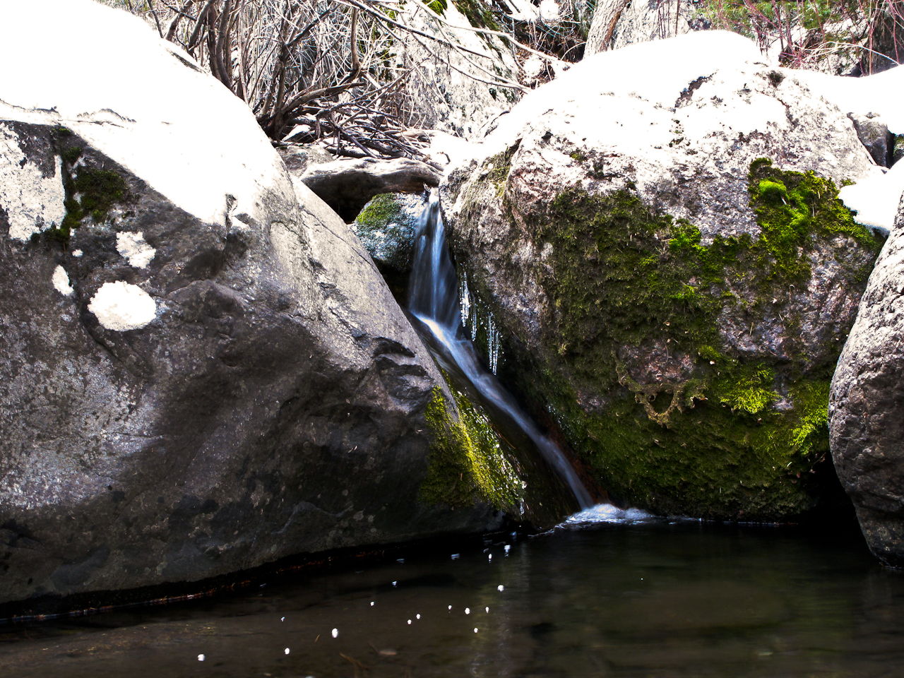
    Icy waters

    The first part was easy to navigate since there is a trail, following a shallow creek. I had to cross the creek every once in a while (approx. 20 times). The (very) low water level in winter keeps your feet dry. The larger problem was the fact that the trail was quite icy. This time of the year the sun can’t reach the ground in the narrow gulch anymore. I was happy that I decided against using my mountain bike for the first part and that I carried my hiking poles – they saved my behind several times.
    I was looking for the ridge I determined on Google Earth to start the bushwhacking portion of the trip. The dense forest did not really help and I finally headed uphills, thinking that I clearly identified the correct spot. Looking at the GPS tracks back home, I missed it by a narrow margin and I sure payed for that mistake. As soon as I got out of the trees, I crossed large areas of mountain mahogany which disappeared higher up leaving me with steep rock outcroppings and the ground covered with cacti and other poky stuff. The views were great though…

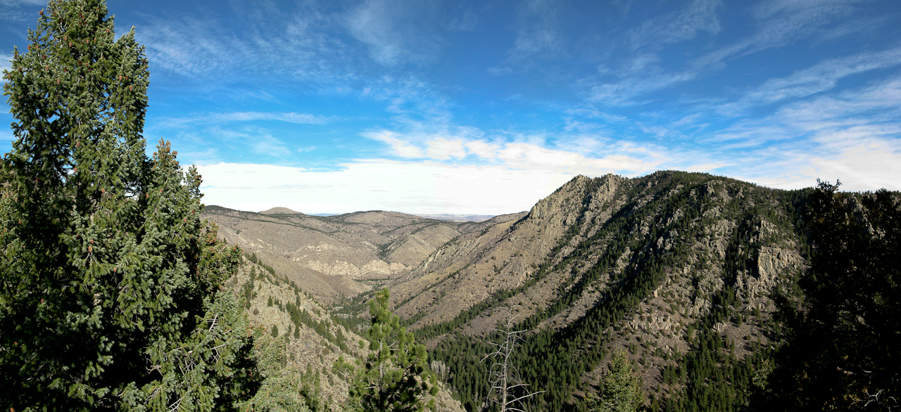
    View towards the Poudre Canyon

    I was not willing to give up all the elevation gain and pressed on uphills, looking for a route through the outcroppings – which I finally found. From up there I could see the summit for the first time… and it was still a lot of ground to cover. The good news was that the weather was still nice and warm and that the terrain was free from large trees and other obstacles. Another 1.5 miles of bushwhacking and two more false summits brought me to  WØC/FR-198.

    The elevation profile
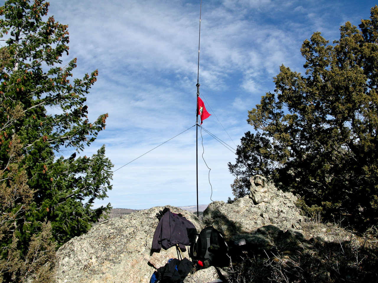
    Setup on the summit

    The Summit:
    The summit is large enough to host several activators if necessary. The views are limited due to the relatively low elevation. Some nice/unusual views can be had towards the north-east, looking down into the Canyon. I found some nice trees close to a large drop towards the east to help me guy the antenna. I spend most of my time on 10m until John (WB3LTT) relayed a message from Phil (NS7P) – a very active SOTA chaser/activator – indicating that he cannot copy me on 10m. So I reconfigured my Buddipole antenna for 20m for some more QSOs. Just around 1PM (MST), the wind picked up suddenly as if somebody had turned on a switch. I saw that as a sign that the winter storm was approaching fast and since all the chasers seemed to be satisfied, I started to pack up and head down.

    The Descent:

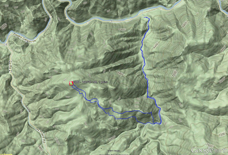
    The route I took

    I was looking for a better route to avoid the steep rock-outcroppings I had encountered on the way up. I found the ridge I was planning to take on my way up and forced my way through dead trees and thick brush – nothing I really enjoyed. Not sure whether it would be an better alternative to get to summit – maybe the westerly approach is no so bad at all. After a lot of swearing (if a man swears in woods and nobody is there, does it still make a sound?) I reached the bottom and followed the little creek towards east – the direction where I expected to meet the Young’s Gulch trail – which I eventually found. The way back to the trail-head/car seemed to be a lot longer than on my way up –  a clear sign that I was tired after five hours of bushwhacking but I got my SOTA point and another first.

    BTW, the winter storm arrived during the night as predicted and left us with a foot (~30 cm) of fluffy snow  in Fort Collins :)

    Some video impressions:

    httpvh://www.youtube.com/watch?v=bzaWovHJ0IM

    If you would like to leave questions or comments, please do so through Youtube.


    ATTENTION !! WARNING !! There are old mountaineers, and bold mountaineers… there are no old-bold mountaineers. Hiking and mountain climbing are potentially hazardous activities particularly in Colorado with its extreme elevations. I am not accepting responsibility for any death or injury resulting from activations based on my trip reports. Proper training, experience, and personal capability assessment is required – enjoy!
  • WØC/FR-Ø50 (Lily Mtn.) – 2977 m / 9786 ft

    On Tuesday we got a foot (~30 cm) of snow  down here in Fort Collins, and at least as much in the mountains.  The weather forecast predicted nice and sunny weather for Thursday and Friday, before a another chance of nasty weather for Saturday (typical Colorado fall weather). So for Friday, I picked Lily Mountain (WØC/FR-Ø50) – a short 4 mile (~6.5 km) round-trip – for my next activation.  This summit is right next door to last week’s activated Estes Cone (WØC/FR-Ø39), just a few miles outside Estes Park and the Rocky Mountain National Park (RMNP), and should provide some pretty nice views of the surrounding mountains, covered in fresh snow. I grabbed my snowshoes, Sorels, Pulka and other winter gear and headed to the mountains.

    Trailhead: 8799 ft / 2682 m
    Summit:   9786 ft / 2983 m
    Elev. gain: 1684 ft / 513 m
    Roundtrip: 3.4 mi / 5.5 km

    Compare this summit with my other activated summits

    How to get there:
    Take US34 from Loveland towards Estes Park through Big Thompson Canyon. In Estes Park, take Highway 7 (S St. Vrain Avenue) to the Lily Lake area (turn left). The trail-head is approximately at mile-marker 6, just after passing through some rock cuts made for the road. It is not well marked and in on the right side (west) of the road (coming from Estes Park). If you pass Lily Lake, you missed it – but make sure to take a look at the very scenic Lily Lake area to make the detour worth your while.

    Parking/Trailhead

    View Larger Map

    Red Tape:

    Lily Mountain TH

    The trail-head has only room for a few cars (approx. 5-6). There is more room further up in the Lily Lake area and you can walk back to the trail-head (~ half a mile). There are no facilities, water, maps or anything like that… just a sign indicating that you are indeed at the Lily Mtn. TH. Lily Mtn. is part of the Roosevelt National Forest and all their rules apply. It is one of the few trails near Estes Park which is not on NP land – it is therefore a popular hike for dog-owners. There is cell-phone coverage all the way up to the mountain… so make sure to turn it off for an undisturbed experience.

    The Ascent:

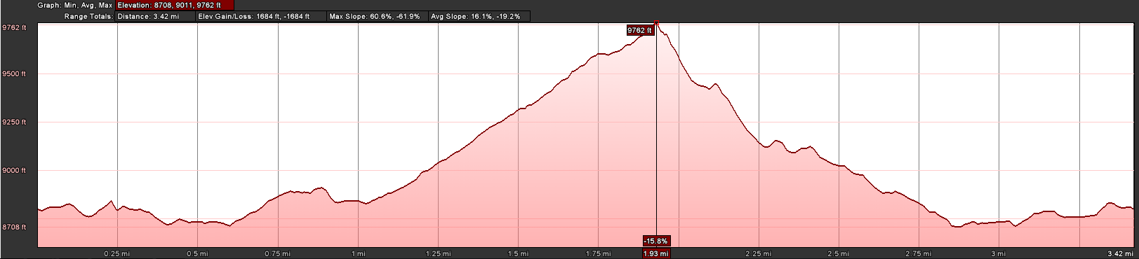
    The Elvation Profile

    Based on the snow situation at the trail-head, I opted for hiking boots/gaiters instead of Sorels and snowshoes. Even though the snow got deeper and deeper reaching higher elevations, I still think it was a good decision based on the terrain.  It was easy to follow the trail at first, I could even follow some tracks made by a hiker ahead of me until his tracks deviated too much from my plotted route to the summit. On the first half of the trail, I hardly gained any elevation – an indicator that it will get quite steep at some point (see elevation profile above). The trail parallels the highway which can be occasionally seen (and heard) until the trail turns sharply to the south-west. That’s where I got deeper in the woods, on steeper terrain and in deeper snow which made it hard and sometimes impossible to follow the trail. The GPS with the necessary way-points sure helped me find the way up to the top. The final several hundred feet to the summit requires the use of all of your extremities to get up and during the last ~30 ft (10m) of elevation you have to do some climbing moves to get to the top of the rock-outcropping where the summit is.

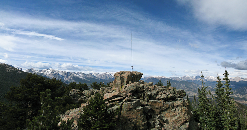
    The Summit:
    The first thought was: “wow – what a view…” and the second was: “careful” – since the summit is not very large and the snow and ice on-top made it even smaller to move around safely.

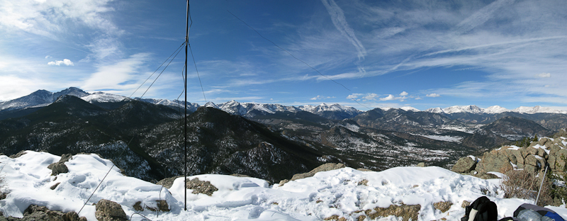
    Panoramic views from the summit

    The weather was cooperating very nicely, there was hardly any wind and the sun on my back warmed me up to a comfortable temperature, even without wearing all my jackets. First, I took some pictures and enjoyed a cup of hot tea, before setting up the equipment. The small size of the summit with the very steep cliff made it difficult to anchor the guy-lines properly. Nevertheless, I felt comfortable with the setup since there was only a light breeze. Naturally, that turned out to be a false sense of security… a sudden gust knocked down the antenna during my QSO with Tom (KZ7ZZ ) – and I lost him for a minute (sorry Tom).

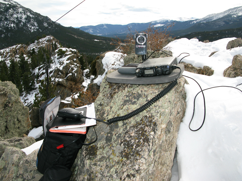
    FT-817ND on the summit

    Luckily I was able to catch the mast before it tumbled down the cliff. The fact that I was using a shock-corded whip (instead a ‘normal’ whip) for my vertical Buddipole saved me from buying a replacement whip (again). After rectifying my mistake, I not only had contacts with the regular SOTA chasers (thanks guys), but also talked to some folks who had never heard of SOTA before. Hopefully I sparked an interest for SOTA with these HAMs. I made contacts on 20m and 10m, the highlights certainly the QSOs with CM6FJJ (Javier in Cuba) and KP4/NØAX currently on a DXpedition in Puerto Rico (~4500 km), all with 5W into a BP.

    The Descent:

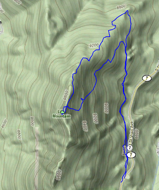
    The route I took

    I wanted to avoid to climb down the steep cliff I came up. Therefore I was looking for an alternate route down the summit. Unfortunately I missed my tracks at the bottom of the summit and had to bushwhack (snow-whack?) my way down to the TH, making it a much steeper route than planned (see route on the right). The snow and ice covered rocks and dead trees did make for a challenging descent.

    Nevertheless, it was a great day to activate a summit – quite warm conditions, with incredible views into the snow covered mountains in and around the Rocky Mountain National Park.

    Some video impressions:
    httpvh://www.youtube.com/watch?v=xvbF-zQnYNk

    If you would like to leave questions or comments, please do so through Youtube.


    ATTENTION !! WARNING !! There are old mountaineers, and bold mountaineers… there are no old-bold mountaineers. Hiking and mountain climbing are potentially hazardous activities particularly in Colorado with its extreme elevations. I am not accepting responsibility for any death or injury resulting from activations based on my trip reports. Proper training, experience, and personal capability assessment is required – enjoy!
  • WØC/FR-Ø39 (Estes Cone) – 3348 m / 11006 ft

    It’s NA SOTA Day!  Since I just returned from an overseas trip the day before, I was looking for an activation which does not need a lot of planning. So I went out  to activate Estes Cone (WØC/FR-Ø39) which is located at the border of Rocky Mountain National Park (RMNP) and Roosevelt National Forest, just a few short miles south from Estes Park. The trail-head is shared with the Longs Peak trail-head. Due to the popularity of Longs Peak (WØC/FR-11Ø – 14259 ft / 4346 m) in summer, the parking lot fills up (very) quickly in the morning.  The weather forecast was calling for a sunny day. The freezing conditions at the TH combined with the altitude and winds  were an indicator for a chilly activation.

    Trailhead: 9537 ft / 2907 m
    Summit:   11006 ft / 3348 m
    Elev. gain: 2000 ft / 610 m
    Roundtrip: 6.0 mi / 9.7 km

    Compare this summit with my other activated summits

    How to get there:
    Take US34 from Loveland towards Estes Park through Big Thompson Canyon. In Estes Park, take Highway 7 (S St. Vrain Avenue) to the Lily Lake area. The nine mile drive is very scenic and represents the Estes Park area very well. Right at mile-marker 9, turn right (west) onto Longs Peak Road  and follow the road up the hill until the parking lot/trail-head/Ranger station. Everything is marked very clearly and it is easy to find.

    Parking/Trailhead

    View Larger Map

    Red Tape:
    There are no fees, even-though the trail is on RMNP area. No dogs are allowed on the trail. Parking lot fills up quickly in summer early fall due to the popular Longs Peak hike.

    The Ascent:

    Estes Cone as seen from the road

    From the trail-head, you follow the trail to Longs Peak. It’s well marked and the trail is in great shape. The moderate ascent leads you though mainly pine forest with very few openings. After approx. half a mile, it splits from the Longs Peak trail – keep right towards Estes Cone. The trail continues through conifers until you encounter a small creek. A wooden bridge is provided to keep your feet dry. On the opposite side of the creek is an old and abandoned gold mine (Eugenia Mine). Based on a sign on the remaining log cabin, it was not a very productive endeavor.
    Shortly after the mine you will reach the Moore Park back-country campsite at about 9730 feet (2966 m). The trail gets steeper and most of the net elevation gain is in the last 1.0 miles. You will notice the change in pace after the last split of the trail. Now it is not just steep, but also rocky and harder to navigate, since a clear trail is no longer visible. Just follow the stone cairns – there are a lot of them. Still, sometimes they are hard to spot.
    You can reach the very top of the cone by scrambling up a scree.

    The Summit:
    The 360-degree views from the top are stunning. Nearby Longs Peak and Mt. Meeker had a cloud cover and the wind was blowing hard from north-west, making it a chilling experience. I had to wear all of  the clothes I had carried up. I took a few quick photographs/videos ‘balancing’ at the top, when a strong gust blew  my baseball cap down into the trees – so much for leaving no trace. I decided to take advantage of the activation zone defined by the SOTA rules by climbing down ~25 feet, looking for a sheltered spot to setup my gear. I found a good spot on the lee side of the mountain. Perched like a bird, I sat under some big rocks which made the cold wind bearable.

    I was perched under these rocks to get out of the wind – Buddipole as high as possible

    The setup was made quickly, even-though it was quite steep and I had to make sure not to loose more equipment. I did not dare to get the solar panel out since the wind was still blowing at about 20-30 miles/h. I was joined by a chipmunk after a while – he was not shy at all and was running over my FT-817 and tried his teeth on the rubbery cord of the microphone. That’s when he crossed the line with me and I had to send him home to his tree. The wind died down a little after 12:00 o’clock making the experience a little warmer and nicer. Another hiker was quite interested in my activities. Overhearing my QSO with Ws1K in MA (~1800 mi / 2900 km), he was impressed to hear that this was possible with just 5 W.

    View of Longs Peak and Mount Meeker

    The Descent:
    After spending more than two hours under my rock, I felt kind of stiff and packed up my gear and headed down the same way I came up. I had been successful in activating a new summit (first activation) and collect my points.

    Some video impressions:
    httpvh://www.youtube.com/watch?v=6nFI1NCkRsc

    If you would like to leave questions or comments, please do so through Youtube.

    I activated this summit again on January 2nd, 2012. You can find the trip-report right here.


    ATTENTION !! WARNING !! There are old mountaineers, and bold mountaineers… there are no old-bold mountaineers. Hiking and mountain climbing are potentially hazardous activities particularly in Colorado with its extreme elevations. I am not accepting responsibility for any death or injury resulting from activations based on my trip reports. Proper training, experience, and personal capability assessment is required – enjoy!

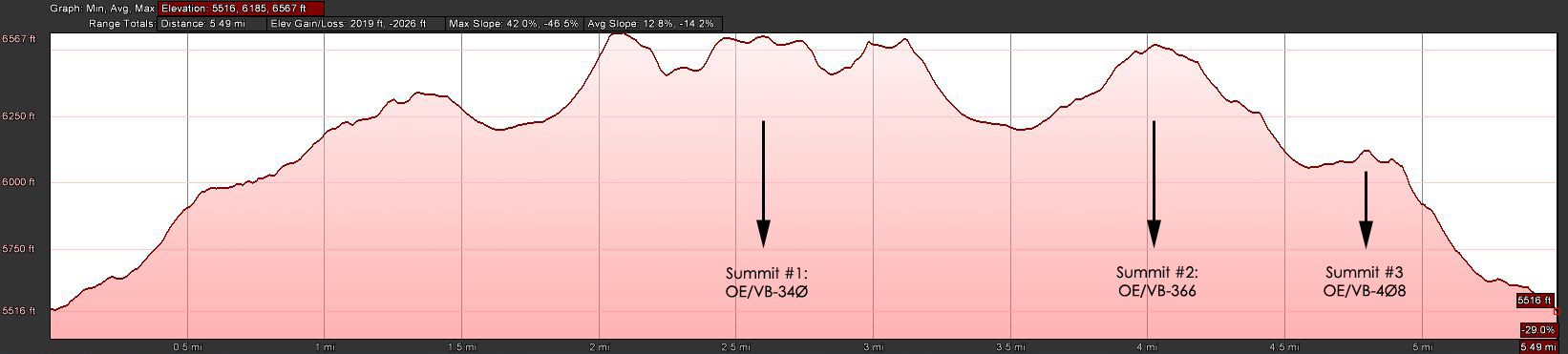
  • Triple Activation: OE/VB-34Ø, OE/VB-366 and OE/VB-4Ø8

    For the last day of my Austrian SOTA activation adventure I contemplated several options. I finally settled on a route suggested by Herbert (OE9HRV), who was an incredible useful source for all my activations here in OE land (check out the other OE trip reports). The route included three peaks, Sünser Spitze (OE/VB-34Ø) – Portlerhorn (OE/VB-366) – Portlerkopf (OE/VB-4Ø8), each awarding 8 points. This seemed to be an adequate finale for my time here. The weather forecast was excellent and I was joined by my wife and brother in law. The only caveat… we had to catch a train at 16:05 local time. To stay within this time-frame, the plan was to hike to the Sünser Spitze first (highest of the three peaks), activate this summit on my HT (VHF) to save some time (setup and break-down of HF equipment) and hike down and along the ridge to the remaining two summits for a VHF and HF activation and still catch the train.

    Elevation Profile (click for a larger view)

    Trailhead: 5522 ft / 1683 m
    Summit:   6765 ft / 2062 m
    Elev. gain: 1999 ft / 600 m
    Roundtrip: 5.6 mi / 9 km

    Compare this summit with my other activated summits

    How to get there:
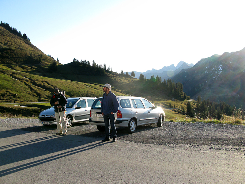
    The shortest route from my temp. QTH was to take L51 west, from the medieval town of Feldkirch towards the Furka-Pass. It’s a small winding road, single lane for the latter part, and going through some beautiful country side. The trail-head is shortly after the Furkajoch.  We parked the car on a gravel  strip on the right side of the road.

    Parking/Trailhead

    View Larger Map

    Red Tape:
    The road (L51) might be closed in winter.
    The gravel strip has room for approx. 10 cars.

    The Ascent:

    At the TH

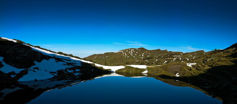
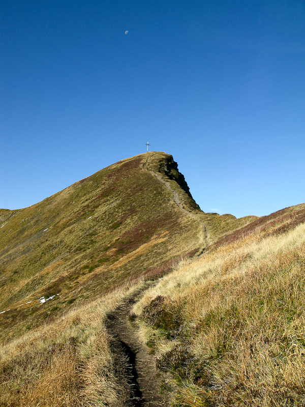
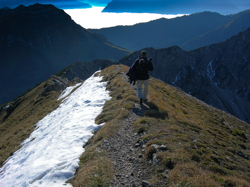
    The ascent hast no big challenges. Like all the other trails around here, they are well marked with frequent signs leading you in the right direction. The first part led up to an alp over a dirt road. The trail went through a few buildings, which were abandoned for the upcoming winter season. Just an old Pinzgauer was sitting in front of one of the buildings. A short but steep section led us from the alp to a saddle from where we could see all three summits for the first time. From here you have two options to continue – we selected the trail splitting to the right, slightly uphills towards the ridge between the Portlerhorn and the Portlerkopf, to avoid loosing any altitude we already gained. We got great views looking back towards the Furkapass and the surrounding mountains. We reached the top of the ridge right at a small lake with the first summit in the background.

    Lake with Sünser Spitze

    Continuing along the ridge, we reached another signpost before tackling a pretty steep section up to the ridge between the  Sünser Spitze and the Ragazer Blanken.

    The final steps to the summit

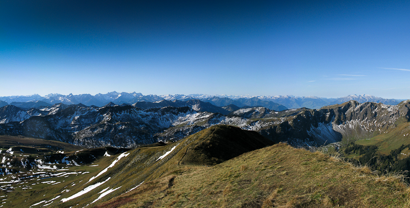
    Towards the east we could see the summit-station of the ski-area of Damüls and towards the west we enjoyed the snow-covered Swiss-Alps. At this point we had made most of the elevation gain towards this summit. The rest of the trail followed very closely the top of the ridge before a last steep section left us breathless reaching the summit. I am claiming that the views were responsible for being out of breath – others disagree. Lake Constance was clearly visible to the north-west of us. At the south end of the lake… the town of Bregenz. This was my best bet on getting my contacts quickly on 2m .

    The Summit:

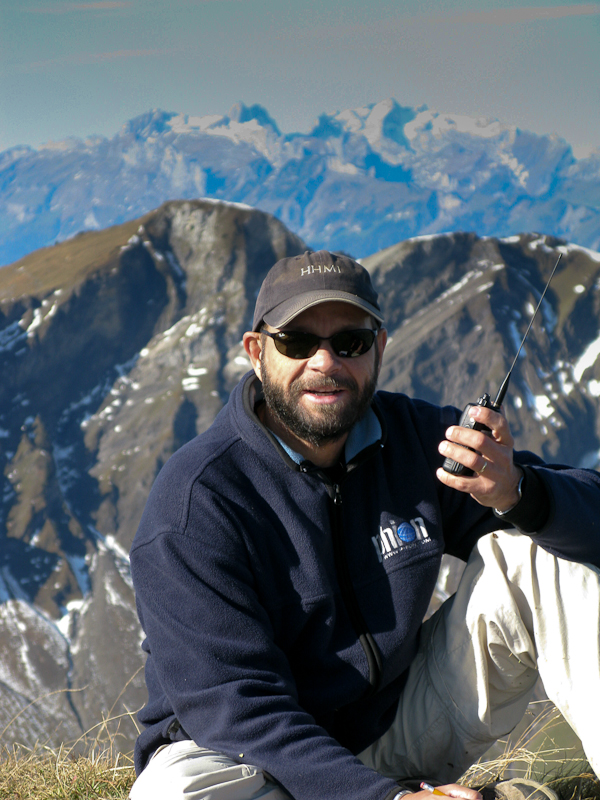
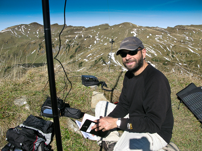
    KØMOS on the summit

    The summit has a sharp drop-off towards the north and the usual wooden cross with the summit register. It was still chilly, mainly due to the stiff breeze from the north. My call on 145.5 MHz was quickly answered by OE9GWI (Gerhard). His spot on SOTAwatch drummed up all the support I needed for this summit, including a contact with a Swiss station (HB9AGH – Ambrosi). It was a nice and unexpected contact with a station in Zürich where I had lived and worked for over 10 years. The activation lasted only 20 minutes and we could move on to the next summit but not before taking some snapshots and  enjoying some warm tea out of the thermos.

    The view towards Switzerland
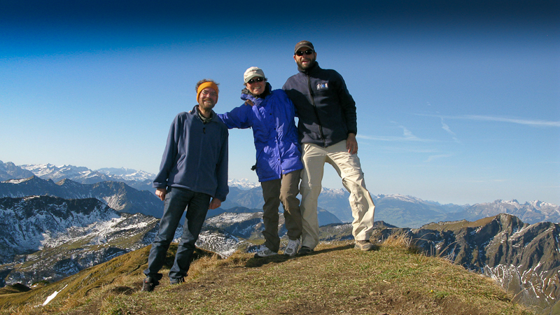
    Sünser Spitze – Group photo

    We followed the same trail back to the mentioned sign-post, but instead of traversing the ridge we followed the ridge to the Potlerhorn. It took us a little more than an hour to get to the second summit, staying close to my timetable. This time we had to share the summit with two other parties. Not a problem since the summit is basically a hump in the ridge and thus provided enough space for my antenna.

    Getting ready for HF

    Before setting up the HF equipment, I tried the HT on 2M again to see whether I would be possible to get any contacts on this peak as well. The line-of-sight towards Bregenz was clearly blocked by the previously activated Sünser Spitze. Never-theless, OE9HRV (Herbert) answered my call. I could even get in contact again with HB9AGH in Zürich… it took a few tries but after finding the sweet spot on the mountain, we could exchange the necessary info.  All in all I made 15 contacts with stations in England, Sweden, Austria, Hungary, Germany, Poland, Denmark and Switzerland before we moved on to the last summit.

    Off to the last summit

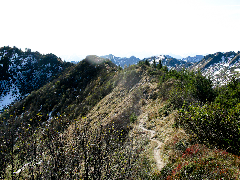
    Again it was easy to find the way to the last summit. We just followed the trail along the ridge connecting the two summits. The down-climb to the saddle was quite steep and we encountered several more hikers coming up. From the saddle to the summit, the trail was clearly less traveled than before. It followed the ridge-line very closely, sometimes crossing over to the other side only to cross again a little later. Both sides of the ridge  drop off sharply and if you suffer from fear of heights you shouldnt look down too much. It was only 3/4 of a mile to the last summit

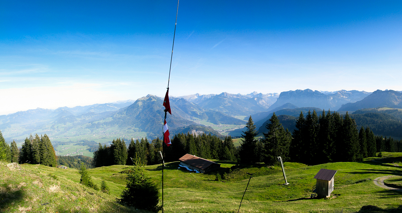
    Antenna on Portlerkopf

    but I started to feel the impact on my knees. I was setting up the antenna for the last time on this trip and thought it might be appropriate to fly the Austrian flag I got from OE9HRV. This time I had no luck on 2m, but Herbert (OE9HRV) was already waiting for me on 20m. Within no-time I had 15 contacts with stations in Austria, Germany, England, Poland, Lithuania, Spain and even Canada (VE1WT) – making this my longest distance contact of the day (approx. 5400 km or 3400 mi).

    The Descent:
    It’s only a short distance from the last summit to the trail-head;  approximately another 3/4 of a mile. We had to backtrack on the same trail for a while until we could get down from the steep ridge. Needless to say that we missed the train by about five minutes – but in Europe, with its highly developed public transportation system, there is always another train.

    Some video impressions:

    If you would like to leave questions or comments, please do so through Youtube.


    ATTENTION !! WARNING !! There are old mountaineers, and bold mountaineers… there are no old-bold mountaineers. Hiking and mountain climbing are potentially hazardous activities particularly in Colorado with its extreme elevations. I am not accepting responsibility for any death or injury resulting from activations based on my trip reports. Proper training, experience, and personal capability assessment is required – enjoy!
  • OE/VB-494 (Hochälpele) – 1464 M / 4803 ft

    After yesterdays activation of the ‘Galinakopf’ (OE/VB-287) under perfect conditions, I selected a less challenging summit for this Sunday. The dart I threw at the map landed closest to ‘Hochälpele’ or OE/VB-494 – a summit close to the previously activated ‘Geißkopf’. The ‘Hochälpele ’ is also part of the ‘Bödele‘, the landmark mountain of Dornbirn, the largest city in the state of Vorarlberg (Austria). The weather forecast was promising and called for a sunny day.

    Trailhead: 3800 ft / 1158m
    Summit:   4803 ft / 1464 m
    Elev. gain: 1010 ft / 308 m
    Roundtrip: 3.0 mi / 4.8 km

    Compare this summit with my other activated summits

    How to get there:
    Take the ‘Bödele-Strasse’ (or L48 ) from Dornbirn or take the Bus line 38 (Dornbirn -Bödele – Schwarzenberg – Bezau) which leaves every 30 minutes, starting at the Dornbirn Railway Station. Park or get out of the Bus at the ‘Bödele Passhöhe‘. The trail starts about 100 yards (100 m) south of the parking lot.

    Parking/Trailhead

    Red Tape:
    This area is a very popular local recreation area and finding a parking spot might be difficult, specially on week-ends and/or during sunny weather. Since it was a Sunday and a sunny day after several days of the rain and fog that is typical for the region at that time of the year… you can imagine the number of cars and people. It was a real zoo up there. The parking fee depends on how long you are staying at the lot, if I remember correctly it is about 1 Euro per hour. The parking lot has exactly one machine where you can pay your parking-fee… I waited approx. 20 minutes in single file to get to the machine when I came back from the summit. The good news… it accepts bills as well as coins.

    The Ascent:
    The ascent has no challenges. Just follow all the other people… no, seriously, the trail is hard to miss and is mostly moderate in steepness. The only challenge was the fact that it was incredibly muddy due to the heavy rain-falls we experienced over the last week. The first part leads through a few vacation homes (beautiful old Chalets), then by a Restaurant (in case you need some fuel before attempting the ascent). From there the trail is over grassy (muddy) terrain along a small ski-lift all the way to a ridge. At this point I made most of the elevation gain for this trip and I followed the south-easterly ridge all the way to the summit. The only challenge was to avoid the deep mud-puddles, which was sometimes difficult with all the foot-traffic.

    The Summit:

    View from the summit


    At the summit – you guessed it – is another restaurant and a ‘Gipfelkreuz‘, a wooden cross. To find a good spot for setting up an antenna is not so easy. For one, there were a lot of people up there and the other ‘problem’ is that the summit is an elongated ridge which drops off steeply in both directions. So in order to get good propagation in all direction, I was looking for a spot very close to the top of the ridge which also coincides with the trail. I tuned the antenna for 10m, hoping for similar results than on the days before. But it was wishful thinking … my CQ calls did not get out well. I was wearing headphones to cancel out some of the noise on the summit (and from the nearby restaurant when I suddenly heard Alpenhorn sounds through my headphones. “I am having a sunstroke” I thought but the sun was not shining that hard and I was wearing a hat… I took the headphones off and turned my head, that’s when I realized that somebody set up their Alpenhorn about 6 feet (~1.8m) behind me… and he was puffing his lungs out. I am as fond of Alpenhorn sounds as the next guy but this was a bit much… as polite as possible I asked him whether it would be possible to move his instrument to another, more distant location. I tried to explain to him what I was doing… maybe he had not realized in light of my ~20 mast/antenna with all the guy-lines and counterpoise? I could not even finish my sentence when he got red all over the face and started lecturing me that this was a free country and that I cannot force him to move – yikes. It was pretty obvious that there was no way that sane arguments could convince this guy to stop or move. His wife/partner/companion tried to mediate the situation and coax him into moving, being obviously careful not to further upset him. In the end, I  turned back to my radio and head-phones, ignoring his further rants.

    What seems funny to me is, that no matter the country and culture, people always try to justify their unconsidered and/or rude actions with the argument that we are in a free country – go figure.

    The first contact with FR/DJ7RJ (Willie) was certainly the highlight. A DX contact of more than 5500 mi (~9000 km) on 5 W. Apart from that, band seemed to favor east-Europe and I made most of my very few contacts with Russia. After my fifth contact I packed up, feeling a little disappointed about this mountain.

    The Descent:
    I went down the same slippery/muddy route to the parking-lot… waiting patiently in-line to pay the fees and get ‘my’ car.

    Some video impressions (no Alpenhorn sounds though):
    Since the trip felt more like traveling on an interstate, I have only very limited footage.
    httpvh://www.youtube.com/watch?v=kvEYUOcWy3g

    If you would like to leave questions or comments, please do so through Youtube.


    ATTENTION !! WARNING !! There are old mountaineers, and bold mountaineers… there are no old-bold mountaineers. Hiking and mountain climbing are potentially hazardous activities particularly in Colorado with its extreme elevations. I am not accepting responsibility for any death or injury resulting from activations based on my trip reports. Proper training, experience, and personal capability assessment is required – enjoy!
  • OE/VB-287 (Galinakopf) – 2198 m / 7211 ft

    As I am writing this (November, 25th, 2011), I learned with great sadness that OE9GWI is now a silent key. Even-though I never met Gerhard personally, I had the pleasure working him on all my SOTA activations in Austria. He chased and spotted me on every activation – including this one. He was not only active in the the SOTA program but was also a fellow Buddipole user – I am sorry I could not share this trip report with him – I am sure he would have liked a report from a summit in his ‘back-yard’.
     

    The rather nasty weather (for a Coloradoan anyway) gave me two days off from my activations. During these days, I exchanged a few e-mails with a local HAM – OE9HRV, Herbert – who was my first contact on the ‘Pfänder‘ (on my first activation in Austria). He not only knows his ‘Ländle’ but is also a very busy SOTA activator. He advised me on summits, routes and other local considerations and invited me for a joint activation of the ‘Galinakopf‘ for the next day. I accepted of course – no better way to activate a summit than with local knowledge. This summit is rather interesting and is part of the ‘Rätikon range‘ of the Eastern Alps. Since the border between Austria and the Principality of Liechtenstein goes right across the summit, it carries two SOTA designations – one for Austria (OE/VB-287) and one for Leichtenstein (HBØ/LI-ØØ7). According to the rules, you can activate this summit from both sides and claim the points twice. Since Liechtenstein is a rather small country (160 square kilometers or 62 sq mi and a population of about 35’000) it has only a few SOTA summits (11) and finding an SOTA activator in HBØ is therefore a rare opportunity for chasers everywhere. Unfortunately I did not research whether my radio-license is valid in Liechtenstein and therefore chose to activate the summit from the Austrian side only – just to be sure not to violate any rules/laws.

    Trailhead: 5145 ft / 1568 m
    Summit:   7211 ft / 2198 m
    Elev. gain: 3271 ft / 997 m
    Roundtrip: 9.3 mi / 14.9 km

    Compare this summit with my other activated summits

    How to get there:
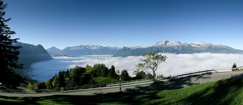
    Herbert (OE9HRV) provided full service and picked me up at my temporary QTH in Dornbirn. First we headed west into Switzerland and took E43 (N13) south until the exit of Buchs (SG). We continued to Sevelen where we crossed the bridge over the Rhein which brought us into Vaduz (Liechtenstein) and continued towards Malbun via Triesenberg und Steg. We drove in pretty thick fog until we reached Triesenberg at about 3000 ft or 1000 m AMSL. The views above the fog were just breathtaking and Herbert made a short detour to Gaflei to show me around. Just click on the pictures below to get a larger version and a better idea how it looked like.

    The view from Gaflei

    There is a skiing area just shortly before arriving in Malbun with the necessary parking lots to accommodate all the cars in winter. That is were we parked the car at 9:30 and walked back down a few hundred yards to to the trail-head.

    Parking/Trailhead

    View Larger Map

    Red Tape:
    Make sure to carry your passport when traveling in this border region. You will slip in and out countries several times a day.

    The Ascent:

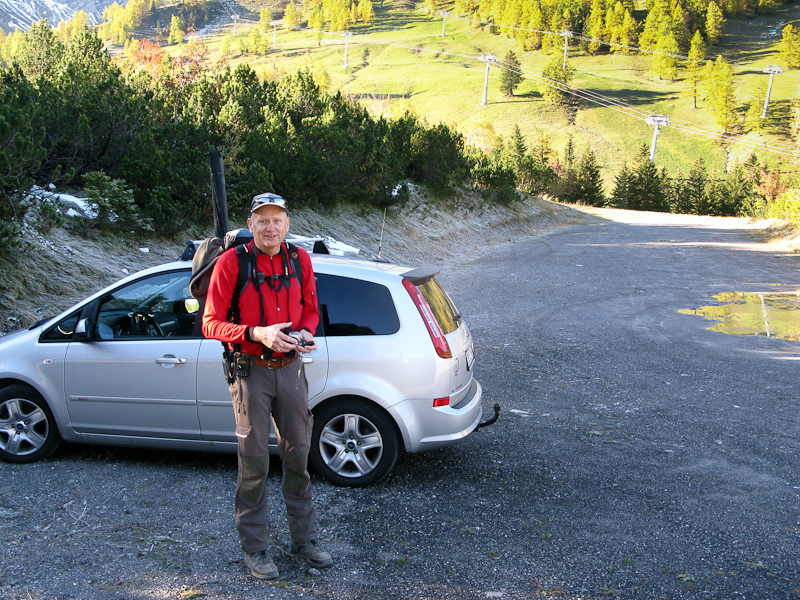
    OE9HRV – Herbert is ready to roll

    The first section of the 9.3 mi or 14.9 km hike is quite steep over a well maintained forest road and gets your heart pumping for sure. Very soon we had to stop and take off some layers of clothing in order not to overheat. After ~1.2 miles or about 2 kilometers we reached  a wooden bench where we stopped for a drink of water and to catch our breath. This is where I heard DL9MDI calling me on the local 2m repeater we were monitoring. DL9MDI (Fred) had been helping me out prior to the trip and so far we only communicated via e-mail and SKYPE. It was a nice surprise and we chatted shortly… he wished us good luck and we were back on the trail. The trail gave away some of the elevation gains (~250 ft / 80 m) on our way towards our target. The trail lead into a large valley where we could finally see the summit.

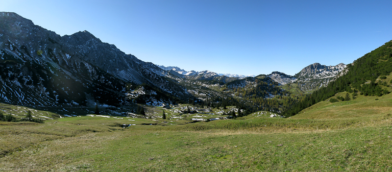
    View into the valley
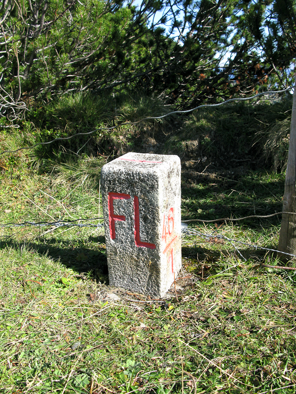
    Grenzstein Austria / Liechtenstein

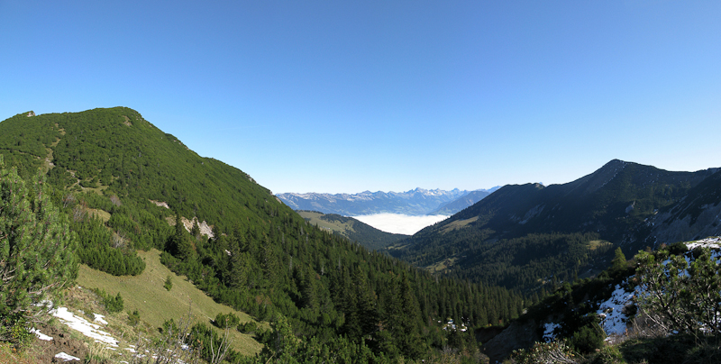
    We continued the hike parallel to a ridge (connecting the Gamsgrat, Ochsenkopf and Scheienkopf and finally the Galinakopf), which also represents the border of Austria/Liechtenstein, at moderate elevation gain. That changed quite a bit after finally reaching it. We followed the ridge/border to the north, heading directly towards the Galinakopf. The last mile (or 1.6 km) was very steep but offered excellent views to the west and south. The thick fog over the valley reminded me of a calm ocean, something you hardly see here in the Rocky Mountains of Colorado. After reaching the summit, we spent the first few minutes taking pictures and videos, before setting up the equipment.

    View from the ridge

    The Summit:

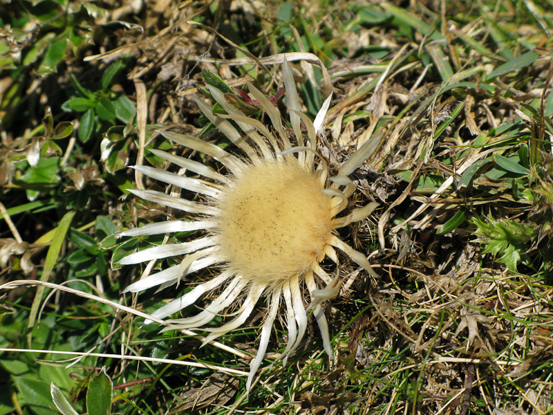
    Silver-thistle along the way

    There is a big wooden cross at the very top with a register. The north side of the mountain is a big, steep and grassy slope – certainly a dangerous avalanche area in winter. The remaining sides are steep cliffs which should give me a nice take-off angle for my vertical Buddipole antenna. Herbert was setting up his double bazooka (for 40m) and J-pol (for 10m) antennas on an insanely tall fiberglass mast. I was setting up my vertical Buddipole close to the abyss.

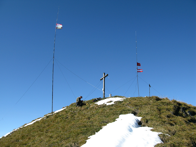
    Our 'antenna-farm' on the summit

    Within a few minutes, we had our rigs going, Herbert his ICOM 706MK2G on a LIFEPO4 (12 Ah) and I my Yaesu FT-817ND with my foldable solar panel. Within minutes I experienced a pile-up using Herbert’s rig with 100 W on 40m,  something I had never experienced in previous WØ activations. I had my hands full answering the stations – the foreign call-signs did not make it any easier for me. After the first wave was over, I left Hebert take over his own rig and retreated to my 5 W rig.

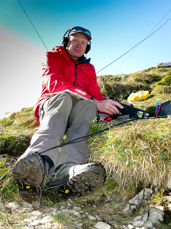
    OE9HRV is heating up the air-waves

    Normally I operate on 20m but shortly before I left for Europe I talked to Chris (W6HFP) from Buddipole by phone who recommended to try the 10m band. So I tuned the antenna to 28.385 Mhz for the first time ever – not sure what to expect. My second CQ call was answered by VE2JCW – that’s over 6000 km (or close to 4000 miles). I was stunned and excited at the same time since I never expected such distances on just 5W. But it got even better… the next two QSOs were with N4EX and

    Working on 40m (Photo by OE9HRV)

    WA2USA (two very active SOTA chasers in the US), both over 7000 km (or ~4500 miles) afar. It does not get better than that. It turned out to be a perfect day in every respect. With the day progressing, the light got better as well and offered lots of opportunities to take pictures of the 360 degrees of unobstructed mountain views with the thick  fog still hanging in the valley well below us – not really a motivator to leave this slice of heaven.

    The Descent:

    Heading down (Photo by OE9HRV)

    After spending four hours on the summit, it began to get colder and we still had quite a hike in front of us. At 16:30 we started to pack up our gear and headed down. Not paying attention, we made a unplanned detour on very steep ground just a few meters below the summit. After climbing back up, we started to pay closer attention to the trail and finally made it back to the car after a two hour hike. Herbert dropped me off at my QTH – just in time to have a shower and make my dinner appointment. It was an exceptional day… a great hike and amazing conditions for a SOTA activation – Thanks Herbert!

     Some video impressions:

    httpvh://www.youtube.com/watch?v=BiEe9nKAneM

    If you would like to leave questions or comments, please do so through Youtube.


    ATTENTION !! WARNING !! There are old mountaineers, and bold mountaineers… there are no old-bold mountaineers. Hiking and mountain climbing are potentially hazardous activities particularly in Colorado with its extreme elevations. I am not accepting responsibility for any death or injury resulting from activations based on my trip reports. Proper training, experience, and personal capability assessment is required – enjoy!

  • OE/VB-5Ø4 (Geißkopf) – 1198 m / 3930 ft

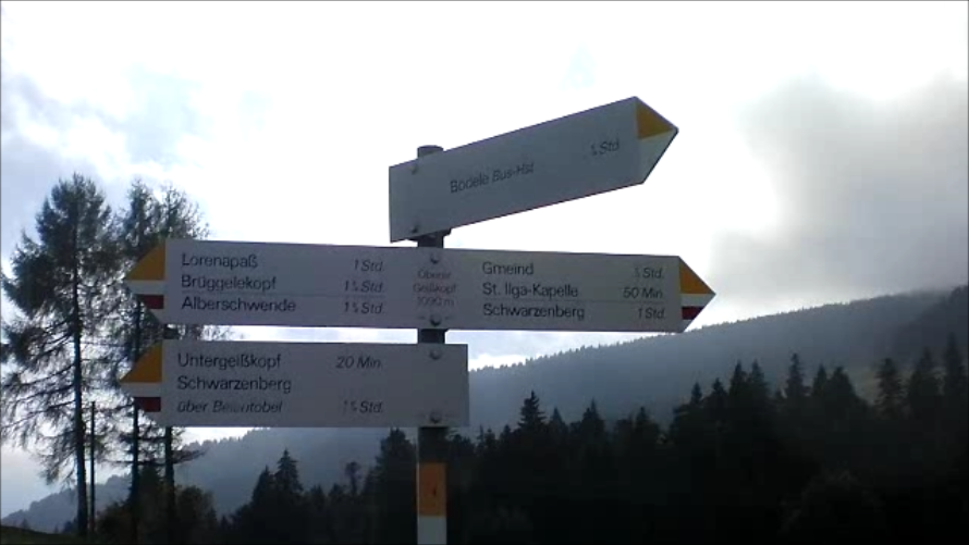
    The weather forecast for today was not too good. Therefore I was looking for another SOTA peak nearby. The ‘Geißkopf’,or OE/VB-5Ø4, fit the bill. The ‘Geißkopf’ is part of the ‘Bödele‘, the landmark mountain of Dornbirn, the largest city in the state of Vorarlberg (Austria). There is a great public transportation system which can get you up there. Since SOTA rules demand that I get to the summit human powered (at least the last 150 ft of elvation), I started out well before the ‘Bödele Pass – 3789 ft / 1155 m‘. Even-though there is a bus stop at the pass, that might not result in the required elevation gain from here. Three bus stops (Dornbirn Langwies) before the pass seemed to be a good fit and served as my trail-head. From here it is possible to hike through the woods for the most part and avoid the busy road. Due to the foggy weather, I have only limited pictures/videos.

    Trailhead: 3030 ft / 924 m
    Summit:   3930 ft / 1198 m
    Elev. gain: 1447 ft / 441 m
    Roundtrip: 4.2 mi / 6.7 km

    Compare this summit with my other activated summits

    How to get there:
    As mentioned earlier you have choices, take a car or take public transportation.

    Just follow the signs

    Take the ‘Bödele-Strasse’ (or L48 ) from Dornbirn or take the Bus line 38 (Dornbirn -Bödele – Schwarzenberg – Bezau) which leaves every 30 minutes, starting at the Dornbirn Railway Station. Park or get out of the Bus at ‘Dornbirn Langwies‘. The trail you are looking for is just a few feet behind the bus-stop – leading south and finally parallels the road.

    Parking/Trailhead

    View Larger Map

    Red Tape:
    This area is a popular local recreation area and finding a parking spot might be difficult, specially on week-ends and/or sunny weather.

    The Ascent:
    There is not a lot to report. It’s a very moderate trail leading directly to the Bödele-Pass (yes, there is a Restaurant). Cross the road to the parking lot. On the north side starts the trail down through a moor and then up through some settlements to the Geißkopf (which you can see from the parking lot). There are no challenges along the way, its a well established trail and there are no doubts when it comes to navigating the area.

    The Summit:
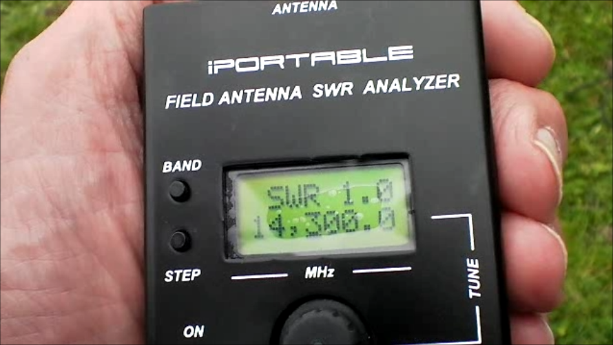
    There is a wooden cross at the highest point (as on most summits in this area) with a wooden bench. Nice for a picnic or to setup your radio. Since the weather was kind of foggy/cloudy (hard to say where the fog stopped and the clouds started) nobody else claimed the summit or the bench. Setting up the antenna for 20 m was easy with the soft, grassy ground (for the pegs) and the available topography. There is enough space for several antennas, in case you are looking for joint activation. Shortly after the antenna was

    Perfect SWR

    up and tuned, the fog rolled in heavily, resulting in chilly temperatures. The scarce sun-rays could not penetrate the fog anymore. My first QSO was DH3RB (Ruediker), a station at the Danish/German border, using a Buddipole configuration as well. Apparently he had seen some of my Youtube videos before and was quite excited to catch me on the air. The remaining QSO’s were with stations in Austria, Greece, England, Bulgaria, Finland and Spain. After 16 QSOs in ~30 minutes, I was happy go pack up my gear due to the chilly temperatures. I am not used to this kind of cold in high humidity.

    The Descent:
    It was a quick descent down the same trail, through the moor and to a nearby parking lot where I had a pick-up shuttle, getting me down to the valley for a nice glass (or two) of ‘Glühwein‘ and cookies.

    Some video impressions:

    httpvh://www.youtube.com/watch?v=2nLgDlCQtbM

    If you would like to leave questions or comments, please do so through Youtube.


    ATTENTION !! WARNING !! There are old mountaineers, and bold mountaineers… there are no old-bold mountaineers. Hiking and mountain climbing are potentially hazardous activities particularly in Colorado with its extreme elevations. I am not accepting responsibility for any death or injury resulting from activations based on my trip reports. Proper training, experience, and personal capability assessment is required – enjoy!
  • OE/VB-512 (Pfänder) – 1064 m / 3491 ft

    I visited Europe for a couple of weeks and took my radio equipment with me to do some SOTA activations. The next few trip-reports summarize my Austrian SOTA activations. BTW, clicking onto a picture included in this trip-report will show you a larger version.

    For my first activation, I was looking for a summit with easy access. I wanted to make sure I have everything with me before heading into the mountains. I found the perfect SOTA summit for my requirements during my time in Austria/Vorarlberg. OE/VB-512 was just a few miles from my temporary QTH and there even is a gondola going from Bregenz (the capital of Vorarlberg) to the very top. Bregenz is delightfully located on the shore of Lake Constance (one of Europes largest lakes) and is probably most famous for it’s summer music festival that features an opera on a open-air /floating stage. Even James Bond could not resist to visit the opera in his quest to rescue the world, in his movie ‘Quantum of Solace‘.

    I decided to take the gondola – which leaves close to the lake shore – and take a short detour downhills in order to satisfy SOTA rules, instead of hiking all the way up.

    Trailhead: 1374 ft / 419 m
    Summit:   3491 ft / 1064 m
    Elev. gain: 2117 ft / 645 m
    Roundtrip: 5.5 mi / 8.9 km

    Compare this summit with my other activated summits

    How to get there:
    Goto the harbour in Bregenz. There is a roundabout with a sign directing you to the base station of the Gondola. If you arrive by train, it’s a short 15 minute walk from the train-station.

    Parking/Trailhead

    View Larger Map

    Red Tape:
    The Pfänder cable car operates daily from 8 AM to 7 PM. It is closed however for an annual audit, so make sure you check their website or call ahead. There is a fee of about € 11.00 for a round-trip. You can check their rates on their website also.

    The Ascent:
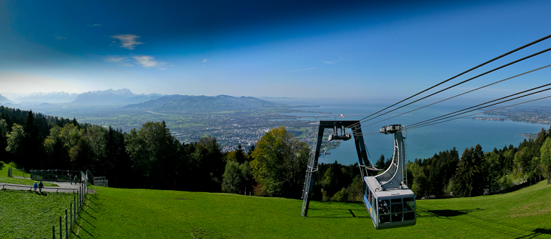
    Since I took the easy way up, there is not a lot to report. The ride to the top lasts about six minutes in a large gondola with panoramic views. Make sure to get the to the window (lake facing) quickly to get the best view on your ride up the mountain.

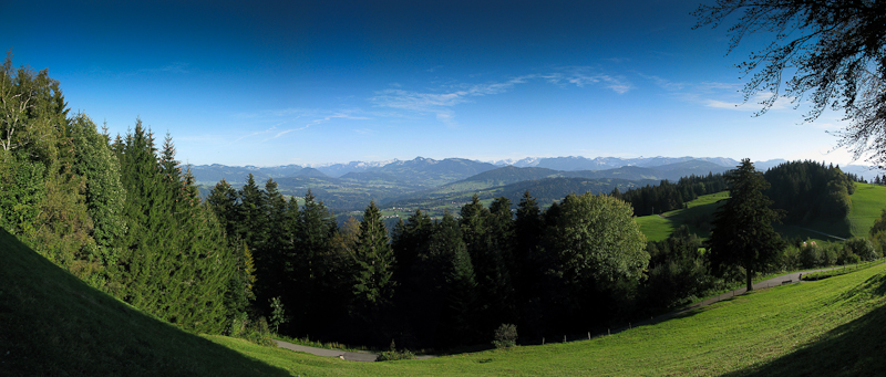
    View from the Summit

    The summit:
    First of all I had to hike downhills for a while to be in line with SOTA regulations. After coming back up to the gondola station, it is a another few minutes to the very top of the Pfänder. This is not a good location for setting up the radio equipment due to its size and popularity with all the tourists/visitors. It does however provide stunning views across Lake Constance, the Swiss, Austrian, German and Lichtenstein alps (assuming clear weather). Even-though it was a week-day, it was very crowded and I started to miss the solitude of the Rocky Mountains.

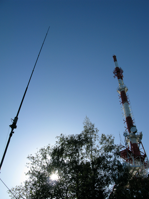
    My Buddipole competing with the Radiotower

    The summit is quite large, providing several restaurants within a few minutes of walking and a huge radio tower!!! I started to setup my equipment about 60 m from the tower and was wondering whether all the RF flying around would even give me a chance to get out. My back-up plan was an activation on 2m and I had my little HT programmed with the Pfänder repeater frequencies to announce my presence. Unfortunately I was not able to open the repeater, which seemed strange to me at such a short distance (I learned later that the repeater was out of order). It took me unusually long  to get the antenna and radio up and ready. For the first time I carried a small antenna analyzer (IP30) with me to get the antenna resonant… but no matter what I tried I could not even get close to an SWR acceptable for transmission – at least that is what the analyzer indicated. I finally ignored the analyzer and hooked up my FT-817, which was quite happy with the antenna. I guess the RF cloud from the radio tower overwhelmed the IP30.
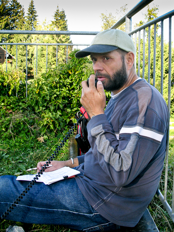
    KØMOS/OE calling CQ on 20m

    My first response to my CQ SOTA on 20m came from OE9HRV (Herbert) and my second contact was OE9GWI (Gerhard), both residents of Bregenz – a whopping 3 miles from my current location. As is turns out, both of them are very active SOTA activators / chasers. Both contacts turned into very reliable chasers during my time in Austria and Herbert was a very knowledgeable source for all SOTA summits ‘im Ländle‘ Vorarlberg. He even invited me to a very memorable activation of the Galinakopf (OE/VB-287) – report/video will follow. The remaining contacts were to Austria (no surprise), England, Greece, Spain and Canada (VE1WT) – 3413 mi / 5493 km on 20m with 5W into my Buddipole – not bad for the first day. I was quite happy with the results and the activation. Since the sun was slowly setting, I was packing up to take more photographs and to catch the last gondola.

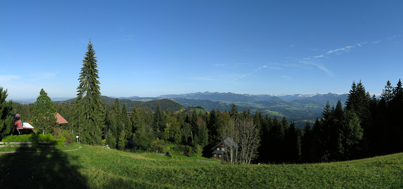
    The view to the east
    Another view from the summit

    The Descent:
    The descent in the gondola was certainly a treat – great views across the lake and Bregenz for six minutes :)

    Some video impressions:
    httpvh://www.youtube.com/watch?v=uN4Bl-6NyGw

    If you would like to leave questions or comments, please do so through Youtube.


    ATTENTION !! WARNING !! There are old mountaineers, and bold mountaineers… there are no old-bold mountaineers. Hiking and mountain climbing are potentially hazardous activities particularly in Colorado with its extreme elevations. I am not accepting responsibility for any death or injury resulting from activations based on my trip reports. Proper training, experience, and personal capability assessment is required – enjoy!