SOTA outings by KØMOS and contributors

Author: k0mos

  • WØC/FR-15Ø (Thunder Peak) – 3083 m / 10134 ft

    I had planned a double activation for today. Thunder Peak or WØC/FR-15Ø was the first on the list.The weather forecast was great for the Estes Park area and a friend of mine joined me for the hike. We drove into Estes Park and were surprised to see how much snow the mountains got during the week. Dark clouds were hanging in the Mummy Range (Continental Divide). A stiff wind greeted us when we left the car at the trail-head. Light snow-flurries were present for the first part of the hike, even though we had blue skies above us.

    Trailhead: 8244 ft / 2513 m
    Summit:   10134 ft / 3083 m
    Elev. gain: 2051 ft / 625 m
    Roundtrip: 4.5  mi / 7.2 km

    Compare this summit with my other activated summits

    How to get there:
    Take US34 from Loveland towards Estes Park through Big Thompson Canyon. Thunder Peak is on the south-west side of Estes Park. Stay on US34 towards Rocky Mountain NP. Go left on County Road 66 (or Tunnel Road), following the signs to the YMCA campus. Follow the road all the way to the end. There is a campground at the very end – as well as the East Portal of the Big Thompson Project Pipeline. Park your car at the loop of the road (there is room for about 10 cars on a gravel strip at the south side of the loop.

    Parking/Trailhead

    View Larger Map
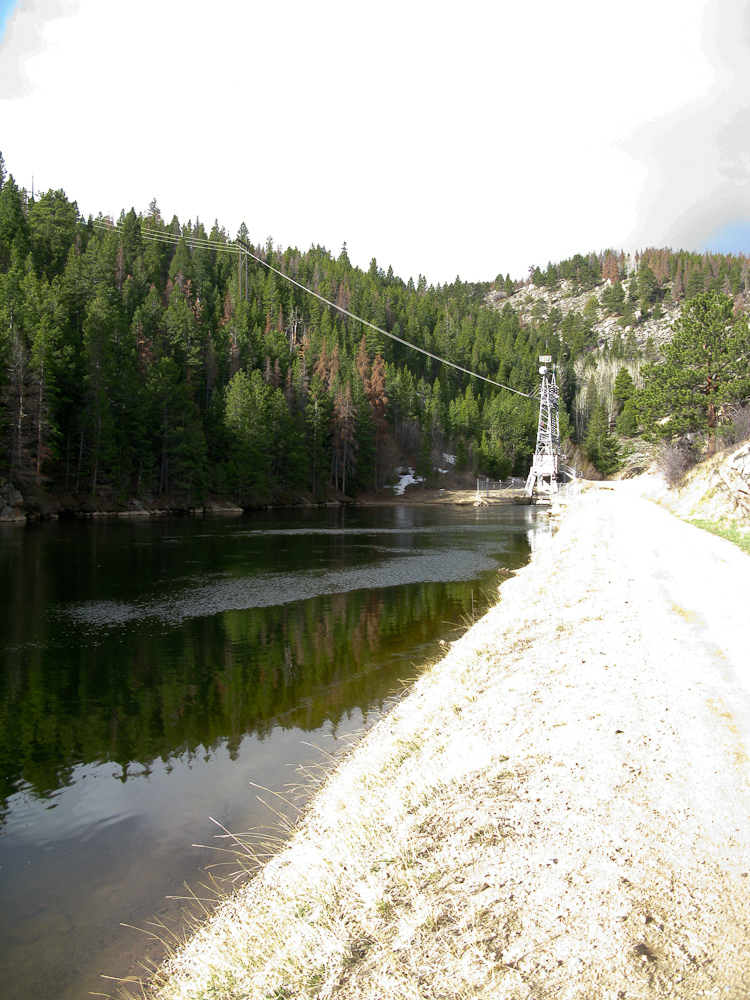
    East Portal with Reservoir

    Follow the dirt road at the end of the loop (SE) towards the reservoir and East Portal trail-head. The kiosk of the trail-head can be found when you follow the road on the right-side (north) of the reservoir.

    Red Tape:
    At the East Portal of the Adams Tunnel is a small (really small) reservoir – and the surrounding area is Federal property. You are not supposed to park, fish, boat, pee etc. within 100 yards of the dam – Homeland security and such. Thunder Peak is within the RMNP, ergo it is a fee area and their rules apply (no dogs etc.) I am not sure about RMNP entry fees… since the parking lot is outside of the park, I think you are not required to have a NP pass. I have a yearly pass anyway and therefore did not look into this further.

    The Ascent:
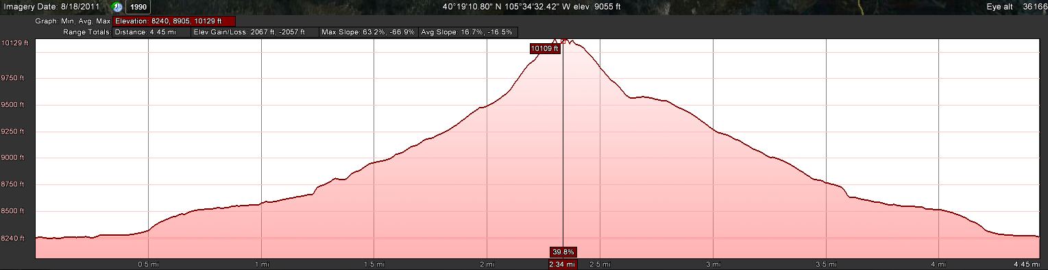
    Elevation Profile
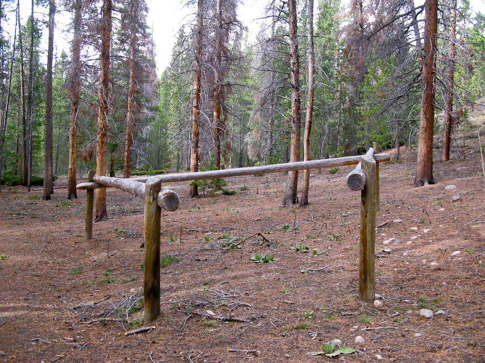
    Turn left after the Horse hitch

    For the first few hundred yards we followed the dirt-road on the north-side of the Reservoir to the kiosk. We continued on the dirt road along Wind River (more like a small creek) to a concrete retention pond. About 20 yards before the pond there is a faint trail to the right which continues to follow the creek. It was hard to see on our way up and we missed it. The result was some bush-whacking until we found the trail again. [UPDATE (3/13/13): There is now a new sign pointing you into the right direction. You cannot miss it.] On the opposite site of the creek are some nice rock-outcroppings. Right around the horse hitch we left the established Wind River trail and turned towards the drainage between Thunder and Lightning Peak.
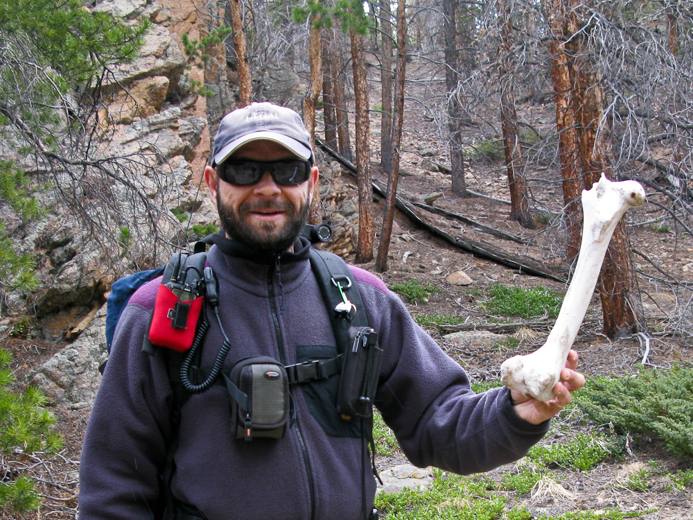
    See what I found

    First we had to cross the creek which was easy with the current water-level. We kept going along the drainage through lodge-pole pines and areas of aspen groves -always staying on the left (NE) side of the drainage where we encountered more open areas. As a result we made good progress. Interestingly, the soil in the drainage was very soft and sandy – sometimes we found big piles of sand as if a few kids had destroyed their sand-castle. You can’t get lost if you stay in the drainage and keep going all the way up to the saddle between Thunder and
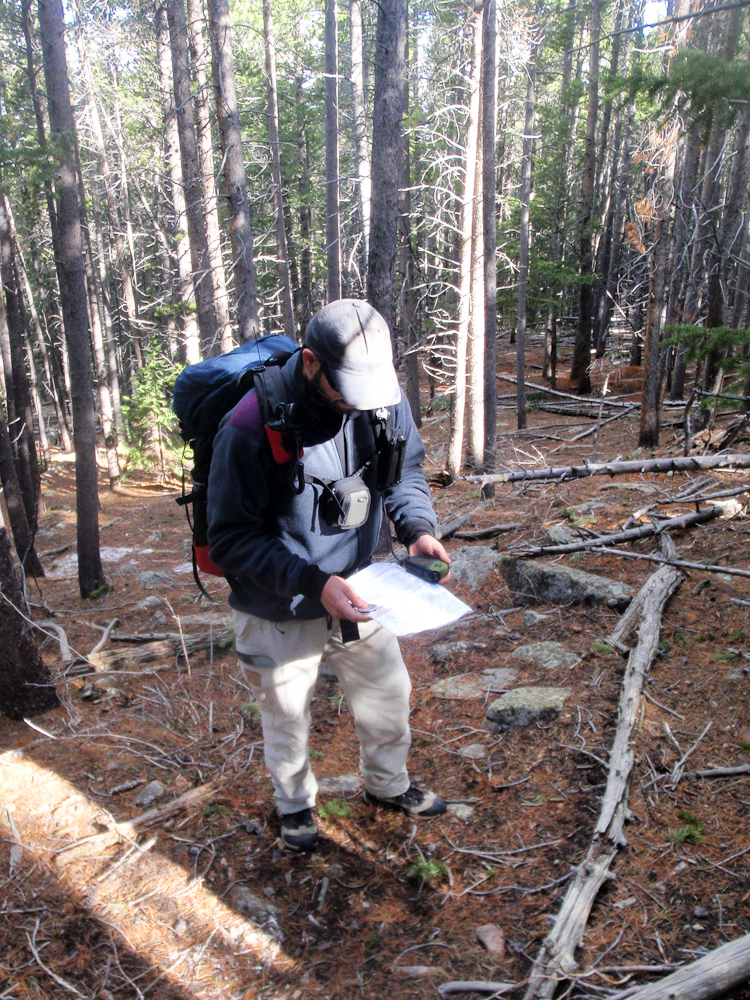
    Where are we?

    Lightning. From there you can see the summit and head up there. We wanted to shave off some time and took a more direct line to the summit since we were aiming for a second activation. Every now and then I verified our position with the GPS to see whether we were still on the plotted track. Heading up the south-west side was quite a work-out… it was rather steep (around 30%) and with the soft and sandy soil it felt like climbing sand-dunes. Having enough momentum was sometimes crucial to overcome a section.

    The Summit:
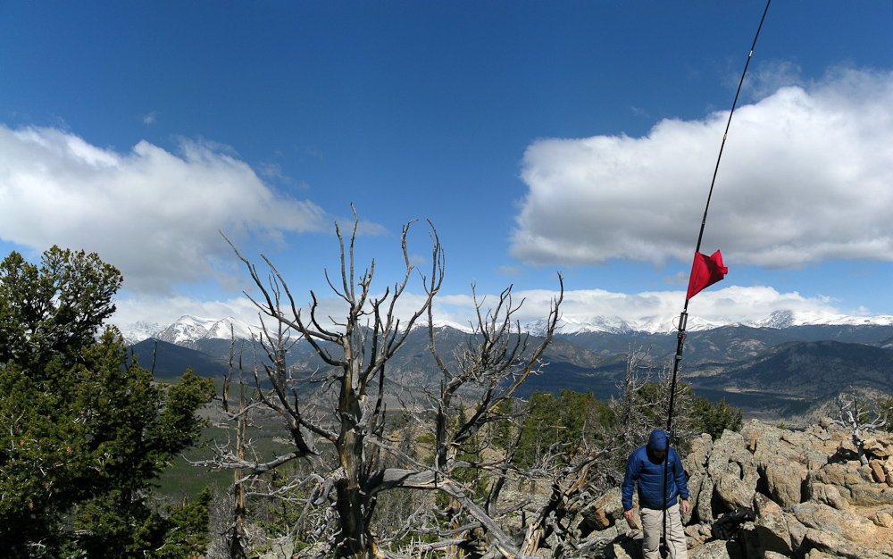
    On the Summit

    The views from the summit are spectacular. There are quite a few SOTA peaks right in front of you. To the south are Estes Cone (WØC/FR-Ø39), Longs Peak (WØC/FR-11Ø) and Mount Meeker; to the East, Lily Mountain (WØC/FR-Ø50), Twin Sister Peak East (WØC/FR-Ø37) and West. To the north we could see Emerald Mountain (WØC/FR-Ø58 ) and Eagle Cliff Mountain (WØC/FR-Ø68 ) and finally to the west, the Continental Divide and the Mummy Range with too many SOTA summits to list. The summit was very windy but the skies to the west looked a lot friendlier than earlier in the morning. Setting up the equipment was very efficient due to the fact that I had help and Phil/NS7P was my second contact after just a few CQs. His spot posted on SOTAwatch attracted the usual chasers within minutes (thanks guys).

    The Descent:
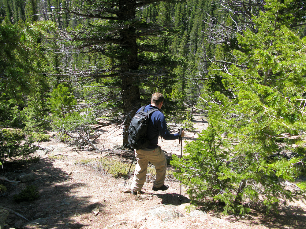
    Ben running downhills

    The descent was quite fun… the soft and sandy soil allowed us to run/slide downhills towards the saddle and finally turn north into the drainage again, following our ascent route back to the trail-head an car. We only took the time to exchange our empty water bottles with full ones and off we went, heading to the second summit, a ~30 minutes drive.

    Some video impressions:

    If you would like to leave questions or comments, please do so through Youtube.


    ATTENTION !! WARNING !! There are old mountaineers, and bold mountaineers… there are no old-bold mountaineers. Hiking and mountain climbing are potentially hazardous activities particularly in Colorado with its extreme elevations. I am not accepting responsibility for any death or injury resulting from activations based on my trip reports. Proper training, experience, and personal capability assessment is required – enjoy!
  • Activation Alert: K0MOS on WØ/FR-150 (Thunder Mountain) & WØ/FR-160

    Fresh snow and rain make access to higher elevation inaccessible. I will
    therefore try to activate:

    Date: 20 April 2012
    Time: Approx.: 1600 UTC – 17:00 UTC
    Location: N-Colorado / DN70fh
    Elevation: 3083 M / 10134 ft – 4 Point(s)
    Call Sign: KØMOS
    Frequencies: 14.3400-ssb +/- QRM / alt. freq.: 14.285-ssb
    146.520-FM

    Depending on conditions, I might try Pierson Mtn. (WØC/FR-16Ø) as well. Here the
    details:

    Date: 20 April 2012
    Time: Approx.: 2100 UTC – 2200 UTC
    Location: N-Colorado / DN70gh
    Elevation: 2982 M / 9803 ft – 4 Point(s)
    Call Sign: KØMOS
    Frequencies: 14.3400-ssb +/- QRM / alt. freq.: 14.285-ssb
    146.520- FM

    QRP (5W) only.
    Equip.: FT-817 and vertical Buddipole

    Keep your ears/antennas pointed towards Colorado.

    Thanks


    ATTENTION

    !! WARNING !! There are old mountaineers, and
    bold mountaineers… there are no old-bold mountaineers.
    Hiking and mountain climbing are potentially hazardous activities particularly in Colorado with its extreme elevations. I am not accepting responsibility for any death or injury resulting from activations based on my trip reports. Proper training, experience, and personal capability assessment is required – enjoy!
  • Ultra-lightweight 2m Yagi for SOTA

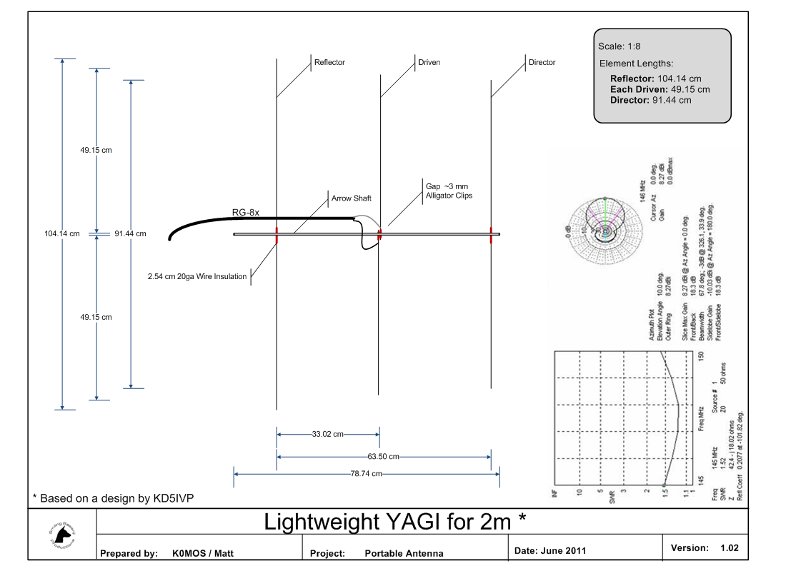
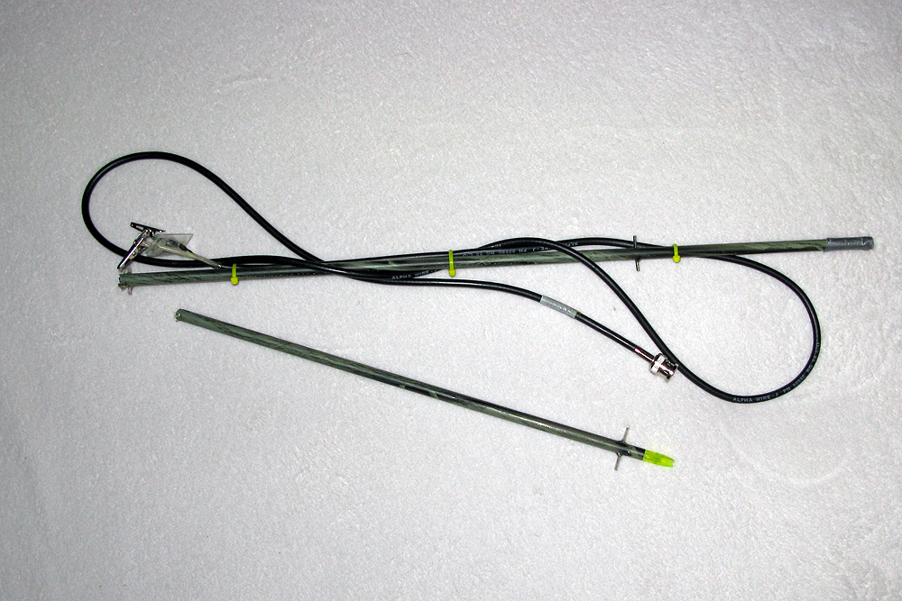
    Yagi – Dimensions

    I am always carrying my HT (Yaesu VX-7R) as a backup on my SOTA activations. It saved my butt on two occasions when high winds prevented me from setting up my vertical Buddipole. Since high winds are not unusual at higher elevations I was looking for a better antenna compared to the stock rubber-ducky for future activations. I found an antenna I really liked on Youtube, created by David/KD7MNI who was inspired by a design by Paul/KD5IVP. Paul even shared his plans online. I based my own plans on the info provided by David and Paul and after a week-end it was ready to test. A lightweight arrow-shaft houses the piano-wire for elements nicely but I was not happy with the dangling RG-8x… even wrapping it around the arrow-shaft made it awkward to transport… so I never actually took it to a summit until last week, when I activated Mt. Herman (WØC/FR-Ø63) with Steve/wGØAT.

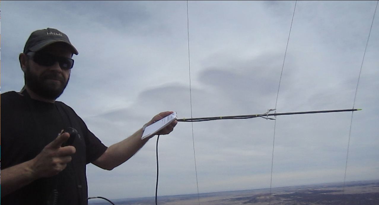
    Yagi on Mt. Herman (photo by Steve/wGØAT)

    On the summit I had a real problem with my Buddipole coax and had to rely on my 2m 3-element Yagi to be able to claim my points. So… did it work you ask? YES, it sure did… the furthest contact I made was with Ken/WB9QDL who was in Thornton in his car (~60 miles). Not that the distance is unusual for a 2m contact with 5W but we had the opportunity to compare the signal with Steve’s HT. According to Ken, my signal and audio quality was better than Steve’s HT with a 17″ flexible whip antenna.

    Remains of a Yagi

    Good enough for me. I decided to take the antenna on my double-activation of Lily Mtn. & Panorama Pk. to see what it is capable of. Unfortunately it never came to another test. The antenna was strapped to the outside of my backpack. The light-weight arrow-shaft broke apart during my ascent through the forested area to Lily Mountain without me noticing and I lost some of the piano-wires which were stored inside.

    My Conclusion: It seems that the antenna was just too flimsy and not rugged enough for my purpose. Most trails around here start well below the treeline and there is always a part where I have to bush-whack through trees.  The arrow shaft is too long to be stored in a backpack and thus needs to be strapped to the outside. Using another container to protect the antenna seems to defeat the purpose of having an ultra-light antenna. I guess it is time to try a tape-measure antenna next  :)

    Video of the antenna in action:
    httpvh://www.youtube.com/watch?v=TeTrAPNo8tQ

    If you would like to leave questions or comments, please do so through Youtube.

    Check my other Yagi-Uda construction attempt.


    ATTENTION

    !! WARNING !! There are old mountaineers, and
    bold mountaineers… there are no old-bold mountaineers.
    Hiking and mountain climbing are potentially hazardous activities particularly in Colorado with its extreme elevations. I am not accepting responsibility for any death or injury resulting from activations based on my trip reports. Proper training, experience, and personal capability assessment is required – enjoy!
  • Activation Alert: K0MOS on WØ/FR-146 (East White Pine Mtn.) & W0/FR-046 (West White Pine Mtn.)

    Since we have high winds in the forecast, I a trying to stay below tree-line. I am trying to activate WØC/FR-146 (East White Pine Mtn.).

    Date: 6 April 2012
    Time: Approx.: 1600 UTC – 17:00 UTC
    Location: N-Colorado / DN70go
    Elevation: 3117 m / 10226 ft – 4 Point(s)
    Call Sign: KØMOS
    Frequencies: 14.3425-ssb +/- QRM / alt. freq.: 14.285-ssb

    Depending on conditions, I might try West White Pine Mtn. (W0C/FR-046) as well. Here the details:

    Date: 6 April 2012
    Time: Approx.: 1800 UTC – 2000 UTC
    Location: N-Colorado / DN70go
    Elevation: 3135 M / 10305 ft – 4 Point(s)
    Call Sign: KØMOS
    Frequencies: 14.3425-ssb +/- QRM / alt. freq.: 14.285-ssb

    QRP (5W) only.

    Equip.: FT-817 and vertical Buddipole

    Keep your ears/antennas pointed towards Colorado.

    Thanks


    ATTENTION

    !! WARNING !! There are old mountaineers, and
    bold mountaineers… there are no old-bold mountaineers.
    Hiking and mountain climbing are potentially hazardous activities particularly in Colorado with its extreme elevations. I am not accepting responsibility for any death or injury resulting from activations based on my trip reports. Proper training, experience, and personal capability assessment is required – enjoy!
  • Activation Alert: K0MOS on W0/FR-064 (West Crosier – CO) & W0/FR-057 (Crosier Mtn.)

    I am trying to activate W0C/FR-064 (West Crosier). This one got away on my last
    attempt (Thunderstorm).

    Date:                  28 March 2012
    Time: Approx.: 1600 UTC – 16:30 UTC
    Location:           N-Colorado / DN70gk
    Elevation:         2744 M / 9020 ft – 4 (+3) Point(s)
    Call Sign:          KØMOS
    Frequencies:    14.3425-ssb +/- QRM / alt. freq.: 14.285-ssb
    146.520-fm

    Depending on conditions, I might try Crosier Mtn. (W0C/FR-057) as well. Here the
    details:

    Date:                   28 March 2012
    Time: Approx.: 1830 UTC – 1900 UTC
    Location:            N-Colorado / DN70gk
    Elevation:          2814 M / 9250 ft – 4 (+3) Point(s)
    Call Sign:          KØMOS
    Frequencies:    14.3425-ssb +/- QRM / alt. freq.: 14.285-ssb
    146.520-fm

    QRP (5W) only.
    Equip.: FT-817 and vertical Buddipole

    Keep your ears/antennas pointed towards Colorado.


    ATTENTION

    !! WARNING !! There are old mountaineers, and
    bold mountaineers… there are no old-bold mountaineers.
    Hiking and mountain climbing are potentially hazardous activities particularly in Colorado with its extreme elevations. I am not accepting responsibility for any death or injury resulting from activations based on my trip reports. Proper training, experience, and personal capability assessment is required – enjoy!
  • W6/SN-048 (Banner Mtn.) or is it?

    I successfully activated W6/SN-048 (Banner Mtn.) today – or so I thought. It seems that either the coordinates provided by the SOTA database or the summit name and elevation are wrong as of 3/12/2012. The provided coordinates (N39.30640030W120.26529694) are taking you to the top of Schallenberger Ridge (2276 m / 7469 ft . Since the nature of the error is unknown to me, I am not providing a full trip report and mislead another activator. I am adding the short version I posted on various Yahoo groups instead. If you are planning to activate Banner Mountain as it is currently defined in the SOTA database, I suggest to wait for clarification on either the correct coordinates or name/elevation of this summit.

    Trip report:

    Banner Mtn. – On the trail

    WX looked very promising when I left my temp. QTH at Lake Tahoe. The sun was out and the temps well above freezing when I drove towards Truckee. The picture was quite different when I arrived at the Schallenberger Ridge. The low hanging and fast moving clouds were around sumit level, and the sun was hardly visible. With the help of the nice lady at the museum (Donner Memorial State Park) I was on my way in no time.

    Avalanche conditions were moderate according to Sierra Avalanche Center. Due to the temps, the snow was quite wet. Snow exposed to the high winds was hard-pressed but easy to tackle with my snowshoes. The summit was very windy and hideouts rare. I was determined to activate this summit at (almost) any cost to get my 5th association under my belt.

    Luckily the Buddipole antenna survived the 40 minutes in high wind conditions, however I experienced not only problems with the counterpoise (keeping the counterpoise attached to my ski-pole in high wind conditions is a recurring problem for me), but I also had issues with my SWR… one second at 1.2, the next at >10 and back to 1.2. I tried to rectify the situation but finally decided to give it a try as long as the antenna is still upright. My first contact was with Paul (W0RW) from Colorado who was hiking at > 10,000 ft. This was my first on-air contact with Paul who is normally too close for my activations in CO and it was an S2S as well. A great start, signal reports were excellent (57/58) and I was hopeful that the antenna is
    performing well. Paul graciously left me the frequency for my  activation (Thanks Paul). The remaining signal reports were underwhelming, not sure whether the antenna or the propagation conditions were to blame.

    Two other first on-air contacts for me was Mike (KD9KC) and Bob (KI0G), both in TX.

    A big THANK YOU to Andy (KI6ZHC) and Fred (K6DGW) for their help during the planning phase of the trip as well as to the spotters (N4EX, AJ5C (no copy), KI0G, K6ILM (no copy)) and all the chasers out there.

    I am glad I went out yesterday, we are experiencing heavy snowfall and high gusts for the last eight hours… and the forecast for tomorrow isn’t any better. I doubt I can activate another summit during my stay here but surely enjoyed my snowshoe hike in the forest today.


    ATTENTION

    !! WARNING !! There are old mountaineers, and
    bold mountaineers… there are no old-bold mountaineers.
    Hiking and mountain climbing are potentially hazardous activities particularly in Colorado with its extreme elevations. I am not accepting responsibility for any death or injury resulting from activations based on my trip reports. Proper training, experience, and personal capability assessment is required – enjoy!

  • Activation Alert: K0MOS on W6/SN-048 (Banner Mtn.) on 03/12 – ~1900 UTC

    I am trying to activate W6/SN-048 (Banner Mtn.).

    Date:                      12 March 2012
    Time: Approx.:    1830 UTC – 1930 UTC
    Location:              Sierra Nevada (CA)  / CM99UH
    Elevation:             1188 M / 3898 ft – 2 Point(s)
    Call Sign:              KØMOS
    Frequencies:        14.3425-ssb +/- QRM / alt. freq.: 14.285-ssb

    QRP (5W) only.
    Equip.: FT-817 and vertical Buddipole

    Keep your ears/antennas pointed towards California.

    Thanks

    Matt / KØMOS


    ATTENTION

    !! WARNING !! There are old mountaineers, and
    bold mountaineers… there are no old-bold mountaineers.
    Hiking and mountain climbing are potentially hazardous activities particularly in Colorado with its extreme elevations. I am not accepting responsibility for any death or injury resulting from activations based on my trip reports. Proper training, experience, and personal capability assessment is required – enjoy!

  • Activation Alert: K0MOS on W0/FR-037 (Twin Sisters Peak East) on 03/04 – ~1800 UTC

    I am trying to activate W0C/FR-037 (Twin Sisters Peak East).

    Date:                      5 March 2012
    Time: Approx.:    1800 UTC – 2030 UTC
    Location:              N-Colorado / DN70fg
    Elevation:             3476 M / 11428 ft – 6 (+3) Point(s)
    Call Sign:              KØMOS
    Frequencies:        14.3425-ssb +/- QRM / alt. freq.: 14.285-ssb
    146.520-fm

    QRP (5W) only.
    Equip.: FT-817 and vertical Buddipole

    Keep your ears/antennas pointed towards Colorado.

    Thanks

    Matt / KØMOS


    ATTENTION

    !! WARNING !! There are old mountaineers, and
    bold mountaineers… there are no old-bold mountaineers.
    Hiking and mountain climbing are potentially hazardous activities particularly in Colorado with its extreme elevations. I am not accepting responsibility for any death or injury resulting from activations based on my trip reports. Proper training, experience, and personal capability assessment is required – enjoy!

  • Activation Alert: KØMOS on VK3/VC-022 (Mt. Cowley – ) on 02/15 ~0000 UTC

    I am trying to activate VK3/VC-022 (Mt. Cowley).

    Date:          15 February 2012
    Time:         Approx.: 0000 UTC – 0100 UTC
    Location:  Victoria – Australia / QF11wk
    Elevation: 689 m – 2 Point(s)
    Call Sign:  KØMOSVK /portable
    Frequencies: 14.200-ssb +/- QRM

    QRP (5W) only.
    Equip.: FT-817 and vertical Buddipole

    Keep your ears/antennas pointed towards VK3

    Thanks


    ATTENTION

    !! WARNING !! There are old mountaineers, and
    bold mountaineers… there are no old-bold mountaineers.
    Hiking and mountain climbing are potentially hazardous activities particularly in Colorado with its extreme elevations. I am not accepting responsibility for any death or injury resulting from activations based on my trip reports. Proper training, experience, and personal capability assessment is required – enjoy!

  • DM/RP-475 (Lerchenberg) – 258 m / 846 ft

    I was in Mainz, Germany for a quick five day business trip with a very dense schedule. Nevertheless, I was hoping to activate at least one SOTA summit and was scanning through my options on Mario’s Adventureradio.de website. DM/RP-475 or Lerchenberg seemed to be the best option for the limited amount of time available to me. The summit is only approx. 7 miles (~11 km) from the Hotel I was staying at. I only brought along my HT (Yaesu VX-7R) to minimize luggage and was hopeful to be able to activate the summit on 2 meters – due to it’s proximity to a larger city.

    A big THANK YOU for all the help goes to

    • DL9MDI – Fred (repeat offender, Fred assisted also my OE activations)
    • DL4FDM – Fritz
    • DF2PI – Bert
    • DF5WA – Bert (joined me on the activation)

    I hope I did not mistakenly omit anyone on my list.

    The summit is not much to speak of (no offense). The “peak’ is just 258m (846 ft) above mean sea-level – about the elevation gain on my daily dog-walk :) .

    DM-RP-475 is within the state of Rhineland-Palatinate and close to the City of Mainz and Frankfurt, a very densely populated area of Germany. The region is fairly flat,  specifically compared to Colorado. My plane landed at 10:30 AM, right on time and I was in my Hotel by noon. My first phone call went out to Bert (DF5WA) soon after, and he picked me up a few minutes later. Bert is a very active SOTA chaser and with more than 42000 points well in the top 10 of all chasers – very impressive!

    He  gave me a quick tour of Mainz, which was founded by the Romans in the late first century BC and is  the home town of Johannes Gutenberg  (~1440) who developed the first printing press. Large parts of the town got destroyed in WWII, but there is still a beautifully restored medieval down-town with old houses, churches, city-walls and towers – definitively worth a visit.

    The Summit:


    View Larger Map

    Lerchenberg – The Summit

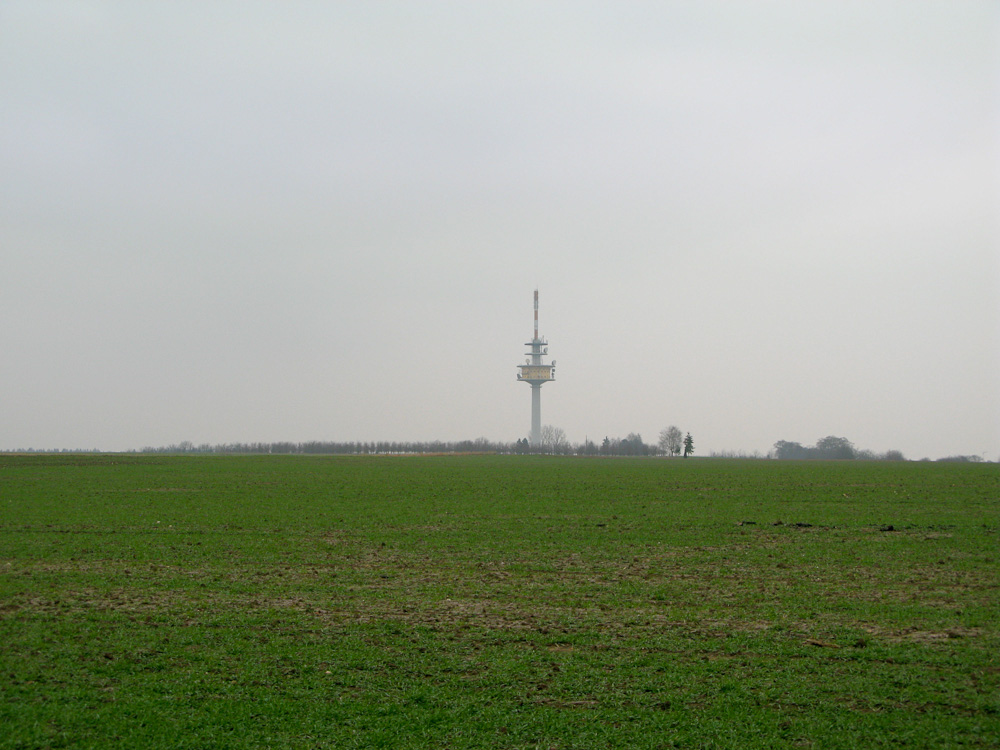
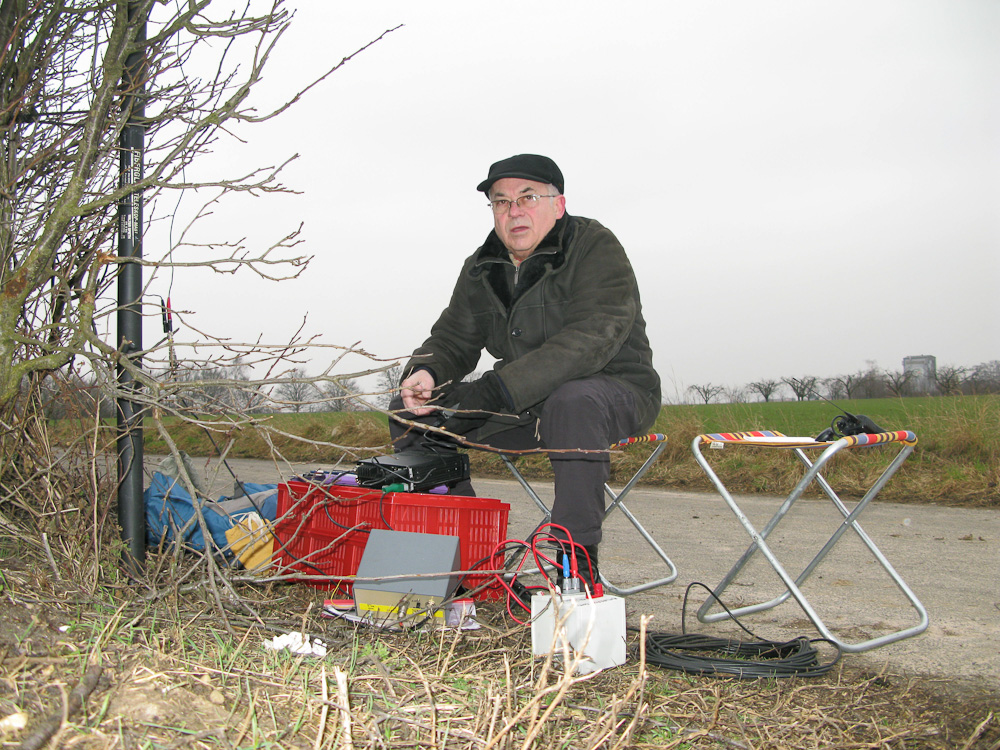
    As you can see on the terrain-map above, the summit is very flat. Finding the highest point is therefore not easy but luckily I had a native guide. The summit consists of mostly farm-land with narrow dirt roads for tractors and other farming equipment running between the fields. Since it was winter, the fields were all barren and wet due to the recent rain. It was a cold, overcast day, making me regret not having gloves and long underwear. Soon after finding a suitable spot for Bert’s antenna, he was on the air in no time on 40m CW. After verifying the local frequencies, I started calling CQ on my HT on 2m, hoping for a quick activation. But no such luck… after 15 minutes of constant calling I had nothing to show for and went back to Bert to verify the frequency. Since each OV (Ortsverein [Regional radio club]) has different calling frequencies I tried my luck on

    Bert (DF5WA ) activating Lerchenberg

    an other QRG recommended by Bert. To make a long story short, I was only able to get one single QSO (DK8IJ) until Bert drummed up some local support via phone. Even then, my  signal reports were quite bad and it took several attempts (in most cases) to complete a QSO. So what was to blame for the poor performance? Well, hard to say but I guess it was a combination of several factors. For one, the topography of the summit combined with my rubber-ducky 5W HT did not make for an ideall combination. The fact that the FSV Mainz (the local soccer club) was playing in the nearby Coface arena (just a stone’s throw away) was not conducive for having a lot of local contacts either. The arena holds over 30000 people and soccer is VERY popular in Germany, leading me believe that a large percentage of local HAMs were either in the arena or glued to the TV following their local club and not listening to a weak signal on 2m.

    What ever the reasons, I consider it another successful activation in a new (to me) association.  Neither the summit nor the outdoor experience was memorable but the warm welcome, help and assistance provided by local  amateurs, specifically by Bert will last. I hope I can return the favor at some point in the future. To wrap up the activation, I was invited to a coffee and a tour of Bert’s shack – thanks again Bert.

    In case you are wondering, FSV Mainz won the game 3:1 against SC Freiburg :)

    Some video impressions:

    httpvh://www.youtube.com/watch?v=_eFUlKINZEI

    If you would like to leave questions or comments, please do so through Youtube.


    ATTENTION

    !! WARNING !! There are old mountaineers, and
    bold mountaineers… there are no old-bold mountaineers.
    Hiking and mountain climbing are potentially hazardous activities particularly in Colorado with its extreme elevations. I am not accepting responsibility for any death or injury resulting from activations based on my trip reports. Proper training, experience, and personal capability assessment is required – enjoy!